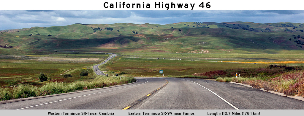
AsphaltPlanet.ca > California > SR-46
Pictures on this page are arranged in order from west to east. CA-46 East photos are left-aligned in the last column, while CA-46 West photos are right-aligned. Center-line pictures are centered within the last column.
|
Location |
Description |
Photo |
||
|
East- |
West- |
|||
| CA-46 ends at CA-1 just south of Cambria. Click here for CA-1 Images. | ||||
|
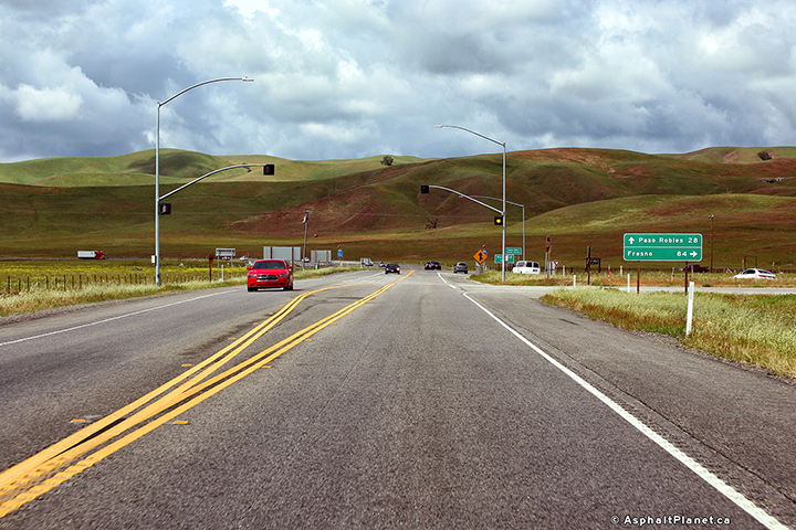
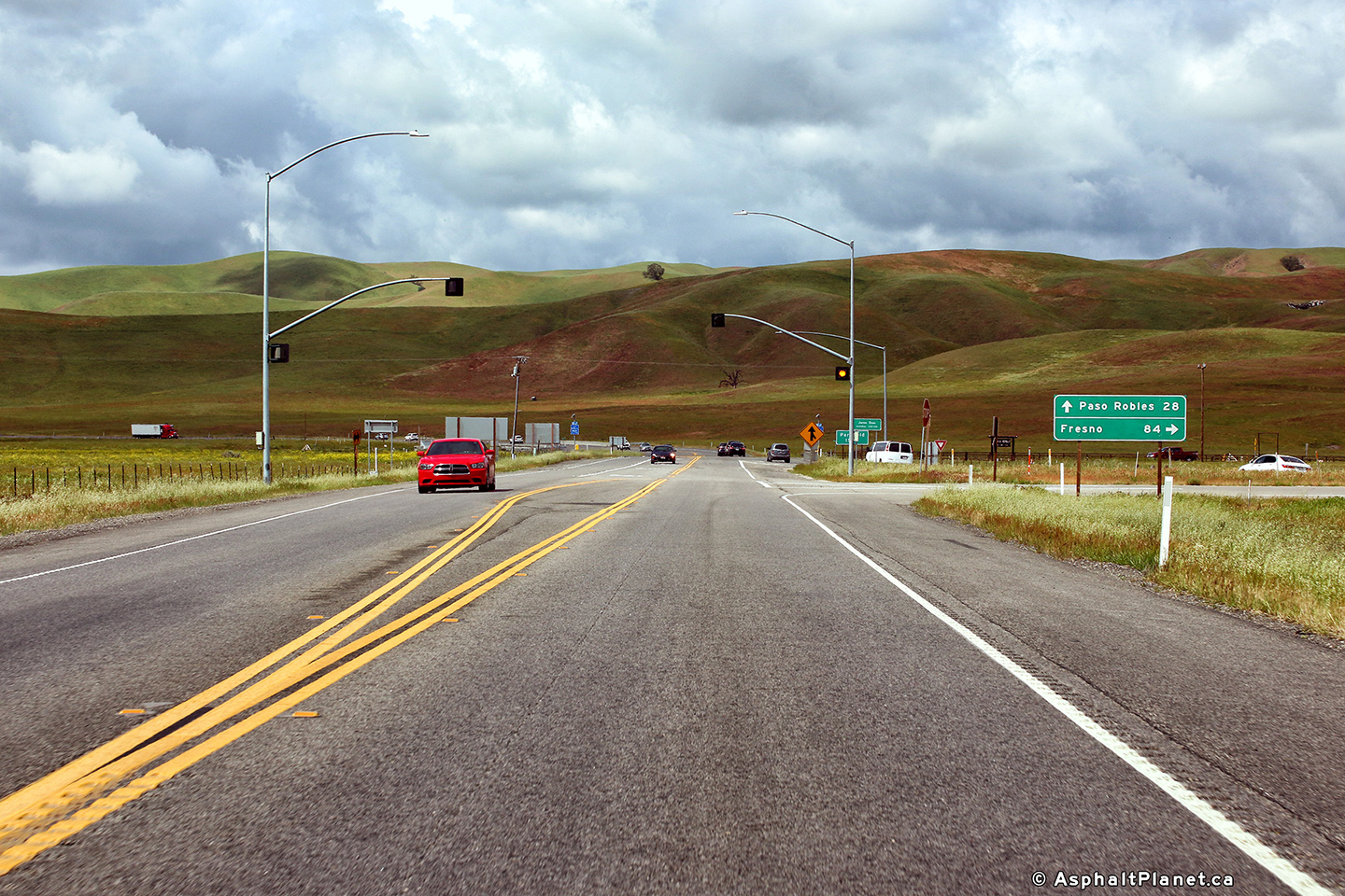
Kern County |
Signage directing traffic bound for Fresno to turn right. |
 |
||
|
Date: 4/06/2010 |
High-res: (1440x960) (2400x1600) |
|||
|
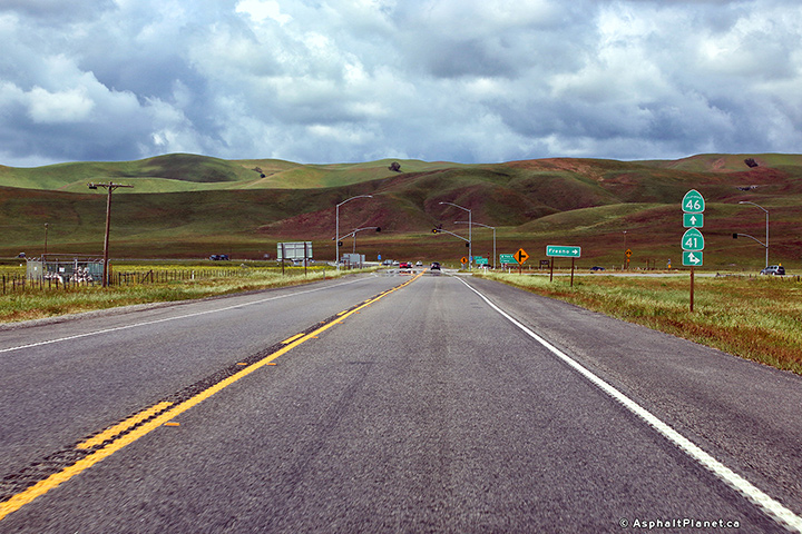
Kern County |
Westbound junction assembly at the eastern SR-41 junction. Traffic bound for SR-41 north must turn right at this intersection while motorists bound for SR-41 South must continue straight ahead. |
|
||
|
Date: 4/06/2010 |
High-res: (1440x960) (2400x1600) |
|||
|
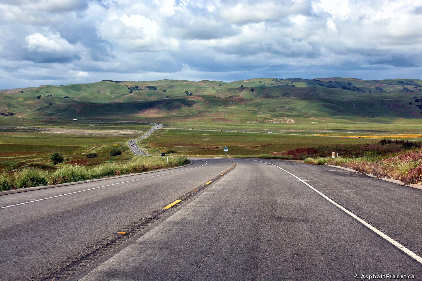
Kern County |
Westerly view as SR-46 descends into the wide valley that is home to the eastern SR-41 intersection. |
 |
||
|
Date: 4/05/2010 |
High-res: (1440x960) (2400x1600) |
|||
|
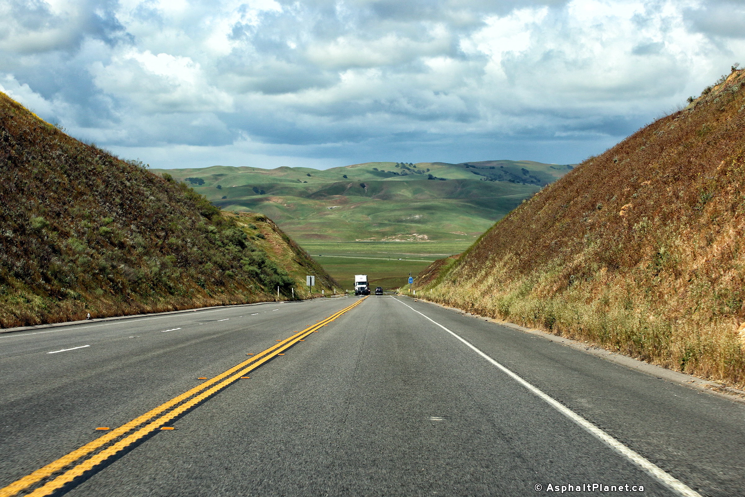
Kern County |
View looking westerly along SR-46. A considerable amount of earth had to be moved to provide for a straight highway alignment for this large grade. |
 |
||
|
Date: 4/05/2010 |
High-res: (1440x960) (2400x1600) |
|||
|
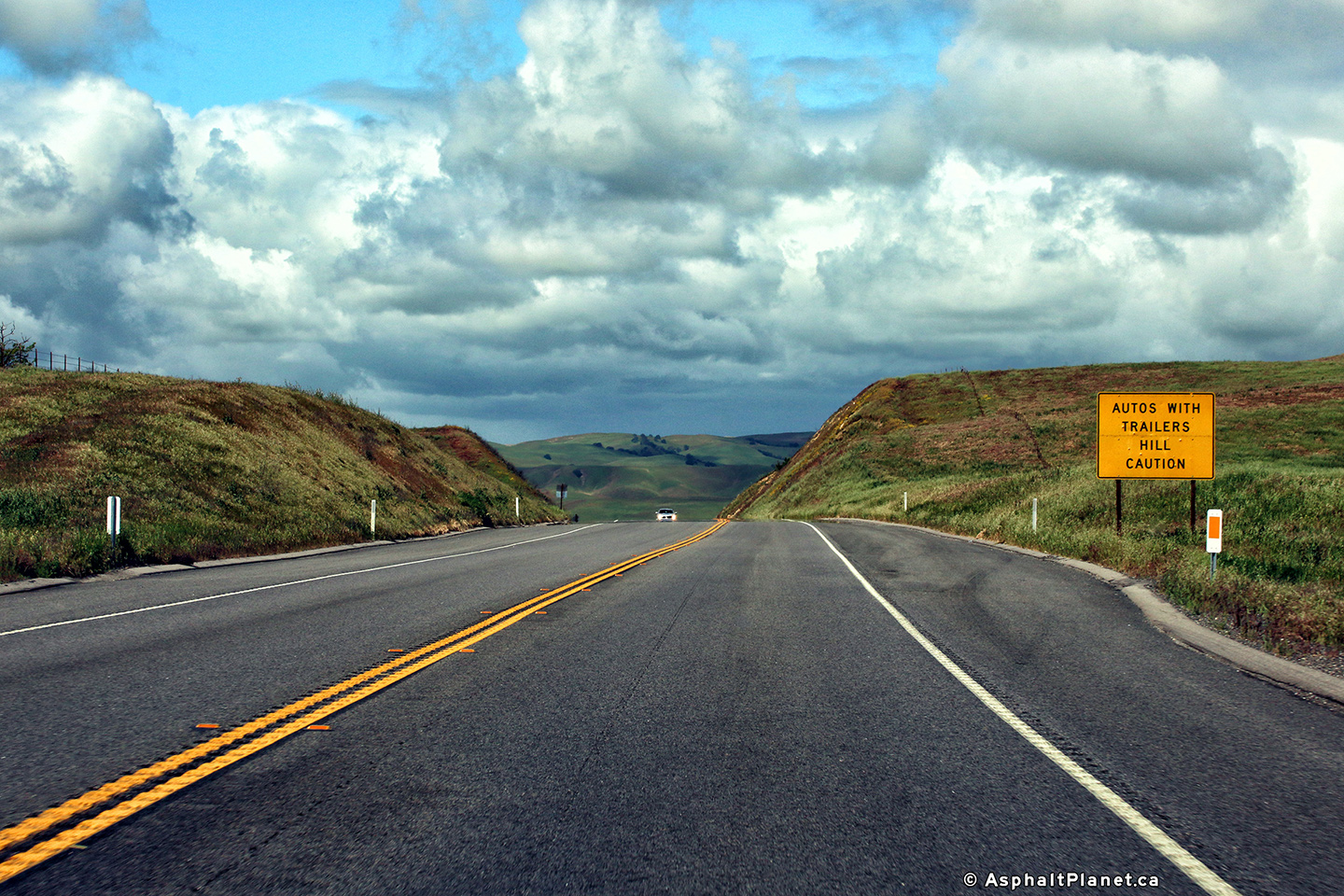
Kern County |
Signage advising westbound motorists of the long hill ahead. |
 |
||
|
Date: 4/05/2010 |
High-res: (1440x960) (2400x1600) |
|||
<- CA-45
CA Highways
CA-47 ->
AsphaltPlanet.ca
© 2010 AsphaltPlanet.ca.
Scott@asphaltplanet.ca
Page Created: November 4, 2017.
Last Updated: November 4, 2017.