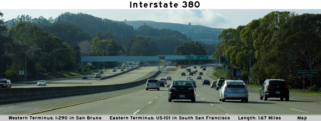
AsphaltPlanet.ca > California > Interstate 380

Pictures on this page are arranged in order from west to east. I-380 East photos are left-aligned in the last column, while I-380 West photos are right-aligned. Center-line pictures are centered within the last column.
|
Location |
Description |
Photo |
||
|
East- |
West- |
|||
|
Interstate 280 continues both north and south of I-380 as it runs between San Jose and San Francisco on the western side of the San Francisco Bay. Click here for Interstate 280 Images. |
||||
|
San Meteo County |
Westbound signage as the westbound lanes of I-380 diverge into ramps to I-280. |
|||
|
Date: 12/13/2014 |
High-res: (1440x960) (2400x1600) |
|||
|
San Meteo County |
Advanced signage for the I-280 interchange. |
|||
|
Date: 12/13/2014 |
High-res: (1440x960) (2400x1600) |
|||
|
San Meteo County |
Westerly view approaching the I-280 interchange. |
 |
||
|
Date: 12/13/2014 |
High-res: (1440x960) (2400x1600) |
|||
|
San Meteo County |
Westerly view from west of the El Camino Real interchange towards the interchange with I-280 and the end of I-380. At one time, a western extension of I-380 to the Cabrillo Highway (SR-1) at Pacifica was envisioned for I-380, hence the unused pavement at the end of this freeway. |
|||
|
Date: 12/13/2014 |
High-res: (1440x960) (2400x1600) |
|||
|
San Meteo County |
Eastbound advanced signage for the off-ramp to El Camino Real. |
|||
|
Date: 12/13/2014 |
High-res: (1440x960) (2400x1600) |
|||
|
San Meteo County |
Overhead signage at the eastbound off-ramp to El Camino Real. |
 |
||
|
Date: 12/13/2014 |
High-res: (1440x960) (2400x1600) |
|||
|
San Meteo County |
Westbound signage at the off-ramp to El Camino Real. |
|||
|
Date: 12/13/2014 |
High-res: (1440x960) (2400x1600) |
|||
|
San Meteo County |
This westbound signage serves to both reassure incoming traffic from the US-101 interchange that are indeed traveling westerly along I-380 in addition to serving as an advanced sign for the El Camino Real interchange. |
|||
|
Date: 12/13/2014 |
High-res: (1440x960) (2400x1600) |
|||
|
San Meteo County |
Eastbound signage situated beyond the El Camino Real interchange in advance of the US-101 interchange. |
 |
||
|
Date: 12/13/2014 |
High-res: (1440x960) (2400x1600) |
|||
|
San Meteo County |
Overhead advanced signage in advance of the off-ramp to US-101. Passenger vehicle traffic bound for San Francisco International Airport is directed to follow the ramp to US-101 South. |
|||
|
Date: 12/13/2014 |
High-res: (1440x960) (2400x1600) |
|||
|
San Meteo County |
Signage at the off-ramp to US-101 North. |
|||
|
Date: 12/13/2014 |
High-res: (1440x960) (2400x1600) |
|||
|
San Meteo County |
View looking westerly along I-380 as the ramp from US-101 North passes overtop of the freeway. |
 |
||
|
Date: 12/13/2014 |
High-res: (1440x960) (2400x1600) |
|||
|
San Meteo County |
Eastbound interchange sequence sign located just beyond the Wheatland Avenue interchange. The Foothill Freeway crosses overtop of the Tujunga Wash immediately beyond this signage. |
|||
|
Date: 12/13/2014 |
High-res: (1440x960) (2400x1600) |
|||
|
US-101 is the principal route between Los Angeles and San Francisco. Click here for US-101 Images. |
||||
|
San Meteo County |
This signage is situated on the on-ramp to I-380 from South Airport Boulevard. |
 |
||
|
Date: 12/13/2014 |
High-res: (1440x960) (2400x1600) |
|||
|
San Meteo County |
Signage situated overtop of the westbound off-ramp to US-101 from the North Access Road. |
|||
|
Date: 12/13/2014 |
High-res: (1440x960) (2400x1600) |
|||
|
San Meteo County |
This signage approaching the US-101 interchange along I-380 is located immediately west of the first signalized intersection with the North Access Road. |
|||
|
Date: 12/13/2014 |
High-res: (1440x960) (2400x1600) |
|||
<- I-305
CA Highways
I-405 ->
AsphaltPlanet.ca
© 2010-2015 AsphaltPlanet.ca.
AsphaltPlanet@asphaltplanet.ca
Page Created: March 8, 2015.
Last Updated: March 8, 2015.