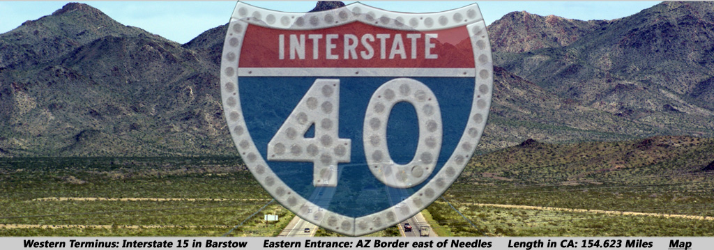
AsphaltPlanet.ca > California > Interstate 40
Pictures on this page are arranged in order from west to east. I-40 East photos are
left-aligned in the last column, while I-40 West photos are right-aligned.
Center-line pictures are centered within the last column.
|
Location |
Description |
Photo |
||
|
East- |
West- |
|||
|
San Bernardino County |
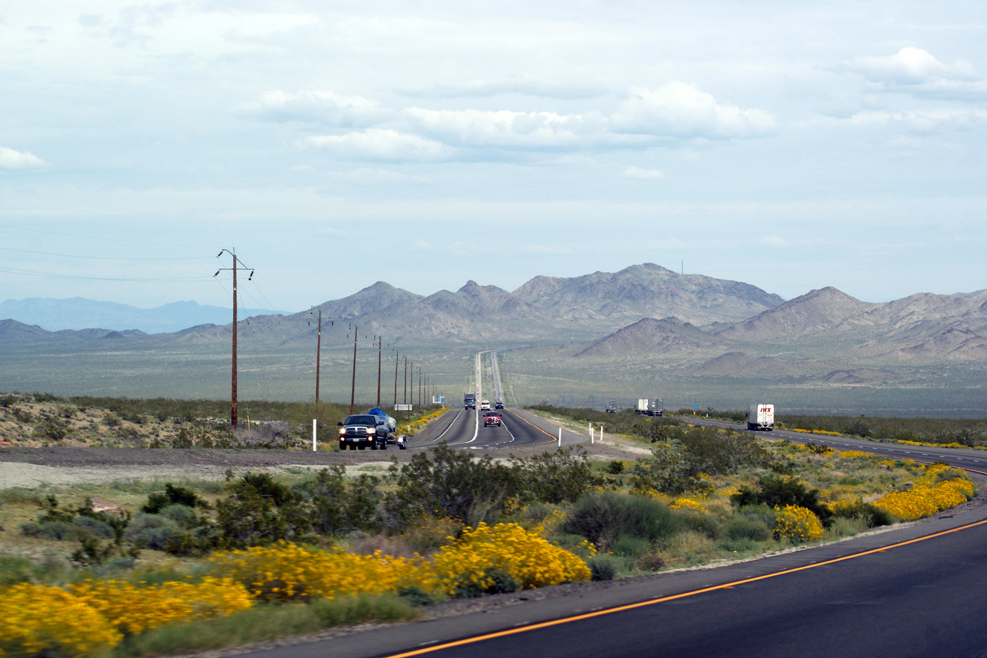
This view looks westerly from the National Trails Highway interchange. The National Trails Highway is the former alignment of US-66 through California. About 65 miles of the former US-66 was by-passed through Central California in order to straighten the route of Interstate 40. The old alignment of US-66 is a worthwhile drive for anyone who appreciates the nostalgia of early motoring. Several large truck stops, motels, and diners were by-passed when Interstate 40 opened and now sit vacant, having been abandoned for decades beside the old highway -- only to remind the few remaining motorists of the highways former importance. |
 |
||
|
Date: 3/31/2010 |
High-res: (1440x960) (2400x1600) | |||
|
San Bernardino County |
Easterly view from the National Trails Highway. Notice the truck climbing lane on the westbound (left) carriageway. Truck climbing lanes are fairly common on rural California Interstates. |
 |
||
|
Date: 3/31/2010 |
High-res: (1440x960) (2400x1600) | |||
|
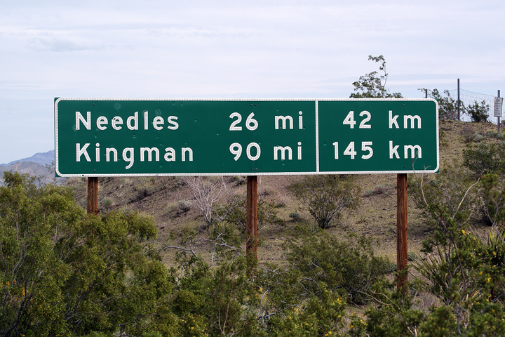
San Bernardino County |
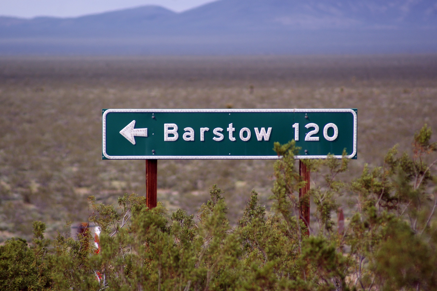
Distance signage along Interstate 40 East taken just east of the National Trails Highway interchange. It is not uncommon to see distances shown in both miles and kilometres along rural roads in California. |
 |
||
|
Date: 3/31/2010 |
||||
|
San Bernardino County |
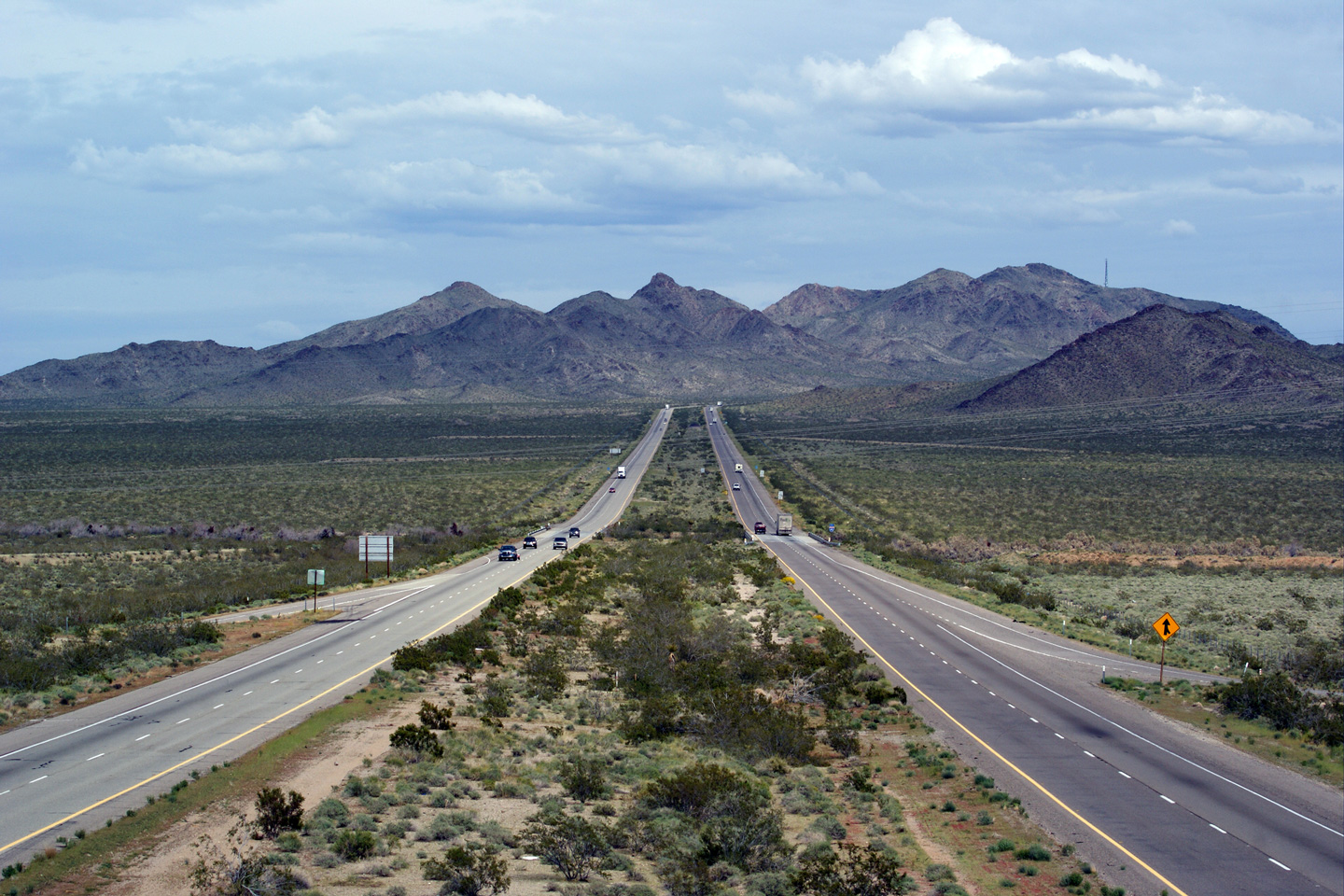
Easterly view as Interstate 40 begins to pass through a large valley. The Water Road interchange is found at the bottom of this long hill. |
 |
||
|
Date: 3/31/2010 |
High-res: (1440x960) (2400x1600) |
|||
|
San Bernardino County |
Westerly view from the Water Road overpass. Despite its name, there is no water present at the bottom of this large valley. |
 |
||
|
Date: 3/31/2010 |
High-res: (1440x960) (2400x1600) | |||
|
San Bernardino County |
Directional freeway entrance guide signage for Interstate 40 at the Water Road interchange. It is not uncommon at some of these uber-rural interchanges for CalTrans to just sign the next control city, and not the freeway itself as is pictured. |
 |
||
|
Date: 3/31/2010 |
High-res: (1440x960) (2400x1600) | |||
|
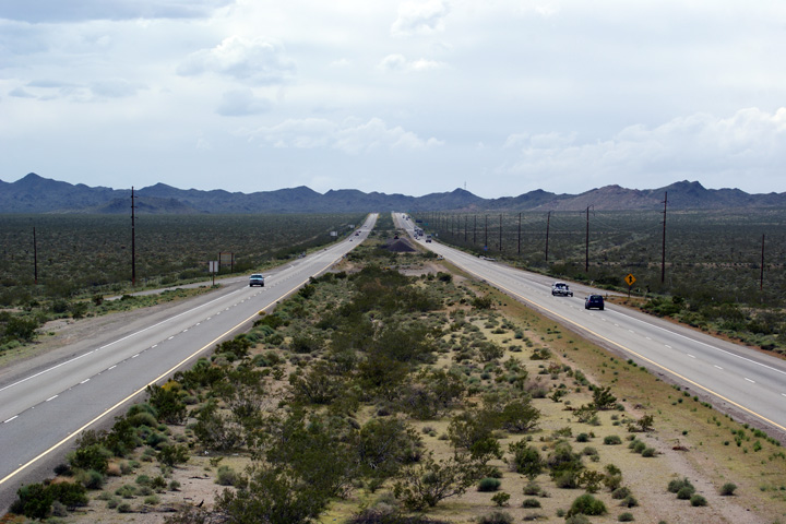
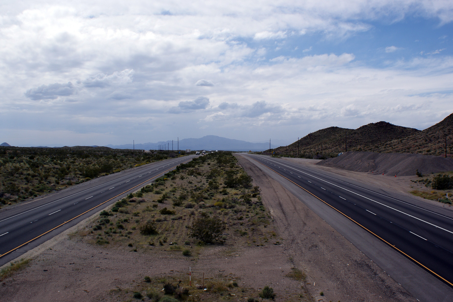
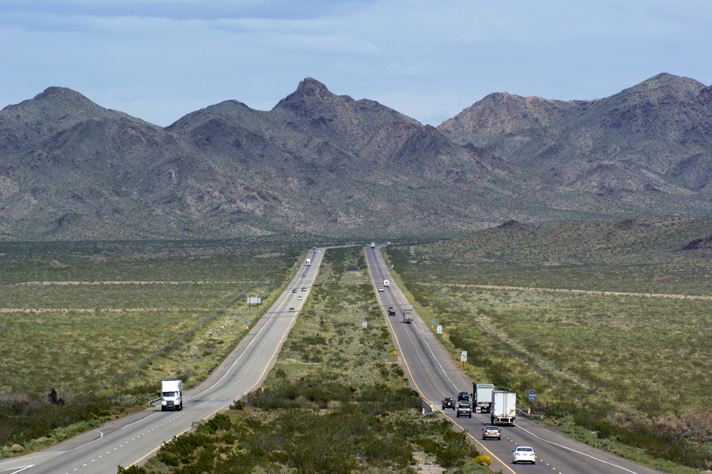
San Bernardino County |
Two views looking easterly as Interstate 40 climbs out of the Ward Valley bound for the South Pass through the Sacramento Mountains. |
 |
||
| High-res: (1440x960) (2400x1600) | ||||
 |
||||
|
Date: 3/31/2010 |
High-res: (1440x960) (2400x1600) | |||
|
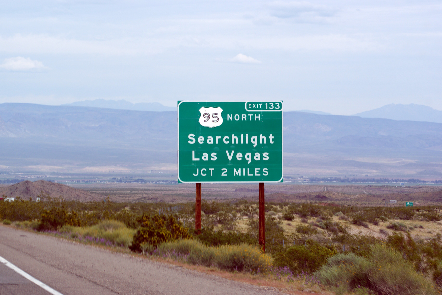
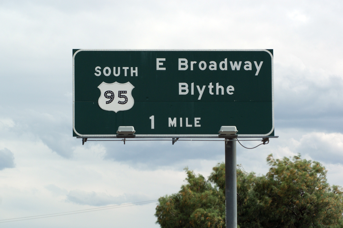
San Bernardino County |
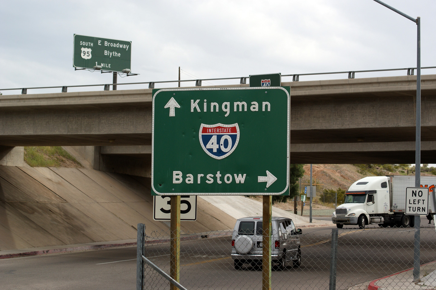
2 Mile advanced signage for the ramp to US-95 North. |
 |
||
|
Date: 3/31/2010 |
||||
|
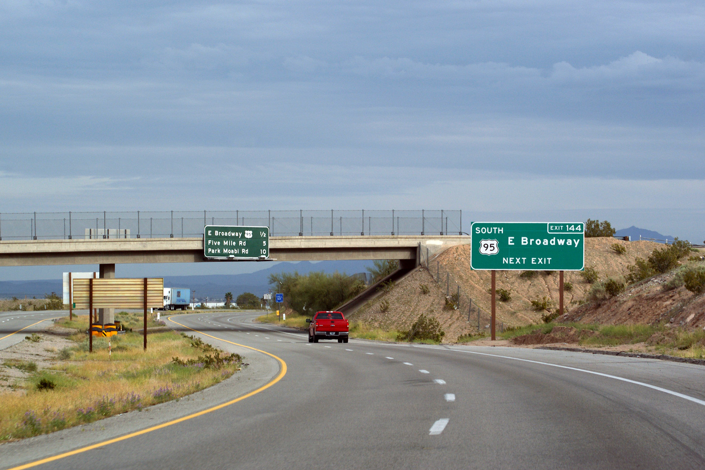
San Bernardino County |
1 Mile advanced signage for the ramp to US-95 North. Notice the button-copy overlay for the US-95 shield on what is otherwise a reflective sign. |
 |
||
|
Date: 3/31/2010 |
||||
|
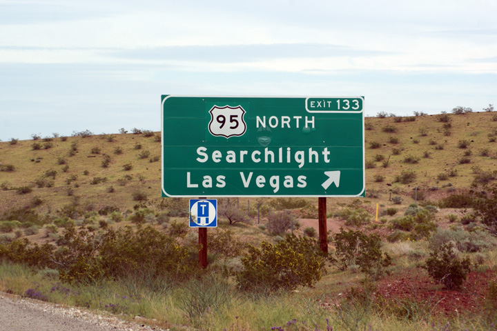
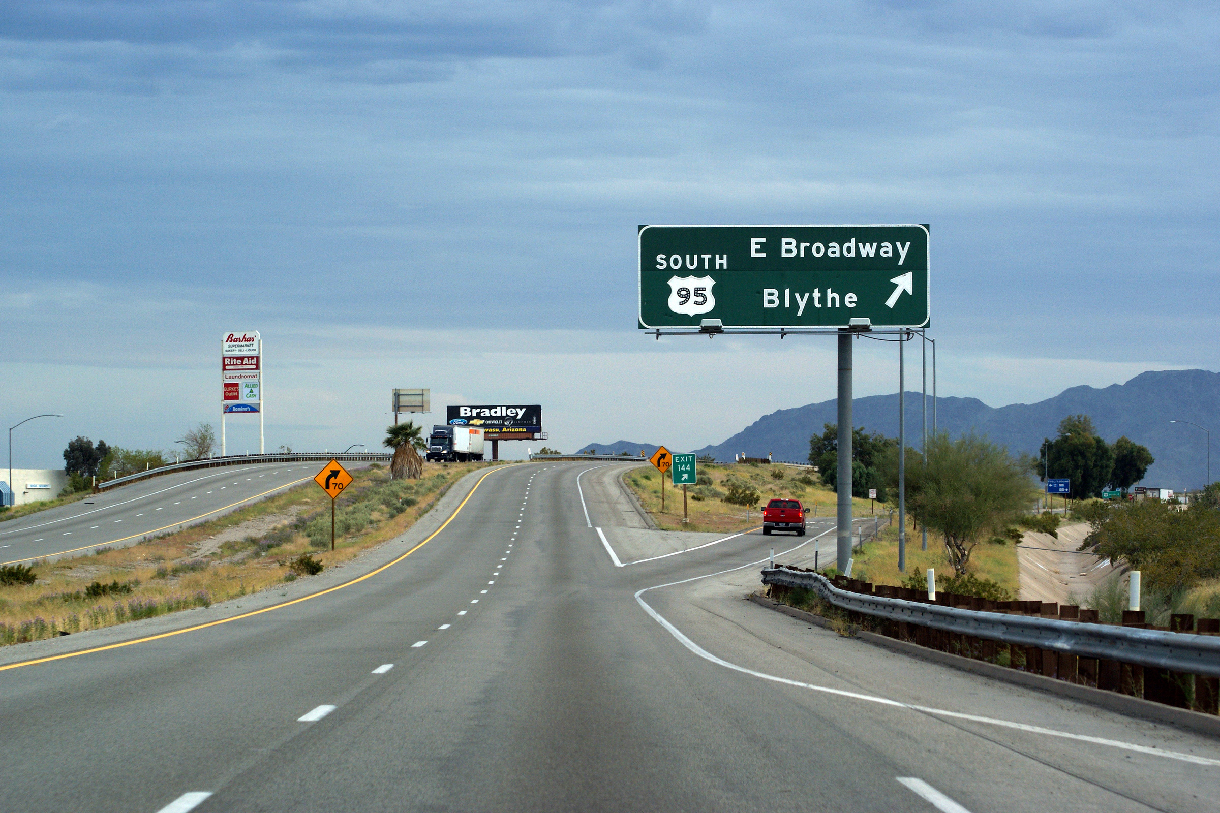
San Bernardino County |
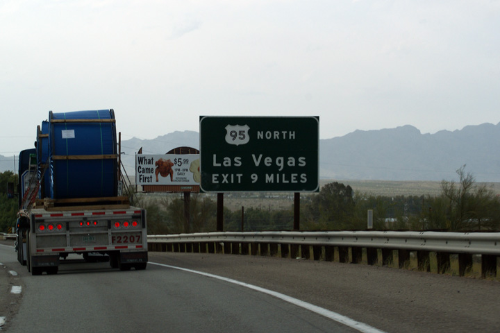
Signage at the eastbound ramp to US-95-North. US-95 intersects Interstate 40 at a diamond interchange. |
 |
||
|
Date: 3/31/2010 |
||||
|
San Bernardino County |
Westerly view as Interstate 40 begins the climb up to the Sacramento Mountains from the US-95 North interchange. |
 |
||
|
Date: 3/31/2010 |
High-res: (1440x960) (2400x1600) | |||
|
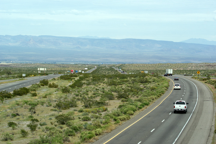
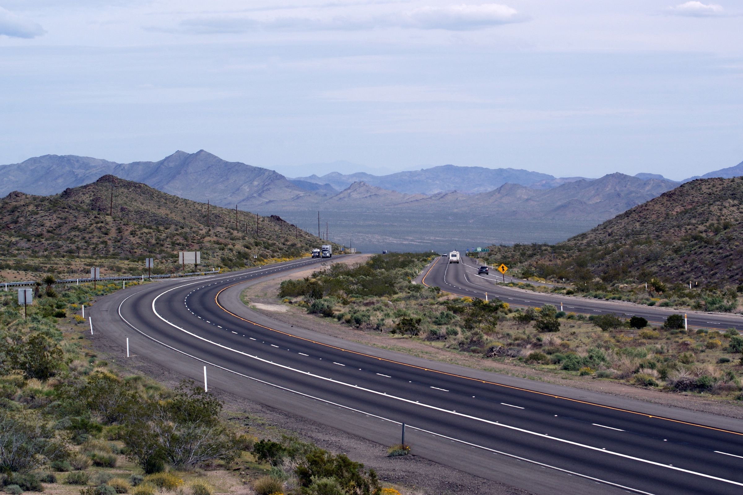
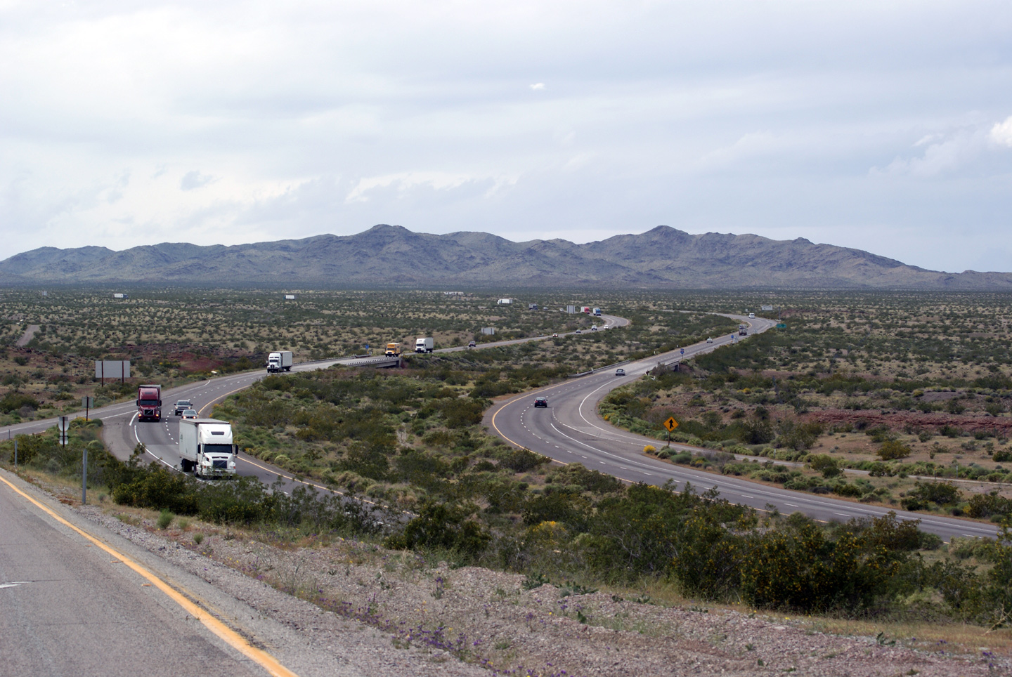
San Bernardino County |
Easterly view along Interstate 40 from the US-95 North overpass. From US-95, Interstate 40 continues a long and gradual descent towards Needles in the Colorado River Valley. The high mountains in the distance are known as the Black Mountains and are found on the eastern bank of the Colorado River in the State of Arizona. |
 |
||
|
Date: 3/31/2010 |
High-res: (1440x960) (2400x1600) | |||
|
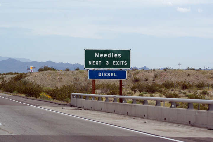
San Bernardino County City of Needles |
Button-copy signage announcing the City of Needles to eastbound Interstate 40 motorists. Notice also the signage proclaiming Diesel. Traveler services are scarce between Barstow and Needles along Interstate 40, and continue to be scarce towards Kingman in Arizona. Numerous traveler services have been built adjacent to I-40 in Needles. |
 |
||
|
Date: 3/31/2010 |
||||
|
San Bernardino County City of Needles |
Next exit signage for three upcoming exits in Needles. |
 |
||
|
Date: 3/31/2010 |
High-res: (1440x960) (2400x1600) | |||
|
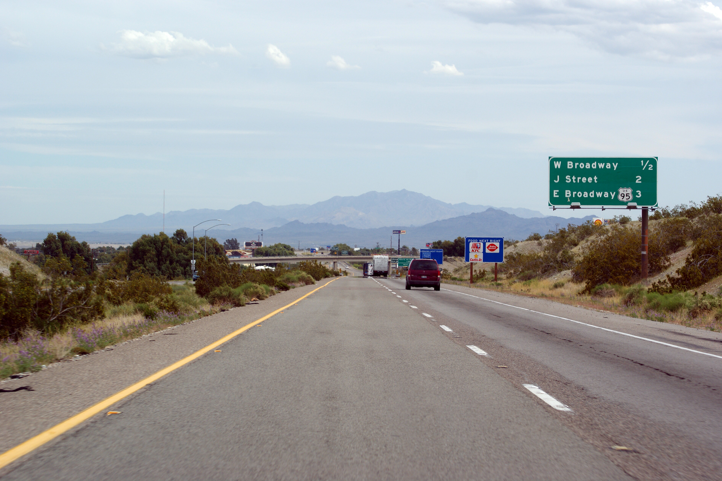
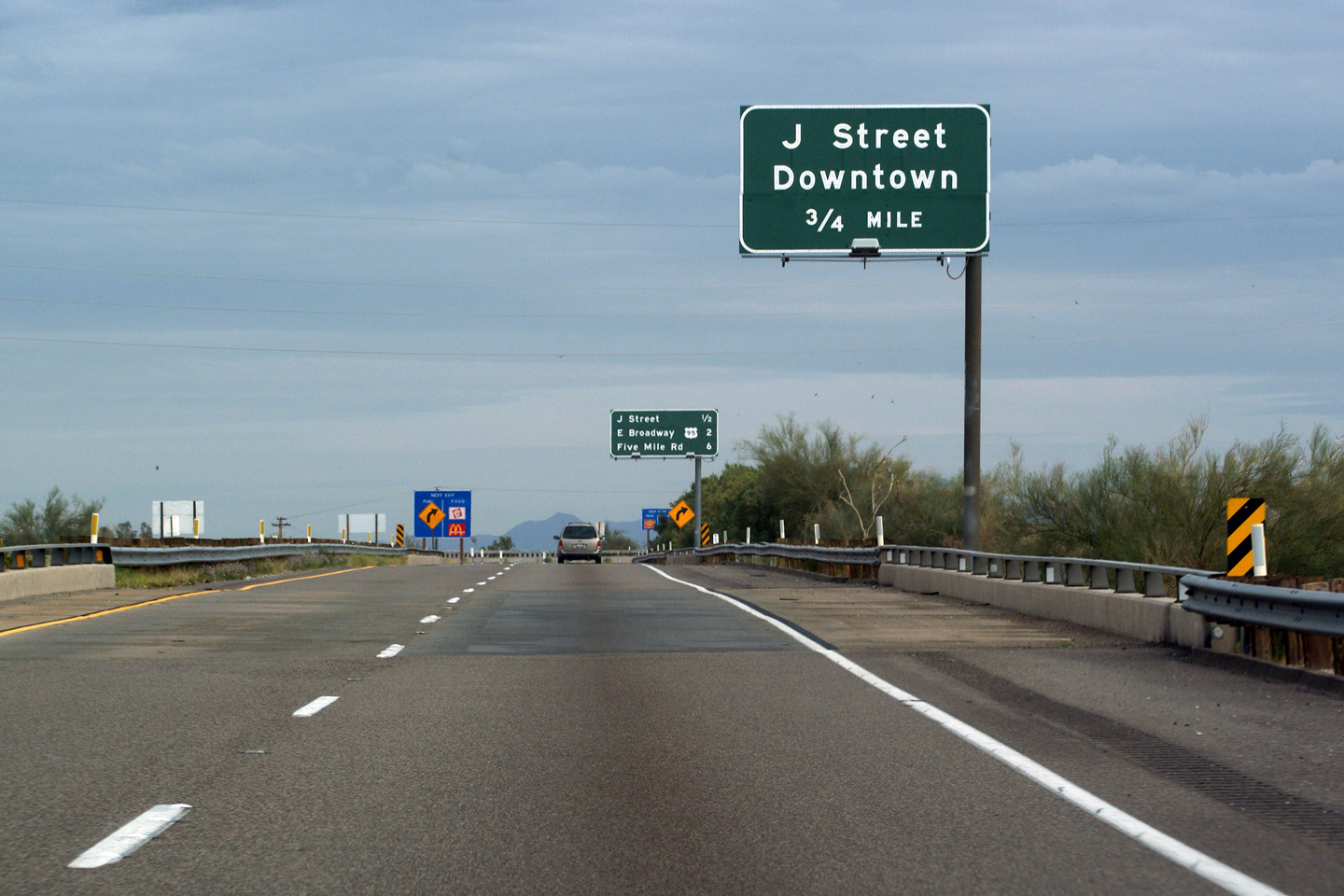
San Bernardino County City of Needles |
Button-copy advanced signage for the exit to J Street. |
 |
||
|
Date: 3/31/2010 |
High-res: (1440x960) (2400x1600) |
|||
|
San Bernardino County City of Needles |
Westbound reassurance signage informing motorists that the interchange for US-95 North is ahead, beyond the City Limits of Needles. |
 |
||
|
Date: 3/31/2010 |
||||
|
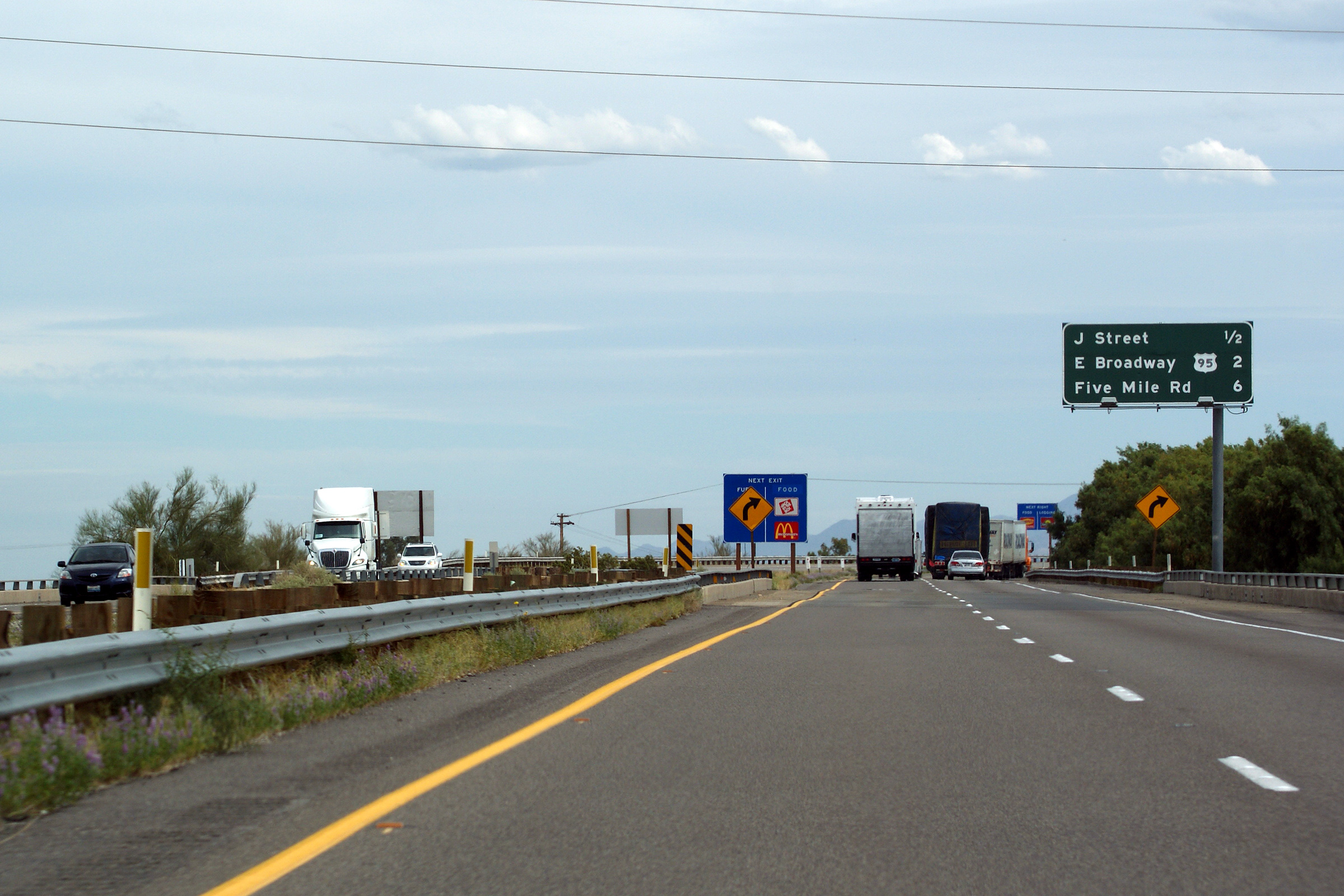
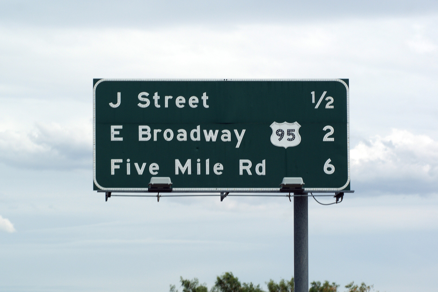
San Bernardino County City of Needles |
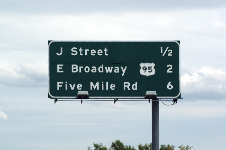
Two views of the next exit signage approaching the J Street interchange. California, and indeed most jurisdictions in the United States, do a very good job of showing the sequence of numerous closely spaced interchanges in an urban environment. |
 |
||
|
High-res: (1440x960) (2400x1600) |
||||
 |
||||
|
Date: 3/31/2010 |
||||
|
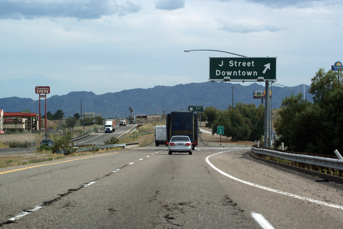
San Bernardino County City of Needles |
Overhead signage for the ramp to J-Street from I-40 Eastbound. Downtown Needles is found north of I-40 adjacent to the Colorado River. J Street also serves as the most efficient route between the Interstate and the Fort Mohave Indian Reservation on the Arizona side of the river. |
 |
||
|
Date: 3/31/2010 |
High-res: (1440x960) (2400x1600) |
|||
|
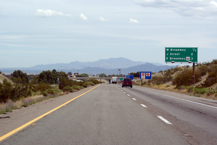
San Bernardino County City of Needles |
Direction signage for Interstate 40 along J Street. |
|
||
|
Date: 3/31/2010 |
||||
|
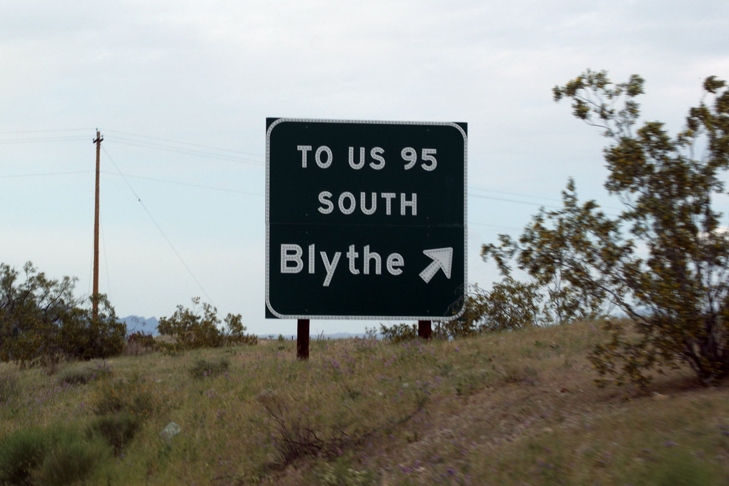
San Bernardino County City of Needles |
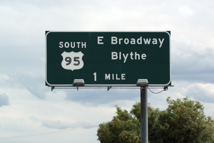
Close-up of the one mile advanced signage for US-95 South. |
 |
||
|
Date: 3/31/2010 |
High-res | |||
|
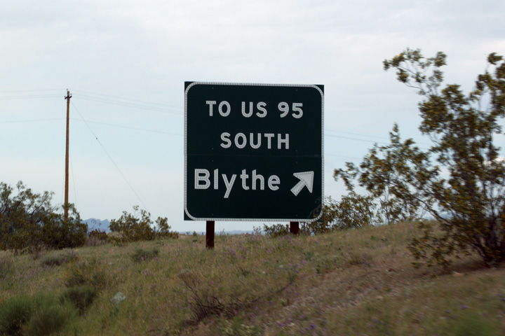
San Bernardino County City of Needles |
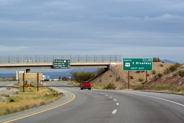
Next exit signage in advance of the US-95 South Interchange. Park Moabi Drive, which is listed as the final exit on the next exit signage, is the eastern-most interchange in the State of California along Interstate 40. A few short miles east of Park Moabi Drive, Interstate 40 crosses the Colorado River into Arizona. |
 |
||
|
Date: 3/31/2010 |
High-res: (1440x960) (2400x1600) |
|||
|
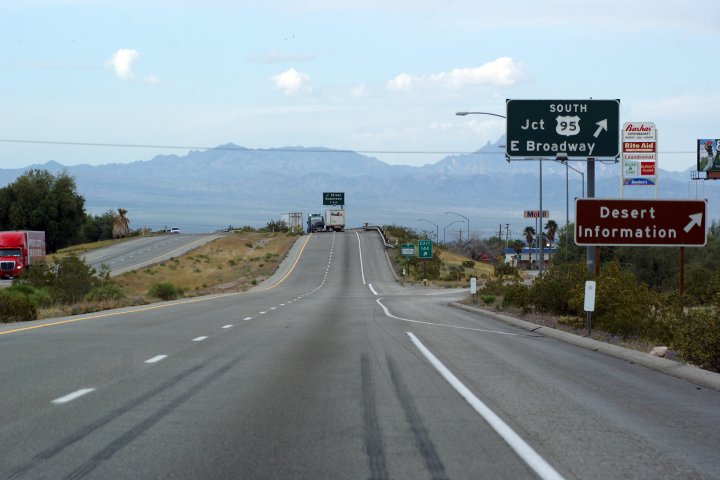
San Bernardino County City of Needles |
Overhead signage at the ramp to US-95 South. Observe the edgeline striping in advance of the interchange. This is typical of all rural exits on California Freeways, and is a very uniquely Californian way to stripe an exit. |
 |
||
|
Date: 3/31/2010 |
High-res: (1440x960) (2400x1600) |
|||
|
San Bernardino County City of Needles |
Westbound overhead signage for the US-95 South Interchange. |
 |
||
|
Date: 3/31/2010 |
High-res: (1440x960) (2400x1600) | |||
|
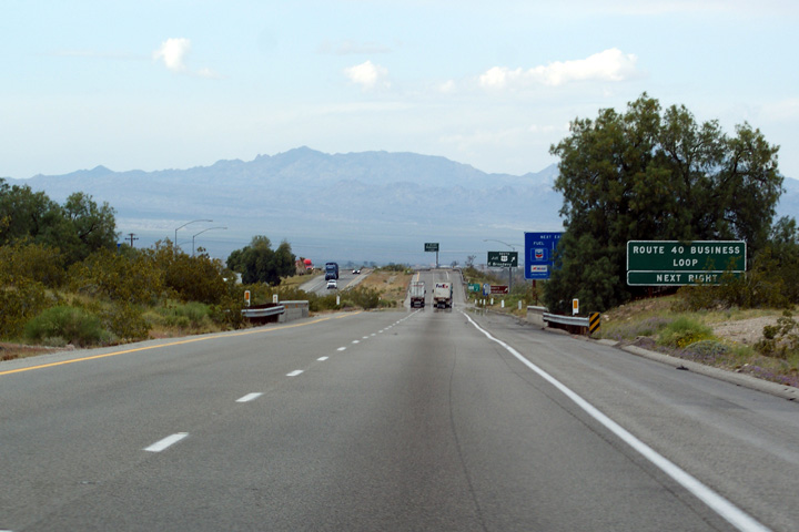
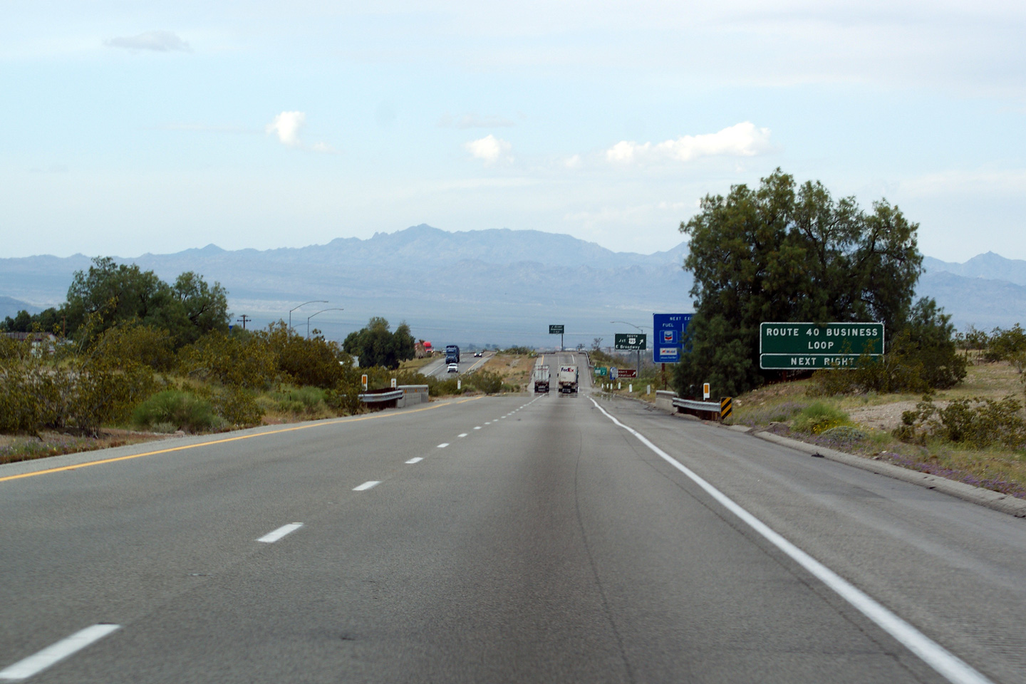
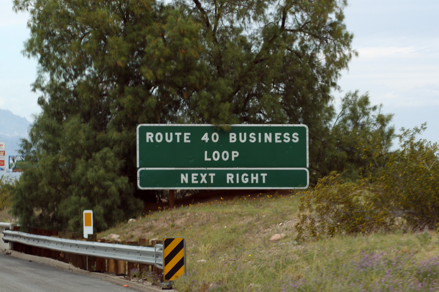
San Bernardino County City of Needles |
Two views looking westerly at the signage denoting Interstate 40's Business Loop. I-40's business loop through Needles follows the historic alignment of US-66 through the community. |
 |
||
| High-res: (1440x960) (2400x1600) | ||||
 |
||||
|
Date: 3/31/2010 |
||||
|
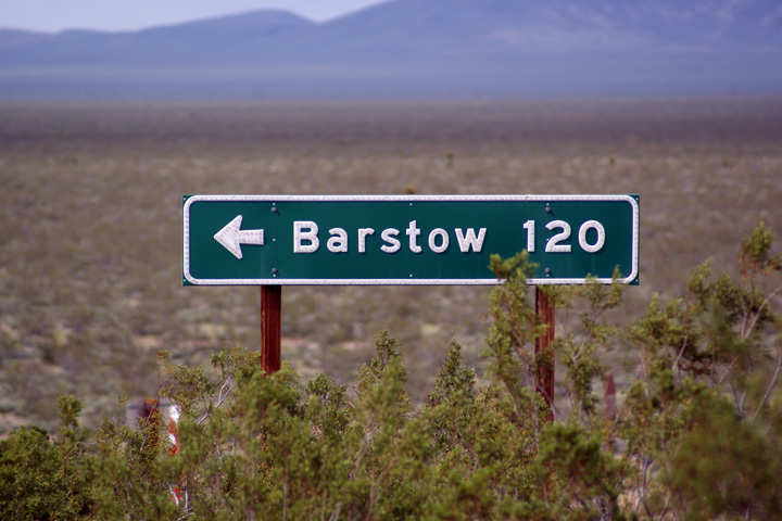
San Bernardino County City of Needles |
Westbound signage at the off-ramp to Five Mile Road. Five Mile Road follows the Historic alignment of US-66 and serves as a useful shortcut route for motorists bound for US-95 South. |
 |
||
|
Date: 3/31/2010 |
||||
<- I-15
CA Highways
I-80 ->
AsphaltPlanet.ca
© 2010-14 AsphaltPlanet.ca.
AsphaltPlanet@asphaltplanet.ca
Page Created: May 16, 2011.
Last Updated: May 16, 2011.
