
AsphaltPlanet.ca > Georgia > Interstate 75
|
Southern Entrance: Florida State Line, south of Lake Park. Northern Entrance: Tennessee State Line, near Chattanooga Length in GA: 351.1 Miles Links:
|
Pictures on
this page are arranged in order from south to north. I-75 North photos are
left-aligned in the last column, while I-75 South photos are right-aligned.
Center-line pictures are centered within the last column.
|
Location |
Description |
Photo |
||
|
North- |
South- |
|||
|
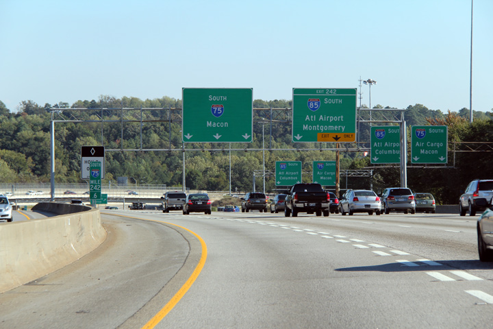
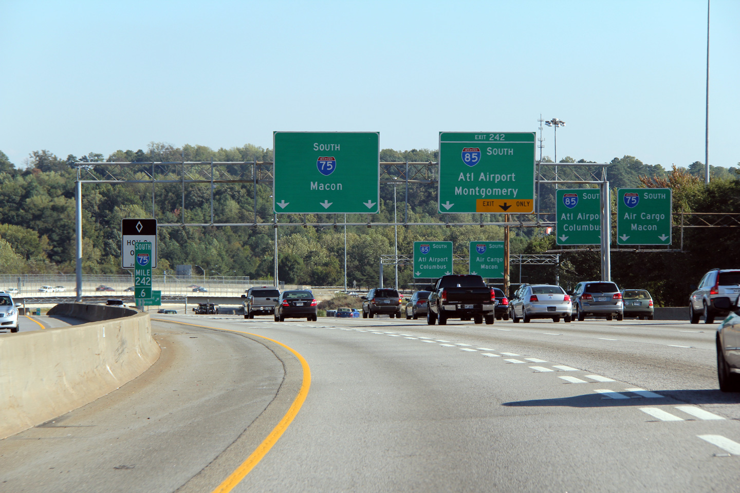
Fulton County |
Southerly view approaching the southern I-75/85 split. Interstate 75 continues south of Atlanta on a slight easterly trajectory bound for Macon, and eventually Florida, while I-85 heads south-westerly -- bound for Montgomery, Alabama. |
 |
||
|
Date: 10/3/2010 |
High-res: (1440x960) (2400x1600) | |||
|
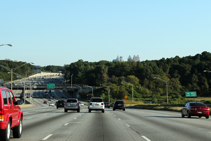
Fulton County |
Northerly view approaching the Fair Drive overpass along Interstate 75. The Downtown Atlanta Skyline is just in view peaking over the tall Carolinian Forests that the South-eastern United States is famous for. |
|
||
|
Date: 10/2/2010 |
High-res: (1440x960) (2400x1600) | |||
|
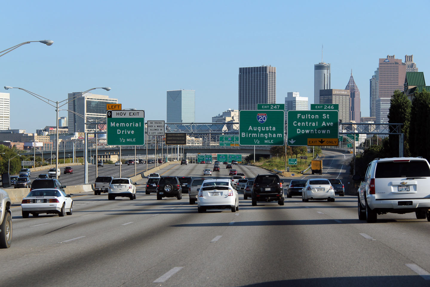
Fulton County |
Overhead sign structure heading northerly along I-75 approaching Pryor Road SW. Downtown Atlanta's impressive skyline is front and centre in the photograph. I-75/85 skirts just east of Downtown Atlanta. |
|
||
|
Date: 10/2/2010 |
High-res: (1440x960) (2400x1600) | |||
|
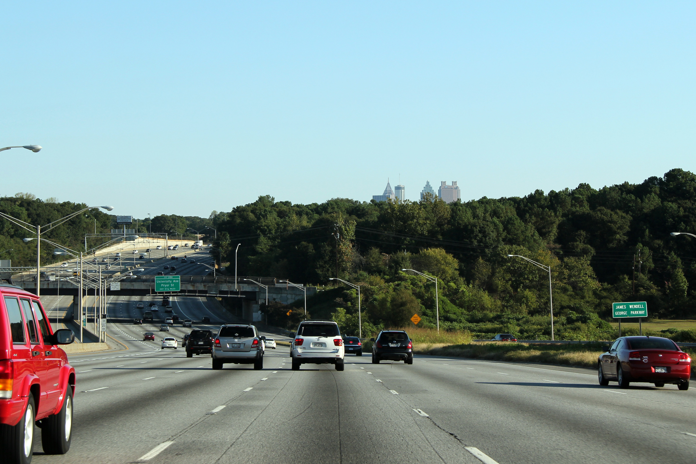
Fulton County |
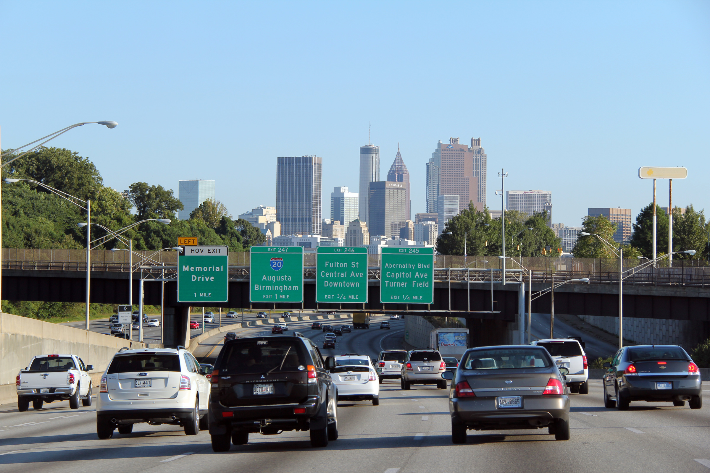
Northbound view approaching the Fulton Street and Central Avenue exit. The ramp to Central Avenue passes overtop of the Downtown Connector (I-75/85), as a high-speed directional ramp before merging with Central Avenue on the west side of the Freeway. Once Downtown, Central Avenue is one of Atlanta's most important north-south streets. |
|
||
|
Date: 10/2/2010 |
High-res: (1440x960) (2400x1600) | |||
|
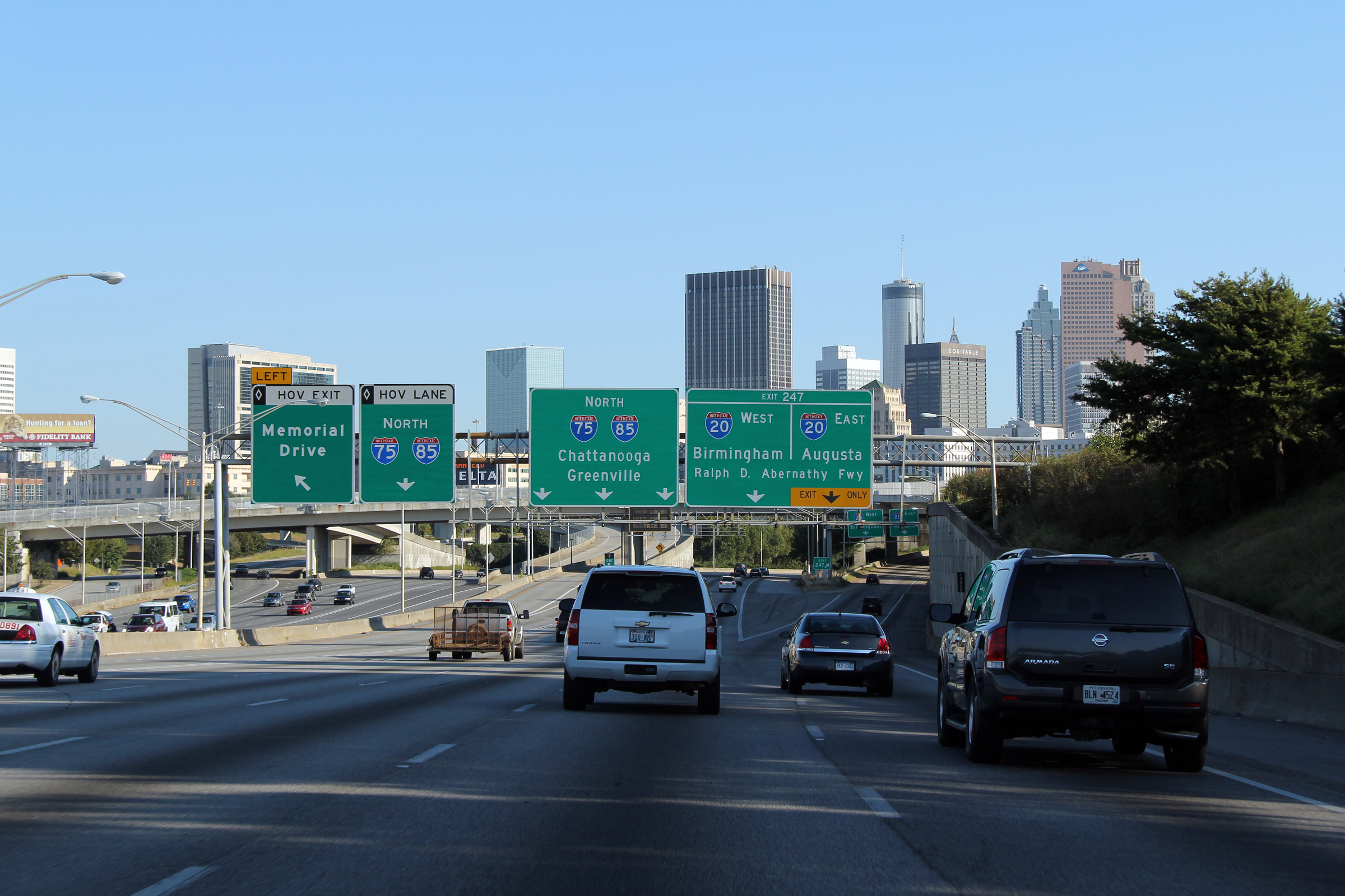
Fulton County |
Overhead signage for the Interstate 20 interchange just south of Downtown on I-75/85. Interstate 20 meets the Downtown Connector at a fairly considerable stack interchange. The Interstate 20/75/85 interchange marks the south-eastern boundary of Downtown Atlanta. |
|
||
|
Date: 10/2/2010 |
High-res: (1440x960) (2400x1600) | |||
|
Fulton County |
Southbound guide view underneath of the North Avenue overpass. Georgia Institute of Technology is visible to the right of the freeway in this photo. The Downtown Atlanta Skyline is visible in the distance. |
 |
||
|
Date: 10/3/2010 |
High-res: (1440x960) (2400x1600) | |||
<- I-65
GA Highways
I-85 ->
Asphaltplanet.ca
© 2010 AsphaltPlanet.ca.
AsphaltPlanet@asphaltplanet.ca
Page Created: October 5, 2010.
Last Updated: October 5, 2010.


