|
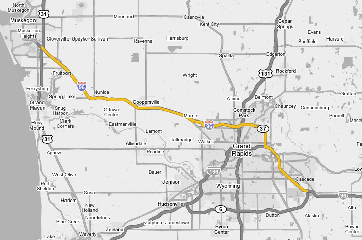
Interstate 96
(Michigan) |
|
|
Pictures are arranged in order from
west to east.
I-96 East photos are
left-aligned in the last column, while I-96 West photos are right-aligned.
Center-line pictures are centered within the last column.
|
Location |
Description |
Photo |
||
|
East- |
West- Bound |
|||
|
I-96's Western Terminus is at US 31, along the Grand Haven-to-Ludington freeway stretch of the U.S. route. Click here for US 31 images. |
||||
|
Sign truss with Clearview guide sign for I-96, Clearview 0.25 mile advance exit sign for US 31 North (Exit 1 B) and Clearview exit sign for US 31 South (Exit 1 A) at the beginning of I-96 East. The interchange that connects US 31 with I-96 and BUS US 31 is one ramp short of being a full cloverleaf. There is no direct ramp from US 31 North to I-96 East. US 31 North traffic looking to make that maneuver must exit at Hile Rd., and head east for 0.25 mile to be able to access I-96 East. |
|
|||
|
Photographer: Josh Anderchek |
Date: 4/21/2007 |
|||
|
Clearview guide sign at I-96's Western Terminus marking the beginning of BUS US 31 and the end of I-96. This sign is located just to the west of the US 31 interchange. |
|
|||
|
Photographer: Patrick Allen |
Date: 11/27/2007 |
|||
|
Clearview guide sign marking the start of I-96 East and the end of BUS US 31, located just after the departure of the exit ramp to US 31 South. |
|
|||
|
Photographer: Patrick Allen |
Date: 11/27/2007 |
|||
|
Muskegon County City of Norton Shores |
Bridge-mounted Clearview 0.25 mile advance exit sign for Hile Rd. (Exit 1 C) and Clearview exit sign for US 31 North (Exit 1 B) on I-96 East. Both of the signs shown here are mounted on the US 31 overpass. Note that right after the exit ramp to US 31 North departs from I-96 East, a deceleration lane for the Hile Rd. exit opens up. |
 |
||
|
Photographer: Josh Anderchek |
Date: 4/21/2007 |
|||
|
Muskegon County City of Norton Shores |
Bridge-mounted Clearview guide sign for BUS US 31 and Clearview exit sign for Airline Rd. and US 31 South (Exit 1 A) on I-96 West at the point where it transitions into BUS US 31 North. These signs are attached to the US 31 overpass. Upon exiting, traffic has the option of either bearing to the left to access Airline Rd., or keeping right and following the loop ramp onto US 31 South. |
 |
||
|
Photographer: Josh Anderchek |
Date: 4/21/2007 |
|||
|
Muskegon County Fruitport Township |
Sign truss with Clearview 0.25 mile advance sign for Airline Rd. and US 31 South (Exit 1 A) and Clearview exit sign for US 31 North (Exit 1 B) on I-96 West as it enters into its final interchange. |
 |
||
|
Photographer: Josh Anderchek |
Date: 4/21/2007 |
|||
|
Muskegon County |
Clearview 0.5 mile advance exit sign for US 31 North (Exit 1 B) on I-96 West. |
|
||
|
Photographer: Josh Anderchek |
Date: 4/21/2007 |
|||
|
Muskegon County |
Pair of warning signs, one on each side of I-96 West, announcing the upcoming end of the freeway in 1.25 miles at US 31. |
|
||
|
Photographer: Josh Anderchek |
Date: 4/21/2007 |
|||
|
M-104, a former stretch of US 16, connects I-96 with Spring Lake and US 31 at the Grand River Drawbridge. Click here for M-104 images. |
||||
|
Ottawa County |
Scene looking west along I-96 from the B-31/112th Ave. overpass, which is located at Exit 10. The median widens out here to accommodate the corresponding left exits from I-96 West to M-104, and from I-96 East to B-31. |
|
||
|
Date: 4/21/2007 |
||||
|
Ottawa County |
View of I-96 looking east toward Coopersville from the B-31/112th Ave. overpass. |
|
||
|
Date: 4/21/2007 |
||||
|
Ottawa County Crockery Township |
Bridge-mounted Clearview 0.5 mile advance exit sign for upcoming left exit for M-104 on I-96 West, affixed to the B-31/112th Ave. overpass. The upcoming interchange marks M-104's Eastern Terminus. |
 |
||
|
Date: 4/21/2007 |
||||
|
Ottawa County City of Coopersville |
Bridge-mounted Clearview exit sign for B-35 (Exit 16) on I-96 East, mounted to the B-35/68th Ave. overpass. A four-ramp interchange with diamond ramps on the north side and parclo B ramps on the south side, this exit marks the southern end of B-35, which heads north through portions of Ottawa, Muskegon and Newaygo Counties before coming to an end at M-82 near Fremont. |
 |
||
|
Date: 4/21/2007 |
||||
|
View looking west along I-96 from the B-35/68th Ave. overpass. The B-35 interchange off of I-96 is Exit 16. |
|
|||
|
Photographer: Josh Anderchek |
Date: 4/21/2007 |
|||
|
Scene of I-96 looking east toward Grand Rapids from the B-35/68th Ave. overpass. |
|
|||
|
Photographer: Josh Anderchek |
Date: 4/21/2007 |
|||
|
Ottawa County City of Coopersville |
Clearview exit sign for B-35 (Exit 16) on I-96 West. |
 |
||
|
Photographer: Josh Anderchek |
Date: 4/21/2007 |
|||
|
Ottawa County Wright Township |
Bridge-mounted Clearview 0.75 mile advance exit sign for M-11 (Exit 24) and Clearview exit sign for Marne (Exit 23) on I-96 East, both attached to the 16th Ave. overpass in the hamlet of Marne at a four-ramp parclo AB2 interchange, with all ramps on the east side. An unusual concrete barrier serves as the railing for this particular bridge. |
 |
||
|
Date: 4/21/2007 |
||||
|
View of I-96 looking west toward Coopersville from the 16th Ave. overpass at Exit 23. This stretch of I-96 was completely reconstructed in 2004. |
|
|||
|
Date: 4/21/2007 |
||||
|
View looking east along I-96 from the same overpass as the previous picture. In the distance, the median of I-96 widens out. This is due to the M-11 interchange (Exit 24), which features M-11 West merging in with I-96 West from the left side. |
|
|||
|
Date: 4/21/2007 |
||||
|
M-37 heads north from I-96 to Newaygo, Baldwin and eventually Traverse City. Click here for M-37 North images. |
||||
|
The US 131 freeway heads south
into downtown Grand Rapids and on to Kalamazoo, and north to Big Rapids
and Cadillac. |
||||
|
View of I-96 West/M-37 North as the duplex crosses the Grand River. Just beyond the high level river crossing, I-96/M-37 intersects US-131 at a partial cloverleaf interchange (Exits 31 B-A). |

|
|||
|
Date: 7/03/2008 |
||||
|
|
 |
|||
|
Date: 7/03/2008 |
||||
|
Kent County City of Grand Rapids |
Sign truss along I-96 West/M-37 North with exit sign for I-196/G.R. Ford Fwy. (Exit 37) and guide sign for I-96 West/M-37 North at the Eastern Terminus of I-196. This exit is a partial interchange, with access possible from I-96 West/M-37 North onto I-196 West, and from I-196 East onto I-96 East/M-37 South only. |
 |
||
|
Photographer: Barry Camp |
Date: 6/26/2005 |
|||
|
After
departing I-96, M-37 traverses the eastern suburbs of Grand Rapids, then
continues south to Hastings and Battle Creek. |
||||
|
|
 |
|||
|
Date: 7/03/2008 |
||||
|
|
|
|||
|
Date: 7/03/2008 |
||||
|
|
|
|||
|
Date: 7/03/2008 |
||||
|
|
|
|||
|
Date: 7/03/2008 |
||||
|
Sign truss with 1.25 mile advance exit sign for M-11/28th St. (Exits 43 B-A) and exit sign for 36th St. (Exit 44) on I-96 West at the 36th St. interchange, which just opened in 2006. This exit, a very distinctive semi-directional "Y" interchange, features four bridges that all have a very high aesthetical appeal. |
|
|||
|
Date: 4/21/2007 |
||||
|
View of I-96 looking west toward the 36th St. interchange from the Thornapple River Dr. overpass. Thornapple River Dr. is located at approximately mile marker 45. I-96 has always had a wide median west of this bridge; the 36th St. interchange (just out of view) was designed with respect to this, and features a bridge carrying the ramp from 36th St. to I-96 West over the ramp from I-96 West to 36th St. in between the I-96 carriageways. |
|
|||
|
Date: 4/21/2007 |
||||
|
Kent County Cascade Township |
View looking east along I-96 from the Thornapple River Dr. overpass toward the M-6 interchange, which is just around the bend. The median of I-96 widens briefly between this overpass and the M-6 interchange. |
 |
||
|
Date: 4/21/2007 |
||||
|
I-96 serves as the Eastern Terminus of M-6, the southern freeway by-pass of the Grand Rapids vicinity. Click here for M-6 images. |
||||
|
Continue east along I-96. Click here for Grand Rapids to Lansing images. |
||||
Michigan Highways Index
CanHighways.com - Home
© 2007-09,
Scott Steeves/Dan Garnell/CanHighways.com. All rights reserved. All pictures
used on this site are the property of the respective photographers, and are
used by permission. No picture may be used without the consent of the
respective photographer.
Page Created: June 6, 2007.
Last Updated: March 1, 2009.


