|
Interstate 96
(Michigan) |
| <- Page 3 |
|
Page 5 -> |
Pictures are arranged in order from
west to east.
I-96 East photos are
left-aligned in the last column, while I-96 West photos are right-aligned.
Center-line pictures are centered within the last column.
|
Location |
Description |
Photo |
||
|
East- |
West- Bound |
|||
|
Continue west along I-96. Click here for East Lansing to Novi images. |
||||
|
I-696 leads easterly from I-96 at Farmington Hills and serves as the northern freeway by-pass for the Detroit Metro. Click here for I-696 images. |
||||
|
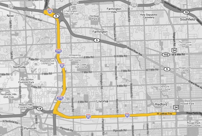
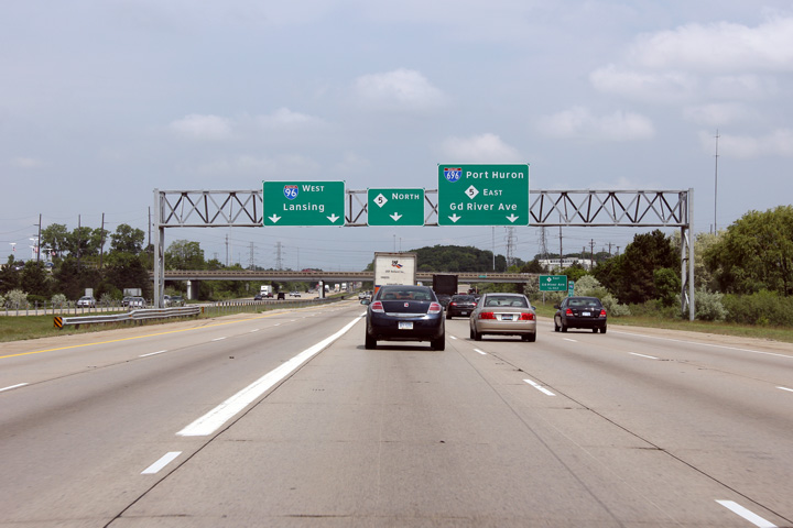
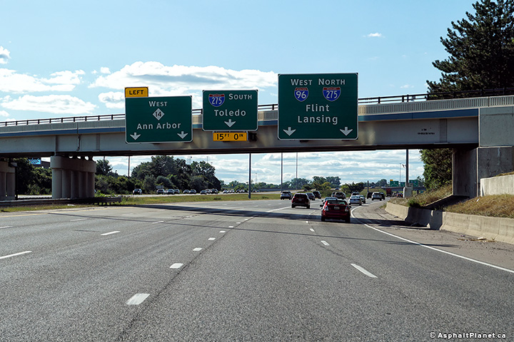
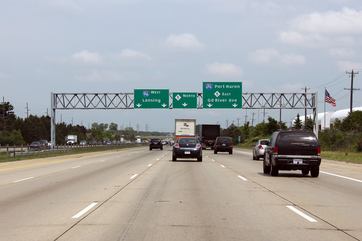
Oakland County |
The final westbound overhead signage approaching the I-696/M-5 interchange in Novi. I-275 ends at this interchange. It was originally envisioned following M-5 northerly through Oakland County, but was cancelled due to local opposition. |
 |
||
|
Date: 10/01/2010 |
High-res: (1440x960) (2400x1600) | |||
|
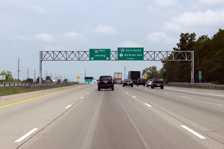
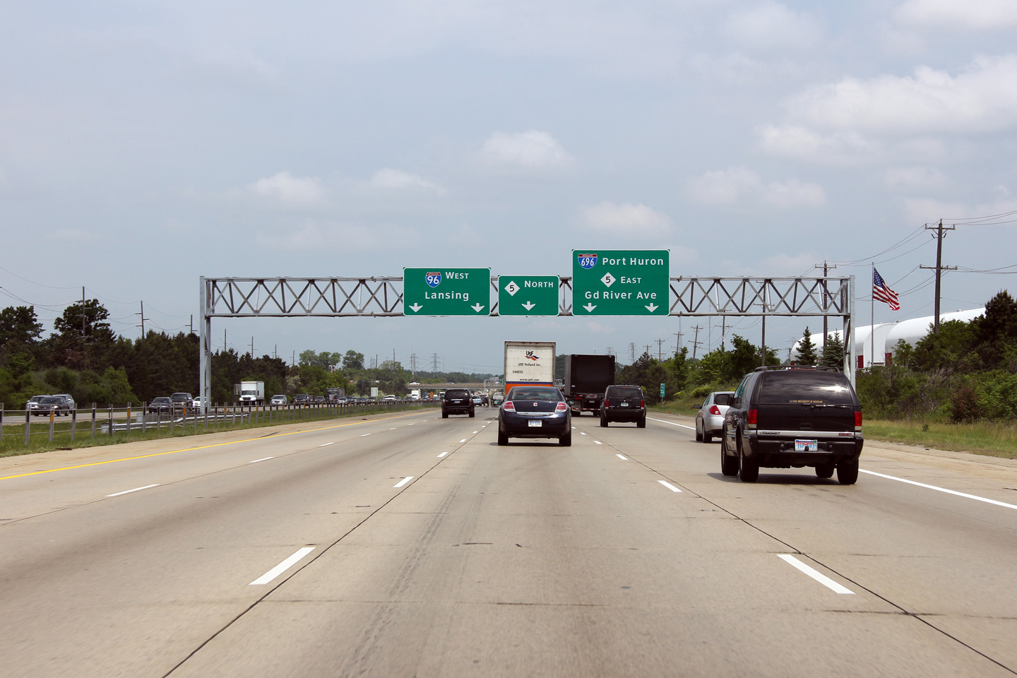
Oakland County |
An additional, more detailed lane assignment overhead signage assembly for the I-696/M-5 interchange. |
|
||
|
Date: 10/01/2010 |
High-res: (1440x960) (2400x1600) | |||
|
Oakland County |
First lane assignment advanced signage for the upcoming I-696/M-5 interchange. |
 |
||
|
Date: 10/01/2010 |
High-res: (1440x960) (2400x1600) | |||
|
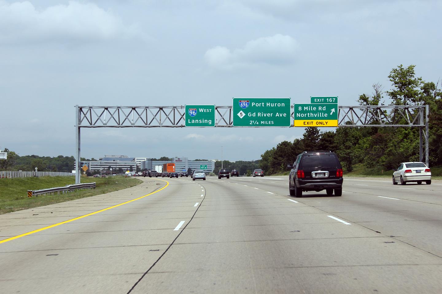
Oakland County |
The 8 exit to 8 Mile Road is signed with the first pre-advanced signage for the upcoming I-696/M-5 interchange. |
|
||
|
Date: 10/01/2010 |
High-res: (1440x960) (2400x1600) | |||
|
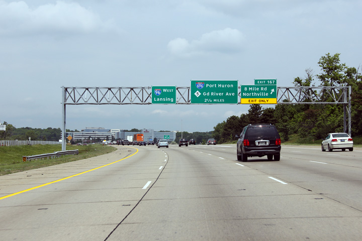
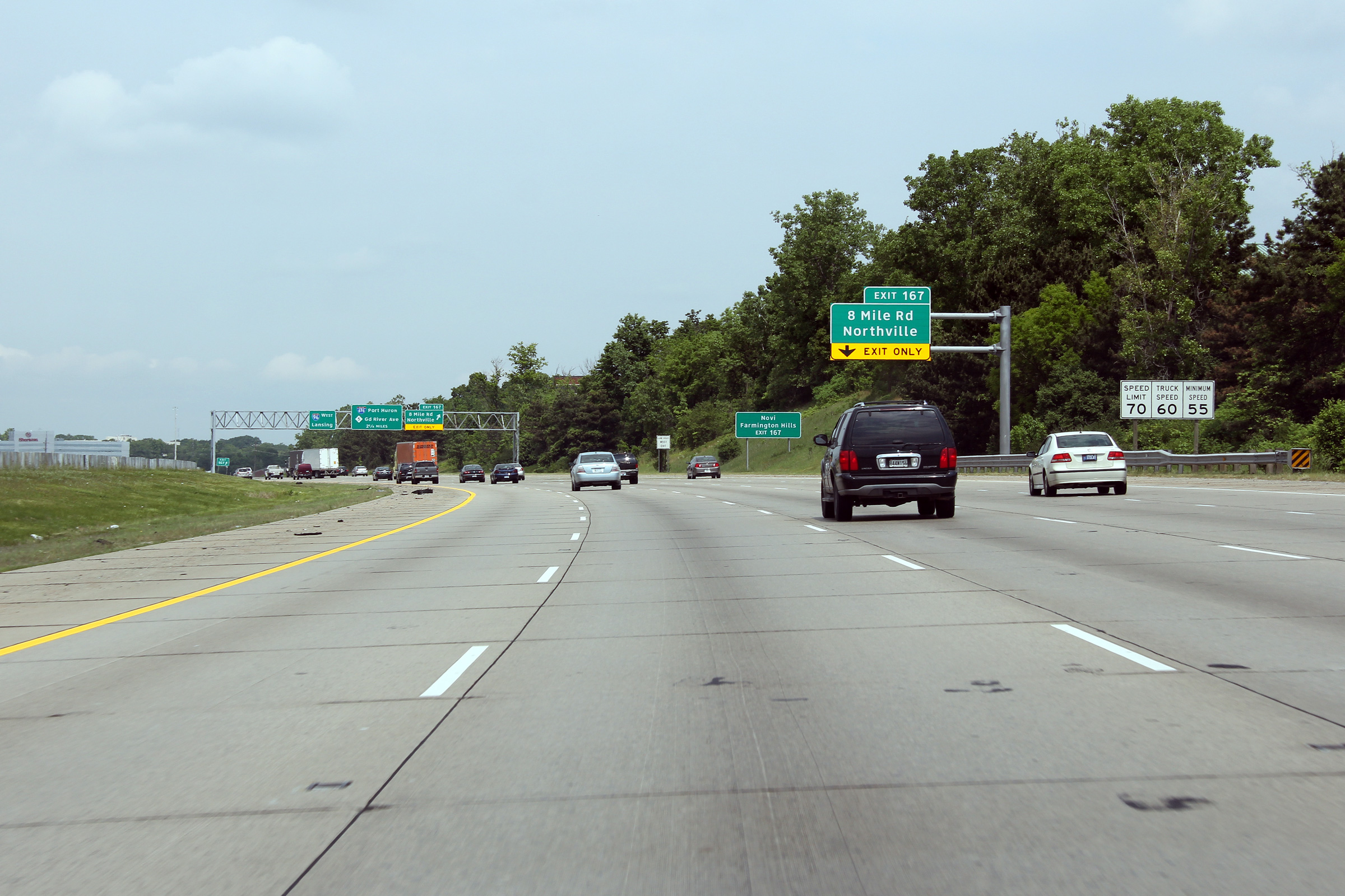
Oakland County |
Northerly view approaching the 8 Mile Road interchange. 8 Mile Road is the boundary between Oakland and Wayne Counties. |
|
||
|
Date: 10/01/2010 |
High-res: (1440x960) (2400x1600) | |||
|
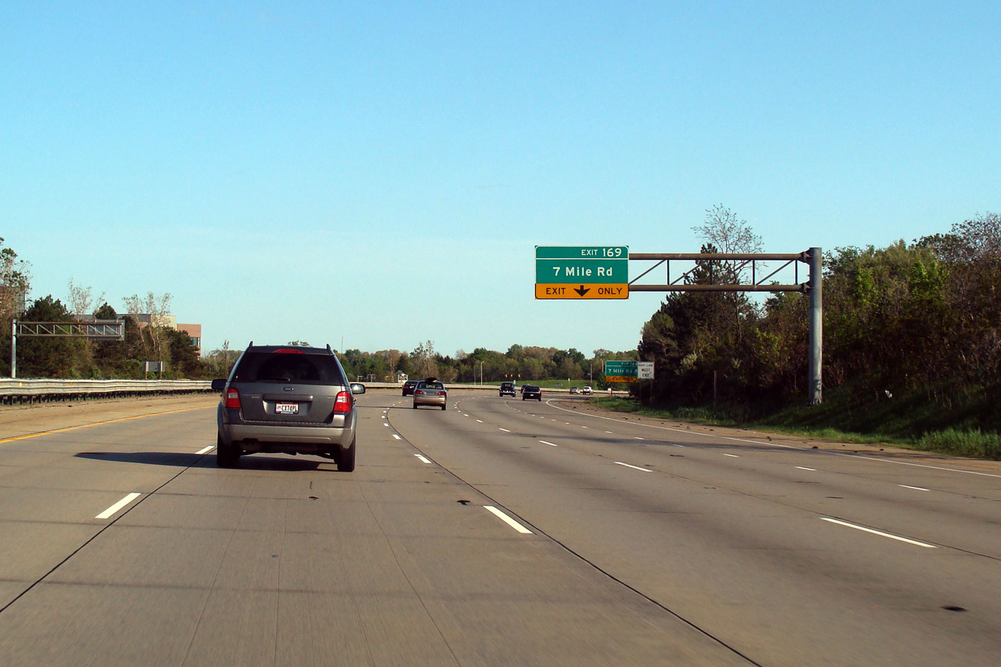
Wayne County |
Southbound signage for the ramp to 7 Mile Road. |
 |
||
|
Date: 1/24/2009 |
||||
|
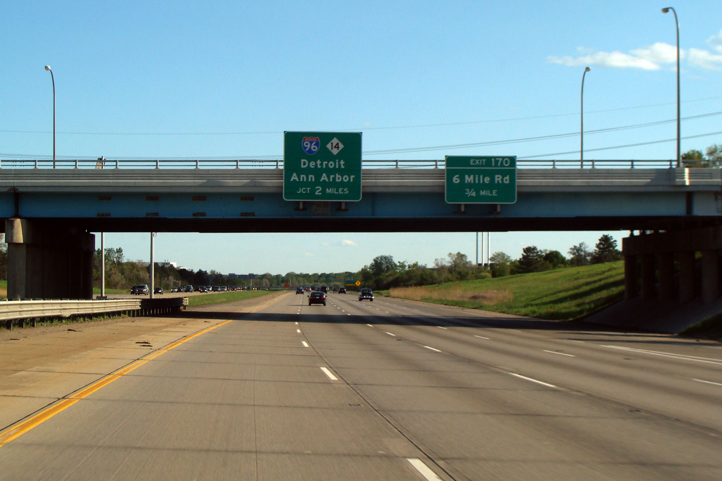
Wayne County |
Advanced signage for both the I-275/M-14 and 6 Mile Road interchanges affixed to the 7 Mile Road overpass. |
 |
||
|
Date: 1/24/2009 |
High Res | |||
|
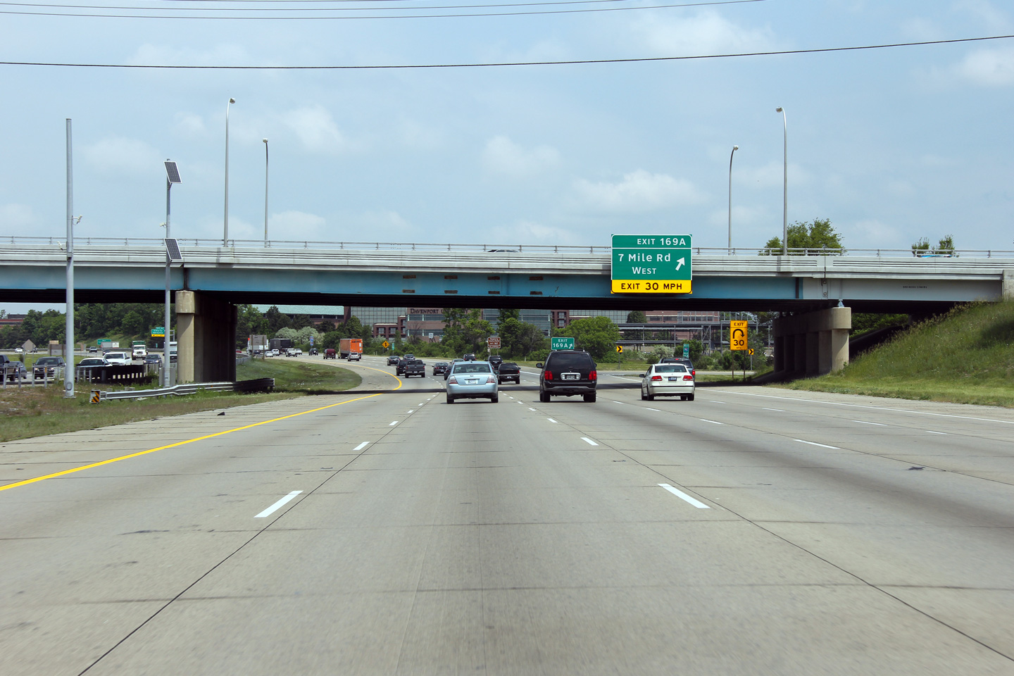
Wayne County |
Signage at the loop ramp to 7 Mile Road West. |
 |
||
|
Date: 10/01/2010 |
High-res: (1440x960) (2400x1600) | |||
|
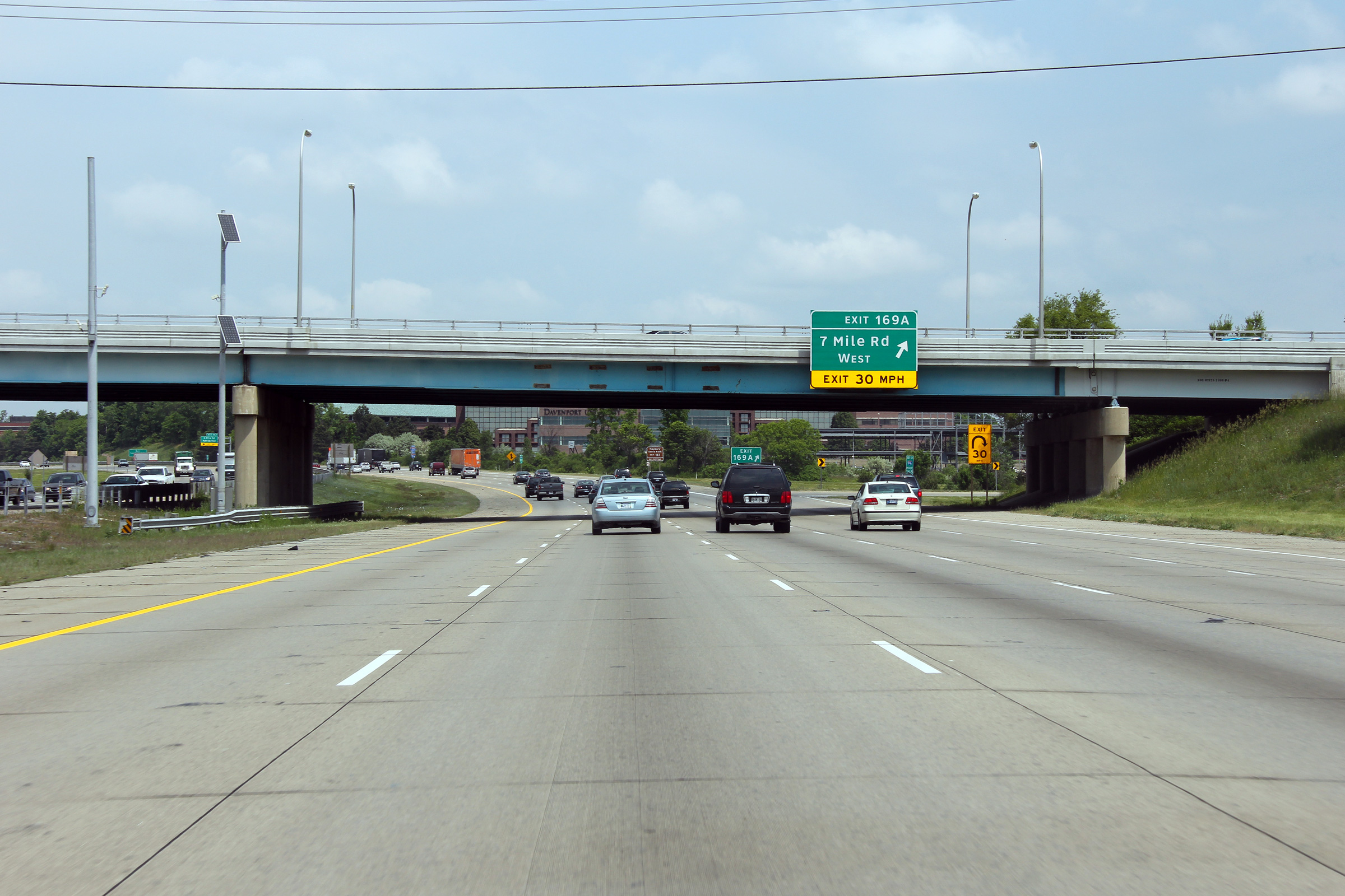
Wayne County |
Overhead signage at the off-ramp to 7 Mile Road East. I-96/I-275 meet 7 Mile Road at a parclo AB4 interchange that favours southbound movements along I-96/I-275. |
 |
||
|
Date: 10/01/2010 |
High-res: (1440x960) (2400x1600) | |||
|
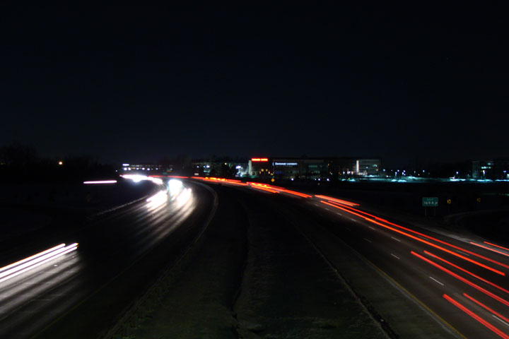
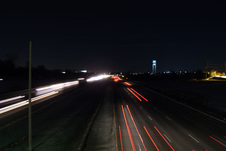
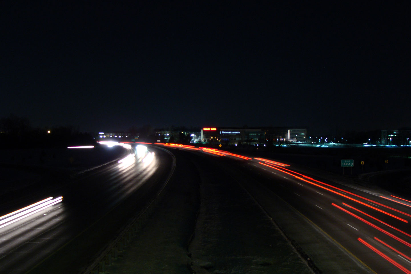
Wayne County |
View looking westerly from the 7 Mile Rd. overpass on a cold January evening. This was the first night photo I had taken in Southeast Michigan, and although it didn't turn out too well, I put it online in high resolution simply because of the effort that was required to capture this image. |
 |
||
|
Date: 1/24/2009 |
||||
|
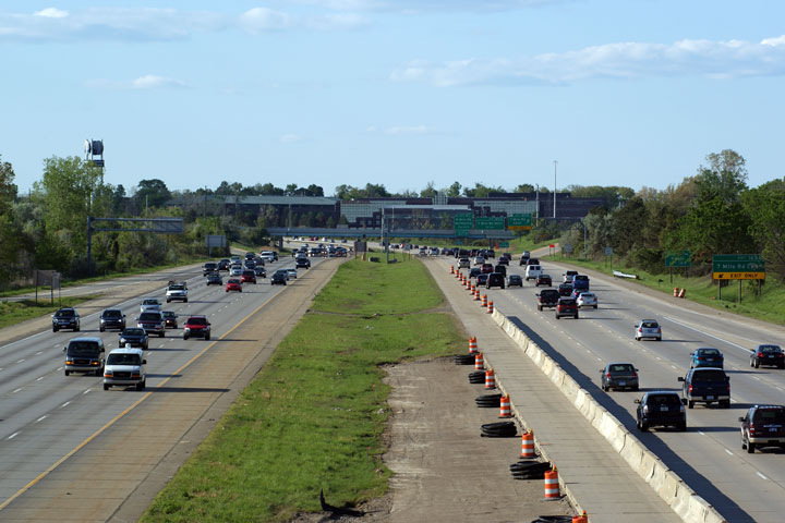
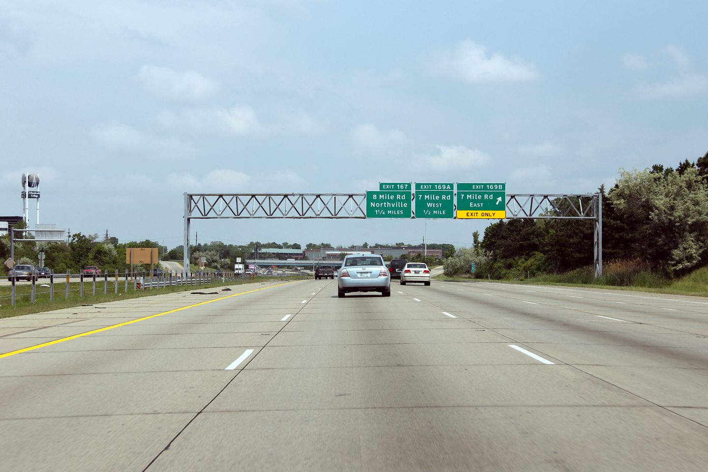
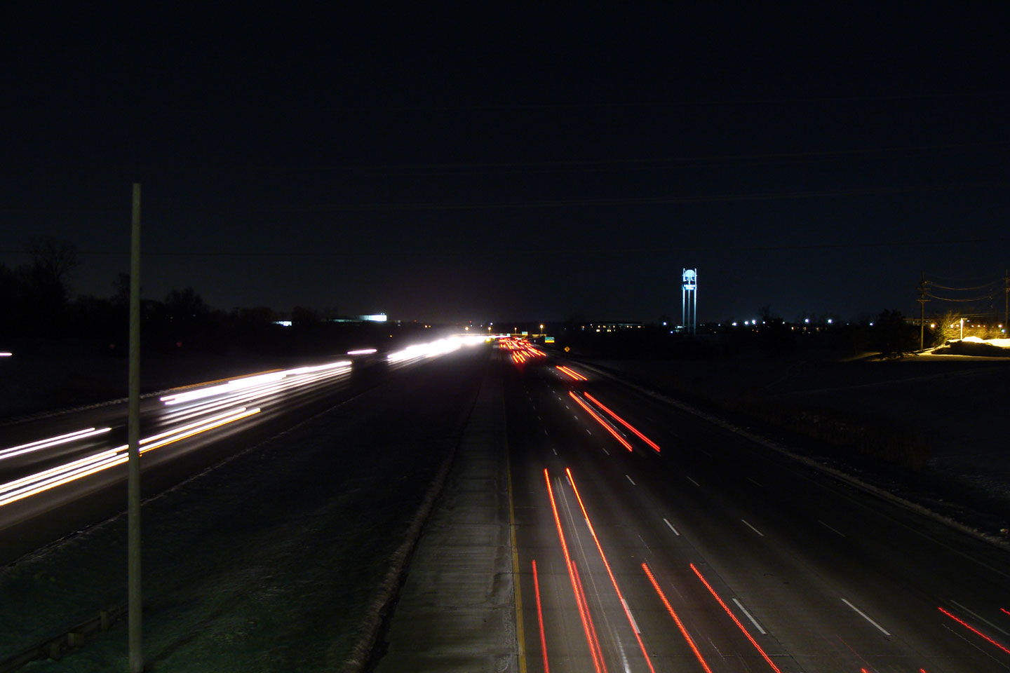
Wayne County |
Easterly view from the 7 Mile Rd. overpass. The I-96/275 corridor is surrounded by large format big-box development. |
|
||
|
Date: 5/17/2009 |
||||
|
Wayne County |
View looking westerly from the 6 Mile Rd. overpass. |
 |
||
|
Date: 5/17/2009 |
||||
|
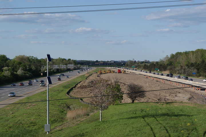
Wayne County |
Easterly view from the 6 Mile Rd. overpass. It would appear that MDOT is extending the northbound lane from I-275 to past the 6 Mile Road interchange to reduce the bottleneck at the I-96/275/M-14 interchange. |
 |
||
|
Date: 5/17/2009 |
||||
|
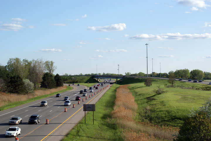
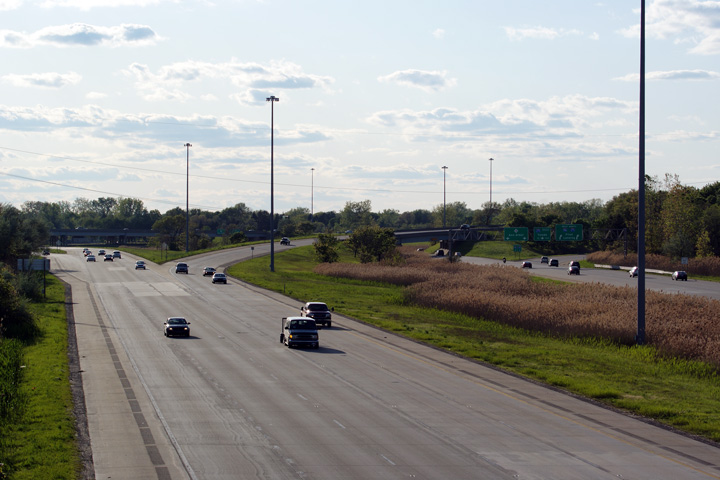
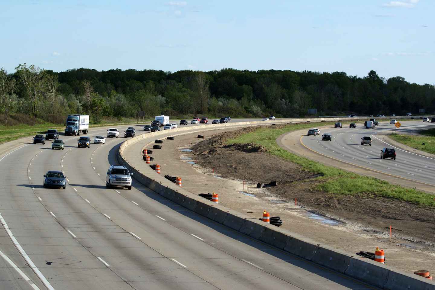
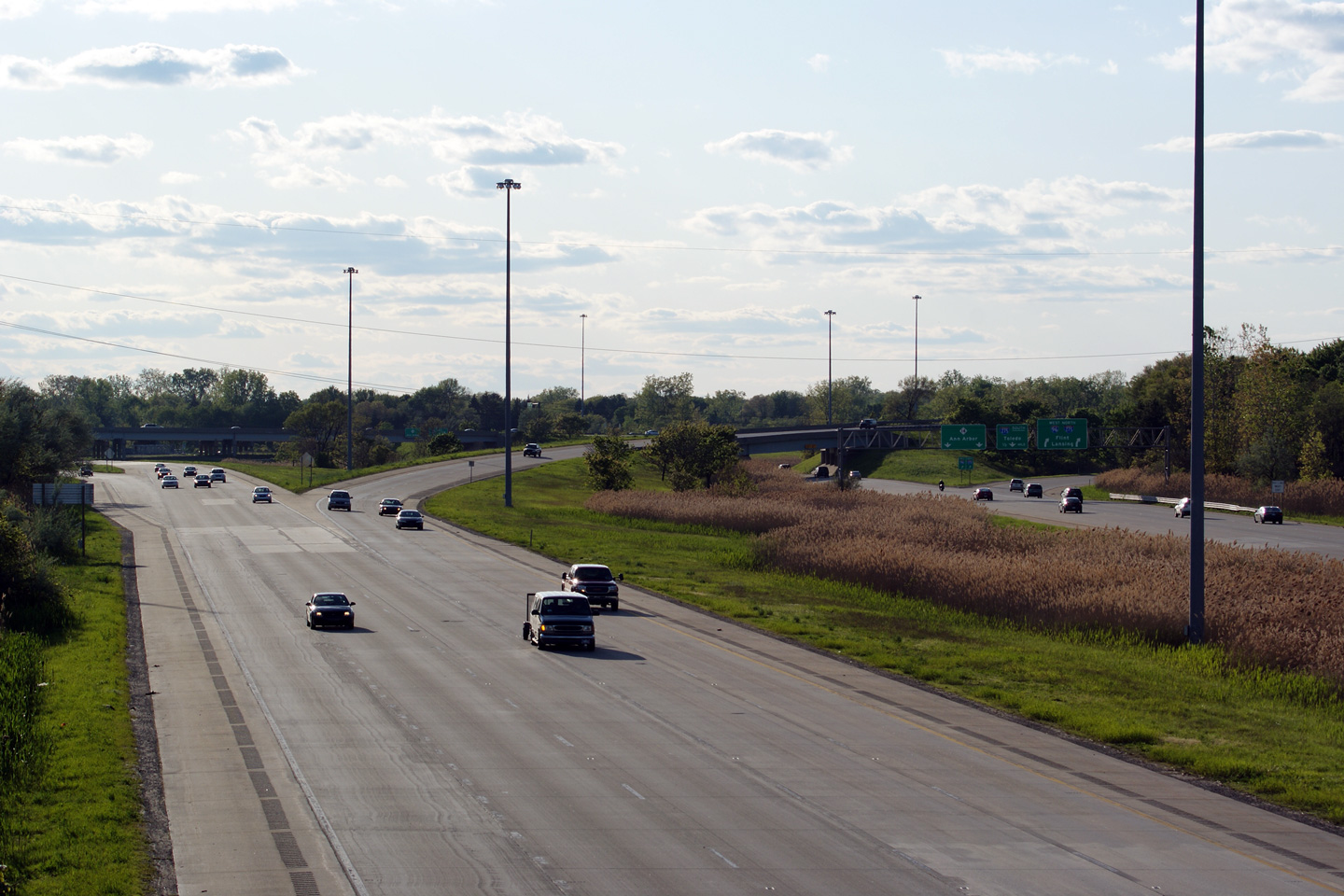
Wayne County |
Westerly view from the 5 Mile Road overpass. I-96/275 has a considerable footprint through western Livonia. |
|
||
|
Date: 5/17/2009 |
||||
|
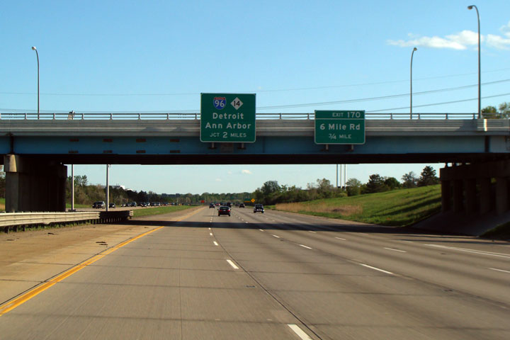
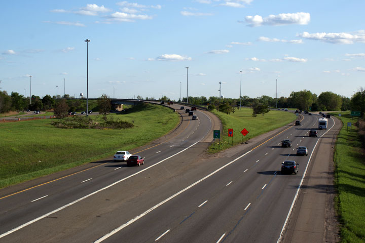
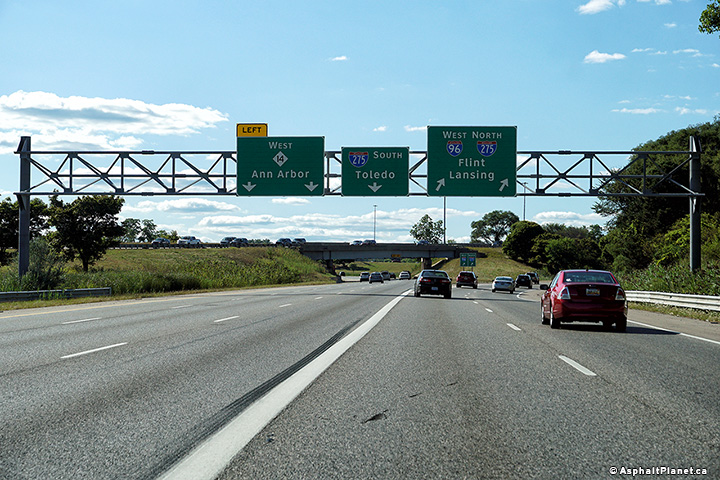
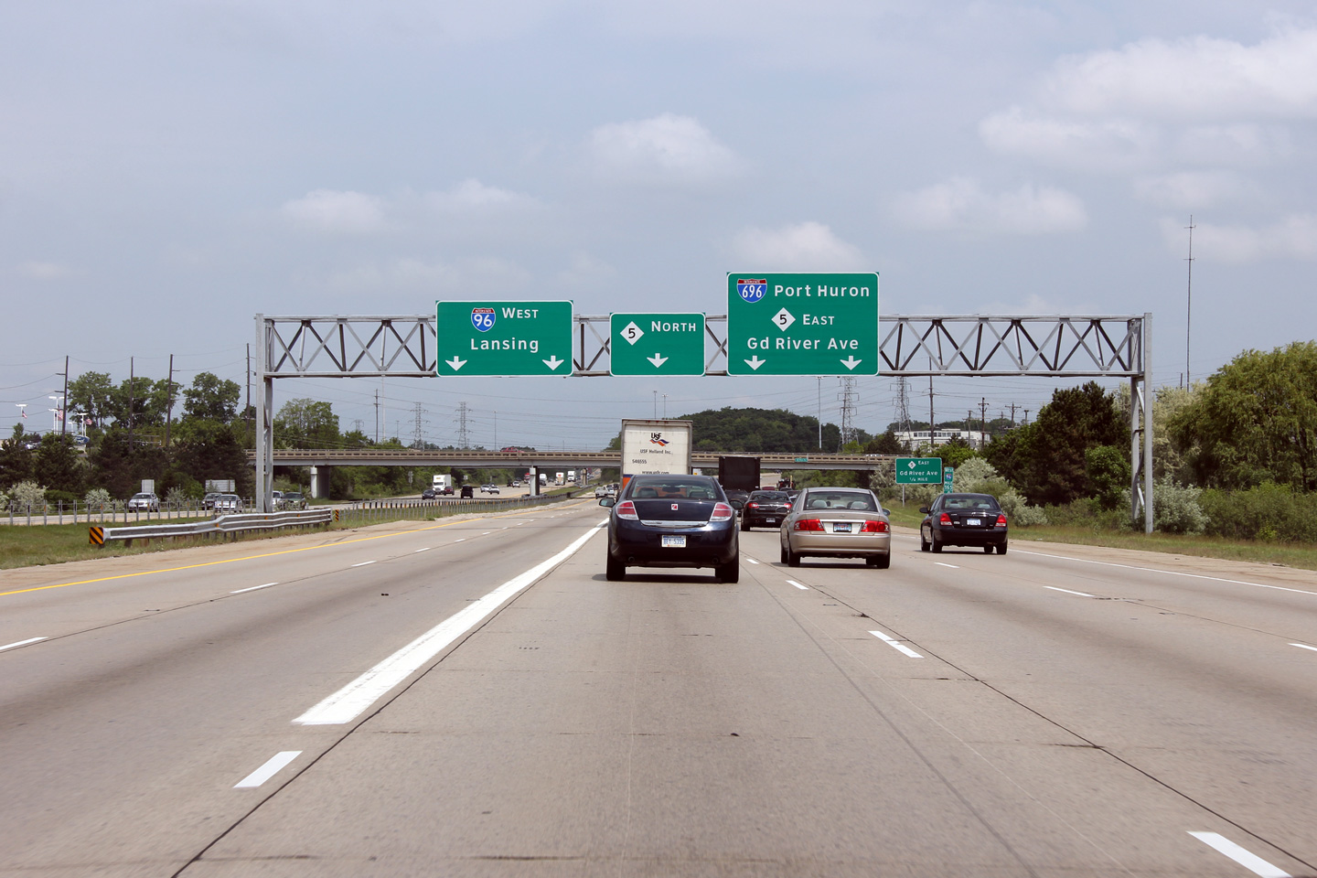
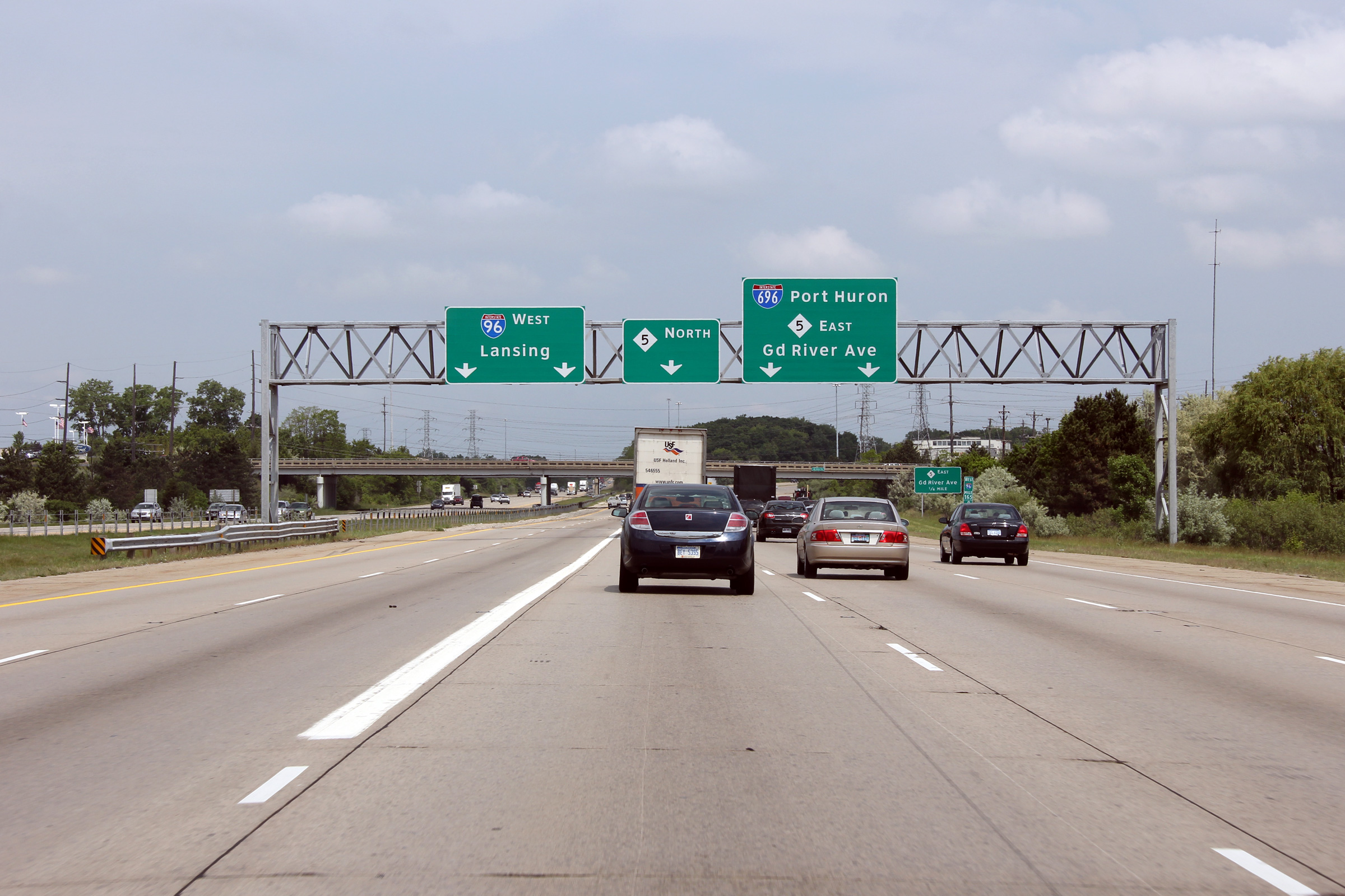
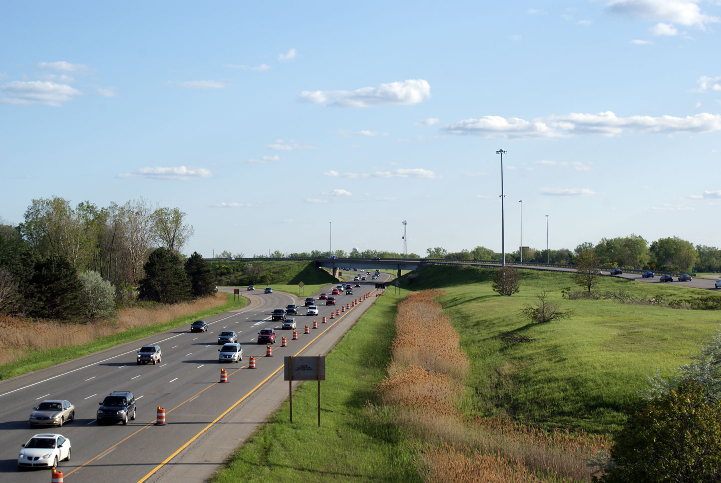
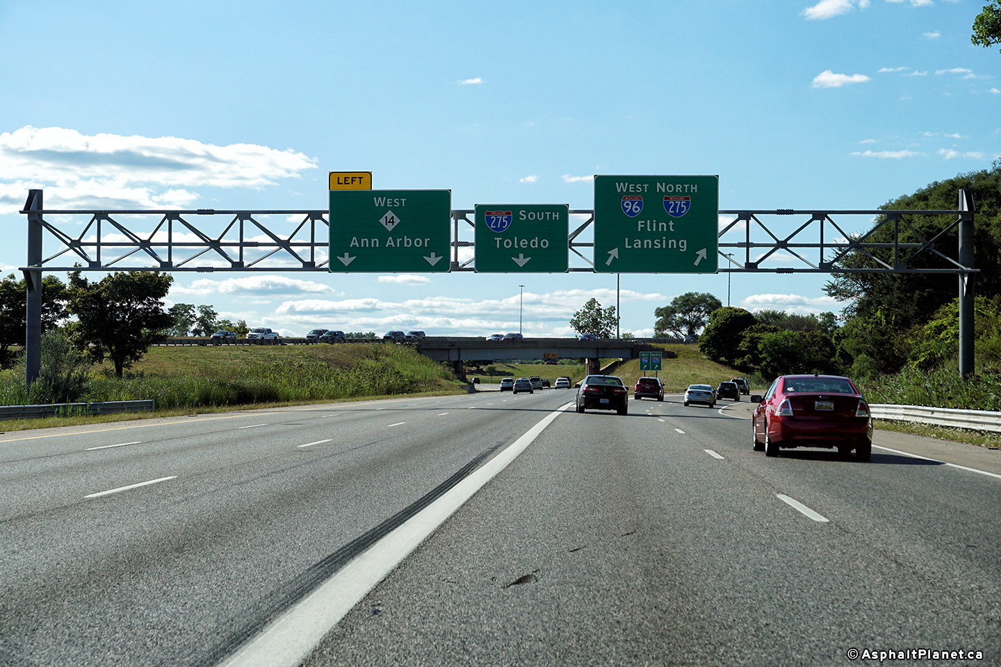
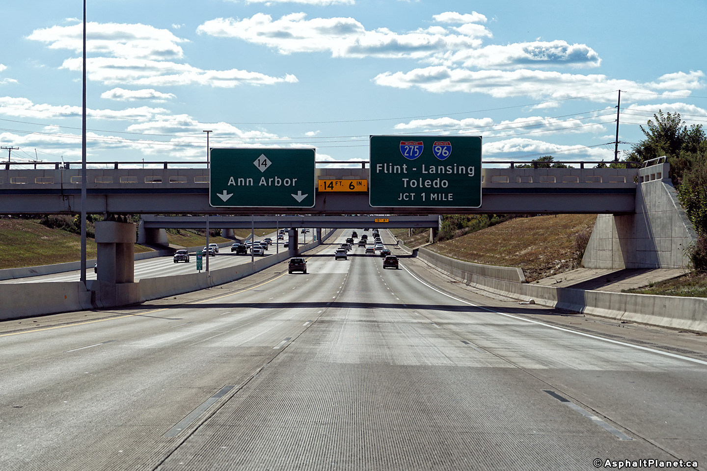
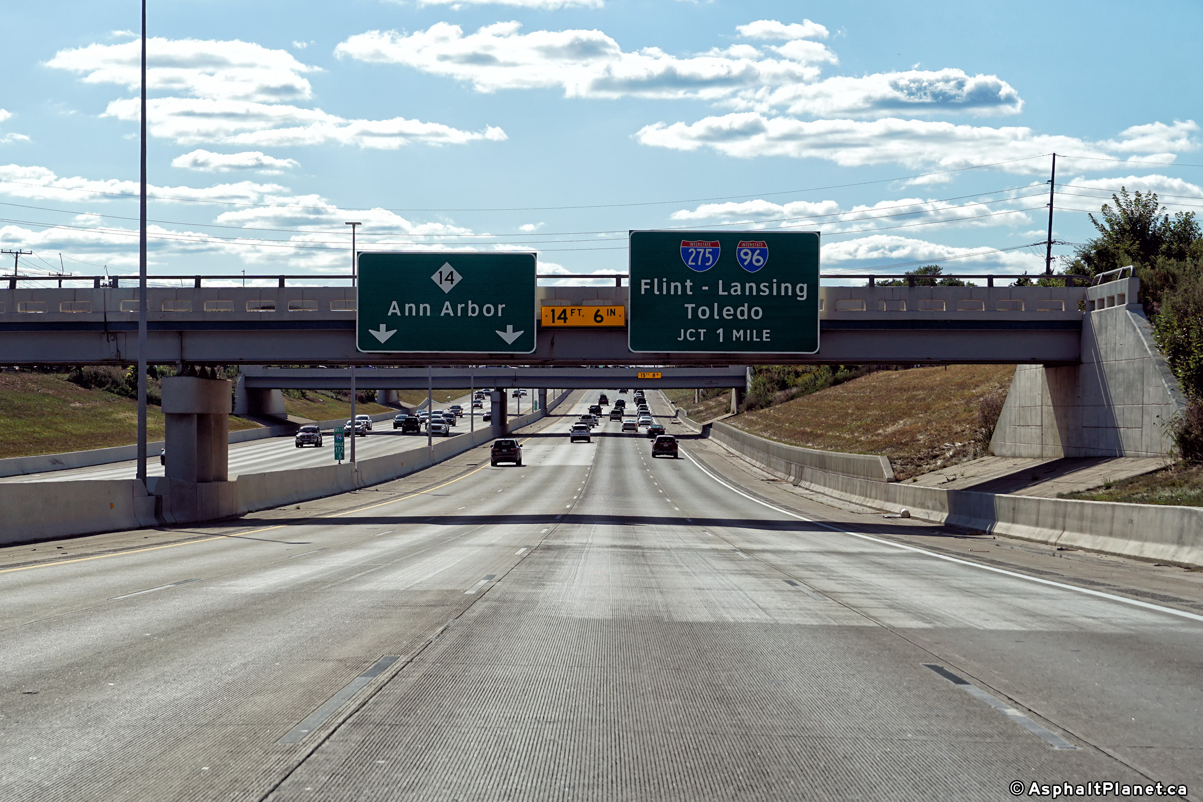
Wayne County |
Two views looking easterly from the 5 Mile Road overpass towards the I-96/275/M-14 interchange. I-275 meets M-14 and I-96-East at a three quarter cloverleaf interchange. A high-speed directional ramp carries eastbound Interstate 96 traffic bound for downtown Detroit. All other ramp movements are accommodated through loop ramps. |
 |
||
 |
||||
|
Date: 5/17/2009 |
||||
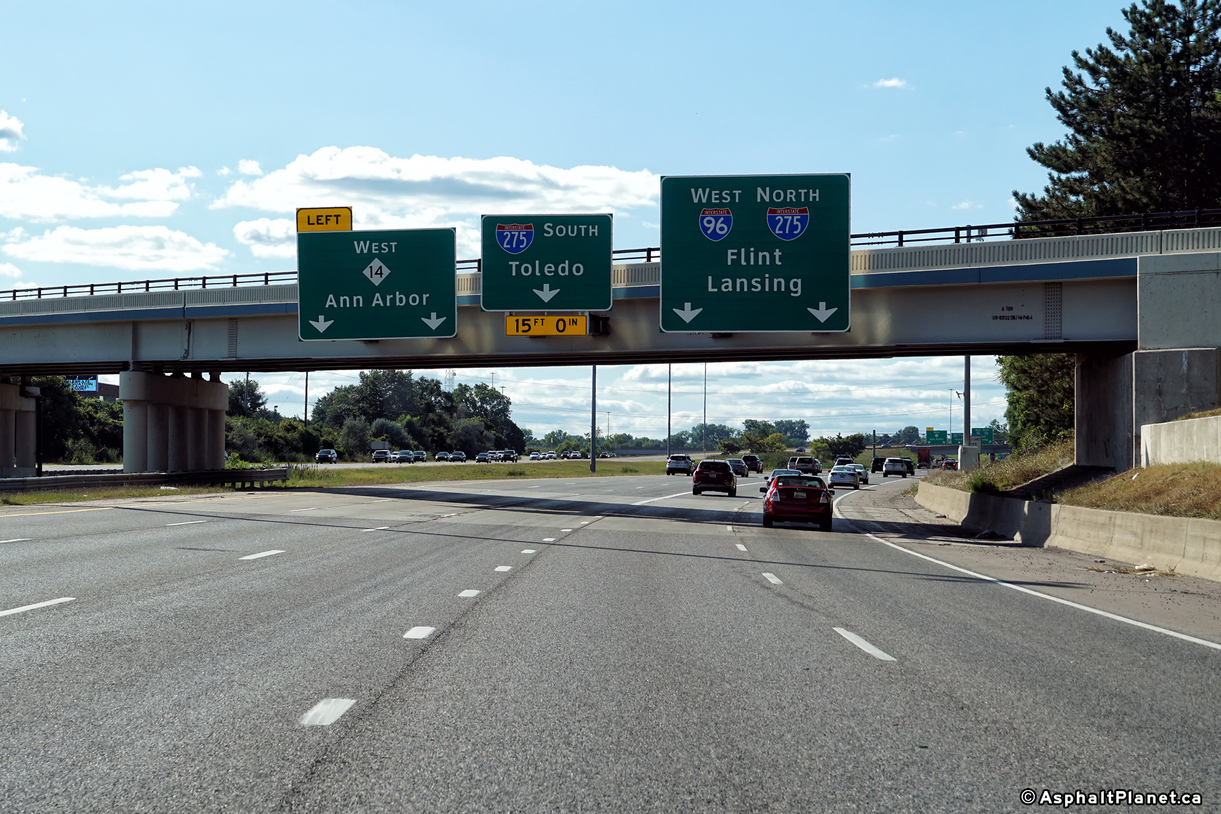
|
Wayne County |
Signage as the ramp to I-96 West and I-275 North departs from the through freeway. |
 |
||
|
Date: 08/24/2019 |
High-res: (1440x960) (2400x1600) | |||
|
Wayne County |
View looking westerly from the Schoolcraft Road overpass towards the M-14 interchange. |
 |
||
|
Date: 5/17/2009 |
High-res: (1440x960) (2400x1600) | |||
|
Wayne County |
View looking easterly from the Schoolcraft Road overpass towards Downtown. I-96 maintains this four-lane depressed cross-section until the highway hits the Detroit City limit and explodes into a 10-12 lane collector-distributor highway. |
|
||
|
Date: 5/17/2009 |
High-res: (1440x960) (2400x1600) | |||
|
Wayne County |
Westbound advanced lane assignment signage affixed to the Schoolcraft Road overpass for the upcoming M-14 interchange. |
 |
||
|
Date: 08/24/2019 |
High-res: (1440x960) (2400x1600) | |||
|
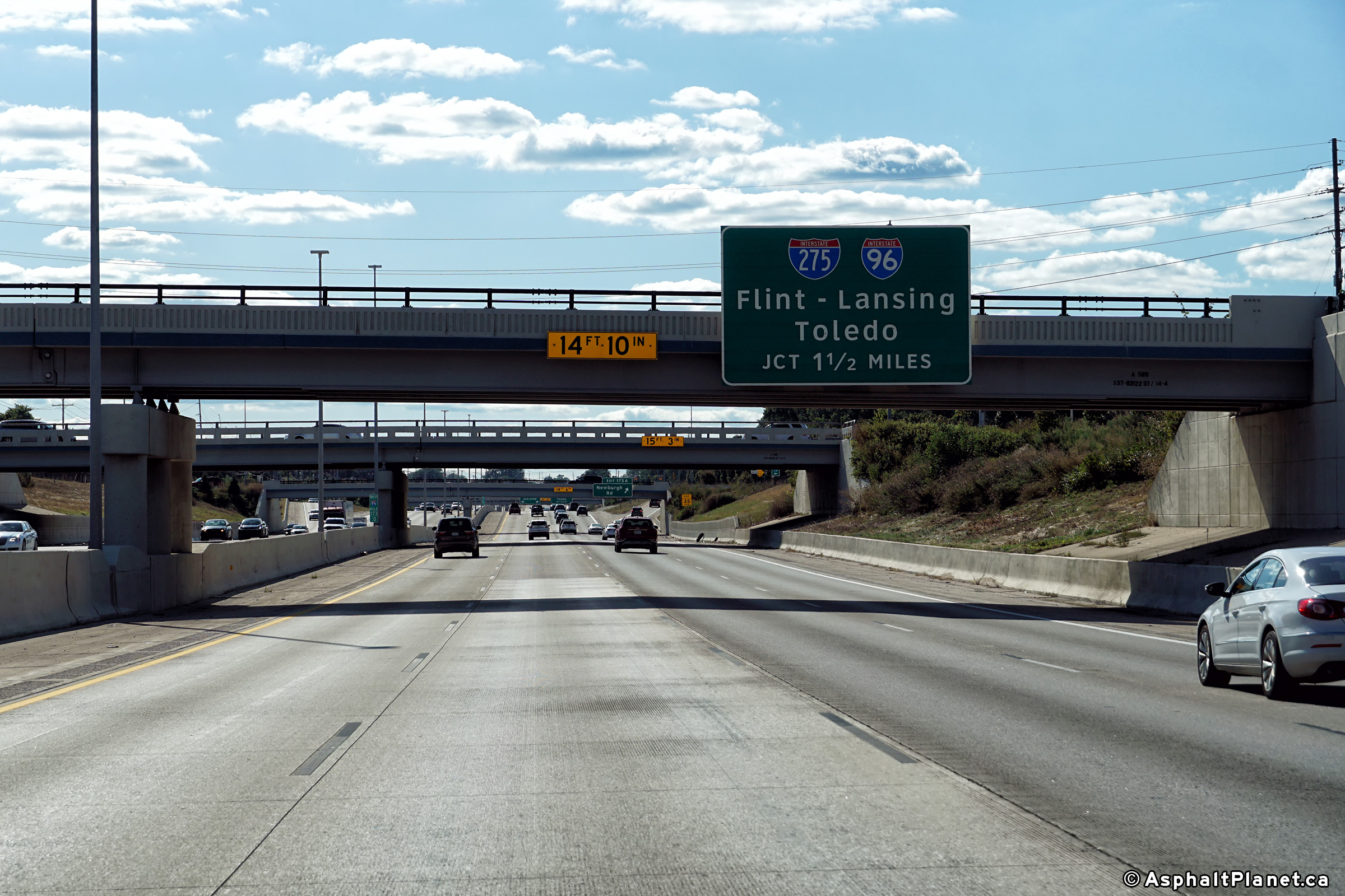
Wayne County |
Westbound advanced signage for the M-14 interchange. |
 |
||
|
Date: 08/24/2019 |
High-res: (1440x960) (2400x1600) | |||
|
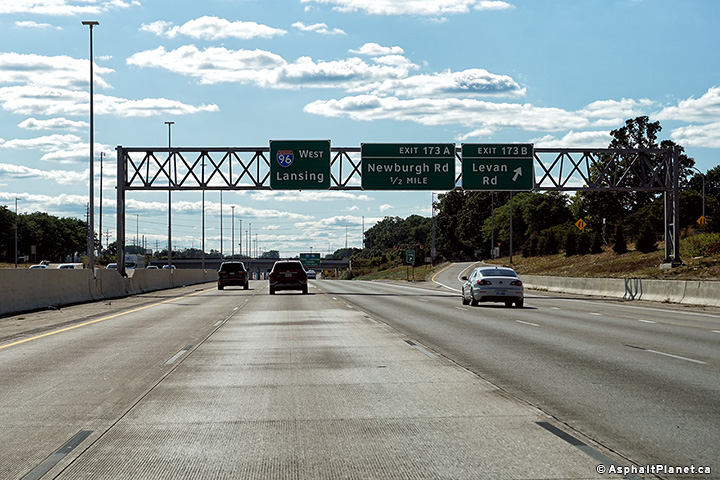
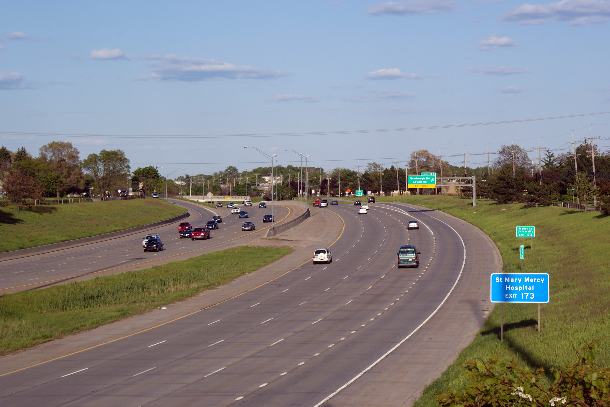
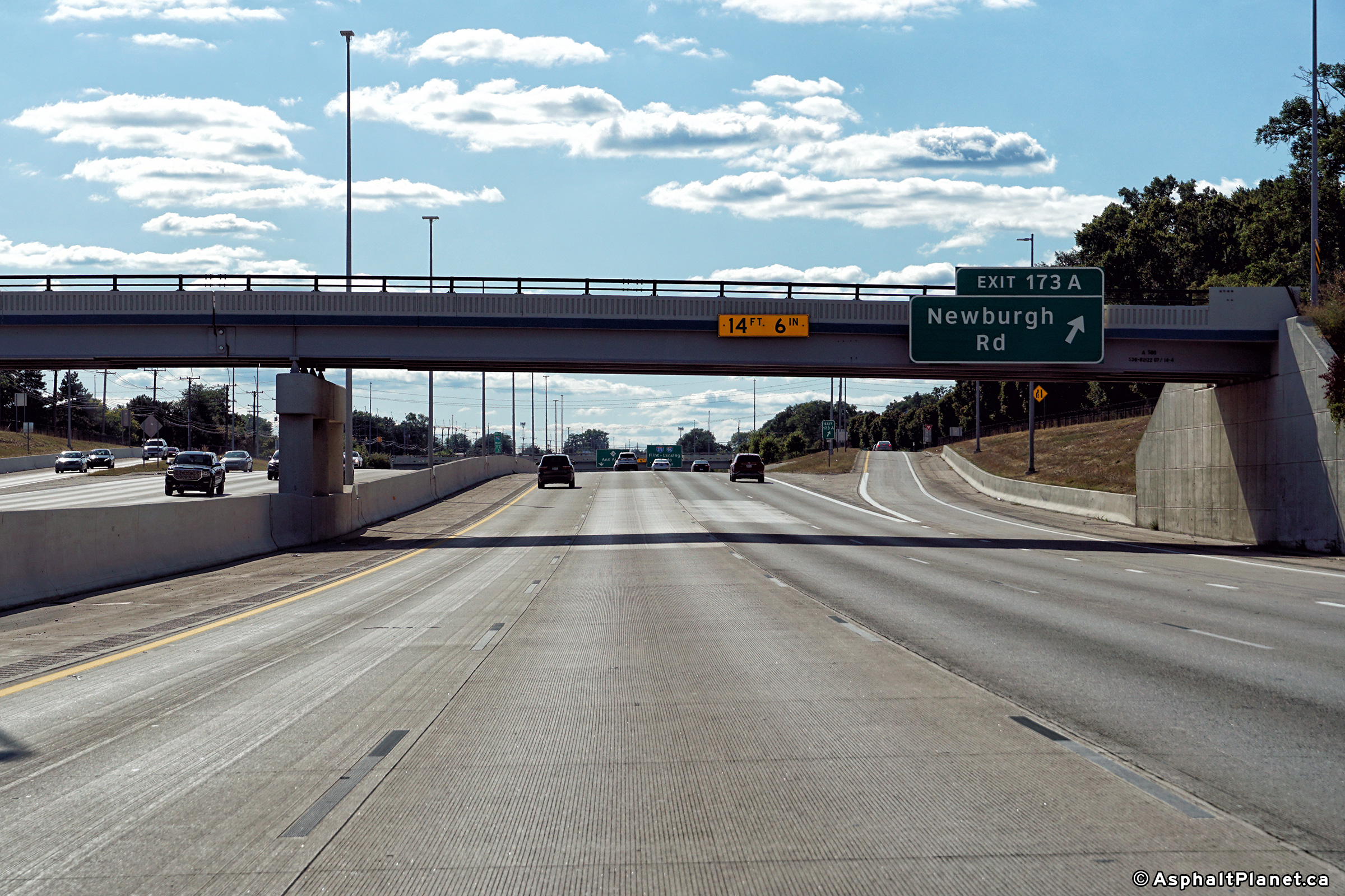
Wayne County |
Signage at the westbound off-ramp to Newburgh Road. |
 |
||
|
Date: 08/24/2019 |
High-res: (1440x960) (2400x1600) | |||
|
Wayne County |
Westbound pre-advanced signage for the I-275 interchange. Interstingly M-14 is not indicated on this pre-advanced signage. |
 |
||
|
Date: 08/24/2019 |
High-res: (1440x960) (2400x1600) | |||
|
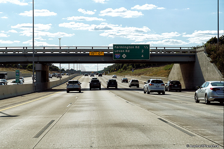
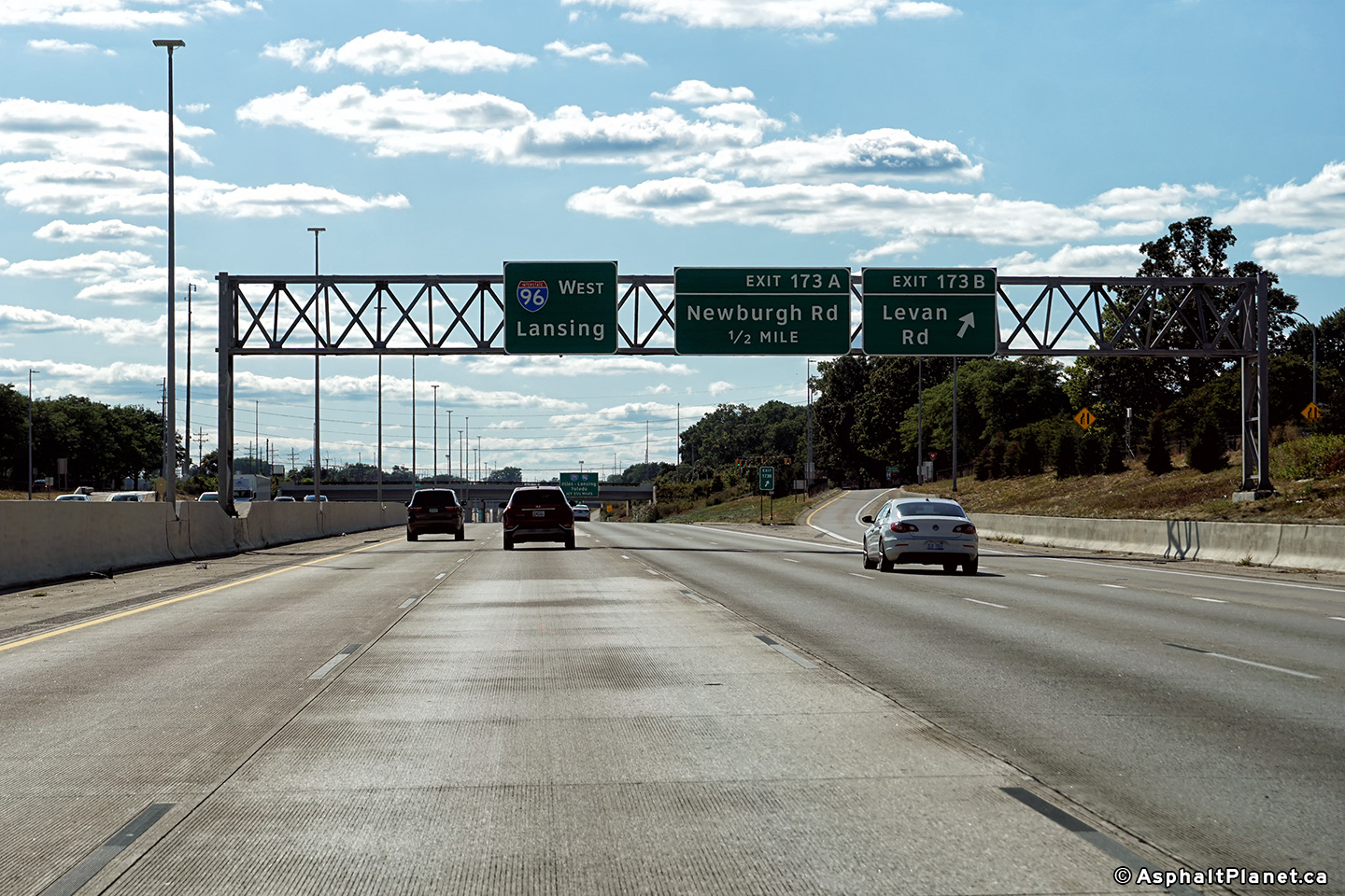
Wayne County |
Westbound signage at the off-ramp to Levan Road. |
 |
||
|
Date: 08/24/2019 |
High-res: (1440x960) (2400x1600) | |||
|
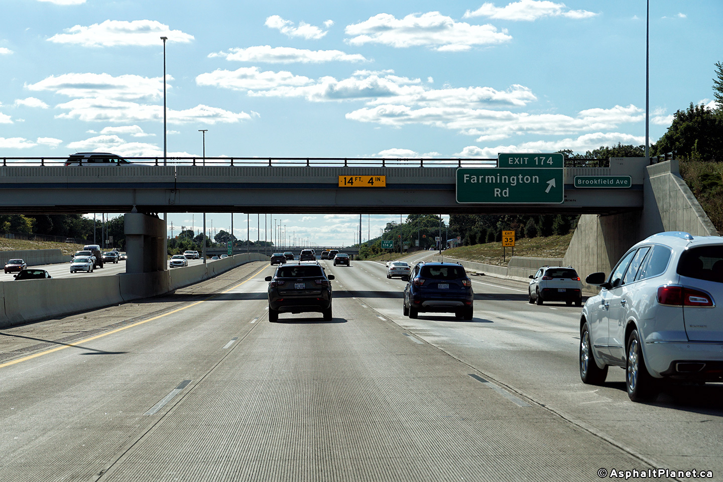
Wayne County |
Signage atht westbound off-ramp to Farmington Road. |
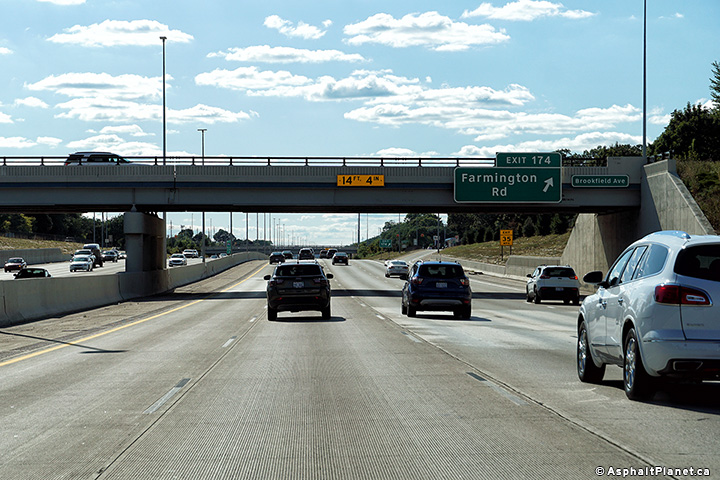 |
||
|
Date: 08/24/2019 |
High-res: (1440x960) (2400x1600) | |||
|
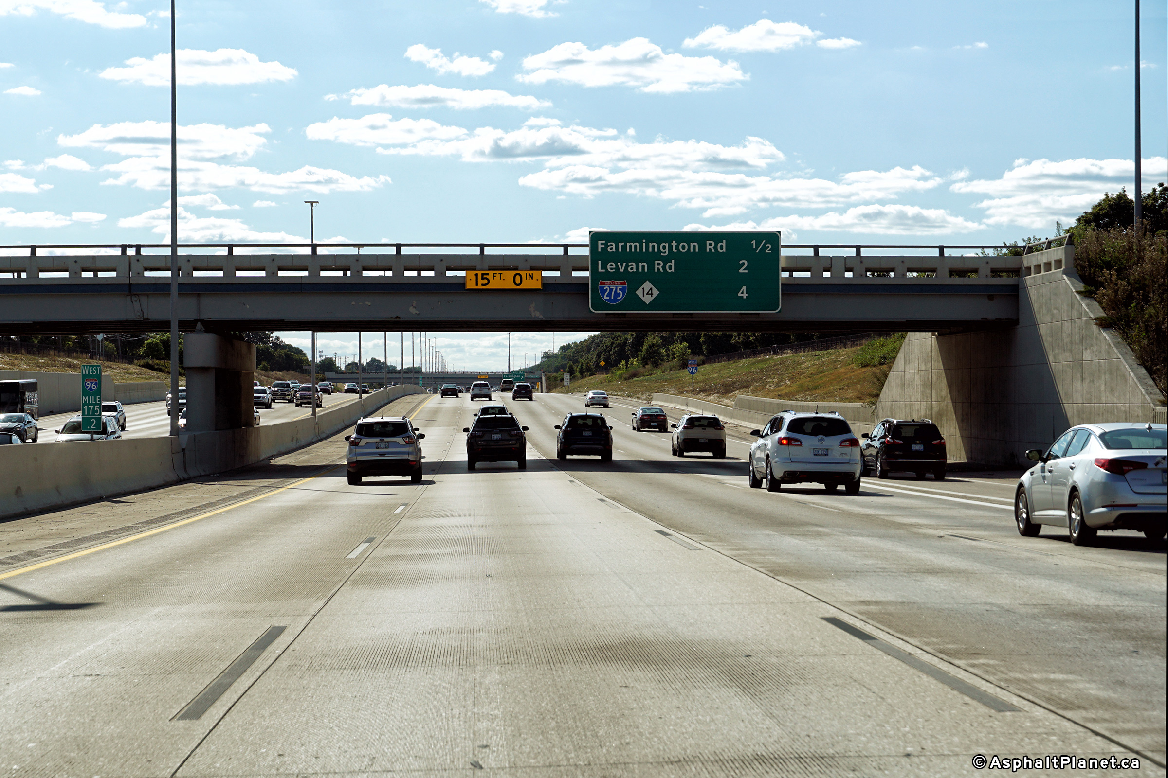
Wayne County |
Interchange sequence signage facing westbound motorists approaching Farmington Road. |
 |
||
|
Date: 08/24/2019 |
High-res: (1440x960) (2400x1600) | |||
<- Page 3 Back to I-96 Index Page 5 ->
Michigan Highways Index
AsphaltPlanet.ca - Home
© 2004-2019 Scott Steeves. AsphaltPlanet@asphaltplanet.ca
Page Created: June 6, 2007.
Last Updated: October 5, 2019.

