Pictures on this page are arranged in order from west to east. US-131 North photos are left-aligned in the last column, while US-131 South photos are right-aligned. Center-line pictures are centered within the last column.
AsphaltPlanet.ca > Michigan > US-131
Pictures on this page are arranged in order from west to east.
US-131
North photos are left-aligned in the last column, while US-131 South photos are right-aligned.
Center-line pictures are centered within the last column.
|
Location |
Description |
Photo |
||
|
North- |
South- |
|||
|
Kalamazoo County |
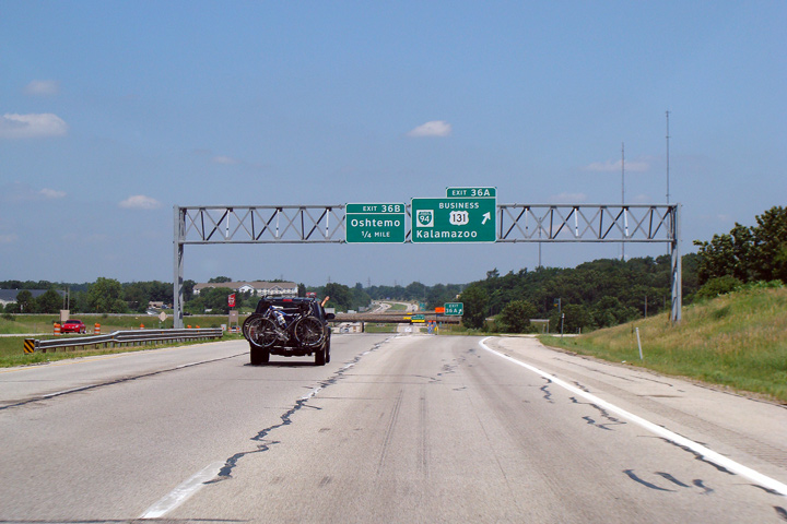
Overhead sign truss for the northbound exit to Business I-94 and Business US-131 in Kalamazoo. |
 |
||
|
Date: 7/06/2008 |
High Res (100 kb) |
|||
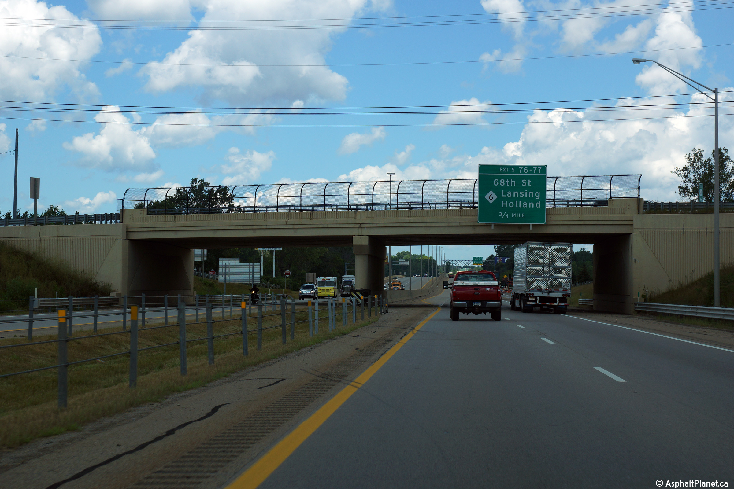
|
Kent County |
Bridge-mounted Clearview 0.75 mile advance exit sign for 68th St. and M-6 (Exits 76 and 77) on US 131 North, affixed to the 76th St. overpass. US 131 transitions from four lanes with a grassy median to six lanes (eight briefly between 76th St. and 68th St.) with a paved median and concrete tall-wall at this location. |
 |
||
|
Date: 8/31/2015 |
High-res: (1440x960) (2400x1600) | |||
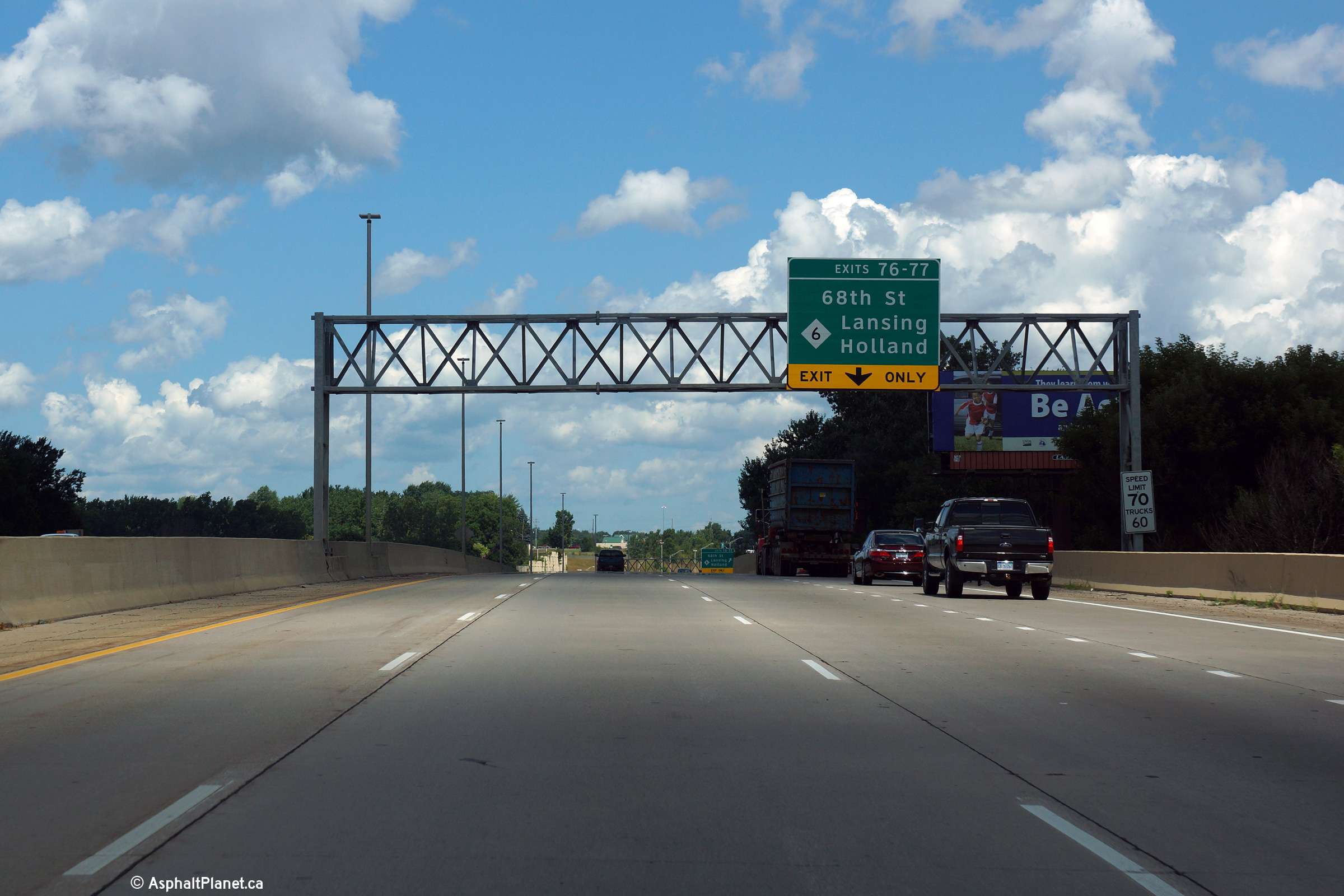
|
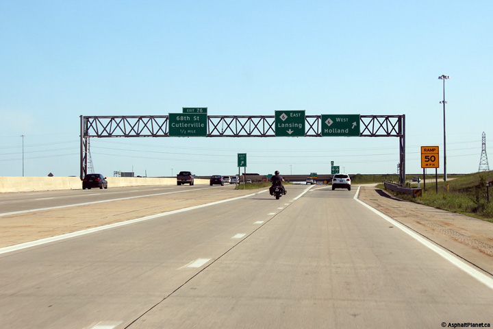
Kent County |
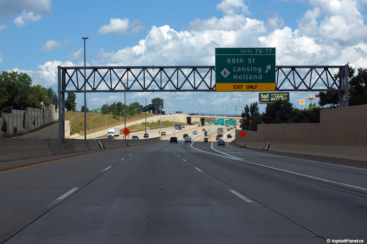
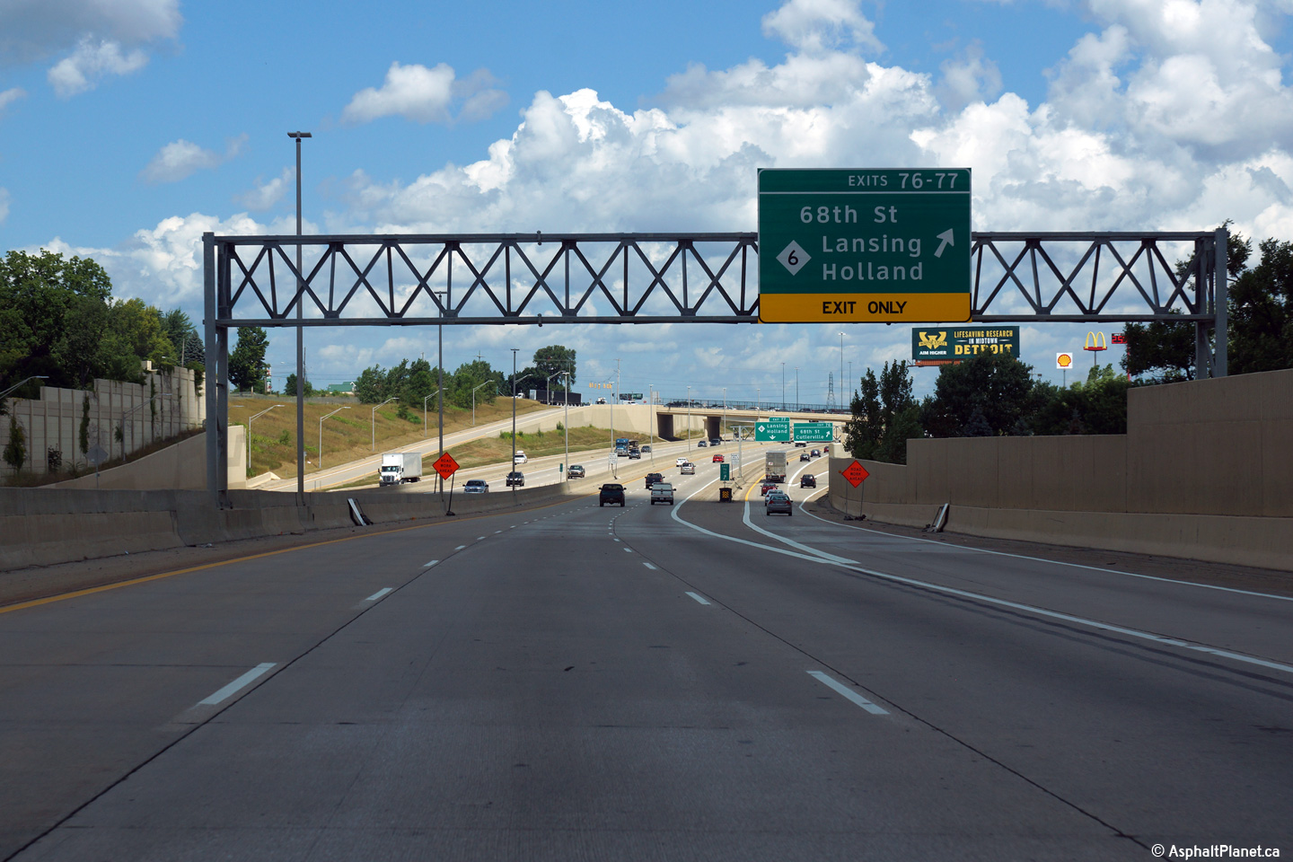
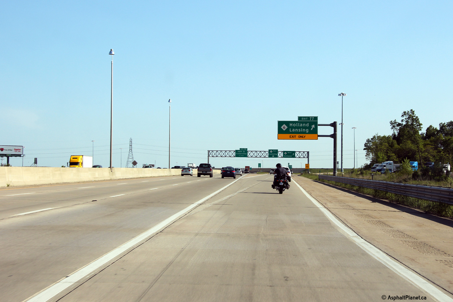
Sign truss with Clearview exit only sign for 68th St. and M-6 (Exits 76 and 77) on US 131 North. A fourth northbound lane is formed by the merge of the on-ramp from 76th St. This lane becomes exit only for both the 68th St. and M-6 interchanges. |
 |
||
|
Date: 8/31/2015 |
High-res: (1440x960) (2400x1600) | |||
|
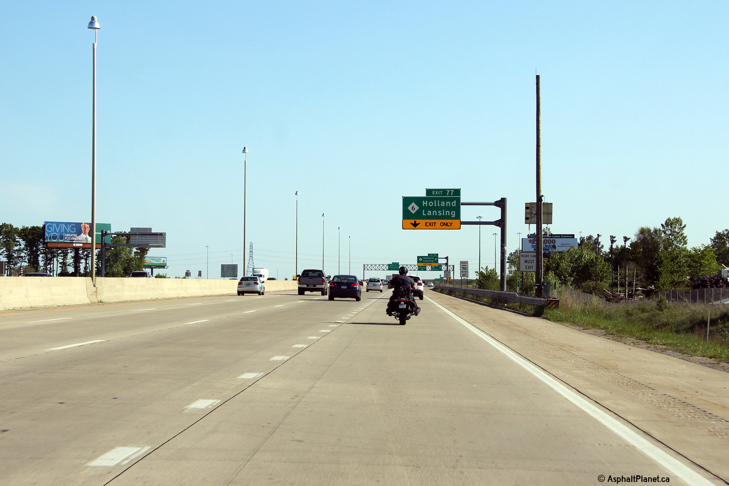
Kent County |
Clearview exit sign for 68th St. and M-6 attached to sign gantry on US 131 North at the point where a C/D lane begins that carries traffic from US 131 North to the next two interchanges: 68th St. (Exit 76) and the M-6 freeway (Exit 77). |
 |
||
|
Date: 8/31/2015 |
High-res: (1440x960) (2400x1600) | |||
|
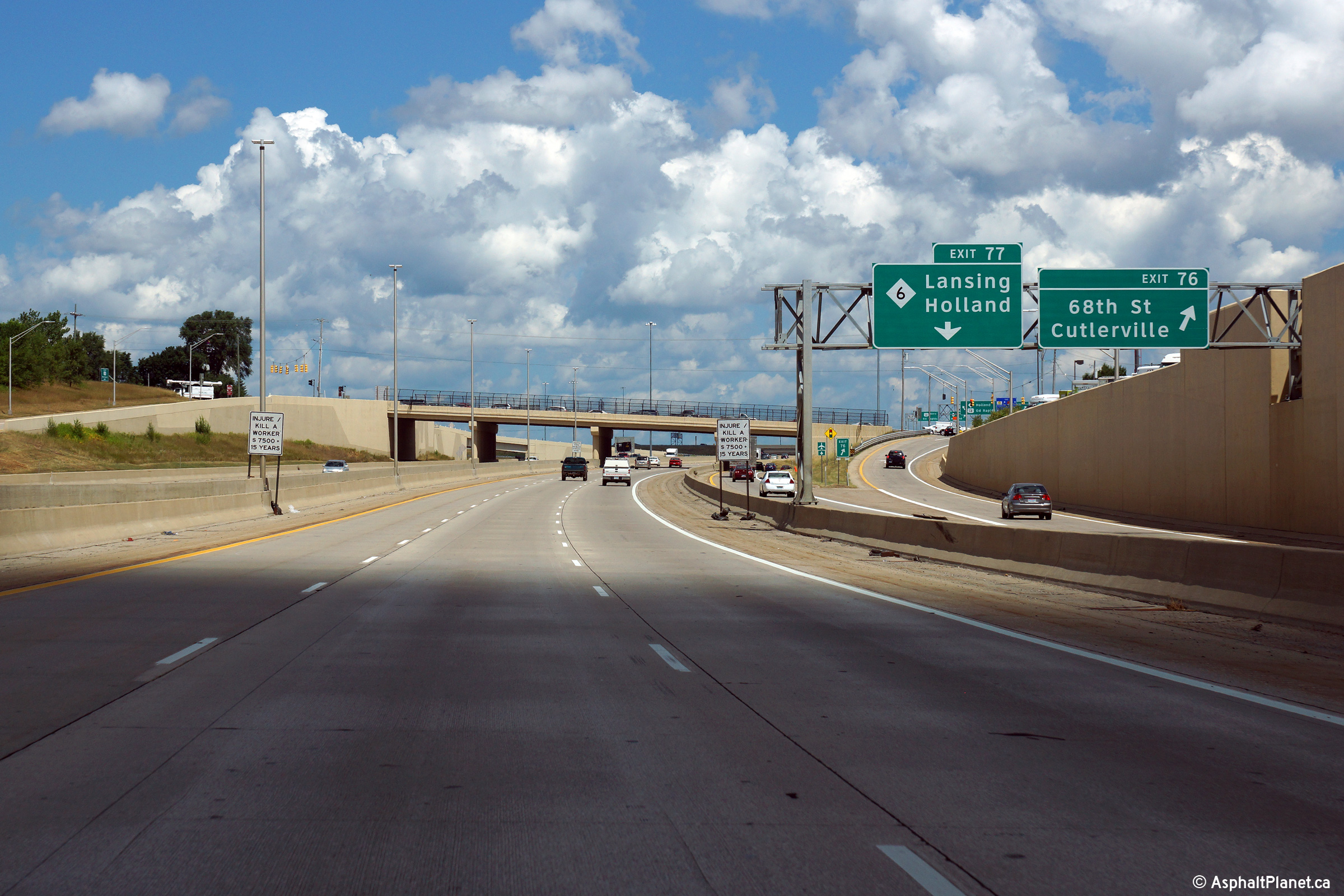
Kent County |
Sign truss with exit signs for M-6 (Exit 77) and 68th St. (Exit 76) on the US 131 North C/D road for these two interchanges at the divergence of the off-ramp to 68th St. |
 |
||
|
Date: 8/31/2015 |
High-res: (1440x960) (2400x1600) | |||
|
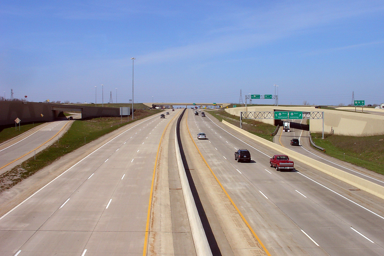
Kent County |
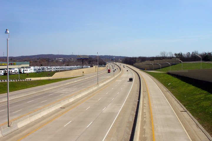
View looking south along US 131 from the 68th St. overpass at Exit 76. The southbound C/D lane from the M-6 interchange continues up to the spot where the entrance ramp from 68th St. merges in with the C/D lane. At that point, the concrete barrier between the mainline and C/D lanes ends, and the C/D lane blends back in with the three mainline US 131 South lanes to form a fourth lane for the 76th St. exit. |
 |
||
|
Date: 4/21/2007 |
High-res: (1440x960) | |||
|
Kent County |
Scene of US 131 as viewed from the 68th St. overpass, looking north toward the expansive cloverleaf interchange with M-6. The ramps from US 131 South to 68th St. and from 68th St. to US 131 North are direct with the mainline US 131 lanes. These connections take place via braided ramps that cross over the respective C/D lanes for the M-6 interchange. |
|
||
|
Date: 4/21/2007 |
High-res: (1440x960) | |||
|
Kent County |
View looking northerly through the twin structures that carry M-6 overtop of the US-131 Freeway. |
 |
||
|
Date: 8/31/2015 |
High-res: (1440x960) (2400x1600) | |||
|
M-6 is a southern freeway by-pass of Grand Rapids, connecting I-196 to the west with I-96 to the east. Click here for M-6 images. |
||||
|
Kent County |
Sign truss spanning both the mainline and C/D lanes for US 131 South at the M-6 interchange. Over the mainline lanes is a Clearview 0.5 mile advance exit sign for 68th St. (Exit 76), and over the C/D road are exit signs for M-6 East and M-6 West. No sooner then the C/D lanes separate from the mainline lanes, the exit ramp to M-6 West diverges from the C/D road. |
 |
||
|
Date: 4/21/2007 |
High-res: (1440x960) (2400x1600) | |||
|
Kent County |
Overhead exit sign for M-6 (Exit 77) on US 131 South. A C/D lane commences at this location to facilitate traffic maneuvers between both directions of M-6 and US 131 South. The exit only lane defaults onto M-6 West, while a second lane accessible from the right-center lane coming into the interchange provides access to M-6 East. |
|
||
|
Date: 4/21/2007 |
High-res: (1440x960) (2400x1600) | |||
|
Kent County |
Overhead exit only sign for M-6 (Exit 77) on US 131 South. The convergence of the on-ramp from 54th St. to US 131 South forms a fourth lane, which immediately becomes exit only for the M-6 freeway. |
|
||
|
Date: 4/21/2007 |
High-res: (1440x960) (2400x1600) | |||
|
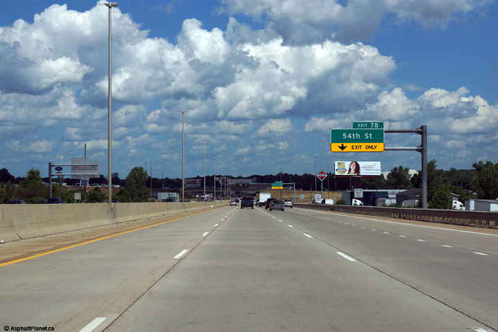
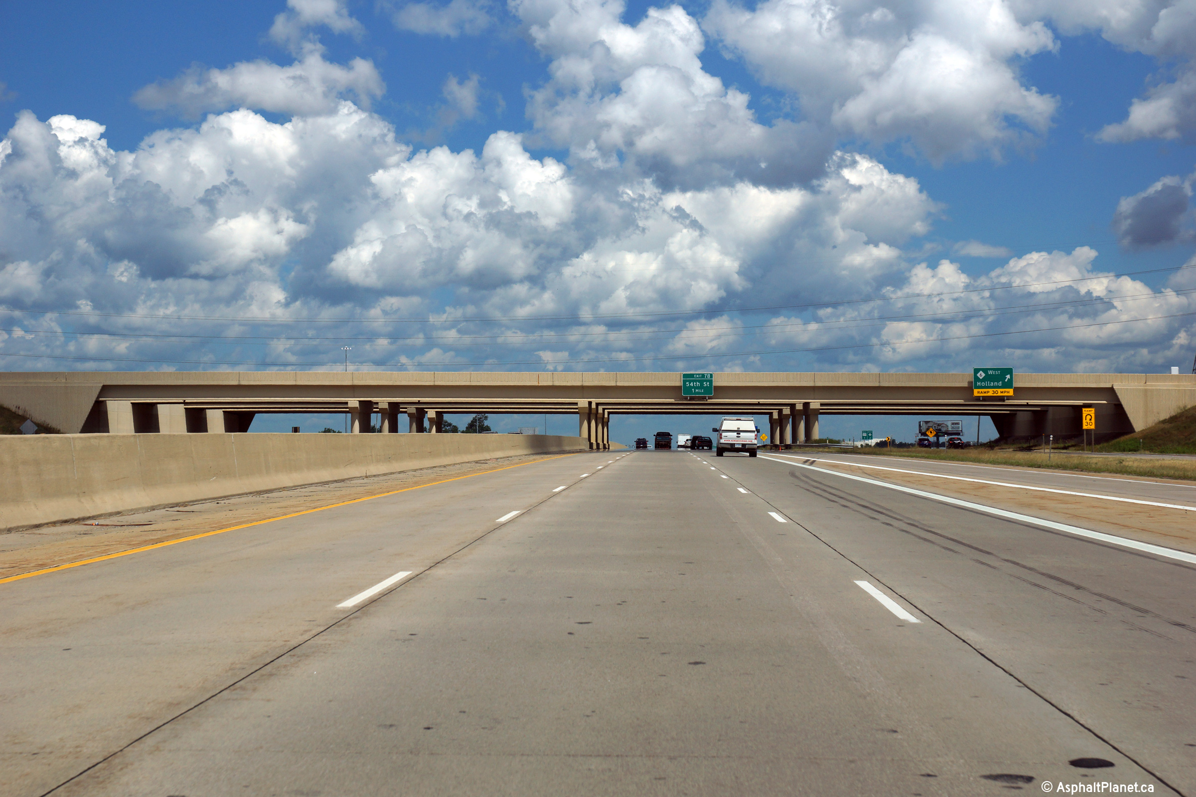
Kent County |
Overhead Clearview exit only sign for 54th St. (Exit 78) on US 131 North. US 131 North temporarily gains a fourth lane following the merge of the C/D lanes from the M-6 interchange. This fourth lane immediately becomes exit only for the 54th St. interchange. |
 |
||
|
Date: 8/31/2015 |
High-res: (1440x960) (2400x1600) | |||
|
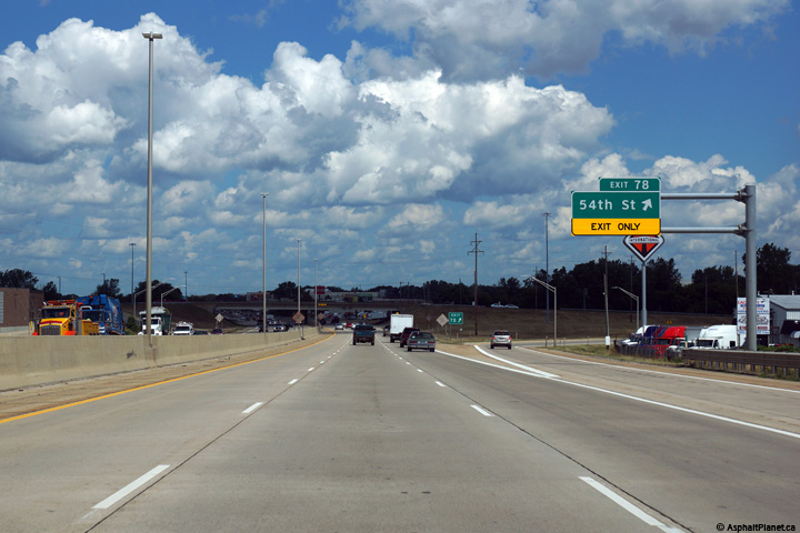
Kent County |
Overhead Clearview exit sign for 54th St. (Exit 78) on US 131 North at the southernmost of four interchanges along US 131 within Wyoming. The interchange between US 131 and 54th St. is a six-ramp parclo A4. |
 |
||
|
Date: 8/31/2015 |
High-res: (1440x960) (2400x1600) | |||
|
Kent County |
Northerly view at the off-ramp to 44th Street. The exit ramps to and from US-131 meet 44th Street as a single-point urban interchange (SPUI). |
 |
||
|
Date: 8/31/2015 |
High-res: (1440x960) (2400x1600) | |||
|
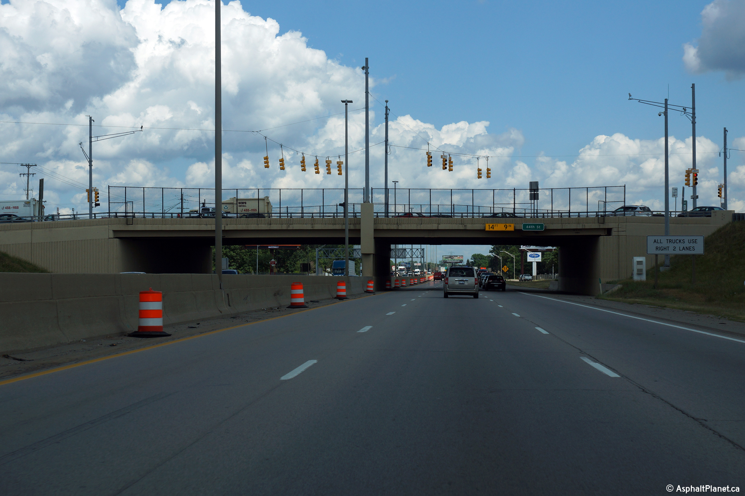
Kent County |
View as US-131 passes beneath the 44th Street overpass. |
 |
||
|
Date: 8/31/2015 |
High-res: (1440x960) (2400x1600) | |||
|
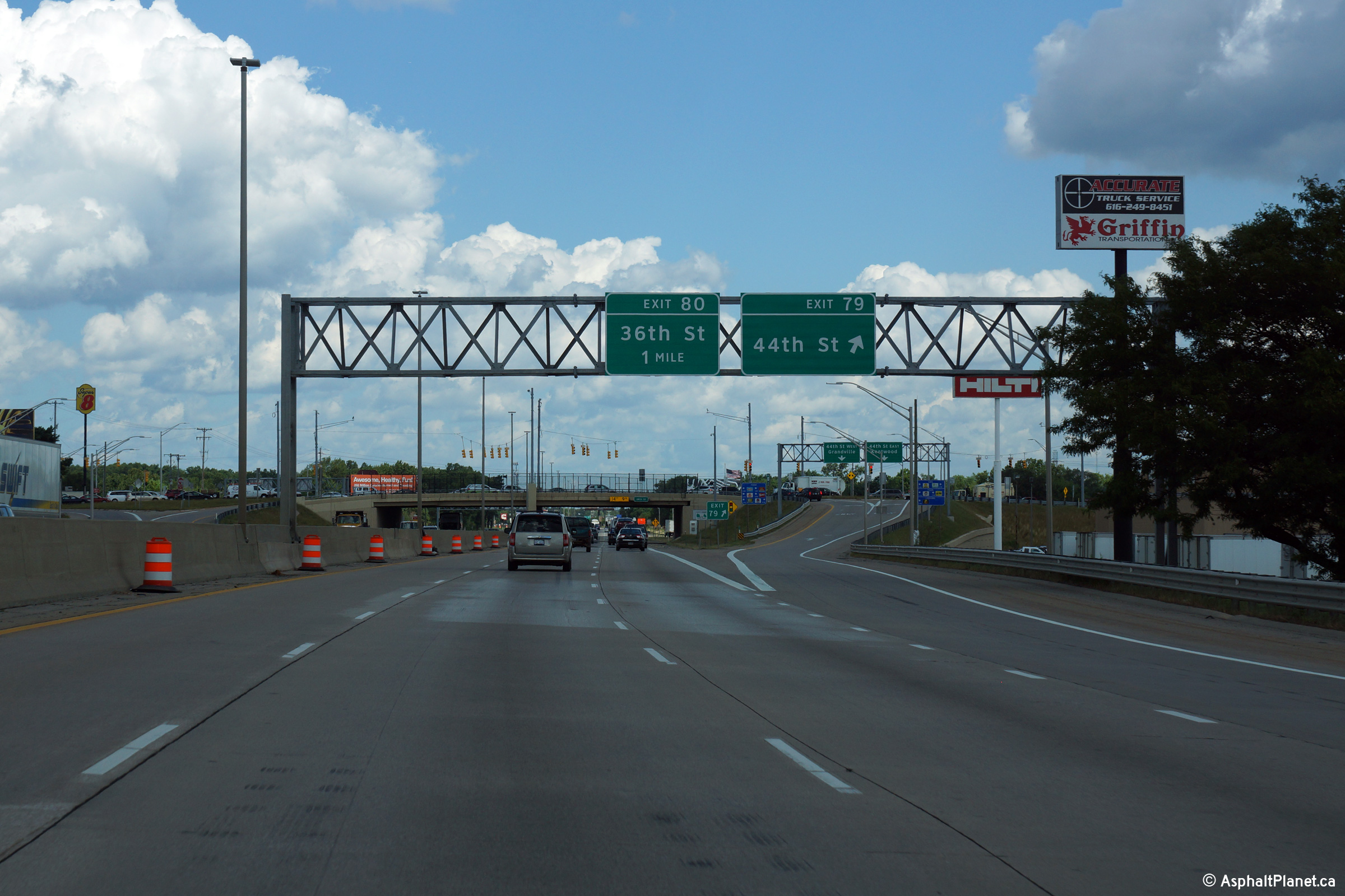
Kent County |
This view looks northerly as the ramp to 36th Street departs from the freeway mainline. |
 |
||
|
Date: 8/31/2015 |
High-res: (1440x960) (2400x1600) | |||
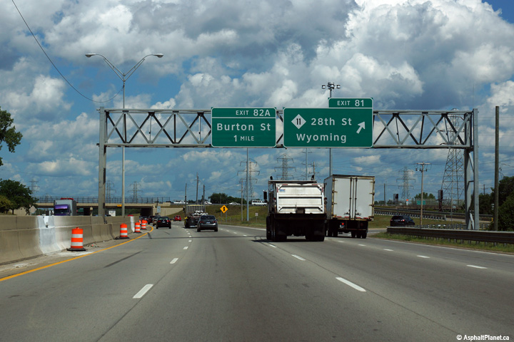
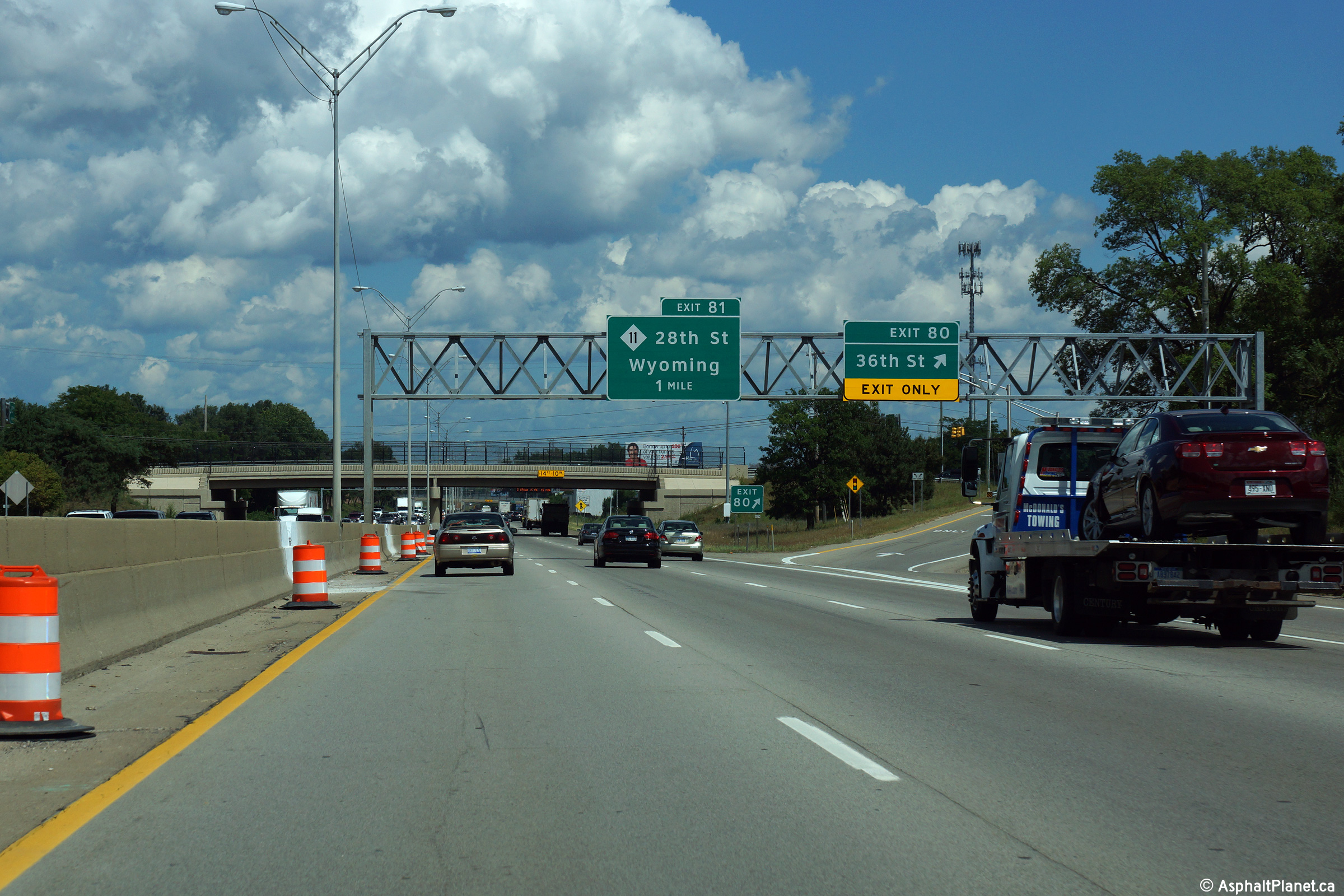
|
Kent County |
Northbound view at the off-ramp to 28th Street. |
|
||
|
Date: 8/31/2015 |
High-res: (1440x960) (2400x1600) |
|||
|
Kent County |
View at the northbound off-ramp to Burton Street. |
 |
||
|
Date: 8/31/2015 |
High-res: (1440x960) (2400x1600) |
|||
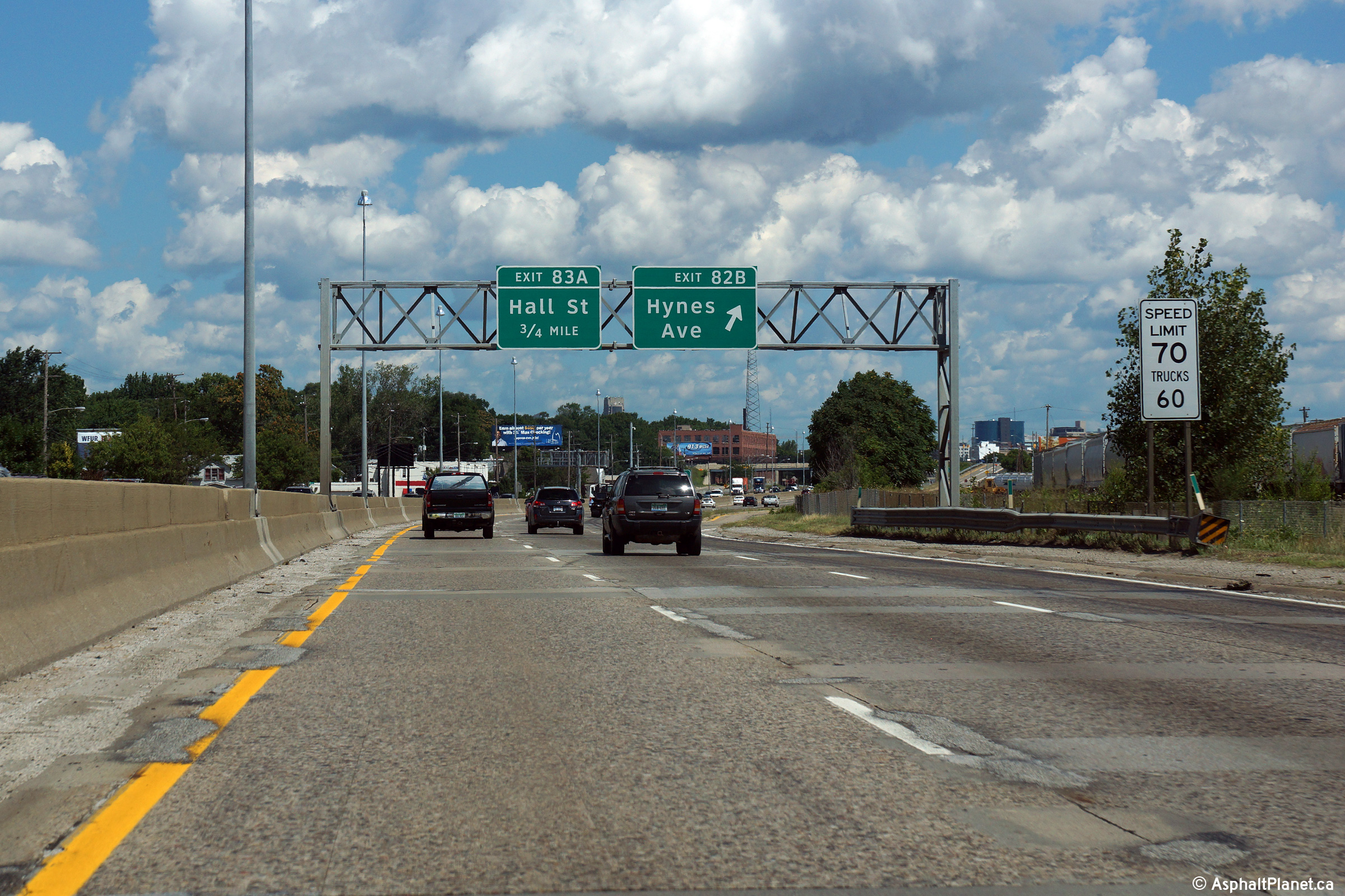
|
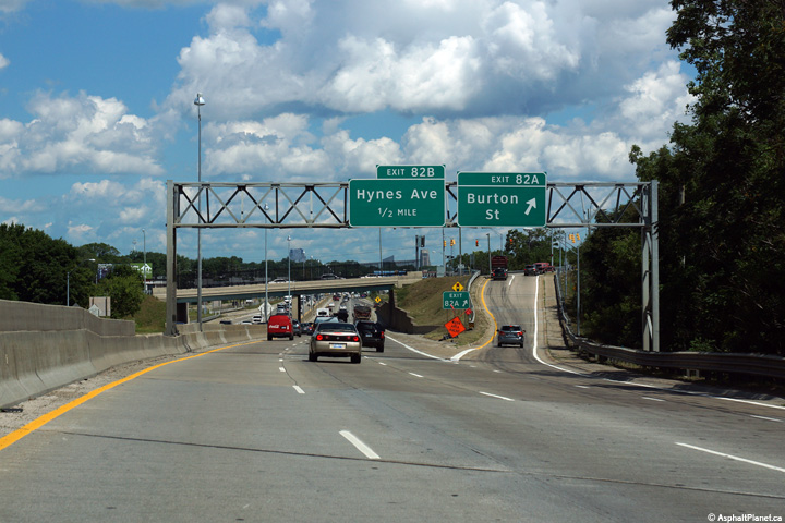
Kent County |
View at the off-ramp to Hynes Avenue. The concrete pavement along US-131 through this part of Grand Rapids is smoother than it looks. |
 |
||
|
Date: 8/31/2015 |
High-res: (1440x960) (2400x1600) |
|||
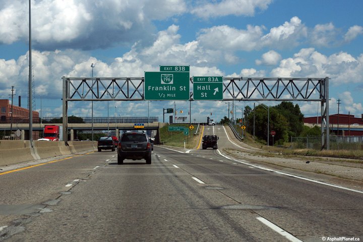
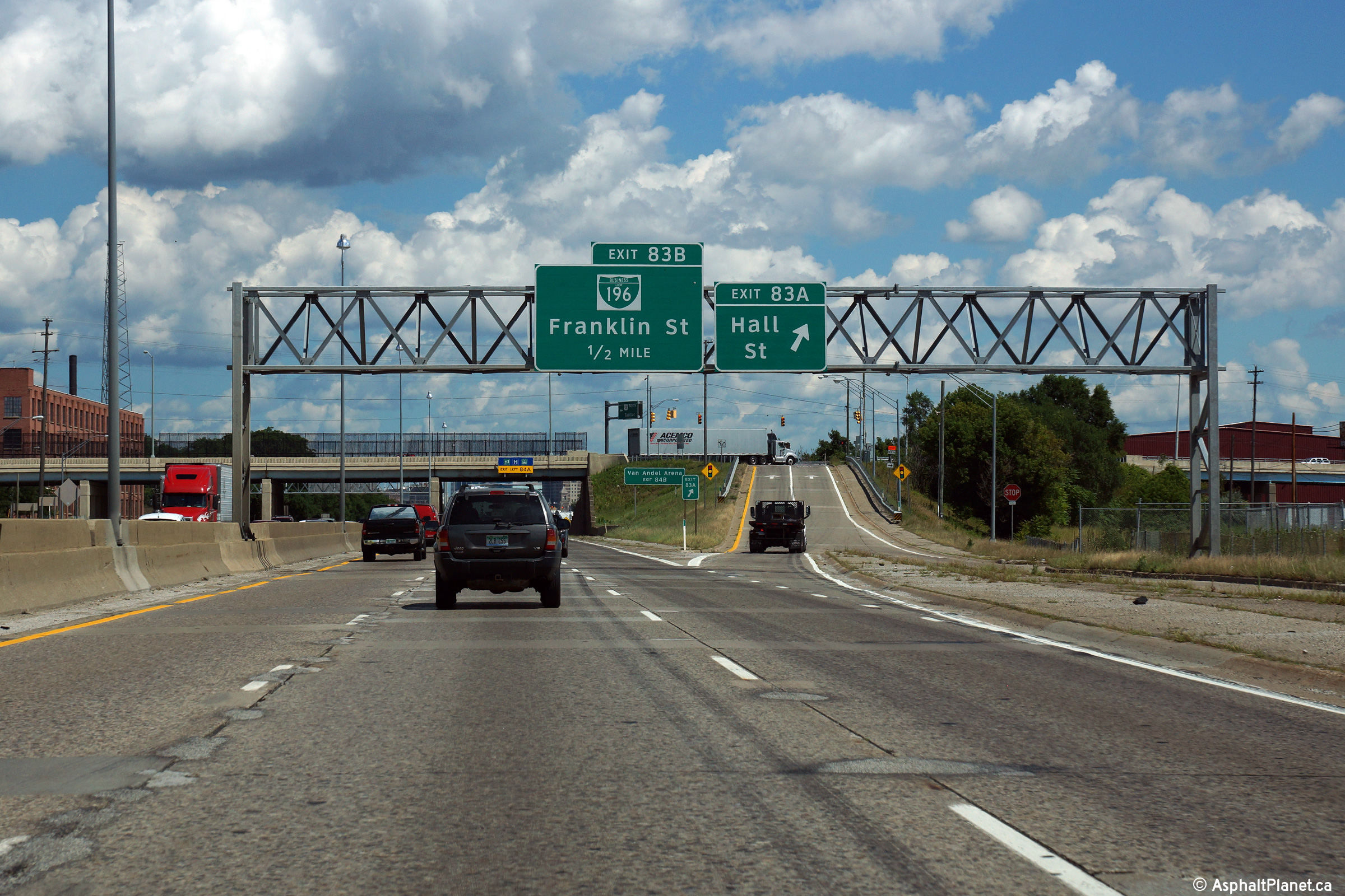
|
Kent County |
Sign truss with Clearview 0.5 mile exit sign for BS I-196/Franklin St. (Exit 83 B) and Clearview exit sign for Hall St. (Exit 83 A) on US 131 North. |
|
||
|
Date: 8/31/2015 |
High-res: (1440x960) (2400x1600) | |||
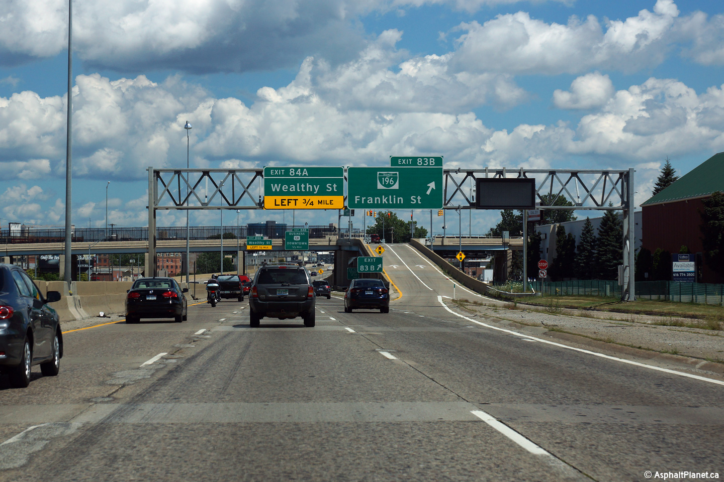
|
Kent County |
Sign truss with Clearview 0.75 mile advance exit sign for the upcoming left exit to Wealthy St. (Exit 84 A) and Clearview exit sign for BS I-196/Franklin St. (Exit 83 B) on US 131 North at the interchange that marks the Eastern Terminus of BS I-196. |
 |
||
|
Date: 8/31/2015 |
High-res: (1440x960) (2400x1600) | |||
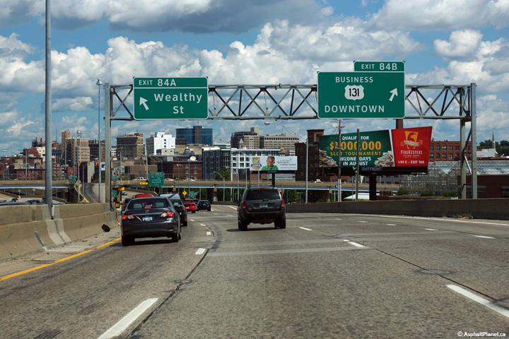
|
Kent County |
Bridge-mounted Clearview advance exit signs for the upcoming left exit for Wealthy St. (Exit 84 A, 0.5 mile) and the upcoming right exit for BUS US 131 (Exit 84 B, 0.5 mile) on US 131 North, mounted on the BS I-196/Franklin St. overpass. |
|
||
|
Date: 8/31/2015 |
High-res: (1440x960) (2400x1600) | |||
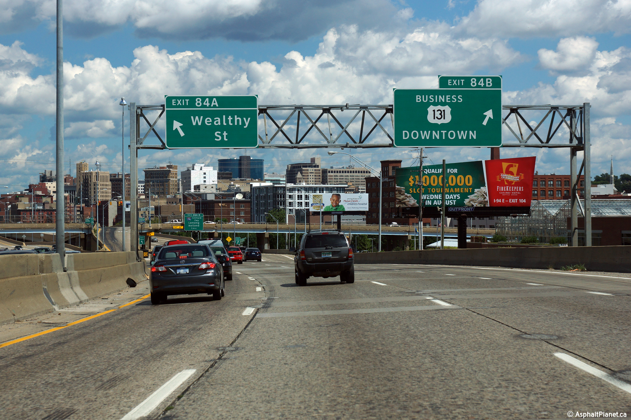
|
Kent County |
These views look northerly approaching the Wealthy Street and US-131 Business exits. It is somewhat unusual to see exits departing from both the left and right side of the freeway almost simultaneously. US-131 was upgraded to a freeway through Grand Rapids fairly early within the freeway era, and accordingly has several design elements such as this that would no longer be implemented on a more modern freeway. |
 |
||
|
High-res: (1440x960) (2400x1600) | ||||
 |
||||
|
Date: 8/31/2015 |
High-res: (1440x960) (2400x1600) |
|||
|
Kent County |
This advanced signage for the upcoming I-196 interchange is affixed to the Wealthy Street overpass. |
 |
||
|
Date: 8/31/2015 |
High-res: (1440x960) (2400x1600) |
|||
|
Kent County |
Advanced signage for both the Pearl Street and I-196 interchanges along US-131 as the freeway navigates Grand Rapids' infamous "S" curve. |
|
||
|
Date: 8/31/2015 |
High-res: (1440x960) (2400x1600) |
|||
|
Kent County |
Overhead exit only sign for Pearl St. (Exit 85 B) on US 131 North. The on-ramp from Market St. forms a fifth northbound lane for US 131 North. Immediately, that lane turns into an exit only lane for Pearl St. |
|
||
|
Date: 8/31/2015 |
High-res: (1440x960) (2400x1600) | |||
|
Kent County |
Sign truss with advance exit sign for I-196/G.R. Ford Frwy. West (Exit 86 B), exit only sign for I-196/G.R. Ford Frwy. East (Exit 86 A) and exit sign for Pearl St. (exit 85 B), all in Clearview, on US 131 North. Beyond the Pearl St. exit, the right lane of the four northbound lanes becomes exit only for I-196 East. |
 |
||
|
Date: 8/31/2015 |
High-res: (1440x960) (2400x1600) | |||
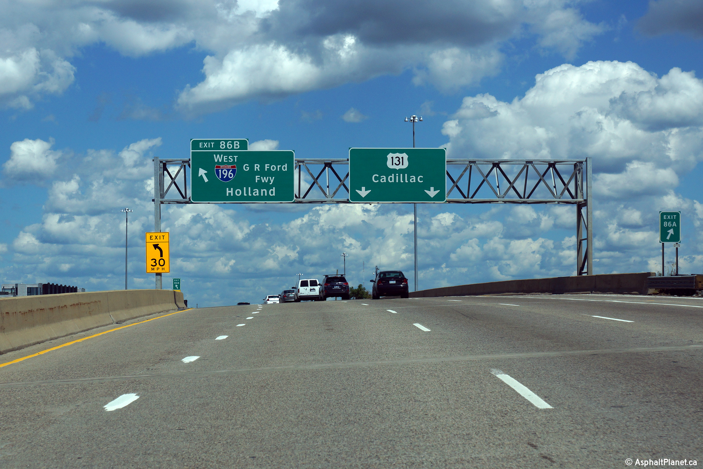
|
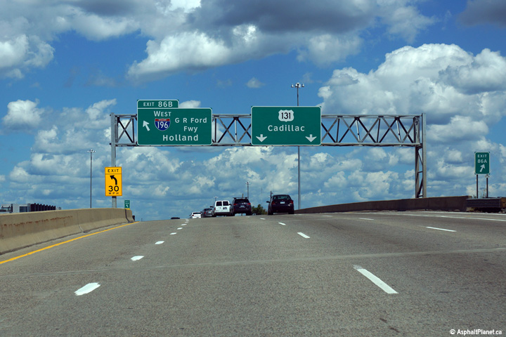
Kent County |
Sign truss with advance exit sign for I-196/G.R. Ford Frwy. West (Exit 86 B) featuring black-on-yellow "Left Exit" text in lieu of the normal "Exit Only" text, US 131 lane distribution sign and second exit only sign for I-196/G.R. Ford Frwy. East (Exit 86 A), all in Clearview, on US 131 North. The right lane begins to diverge just after this sign gantry, and the exit sign in the distance appears well after the ramp to I-196 East has split from mainline US 131. |
 |
||
|
Date: 8/31/2015 |
High-res: (1440x960) (2400x1600) | |||
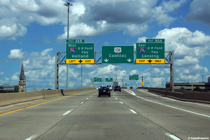
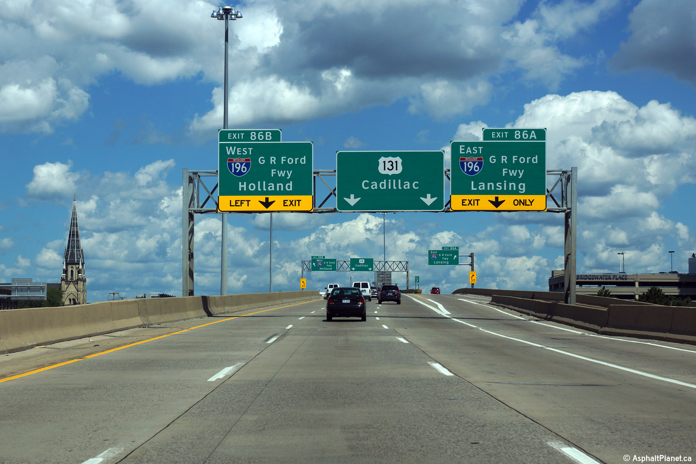
|
Kent County |
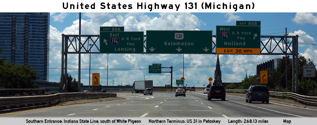
Overhead Clearview exit sign for I-196/G.R. Ford Frwy. East (Exit 86 A), followed by sign truss with Clearview exit sign for the left-side exit to I-196/G.R. Ford Frwy. West (Exit 86 B) and Clearview US 131 lane distribution sign on US 131 North at the I-196 interchange. Immediately prior to the left exit, the northbound and southbound US 131 lanes criss-cross, accommodating for easier left-hand exit maneuvers from US 131 North to I-196 West and from US 131 South to I-196 East, respectively. |
 |
||
|
Date: 8/31/2015 |
High-res: (1440x960) (2400x1600) | |||
<- US-127
MI Highways
US-141 ->
AsphaltPlanet.ca
© 2007-15 AsphaltPlanet.ca.
AsphaltPlanet@asphaltplanet.ca
Page Created: June 6, 2007.
Last Updated: October 22, 2015.


