AsphaltPlanet.ca > OntHighways >
Highway 401 > Images
> Page 11
King's Highway 401 - Images
<- Page 10 Page 11 - Scarborough to Oshawa Page 12 ->
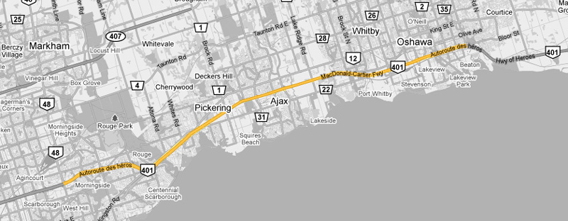
Photos shown in this table are arranged from West to East:
| Proper Municipality Name | Photo Description | Photo | |||||
|
Pictures taken from driver's perspective appear offset from centre-line pictures: |
East- |
West- |
|||||
| Continued from North York to Scarborough Images | |||||||
| City of Toronto |
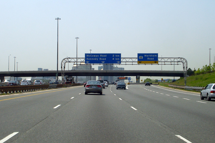
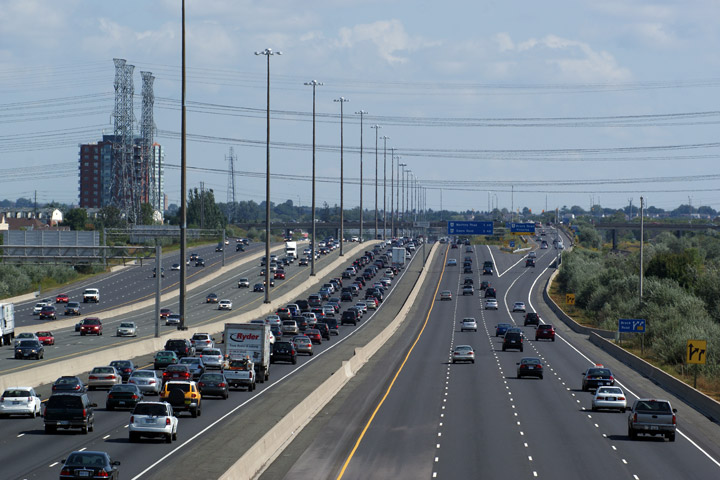
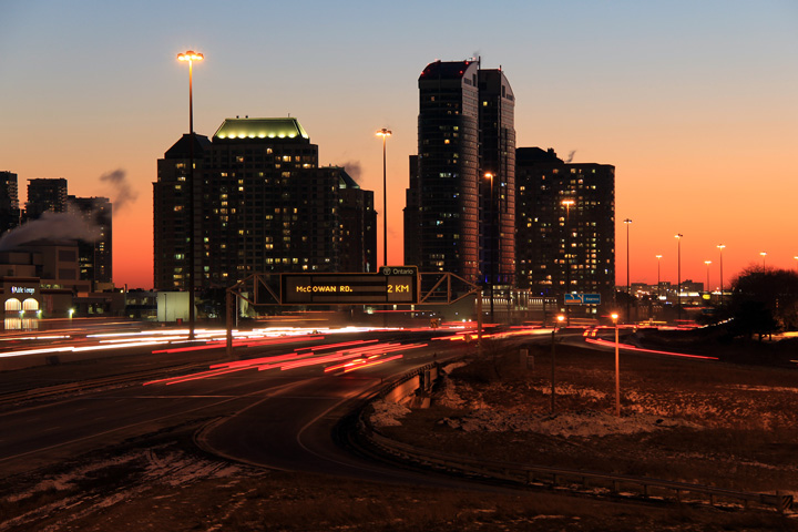
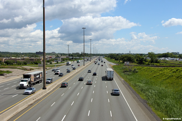
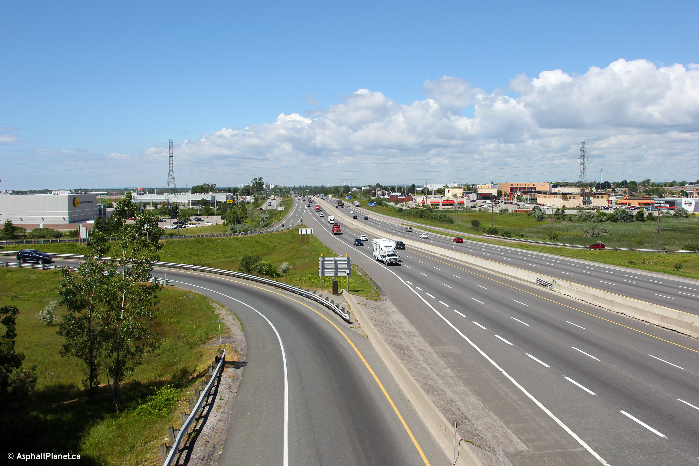
Two views looking westerly from the Progress Avenue overpass.
Scarborough City Centre dominates the south side of Highway 401 in these
photos. Scarborough City Centre features a large shopping centre
that is surrounded by various commercial and residential towers. Upper photo taken: June 28th, 2010. Lower photo taken: February 22nd, 2011. |

(720x480)
(1440x960)
(2400x1600) |
|||||
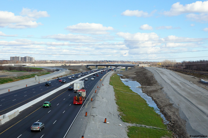
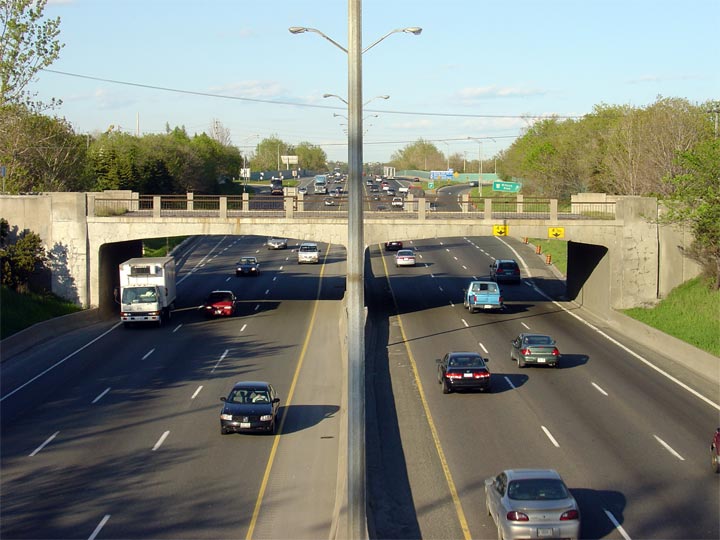
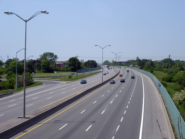
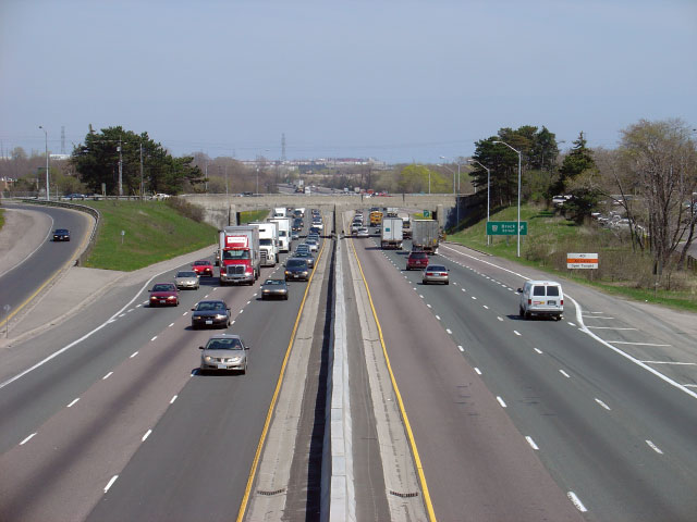
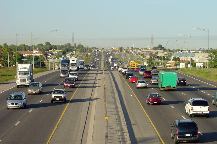
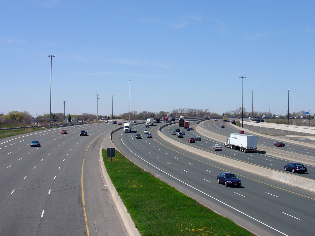
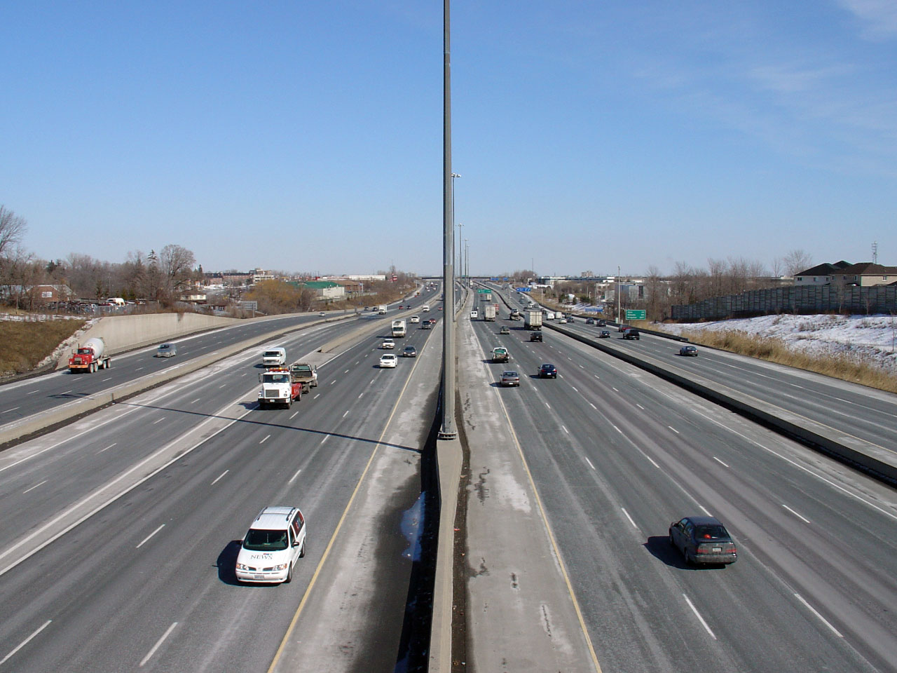
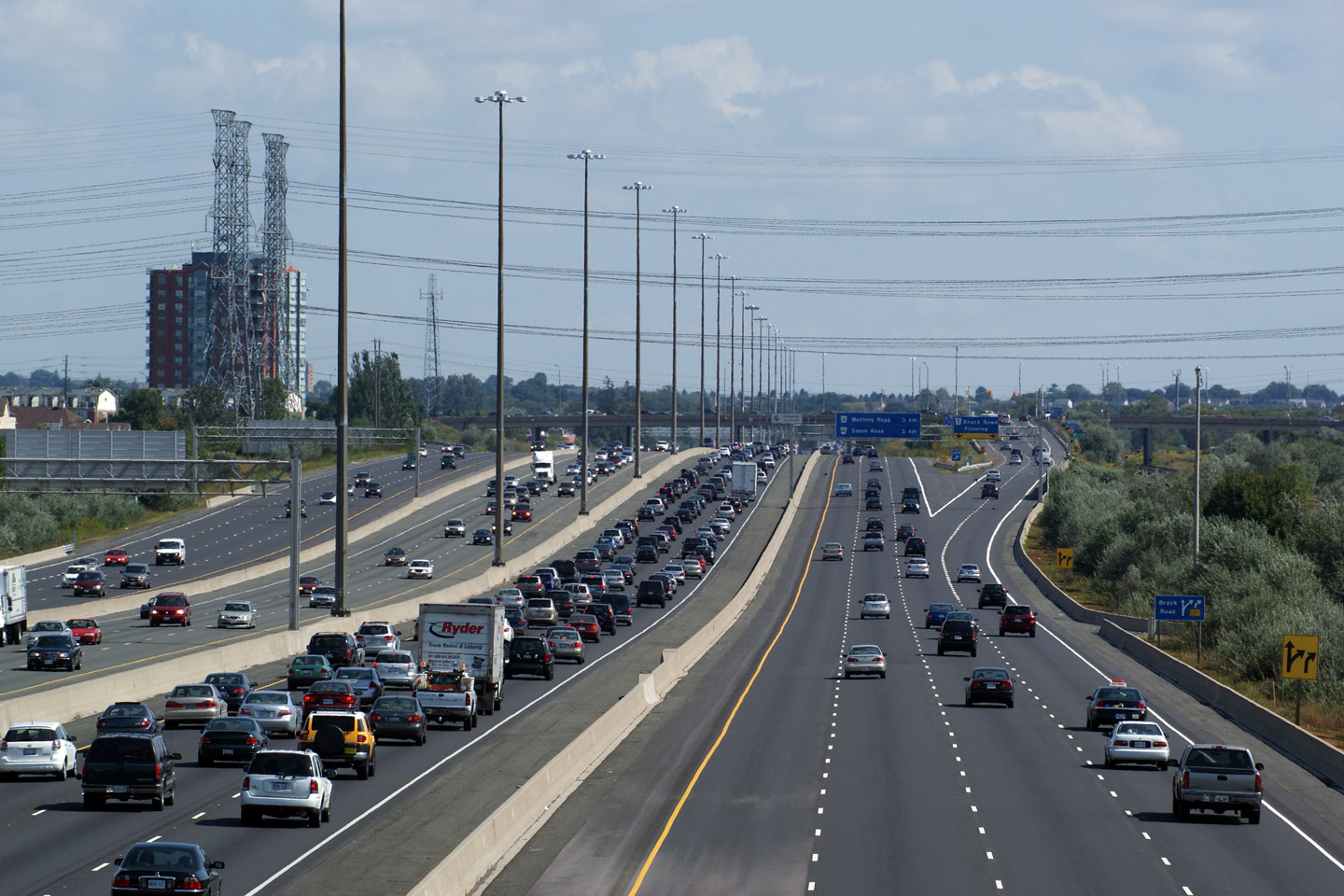
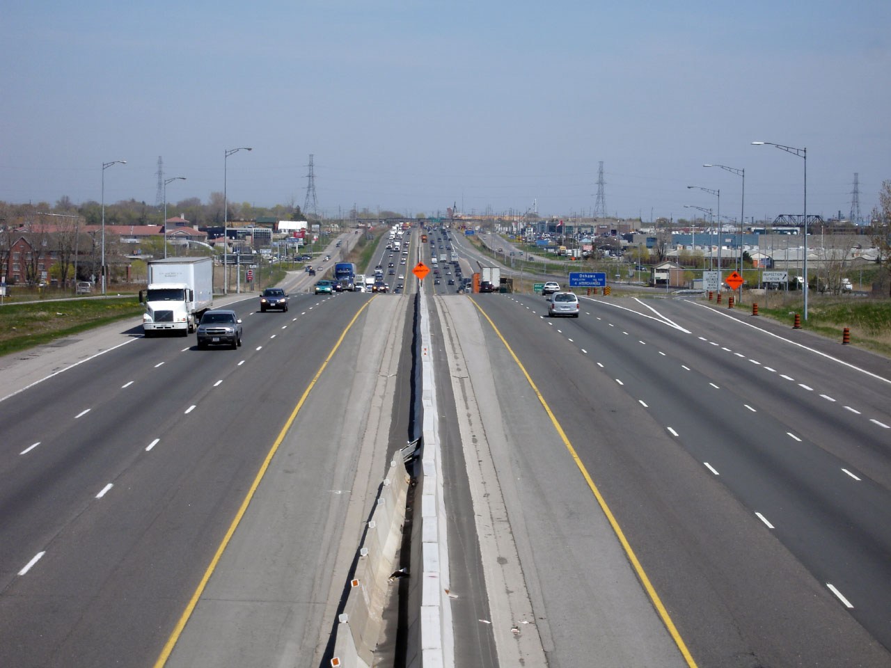
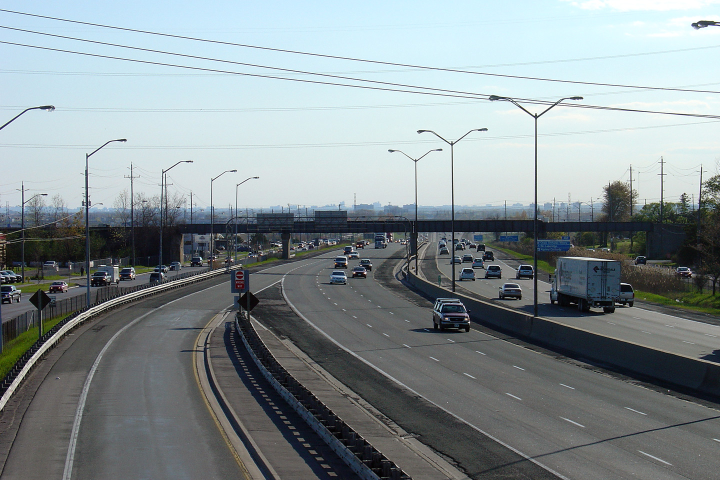
| City of Toronto |
Highway 401 looking east from the Progress Road overpass. Until the early 1990s, the 12-lane core/distributor system narrowed to six-lanes at the transfers pictured in this photo. The core/distributor system was extended eastwards to Brock Road in Pickering during the early and mid 1990s. Photo taken: June 28th, 2010. |
|
|||||
| Before 1998, Highway 48 continued north of Highway 401 through Scarborough and Markham to Highway 35 at Coboconk. Click here for Highway 48 images. | |||||||
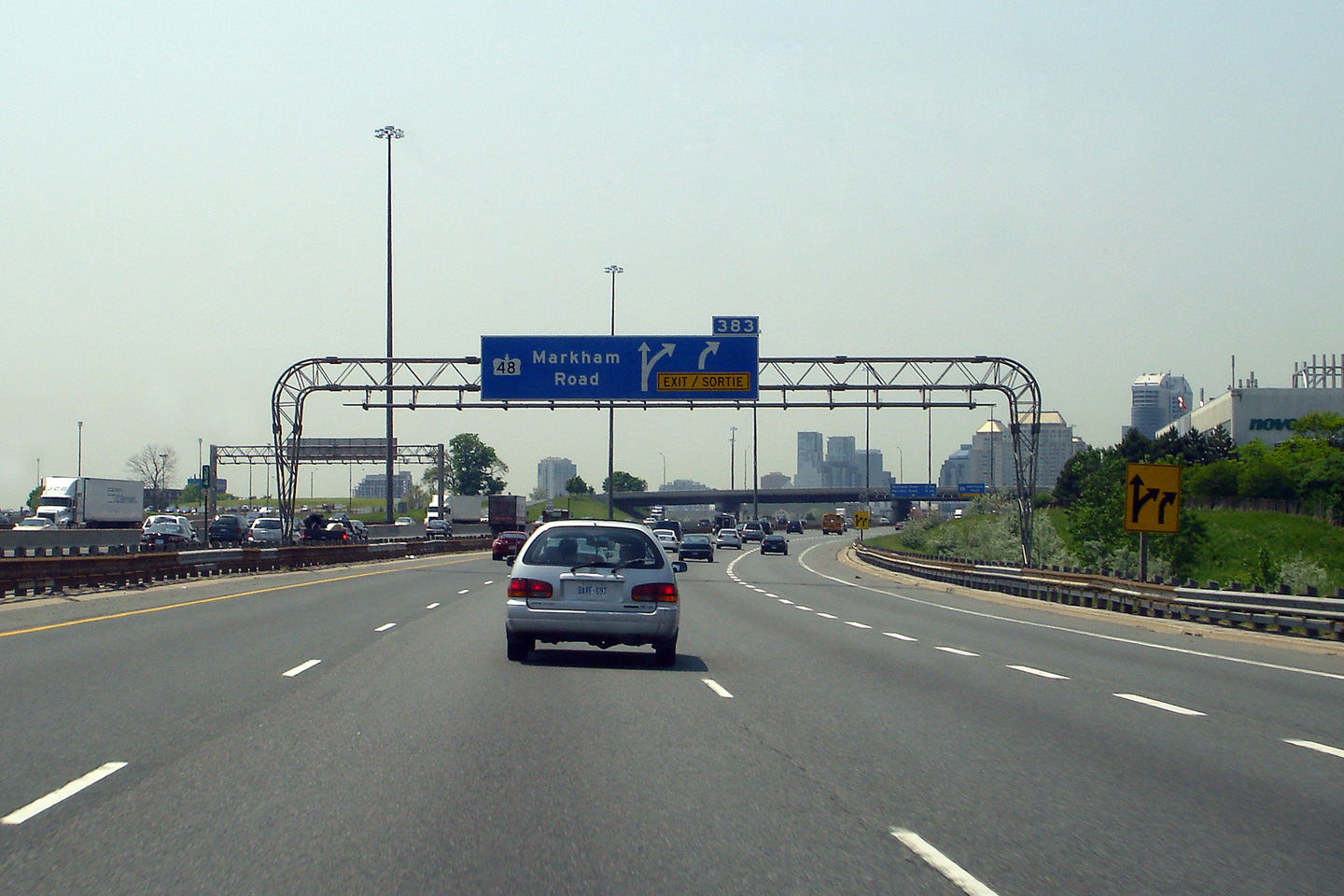
| City of Toronto |
Drivers view from the westbound collector at the
Markham Road off-ramp. Highway 401 marked the 1998 historic
southern terminus of Highway 48.
The Highway 48 shield has since been removed from both this sign, and
the advanced sign that precedes it. Photo taken: May 30th, 2007. |
 (720x480) (720x480)(1440x960) |
|||||
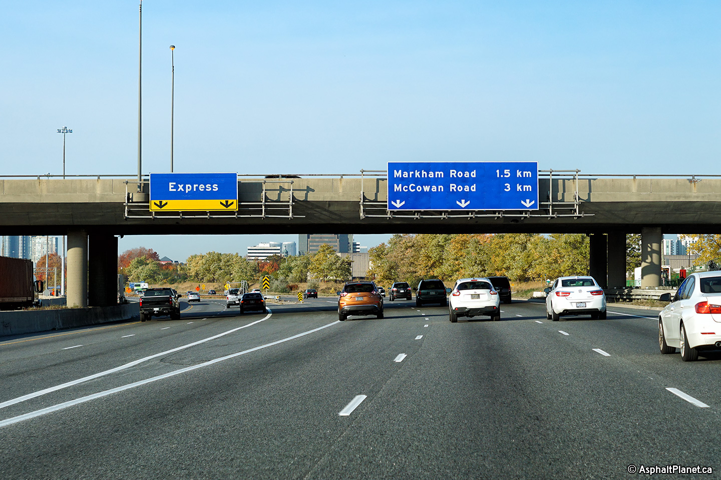
| City of Toronto |
Overhead advanced signage in advance of the Markham Road interchange
from the westbound collectors. Photo taken: May 30th, 2007. |
 (720x480) (720x480)(1440x960) |
|||||
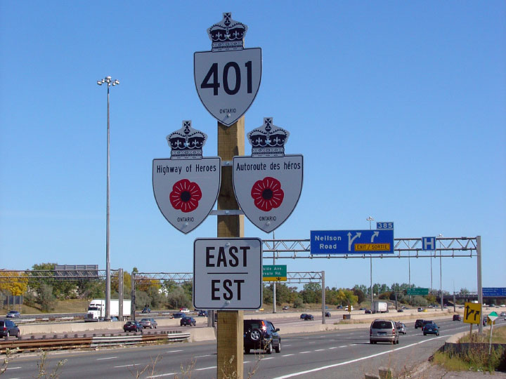
| City of Toronto |
Bilingual Highway of Heroes signage found along side the eastbound
collector lanes in Scarborough. M-C shields were once signed with
every Highway 401 marker across the province in similar fashion. Photo taken: September 23rd, 2007. |
 |
|||||
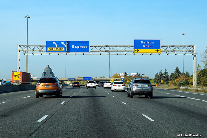
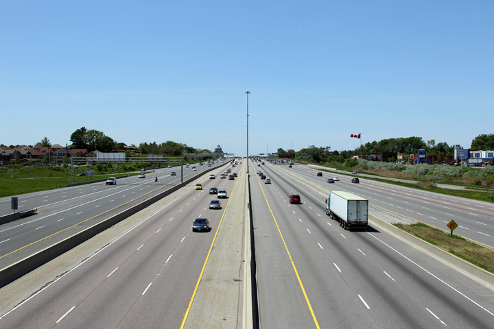
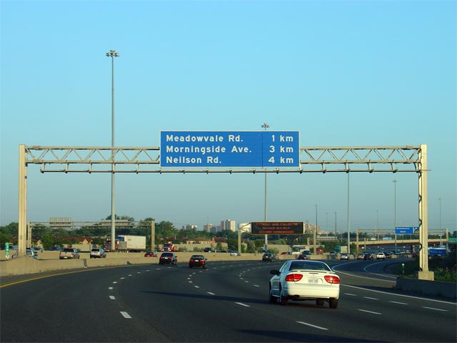
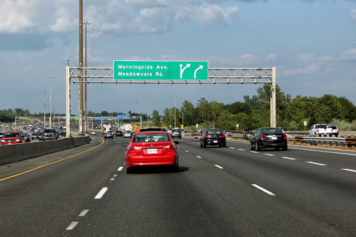
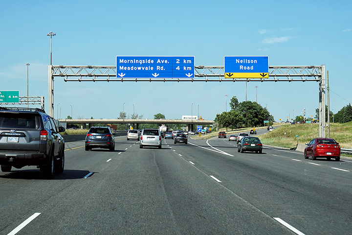
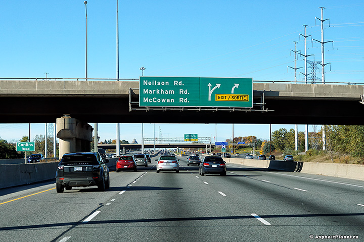
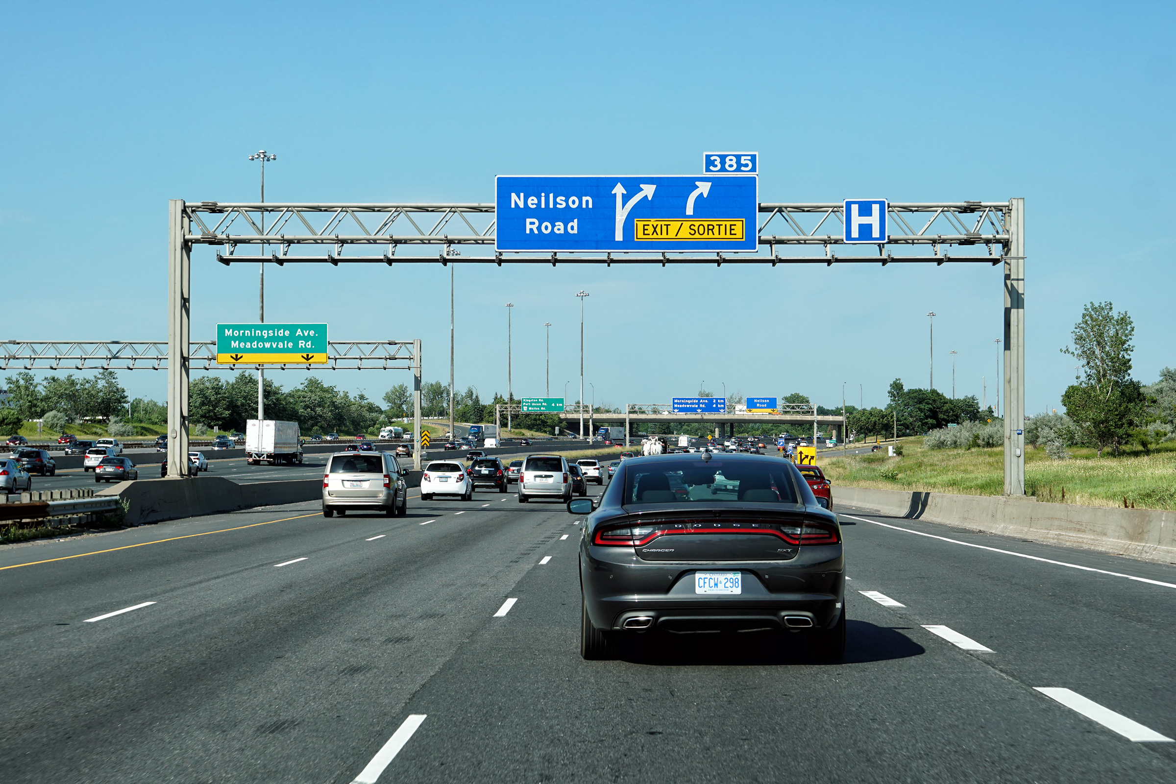
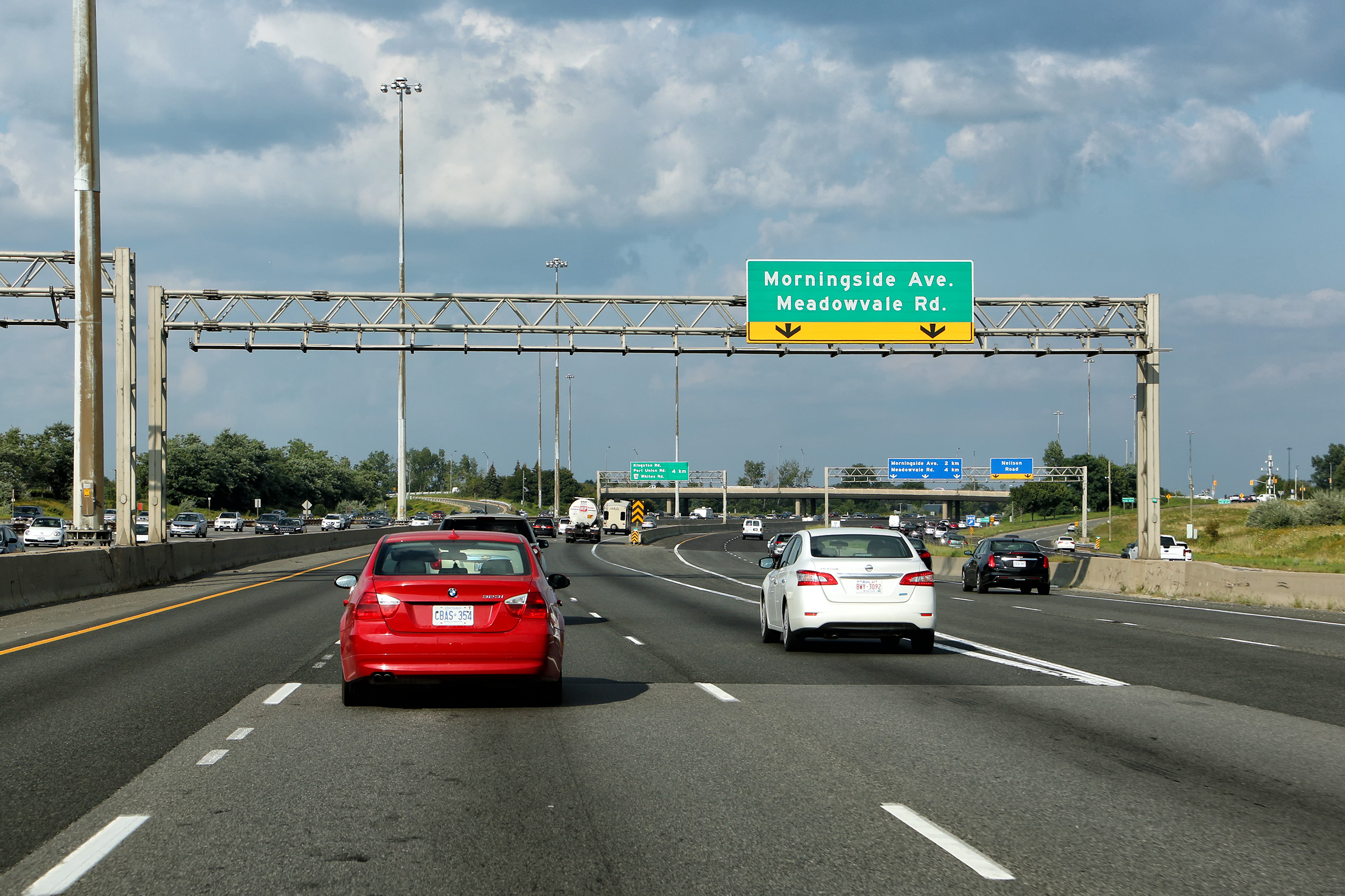
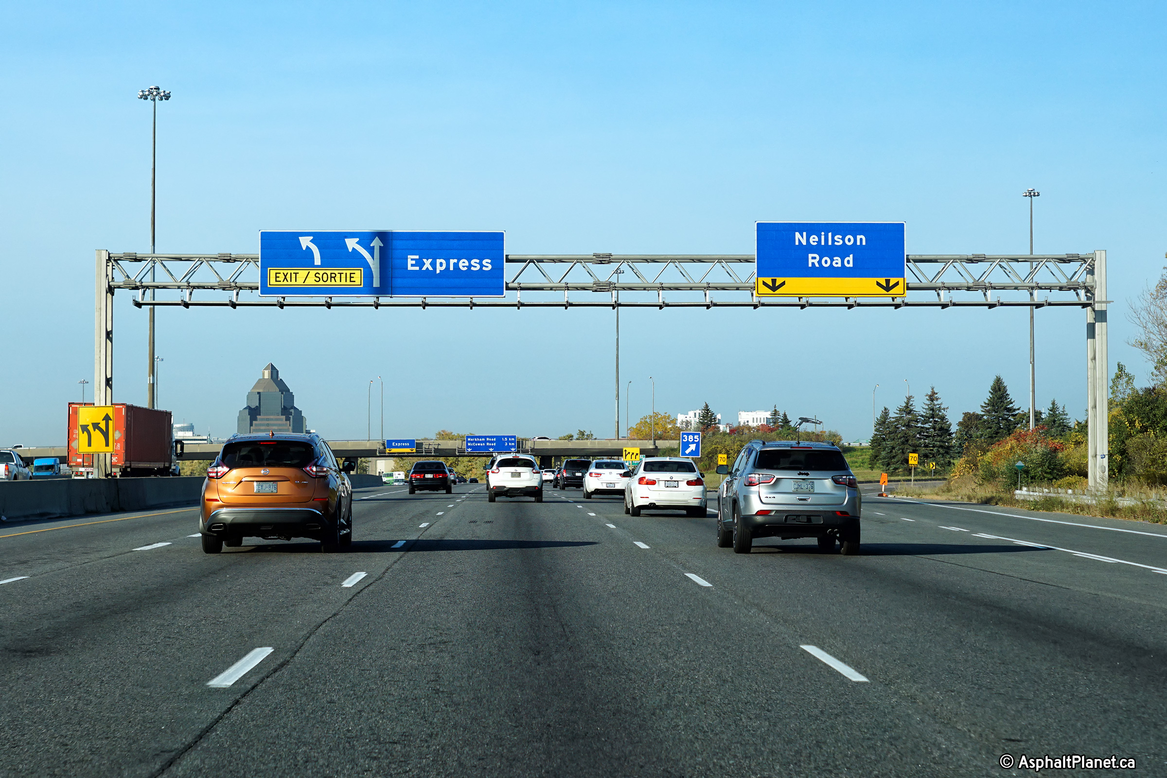
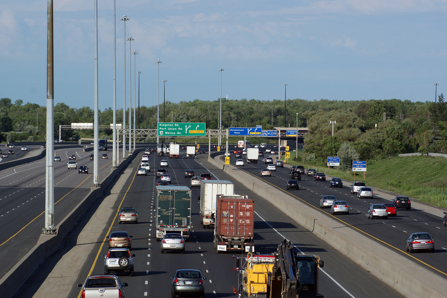
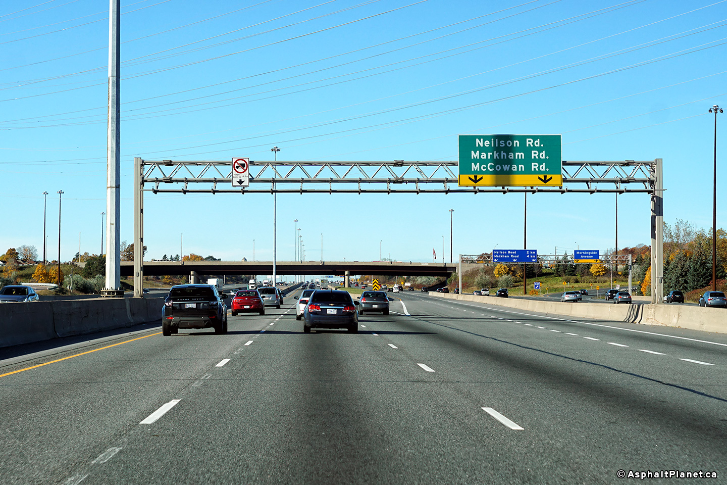
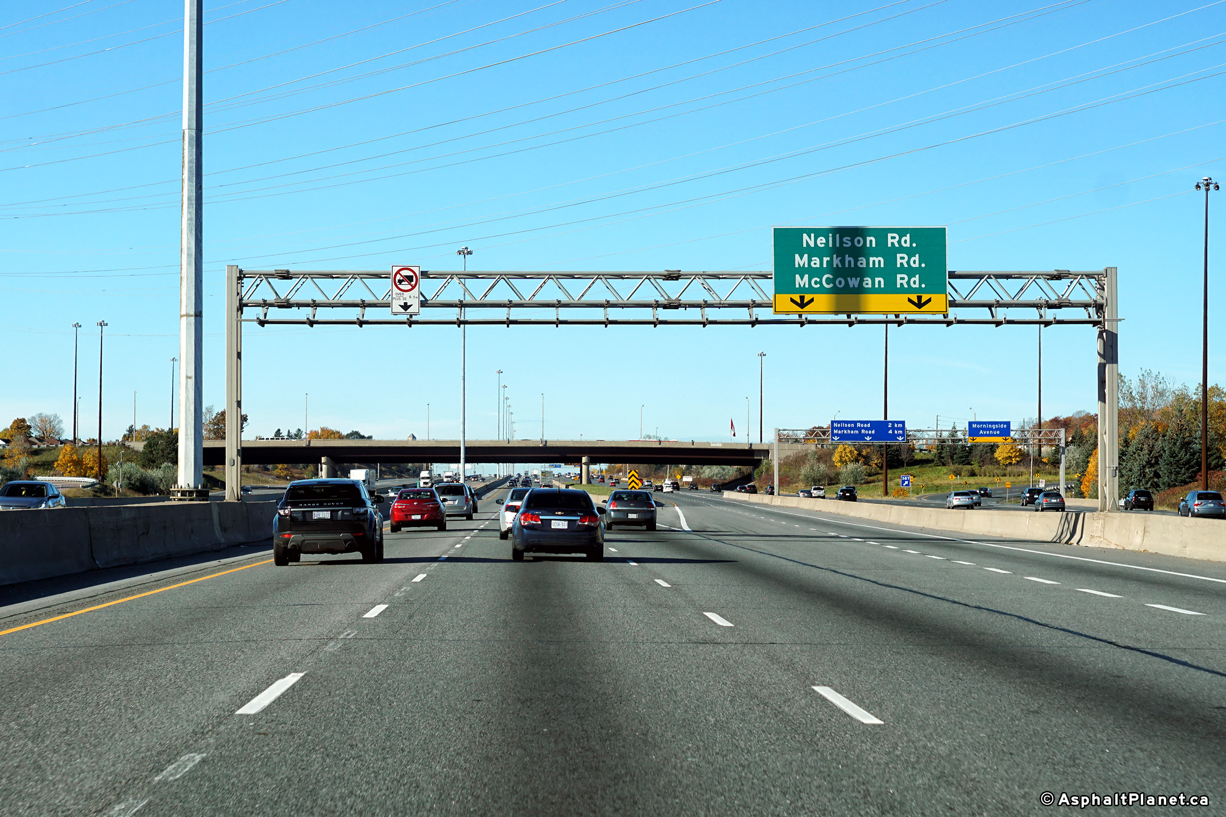
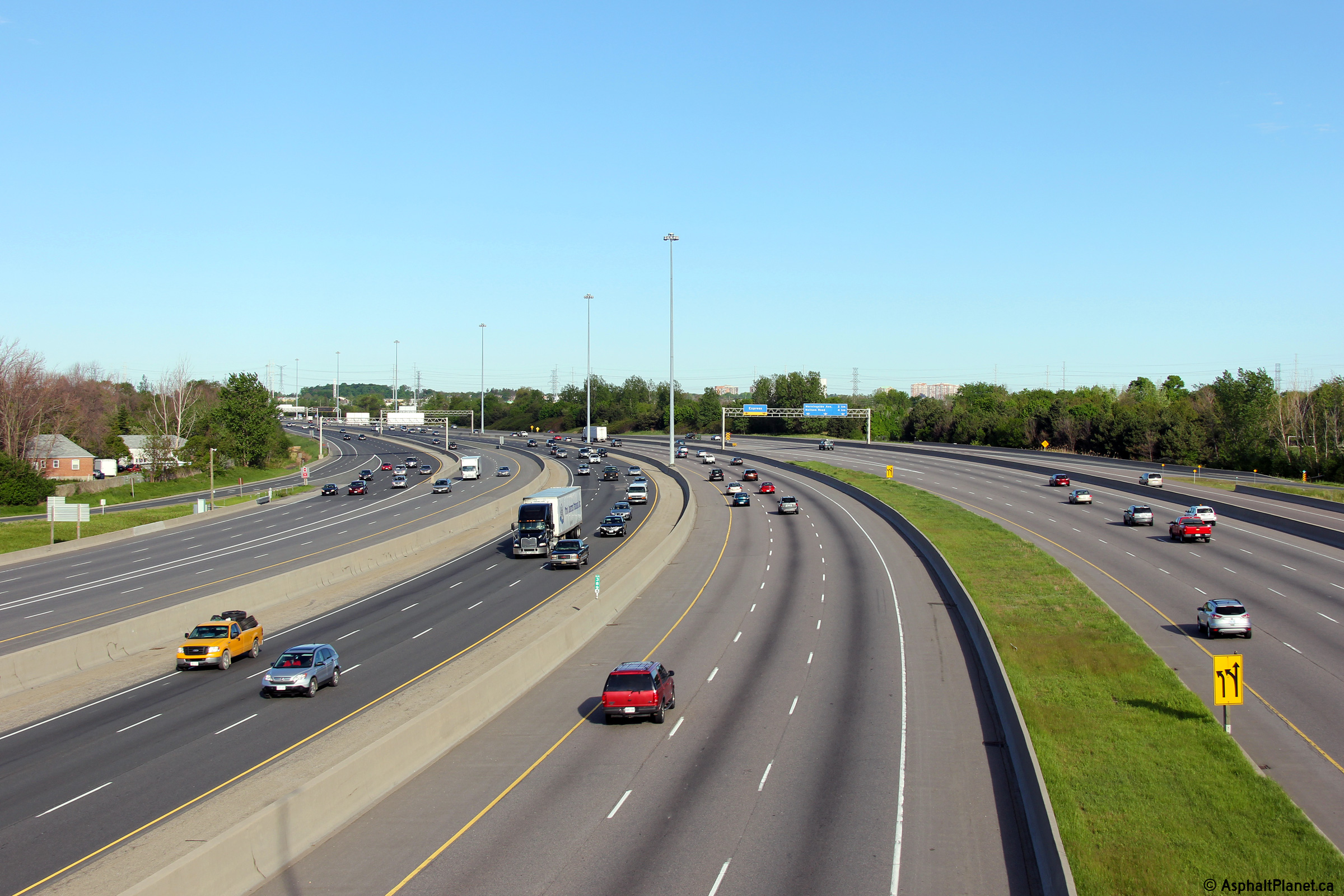
| City of Toronto |
Signage in both the express and collector lanes approaching Nielson
Road. Over the express lanes is an overhead advanced sign for the
transfer to the collector lanes, while the collector lanes have an
advanced sign for the Nielson Road off-ramp. Upper (Express Lanes) photo taken: August 20th, 2017. Lower (Collector Lanes) photo taken: July 9th, 2018. |
||||||
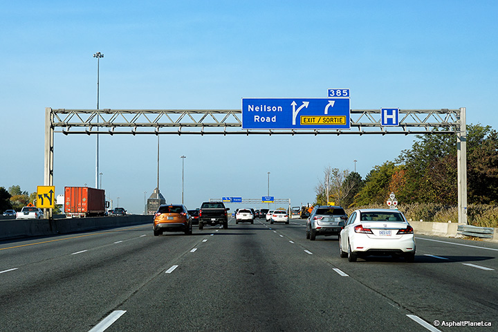
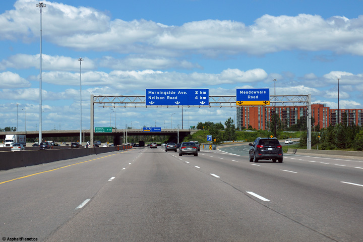
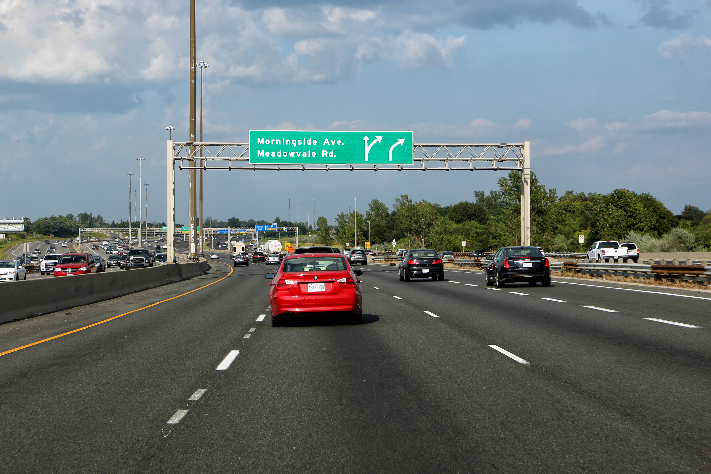
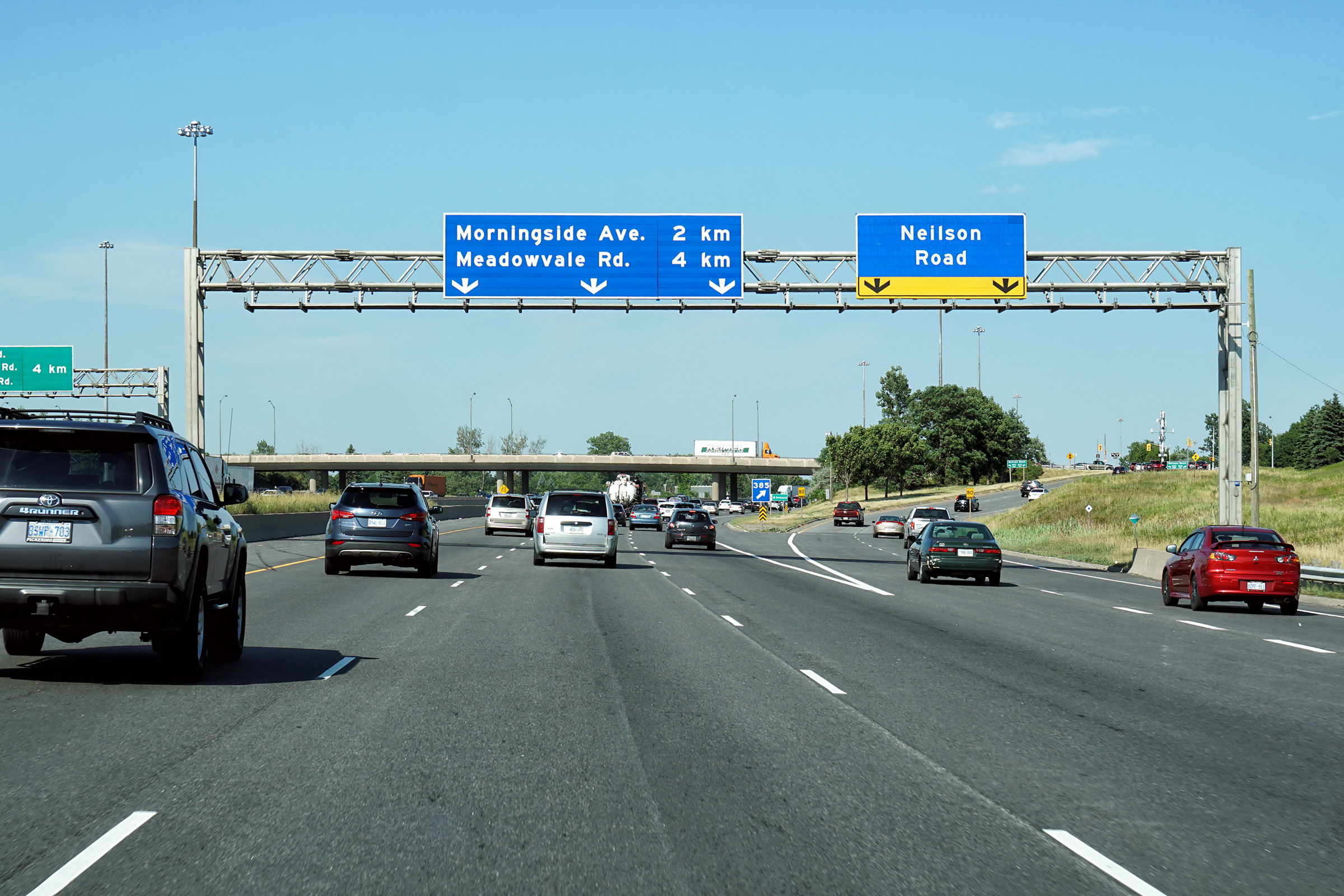
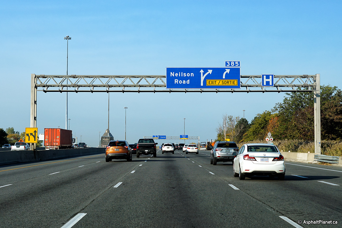
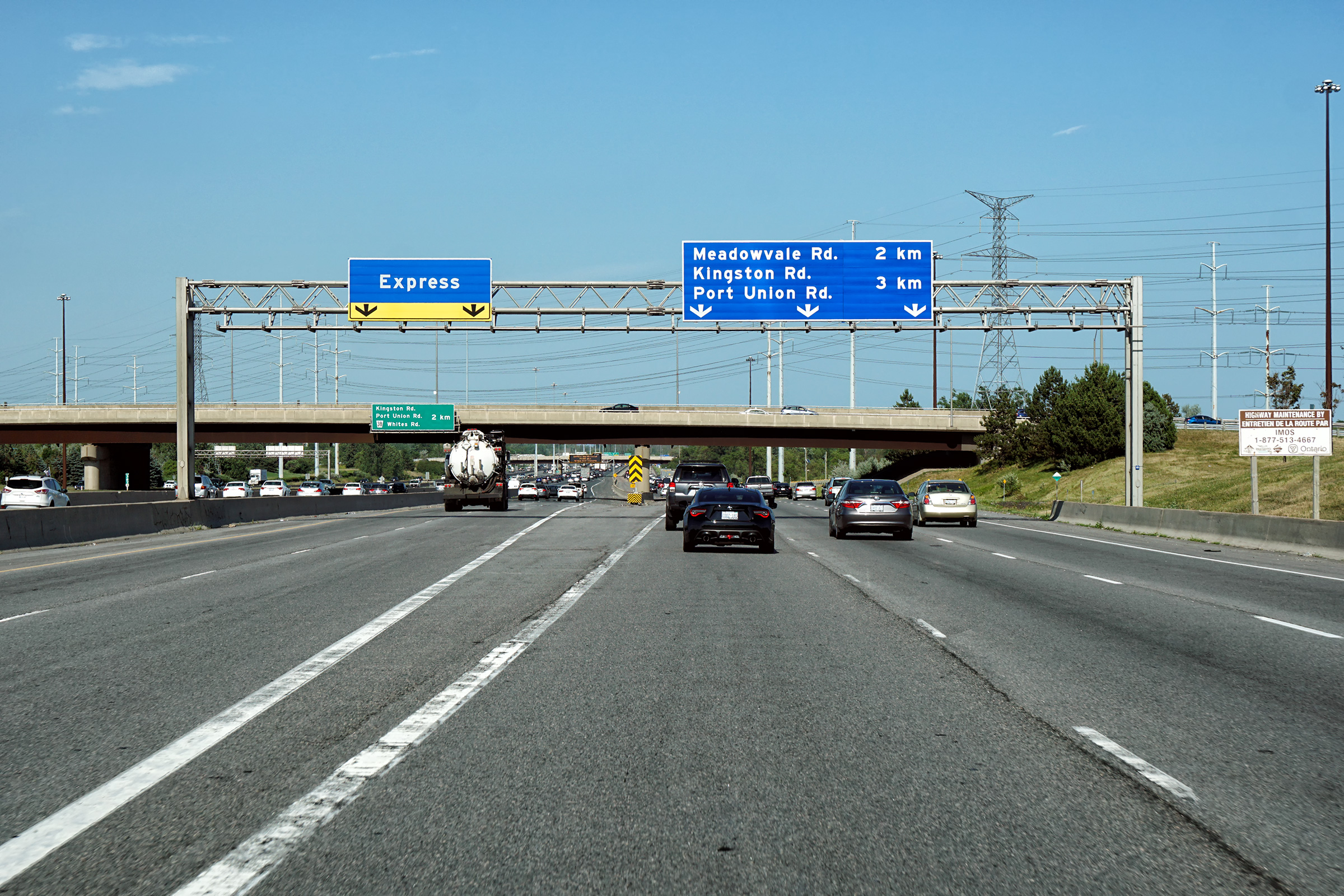
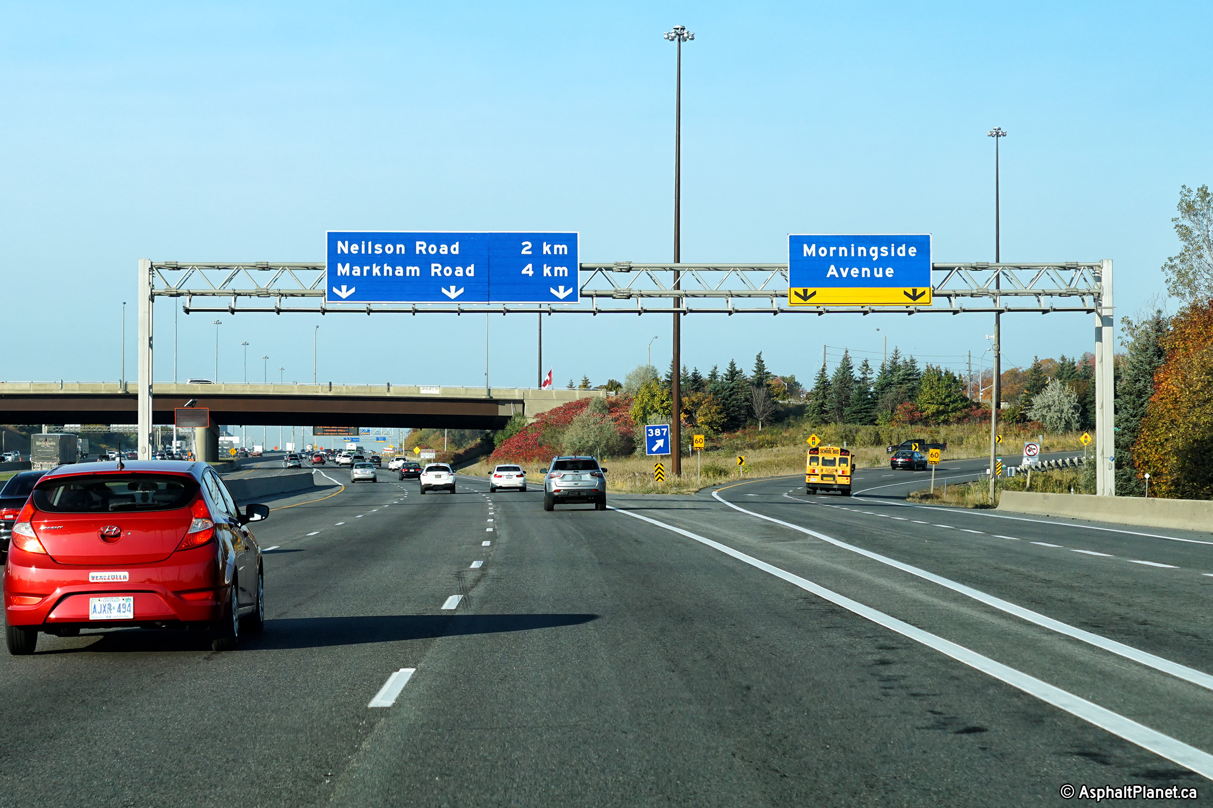
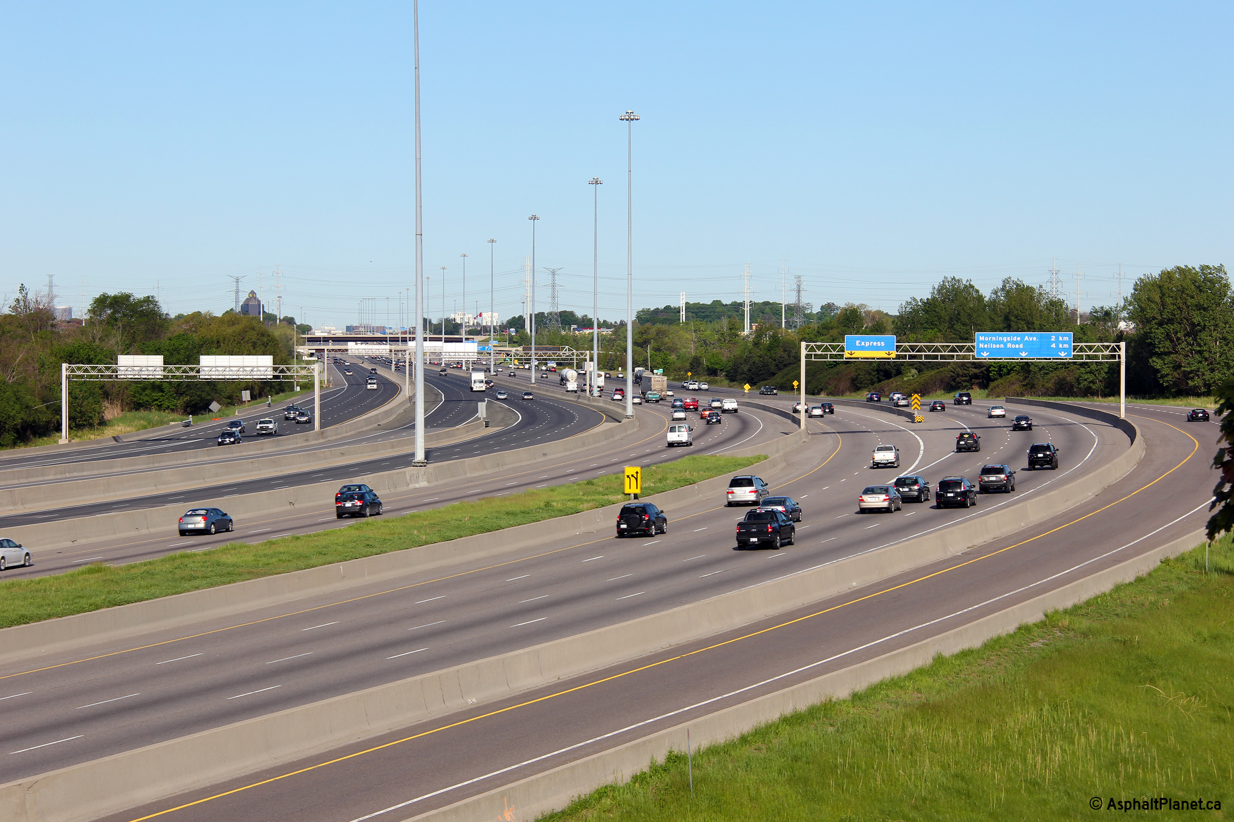
| City of Toronto |
Easterly views at the off-ramp to Nielson Road and as the transfer from
the express to both Meadowvale and Morningside Roads. Upper (Express Lanes) photo taken: August 20th, 2017. Lower (Collector Lanes) photo taken: July 9th, 2018. |
||||||
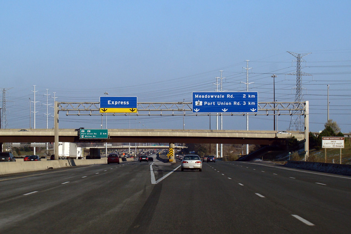
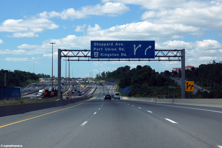
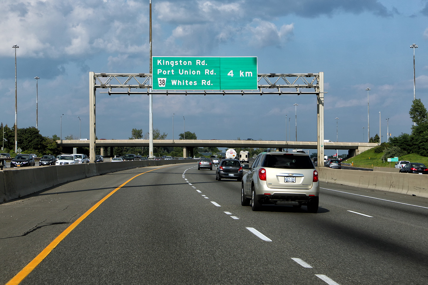
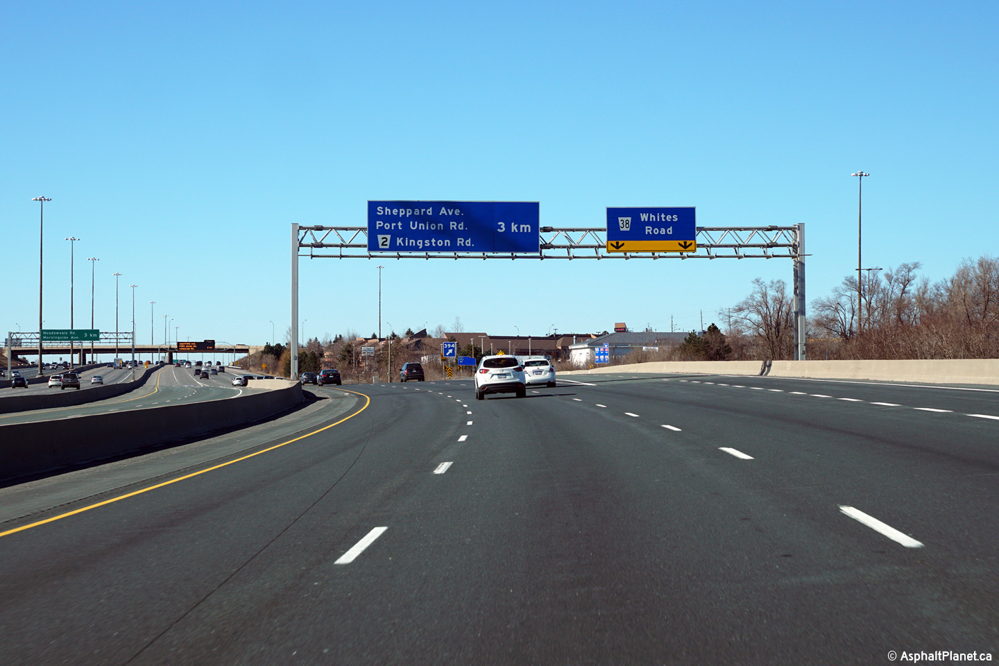
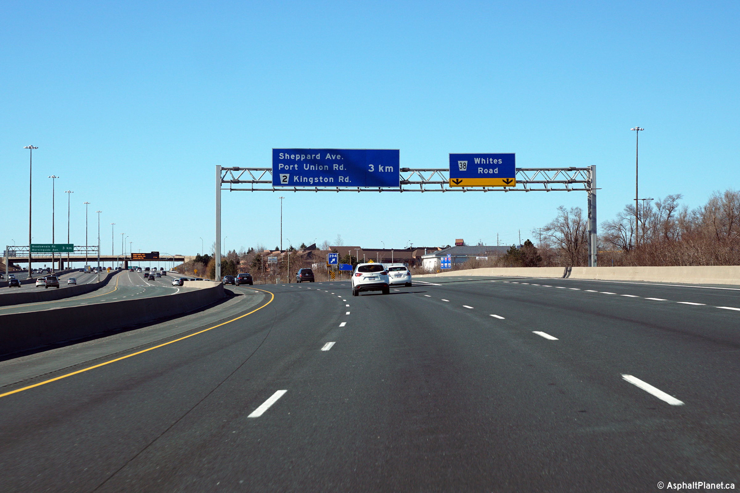
| City of Toronto |
Pre-advanced signage for the Port Union Road transfer to the collector
lanes with Nielson Road in the background. Photo taken: August 20th, 2017. |
 (720x480) (720x480)(1440x960) (2400x1600) |
|||||
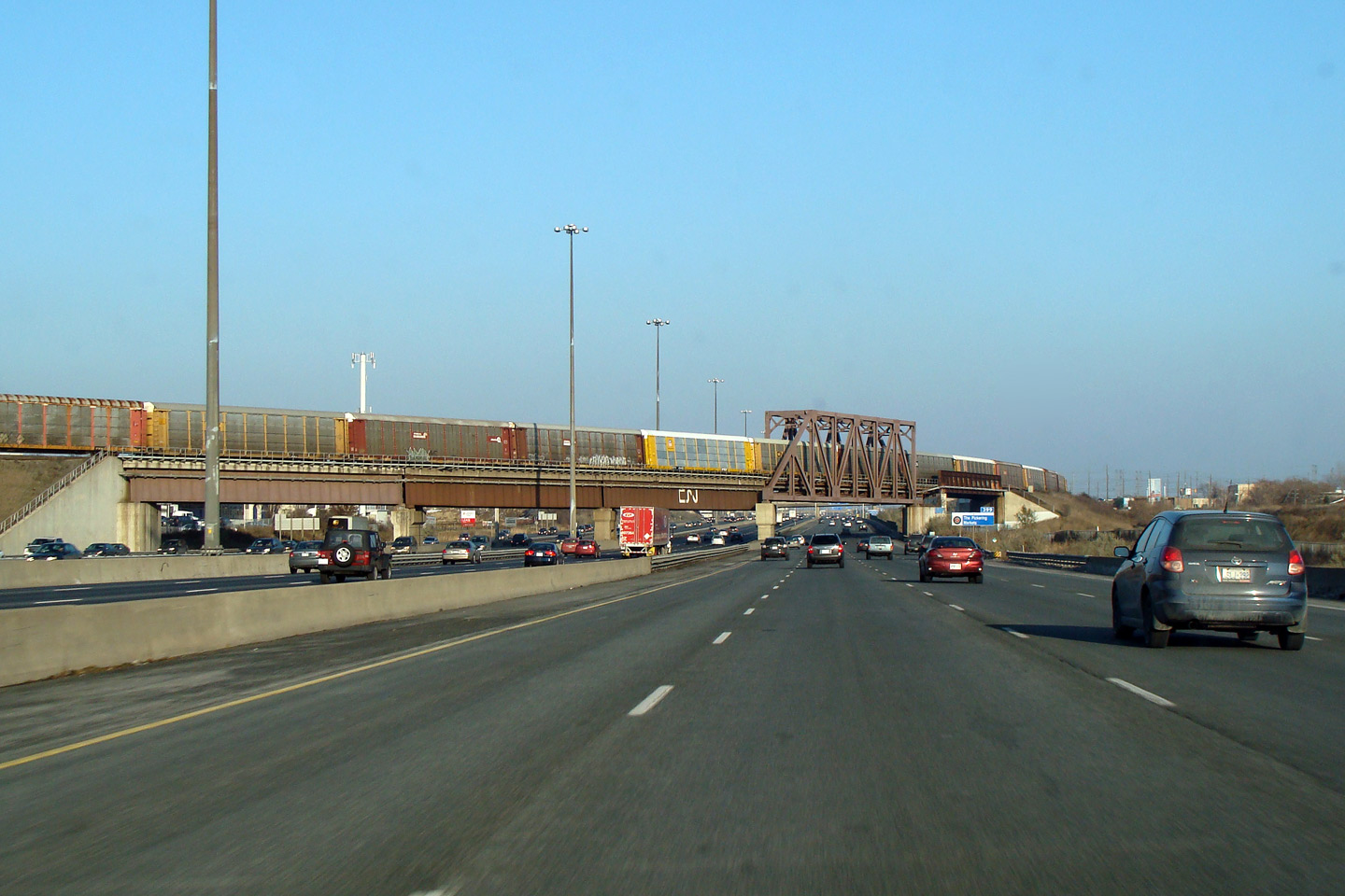
| City of Toronto |
View looking west from the Nielson Road overpass. Between the
1970s and 1995, the complex freeway ended here as all traffic was
diverted into what is now the collector lanes. Notice the vintage
steal beam barrier separating core and collector lanes west of this
structure -- this barrier is indicative of older freeways as concrete
median barriers did not start to proliferate Ontario's freeways until
the early 1980s. Photo taken: July 2nd, 2010. |
 |
|||||
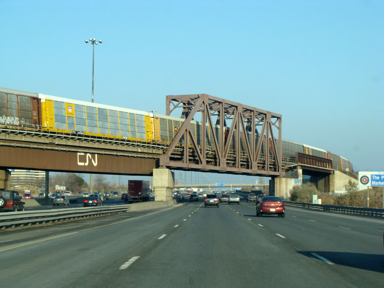
| City of Toronto |
View looking east from the Nielson Road overpass. Prior to 1995,
east of Neilson Road, Highway 401 narrowed to a six lane cross-section
separated with a steal beam barrier. Photo taken: July 2nd, 2010. |
 |
|||||
| City of Toronto |
Signage at the westbound transfer to from the collector lanes to the express
lanes at Nielson Road. For two decades, this marked the eastern end of
the express lanes through Toronto. Photo taken: October 21st, 2019. |
 (720x480) (720x480)(1440x960) (2400x1600) |
|||||
| City of Toronto |
Westbound signage for the off-ramp to Nielson Road,. Photo taken: October 21st, 2019 |
 (720x480) (720x480)(1440x960) (2400x1600) |
|||||
| City of Toronto |
Westbound advanced signage for the ramp to Nielson Road. Photo taken: October 21st, 2019 |
 (720x480) (720x480)(1440x960) (2400x1600) |
|||||
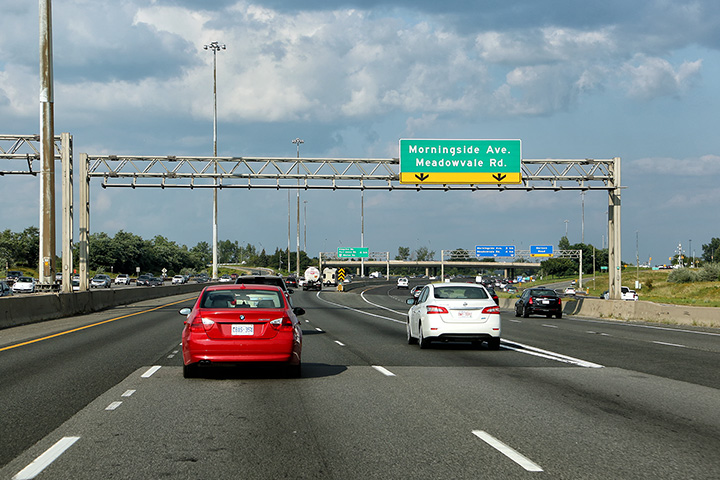
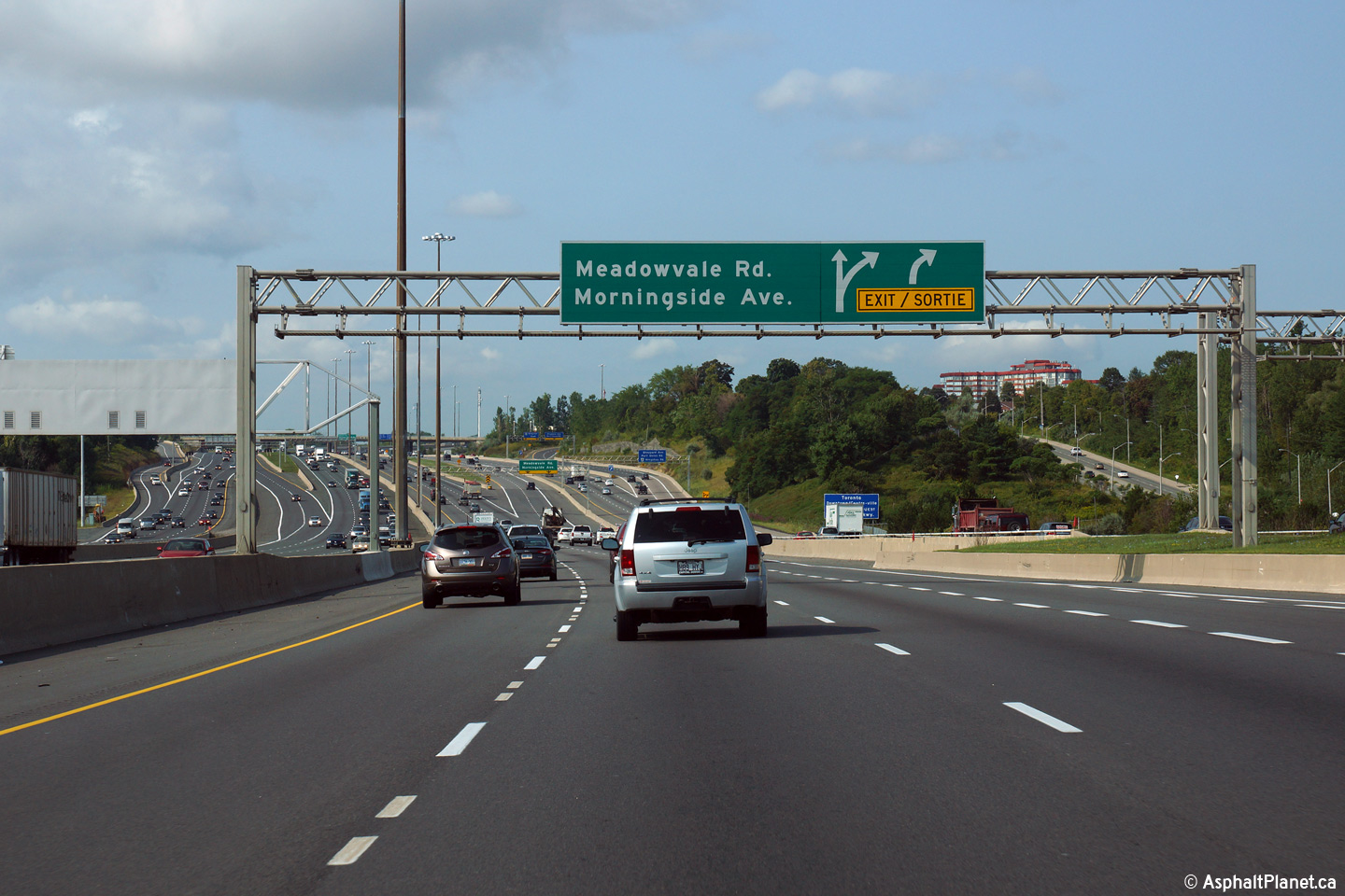
| City of Toronto |
Eastbound advanced signage for the off-ramp to Meadowvale Road. Photo taken: July 9th, 2018. |
 (720x480) (720x480)(1440x960) (2400x1600) |
|||||
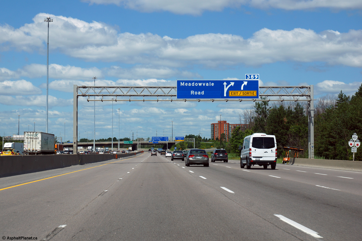
| City of Toronto |
Signage at the eastbound off-ramp from the collector laens to Meadowvale
Road. Photo taken: July 9th, 2018. |
 (720x480) (720x480)(1440x960) (2400x1600) |
|||||
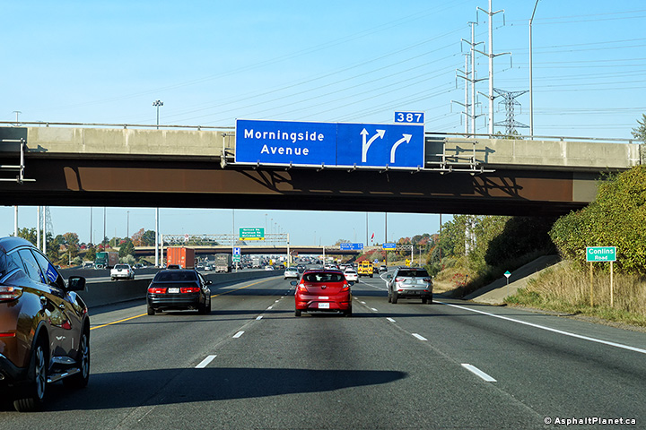
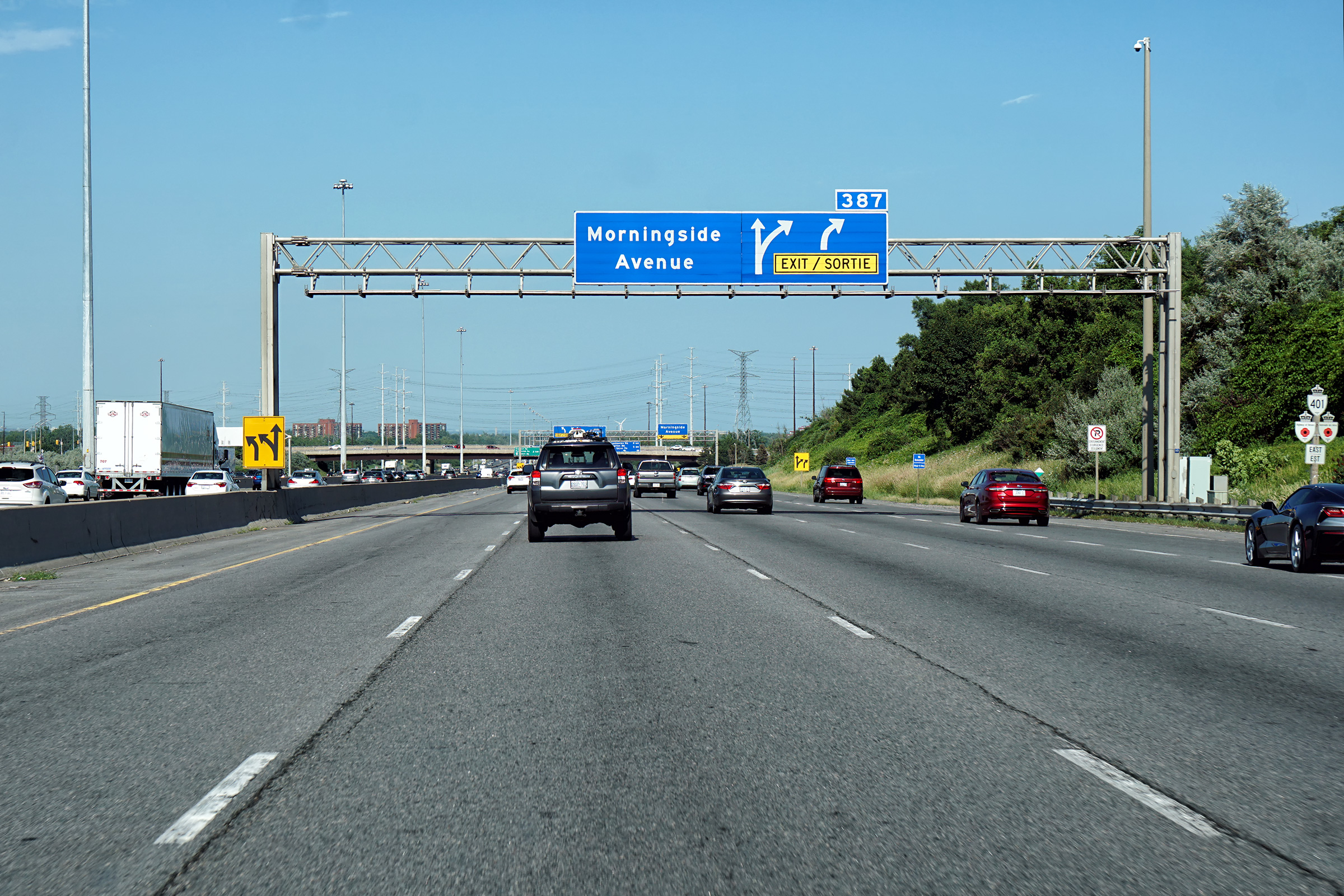
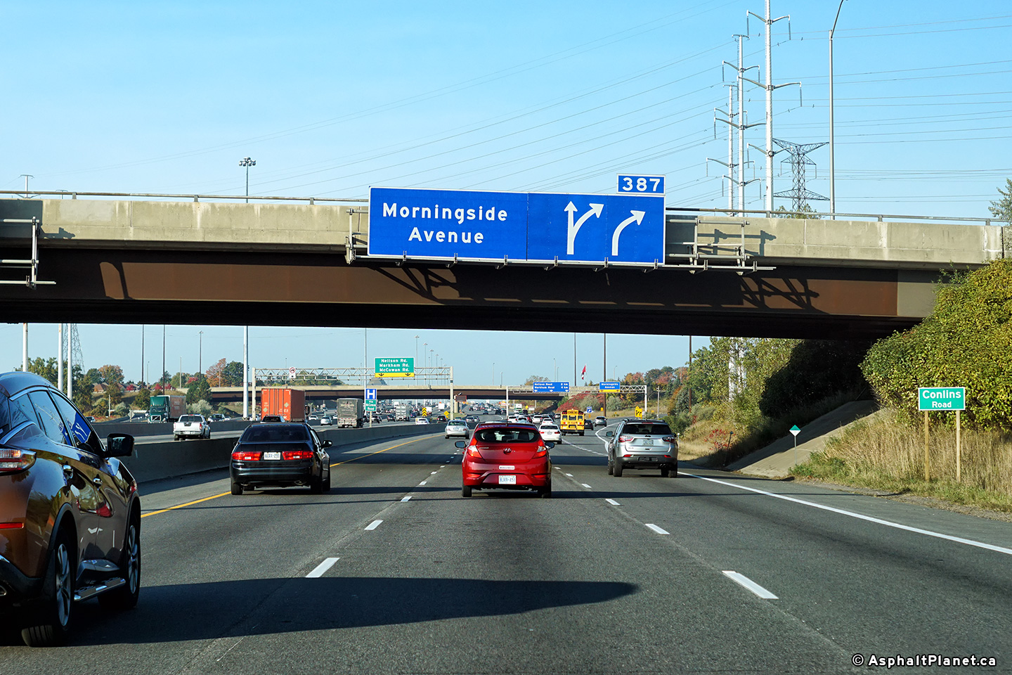
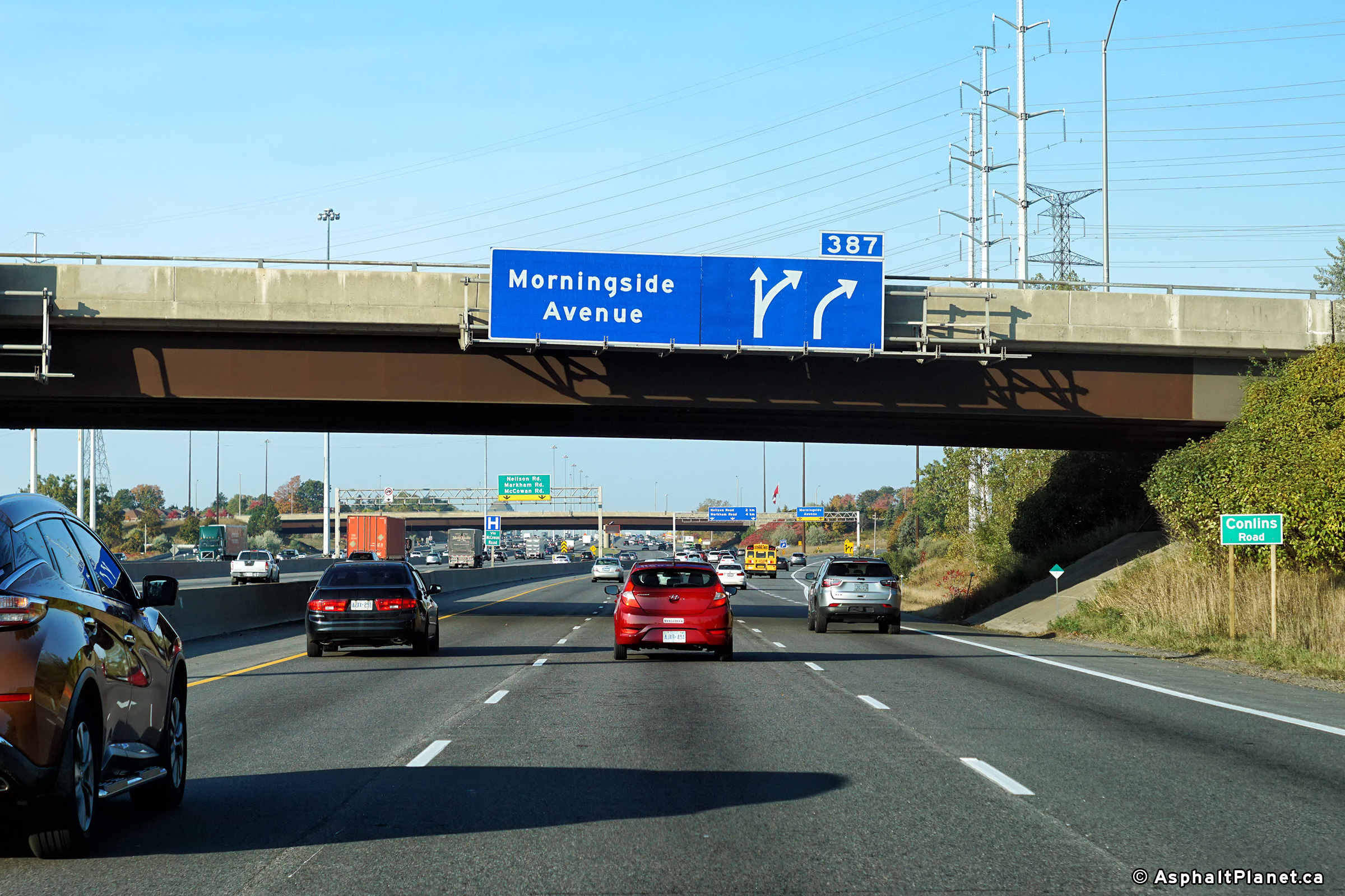
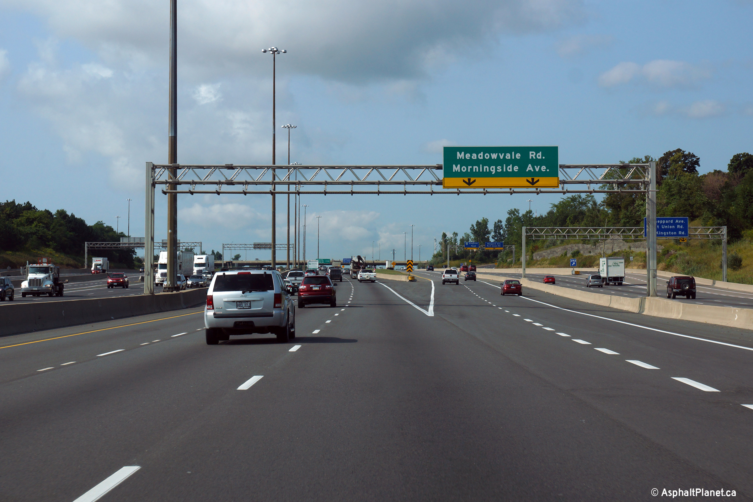
| City of Toronto |
View of the signage for the eastbound collector to core transfer at
Morningside Avenue. The upper photo shows the signage before the
former highway shields had been removed, while the lower photo shows the
up-to-date signage.. Upper photo taken: November 25th, 2007. Lower photo taken: July 9th, 2018. |
 (720x480) (720x480)(1440x960) (2400x1600) |
|||||
| City of Toronto |
Westerly view from the Morningside Avenue overpass. Photo taken: June 3rd, 2011. |
 |
|||||
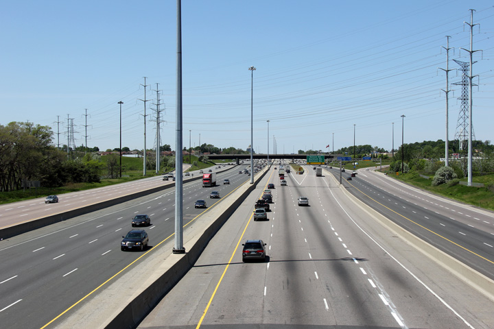
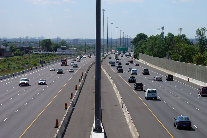
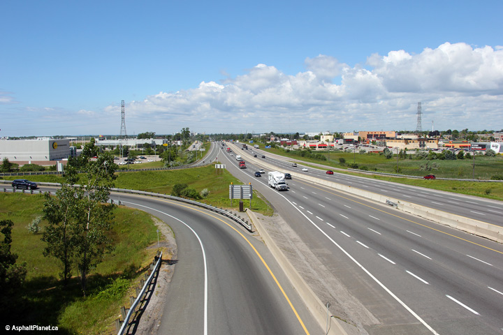
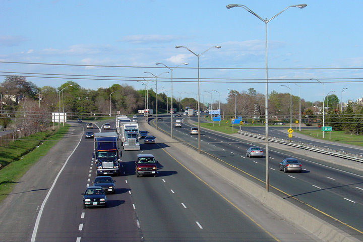
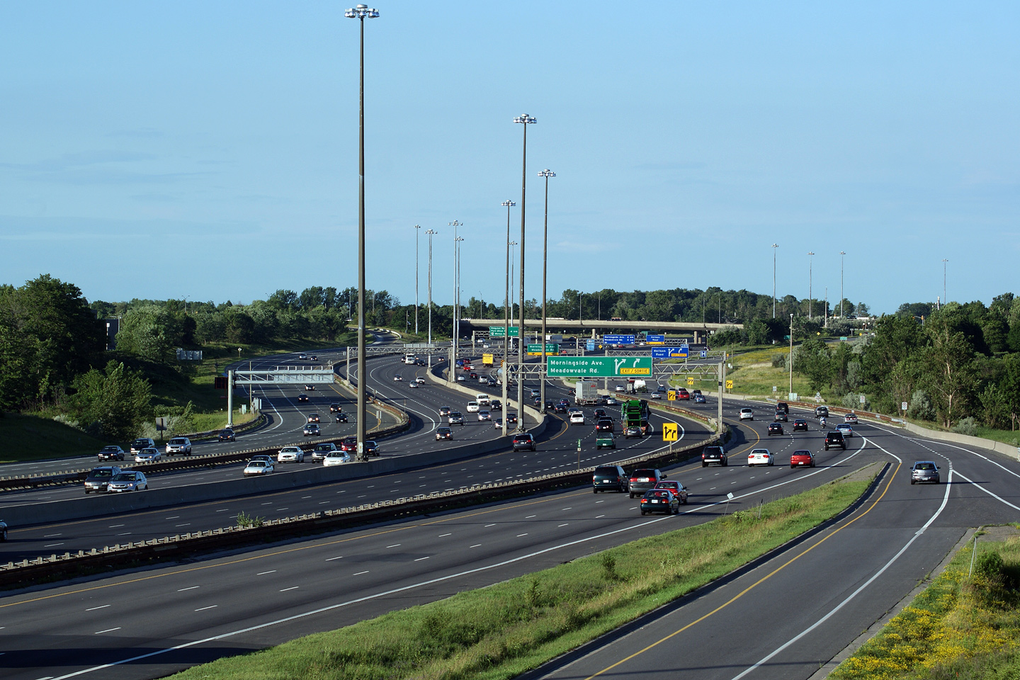
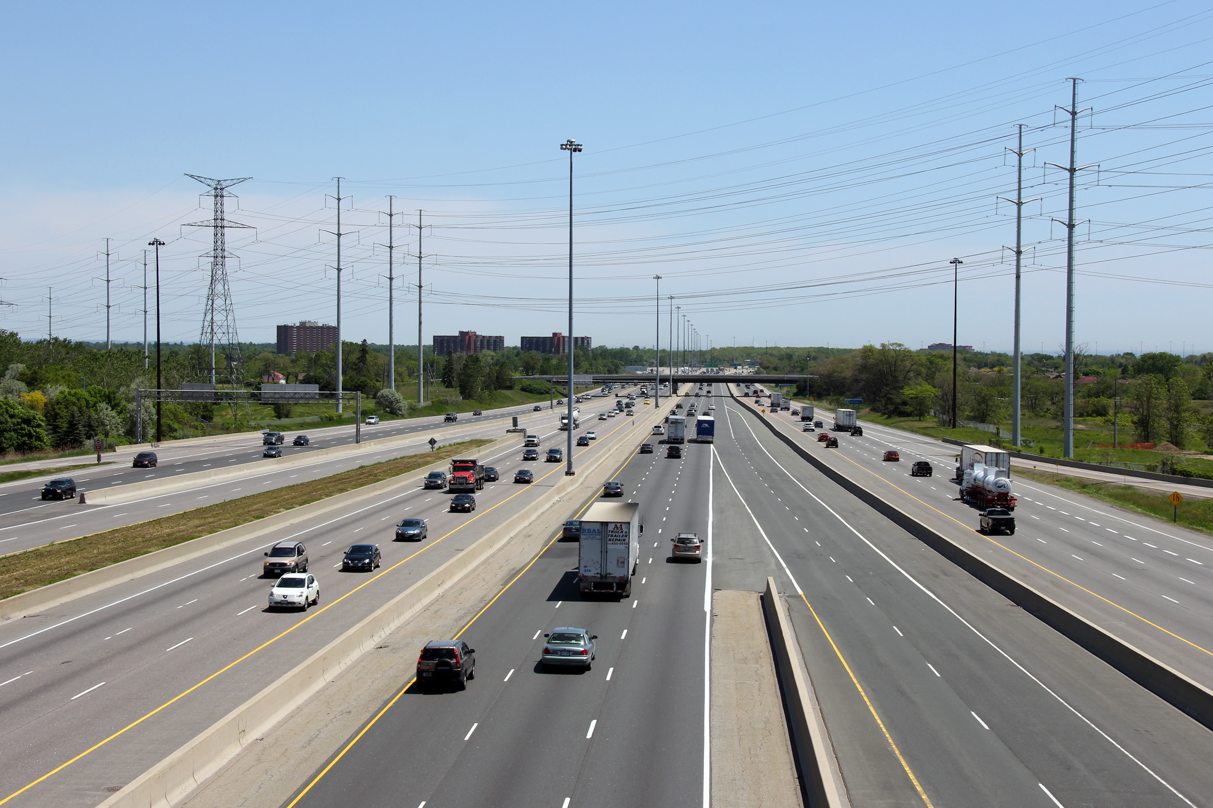
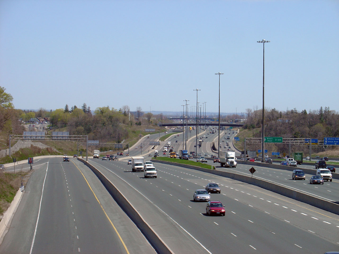
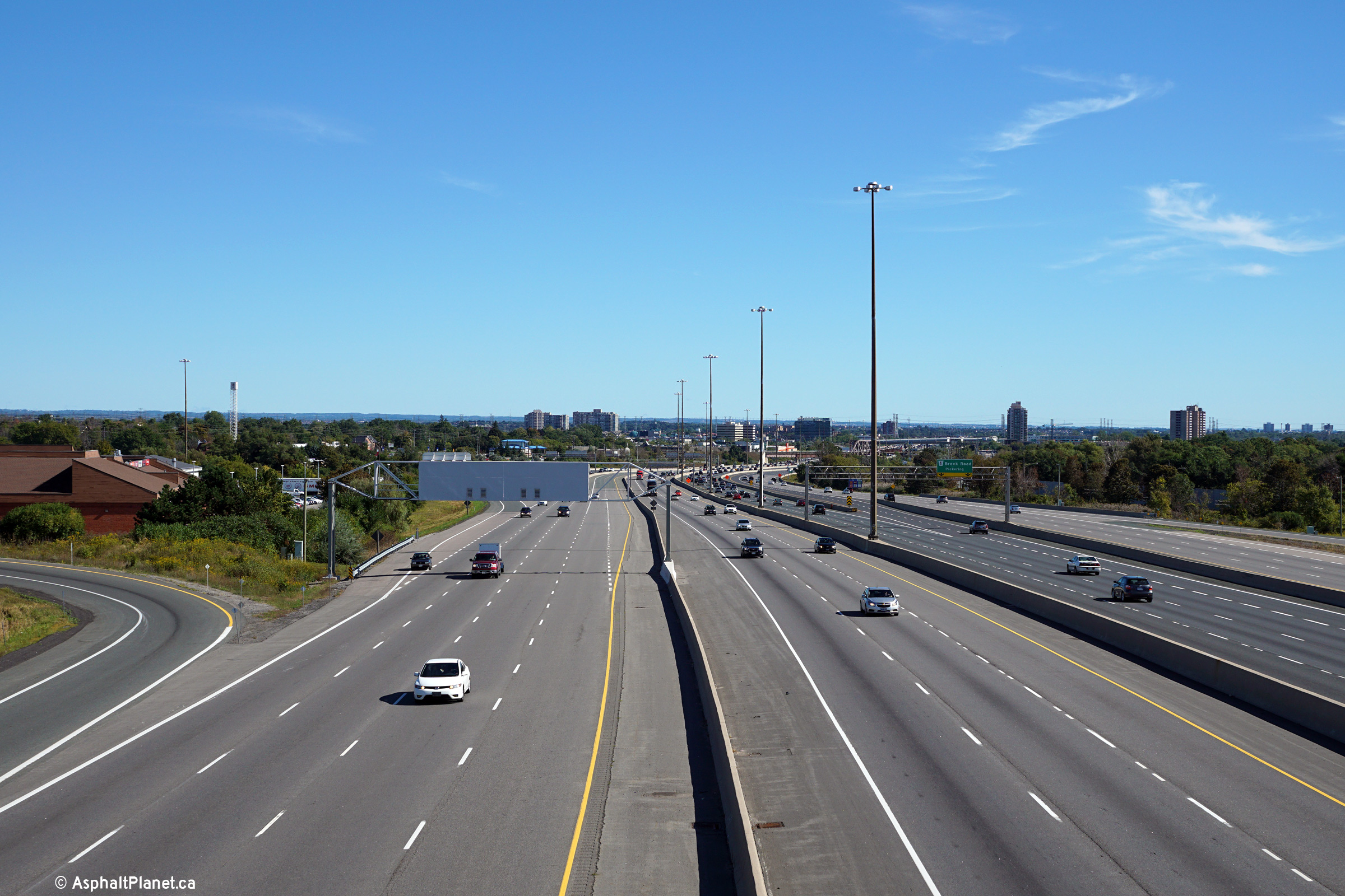
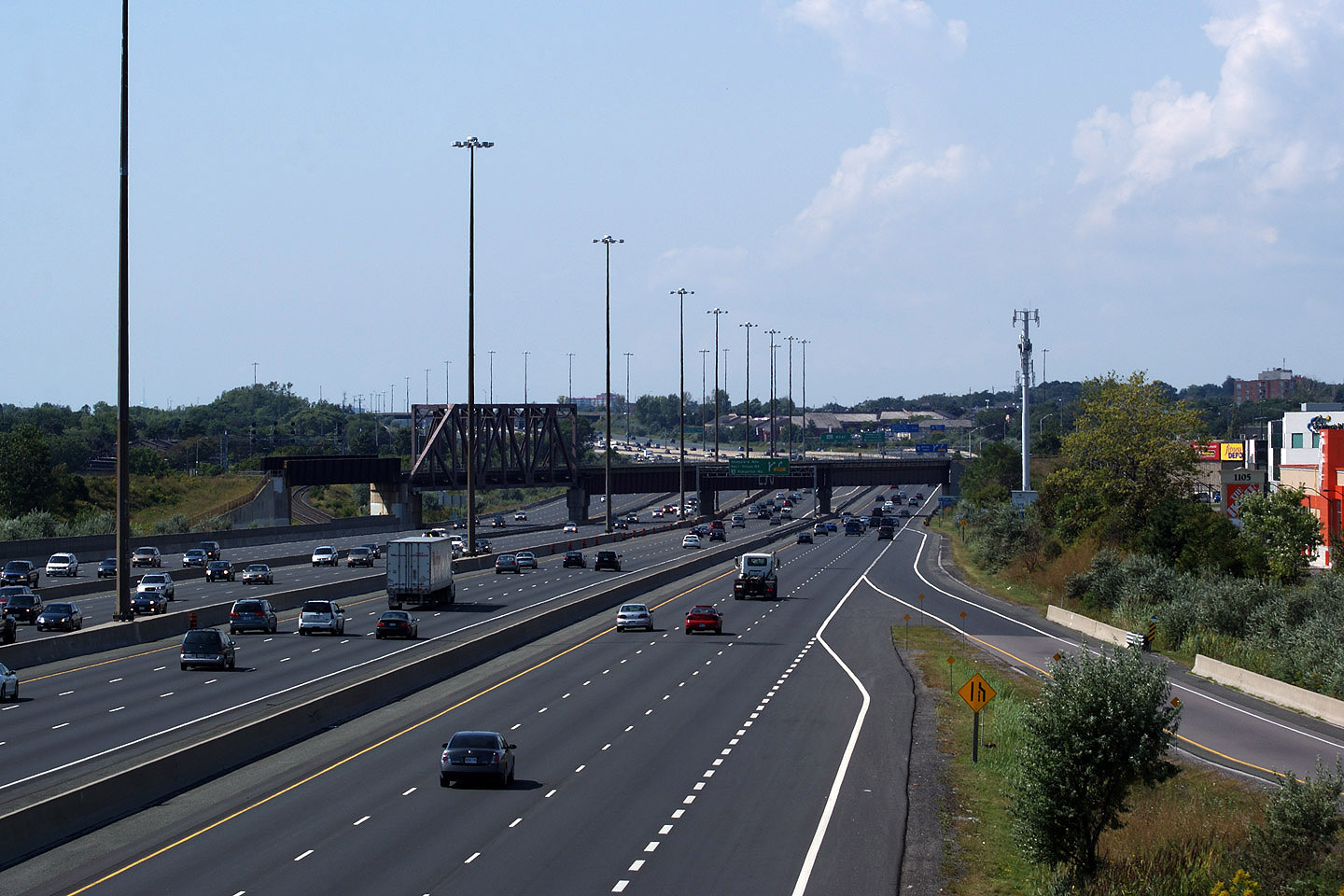
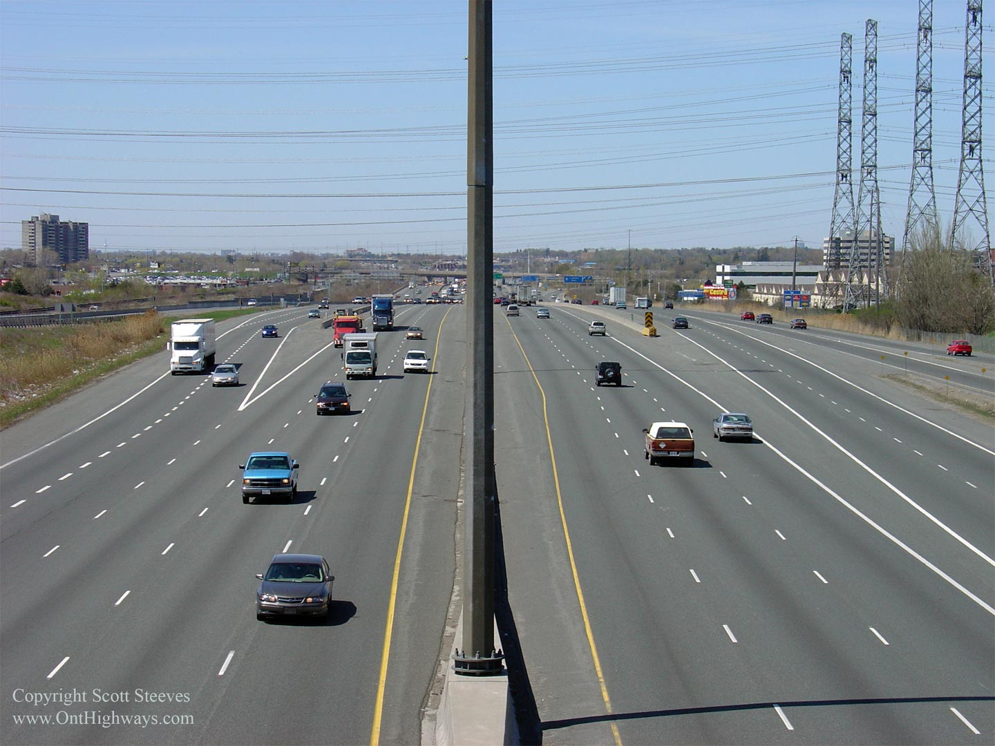
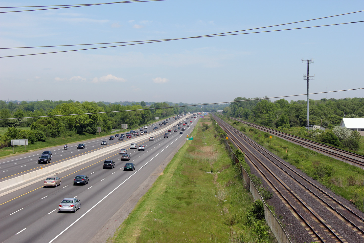
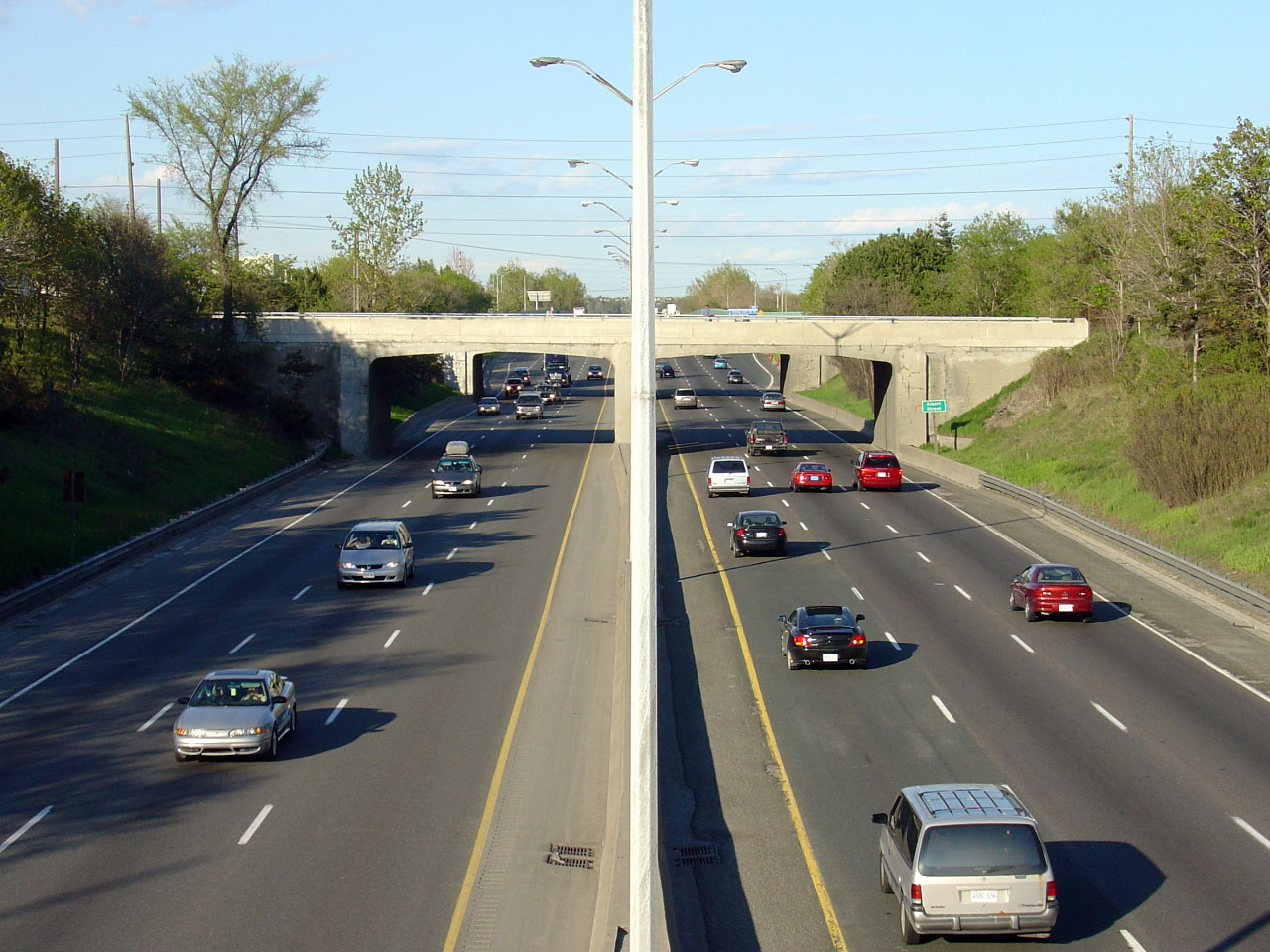
| City of Toronto |
Easterly view of Highway 401 from the Morningside Avenue overpass.
The complex freeway system along Highway 401 through Eastern Scarborough
was completed in stages during the 1990s. Because this section of
complex freeway is so much newer than sections through Central Toronto, this
part of the freeway is much better designed. Design improvements
include: longer transfer lanes, concrete medians, improved lighting, as well as a continuous
14-lane configuration. Older sections of complex freeway through
Toronto were built to a 12-lane configuration. Photo taken: June 3rd, 2011. |
 |
|||||
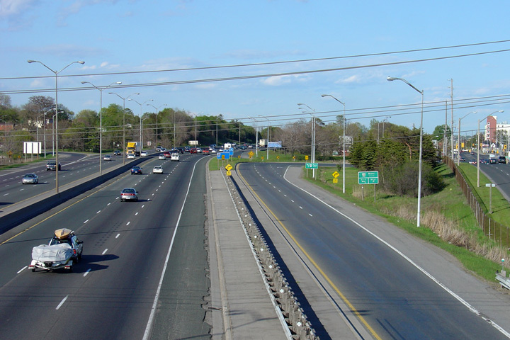
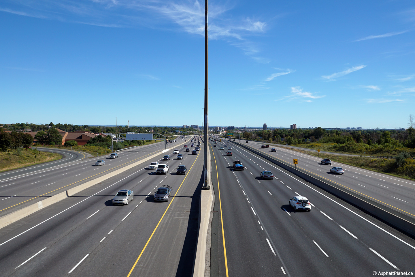
| City of Toronto |
Westerly view from the Collins Road overpass. The Gatineau Hydro
Corridor crosses Highway 401 between Collins Road and Morningside
Avenue. Some
private citizen's groups suggest that a new freeway should be
constructed through Scarborough alongside the hydro corridor between the
Don Valley Parkway and Highway 401 in order to relieve traffic
congestion through Scarborough. Photo taken: June 3rd, 2011. |
 (720x480) (1440x960) (2400x1600) |
|||||
| City of Toronto |
Two easterly views from the Collins Road overpass. Unlike many of
the sign photos in this gallery that both supersede and precede the
photos to the right, all the references to Toronto's former provincial
highways were removed from Highway 401's signage stock no later than
early in 2010. Upper photo taken: June 3rd, 2011. Lower photo taken: June 28th, 2010. |
(720x480)
(1440x960)
(2400x1600) |
|||||
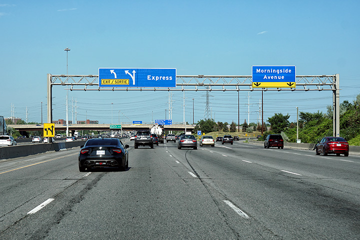
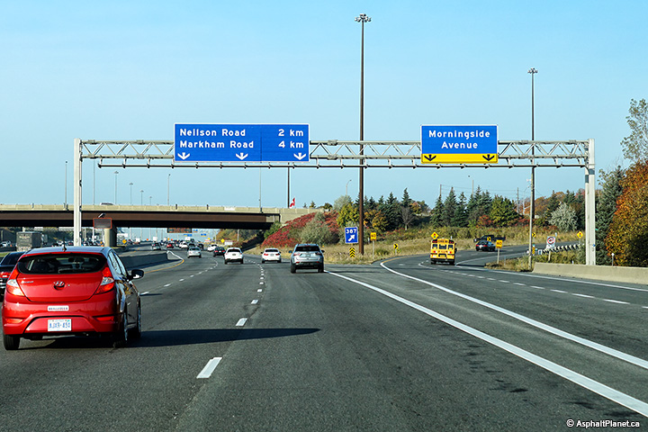
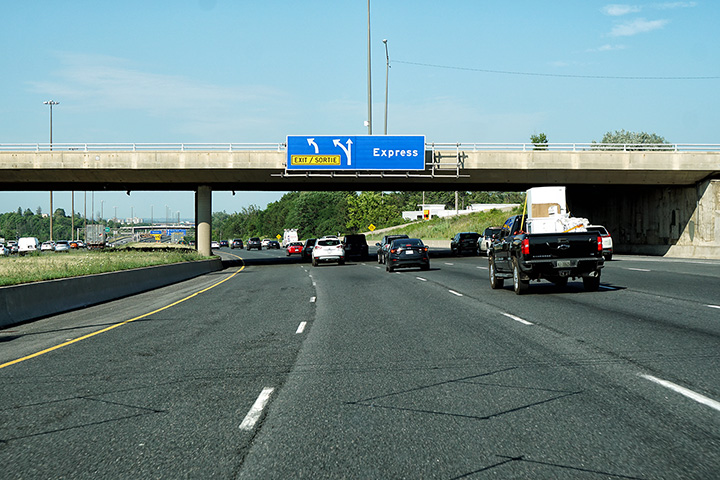
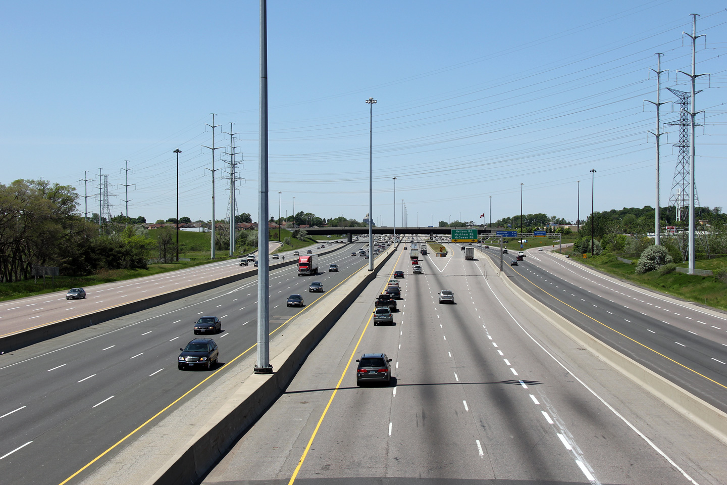
| City of Toronto |
Express and collector signage
approaching the Morningside Road overpass. The signage in the express
lanes directs traffic into the collectors. While the signage for
collector lane traffic is for the Morningside Road interchnage. Upper (Express Lanes) photo taken: August 28th, 2015. Lower (Collector Lanes) photo taken: October 21, 2019 |
||||||
| City of Toronto |
Express and collector signage affixed to
the Conlins Road overpass. Upper (Express Lanes) photo taken: August 28th, 2015. Lower (Collector Lanes) photo taken: October 21, 2019 |
||||||
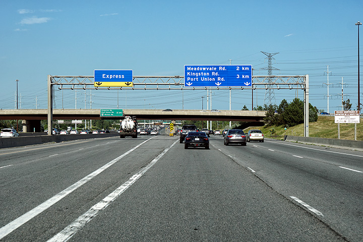
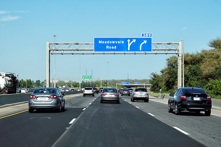
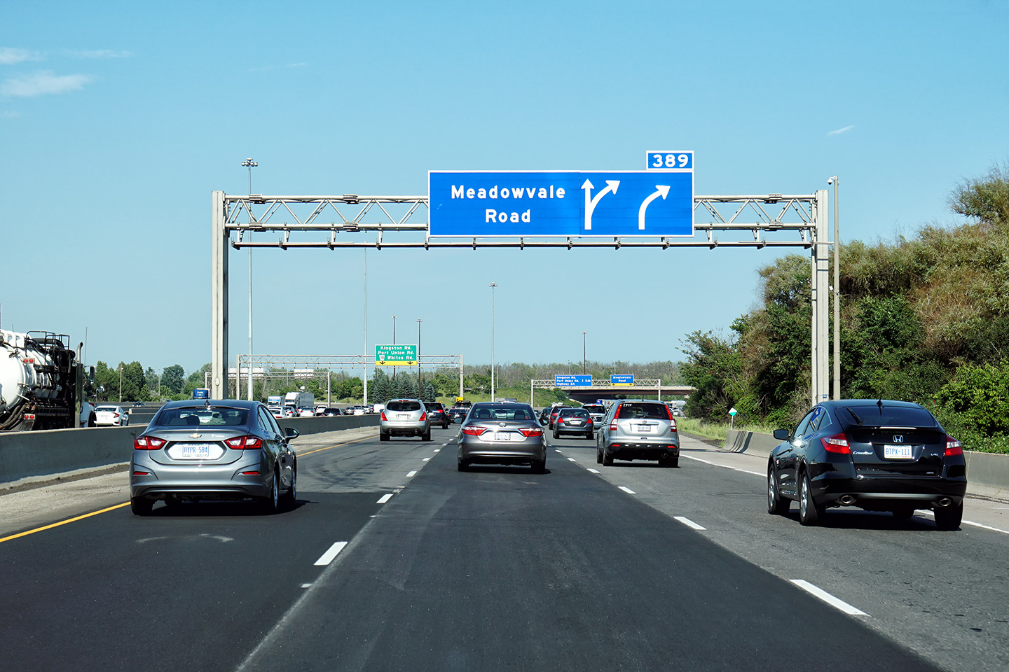
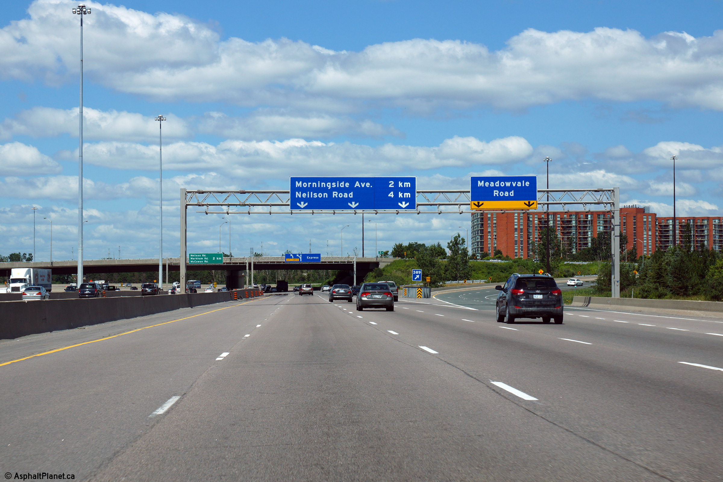
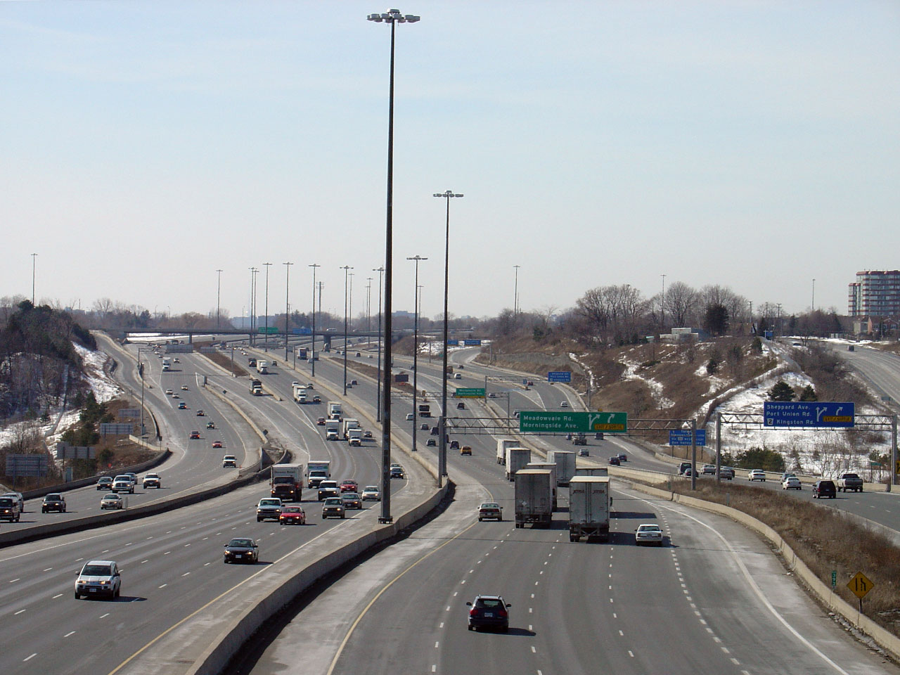
| City of Toronto |
Two views of the overhead advanced sign for the Meadowvale Road core to
collector transfer in the express lanes, as well as the advanced sign
for the Meadowvale Road interchange. Upper (Express Lanes) photo # 1 taken: December 24th, 2006. Middle (Express Lanes) photo # 2 taken: November, 2018. Lower (Collector Lanes) photo taken: July 9th, 2018. |
||||||
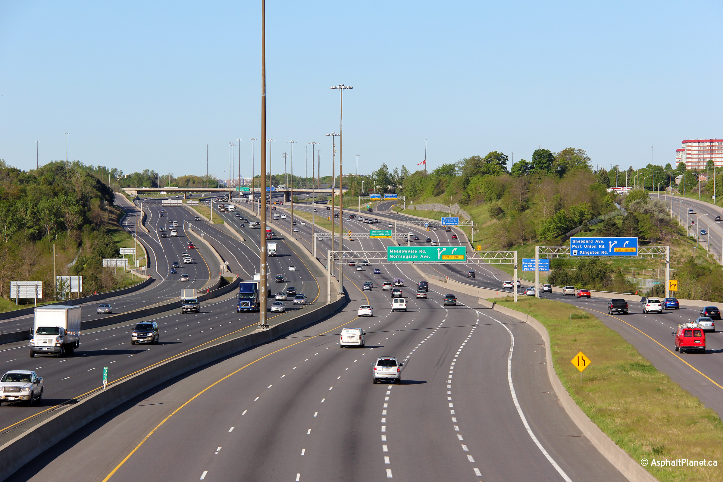
| City of Toronto |
Two photos at the Meadowvale Road transfer from the express to collector
lanes, as well as signage at the off-ramp to Meadovale Road. Upper (Express Lanes) photo # 1 taken: December 24th, 2006. Middle (Express Lanes) photo # 2 taken: November, 2018. Lower (Collector Lanes) photo taken: July 9th, 2018. |
||||||
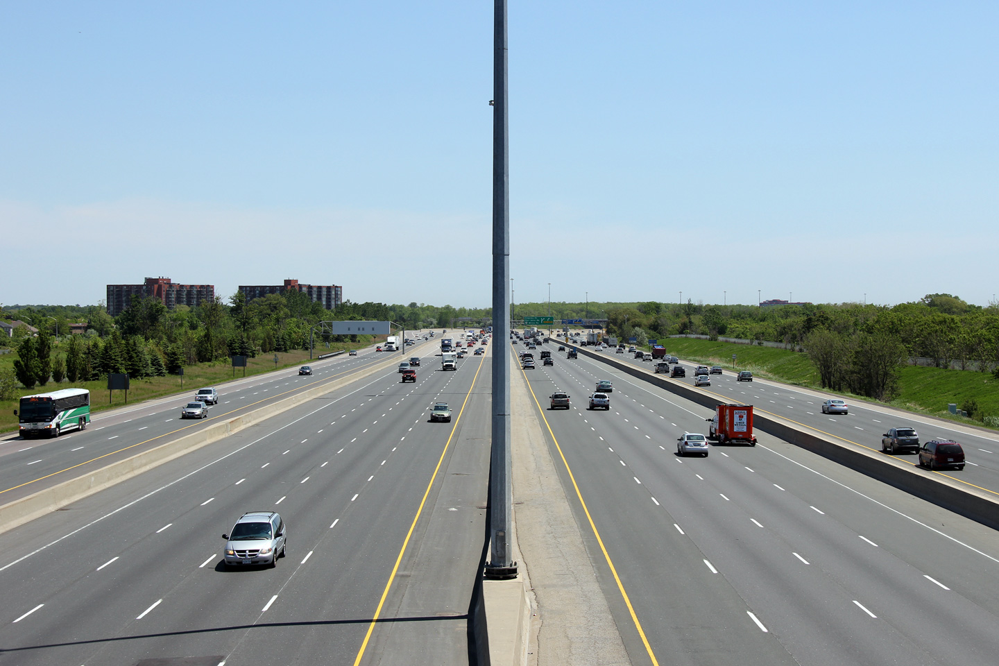
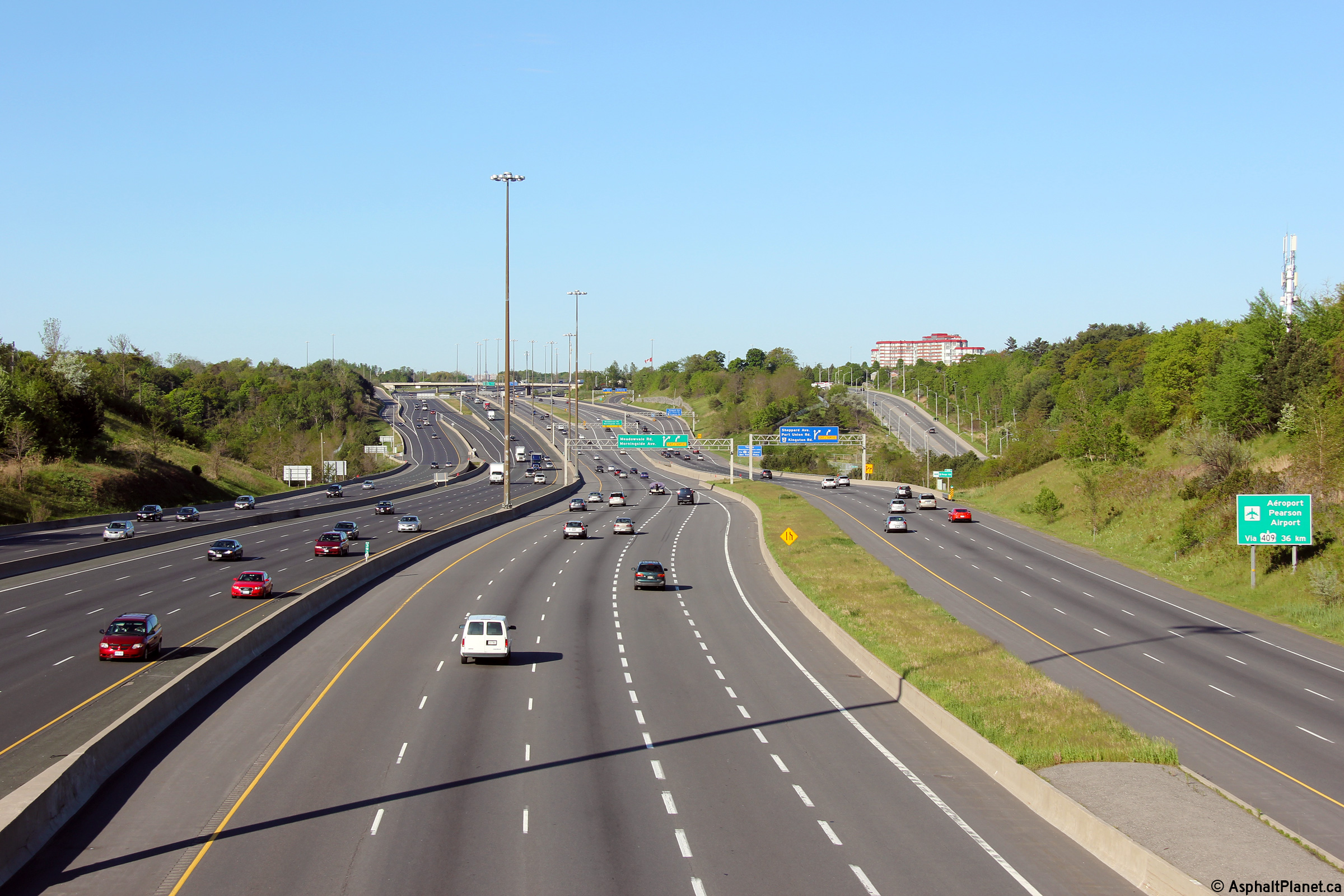
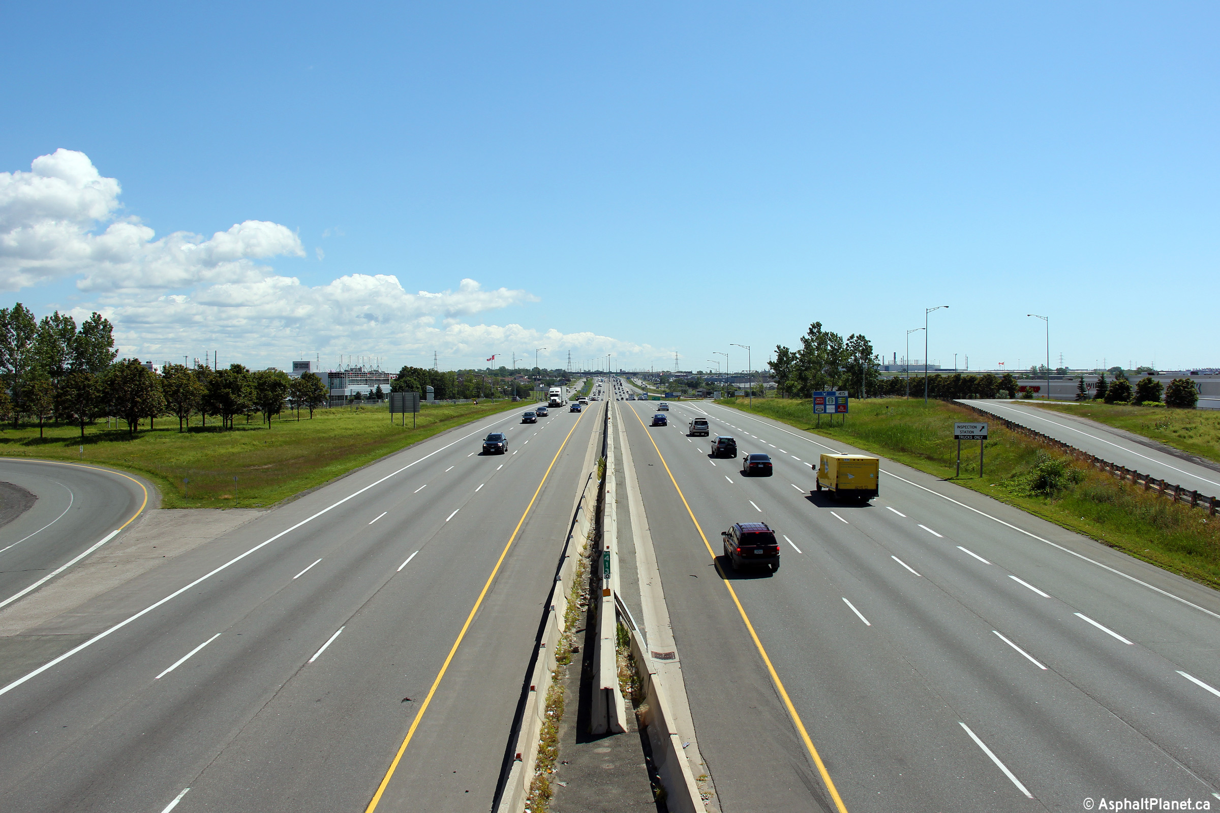
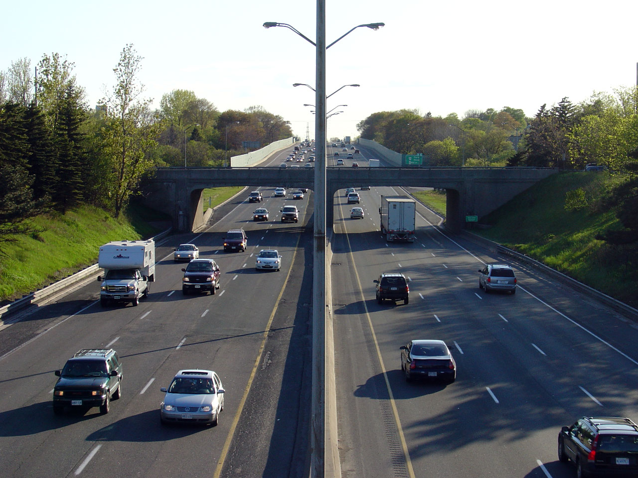
| City of Toronto |
View looking west from the Meadowvale Road overpass. Meadowvale
Road is the main artery to Toronto's Zoo.
Click here for an additional photo from
this vantage point, taken in August, 2006. Photo taken: August, 21st, 2006. |
(720x480) (1440x960) (2400x1600)
|
|||||
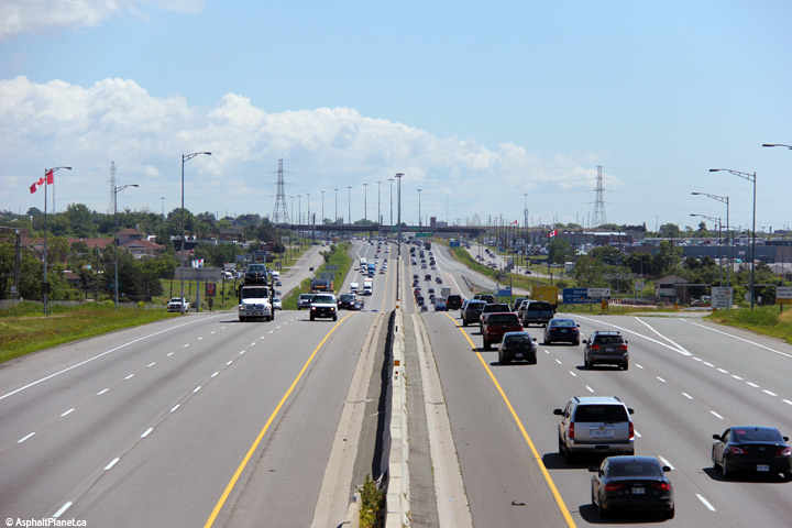
| City of Toronto |
Opposing view from the Meadowvale Road overpass.
Click here for an additional photo from
this vantage point, taken in August, 2006. Photo taken: August, 21st, 2006. |
|
|||||
| City of Toronto |
Signage at the off-ramp from the westbound collector lanes to Meadowvale
Road in Scarborough. Photo taken: August 28th, 2014. |
 (720x480) (720x480)(1440x960) (2400x1600) |
|||||
| City of Toronto |
Westbound advanced signage for the off-ramp to Meadowvale Road in
Scarborough. Photo taken: August 28th, 2014. |
 (720x480) (720x480)(1440x960) (2400x1600) |
|||||
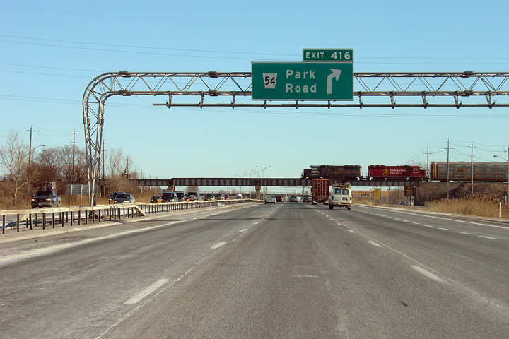
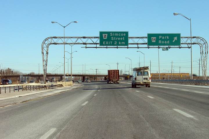
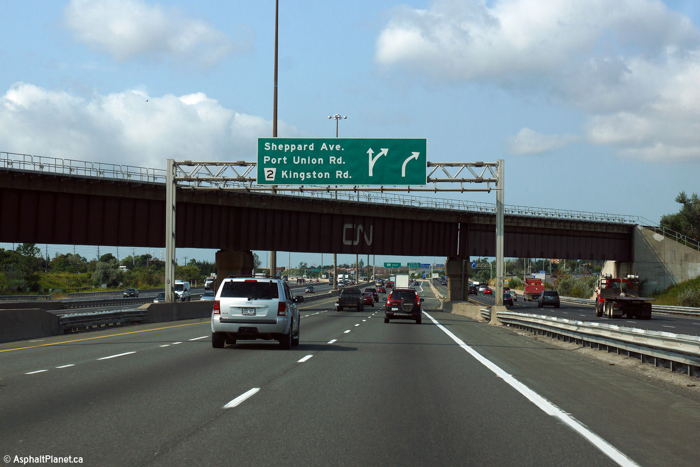
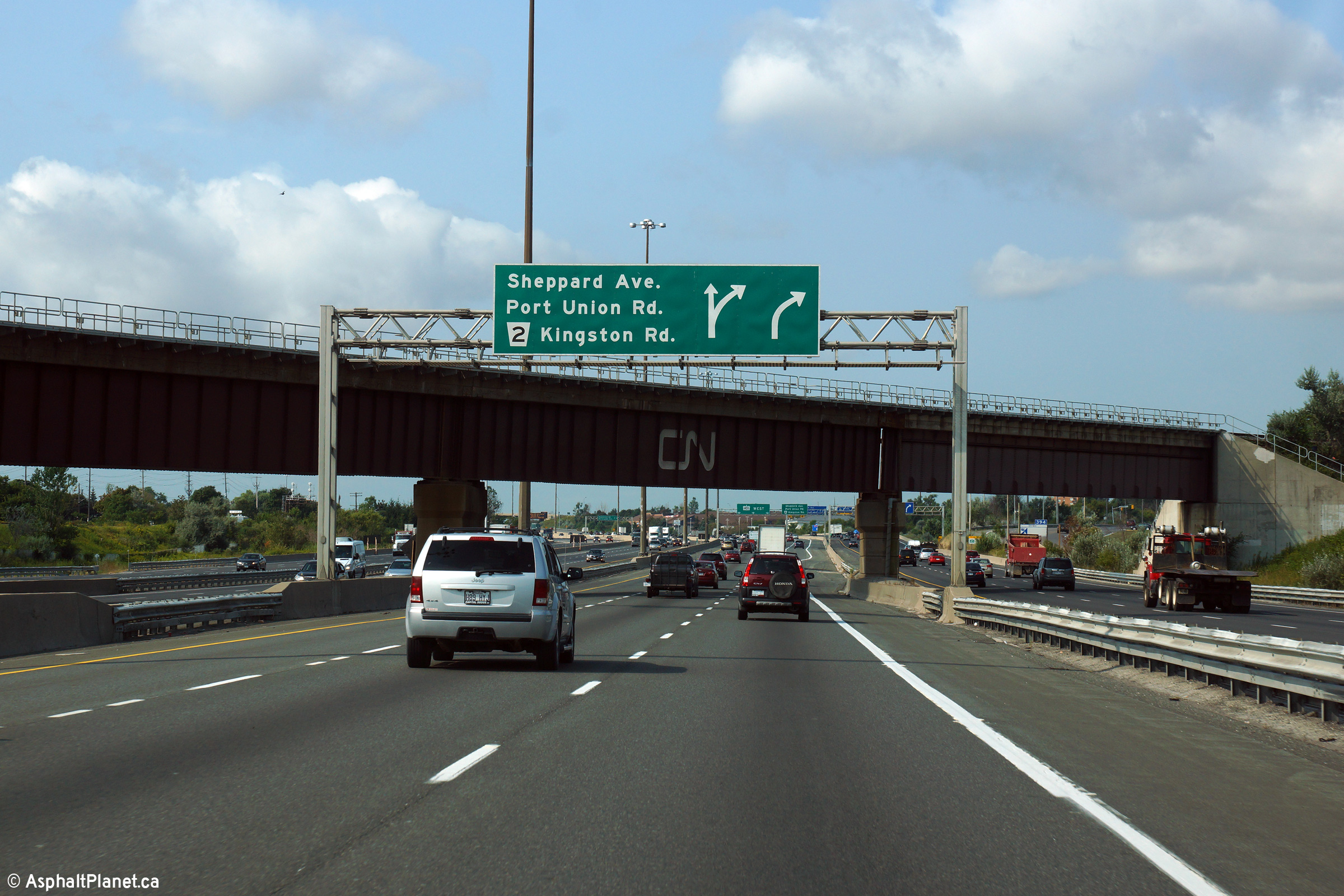
| City of Toronto | Next exit signage just west of the Port Union
Road overpass in Scarborough. Picture taken: July 2007. |
 |
|||||
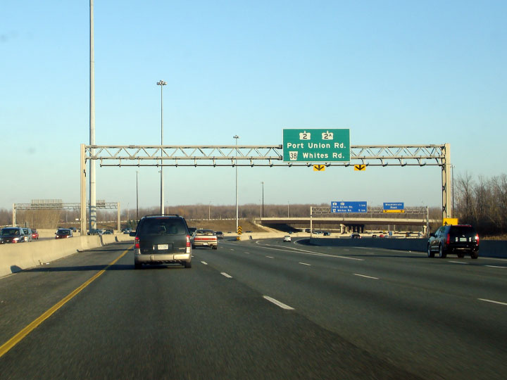
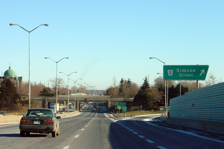
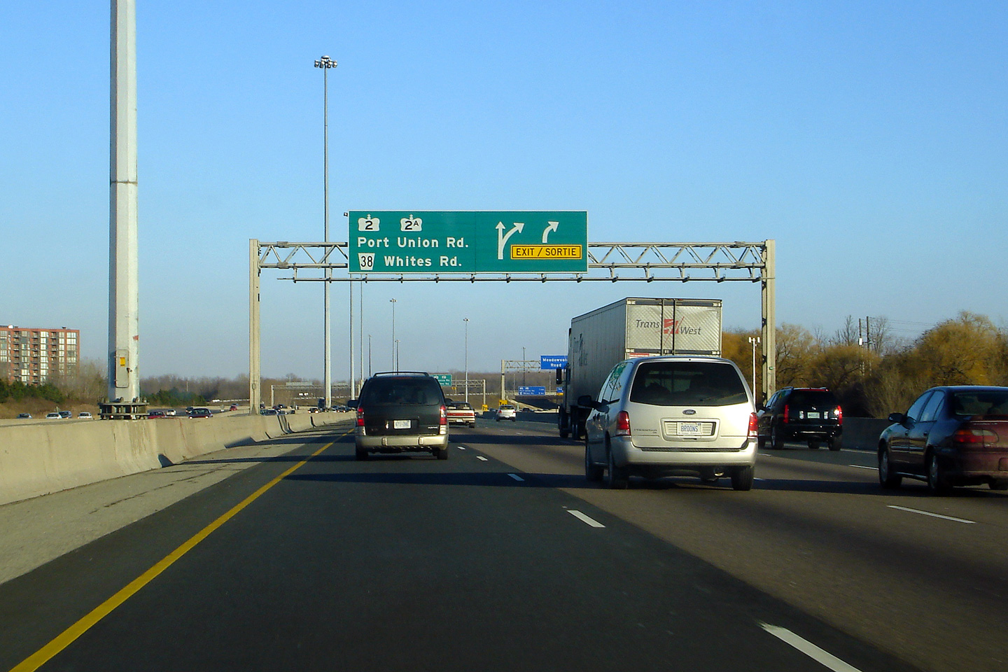
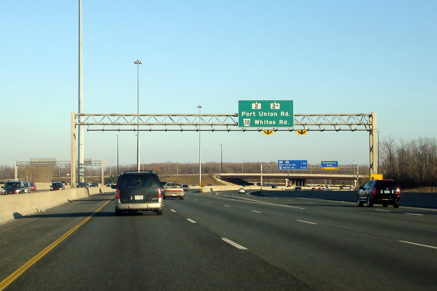
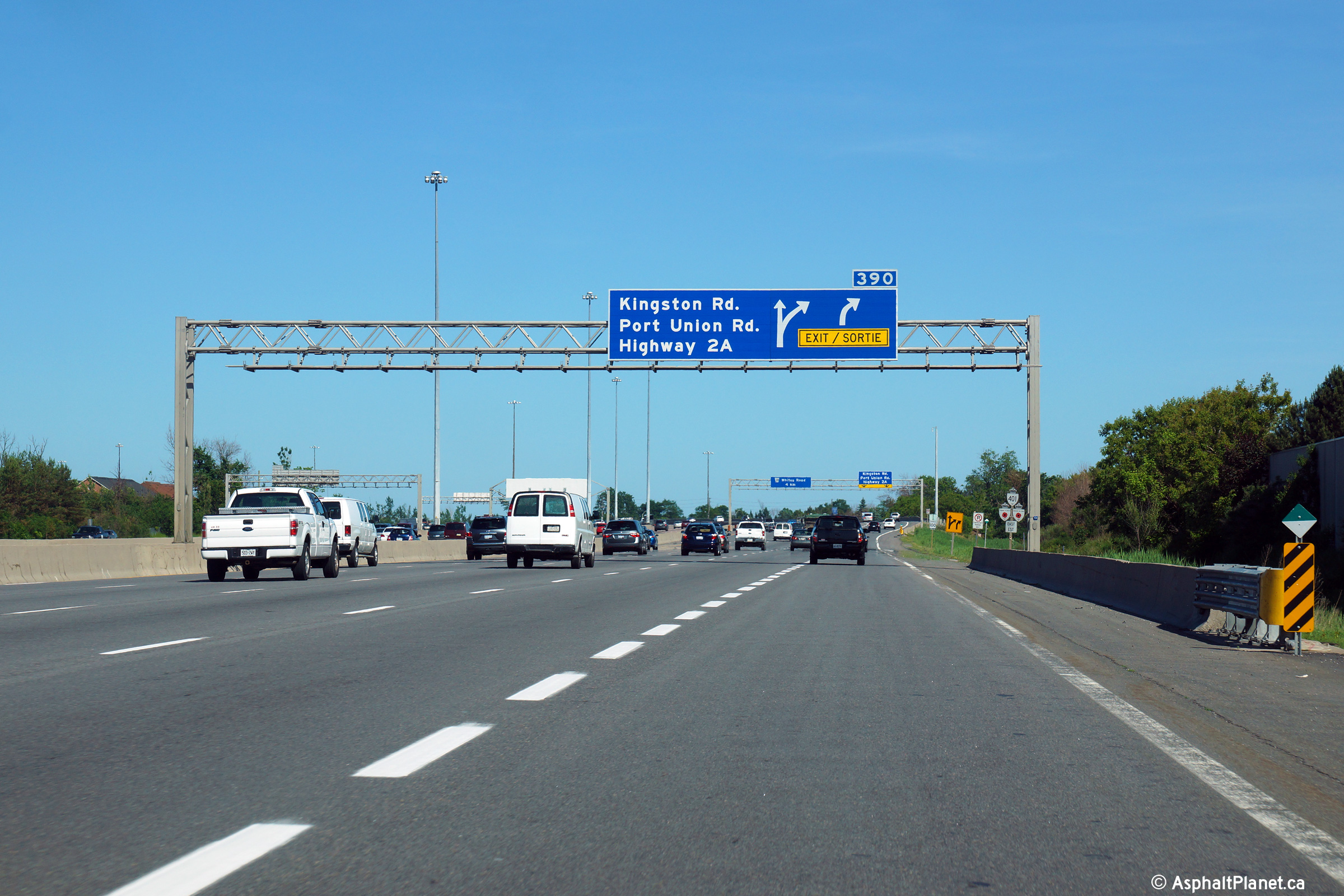
| City of Toronto |
Overhead advanced sign for the ramp to Highway 2 and Highway 2A.
Highway 2A, while now defunct, is a short spur freeway that was part of
Highway 401's original alignment before the Toronto by-pass was
completed in 1957. Upper photo taken: November 25th, 2007. Lower photo taken: June 19th, 2014. |
 (720x480) (720x480)(1440x960) (2400x1600) |
|||||
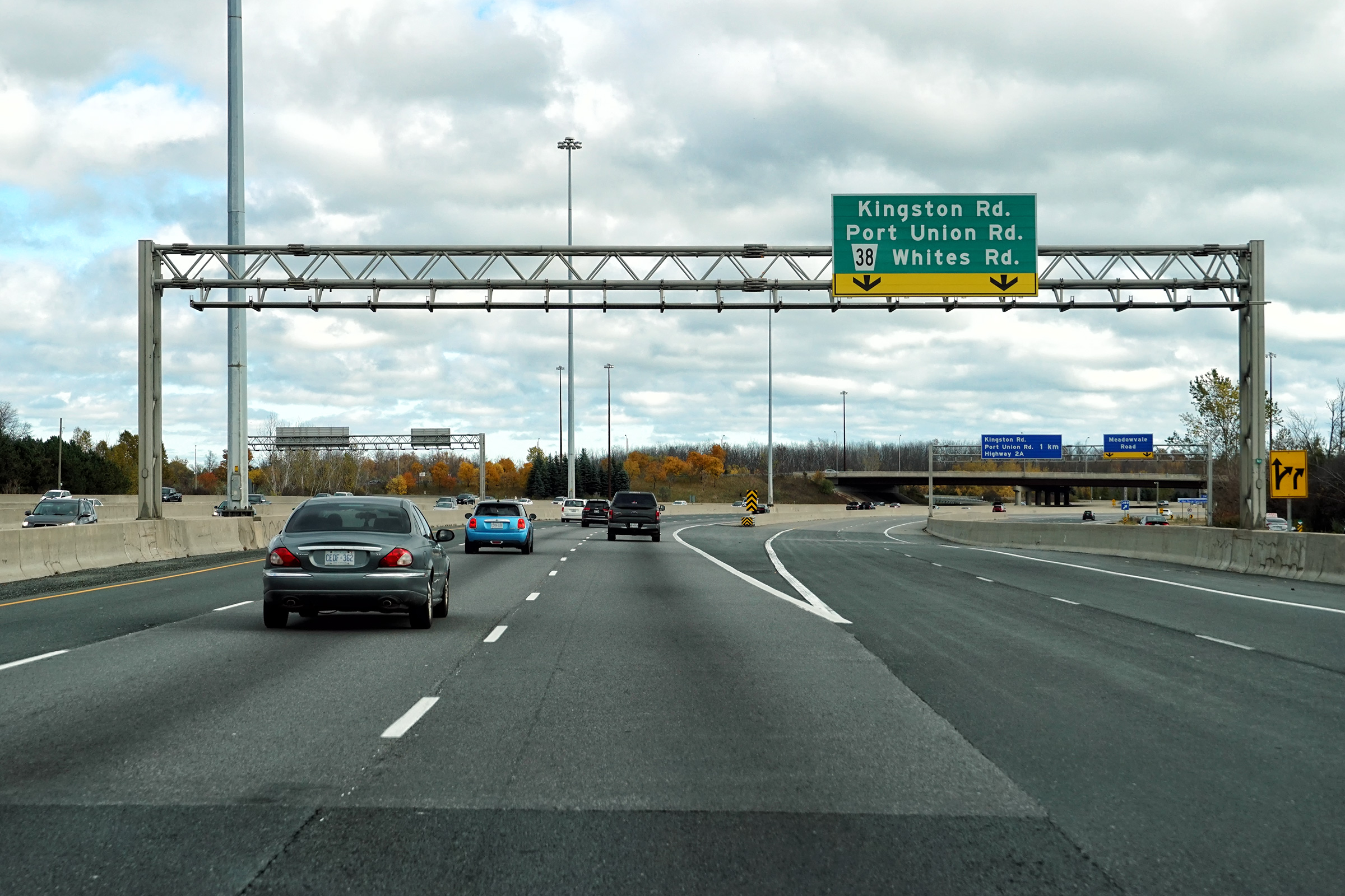
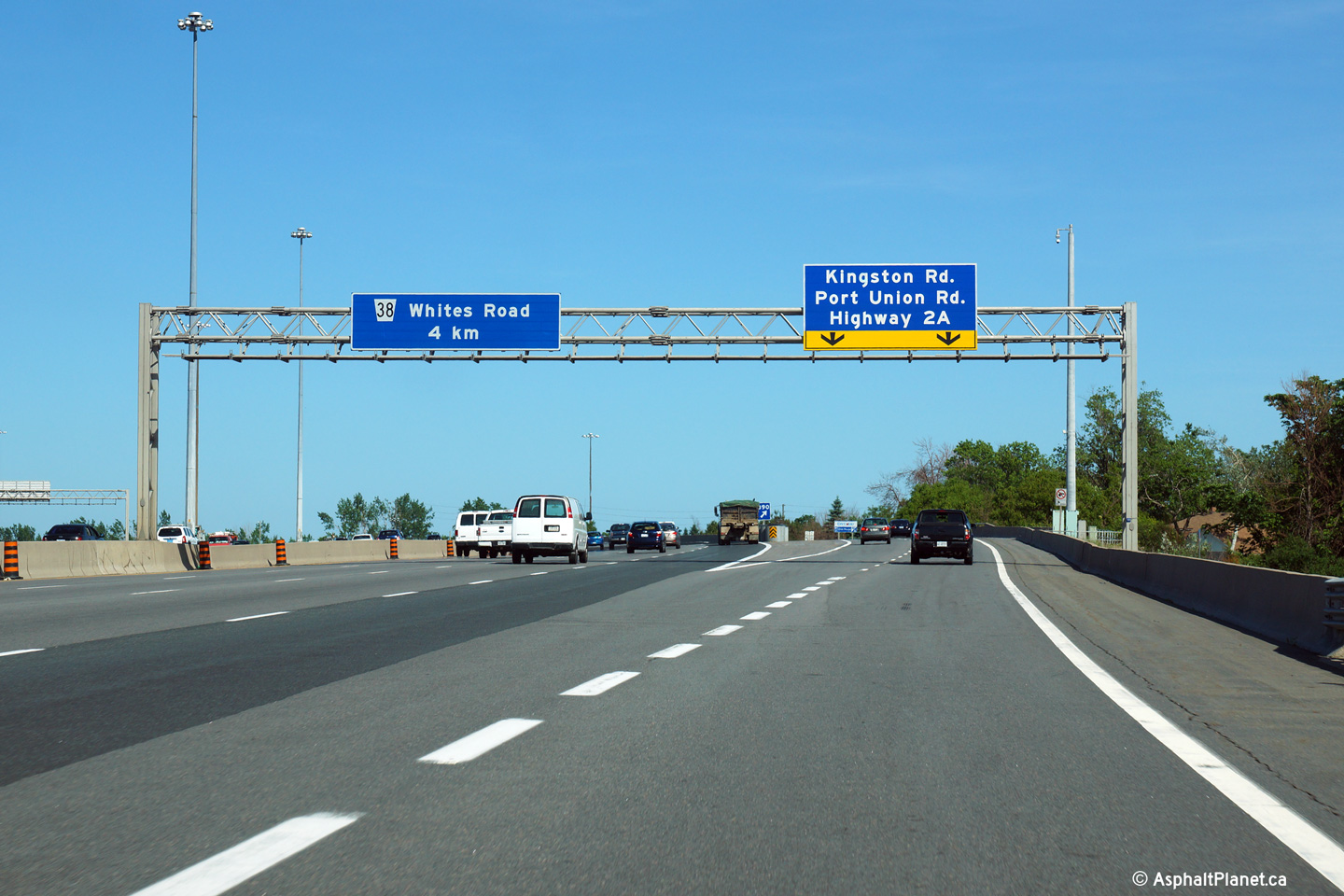
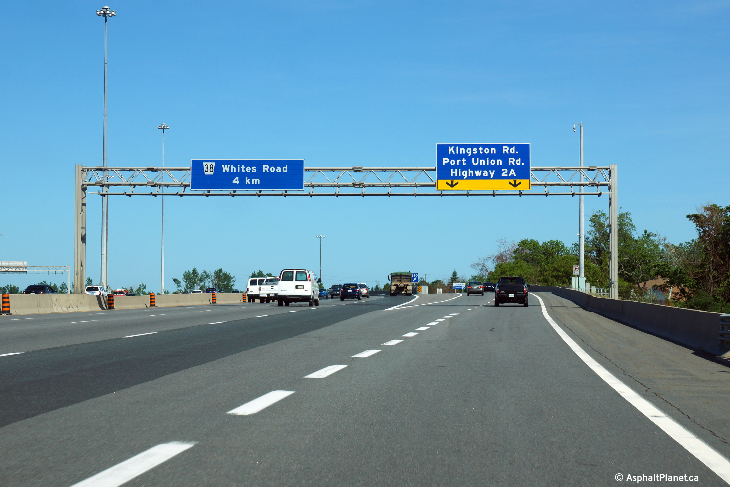
| City of Toronto | Signage at the ramp to Highway 2 and 2A.
Though Highway 2A is no longer a provincial highway, it has no other
designation, and wisely, the signs have been left in place along Highway 401. Upper photo taken: November 25th, 2007. Lower photo taken: June 19th, 2014. |
 (720x480) (720x480)(1440x960) (2400x1600) |
|||||
| City of Toronto |
Signage for the transfer from collector to express lanes at Port Union Road. Picture taken: July 9th, 2018. |
||||||
| Click here for Highway 2 images and click here for Highway 2A images | |||||||
| City of Toronto |
Highway 401 looking west from the Port Union Road overpass in Scarborough. Photo taken: May 12th, 2005. |
 |
|||||
| City of Toronto |
Highway 401 looking east from the Port Union Road overpass in Scarborough.
Port Union Road is located roughly at kilometre marker 392. This
picture looks east towards the Rouge River and the Rougemont Drive overpass. Upper photo taken: May 12th, 2005. Lower photo taken: May 12th, 2005. |

|
|||||
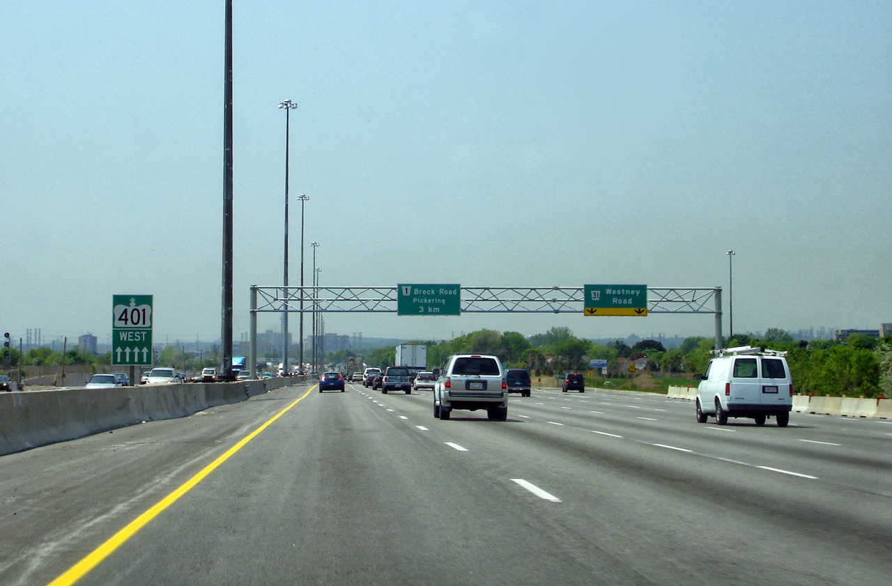
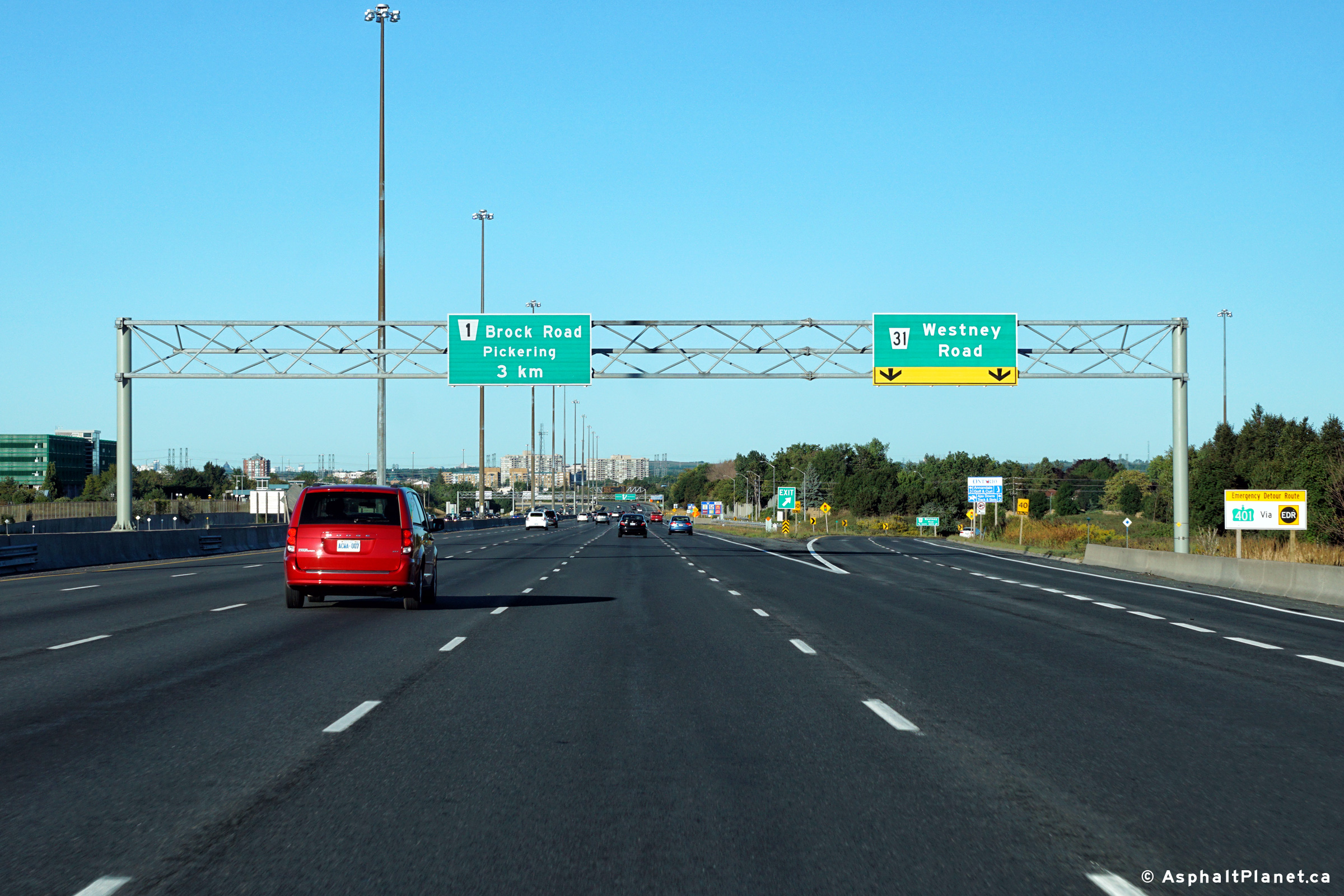
| City of Toronto |
Pre-advanced signage in the express lanes for the Brock Road transfer, along
with signage in the collector lanes for the transfer to the express just
east of Port Union Road. Upper (Express Lanes) photo taken: November,
2018. |
||||||
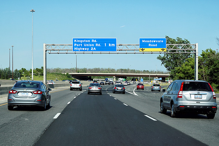
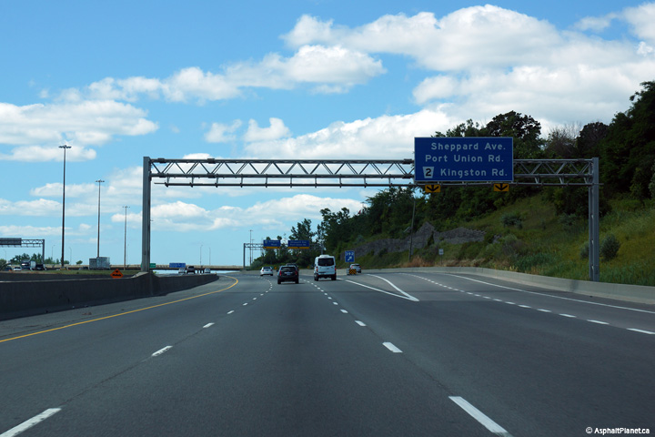
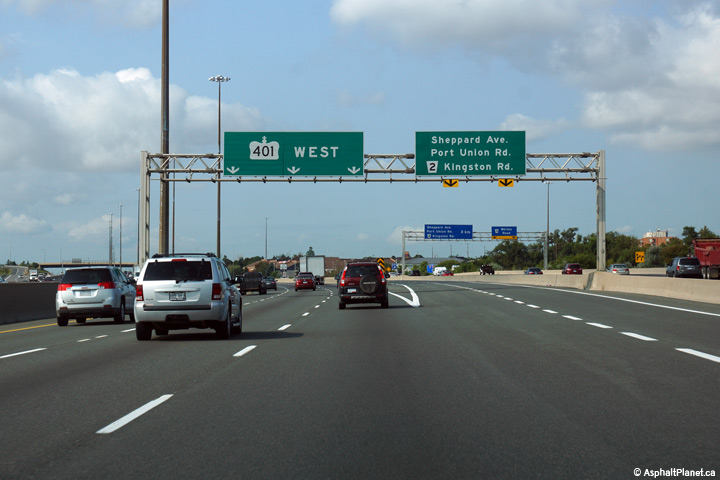
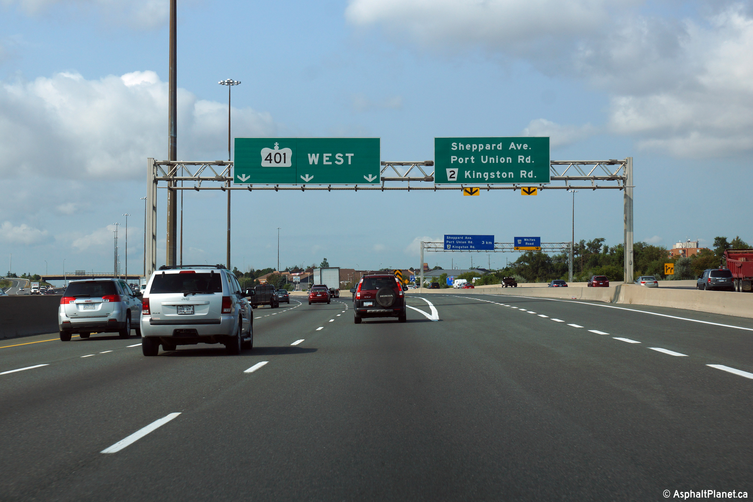
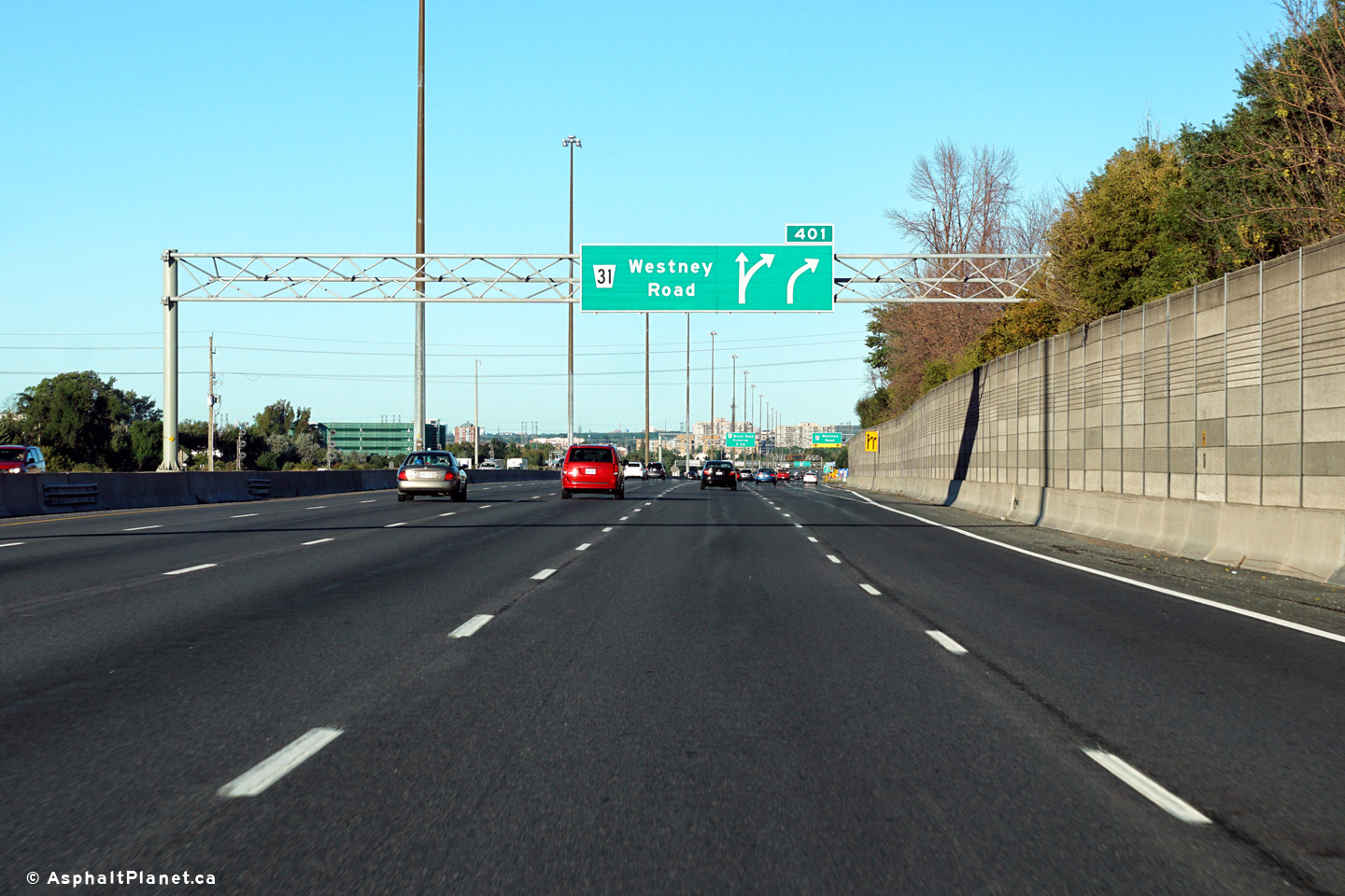
| City of Toronto |
Express and collector signage along the westbound 401 at the Rouge River.
The express lane signage is for the express to collector transfer for
Meadowvale Road and Morningside Avenue, while the collector lane signage is
for the westbound off-ramp to Kingston Road and Highway 2A. Upper (Express Lanes) photo taken: August 28th, 2015. Lower (Collector Lanes) photo taken: July 24th, 2014. |
||||||
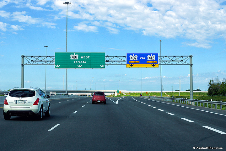
| City of Pickering Regional Municipality of Durham |
Express and collector lane signage in advance to the respective transfer to
collector and exit to Kingston Road and Highway 2A. Upper (Express Lanes) photo taken: August 28th, 2015. Lower (Collector Lanes) photo taken: July 24th, 2014. |
||||||
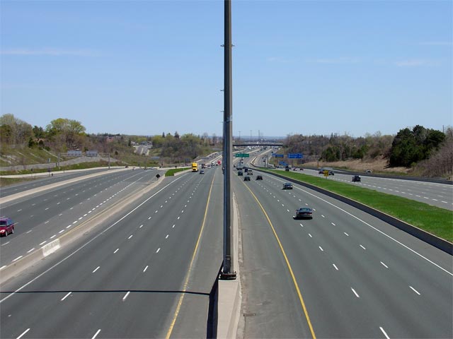
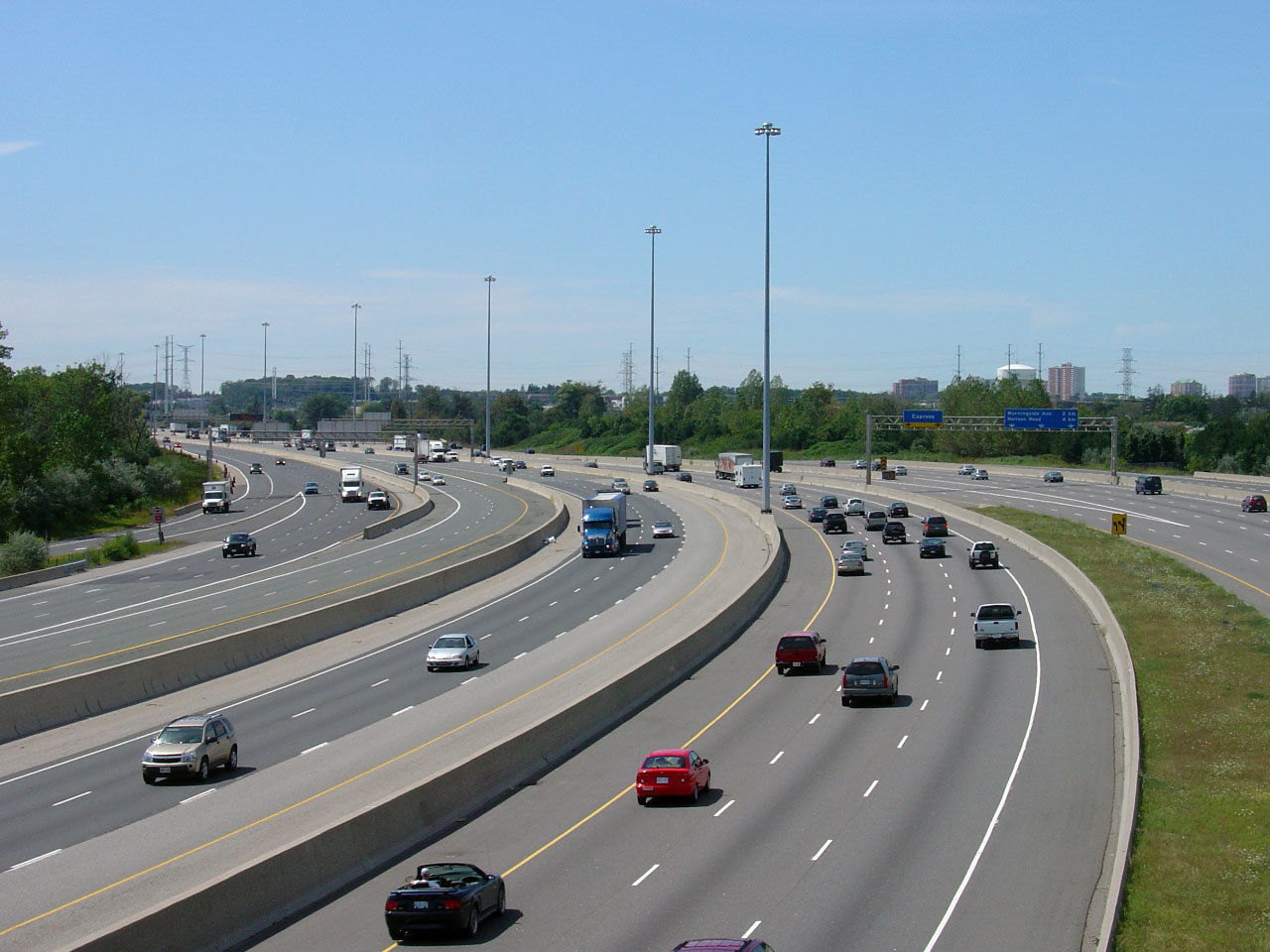
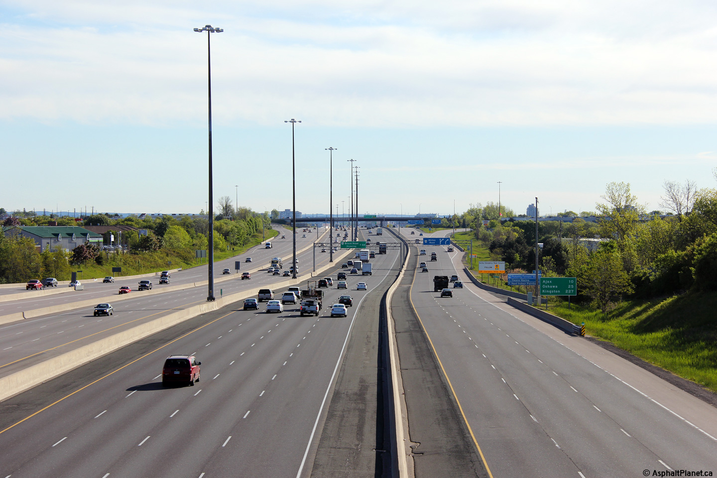
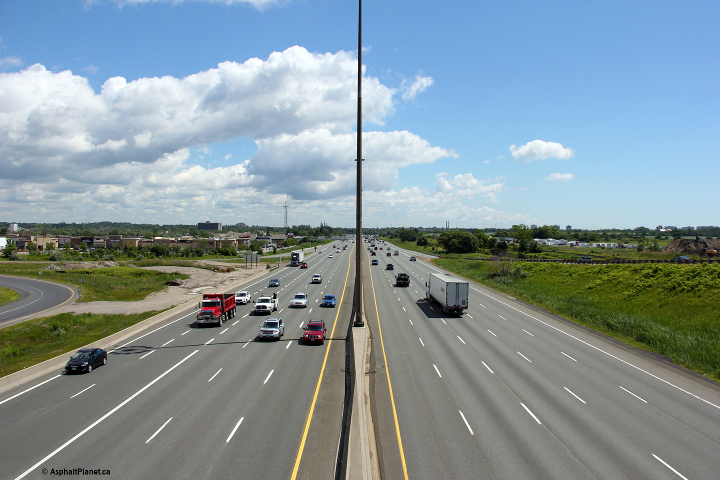
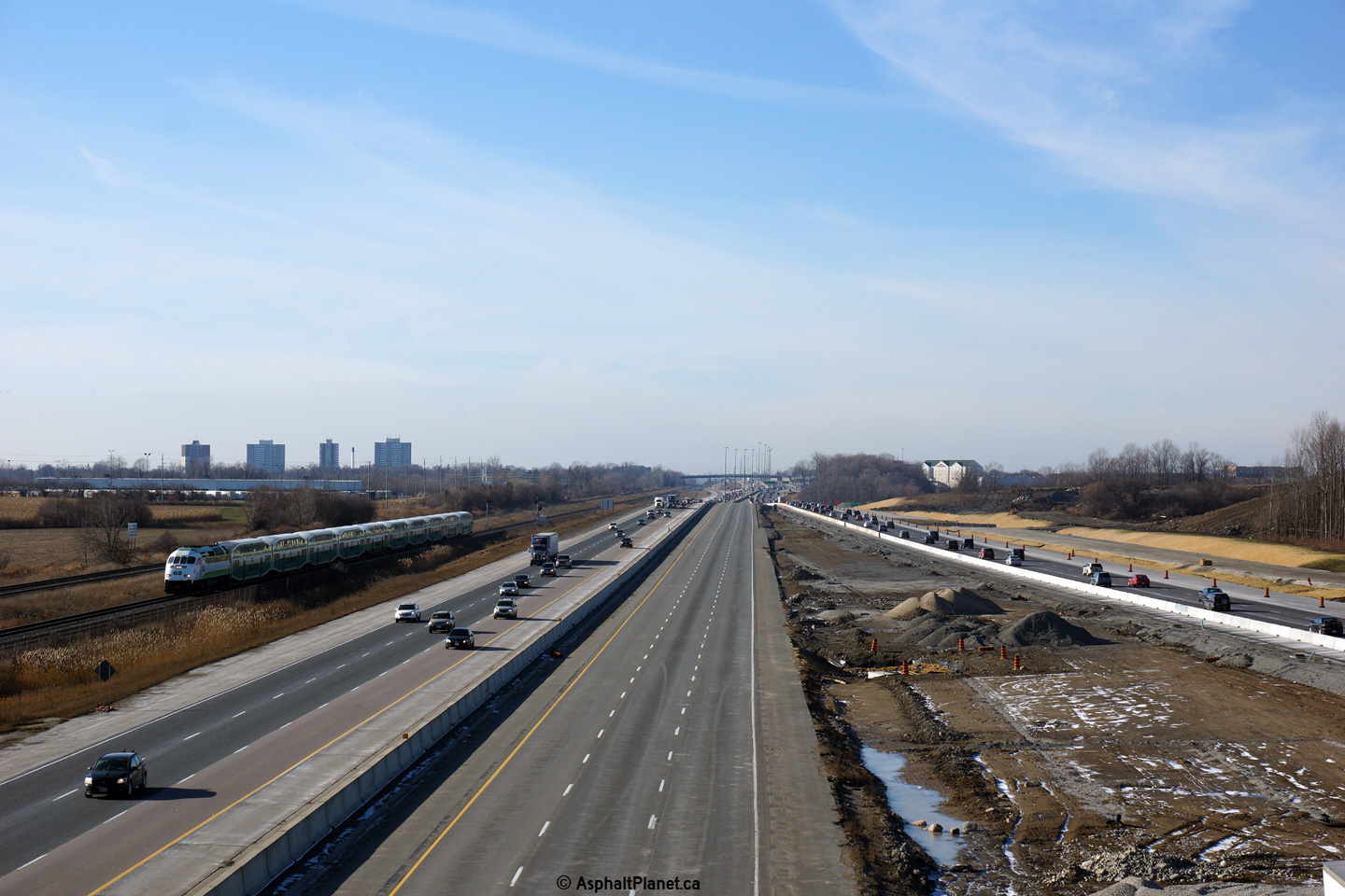
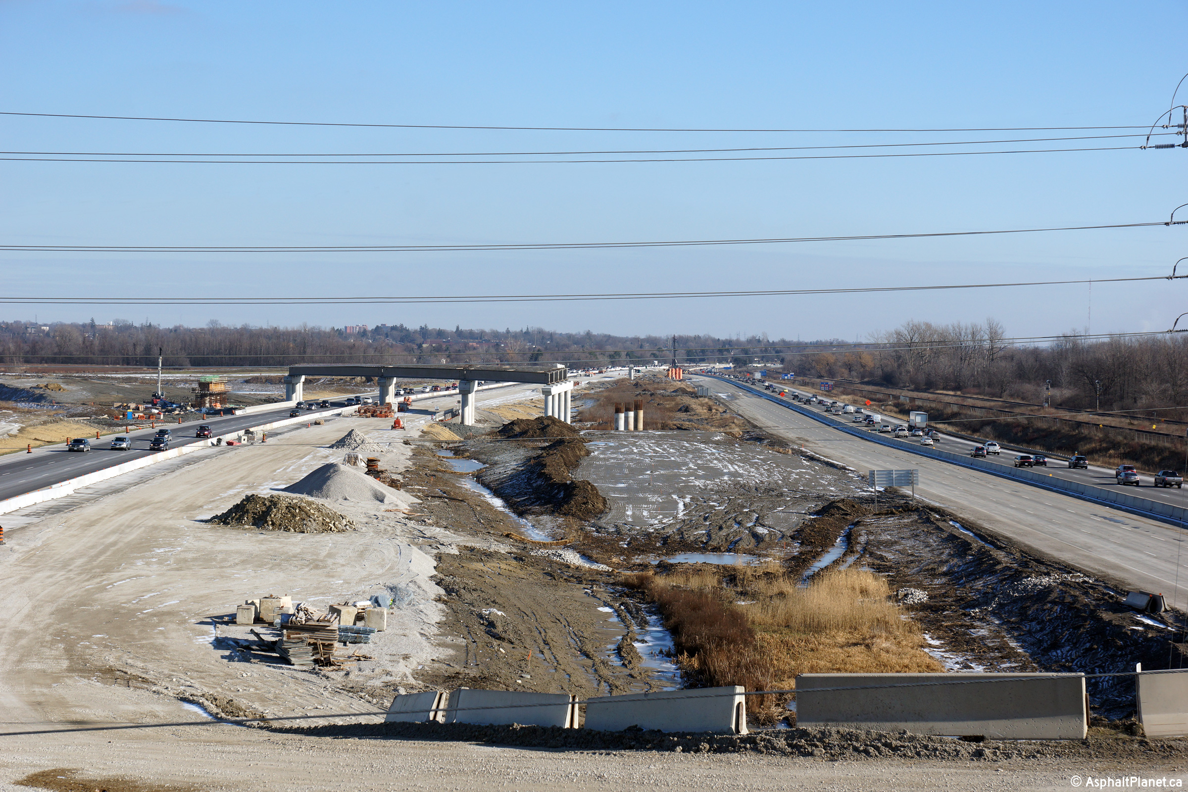
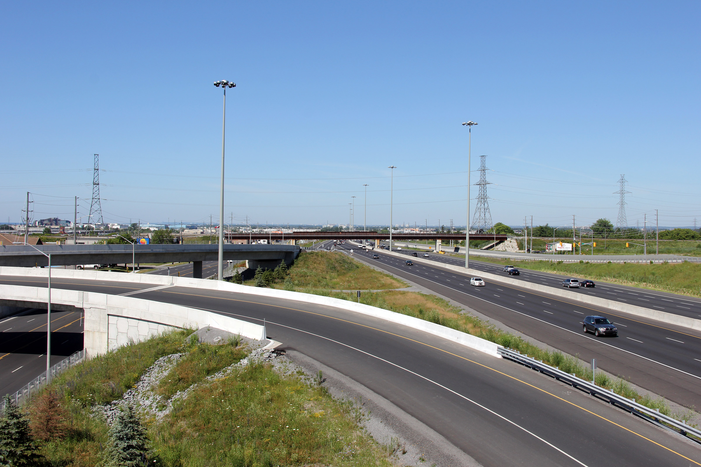
| City of Pickering Regional Municipality of Durham |
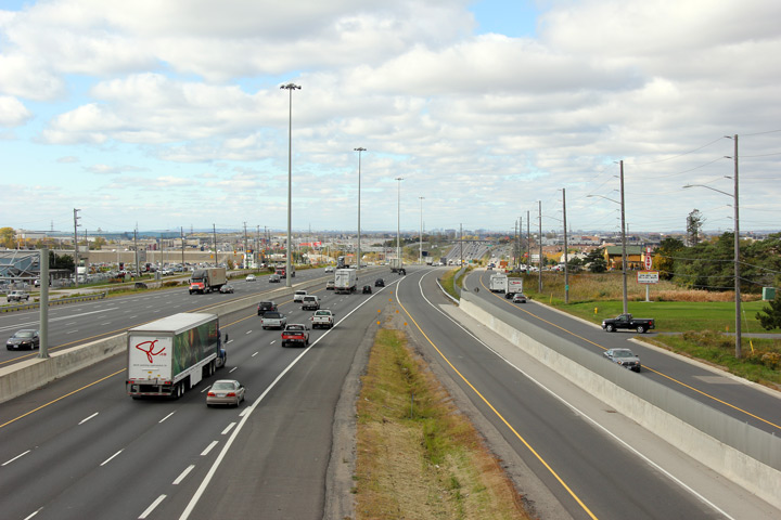
Highway 401 looking west from the Rougemont Drive overpass in the very west
end of Pickering. As far as I am concerned, this is one of the most
impressive views of Highway 401's mammoth core-distributor system.
This section of Highway 401 was widened from six to 14 lanes in 1996/97.
Click here for an additional photo from
this vantage point, taken in February, 2004. Upper photos taken: May 25th, 2015. Lower photo taken: August 7th, 2015. |
(720x480)
(1440x960)
(2400x1600) |
|||||
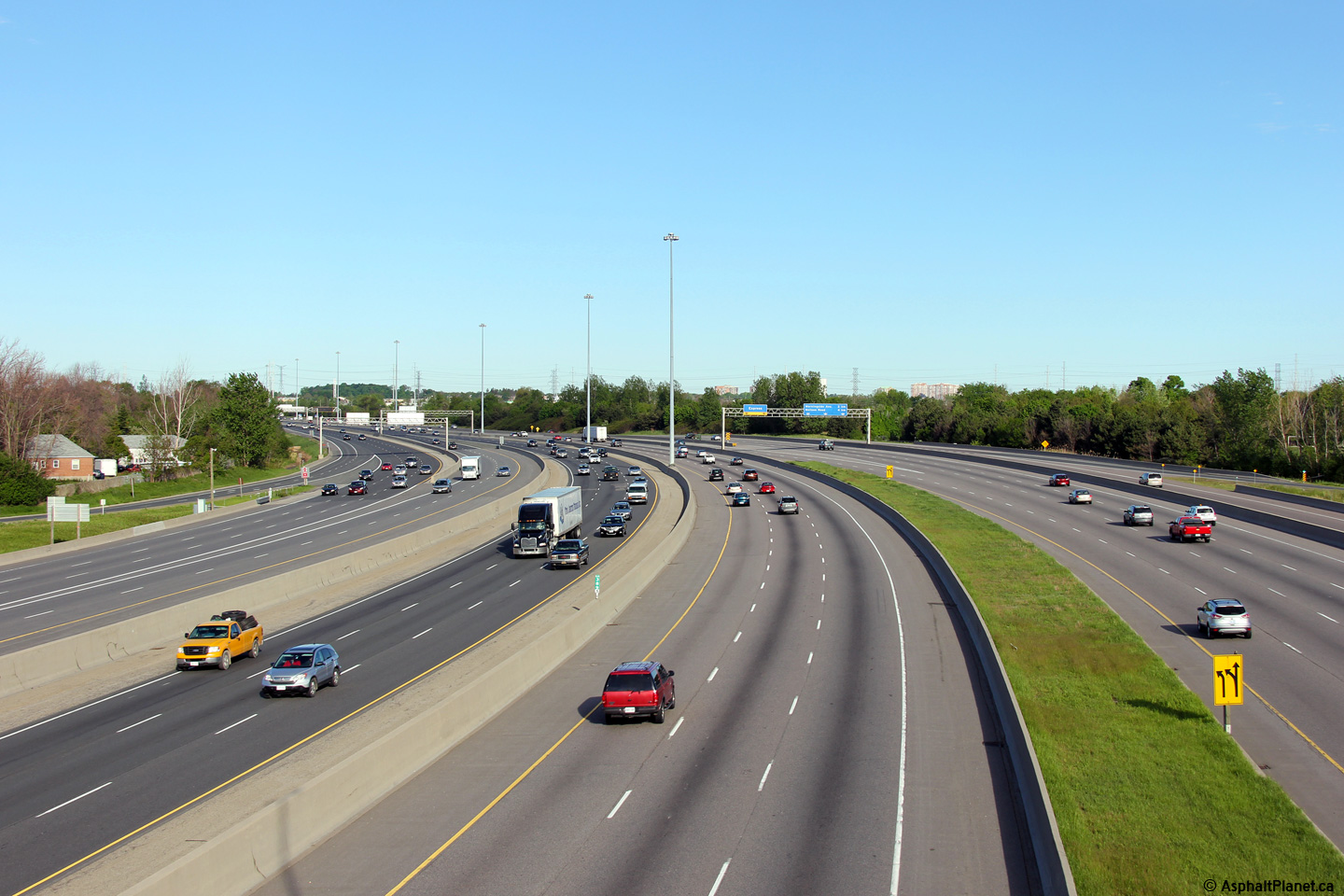
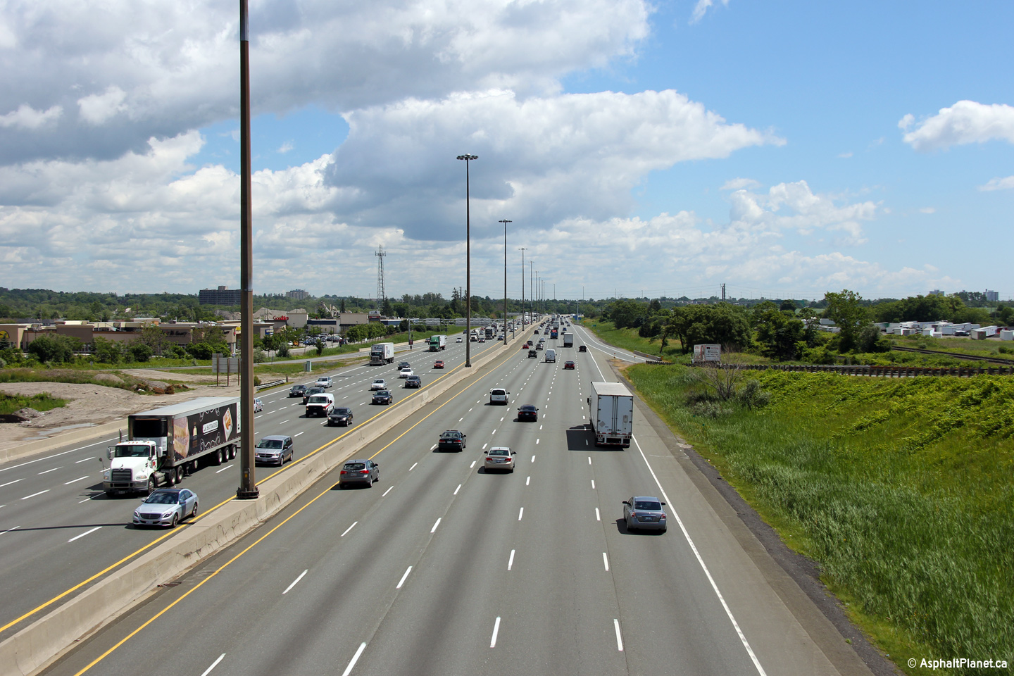
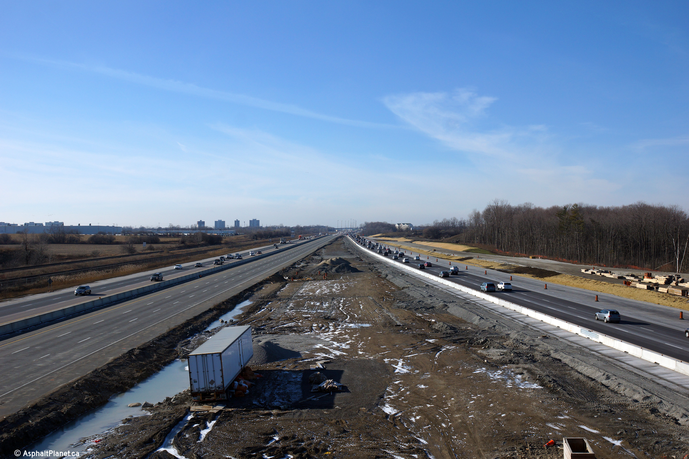
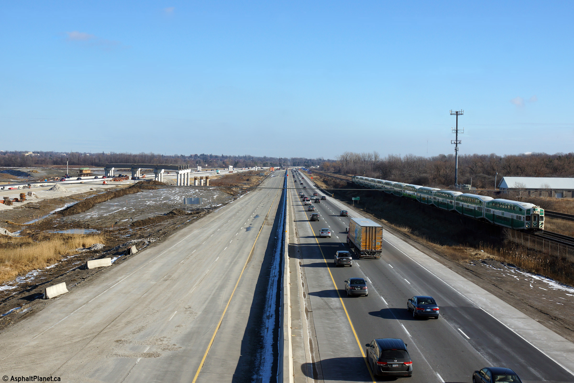
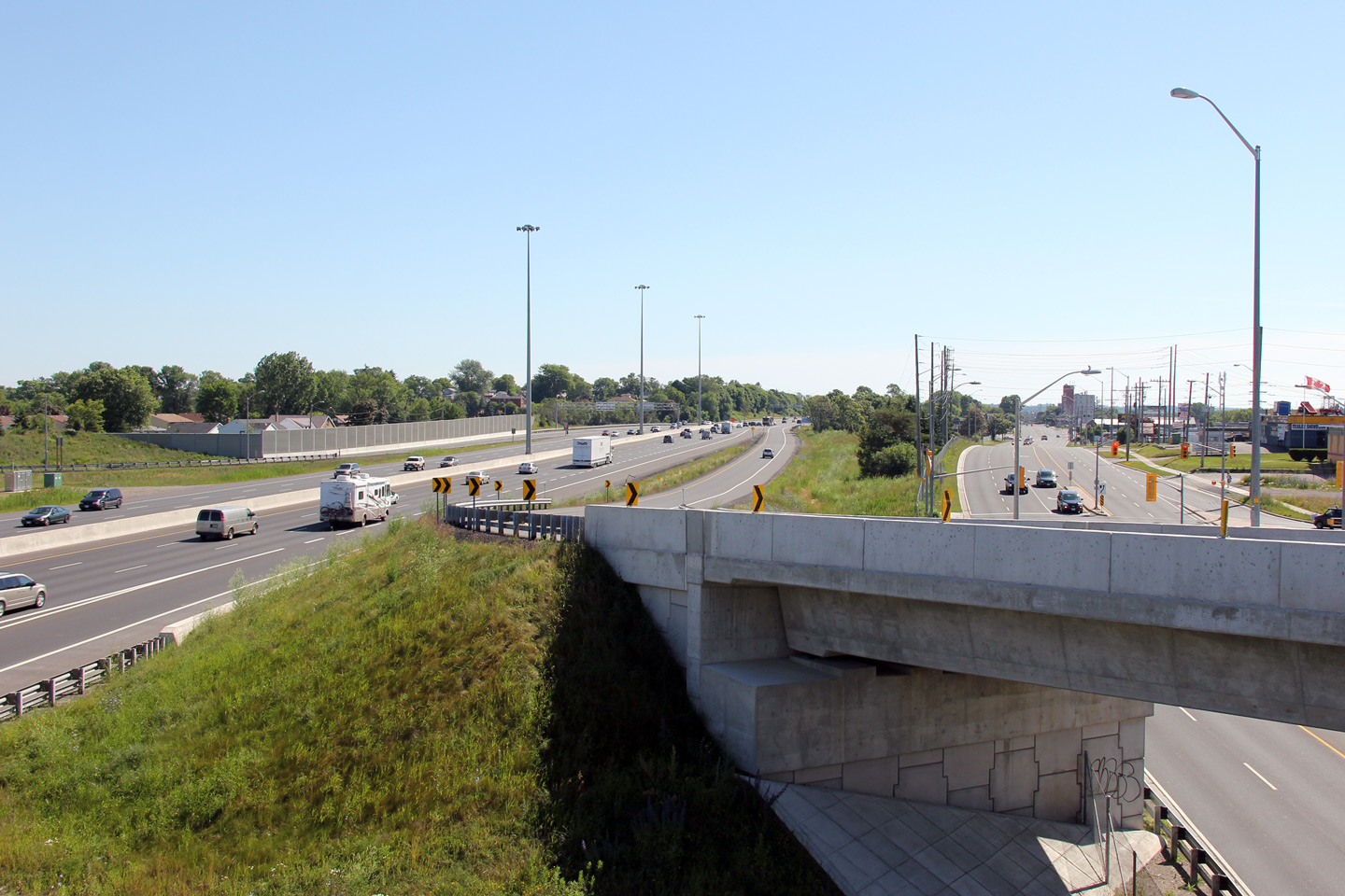
| City of Pickering Regional Municipality of Durham |
This view looks east from the Rougemont Drive overpass. Note the lack
of overhead signs for the collector to core transfer at this location.
This is the only transfer along the 401 not to be fully signed with overhead
signage. Click here for an additional photo from
this vantage point, taken in February, 2004. Upper photos taken: May 25th, 2015. Lower photo taken: August 7th, 2015. |
(720x480) (1440x960) (2400x1600)
|
|||||
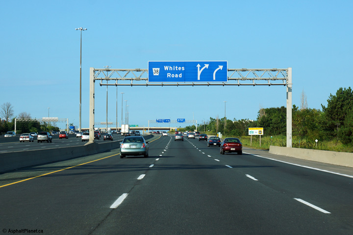
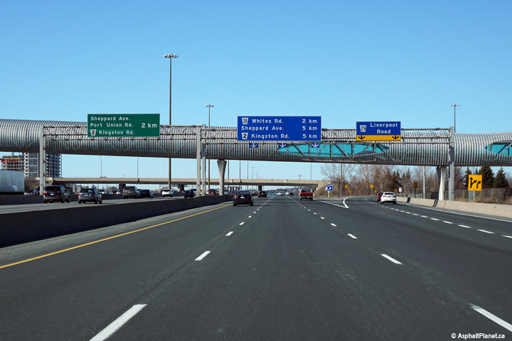
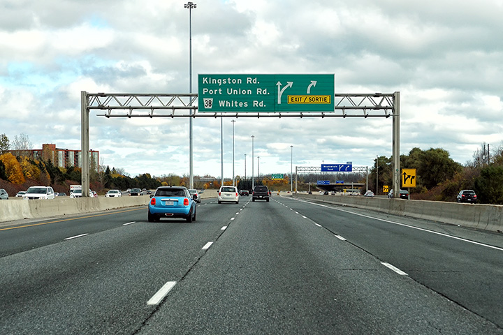
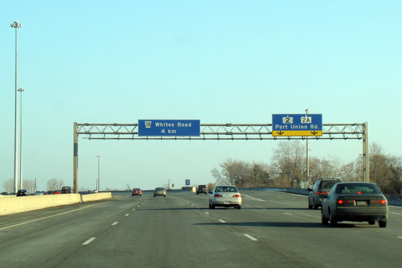
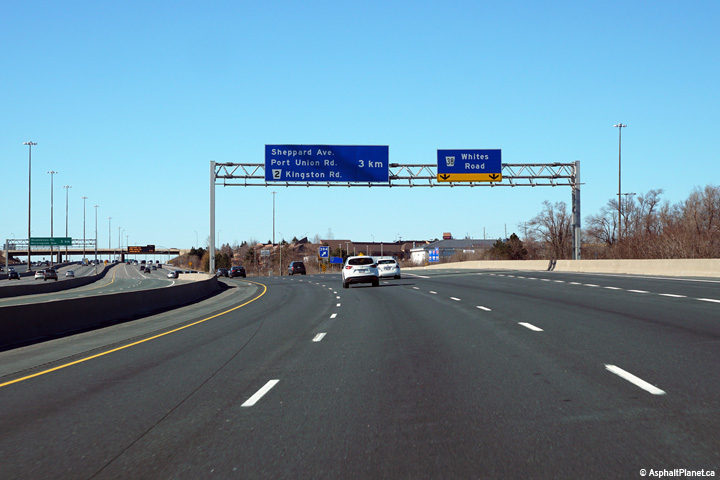
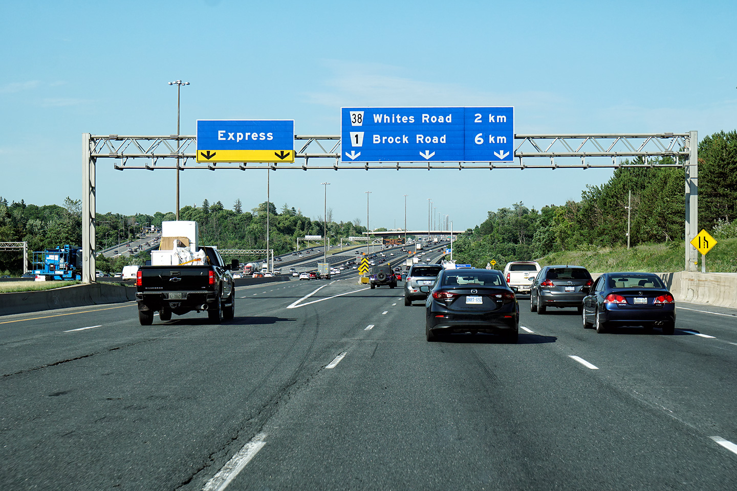
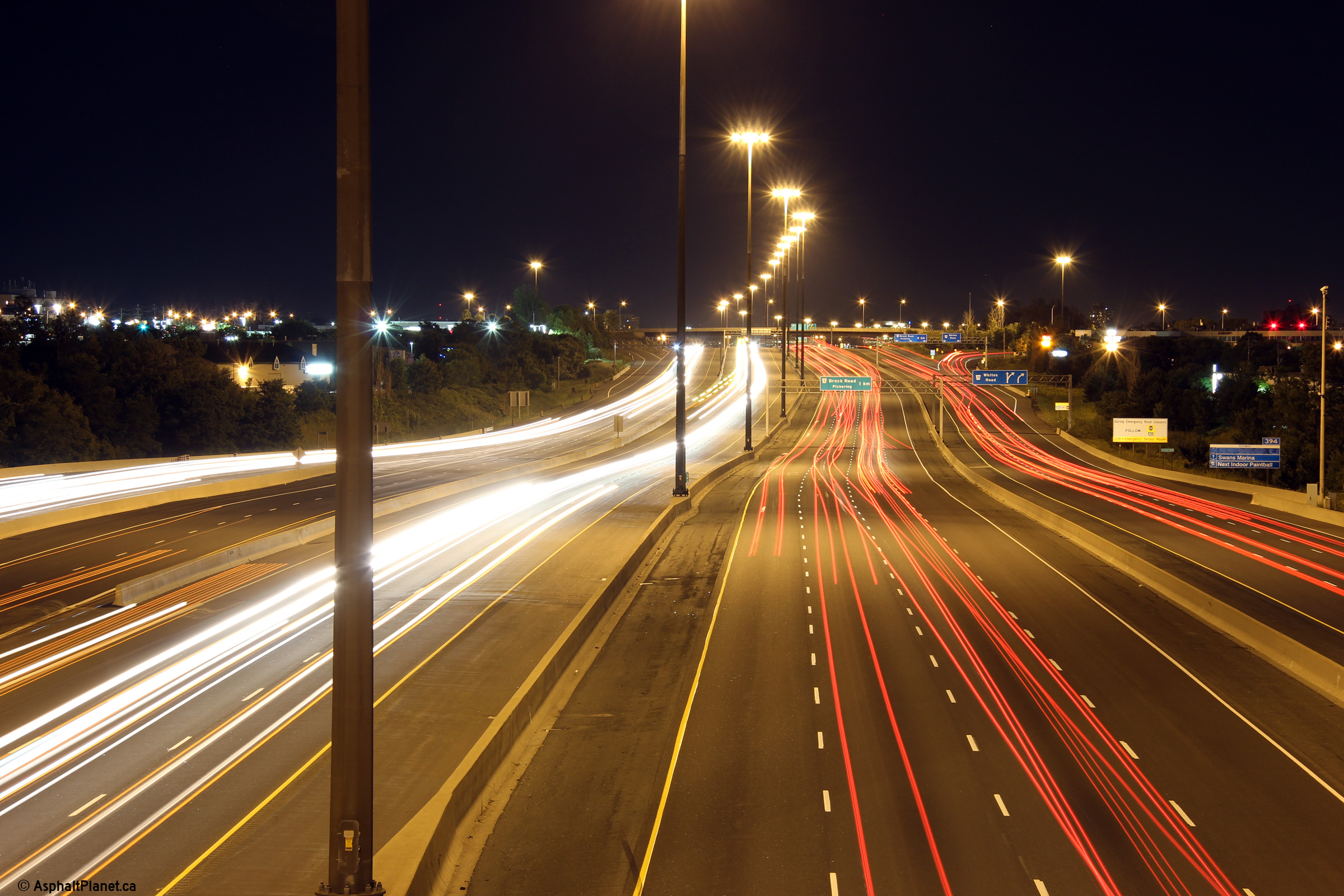
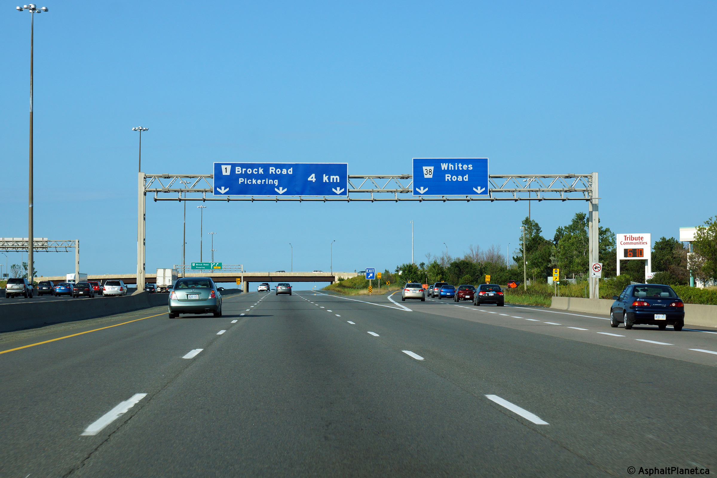
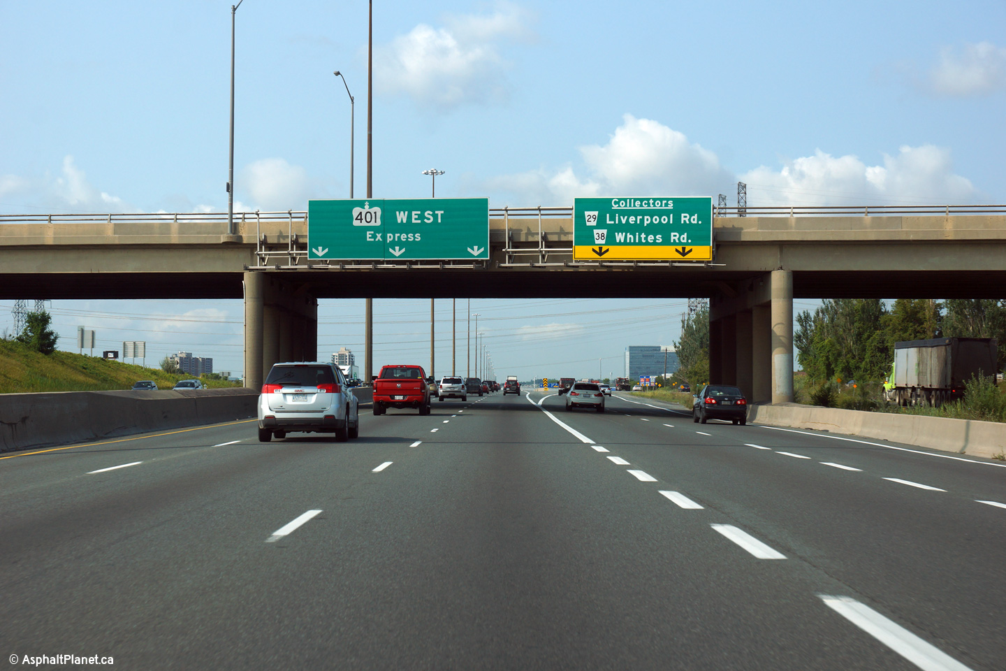
| City of Pickering Regional Municipality of Durham |
Signage in the eastbound collector lanes for the Whites Road interchange. Photo taken: August 19th, 2014. |
 (720x480) (720x480)(1440x960) (2400x1600) |
|||||
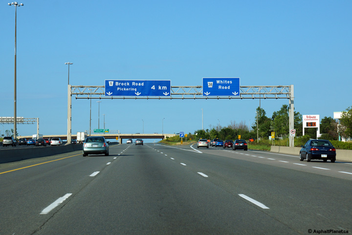
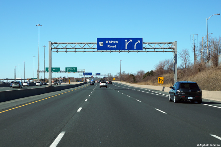
| City of Pickering Regional Municipality of Durham |
Signage for the eastbound exit to Whites Road. Photo taken: August 19th, 2014. |
 (720x480) (720x480)(1440x960) (2400x1600) |
|||||
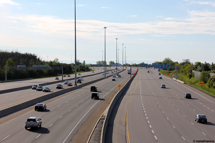
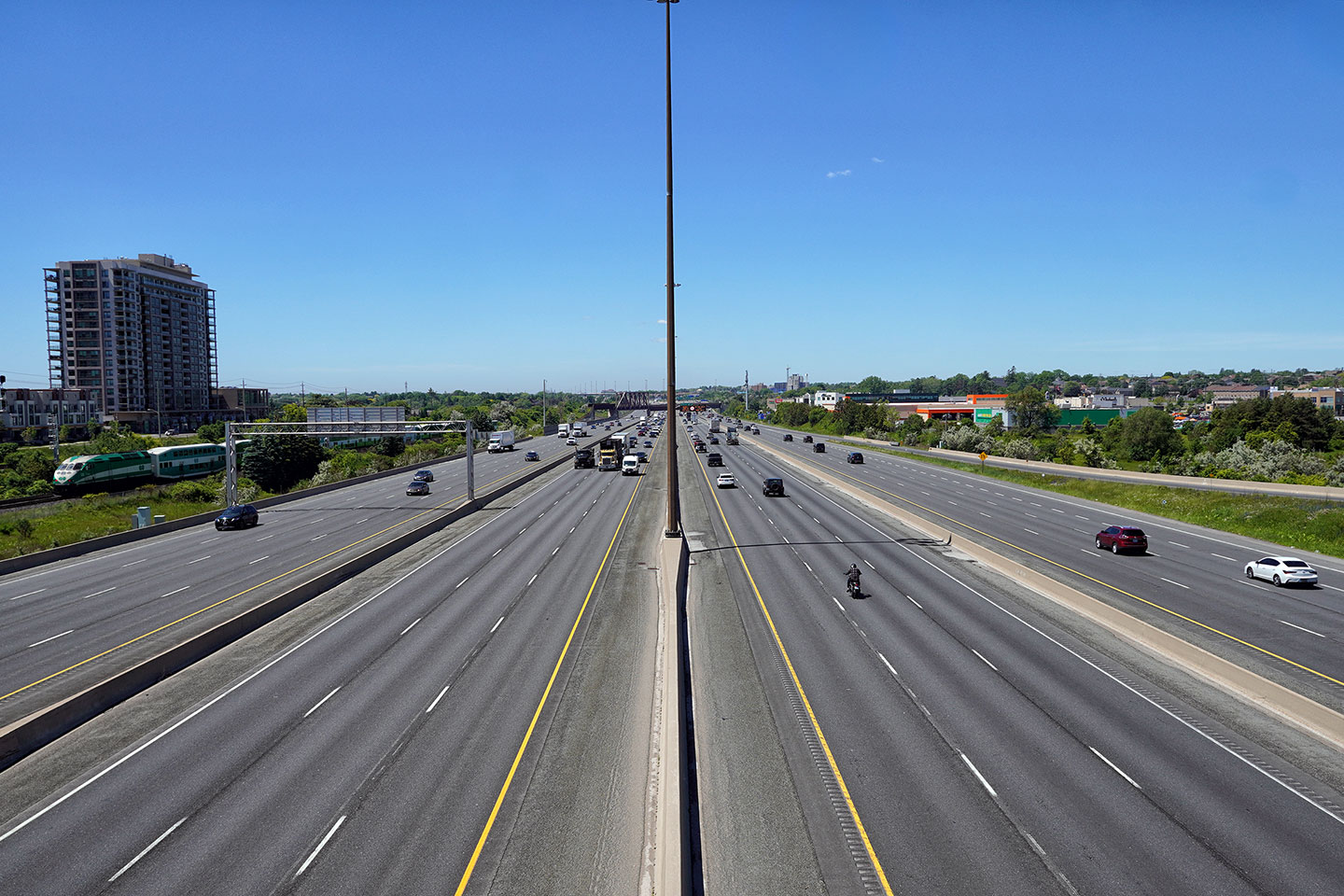
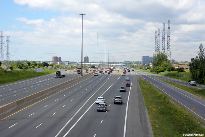
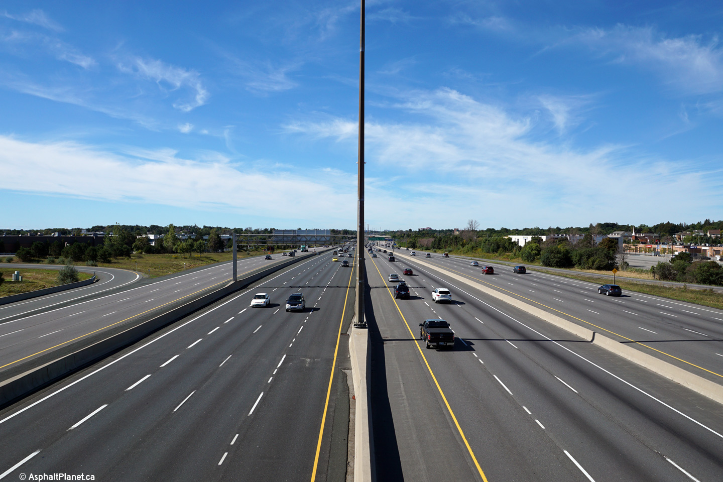
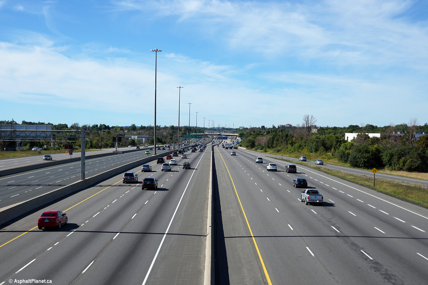
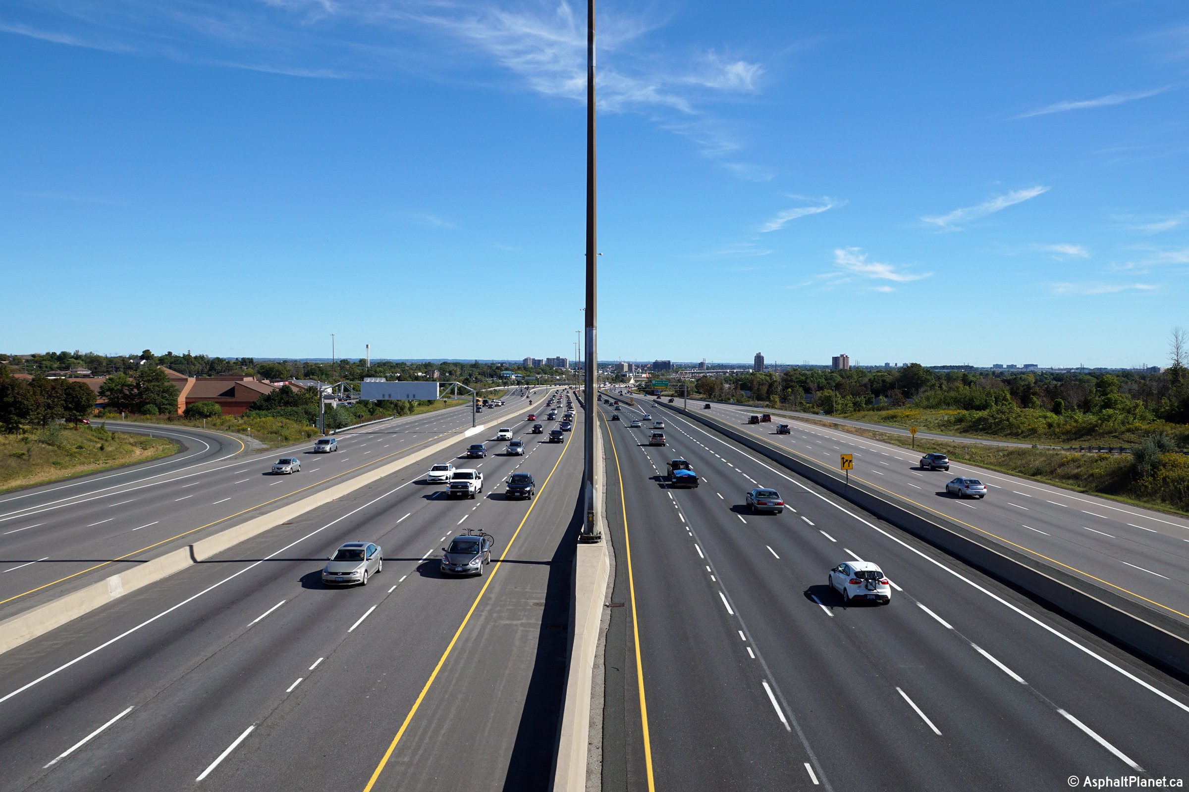
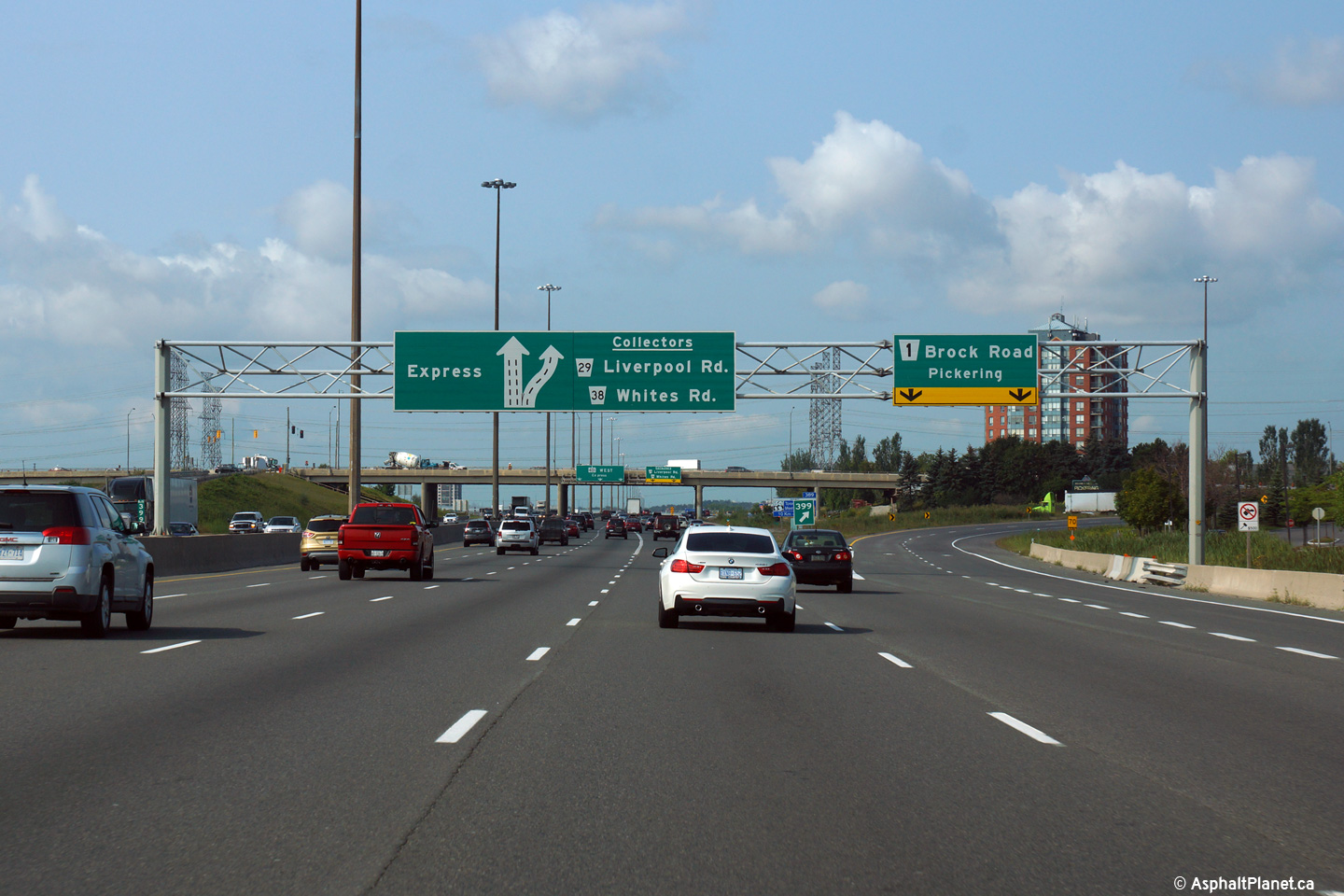
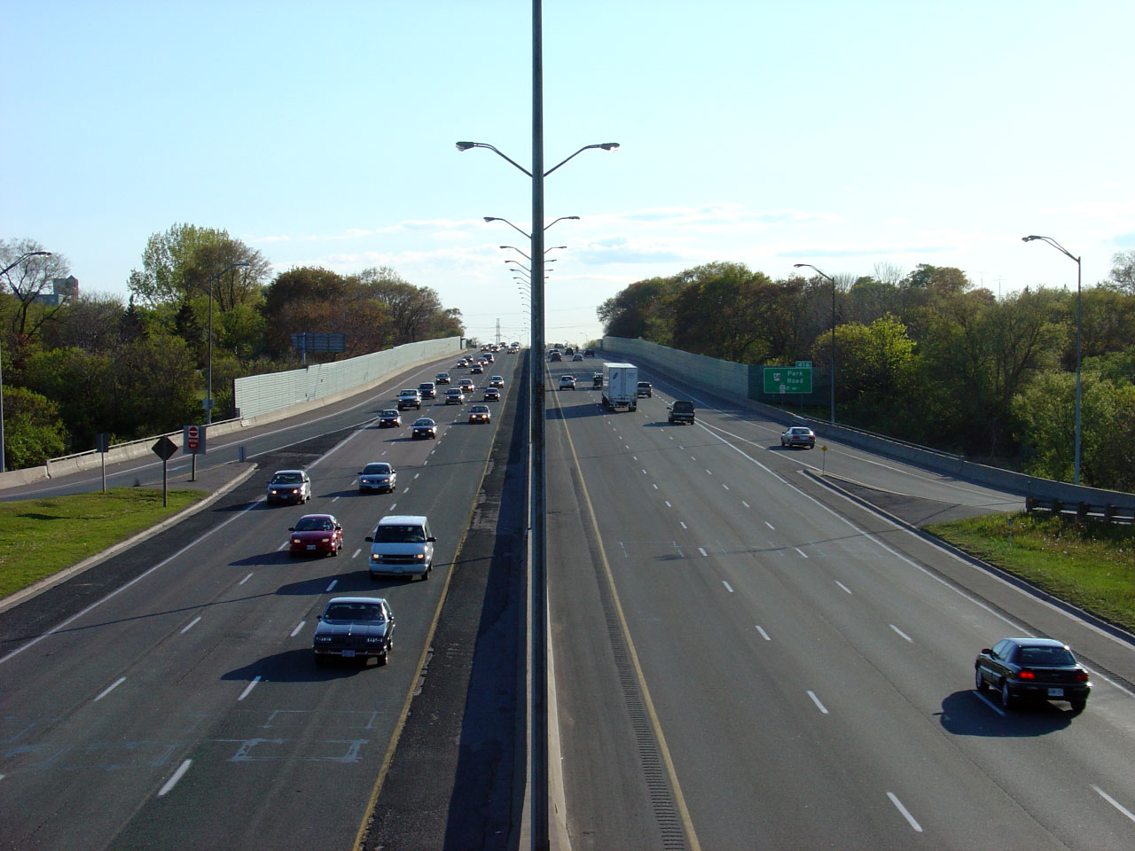
| City of Pickering Regional Municipality of Durham |
Looking west from the Whites Road overpass in Pickering. Whites Road
is located roughly at kilometre marker 394.
Click here for an additional photo from
this vantage point, taken in May, 2005. Photos taken: September 20th, 2015. |
(720x480) (1440x960) (2400x1600)
|
|||||
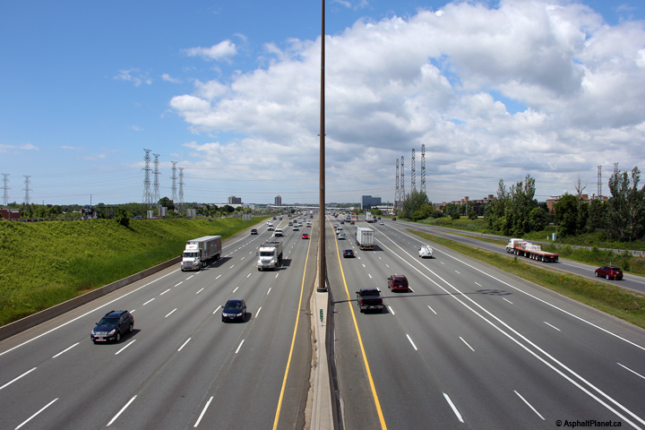
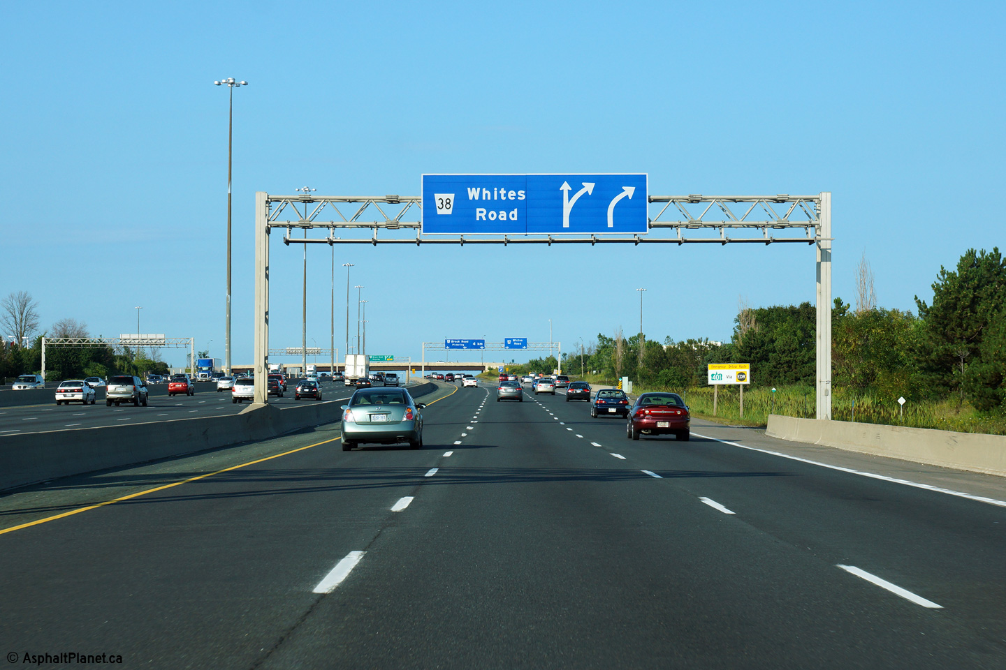
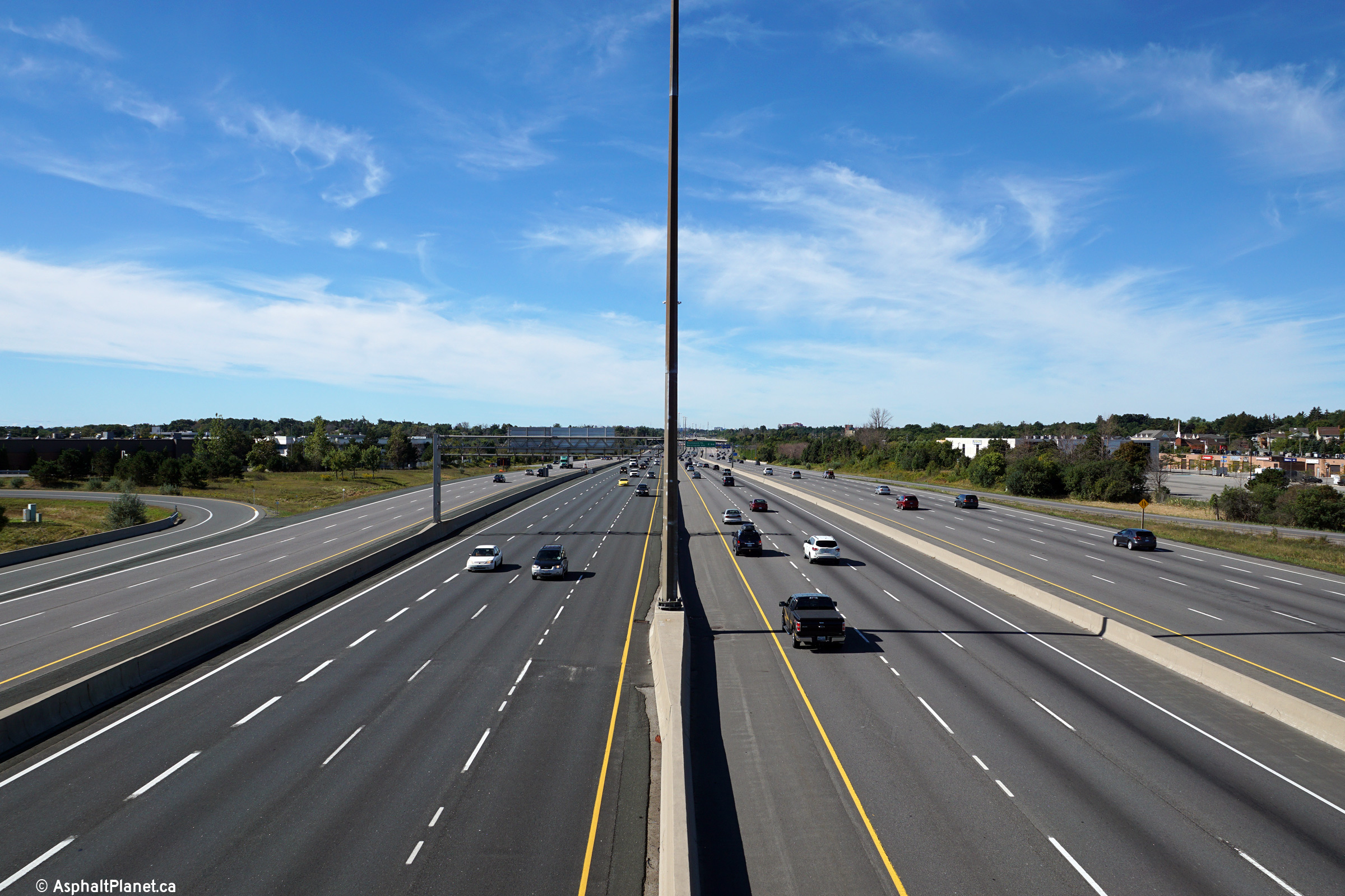
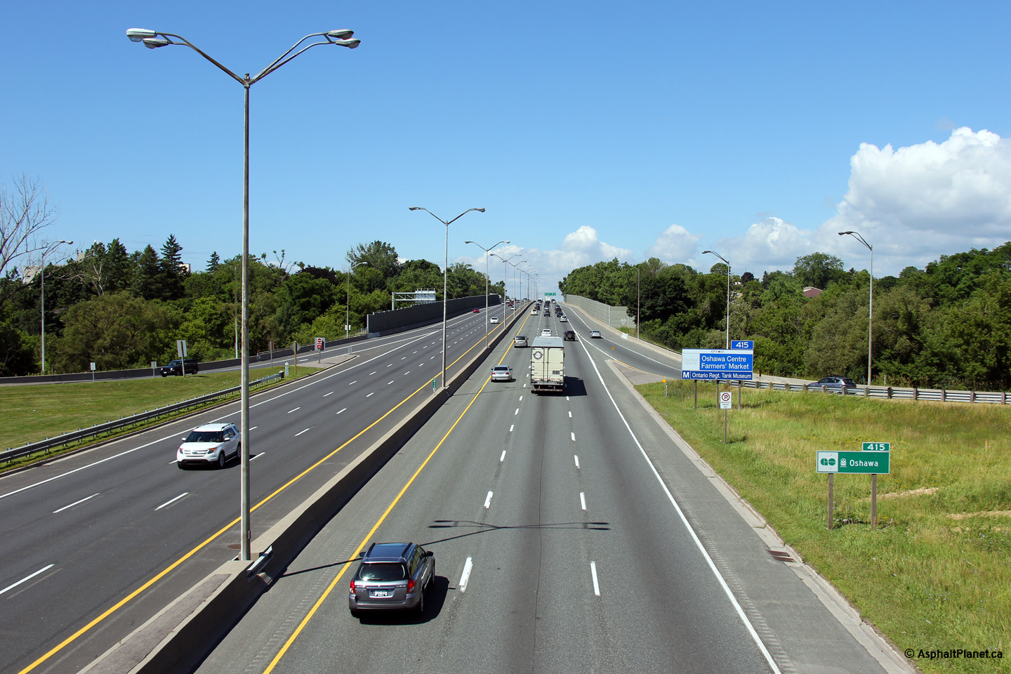
| City of Pickering Regional Municipality of Durham |
Highway 401 looking east from the Whites Road overpass. This picture
showcases the first (or last, depending upon travel direction)
core-collector transfer at the eastern end of Highway 401's C-D system.
Click here for an additional photo from
this vantage point, taken in May, 2005. Photos taken: September 20th, 2015. |
(720x480) (1440x960) (2400x1600)
(720x480) (1440x960) (2400x1600)
|
|||||
| City of Pickering Regional Municipality of Durham |
Express and collector signage along the westbound 401appoaching Whites Road.
The express lane signage is for the express to collector transfer to Highway
2A and Kingston Road, while the signage for the westbound collectors stands
overtop of the off-ramp to Whites Road. Upper (Express Lanes) photo taken: August 28th, 2015. Lower (Collector Lanes) photo taken: March 19th, 2016. |
||||||
| City of Pickering Regional Municipality of Durham |
Express and collector lane signage in advance to the respective transfer to
collector and exit to Whites Road. Upper (Express Lanes) photo taken: August 28th, 2015. Lower (Collector Lanes) photo taken: March 19th, 2016. |
||||||
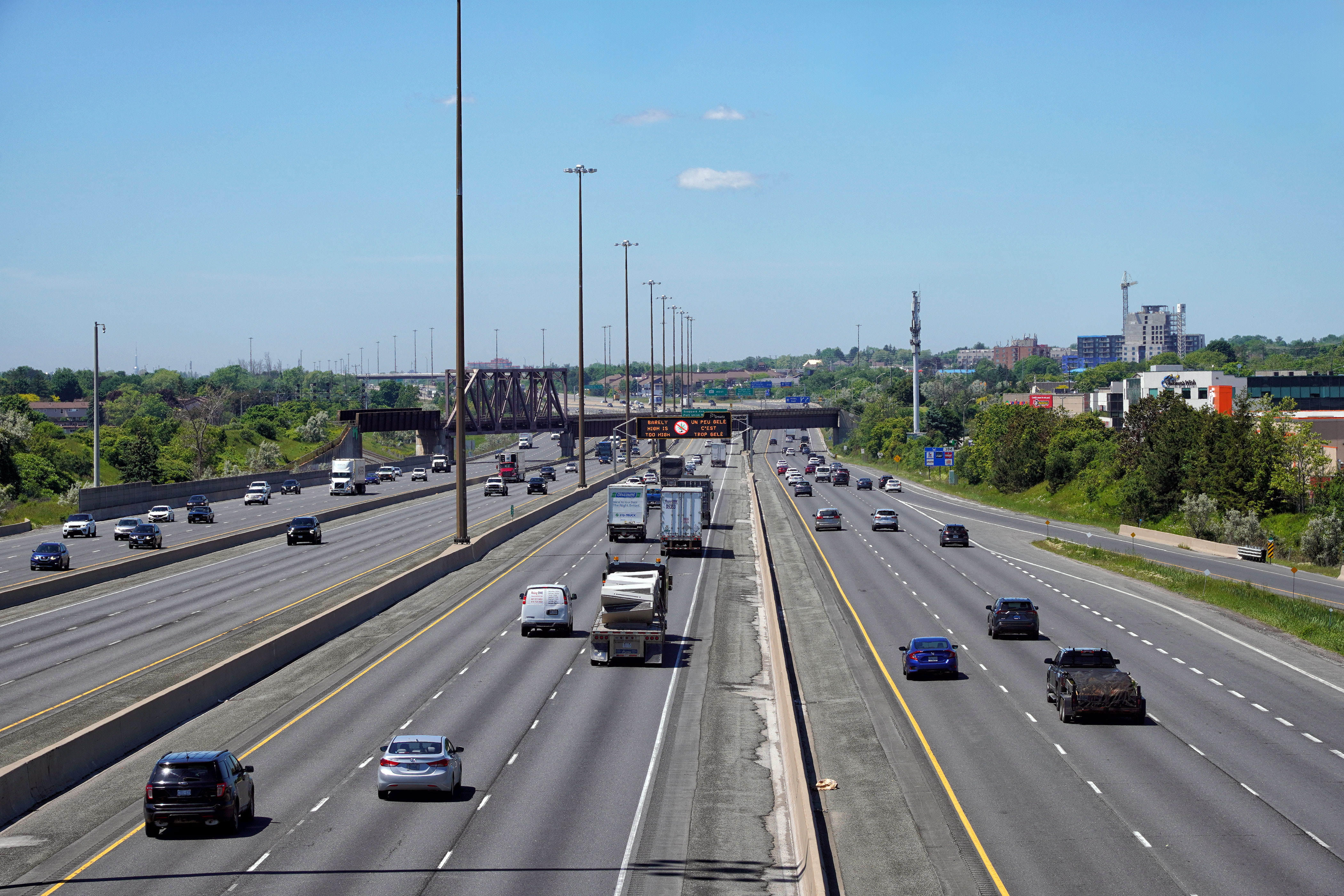
| City of Pickering Regional Municipality of Durham |
View from the eastbound collector lanes towards the Pickering CN Railway
overpass. Photo taken: November 25th, 2007. |
 |
|||||
| City of Pickering Regional Municipality of Durham |
Another view looking east through the CN Railway overpass. The spans
bridging the express lanes of the highway were completed in the 1960s while
the outer spans (including the truss span) was completed between 1996 and
1997. Photo taken: November 25th, 2007. |
 |
|||||
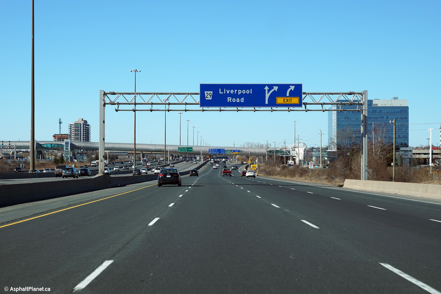
| City of Pickering Regional Municipality of Durham |
Westerly view from the Liverpool Road overpass towards CN's York
Subdivision. The York Subdivision is a freight by-pass of CN's
Lakeshore East and West lines. The Lakeshore East and West rail lines
see heavy passenger traffic due to Toronto's GO Transit system.
Click here for an additional view from this vantage point taken
September, 2009. Photo taken: September 5th, 2009. |
(1440x960) (2400x1600) (4200x2800)
|
|||||
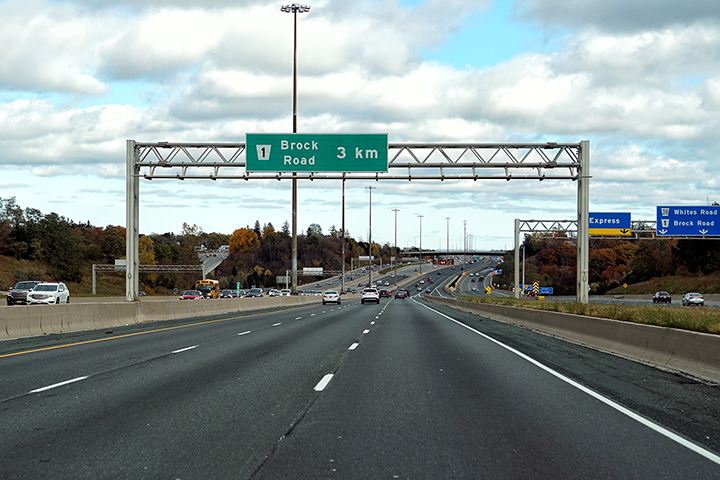
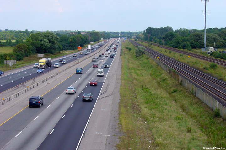
| City of Pickering Regional Municipality of Durham |
View looking easterly from Liverpool Road to the Brock Road interchange.
Notice the ground mounted exit signage for Brock Road. Permanent
ground mounted signage is very atypical on wide stretches of highway such as
this. Photo taken: September 5th, 2009. |
|
|||||
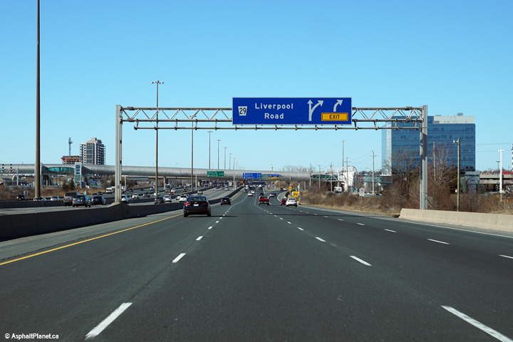
| City of Pickering Regional Municipality of Durham |
Signage at the westbound off-ramp to Liverpool Road from the collector
lanes. There is no matching eastbound off-ramp to Liverpool Road. Photo taken: March 19th, 2016. |
 (720x480) (720x480)(1440x960) (2400x1600) |
|||||
| City of Pickering Regional Municipality of Durham |
Westbound advanced signage for the ramp to Liverpool Road from the collector
lanes. Photo taken: March 19th, 2016. |
 (720x480) (720x480)(1440x960) (2400x1600) |
|||||
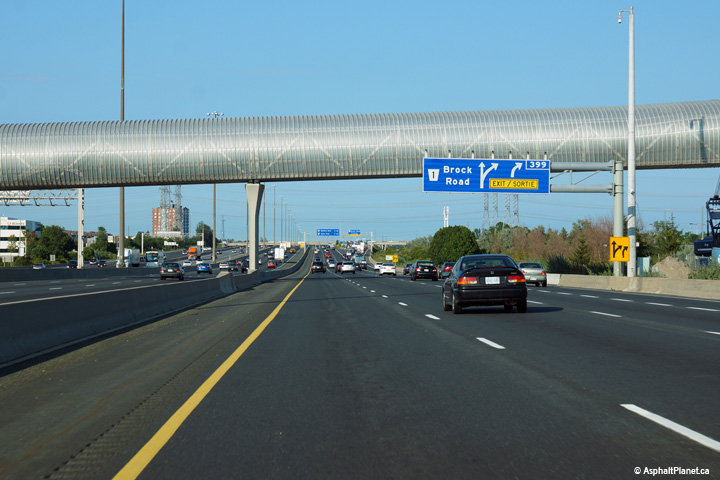
| City of Pickering Regional Municipality of Durham |
Eastbound advanced signage for the ramp to Brock Road. The fourth
eastbound collector lane exits the freeway at the Brock Road interchange. Photo taken: August 19th, 2014. |
 (720x480) (720x480)(1440x960) (2400x1600) |
|||||
| City of Pickering Regional Municipality of Durham |
Eastbound signage at the off-ramp to Brock Road. The collector lanes
end just beyond this off-ramp. Photo taken: August 19th, 2014. |
 (720x480) (720x480)(1440x960) (2400x1600) |
|||||
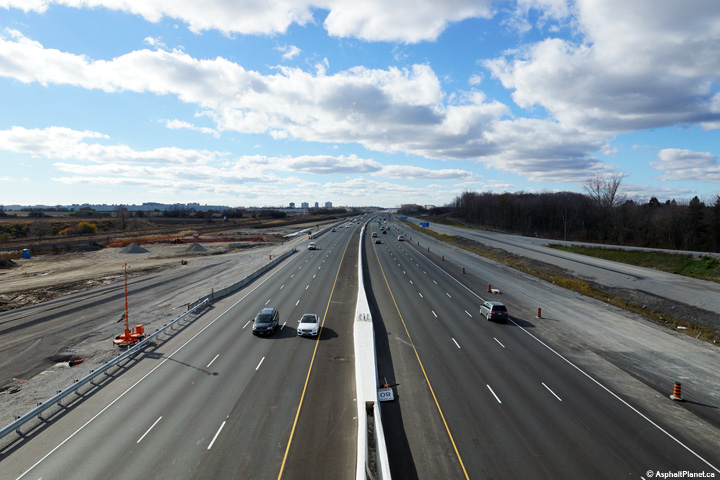
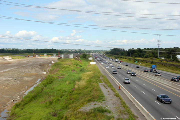
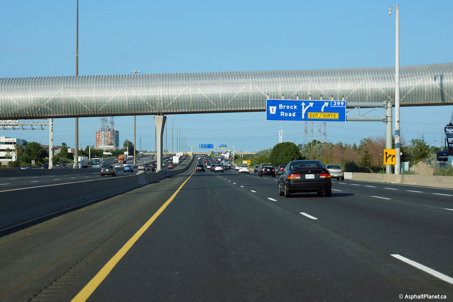
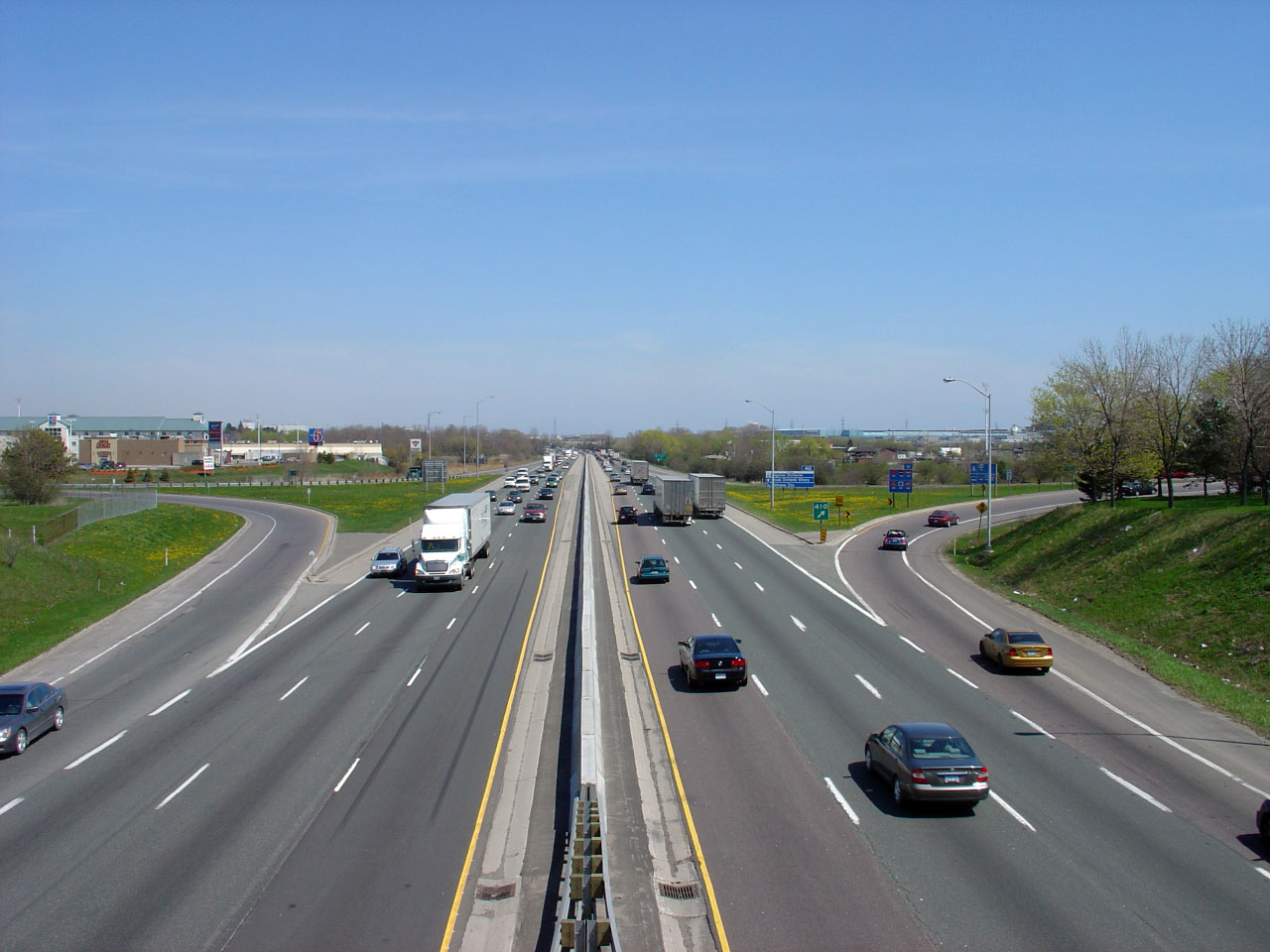
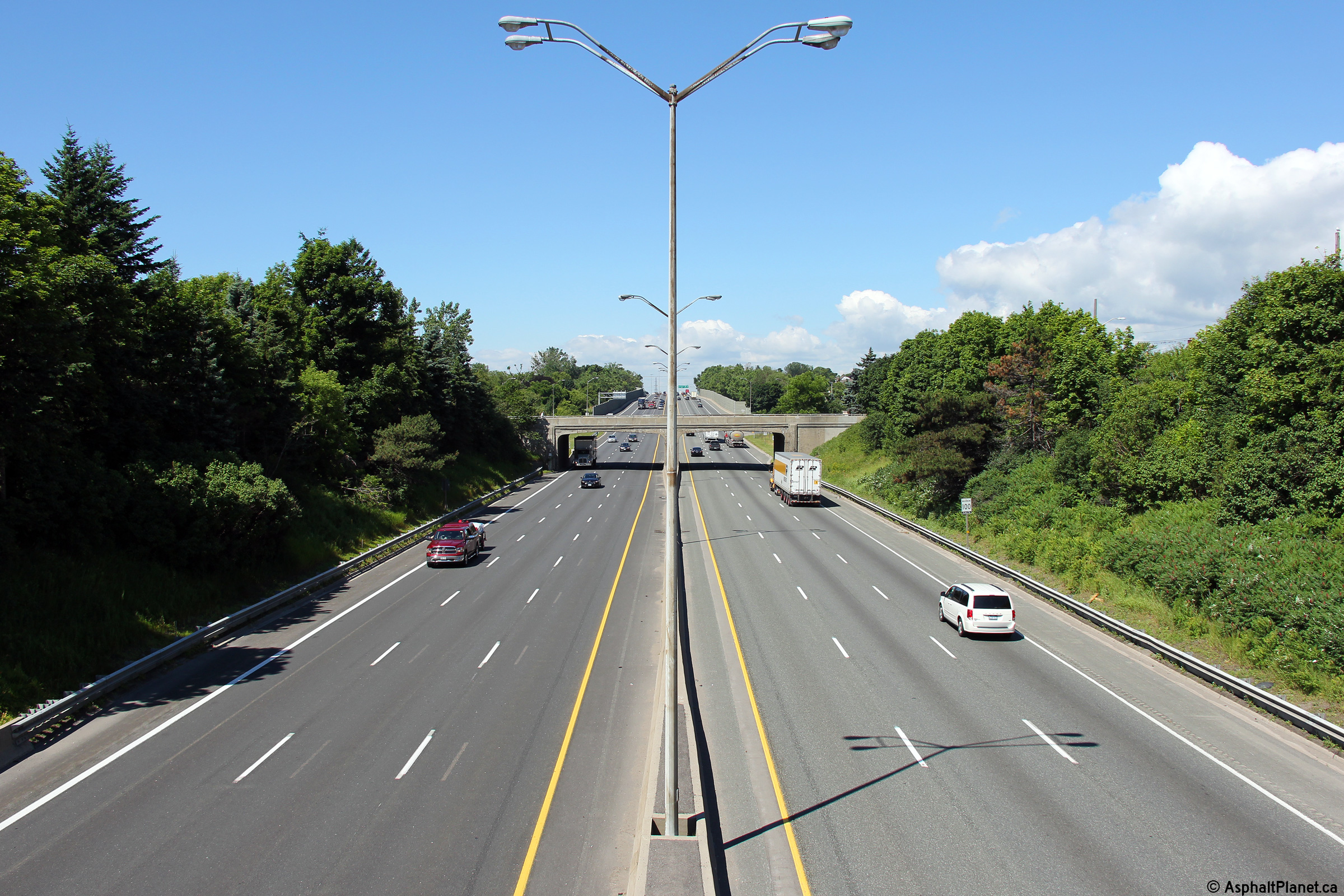
| City of Pickering Regional Municipality of Durham |
Looking west from Brock Road, this picture shows the current eastern end of Highway 401's complex freeway system. In late 2015, the MTO recently completed an Environmental Assessment (EA) to extend the collector lanes easterly from the Brock Road to the Highway 412 interchange at the Ajax / Whitby Boundary. A PDF of the final Transportation Environmental Study Report (TESR) can be accessed here. Click here for an additional view from this vantage point taken May, 2005.
Photo taken: July 10th, 2014. |
|
|||||
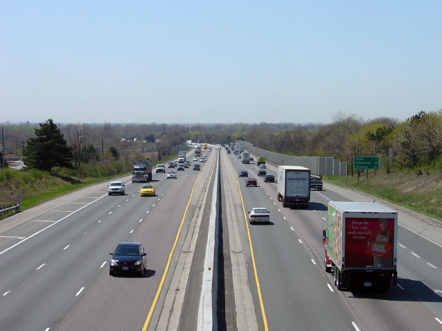
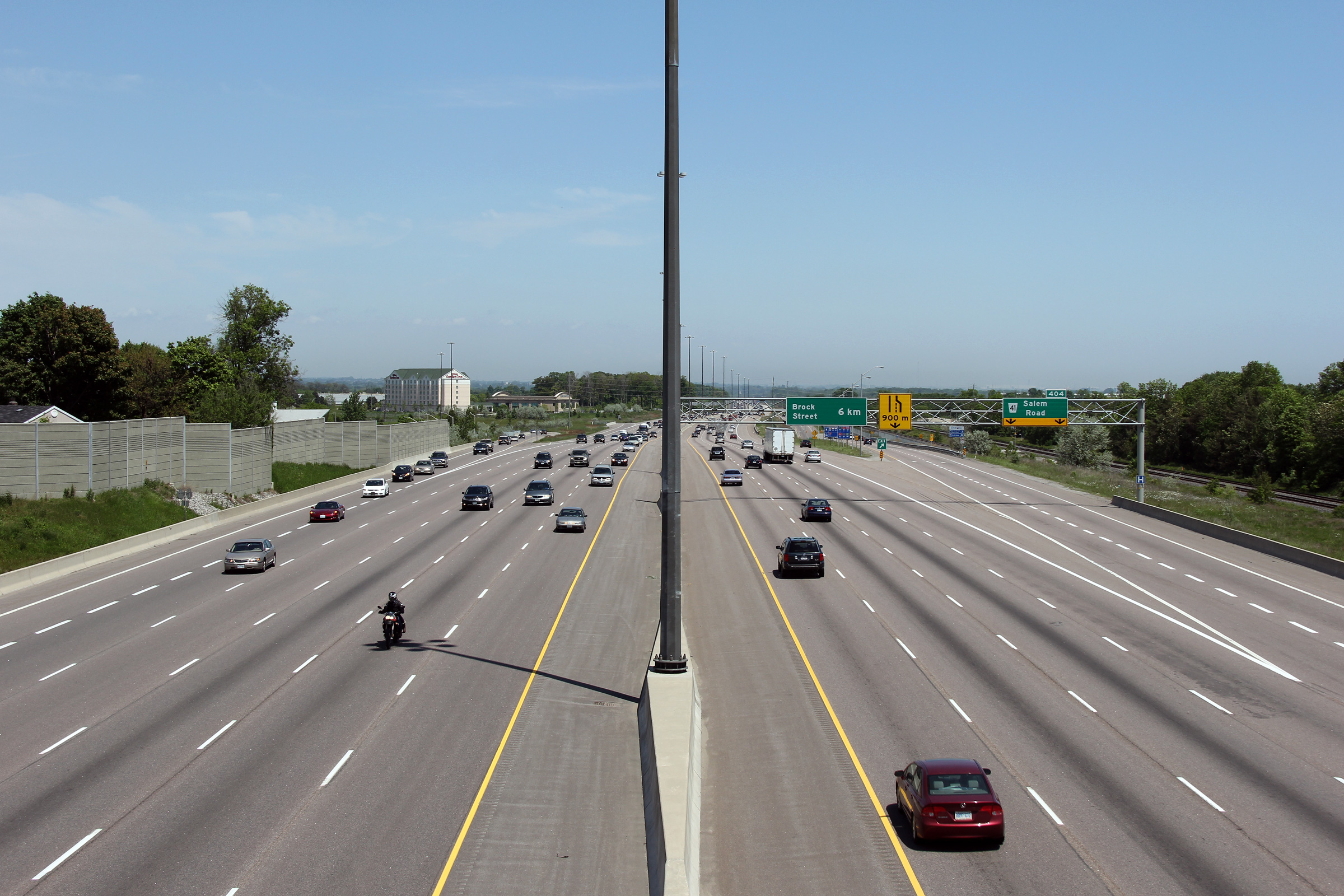
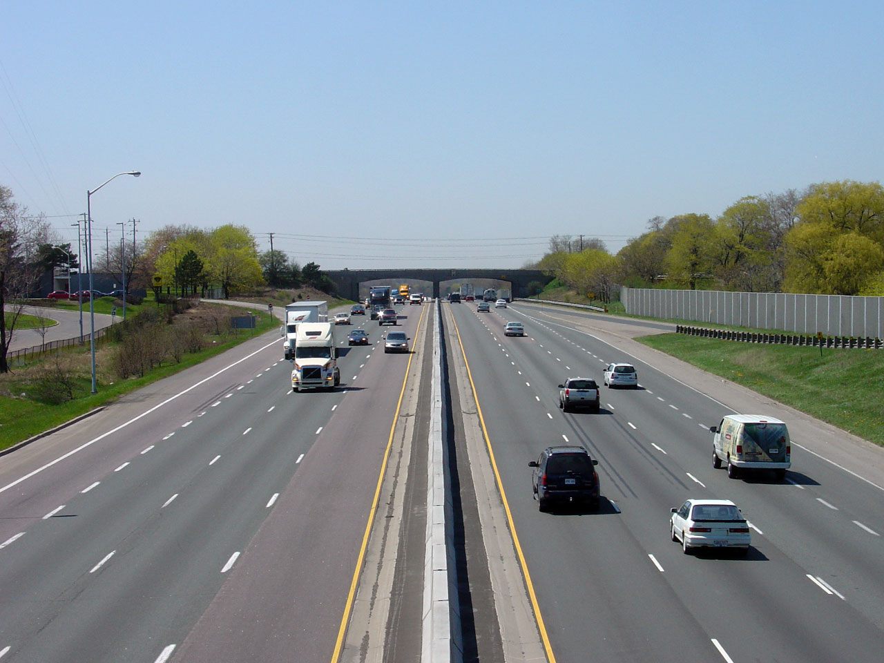
| City of Pickering Regional Municipality of Durham |
Highway 401 looking east from the Brock Road overpass. Highway 401
is 10-lanes from Brock Road easterly to the Salem Road interchange.
East of Salem Road, Highway 401 narrows to six lanes; a configuration it
maintains easterly to Cobourg.
Click here for an additional view from this vantage point taken May,
2005. Photos taken: July 10th, 2014. |
(720x480) (1440x960) (2400x1600)
|
|||||
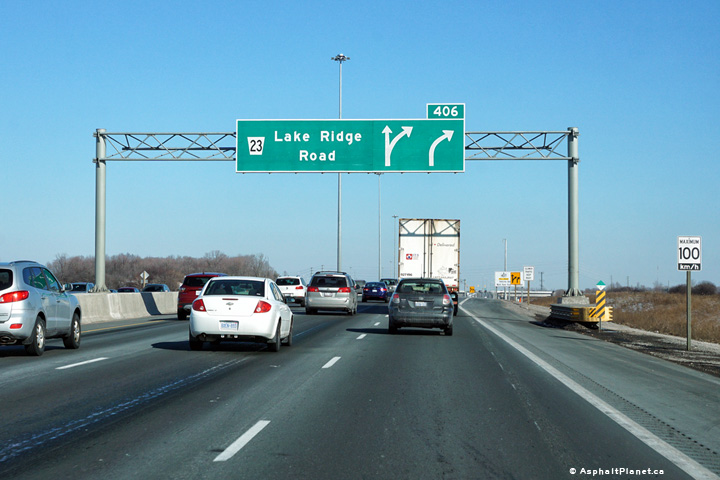
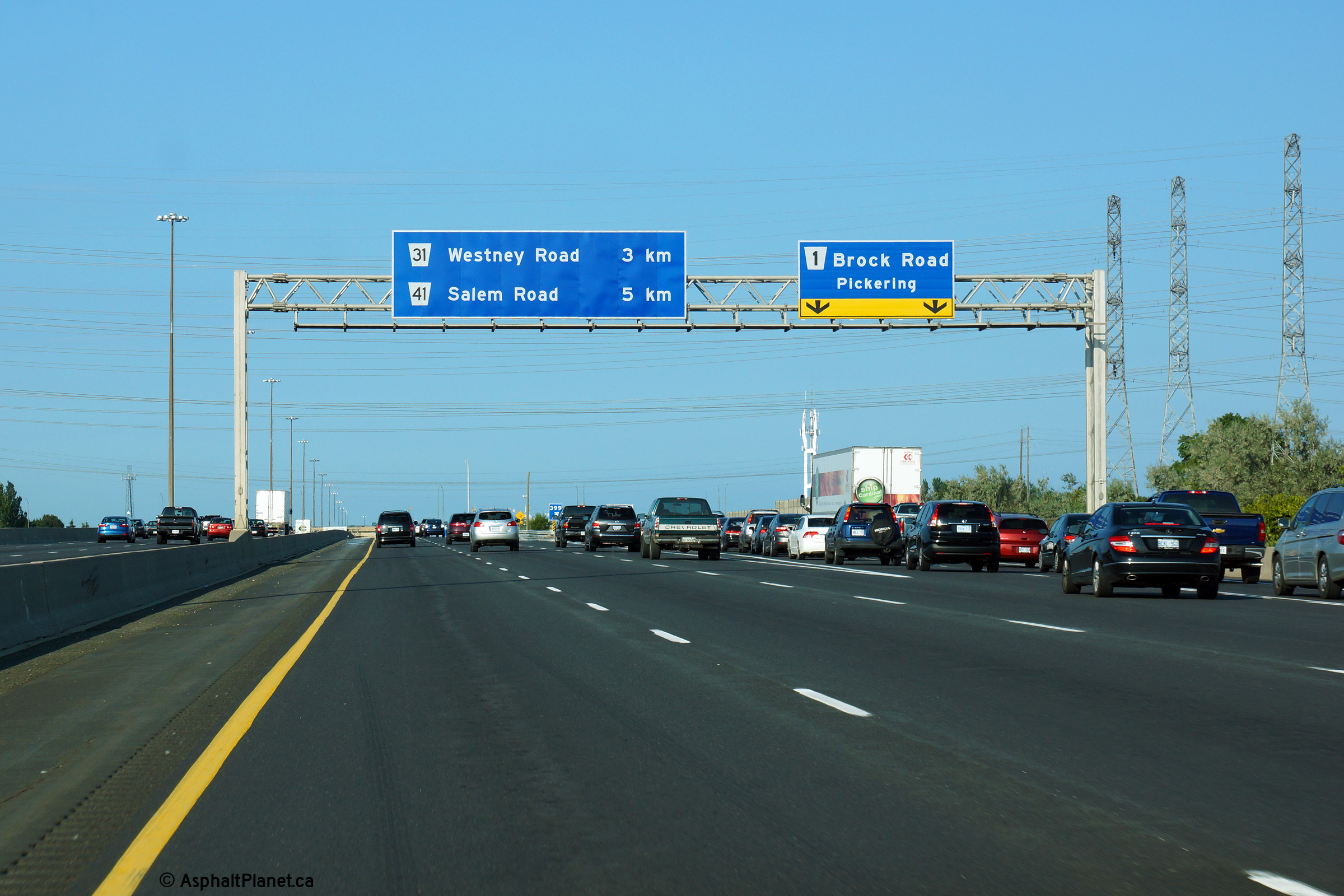
| City of Pickering Regional Municipality of Durham |
This overhead sign is affixed to the Brock Road overpass in Pickering.
This signage denotes the eastern beginning of Highway 401's collector
lanes through Toronto. Photo taken: August 28th, 2015. |
 (720x480) (720x480)(1440x960) (2400x1600) |
|||||
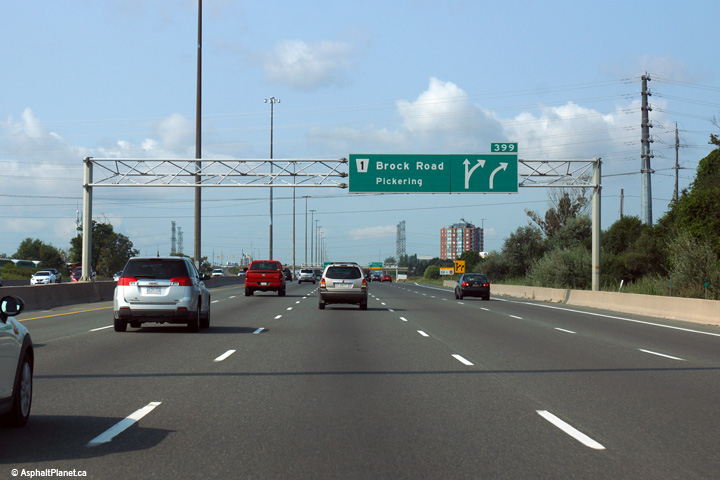
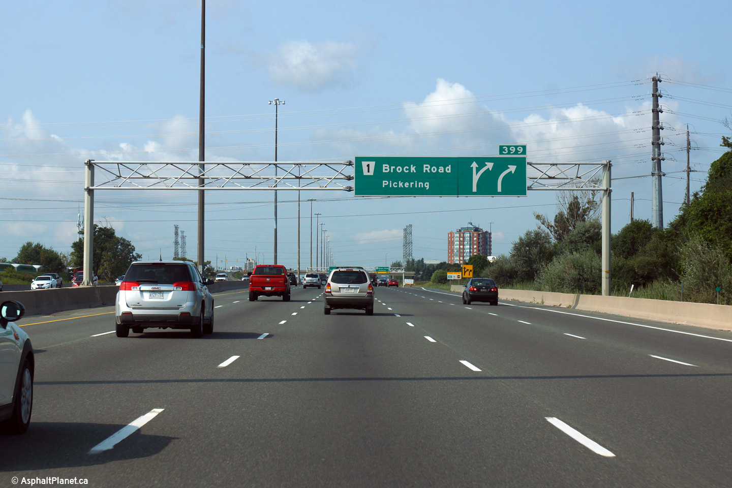
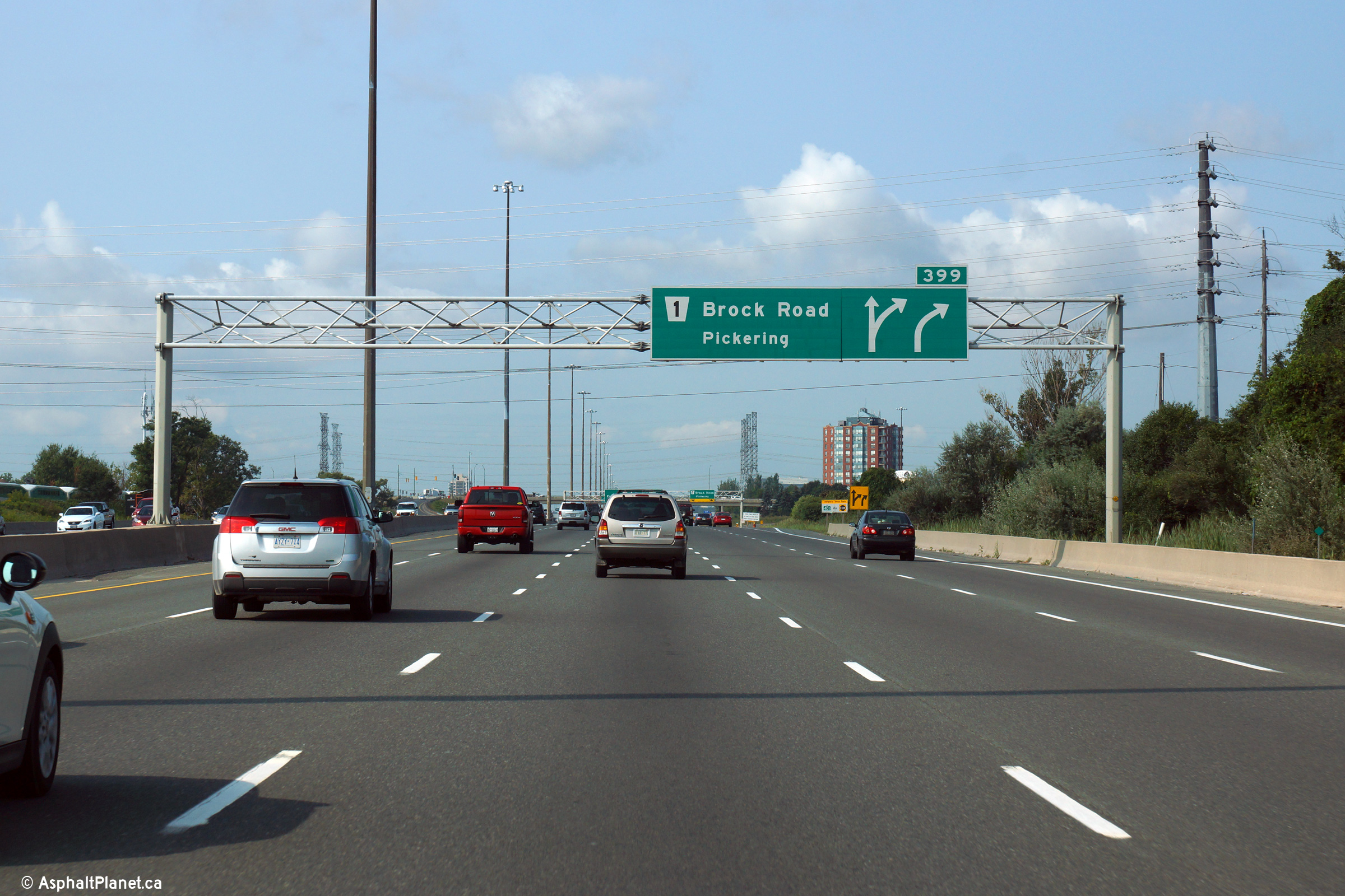
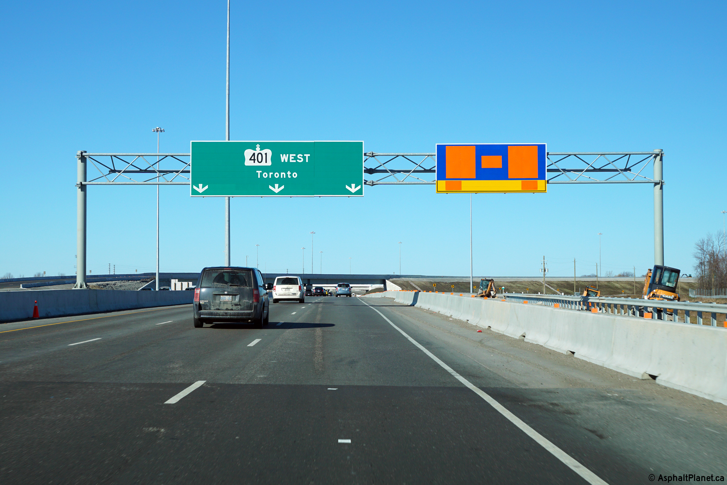
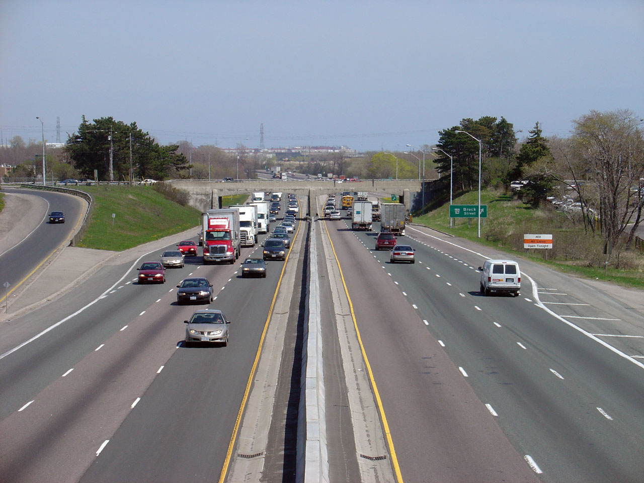
| City of Pickering Regional Municipality of Durham |
Signage for the westbound exit to Brock Road coupled with an advanced sign for the
upcoming Core-Distributor lane split. This is the second diagram sign denoting this split, and the first sign detailing what
interchanges exit from the collector (distributor) lanes before the next
core to collector transfer. Photo taken: August 28th, 2015. |
 (720x480) (720x480)(1440x960) (2400x1600) |
|||||
| City of Pickering Regional Municipality of Durham |
Advanced signage for the westbound off-ramp to Brock Road. The
control city of Pickering was added to all signage referencing Brock
Road in 2006 to differentiate Pickering's Brock Road from Whitby's Brock
Street. Photo taken: August 28th, 2015. |
 (720x480) (720x480)(1440x960) (2400x1600) |
|||||
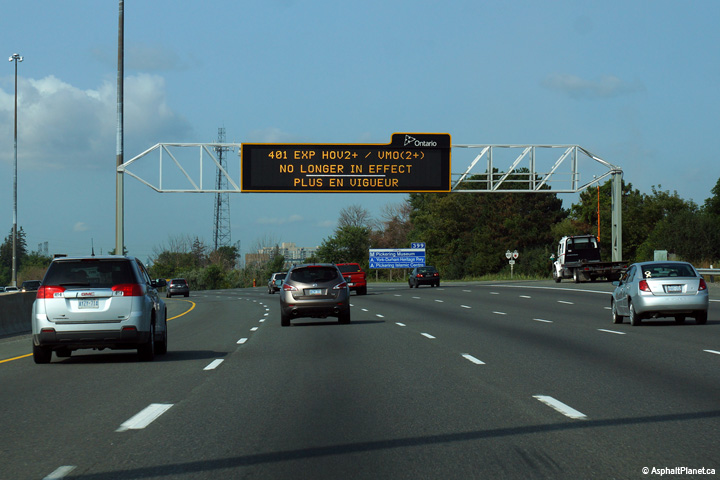
| Town of Ajax Regional Municipality of Durham |
Changeable message signage in upstream of the start of the collector
lanes at Brock Road. During the Summer of 2015, the Greater
Toronto Area hosted the Pan-American Games. During this time,
temporary HOV lanes were designated along several stretches of highway
in the GTA, including the 401 through western Durham Region. This
sign notified motorists that the HOV lane restrictions had ended. Photo taken: August 28th, 2015. |
 (720x480) (720x480)(1440x960) (2400x1600) |
|||||
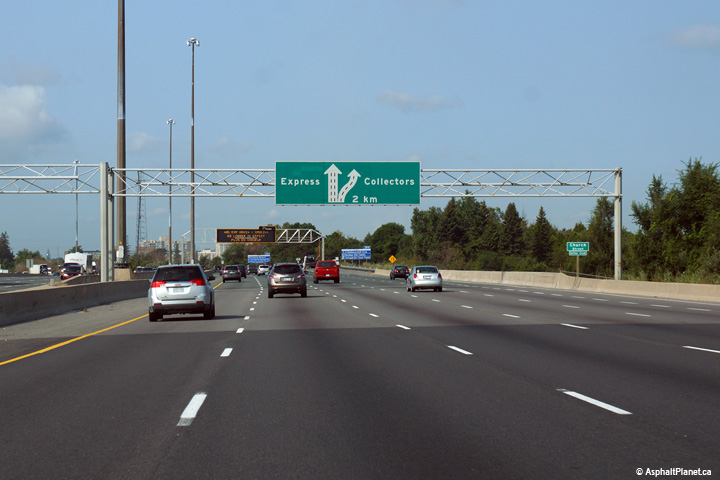
| Town of Ajax Regional Municipality of Durham |
Westbound advanced signage advising motorists of the upcoming
express-collector split. Photo taken: August 28th, 2015. |
 (720x480) (720x480)(1440x960) (2400x1600) |
|||||
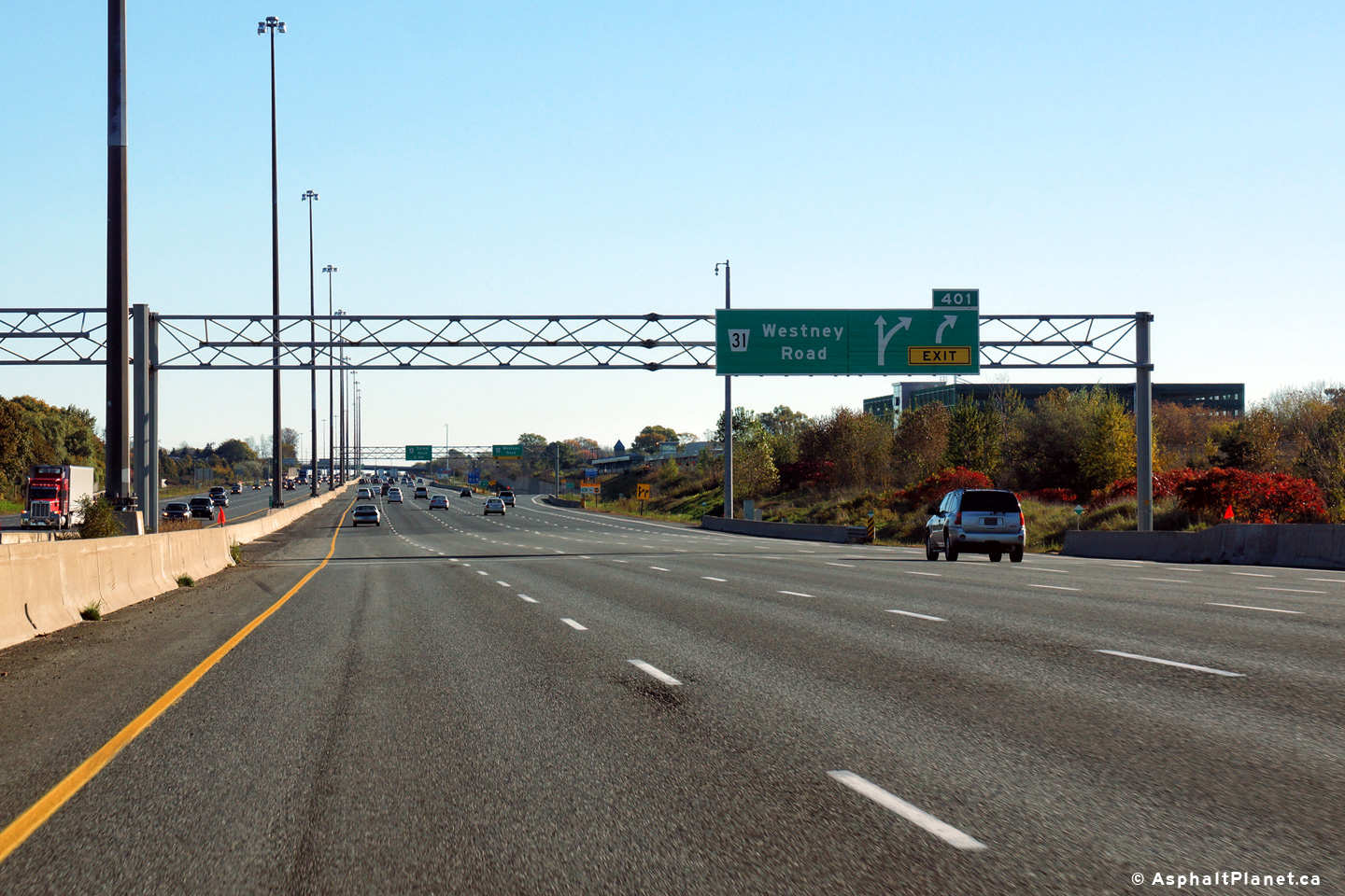
| Town of Ajax Regional Municipality of Durham |
Eastbound advanced signage for the Westney Road off-ramp. Photo taken: October 14th, 2013. |
 (720x480) (720x480)(1440x960) (2400x1600) |
|||||
| Town of Ajax Regional Municipality of Durham |
Signage at the eastbound off-ramp to Westney Road in Ajax. Highway
401 passes overtop of Westney Road. Photo taken: October 14th, 2013. |
 (720x480) (720x480)(1440x960) (2400x1600) |
|||||
| Town of Ajax Regional Municipality of Durham |
View looking westerly at the Westney Road off-ramp. Because
Westney Road is Exit #401, for several years, Highway 401 was signed
with a supplemental sign
indicating that Highway 401 continued through the interchange. Photo taken: September 11th, 2016. |
 (720x480) (720x480)(1440x960) (2400x1600) |
|||||
| Town of Ajax Regional Municipality of Durham |
Westbound advanced signage for the off-ramp to Westney Road interchange. Photo taken: September 11th, 2016. |
 (720x480) (720x480)(1440x960) (2400x1600) |
|||||
| Town of Ajax Regional Municipality of Durham |
Highway 401 looking west from the Harwood Avenue overpass in Ajax.
Harwood Avenue is located roughly at kilometre marker 403. During
the summer of 2006 Highway 401 was widened from 8 to 10-lanes between
Westney Road and Salem Road. Upper photo taken: August 17th, 2005. Lower photo taken: June 5th, 2011. |
 |
|||||
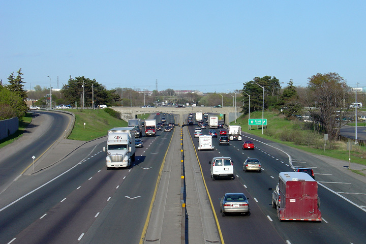
| Town of Ajax Regional Municipality of Durham |
This picture showcases Highway 401 looking east from the Harwood Avenue
overpass. The interchange shown in this photo is that of Salem
Road. A new interchange was constructed at Salem Road replacing
the rather old and outdated interchange at Harwood Avenue.
A short distance east of Salem Road, Highway 401 narrows to a
6-lane cross-section. Photo taken: August 17th, 2005. |
 |
|||||
| Town of Ajax Regional Municipality of Durham |
Eastbound signage in advance of the Salem Road interchange. The
fifth eastbound lane of Highway 401 exits at the Salem Road off-ramp. Photo taken: October 14th, 2013. |
 (720x480) (720x480)(1440x960) (2400x1600) |
|||||
| Town of Ajax Regional Municipality of Durham |
Eastbound signage at the off-ramp to Salem Road. Beyond Salem
Road, the eastbound lanes of Highway 401 narrow to three lanes from
five. This photo was taken before construction of the Highway 412
and Lake Ridge Road interchanges. Photo taken: October 14th, 2013. |
 (720x480) (720x480)(1440x960) (2400x1600) |
|||||
| Town of Ajax Regional Municipality of Durham |
View looking westerly at the off-ramp to Salem Road. Photo taken: September 11th, 2016. |
 (720x480) (720x480)(1440x960) (2400x1600) |
|||||
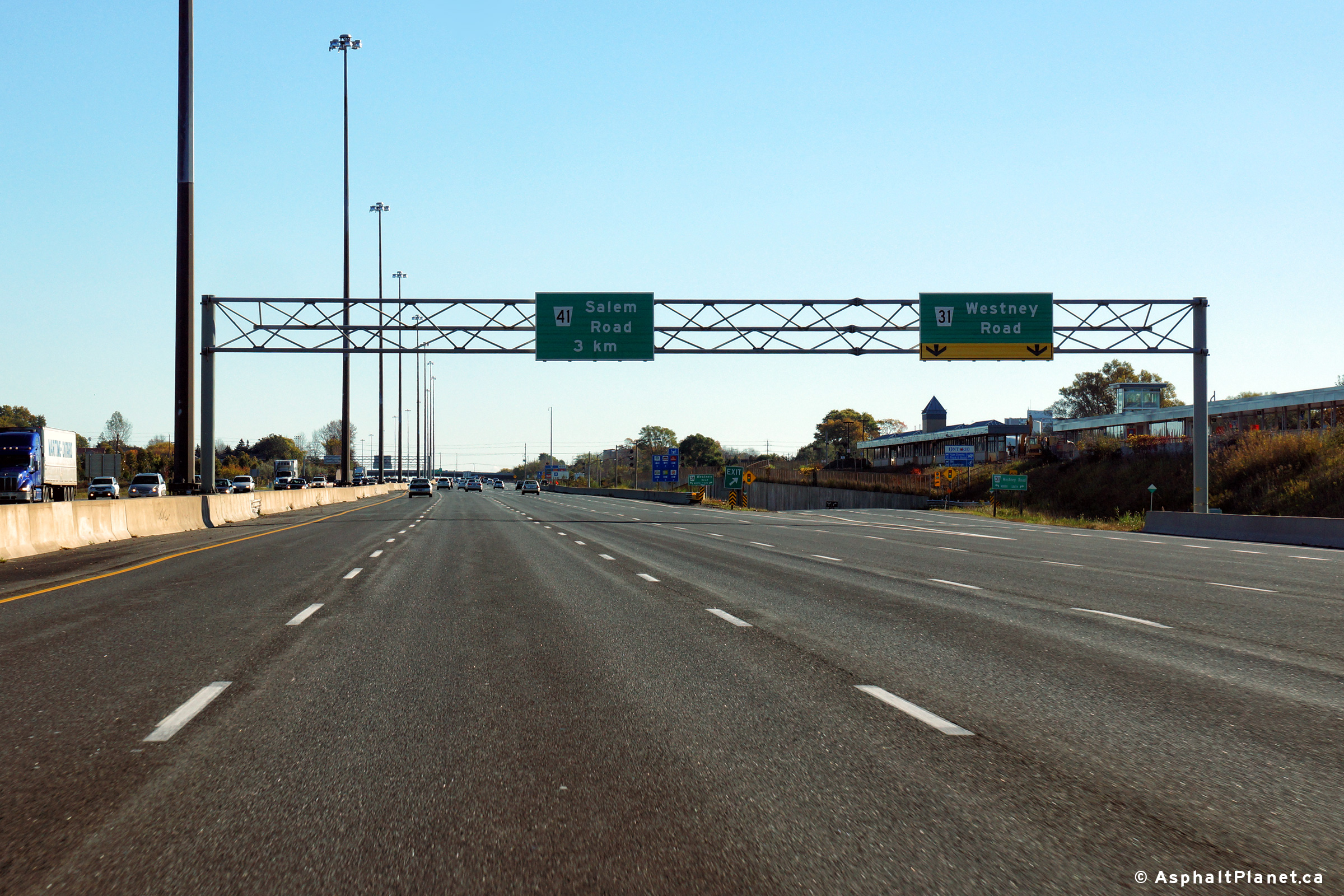
| Town of Ajax Regional Municipality of Durham |
Westbound advanced signage for the Salem Road interchange.
Somewhat surprisingly, the MTO chose to erect a ground mounted advanced
sign fro the Salem Road interchange instead of an overhead sign. Photo taken: September 11th, 2016. |
 (720x480) (720x480)(1440x960) (2400x1600) |
|||||
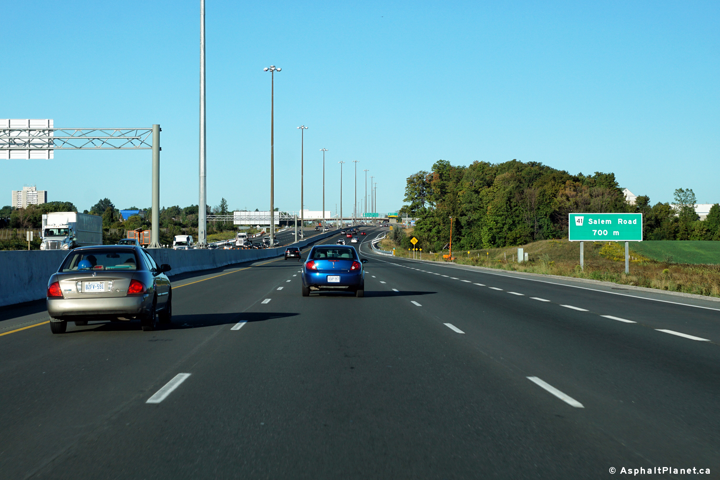
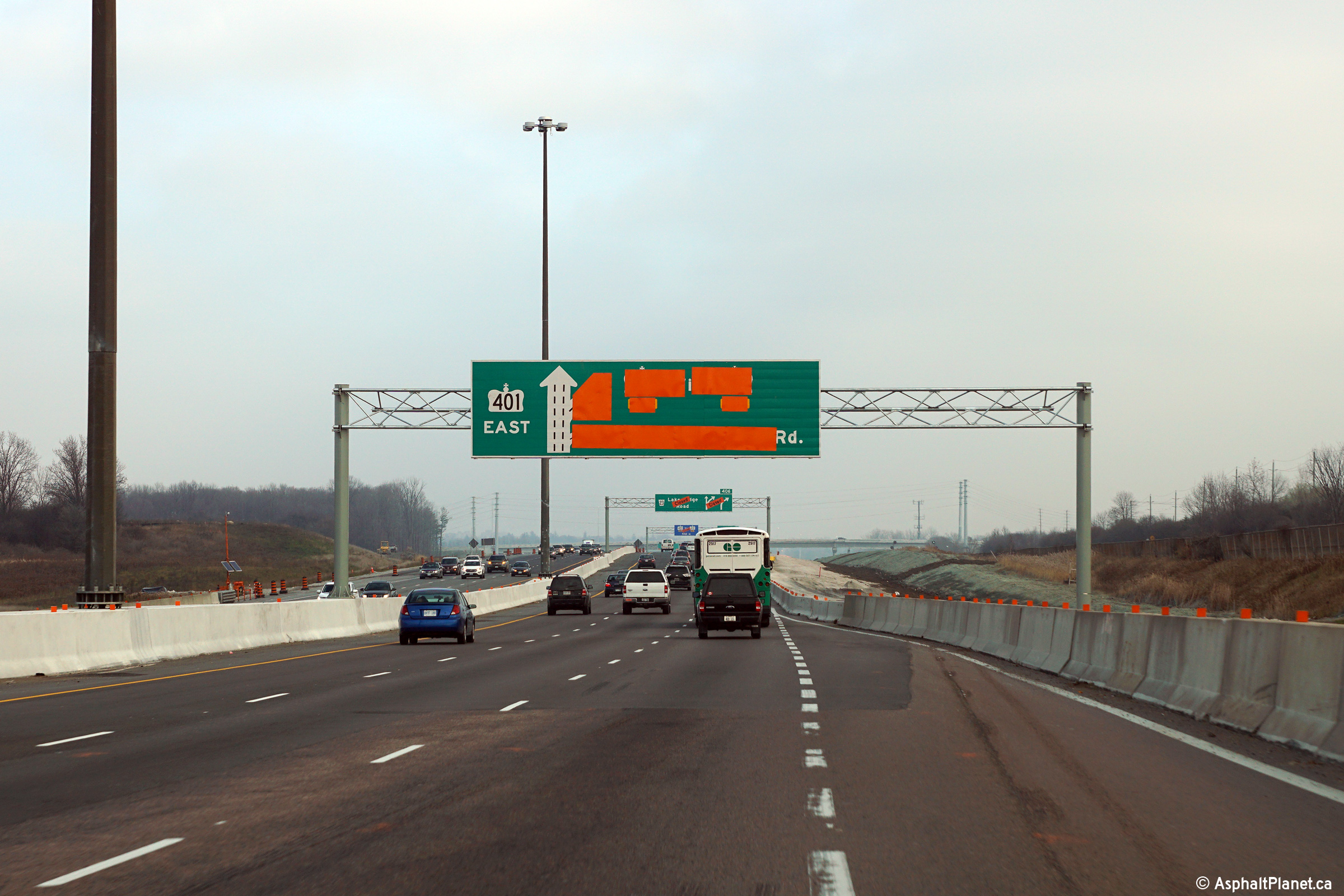
| Town of Ajax Regional Municipality of Durham |
Overhead changeable message sign in advance of the Lake Ridge Road
interchange. Photo taken: February 18th, 2017. |
|
|||||
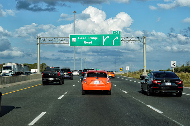
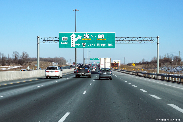
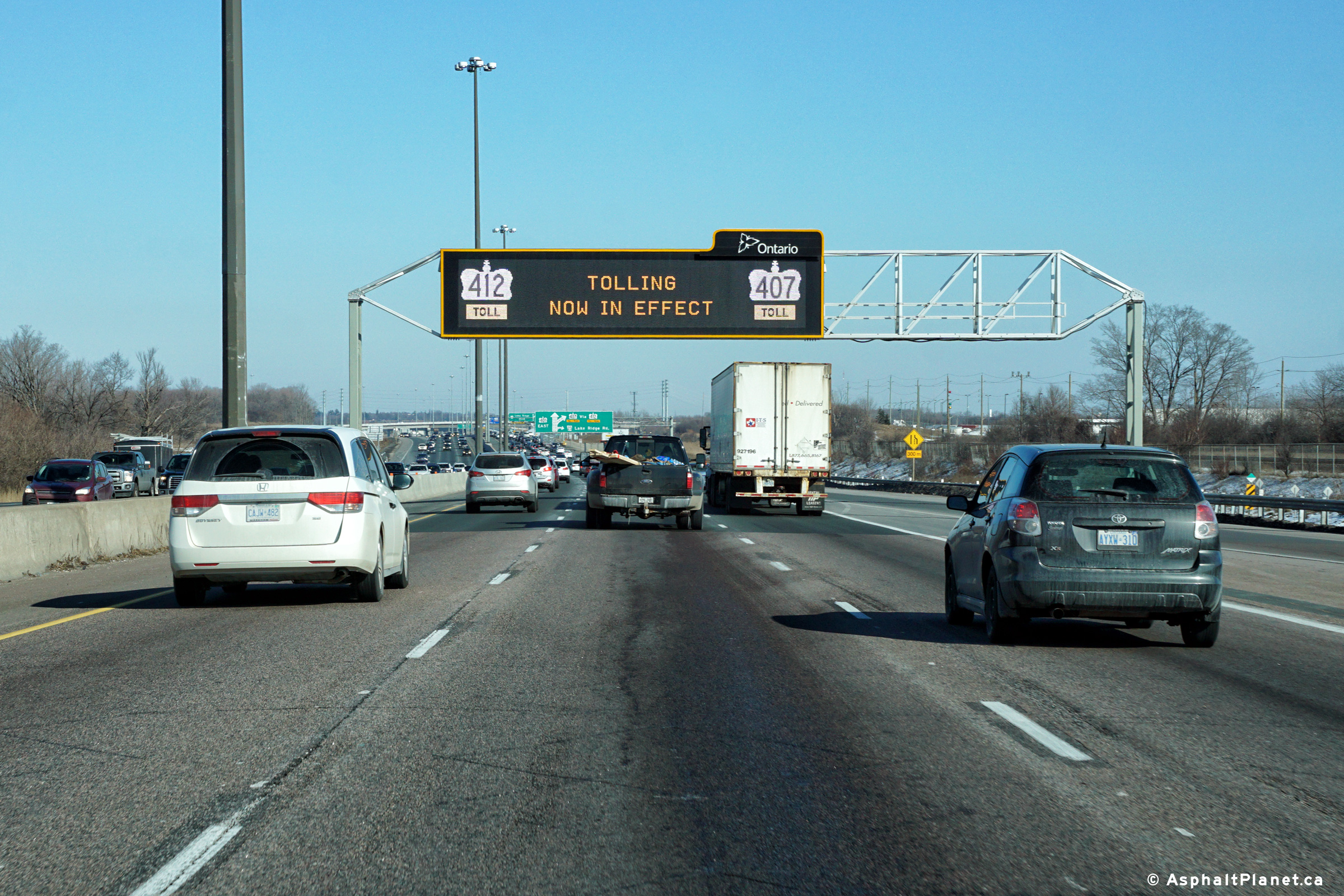
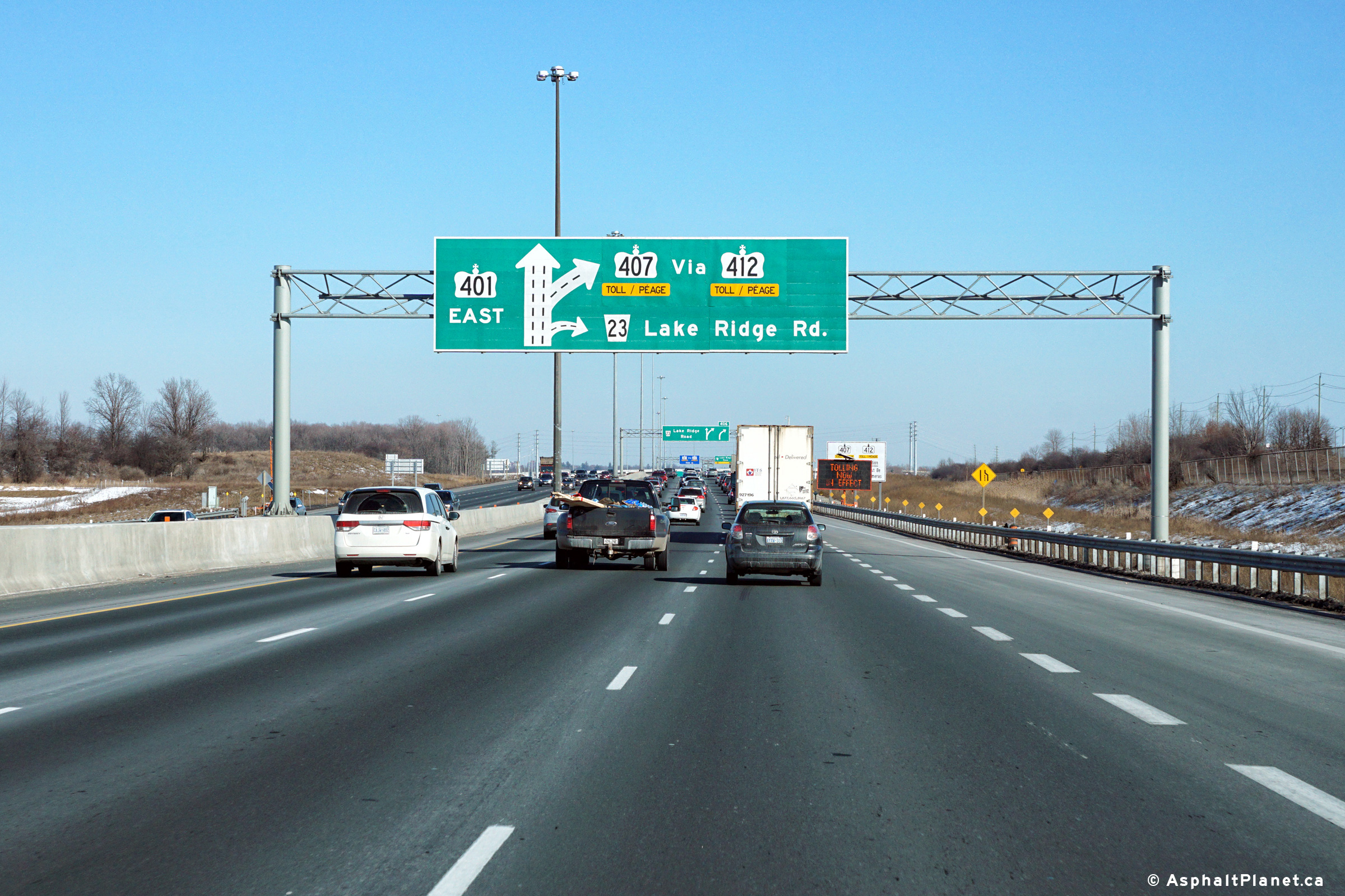
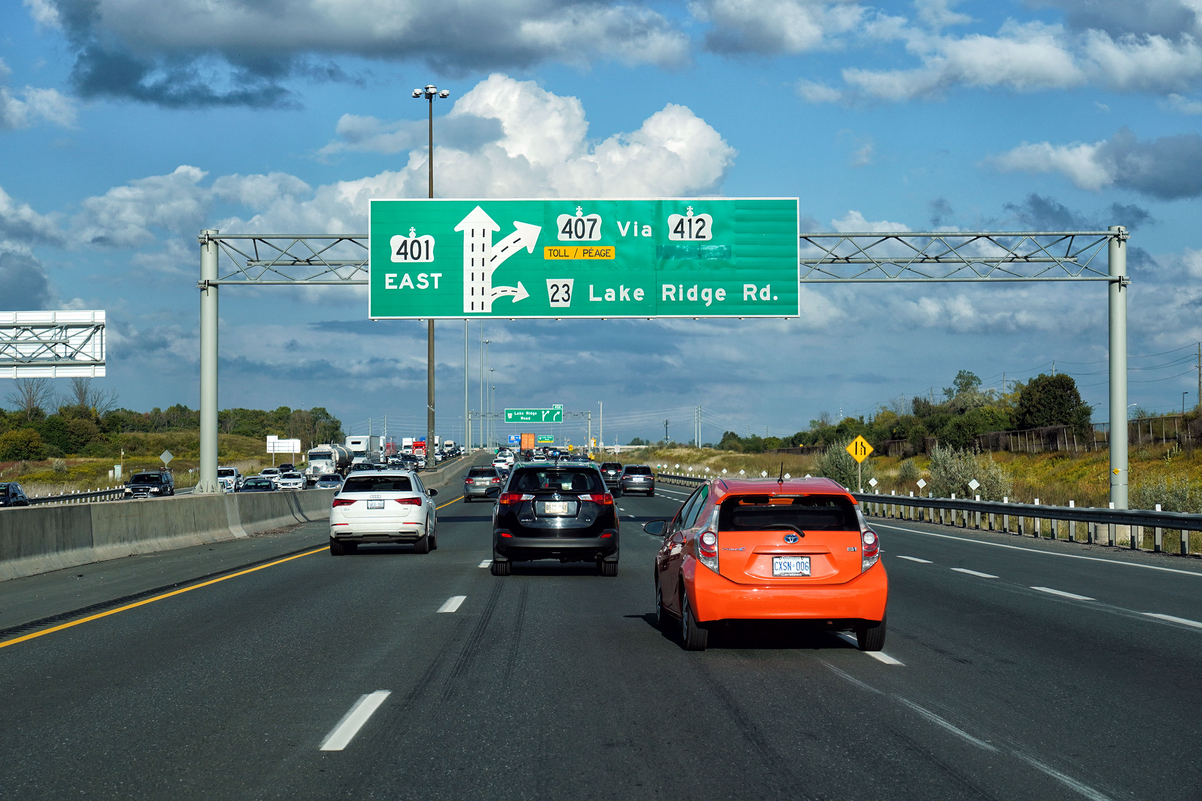
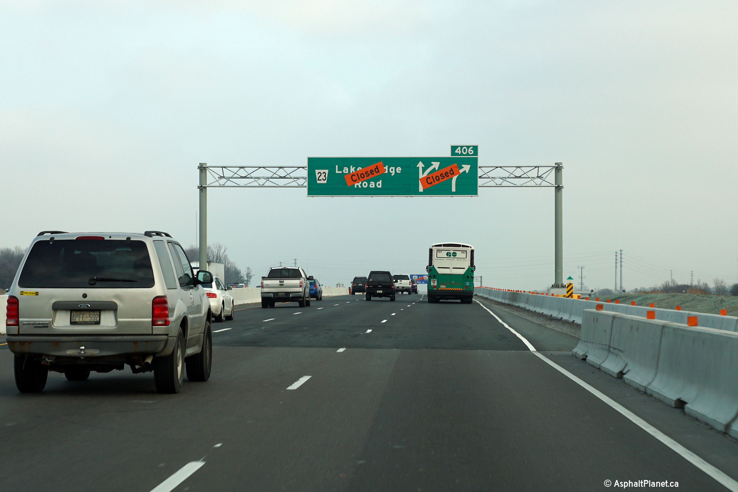
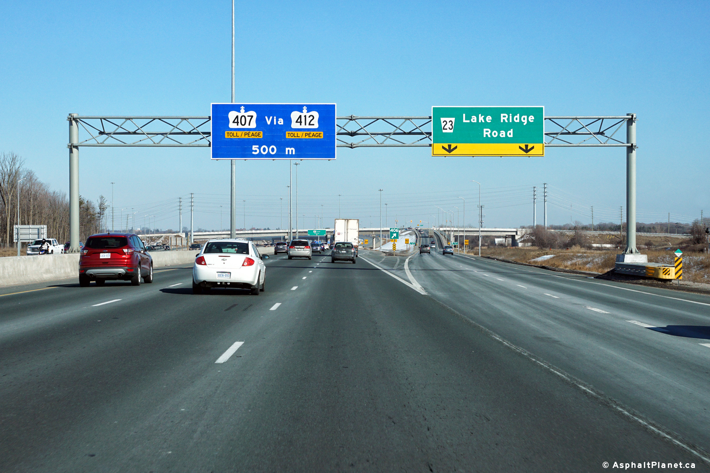
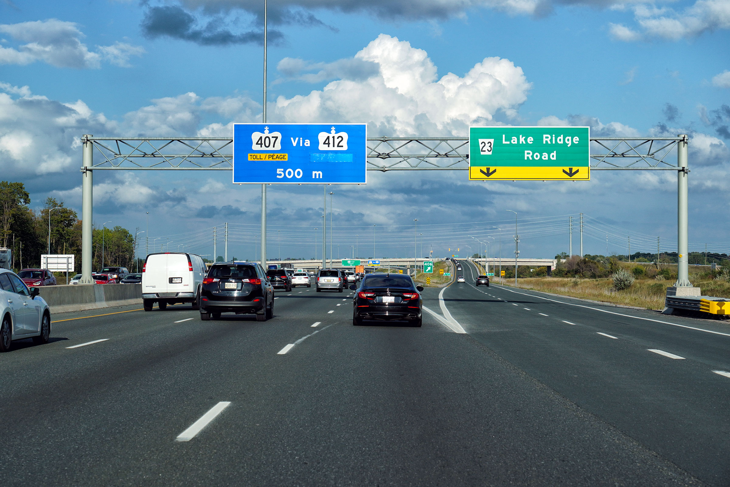
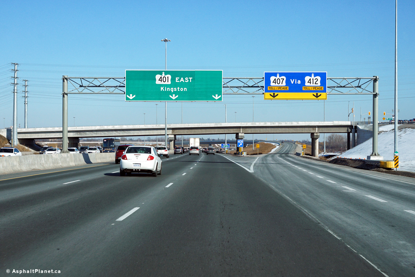
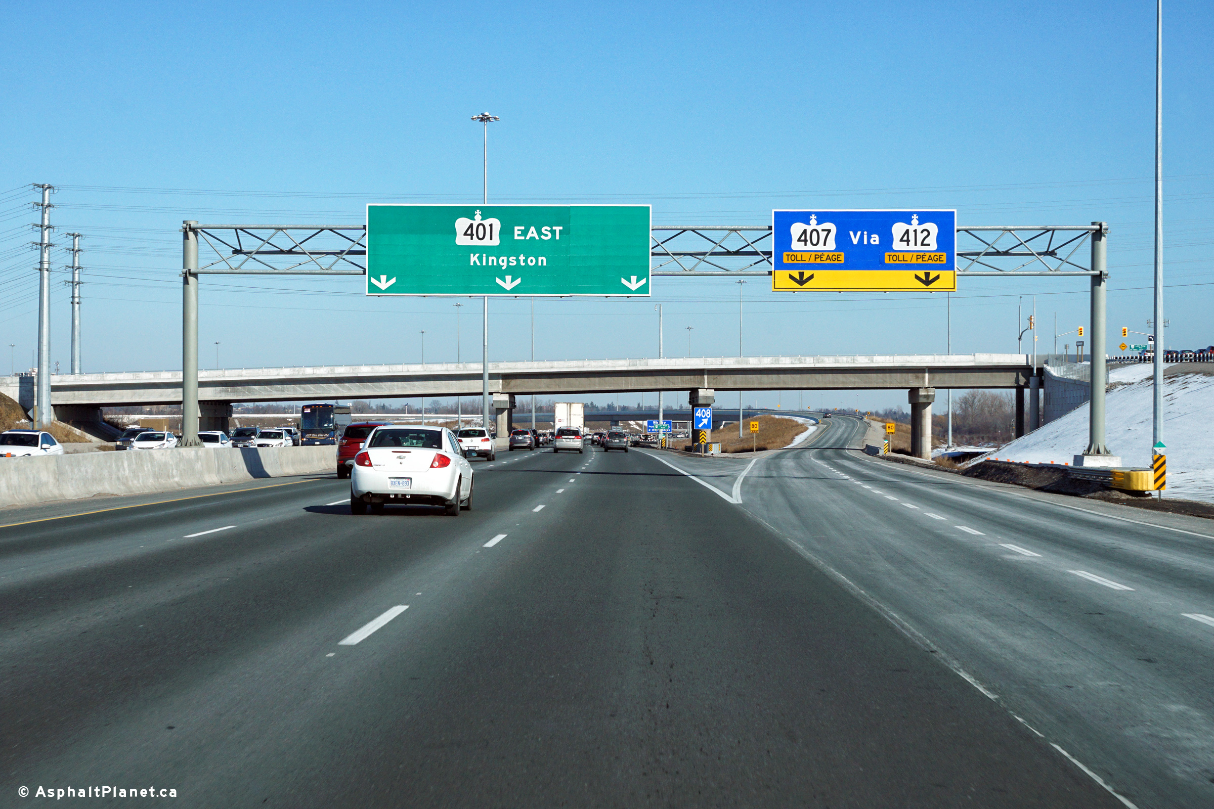
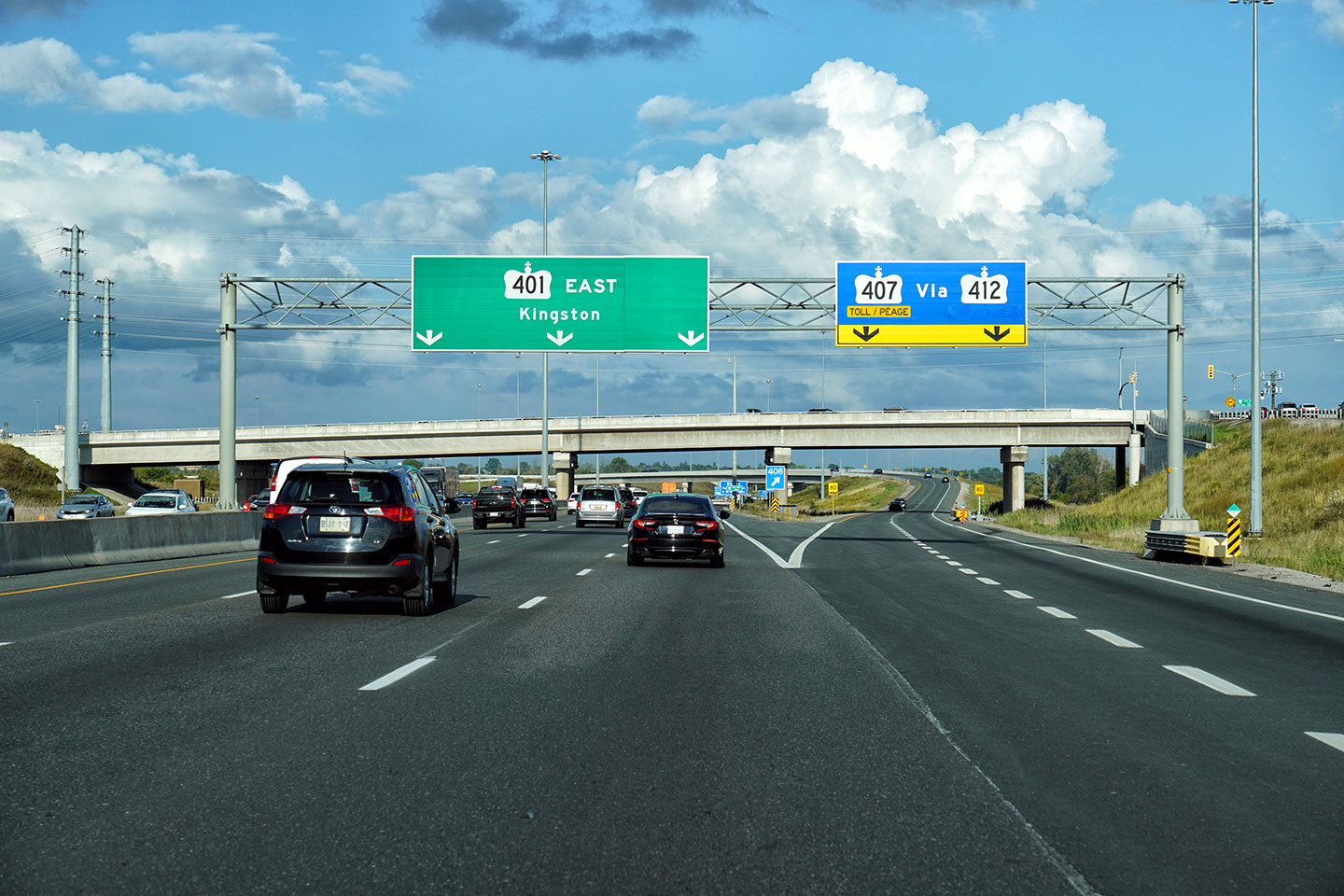
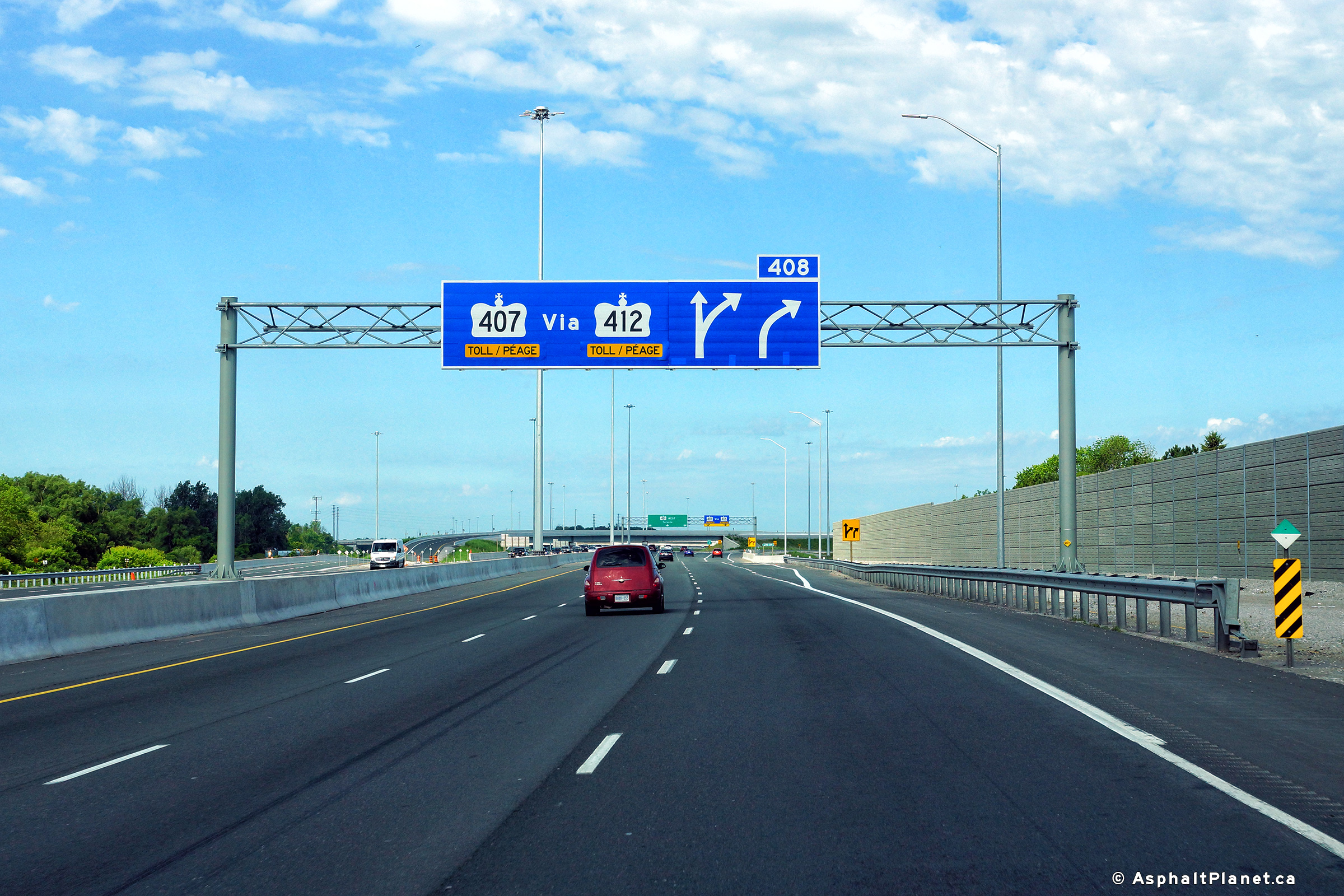
| Town of Ajax Regional Municipality of Durham |
Eastbound diagram signage in advance of the ramps to both Lake Ridge
Road and Highway 412. Click here
for a photo of the signage before the ramps had opened, taken in
December, 2015. Tolls were removed from Highway 412 effective
April 5, 2022, so the signage was updated to reflect this change. Upper photo taken: February 18th, 2017. Lower photo taken: September 20, 2022. |
 (720x480) (720x480)(1440x960) (2400x1600) |
|||||
| Town of Ajax Regional Municipality of Durham |
Eastbound advanced signage for the eastbound off-ramp to Lake
Ridge Road. Click here
for a photo of the signage before the ramps had opened, taken in
December, 2015. Upper photo taken: February 18th, 2017. Lower photo taken: September 20, 2022. |
 (720x480) (720x480)(1440x960) (2400x1600) |
|||||
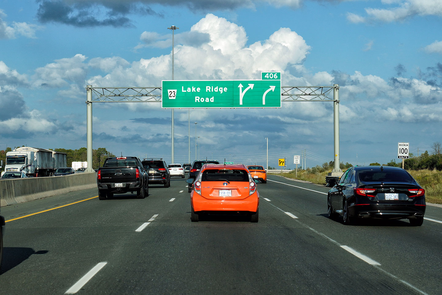
| Town of Ajax Regional Municipality of Durham |
Signage for the turn-off to Lake Ridge Road. Click here
for a photo of the signage before the ramps had opened, taken in
December, 2015. Upper photo taken: February 18th, 2017. Lower photo taken: September 20, 2022. |
 (720x480) (720x480)(1440x960) (2400x1600) |
|||||
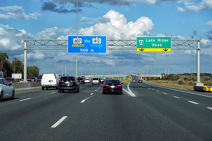
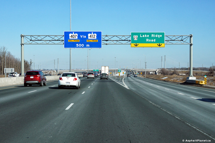
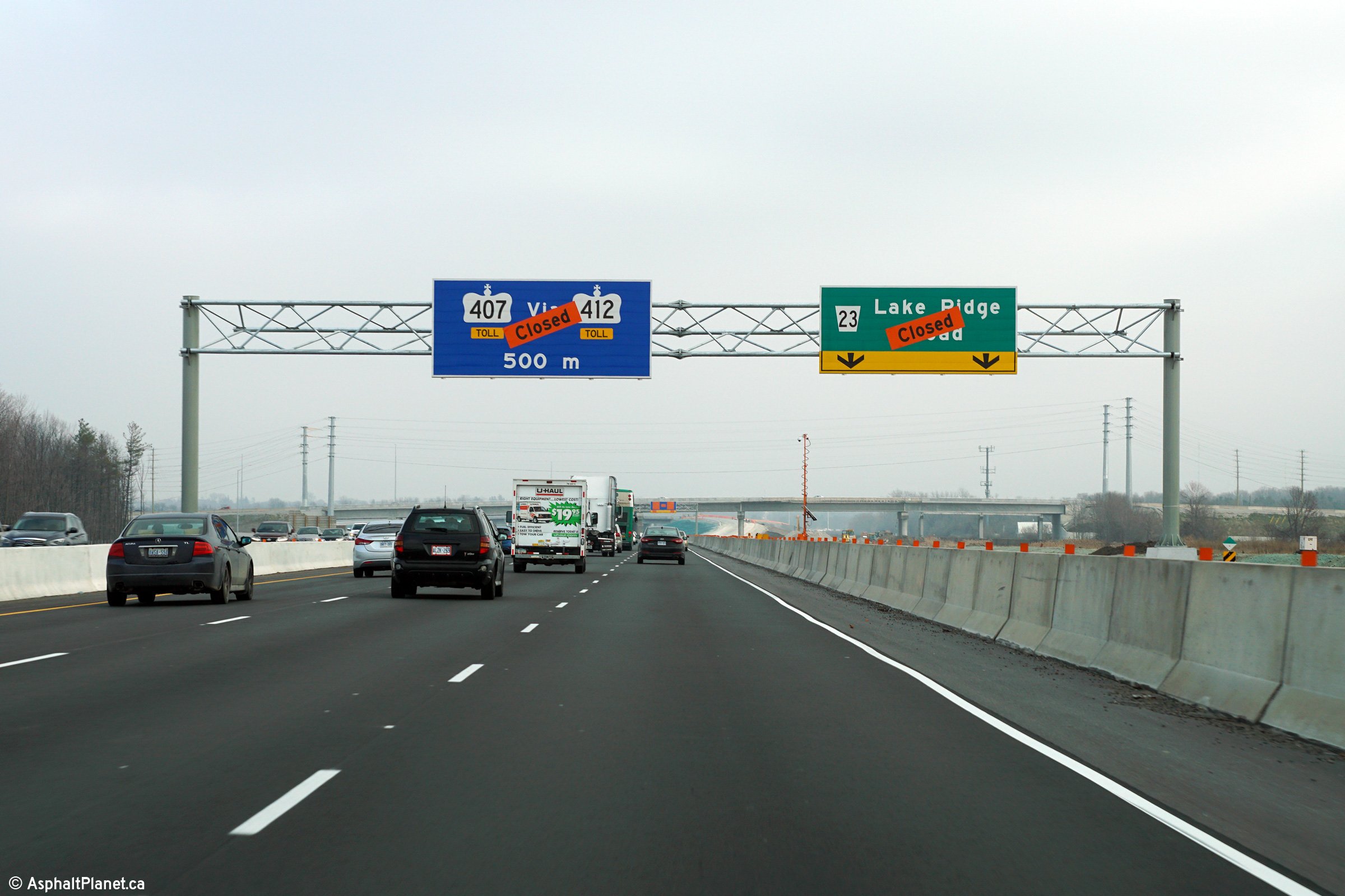
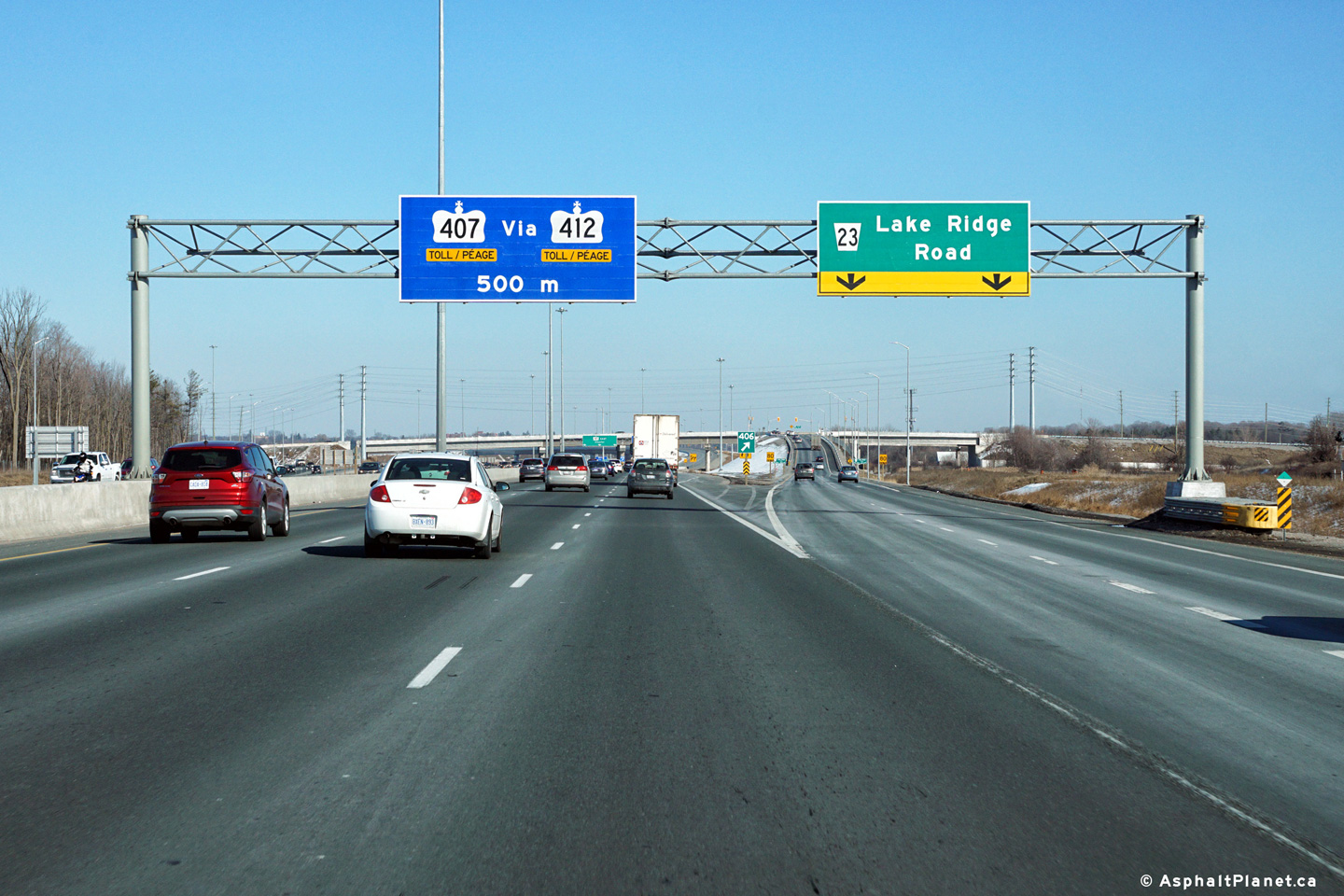
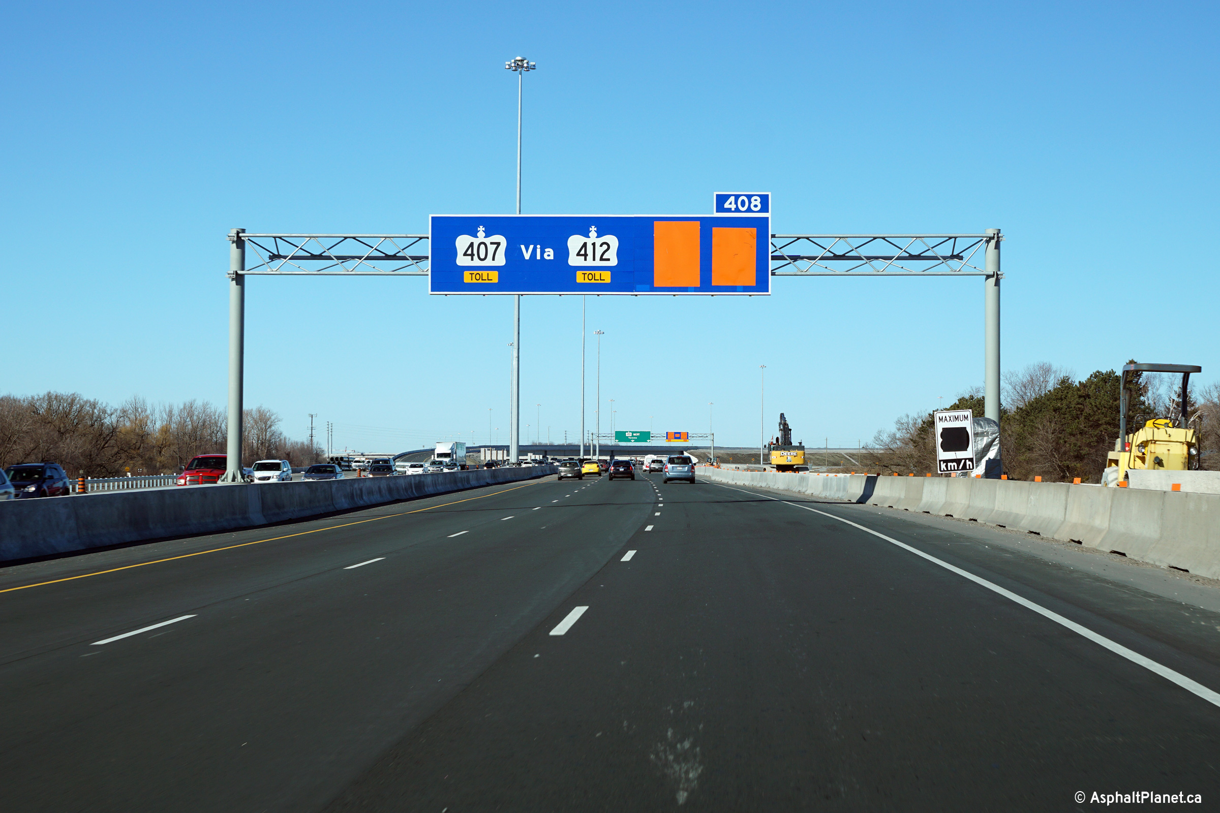
| Town of Ajax Regional Municipality of Durham |
Signage for the future eastbound off-ramp to Highway 412 Toll. The
Lake Ridge Road overpass is visible situated behind the overhead
signage. Click here
for a photo of the signage before the ramps had opened, taken in
December, 2015. Upper photo taken: February 18th, 2017. Lower photo taken: September 20, 2022. |
 (720x480) (720x480)(1440x960) (2400x1600) |
|||||
| Town of Ajax Regional Municipality of Durham |
These views look westerly from the Lake Ridge
Road overpass. These photos chronicle the realignment of Highway 401
through the Lake Ridge Road interchange as part of the Highway 412
interchange construction. Photo # 1 taken: June 5th, 2011. Photo # 2 and 3 taken: December 20th, 2014. Photo taken: November 8th, 2015. |
 (720x480) (1440x960) (2400x1600) |
|||||
| Ajax / Whitby Boundary Regional Municipality of Durham |
Side view of the historic (now demolished) Lake
Ridge Road overpass.
The Highway 401 corridor through Durham Region is the definition of a
transportation corridor. CN's Belleville Subdivision is in the
forefront of this photo -- this is CN's mainline between Toronto and
Montreal, it is followed by twin GO transit tracks which carry passenger
trains all day between Oshawa and Burlington. Of course the 401 needs
no introduction, and is in view behind the railway tracks. Photo taken: June 5th, 2011. |
|
|||||
| Town of Whitby Regional Municipality of Durham |
Easterly view from the Lake Ridge Road
overpass towards Whitby. Photo #1 shows Highway 401 when it still had
the box-beam median barrier. Photo # 2 shows Highway 401 after the
box-beam median barrier had been replaced with a pre-cast segmented concrete
tall wall barrier. Grading and structures were underway when Photo # 3
was taken. At the time that both Photo # 4 and 5 were taken, the
westbound lanes of Highway 401 had be realigned onto the new alignment
through the 412 interchange. The westbound lanes of the 401 were moved
to the new alignment in December of 2014. Eastbound motorists were not
moved onto the new highway alignment until July of 2015. The final
photo shows the Highway 412 interchange just before the winter shut-down of
2015. The new interchange had nearly been completed when this photo
was taken. Photo # 1 taken: August 31st, 2004. Photo # 2 taken: June 5th, 2011. Photo # 3 taken: August 17th, 2014. Photo # 4 and 5 taken: December 20th, 2014. Photo # 6 taken: November 8th, 2015. |
 (720x480) (1440x960) (2400x1600) |
|||||
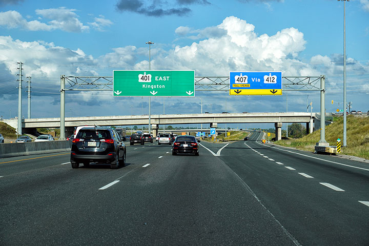
| Town of Whitby Regional Municipality of Durham |
Signage at the westbound off-ramp to Highway
412. Click here for a
photograph taken of this signage months before the ramp had opened to
traffic in March, 2016. Photo taken: July 2nd, 2017. |
 (720x480) (720x480)(1440x960) (2400x1600) |
|||||
| Town of Whitby Regional Municipality of Durham |
Advanced signage for the ramp to Highway 412.
Click here for a photo of
this signage for the then opened ramp taken in March, 2016. Photo taken: July 2nd, 2017. |
 (720x480) (720x480)(1440x960) (2400x1600) |
|||||
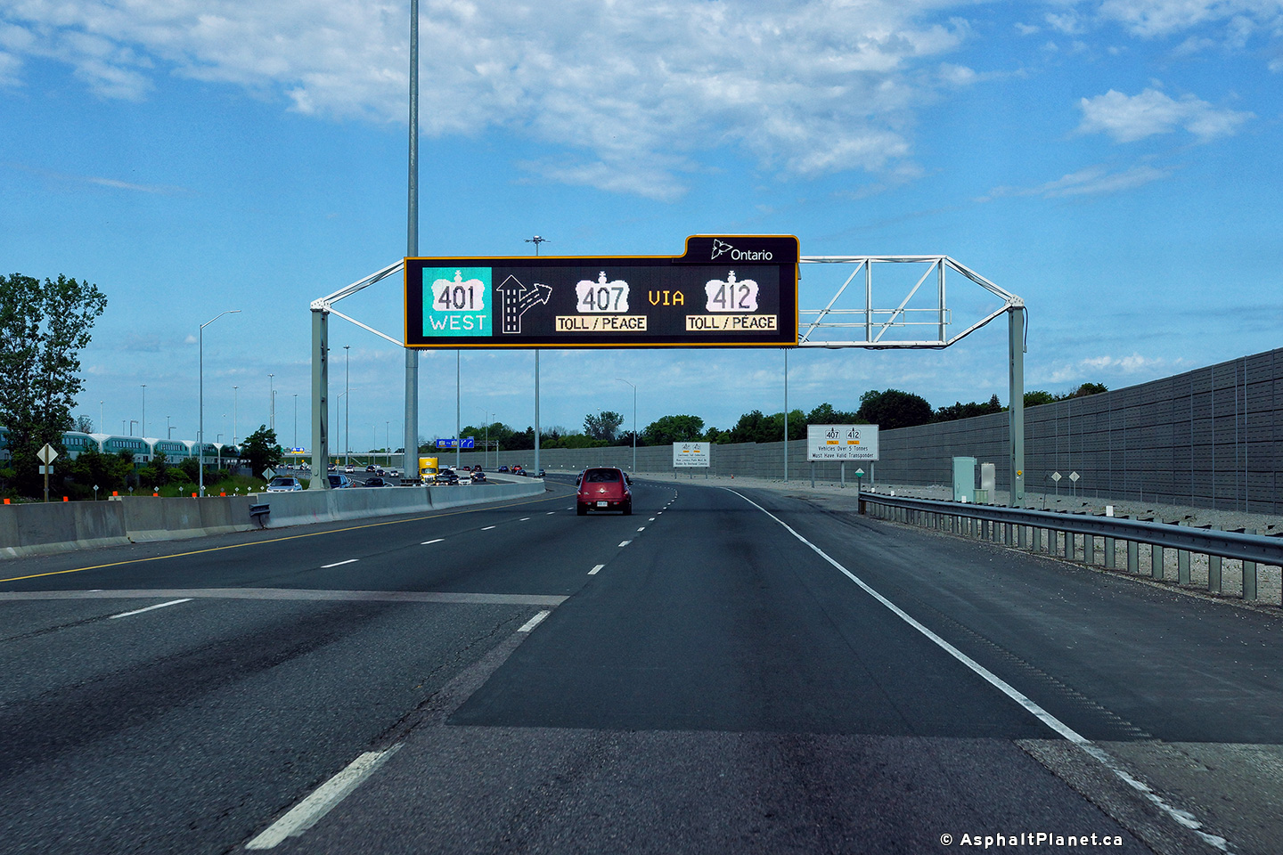
| Town of Whitby Regional Municipality of Durham |
Overhead changeable message signage approaching
the Highway 412 interchange. The MTO has definitely made use of the
full colour capabilities of this signage. Photo taken: July 2nd, 2017. |
 (720x480) (720x480)(1440x960) (2400x1600 |
|||||
| Town of Whitby Regional Municipality of Durham |
View looking westerly from the Henry Street
overpass in Whitby. The old chevron line paint is barely visible -
though all the signs have been removed. Similar lane markings adorn
Pennsylvania's I-80 through the Pocono's. Photo taken: May 3rd, 2006. |
 |
|||||
| Town of Whitby Regional Municipality of Durham |
Two view looking east from the Henry Street overpass
to the Brock Street (Highway 12) interchange. Upper photo taken: May 12th, 2005. Lower photo taken: May 3rd, 2006. |
 |
|||||
| Town of Whitby Regional Municipality of Durham |
Looking back towards the Henry Street overpass
from Brock Street. Having grown up in the area, I take for granted the
decorative elements these vintage structures posses. Photo taken: May 3rd, 2006. |
 |
|||||
| Prior to 1998, Highway 12 began its trek northerly to Midland from this interchange. Click here for Highway 12 images. | |||||||
| Town of Whitby Regional Municipality of Durham |
View looking east from the Brock Street
overpass. The Brock Street interchange is a myriad of different design
eras. The ramps in the northeast quadrant were reconstructed in the
early 1990s. The southern ramps were reconfigured in the 1970s, while
the lone ramp in the Northwestern quadrant dates back to when the 401 opened
in 1947. Photo taken: May 3rd, 2006. |
 |
|||||
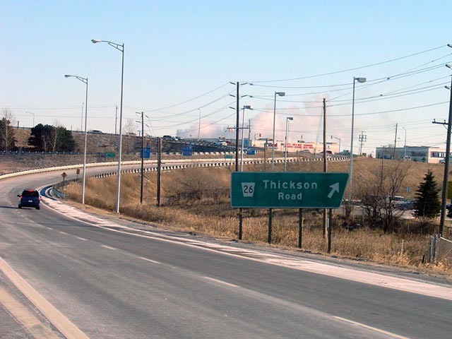
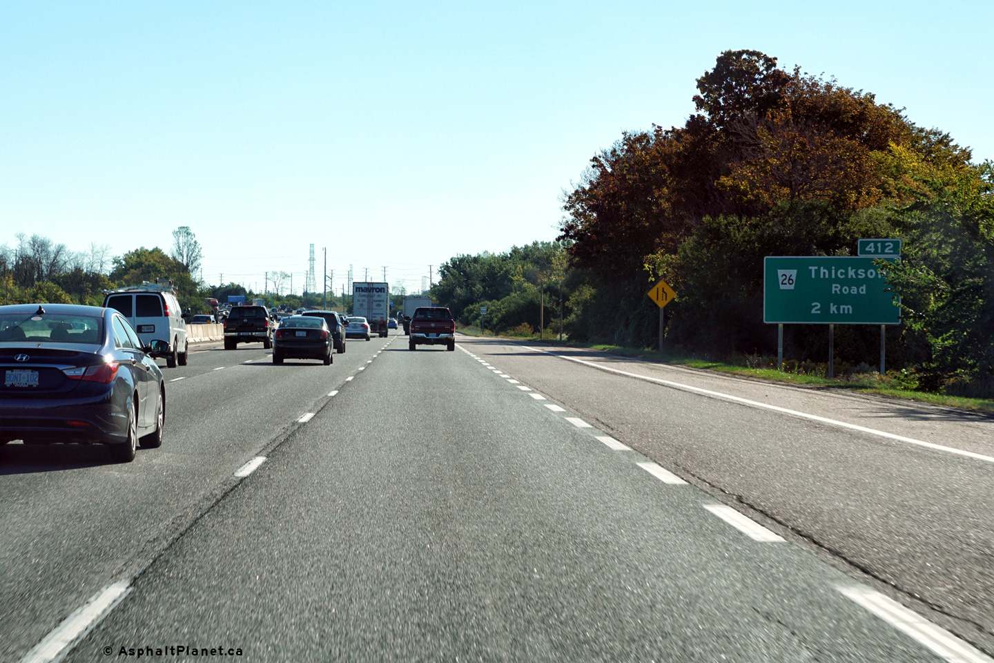
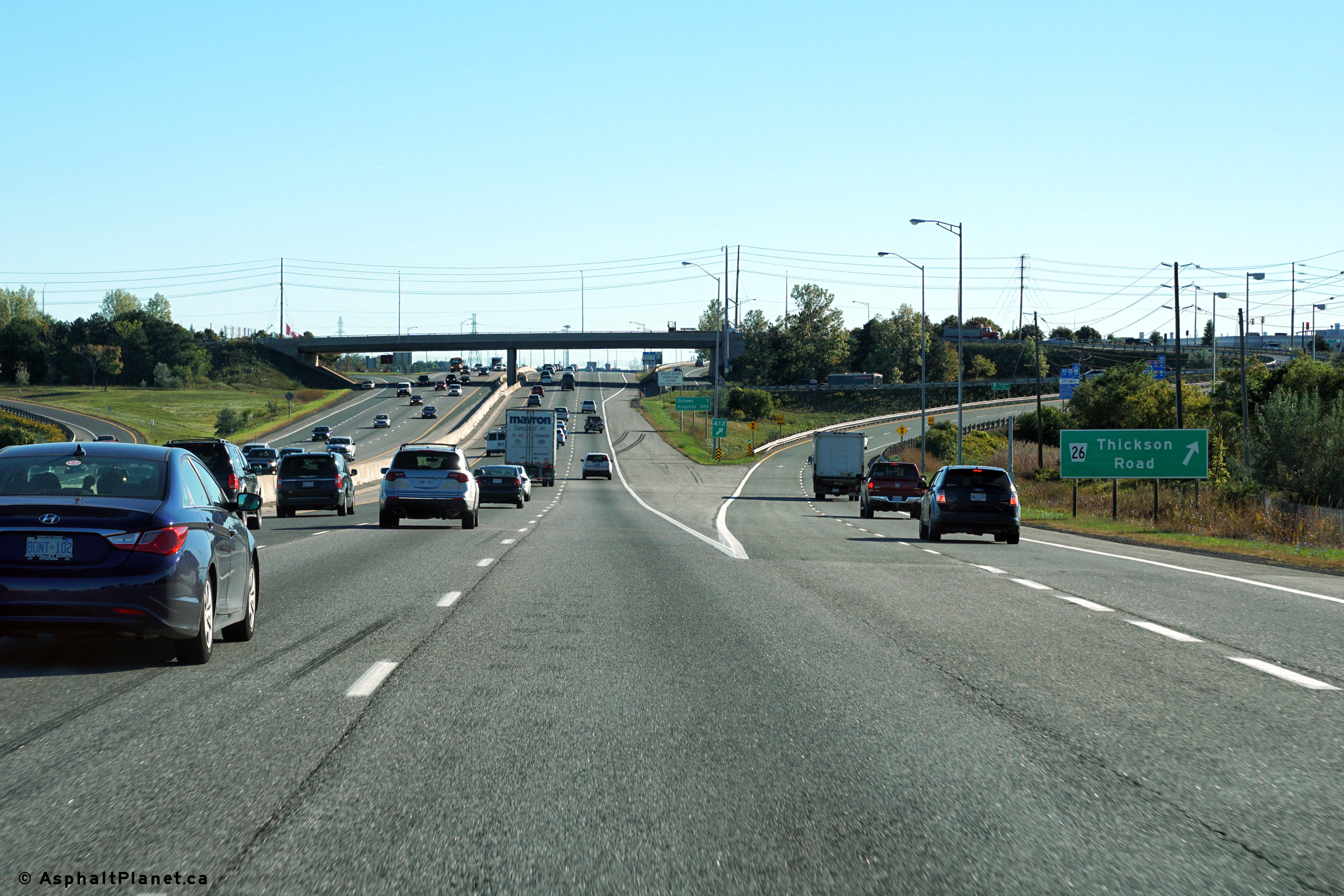
| Town of Whitby Regional Municipality of Durham |
Eastbound advanced signage for the Thickson Road interchange located
east of the Highway 12 interchange. Photo taken: September 24th, 2016. |
 (720x480) (720x480)(1440x960) (2400x1600) |
|||||
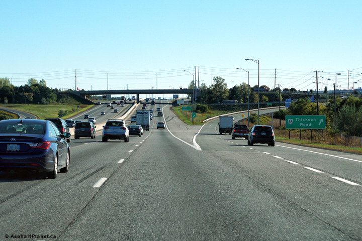
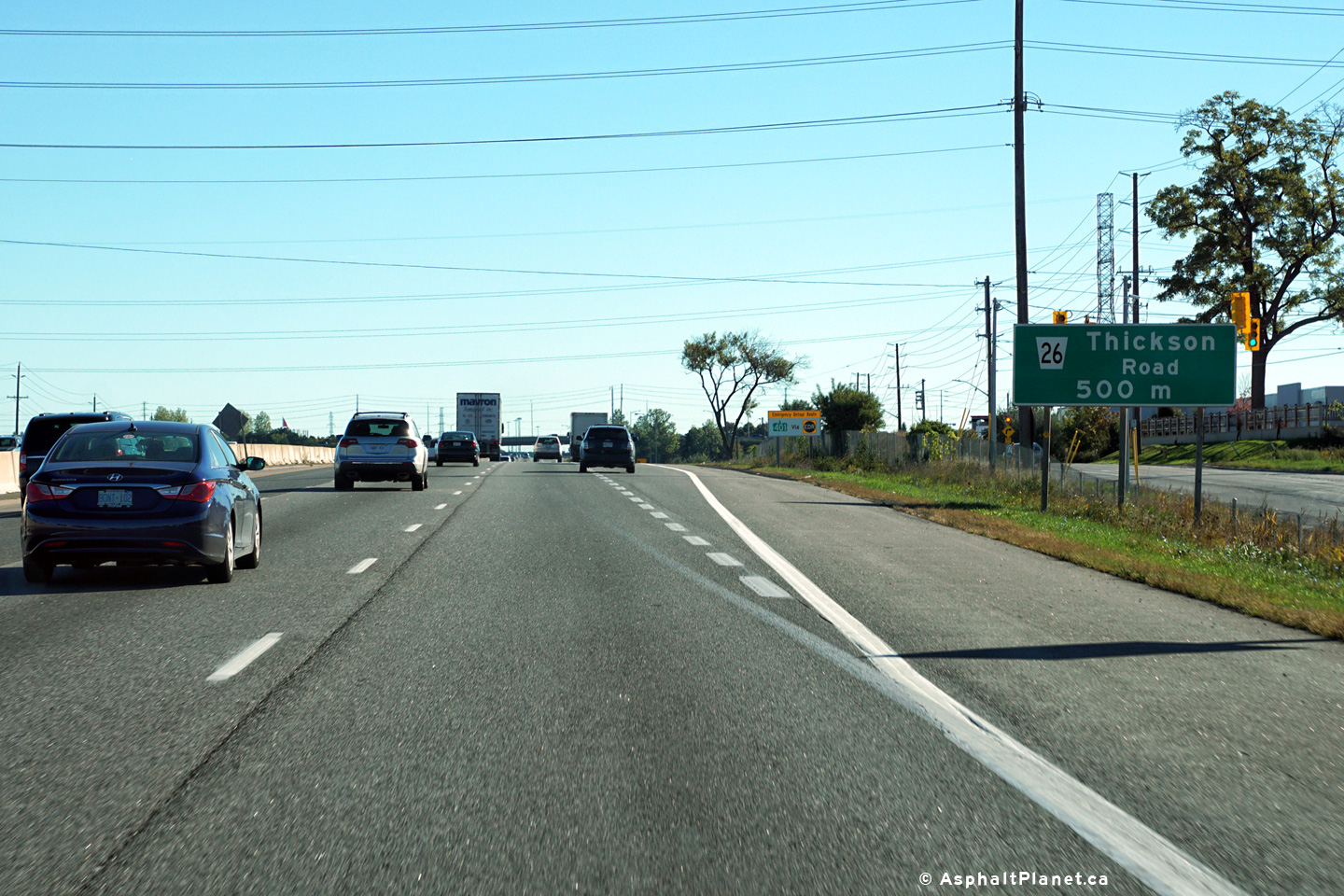
| Town of Whitby Regional Municipality of Durham |
A second advanced sign stands for the Thickson Road interchange, this
time only 500m upstream of the interchange. Photo taken: September 24th, 2016. |
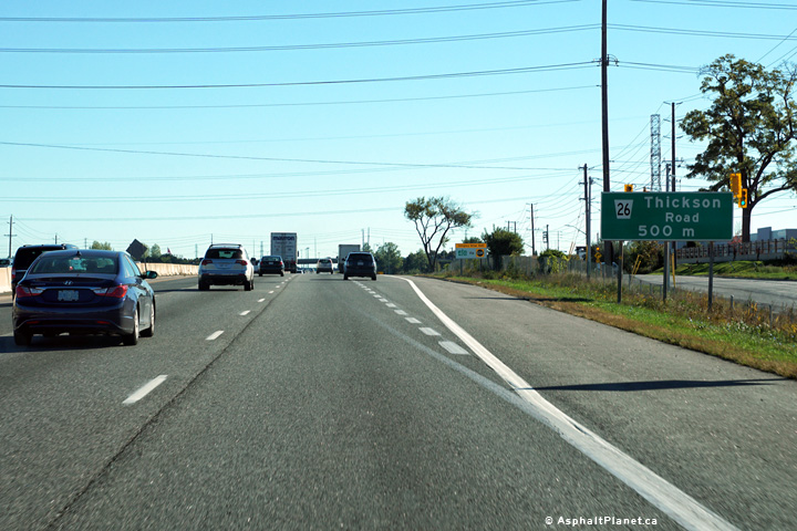 (720x480) (720x480)(1440x960) (2400x1600) |
|||||
| Town of Whitby Regional Municipality of Durham |
Older style Thickson Road sign heading eastbound through Whitby. The upper photo shows an older style trapezoidal sign for Thickson Road sign. This sign was subsequently replaced several years ago, as is featured in the lower photo.
Upper photo taken: December 20th, 2004.
Lower photo taken: September 24th, 2016. |
|
|||||
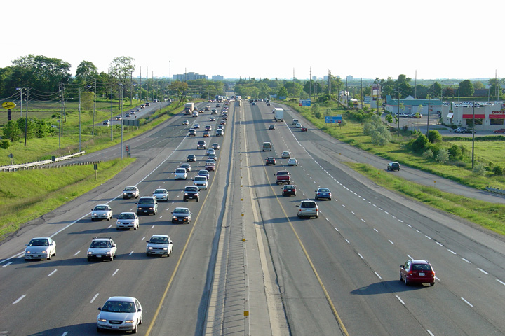
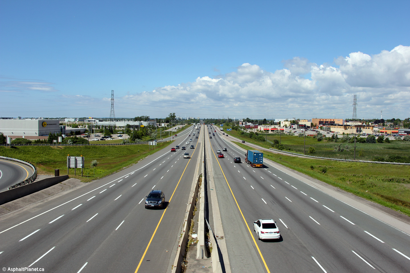
| Town of Whitby Regional Municipality of Durham |
Looking west from the Thickson Road overpass.
The Thickson Road overpass was one of the first interchanges to be
reconfigured from its 1947 design. The current Thickson Road overpass
was completed in 1982. Click here
for an additional view looking easterly from the Thickson Road overpass,
taken in May, 2006. Upper photo taken: June 11th, 2004. Lower photos taken: July 10th, 2015. |
 |
|||||
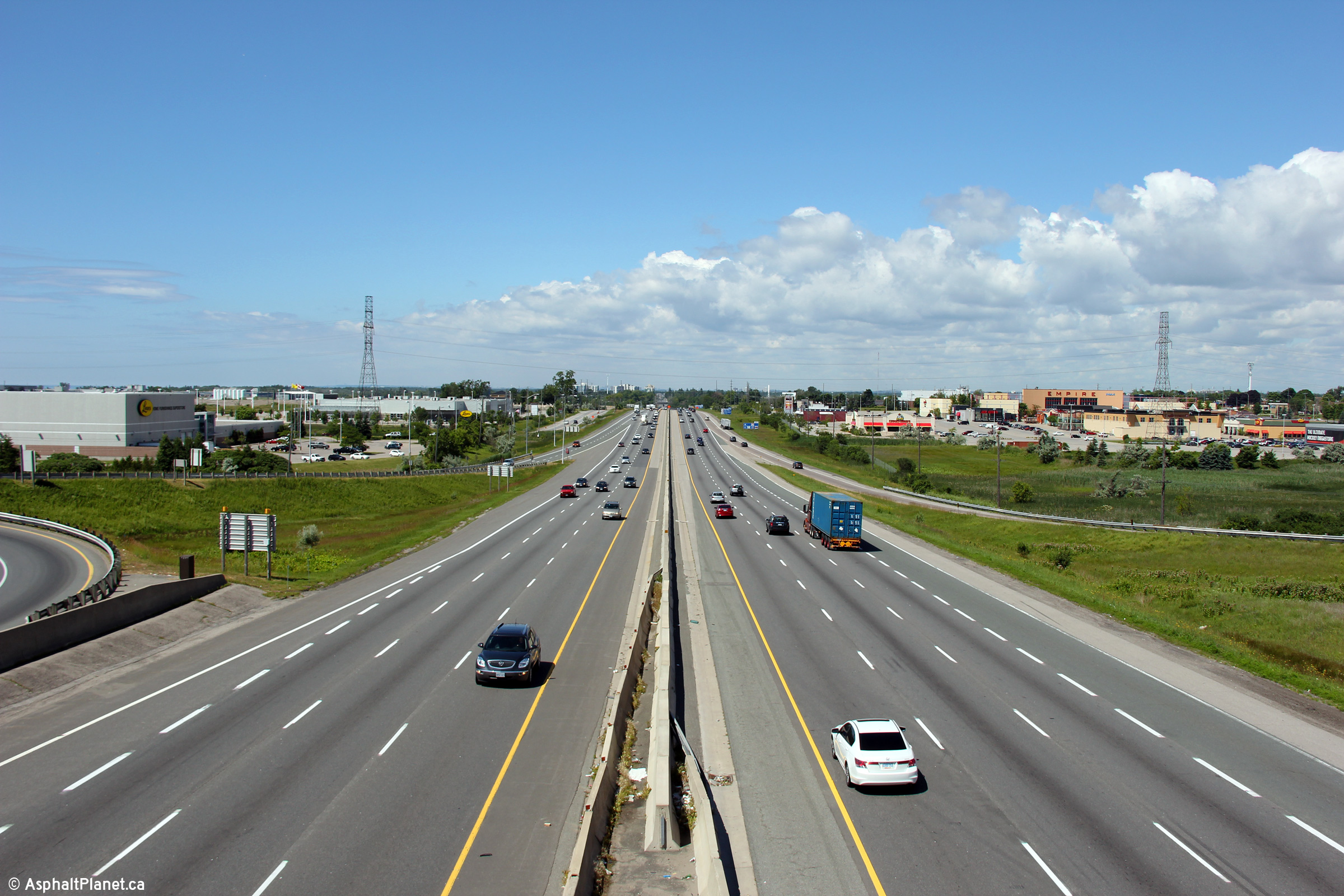
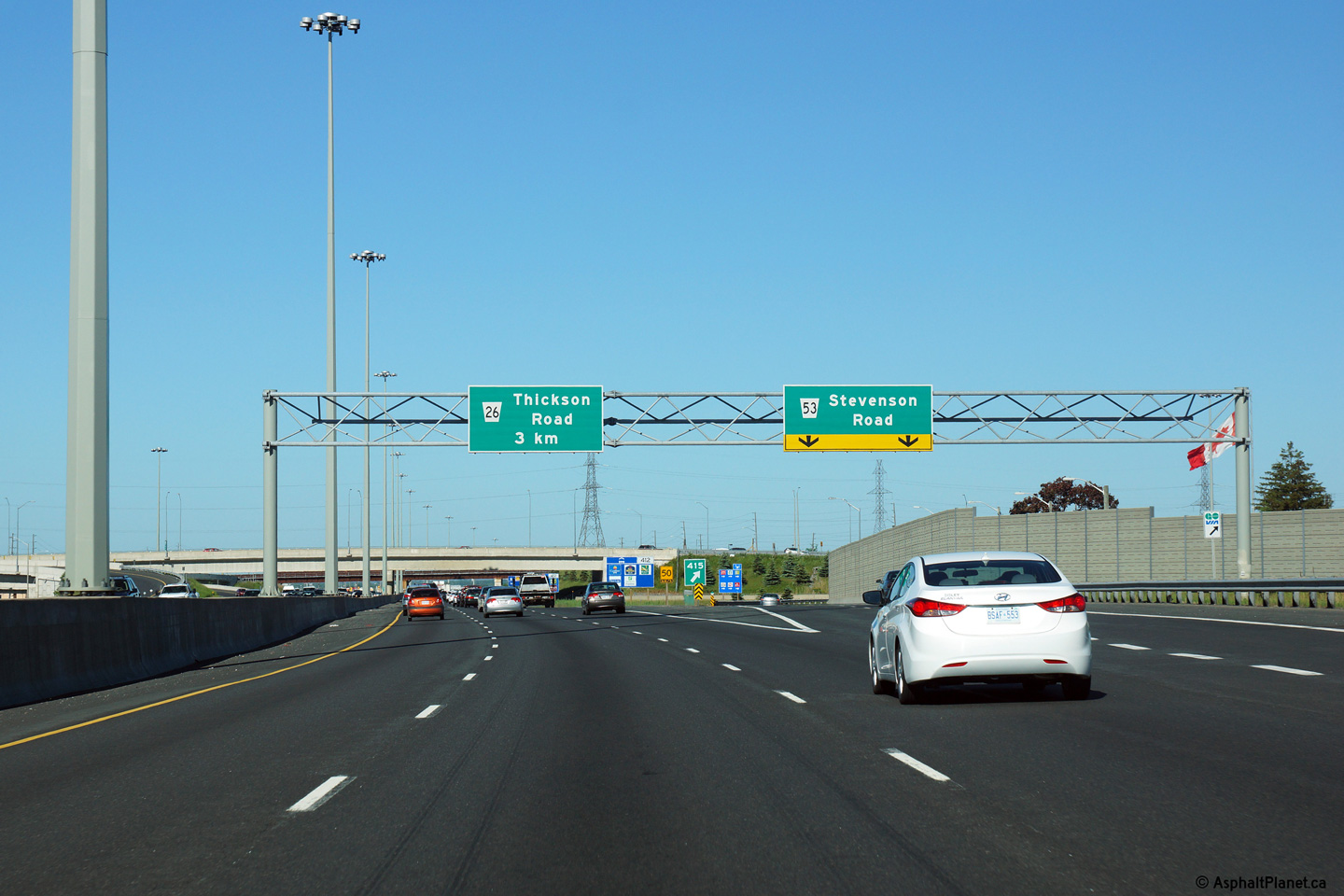
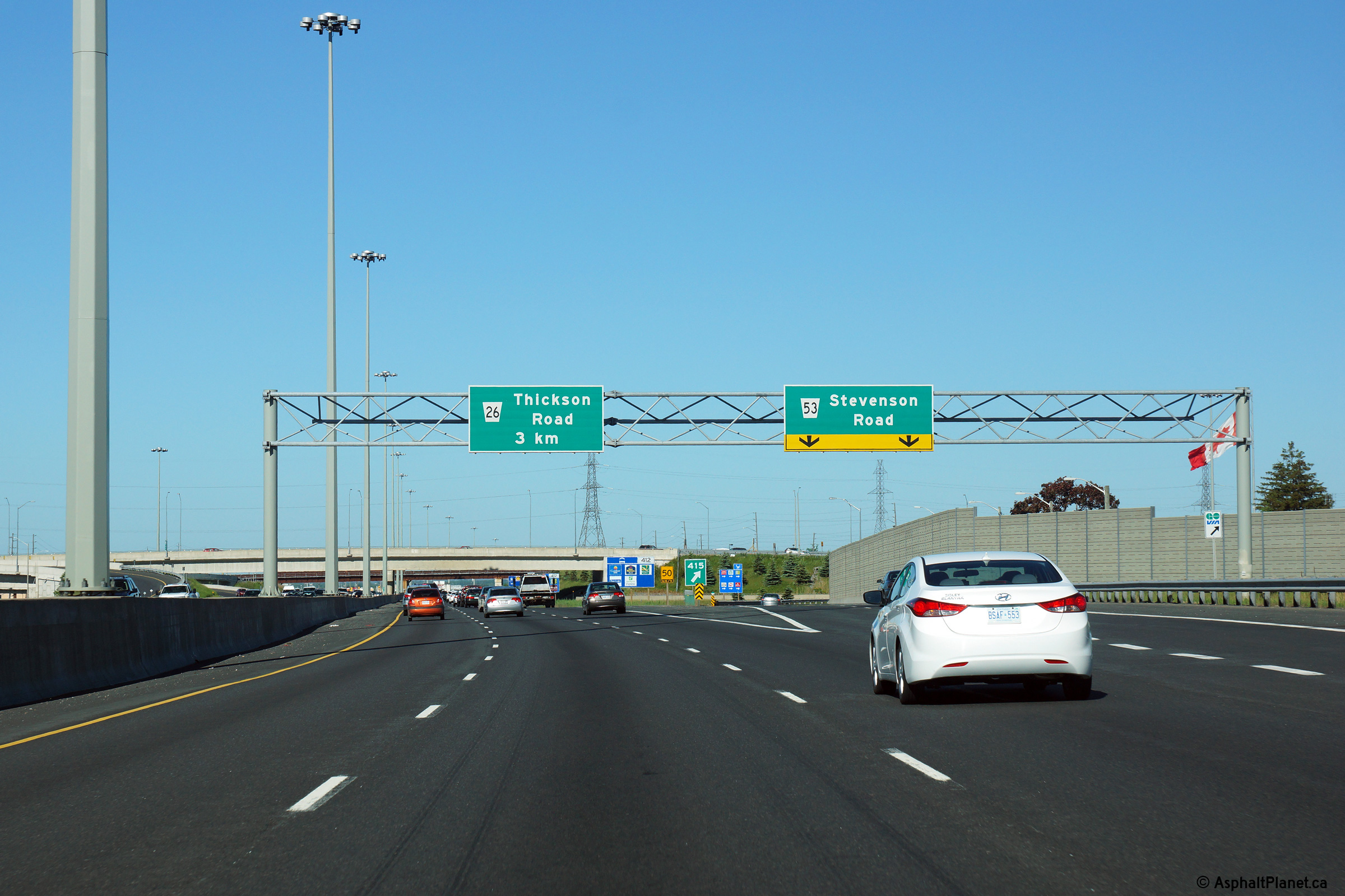
| Town of Whitby Regional Municipality of Durham |
View looking easterly towards the Stevenson Road
interchange from the Thickson Road overpass.
Click here for an additional view
looking easterly from the Thickson Road overpass, taken in May, 2006. Upper photo taken: June 11th, 2004. Lower photos taken: July 10th, 2015. |
 (720x480) (1440x960) (2400x1600)  (720x480) (1440x960) (2400x1600) |
|||||
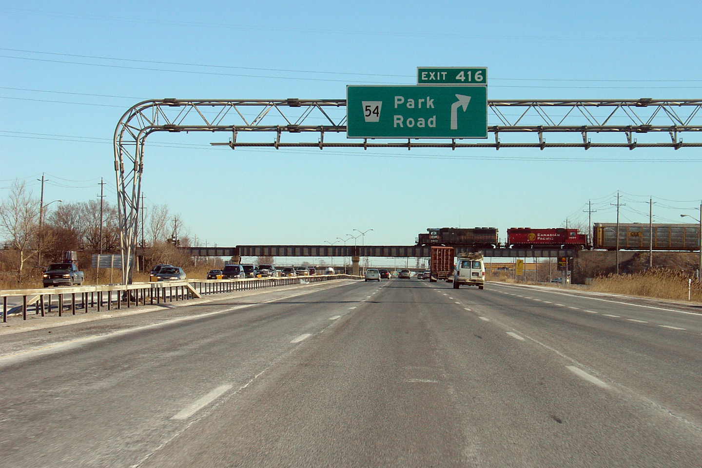
| City of Oshawa Regional Municipality of Durham |
Eastbound advanced signage approaching the Park Road and Stevenson Road
interchanges. The Park Road interchange was permanently closed and
replaced by the Stevenson Road interchange during a multiyear
construction project that was completed in 2010. Upper photo taken: December 20th, 2004. Lower photo taken: September 11th, 2011. |
|
|||||
| City of Oshawa Regional Municipality of Durham |
Signage for both the Park Road and Stevenson Road interchanges.
Upper photo taken: December 20th, 2004.
Lower photo taken: September 11th, 2011. |
|
|||||
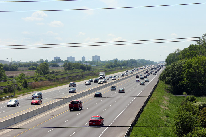
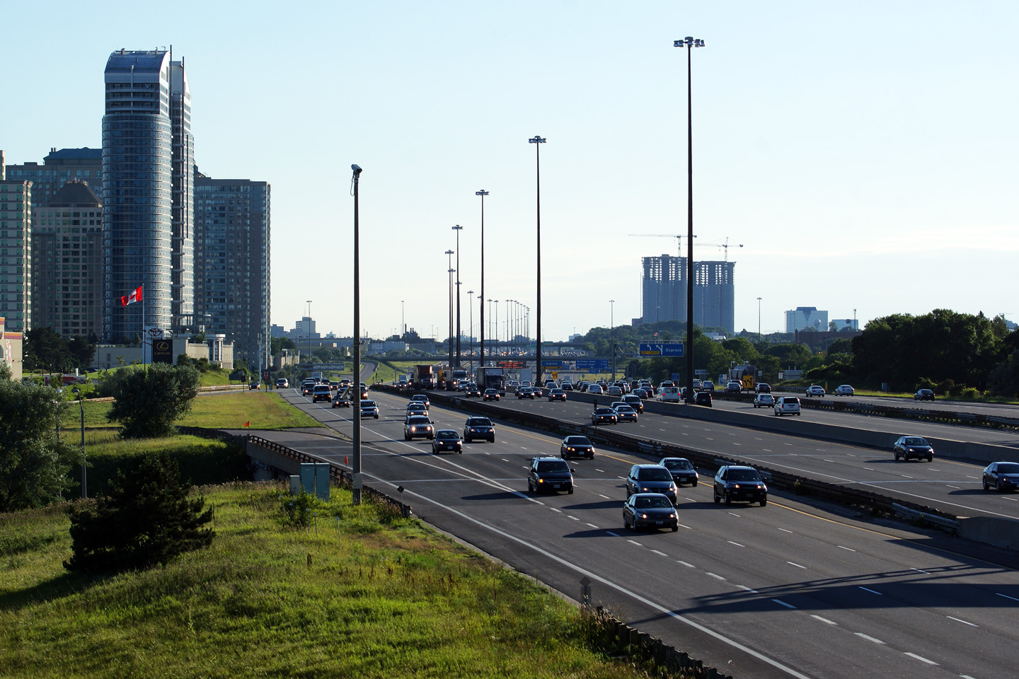
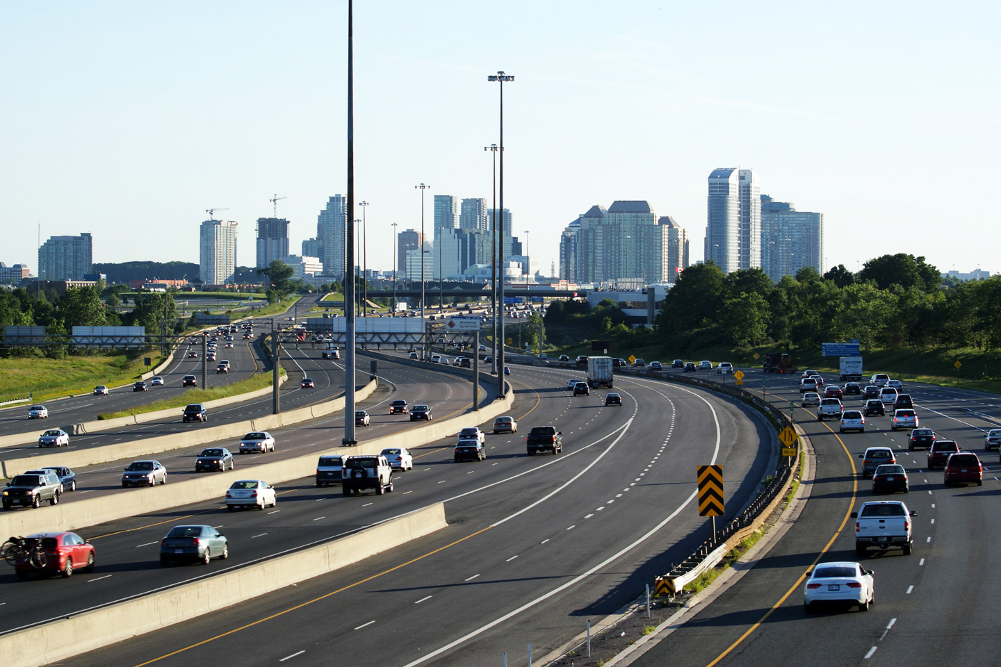
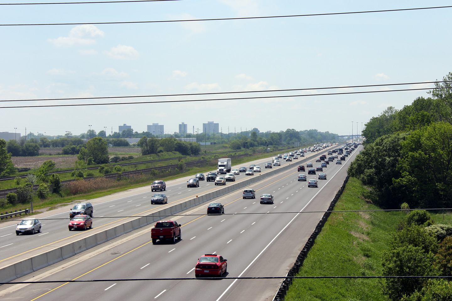
| City of Oshawa Regional Municipality of Durham |
View looking westerly towards Toronto from the Oshawa rail spur.
The Toronto skyline is visible from this vantage point. Photo taken: October 16th, 2012. |
 (720x480) (1440x960) (2400x1600) |
|||||
| City of Oshawa Regional Municipality of Durham |
This view looks easterly towards the Stevenson Road interchange from the
Oshawa Rail spur. The off-ramp from the eastbound 401 passes
overtop of Bloor Street before intersecting Stevenson Road. Photo taken: October 15rh, 2012. |
 (720x480) (1440x960) (2400x1600) |
|||||
| City of Oshawa Regional Municipality of Durham |
A series of views looking westerly from the Stevenson Road interchange.
The upper (2005) photo was taken before construction had began to
construct a new interchange at Stevenson Road to replace the outdated
Park Road interchange. The middle (2007) photo was taken during
construction. As is displayed in the photo, the centreline of
Highway 401 was shifted considerably to the north at Stevenson Road.
The lower (2011) photo shows completed on the new Stevenson Road
interchange. Upper photo taken: May 20th, 2005. Middle photo taken: November 25th, 2007. Lower photo taken: July 3rd, 2011. |
 |
|||||
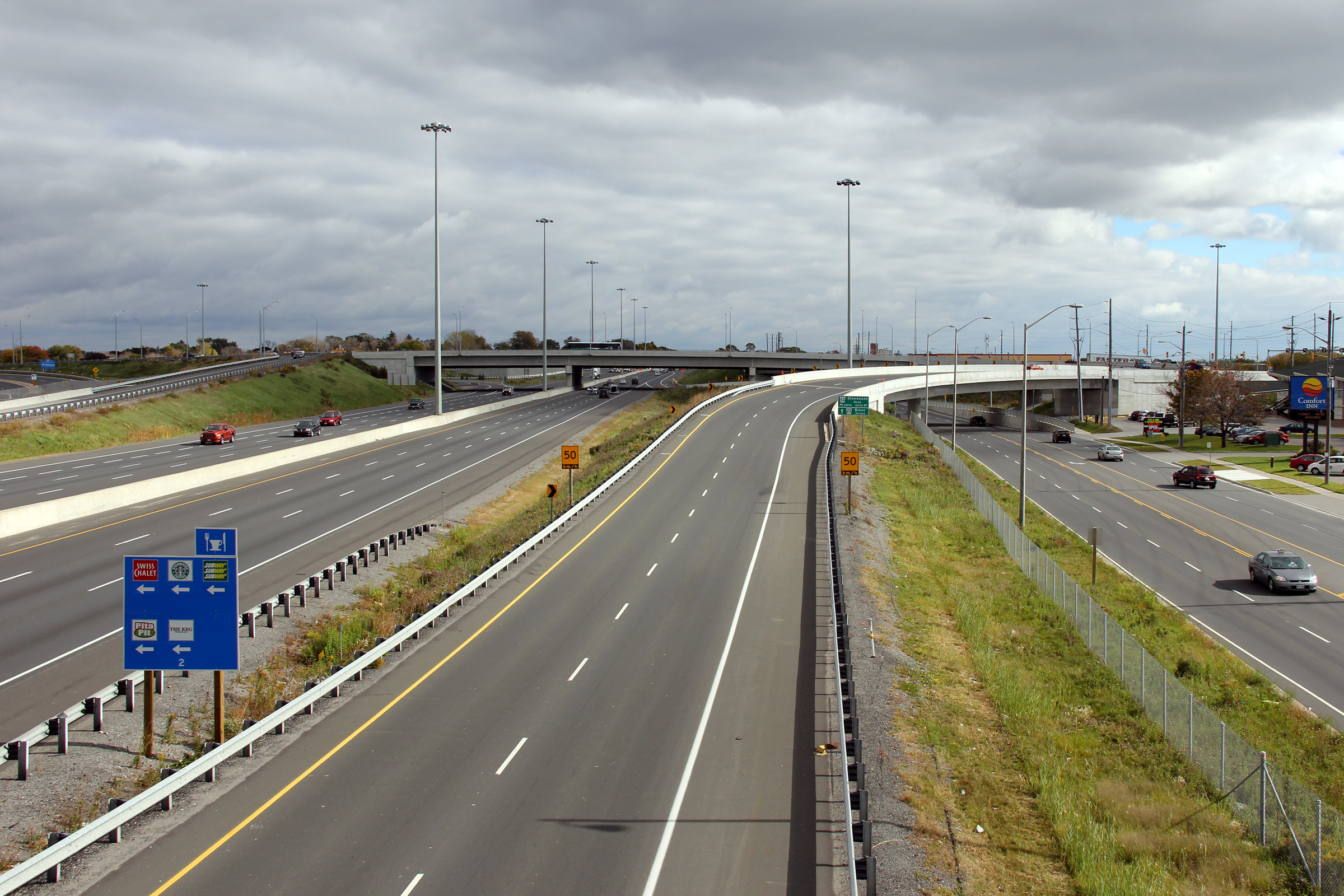
| City of Oshawa Regional Municipality of Durham |
Easterly views from the Stevenson Road overpass. The Park Road
interchange was permanently closed in 2007/2008 to be replaced with a
new interchange at Stevenson Road. Upper photos taken: May 20th, 2005. Lower photo taken: July 3rd, 2011. |
 (720x480) (1440x960) (2400x1600) |
|||||
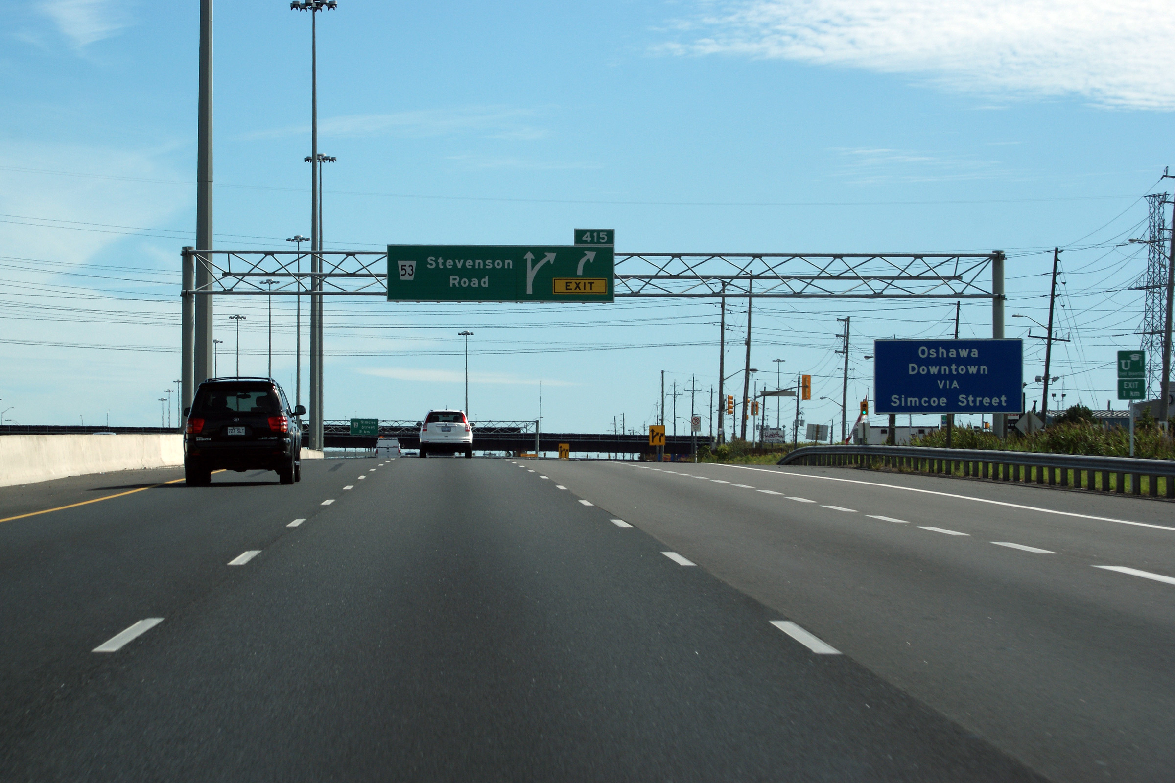
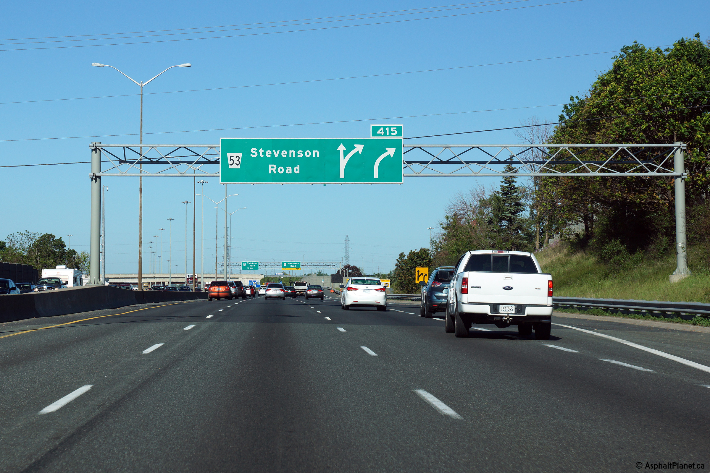
| City of Oshawa Regional Municipality of Durham |
Signage at the westbound off-ramp to Stevenson Road. Photo taken: June 6th, 2015. |
 (720x480) (720x480)(1440x960) (2400x1600) |
|||||
| City of Oshawa Regional Municipality of Durham |
Westbound advanced signage for the Stevenson Road interchange. Photo taken: June 6th, 2015. |
 |
|||||
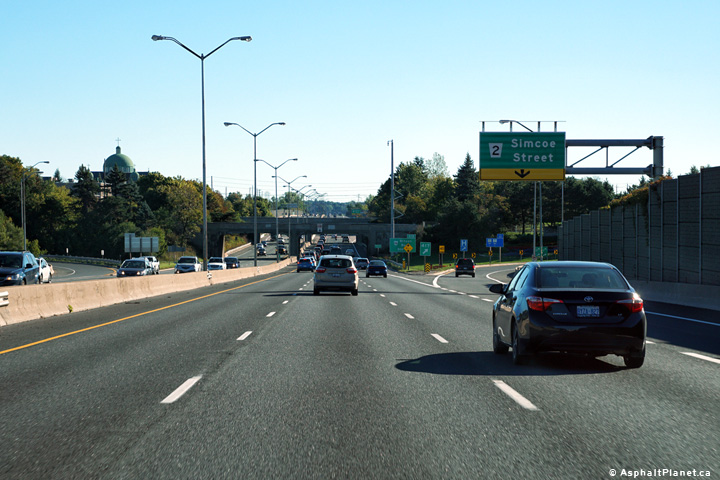
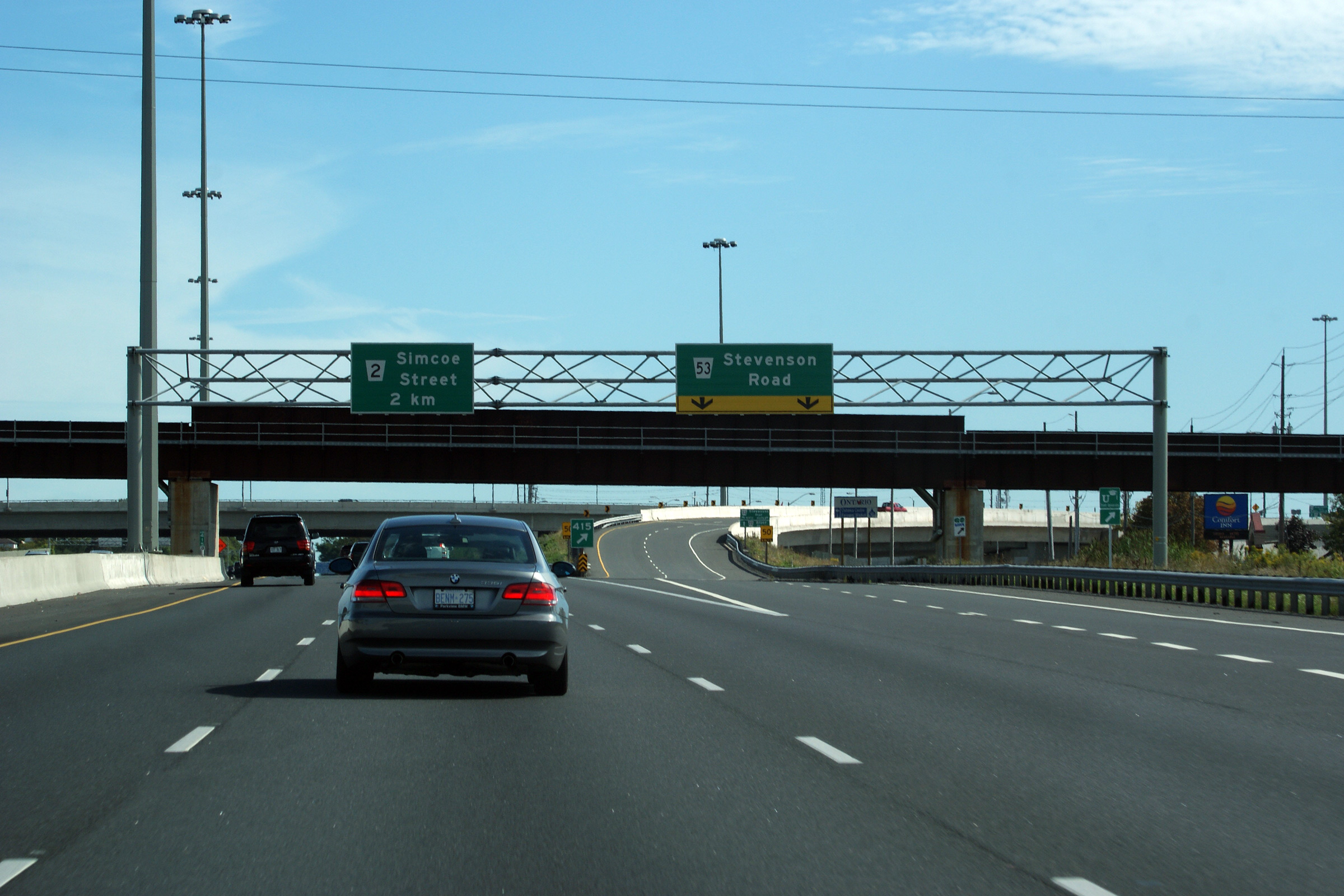
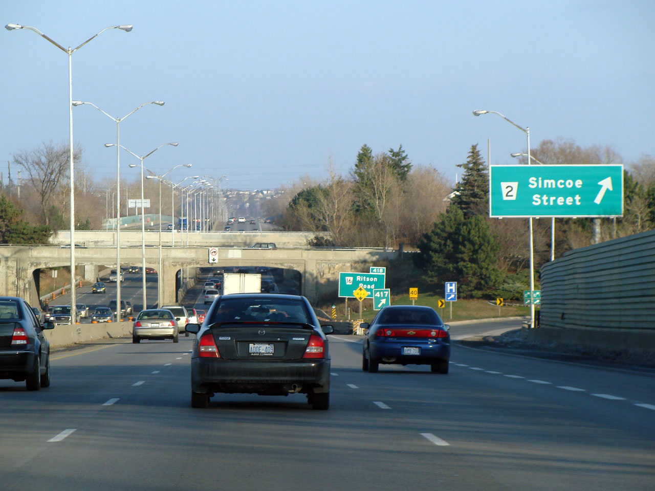
| City of Oshawa Regional Municipality of Durham |
Eastbound view towards the Simcoe Street
interchange. The 401 is quite narrow through Oshawa with some of the
oldest freeway infrastructure in the province. This photo gallery
shows the modern history of highway signage through Osahwa. Photo #1 taken: December 20th, 2004. Photo #2 taken: November 25th, 2007. Photo #3 taken: September 24th, 2016. |
 (720x480) (720x480)(1440x960) (2400x1600) | |||||
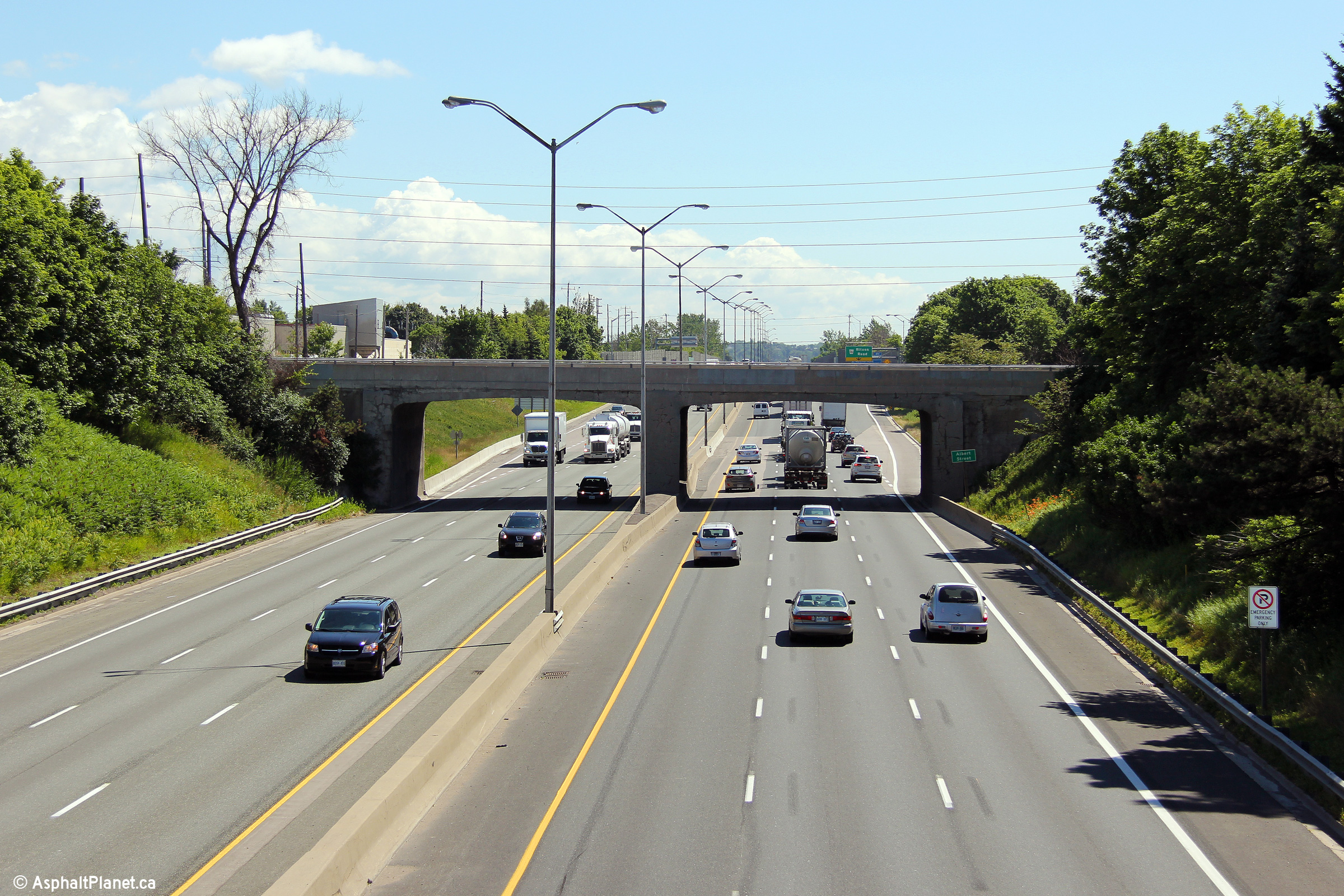
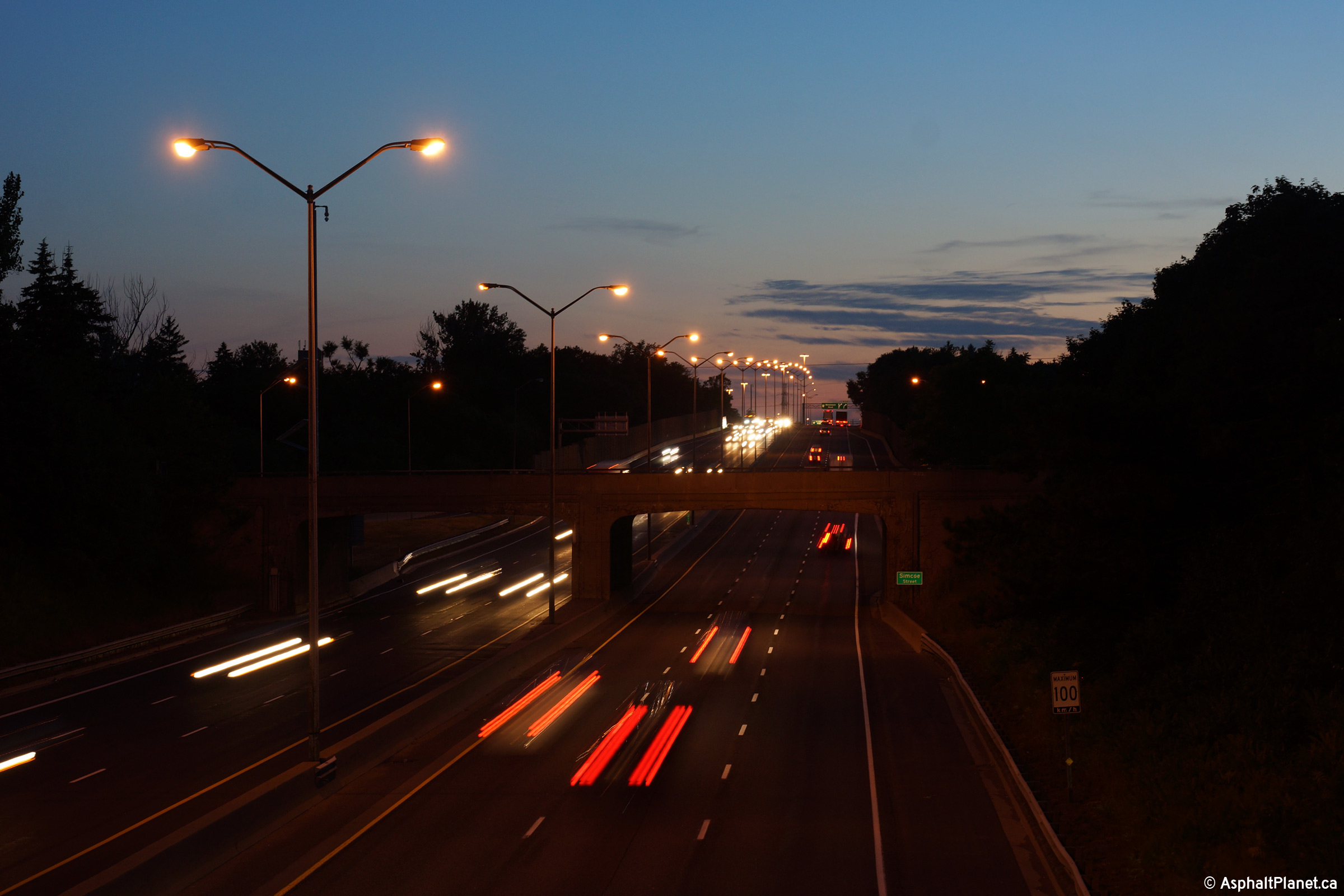
| City of Oshawa Regional Municipality of Durham |
View looking easterly as Highway 401 passes beneath both the Simcoe
Street and Albert Street overpasses. Photo taken: September 24th, 2016. |
 (720x480) (720x480)(1440x960) (2400x1600) |
|||||
| City of Oshawa Regional Municipality of Durham |
Looking west from the Simcoe Street overpass in South Oshawa.
Though not discernible from the photo, only a west-side partial
interchange links Simcoe Street to Highway 401. When Highway 401
was first constructed, this was a full interchange, however the eastern
loop ramps were removed in the late 1970s to allow the 401 to be 6-laned
through the Simcoe Street underpass. Upper photo taken: May 20th, 2005. Lower photo taken: July 10th, 2015. |
|
|||||
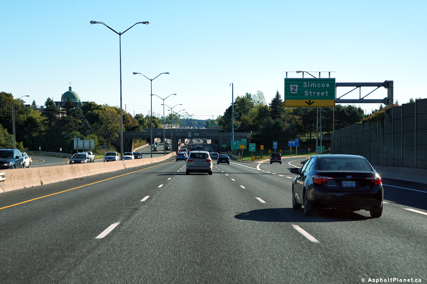
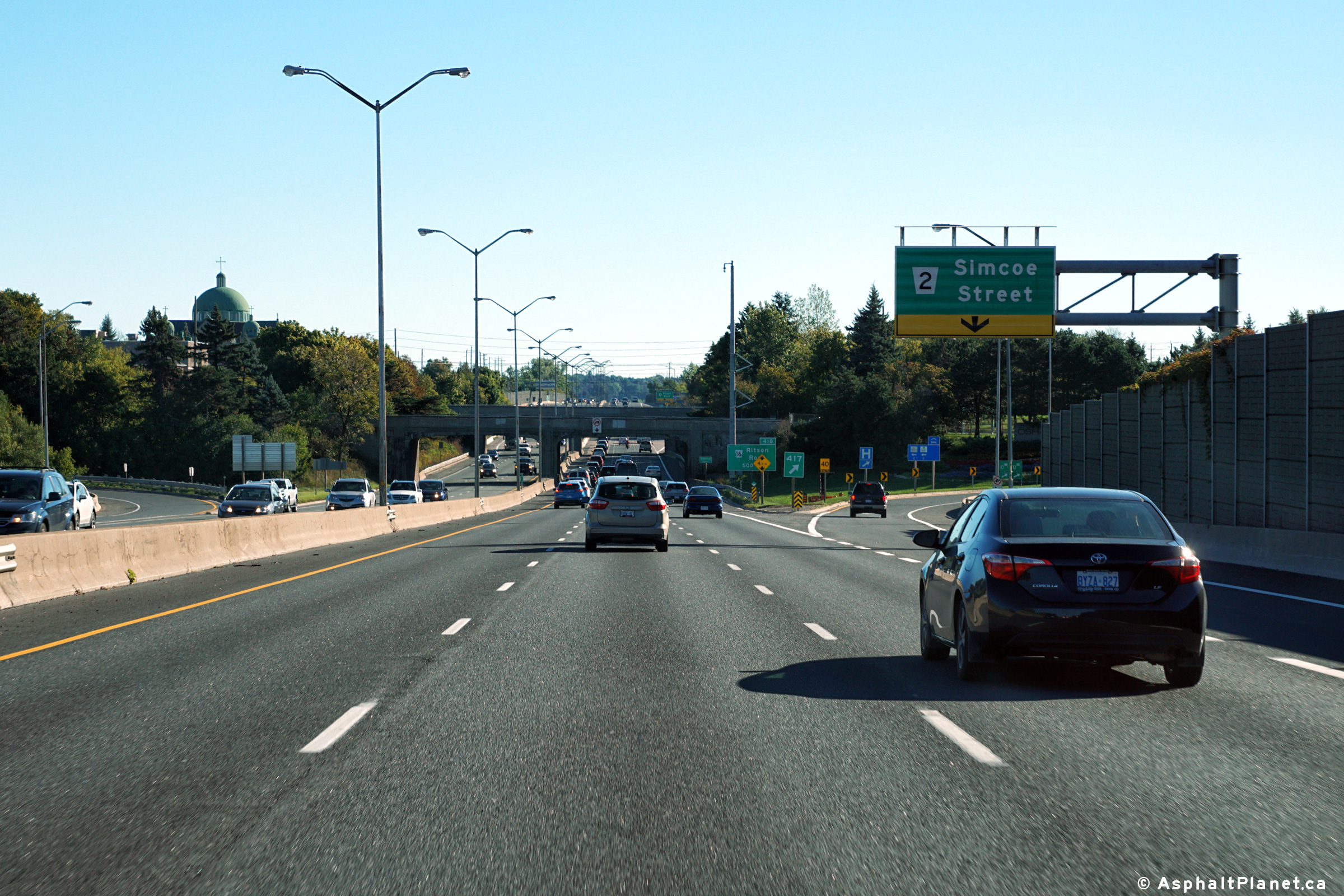
| City of Oshawa Regional Municipality of Durham |
Looking east from the Simcoe Street overpass towards the Albert Street
overpass in Oshawa. Simcoe Street is located at roughly kilometre
marker 417. Upper photo taken: May 20th, 2005. Lower photo taken: July 10th, 2015. |
|
|||||
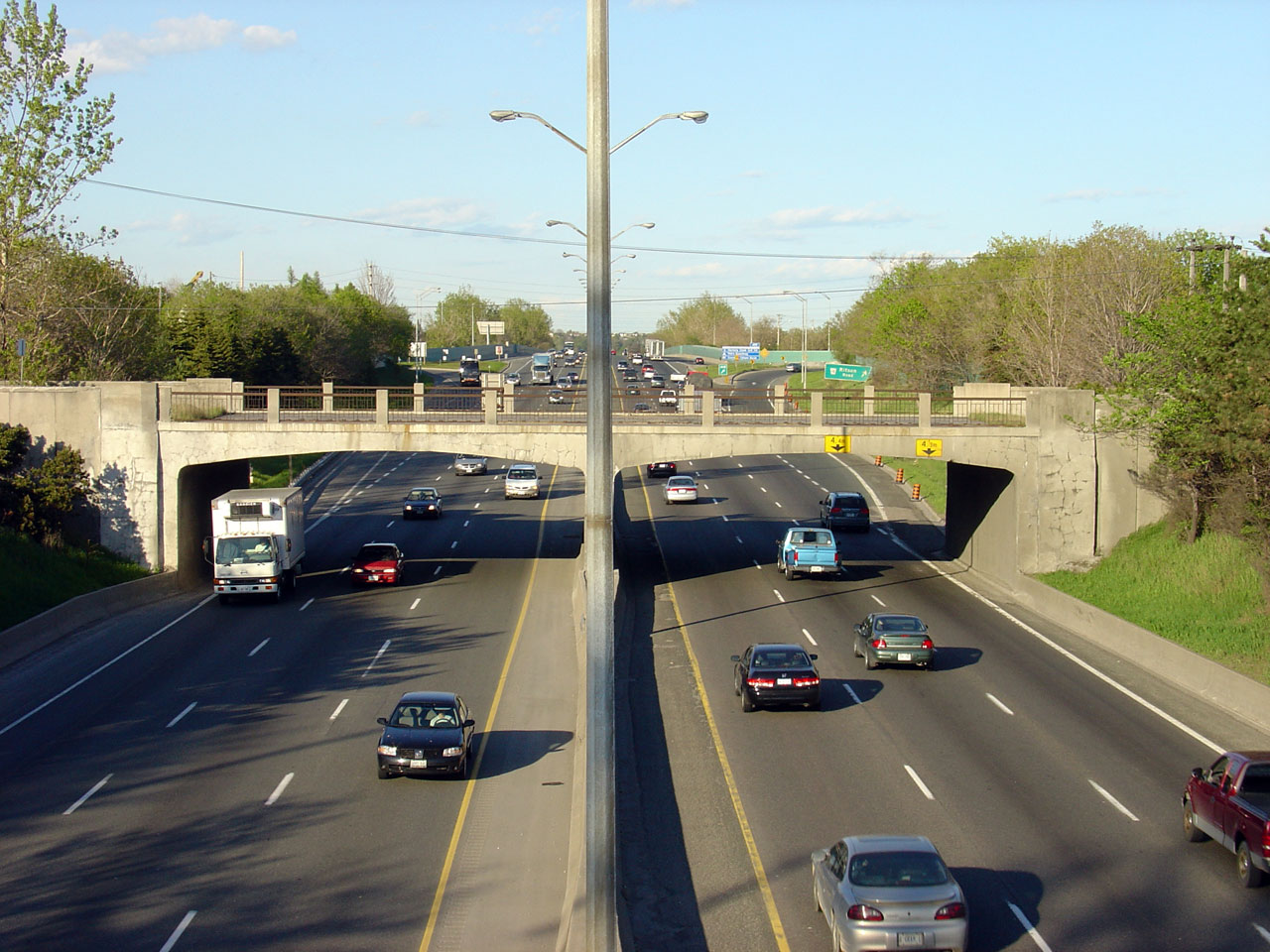
| City of Oshawa Regional Municipality of Durham |
Looking west from the Albert Street overpass towards the Simcoe Street
overpass. As noted above, it is easy to see why the old loop ramps
were removed at the Simcoe Street interchange considering how narrow
these old historic overpasses are. Photo #1 taken: May 20th, 2005. Photo #2 taken: July 10th, 2015. Photo #3 taken: August 8th, 2015. |
|
|||||
| City of Oshawa Regional Municipality of Durham |
A series of views looking easterly from the Albert Street overpass.
The upper photo highlights the now demolished abandoned CNR Oshawa Spur overpass. This overpass was decommissioned in the early
1990s, and was later demolished in 2011. Before it was demolished,
it was the final Highway 2A era structure to retain its original
railings Prior to 1952, Highway 401 was know as Highway 2A. Photo #1 taken: May 20th, 2005. Photo #2 taken: July 10th, 2015. Photo #3 taken: August 8th, 2015. |
(720x480) (1440x960) (2400x1600)
|
|||||
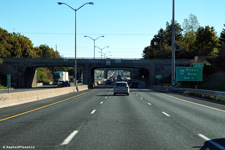
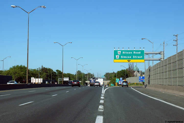
| City of Oshawa Regional Municipality of Durham |
Eastbound signage at the off-ramp to Ritson Road. Photo taken: September 24th, 2016. |
 (720x480) (720x480)(1440x960) (2400x1600) |
|||||
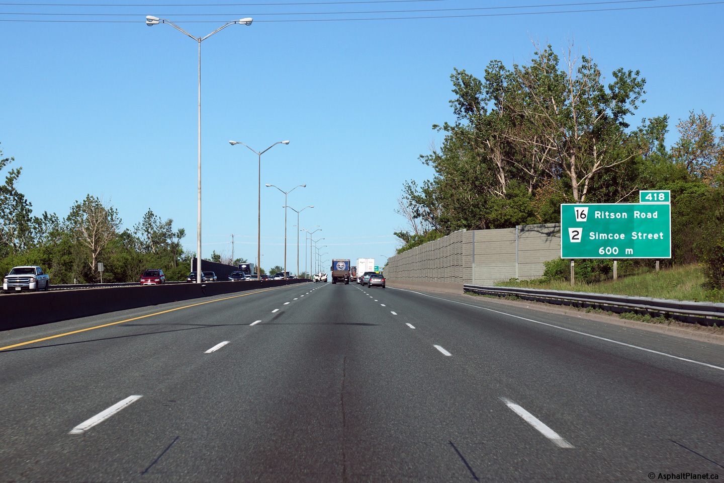
| City of Oshawa Regional Municipality of Durham |
Westbound signage for the ramp to Ritson Road and Simcoe Street.
Because of the close proximity of the Ritson Road and Simcoe Street
interchanges, the westbound off-ramps were consolidated into a single
ramp when the 401 was widened to six lanes in the 1970s. Photo taken: June 6th, 2015. |
 |
|||||
| City of Oshawa Regional Municipality of Durham |
Westbound advanced signage for the off-ramp to Ritson Road and Simcoe
Street. Photo taken: June 6th, 2015. |
 |
|||||
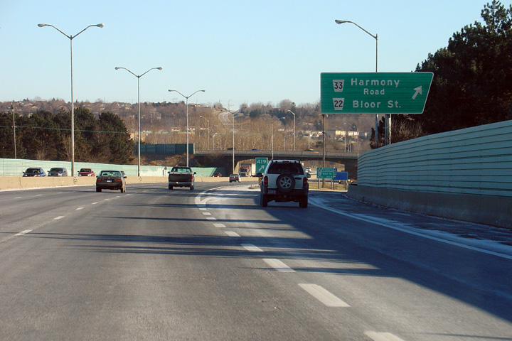
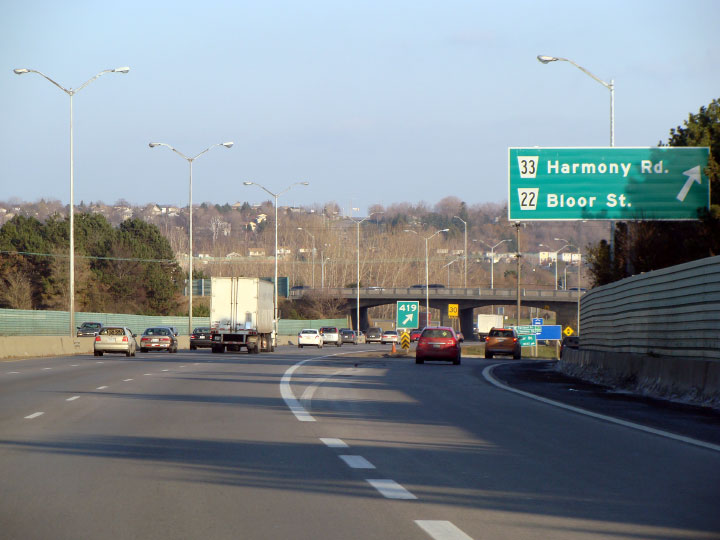
| City of Oshawa Regional Municipality of Durham |
Eastbound advanced signage approaching the Harmony Road interchange. Photo taken: September 24th, 2016. |
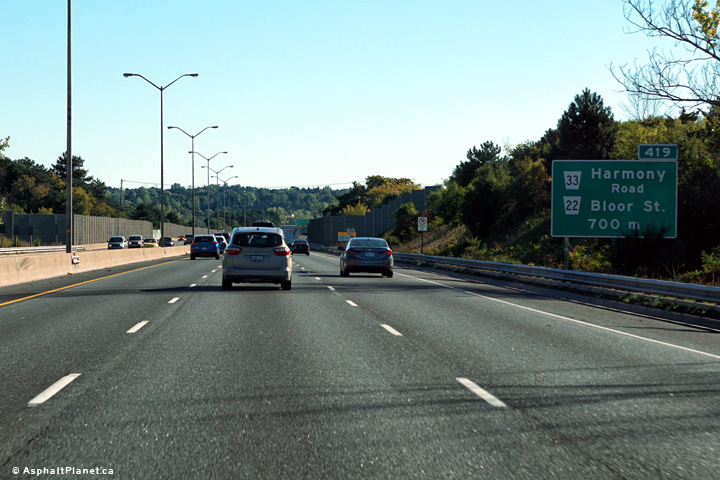 (720x480) (720x480)(1440x960) (2400x1600) |
|||||
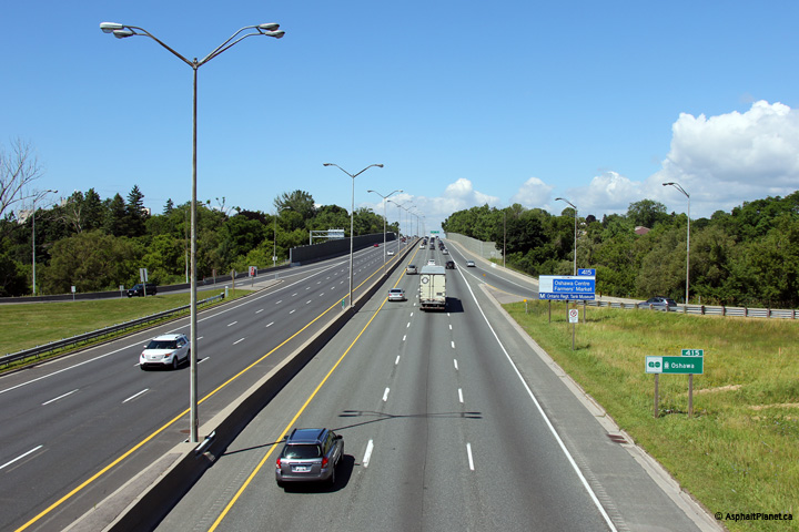
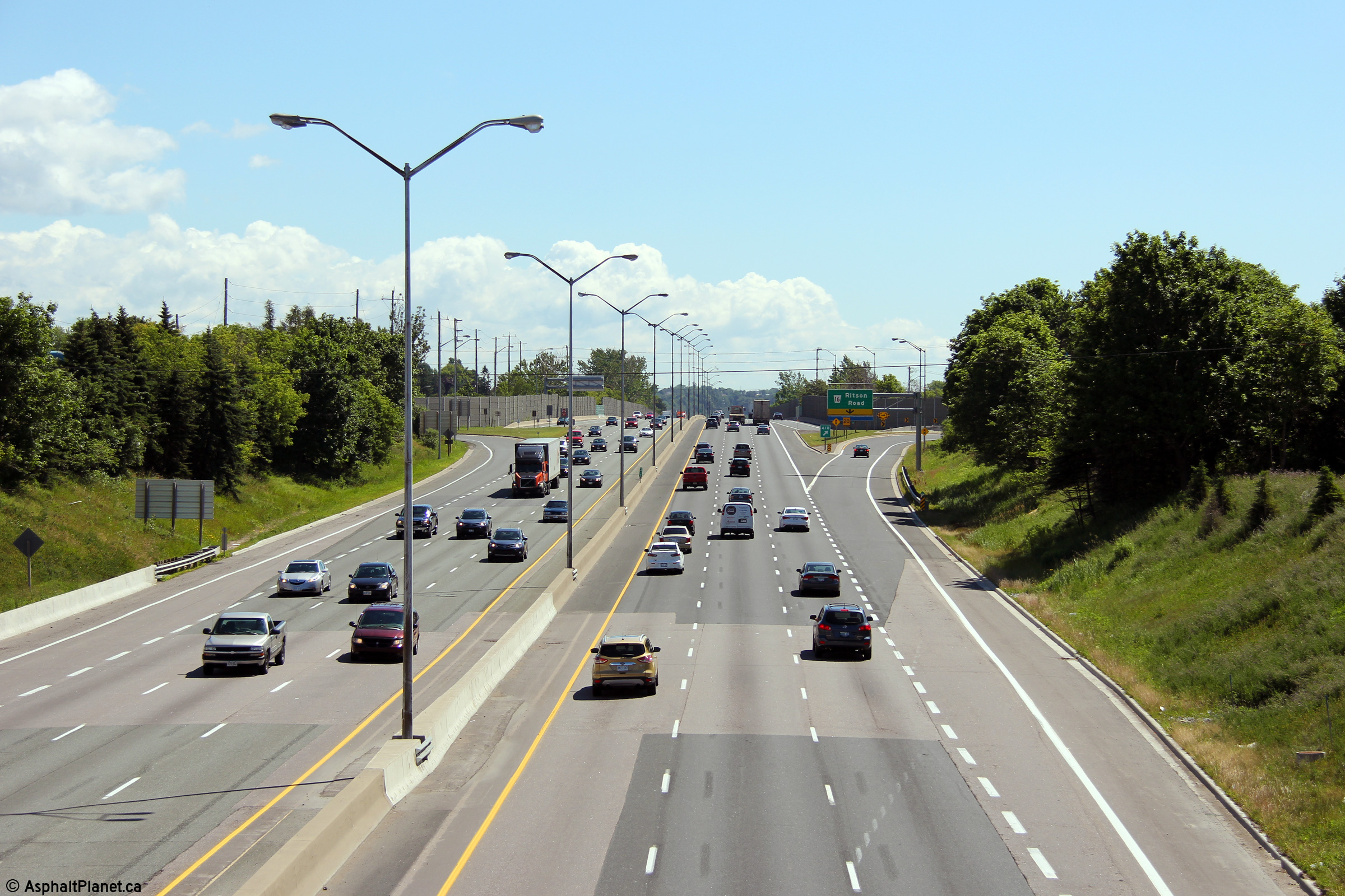
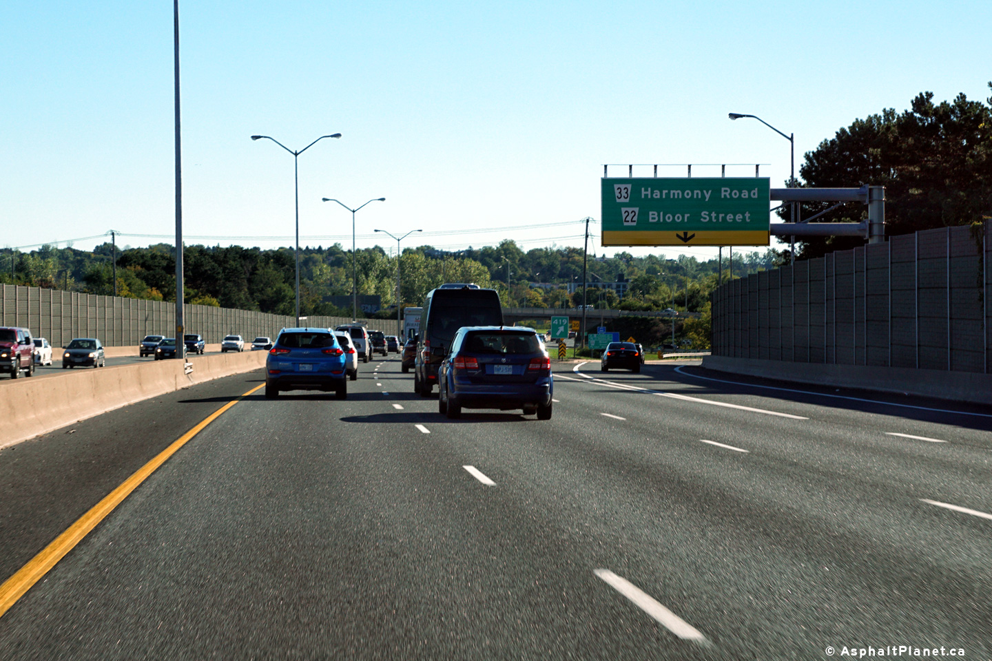
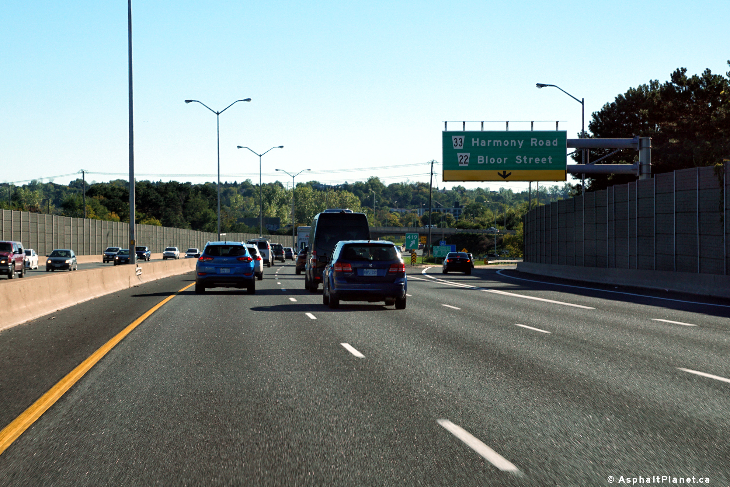
| City of Oshawa Regional Municipality of Durham |
Highway 401 driving eastbound at the Harmony Road exit. East of Harmony Road, Highway 401 leaves urban Oshawa, heading out of the GTA and to a more rural part of Ontario. Surprisingly no reference of the connection to Oshawa's Farwell Street, which is effect Harmony Road's continuation south of the 401. Photo #1 taken: December 20th, 2004. Photo #2 taken: November 25th, 2007.
Photo #3 taken: September 24th, 2016. |
|
|||||
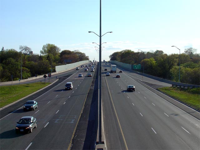
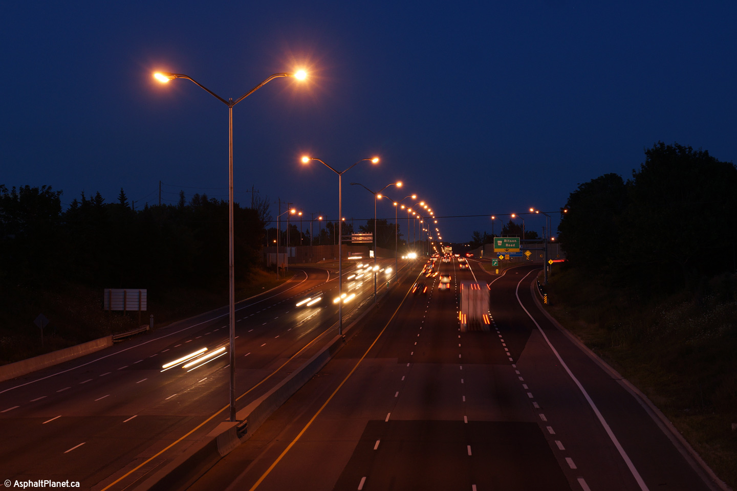
| City of Oshawa Regional Municipality of Durham |
View looking west from the Harmony Road overpass
towards Oshawa. Notice the odd lighting that is found exclusively on
Highway 401 throughout Oshawa. Though the mast is conventional, each
mast carries 4 bulbs; two-bulb truss lighting was typical during this time
period. Photo taken: May 30th, 2007. |
 |
|||||
| Continue east via Oshawa to Cobourg to Images | |||||||
<- Page 10 Images Highway 401 Images Index Page 12 Images ->
<- Highway 400 Images Back to Highway 401 Highway 402 Images ->
Copyright (c) 2004-2024, AsphaltPlanet.ca AsphaltPlanet@asphaltplanet.ca

 (720x480)
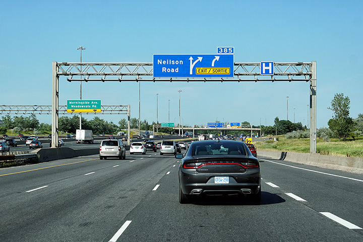


 (720x480)


 (720x480)
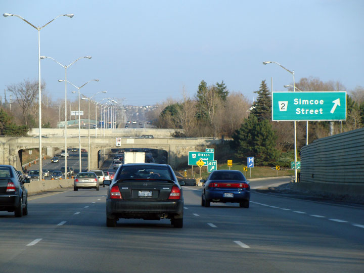


