Secondary Highway 529 - Secondary.OntHighways.com
Highway 529 is a retired
alignment of Highway 69 that was bypassed circa 1960. Traffic volumes are
low for its entire length, and this highway serves very little provincial
purpose.
There is no lower-tiered municipality to transfer this highway to, which is
why it has remained in the provincial highway system for so long.

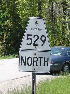
Secondary Highway 529 Shield
|
|
Southern Terminus: Junction Highway 69 2 km
north of Pointe Au Baril Station.
Northern Terminus: Junction Highway 69 just south of the Magnetawan River
Length: 25.7 km
Multiplexes: None
Orientation: North-South
Regions Served: Parry Sound District
AADT (2001): Highest: 420, from Highway 69 (south jct) to Highway 529A;
Lowest: 50, from Highway 529A to Highway 645.
Road Info: Highway 529 is in pretty
good shape for its entire length (especially considering how low its traffic
volumes are). |
Communities and Intersections along and Highway 529 from South to
North:
Highway 529 - Images
Secondary.OntHighways.com
- Home
Copyright (c) 2004,2005, Scott Steeves (Webmaster)
webmaster@onthighways.com
Page last updated: November 13th, 2006
Page created: June 1st, 2004
