Secondary
Highway 651 - Secondary.OntHighways.com
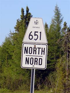
Highway 651 runs north from Highway
101 to the Missinabi CPR crossing near Missinabi. Highway 651 is a fairly
desolate highway, and serves to connect Missanbi and Dalton to the rest of the
provincial highway network. Highway 651 was unaffected during the
downloading sprees of the late 1990s.
Secondary Highway 651 Shield
|
|
Southern Terminus:
Highway 101 junction about halfway between Chapleau and Wawa.
Northern Terminus: Missinabi CPR crossing just east of Missinabi
Length: 53.9 km
Multiplexes: None
Orientation: North-South
Regions
Served: Algoma District
AADT (2002):
170, for the entire length of Highway 651
Road Info: Coming Soon! |
Communities and Intersections along and Highway 651 from South to
North:
|
Proper Municipality Name |
Community Name |
Distance |
Intersecting
Road |
| District of Algoma |
----- |
0 km / 53.9 km |
King's Highway 101 |
| District of Algoma |
----- |
27.5 km / 26.4 km |
Dalton Road |
| District of Algoma |
----- |
51.3 km / 2.6 km |
Renabie Road |
| District of Algoma |
----- |
53.9 km / 0 km |
(Missinabie CPR Crossing) |
|
Highway 651 Ends |
Highway 651 - Images
Secondary.OntHighways.com
- Home
www.OntHighways.com - Home
Copyright (c) 2004-2007, Scott Steeves (Webmaster)
webmaster@onthighways.com
Page last updated: October 13th, 2006
Page created: February 12th, 2005