Secondary
Highway 657 - Secondary.OntHighways.com
Highway 657 is a short highway that
leads east of Highway 105 at Ear Falls. Despite being located entirely
within an organized municipality it was not downloaded in the late 1990s.
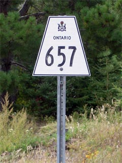
Secondary Highway 657 Shield
|
|
Western Terminus:
Junction Highway 105 in Ear Falls
Eastern Terminus:
At Wier's Goldpines camp in the tiny community of Goldpines.
Length: 6.0km
Multiplexes: none
Orientation: East-West
Regions Served: Kenora District
AADT (2002):
410, for the entire length of Highway 657.
Road Info: Highway 657 is paved
for its entire length, and has a rural posted speed limit of 80km/h. |
Communities and Intersections along and Highway 540 from West to East:
|
Proper
Municipality Name |
Community Name |
Distance |
Intersecting
Road |
| Township of Ear Falls |
Ear Falls |
0km / 6.0km |
King's Highway 105 |
| Township of Ear Falls |
Goldpines |
6.0km / 0km |
----- |
|
Highway 657 Ends |
Highway 657 - Images
Secondary.OntHighways.com - Home
www.OntHighways.com - Home
Copyright (c) 2004-2007, Scott Steeves (Webmaster)
webmaster@onthighways.com
Page last updated: September 25th, 2006
Page created: September 25th, 2006