
QUEEN ELIZABETH WAY
1978
| |
Looking south along southbound Highway 10 (Hurontario Street) at where it interchanges with the QEW in Mississauga. This interchange, which was Canada's first cloverleaf interchange, was reconfigured to a half parclo/half diamnond design in 2009. Autumn of 1978. |
 |
Toronto-bound QEW approaching the Dixie Road overpass in Mississauga. As I pointed out in some of the 1981 photos, this stretch of highway is adorned with DHO era illumination. Autumn of 1978. |
 |
Looking east along the Toronto-bound QEW at the Etobicoke Creek bridge on the Toronto/Peel line. Autumn of 1978. |
 |
Overhead gantry located on the Toronto-bound QEW near the Highway 427 interchange. The sign indicates the exit for the small collector lane segment, approximately 1.5 kilometres to the east. Here's the same gantry in 1989. Notice that in 1978, the Islington Avenue exit is indicated as northbound only. Autumn of 1978. |
| Express lanes of the Hamilton-bound QEW, approximately 1 kilometre east of the Highway 427 interchange. Kipling Avenue overpass in the background. Second shot is a close up of the first. Notice the collector lanes BBS indicating Kipling Avenue NORTH only. In c. 2005, years after the City of Toronto took possession of the QEW from the MTO, the city augmented the ramp to allow for access to southbound Kipling Avenue. Autumn of 1978. |   |
| Looking west along the Hamilton-bound QEW between Royal York Road and Islington Avenue in Etobiocke. The short collector lane segment on the QEW in Etobicoke is to limit the effects of weaving between the closely spaced Kipling and Islington Avenue interchanges. Autumn of 1978. | 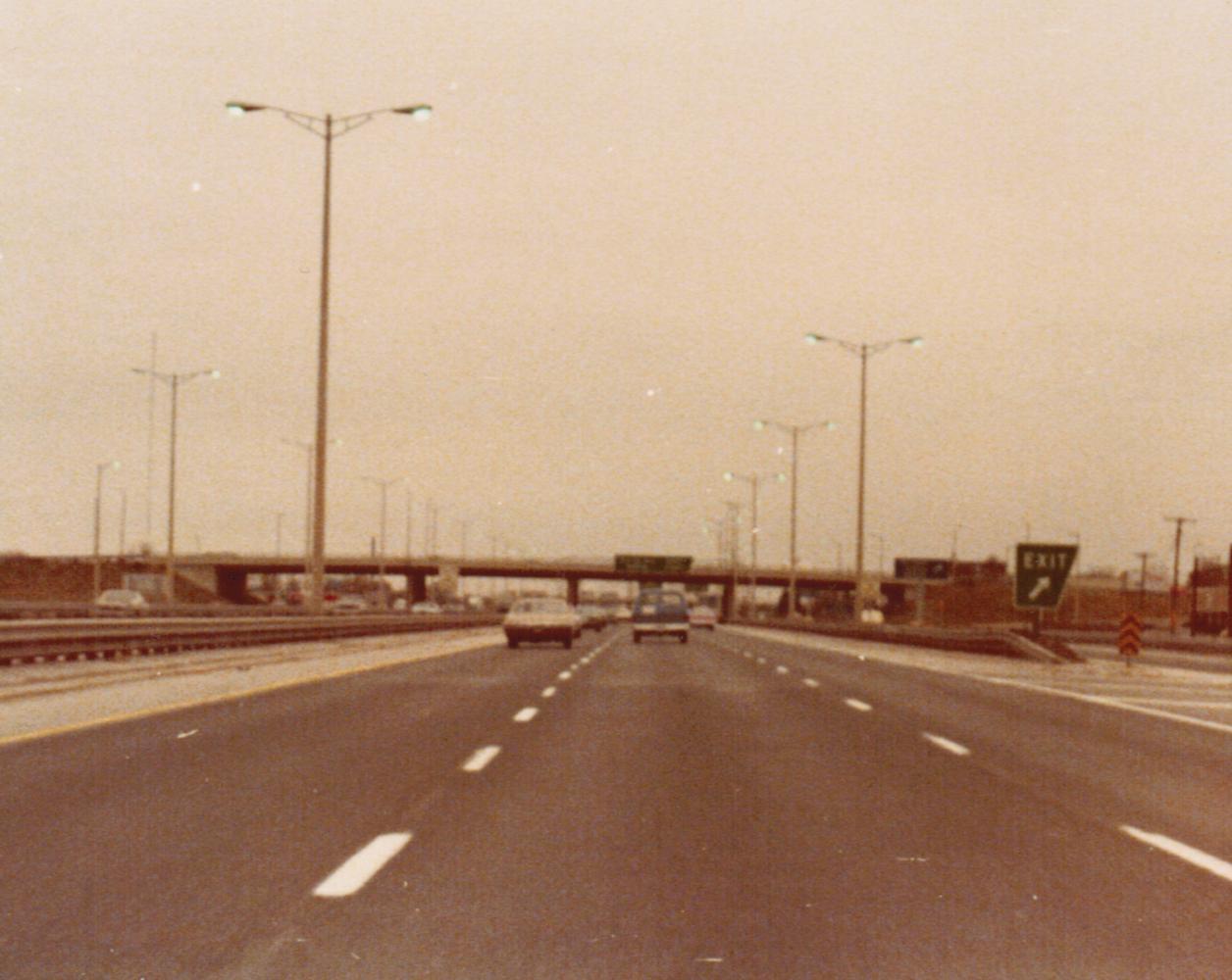 |
 |
 Facing east along the Toronto-bound QEW collector lanes, just east of the Islington Avenue overpass in Etobicoke. This shot gives you a good idea of the proximity of some of the interchanges on the QEW east of Highway 427. Autumn of 1978. Facing east along the Toronto-bound QEW collector lanes, just east of the Islington Avenue overpass in Etobicoke. This shot gives you a good idea of the proximity of some of the interchanges on the QEW east of Highway 427. Autumn of 1978. |
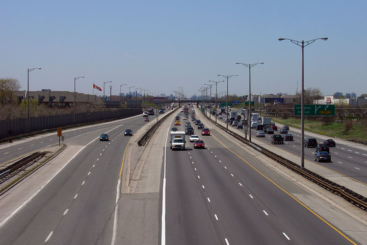
| Photo taken of the QEW from the Royal York Road overpass in Etobicoke, facing west towards Hamilton. Here's a shot of the QEW from the same location in 2005. Except for an increase in traffic volume, not much has changed. Autumn of 1978. |
 |
 |
Photo taken of the QEW from the Royal York Road overpass in Etobicoke, facing east towards Toronto. At 1.4 kilometres, the ramp from Toronto-bound QEW to Park Lawn Road, which is the carriageway on the right, is one of the longest of its kind in Ontario (EB 401 to Dixie Road offramp is longer at 2.3km, but came along about 10 years later). Autumn of 1978. |
 |
Looking east along the Toronto-bound QEW approximately 400 metres west of the Grand Avenue overpass. Autumn of 1978. |
| Hamilton-bound QEW approaching the Grand Avenue overpass in Etobicoke. Believe it or not, the BGS affixed to this overpass was only finally removed in the Spring of 2010. View 3:54-3:56 of this youtube video to see this sign just prior (2009) to its removal. Autumn of 1978. |  |
| Looking west along the Hamilton-bound QEW near the Park Lawn Road underpass in Etobicoke. Autumn of 1978. |  |