AsphaltPlanet.ca > Québec > Autoroute 19
|
Southern Terminus: At A-40/Autoroute Metropalitaine in northern
Montreal.
Northern Terminus: At A-440 and R-335 in Laval. A-19 is set to be extended northerly along R-335's alignment to A-640 with construction scheduled to commence in 2014. Regions: Agglomeration de Montreal, MRC de Laval Routing: A-19 is a short highway that carries commuter traffic between Montreal and Laval. On Montreal Island the highway is a six-lane divided arterial. In Laval, the highway is a six-lane freeway. A-19 developed a fair amount of notoriety in 2006 when the Boulevard de la Concorde Overpass collapsed killing five. Links:
|
Pictures on this page are arranged in order from south to north. A-19 North photos are left-aligned in the last column, while A-19 South photos are right-aligned. Center-line pictures are centered within the last column.
|
Location |
Description |
Photo |
||
|
North- |
South- |
|||
|
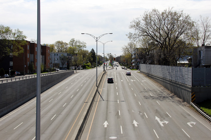
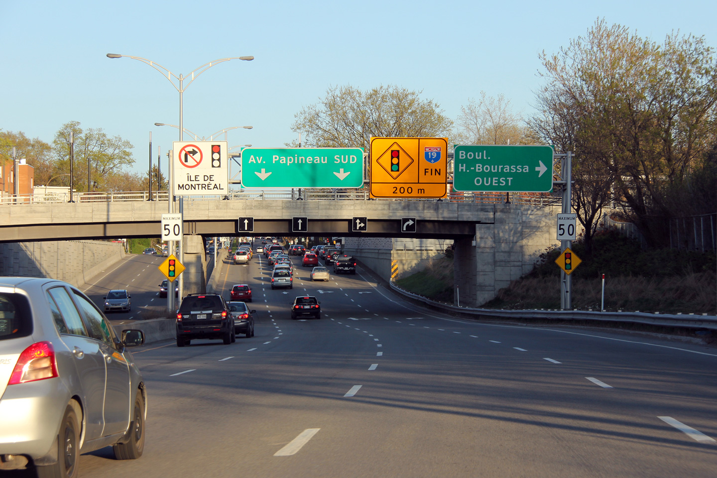
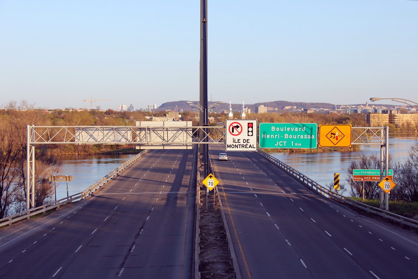
Agglomeration de Montréal |
Southerly view from the Boulevard Gouin overpass towards the signalized intersection with Boul. Henri-Bourassa. Autoroute 19 continues south of the intersection with Henri-Bourassa to Autoroute 40 as a six lane at-grade urban boulevard.
Vue en direction sud à partir du pont d'étagement du boul. Gouin vers le carrefour avec le boul. Henri-Bourassa. L'aut. 19 continue au sud de cet intersection vers l'aut. 40 comme un boulevard urbain à six voies. |
 |
||
|
Date: 5/6/2012 |
High-res: (1440x960) (2400x1600) | |||
|
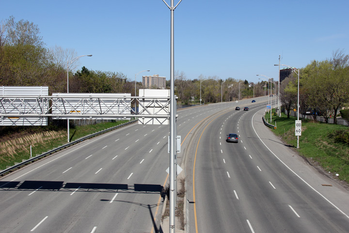
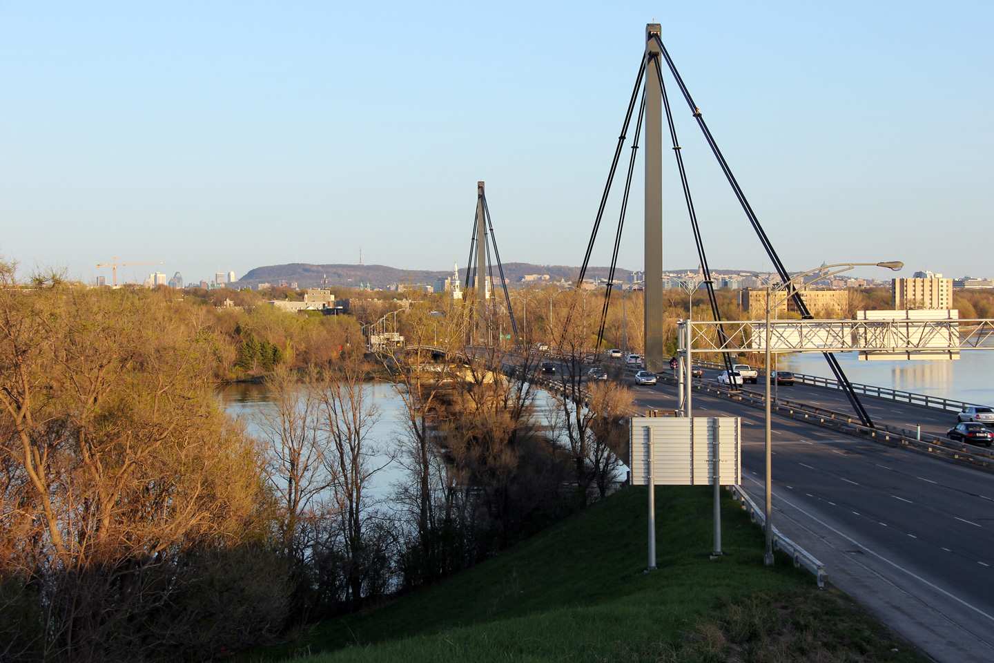
Agglomeration de Montréal |
Northerly view from the Boul. Gouin overpass. Just out of view, Autoroute 19 crosses Rivière des Praries across the Papineau-Leblanc Bridge.
Vue en direction nord à partir du viaduc du boul. Gouin. Tout juste sorti de vue de la photo, l'autoroute 19 enjambe la rivière des Praires sur le pont Papineau-Leblanc. |
 |
||
|
Date: 5/6/2012 |
High-res: (1440x960) (2400x1600) | |||
|
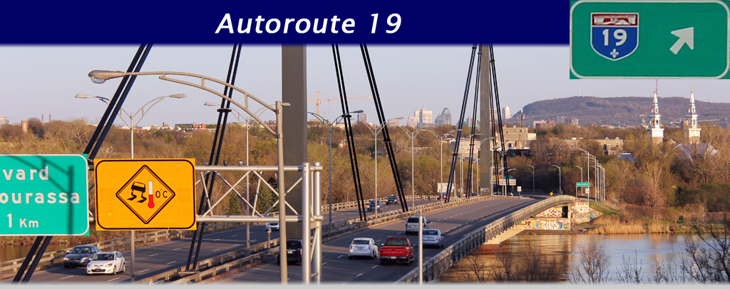
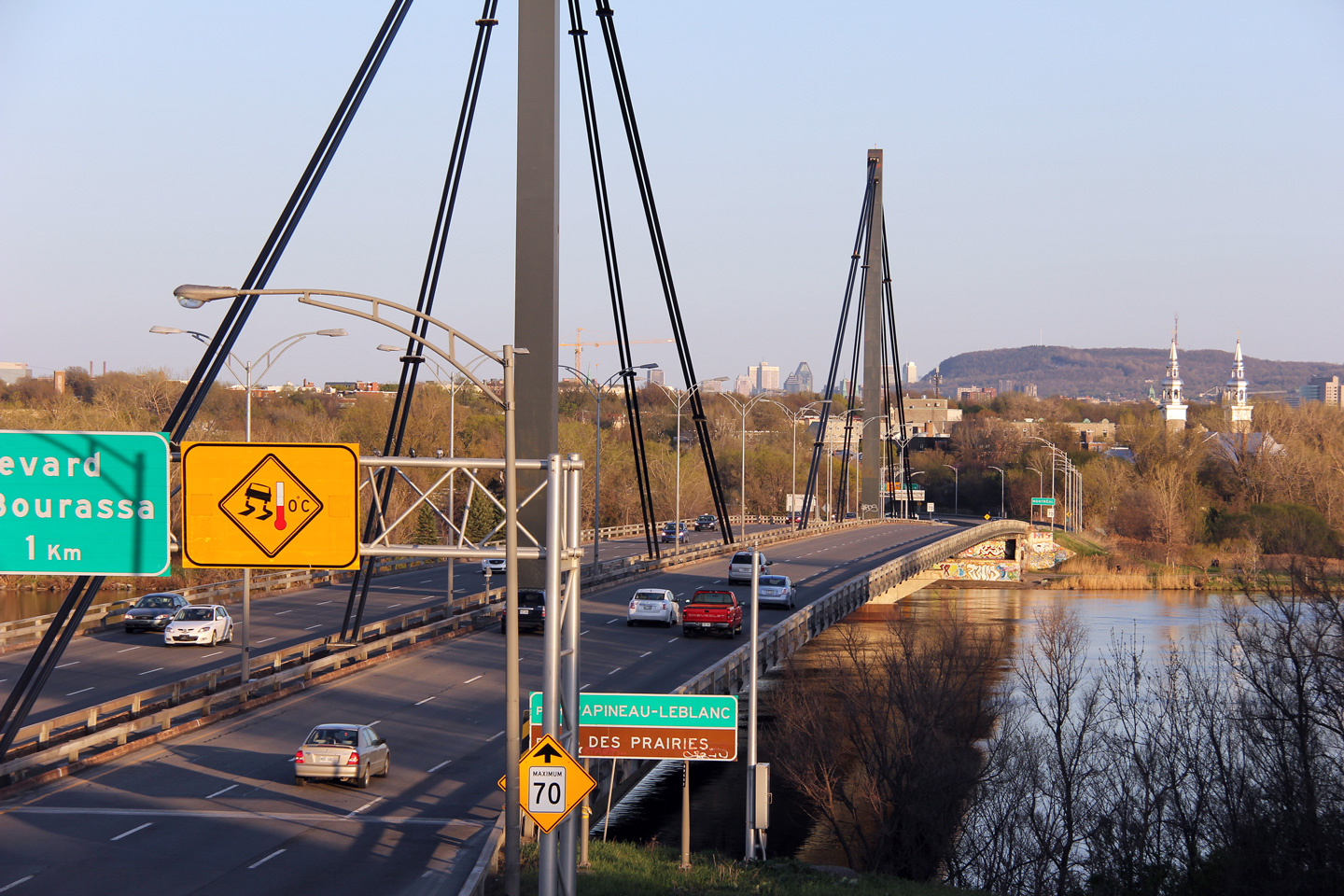
Agglomeration de Montréal |
Southbound signage in advance of the signalized intersection with Henri-Bourassa Boulevard.
Panneau en direction sud en avance de l'intersection signalisés du boul. Henri-Bourassa. |
 |
||
|
Date: 5/5/2012 |
High-res: (1440x960) (2400x1600) | |||
|
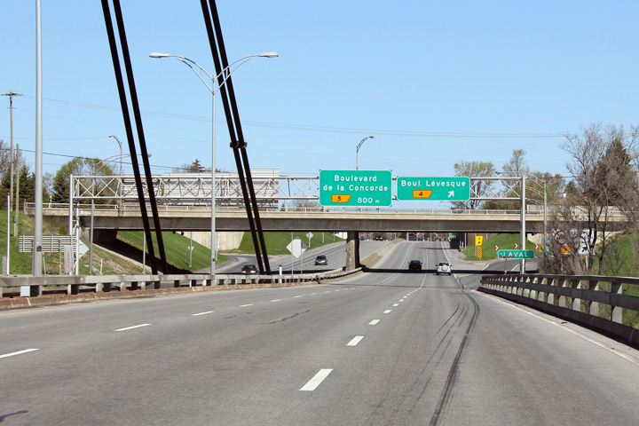
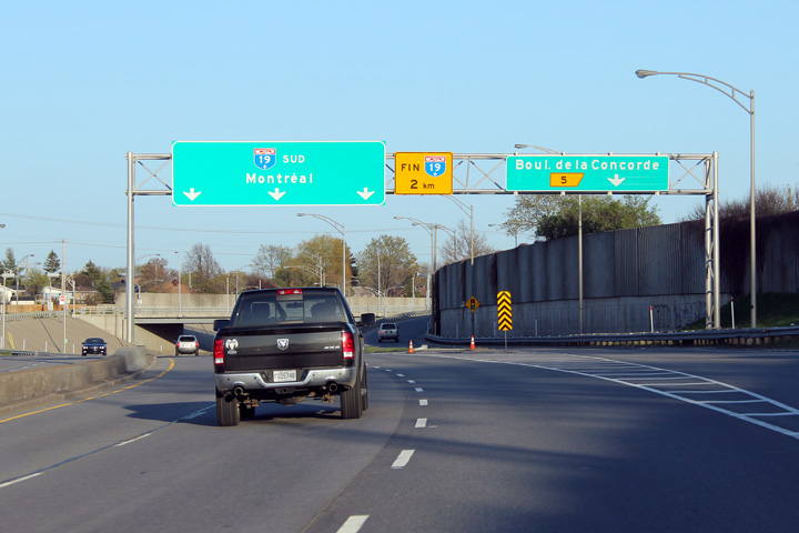
M.R.C. de Laval |
Advanced guide signage for Boulevard Levesque in Laval.
Signalisation avancée pour l’échangeur avec le boul. Levesque à Laval. |
 |
||
|
Date: 5/6/2012 |
High-res: (1440x960) (2400x1600) | |||
|
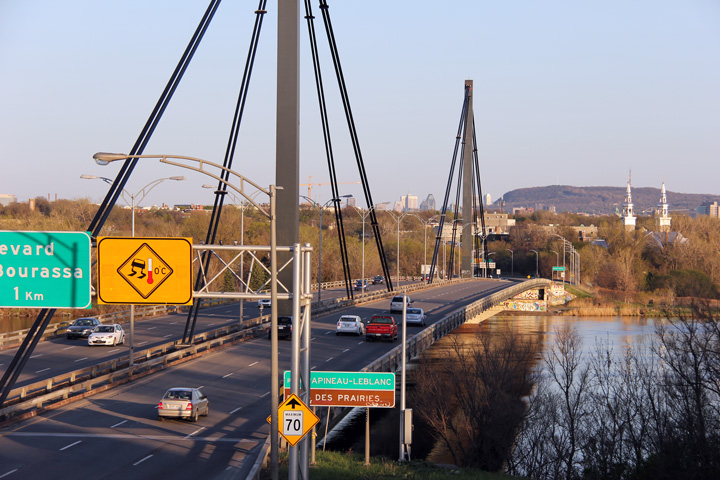
M.R.C. de Laval |
A series of views of Pont Papineau-Leblanc from the Boulevard Levesque. This cable stayed bridge was constructed in 1969.
Deux vues vers le pont Papineau-Leblanc à partir du boulevard Levesque.
Ce pont à haubans était construit en 1969. |
 |
||
| High-res: (1440x960) (2400x1600) | ||||
 |
||||
| High-res: (1440x960) (2400x1600) | ||||
 |
||||
| High-res: (1440x960) (2400x1600) | ||||
 |
||||
|
Date: 5/5/2012 |
High-res: (1440x960) (2400x1600) | |||
|
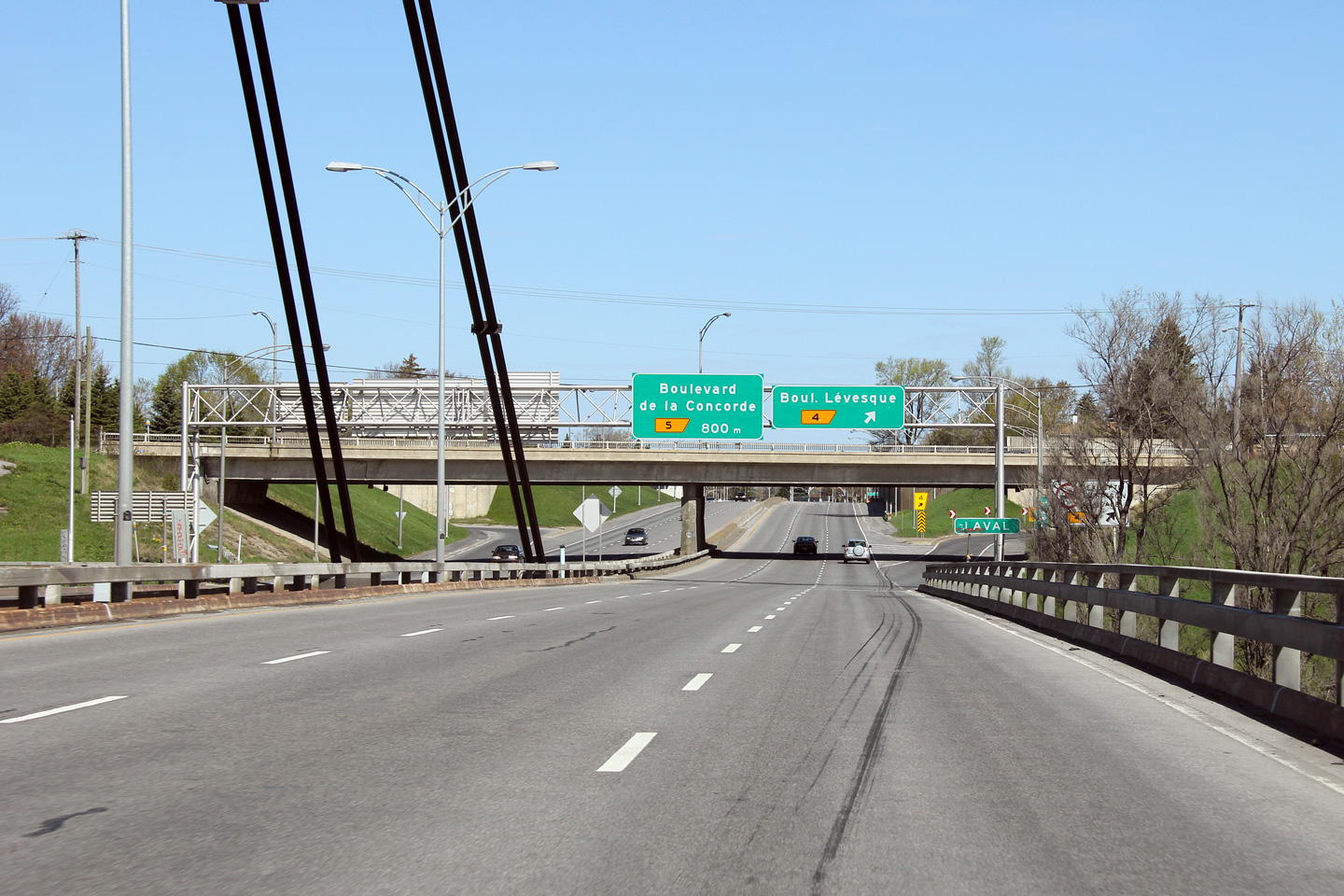
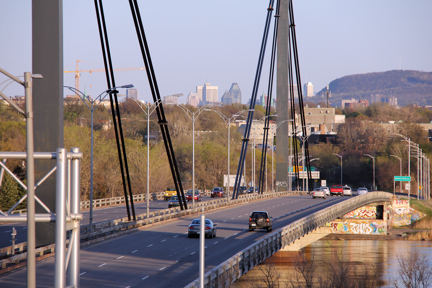
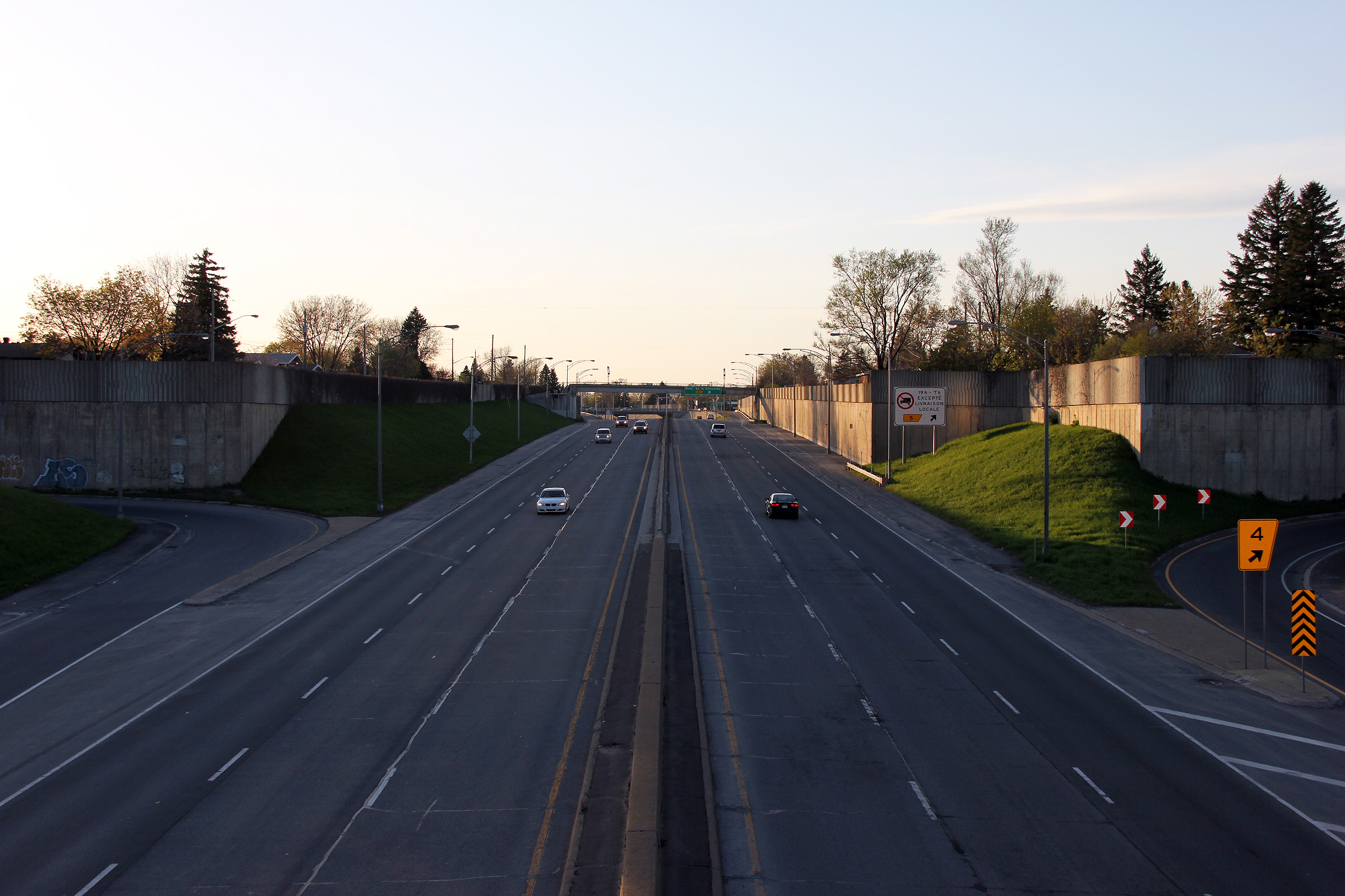
M.R.C. de Laval |
Northerly view from Boul. Levesque. This view looks northerly to Boul. de la Concorde. The Boul. de la Concorde overpass failed in 2006, crumbling to the freeway beneath. The tragedy killed five people.
Vue en direction nord à partir du pont d'étagement du boul. Levesque. Le prochain viaduc le long de l’autoroute 19 est le viaduc du boul. de la Concorde. En 2006, le viaduc du boul. de la concorde effondré sur l’autoroute 19 en dessous, tuant cinq personnes. |
 |
||
|
Date: 5/5/2012 |
High-res: (1440x960) (2400x1600) | |||
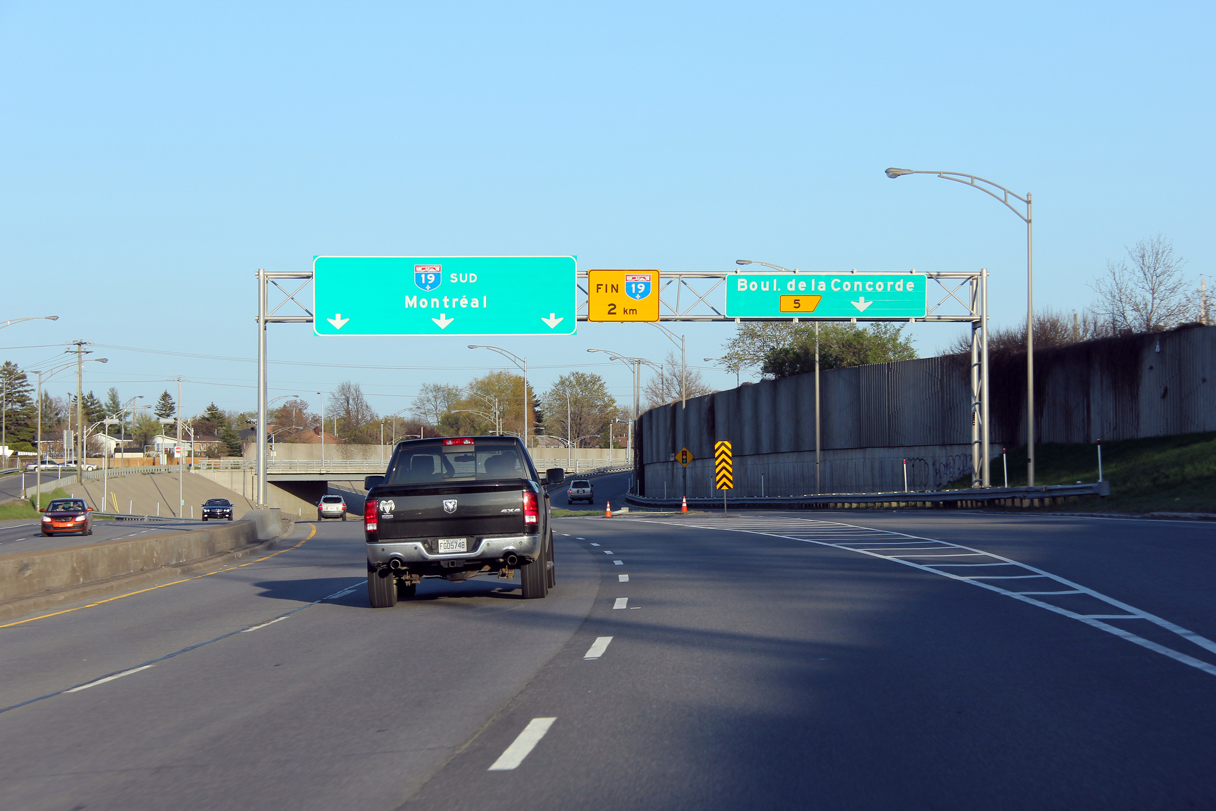
|
M.R.C. de Laval |
Southbound signage at the ramp to Boul. de la Concorde
Panneau en direction sud à la bretelle vers la boul. de la Concorde. |
 |
||
|
Date: 5/5/2012 |
High-res: (1440x960) (2400x1600) | |||
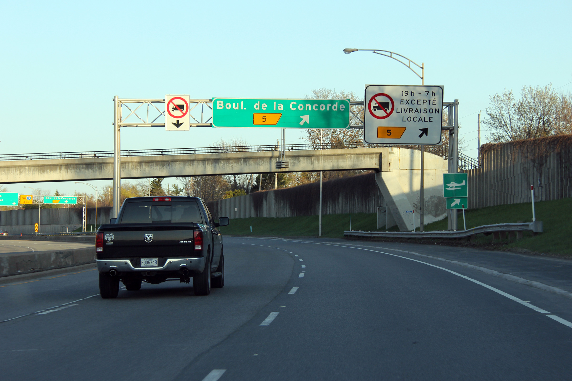
|
M.R.C. de Laval |
Advanced signage for the ramp to Boul. de la Concorde
Panneau avancé pour la bretelle vers la boul. de la Concorde. |
 |
||
|
Date: 5/5/2012 |
High-res: (1440x960) (2400x1600) | |||
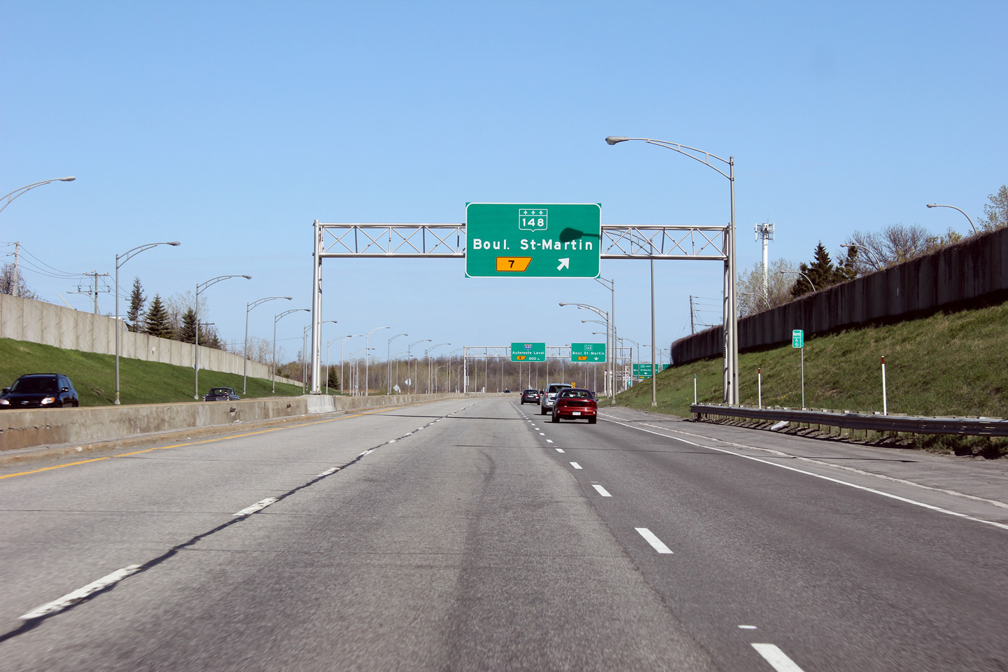
|
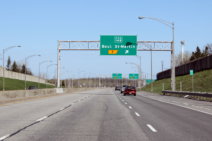
M.R.C. de Laval |
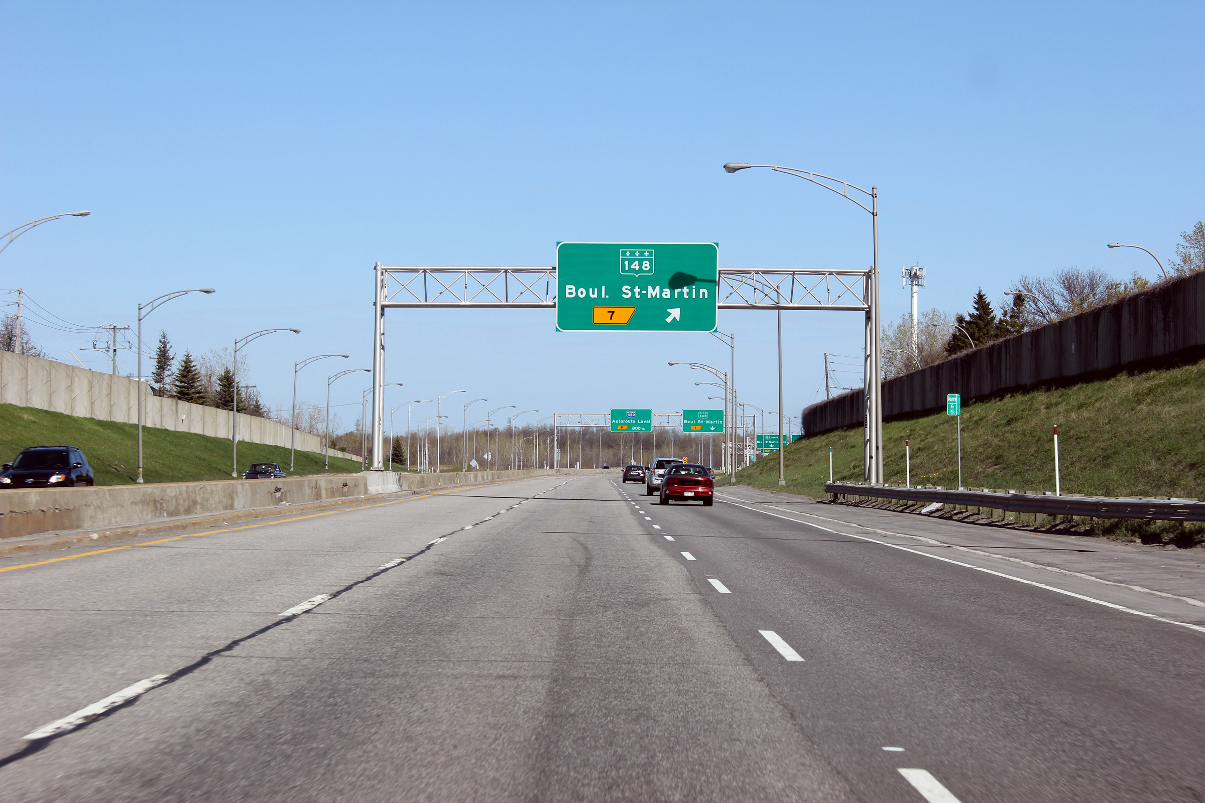
Advanced guide signage for the exit to Highway 148.
Signalisation avancée pour la sortie vers la route 148. |
|
||
|
Date: 5/6/2012 |
High-res: (1440x960) (2400x1600) | |||
|
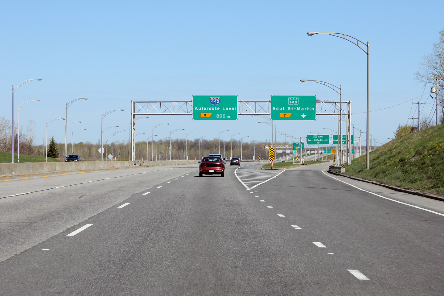
M.R.C. de Laval |
Northerly view at the ramp to Highway 148.
Vue en direction nord à la bretelle vers la route 148. |
|
||
|
Date: 5/6/2012 |
High-res: (1440x960) (2400x1600) | |||
|
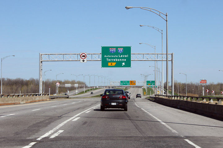
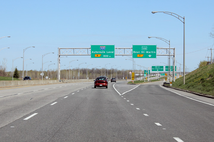
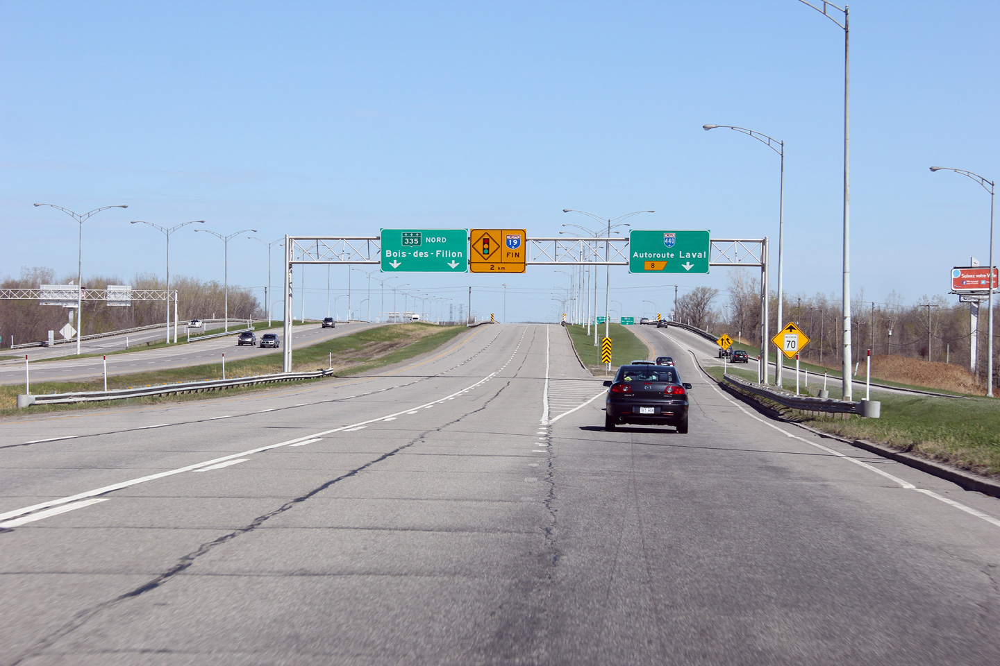
M.R.C. de Laval |
The advanced signage for the ramp to Autoroute Laval (A-440) is situated overtop of the Highway 148 overpass.
La signalisation avancée pour l’échangeur avec l'autoroute Laval (A-440) est situé au-dessus du pont d'étagement de la route 148. |
 |
||
|
Date: 5/6/2012 |
High-res: (1440x960) (2400x1600) | |||
|
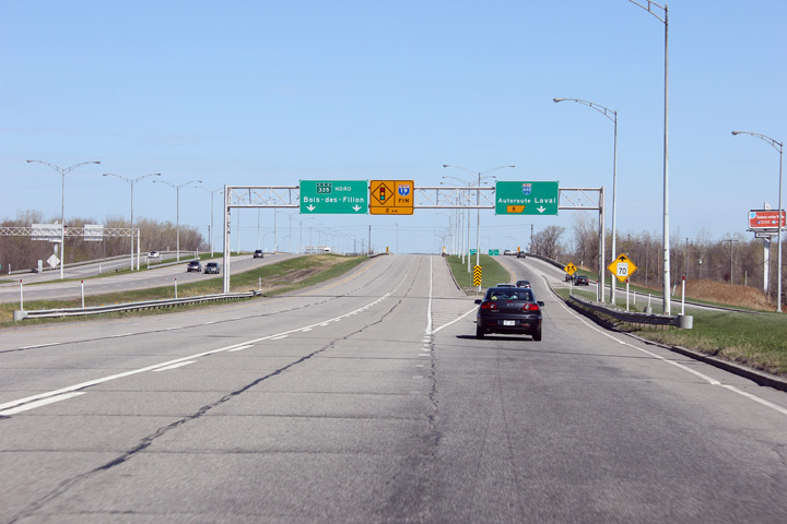
M.R.C. de Laval |
Northbound signage at the ramp to Autoroute 440. Autoroute 19 meets Autoroute 440 at a cloverleaf interchange.
Signalisation en direction nord à la bretelle vers l'autoroute 440. L'autoroute 19 croise l'autoroute 440 à un échangeur en trèfle. |
|
||
|
Date: 5/6/2012 |
High-res: (1440x960) (2400x1600) | |||
|
Autoroute 440 runs across Laval between Autoroute 13 and Autoroute 25. Click here for A-440 images. |
||||
<- A-15
PQ Highways
A-20 ->
AsphaltPlanet.ca
© 2008-12 AsphaltPlanet.ca.
AsphaltPlanet@asphaltplanet.ca
Page Created: December 13, 2008.
Last Updated: June 3, 2012.