AsphaltPlanet.ca > Quebec > Aéroport Mirabel
|
Western Terminus: R-148 interchange in Downtown Hull. Eastern Terminus: R-117 interchange southeast of St. Jerome. Routing: A-50 starts its trek through the the Ottawa Valley at the Boulevard Alummettiers interchange complex in Downtown Hull (Gatineau). A-50 progresses northerly through Hull, then turns easterly through Suburban Gatineau. A Northerly By-pass of Gatineau, Autoroute 550, was proposed to intersect with A-50 where the freeway turns easterly northeast of Downtown. A-550 would have linked to A-5 through Gatineau Park. A-50 continues along the north side of the Ottawa Valley around the southeast of Buckingham where it narrows to a Super-2. A-50 continues as a Super-2 through to Lachute, where it briefly widens to a four-lane freeway where it by-passes the small community. East of Highway 329, A-50 narrows back to a two-lane highway. Between Lachute and Aeroport Mirabel, the highway crosses two railways at-grade, and has two minor at-grade intersections. At Mirabel Airport, A-50 widens to a four lane freeway, maintaining this four lane cross-section easterly until it terminates at A-15 and R-117. The western-most interchange of A-50 in Hull is numbered 134. When originally conceived, A-50 was envisioned to continue westerly by-passing Highway 148 all the way to Pembroke Ontario. Such an extension is very unlikely to ever be realised. Links:
|
Pictures on this page are arranged in order from south to north. A-50 East
photos are left-aligned in the last column, while A-50 West photos are right-aligned.
Center-line pictures are centered within the last column.
|
Location |
Description |
Photo |
|
|
MRC D'Argenteuil |
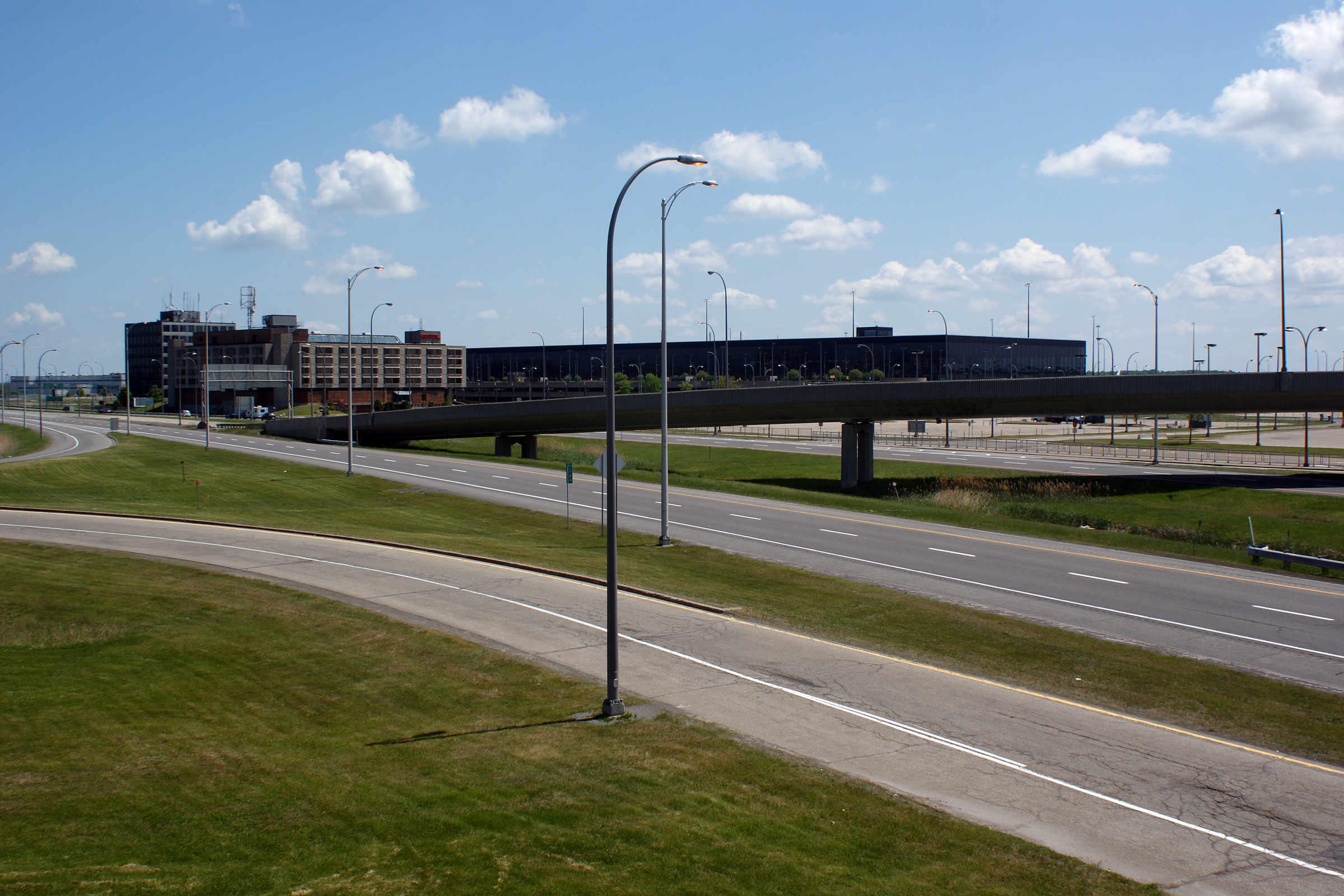
View of the Mirabel Airport facility with Autoroute 50 in the foreground.
Vue vers l'aéroport Mirabel situé au sud de l'autoroute 50. |
 |
|
|
Date: 5/24/2010 |
High-res: (1440x960) (2400x1600) | ||
|
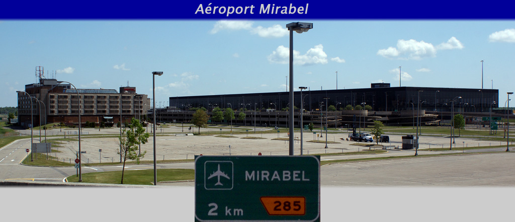
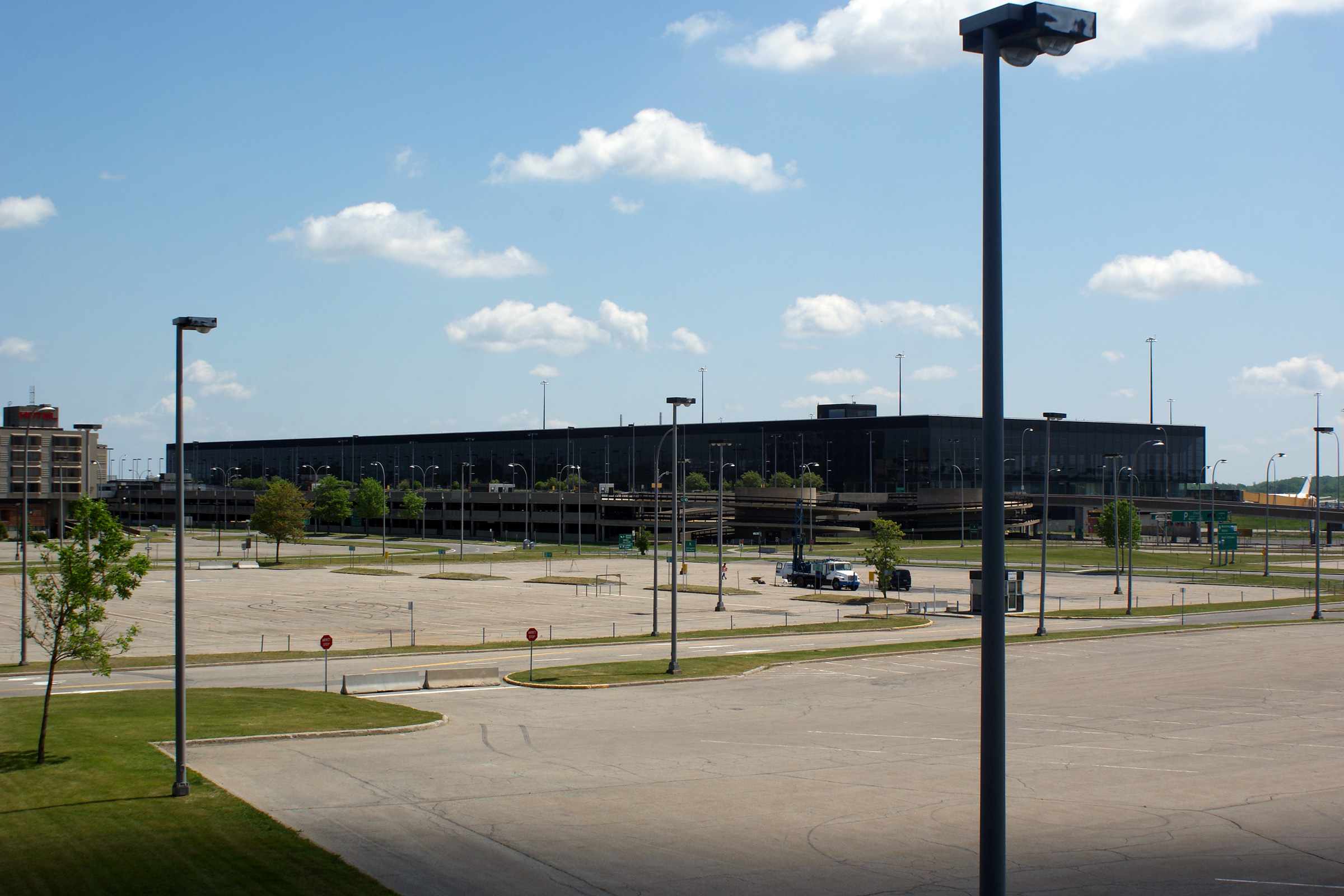
MRC D'Argenteuil |
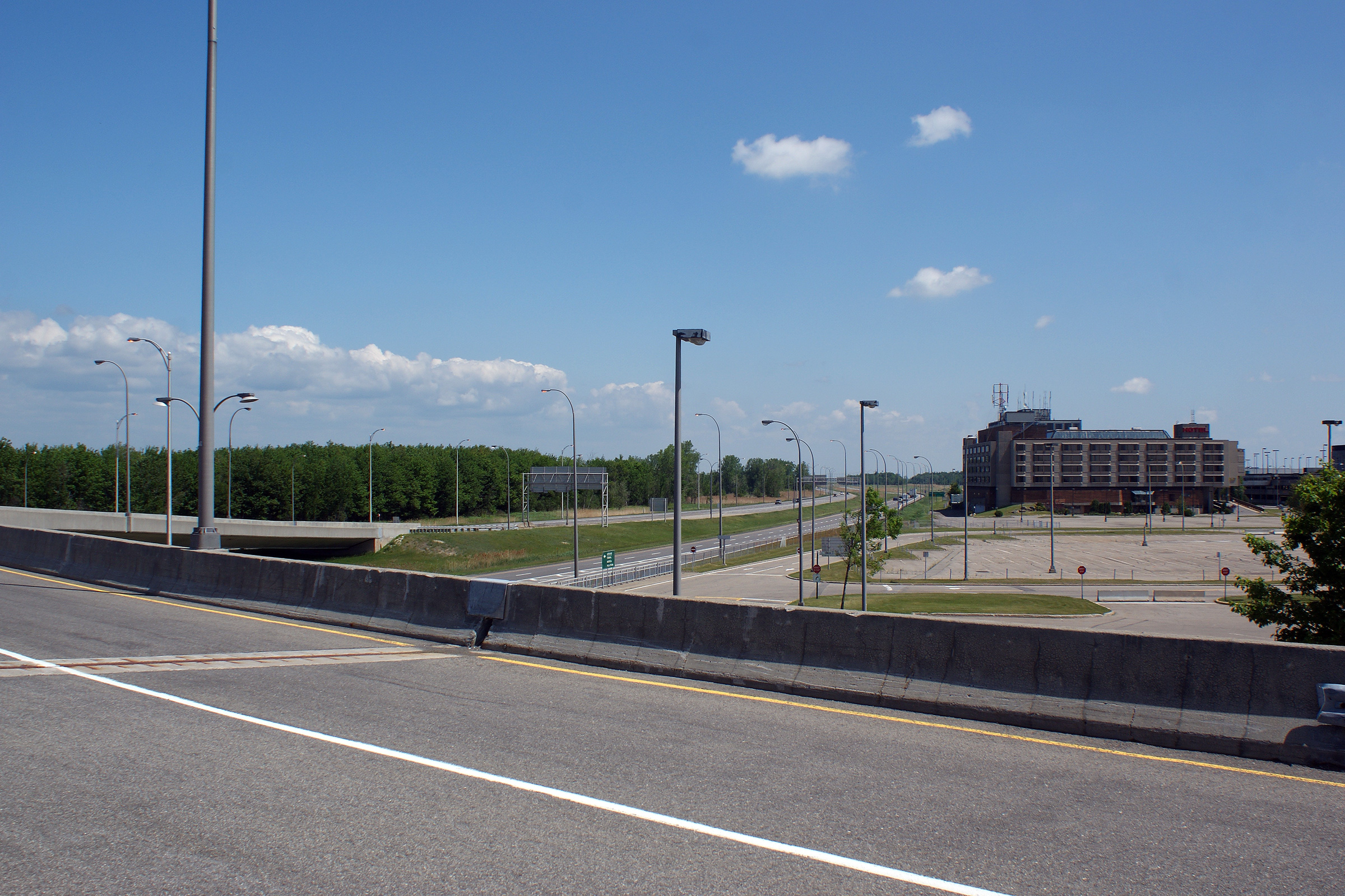
An overall view of Mirabel Airport from the Autoroute 50 off-ramp. The abandoned Mirabel hotel sits at the left side of the photo, while the disused terminal building dominates the right side of the photo.
Un vue complet de l'aéroport Mirabel à partir de la bretelle de l'autoroute 50 vers l'aéroport. L'hôtel Mirabel a été abandonné et est situé a la gauche de la photo. Le terminal est aussi vacant et est situé a la droite. |
 |
|
|
Date: 5/24/2010 |
High-res: (1440x960) (2400x1600) | ||
|
MRC D'Argenteuil |
View looking easterly towards the vacant airport hotel from the high-speed flyover that carries traffic from Autoroute 50 westbound to the airport.
Vue vers l'ouest depuis le pont d'étagement de la mtée Paiement. |
 |
|
|
Date: 5/24/2010 |
High-res: (1440x960) (2400x1600) | ||
|
MRC D'Argenteuil |
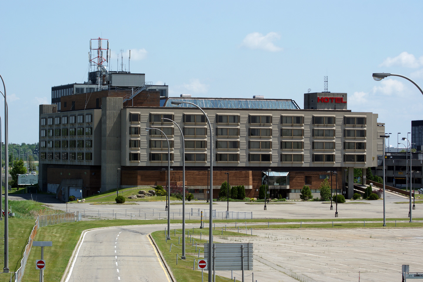
Close-up view of the abandoned airport hotel.
Vue près de l'hotel abandonné. |
 |
|
|
Date: 5/24/2010 |
High-res: (1440x960) (2400x1600) | ||
|
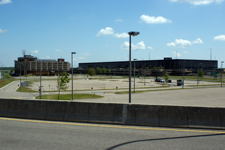
MRC D'Argenteuil |
View of the former passenger terminal building. A plane was docked at the building when this photo was taken, however, this terminal no longer serves commercial traffic.
Vue vers l'est depuis le pont d'étagement du boul. des Laurentides. |
 |
|
|
Date: 5/24/2010 |
High-res: (1440x960) (2400x1600) | ||
|
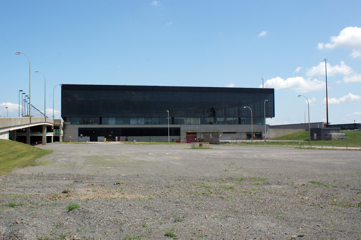
MRC D'Argenteuil |
Western side of the terminal building.
La cote ouest du bâtiment terminal. |
 |
|
|
Date: 5/24/2010 |
High-res: (1440x960) (2400x1600) | ||
|
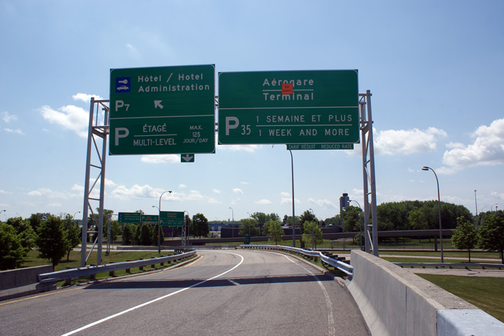
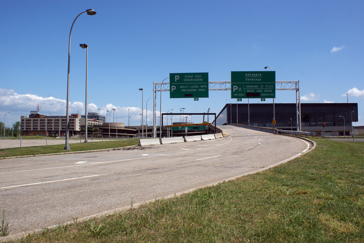
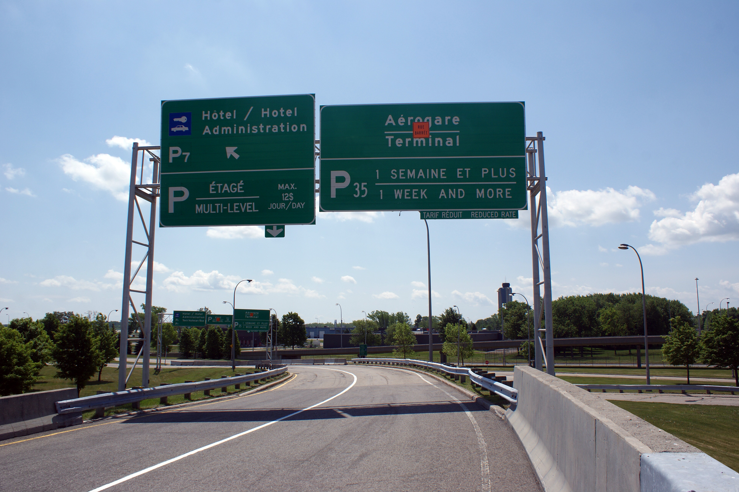
MRC D'Argenteuil |
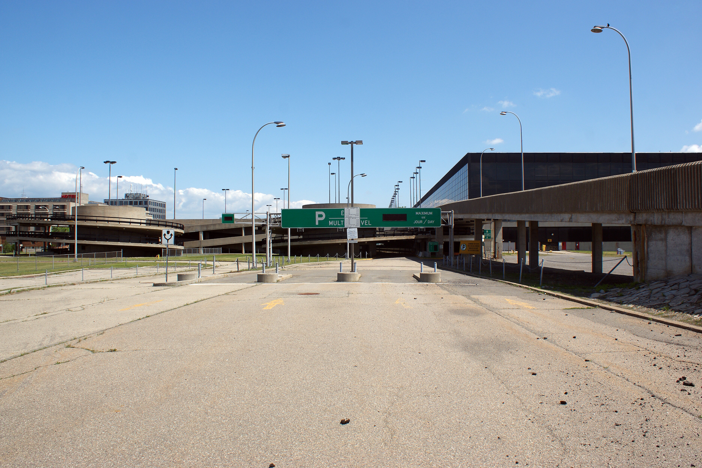
Overhead signage situated overtop of the high-speed ramp from Autoroute 50 West.
Signalisation aérienne situé au-dessus de la brettelle haute-vitesse vers l'aéroport Mirabel de l'autoroute 50 ouest. |
 |
|
|
Date: 5/24/2010 |
High-res: (1440x960) (2400x1600) | ||
|
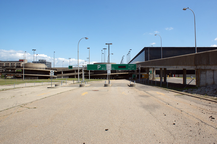
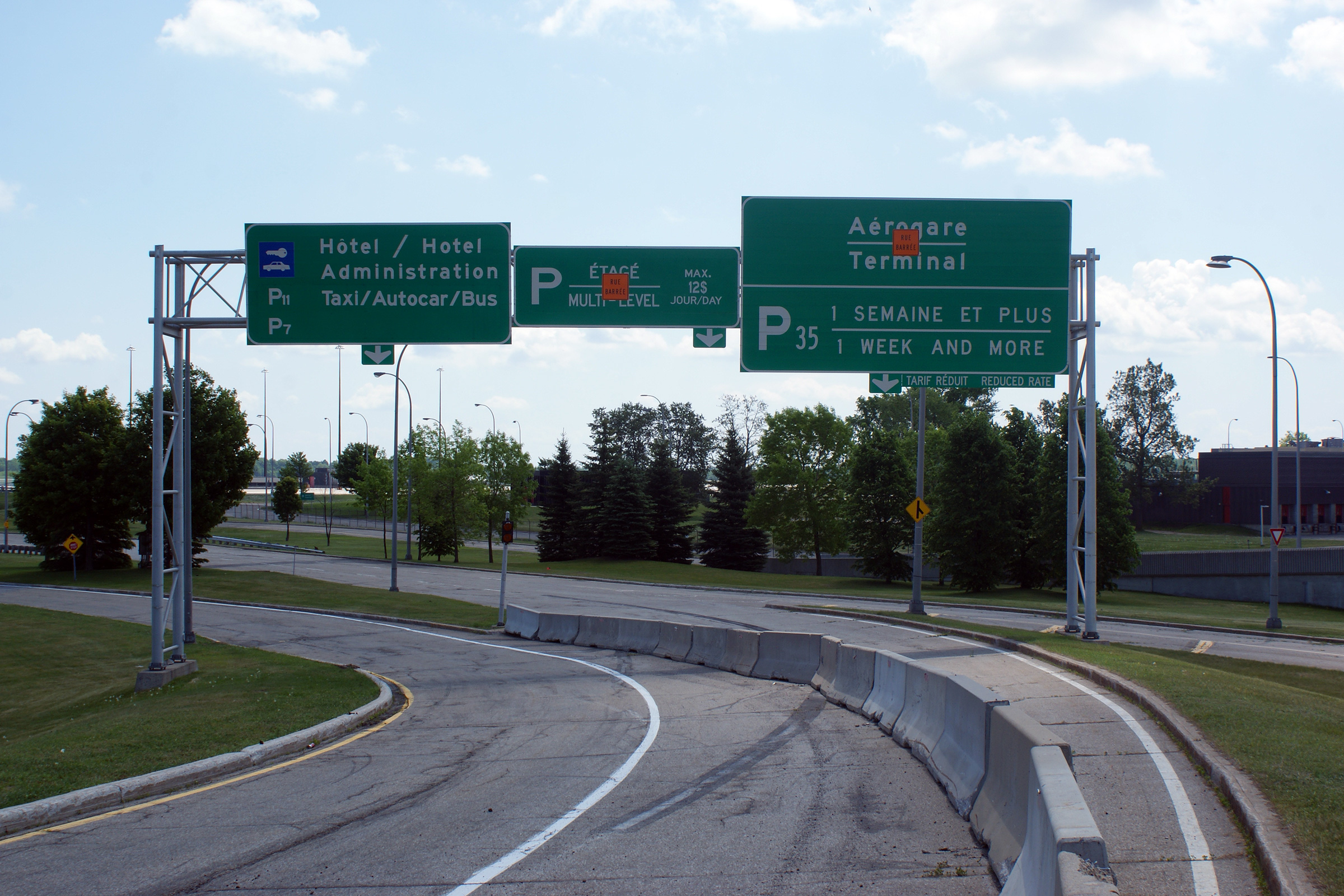
MRC D'Argenteuil |
Overhead signage along the airport road network. Virtually all roads and parking lots servicing the now closed hotel and airport terminal have been closed to traffic.
Signalisation aérienne au-dessus de la brettelle haute-vitesse vers l'aéroport Mirabel de l'autoroute 50 ouest. |
 |
|
|
Date: 5/24/2010 |
High-res: (1440x960) (2400x1600) | ||
|
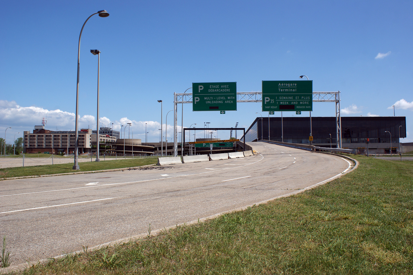
MRC D'Argenteuil |
Overhead signage along the closed airport road network approaching the terminal.
Signalisation aérienne à l'approche de la terminal. |
 |
|
|
Date: 5/24/2010 |
High-res: (1440x960) (2400x1600) | ||
|
MRC D'Argenteuil |
These median islands once housed ticket booths for one of the airport's paid parking lots
Vue vers l'ouest le long de l'autoroute 50 depuis le pont d'étagement de la route 317. Quand cette photo a été prise, le tronçon Gatineau de l'autoroute 50 terminé à l'échangeur avec la route 317. |
 |
|
|
Date: 5/24/2010 |
High-res: (1440x960) (2400x1600) | ||
|
MRC D'Argenteuil |
The entrance to the now closed parking lot is at left, while the unloading area is at the right.
Vue vers l'ouest le long de l'autoroute 50 depuis le pont d'étagement de la route 317. Quand cette photo a été prise, le tronçon Gatineau de l'autoroute 50 terminé à l'échangeur avec la route 317. |
 |
|
|
Date: 5/24/2010 |
High-res: (1440x960) (2400x1600) | ||
|
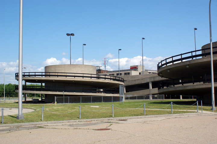
MRC D'Argenteuil |
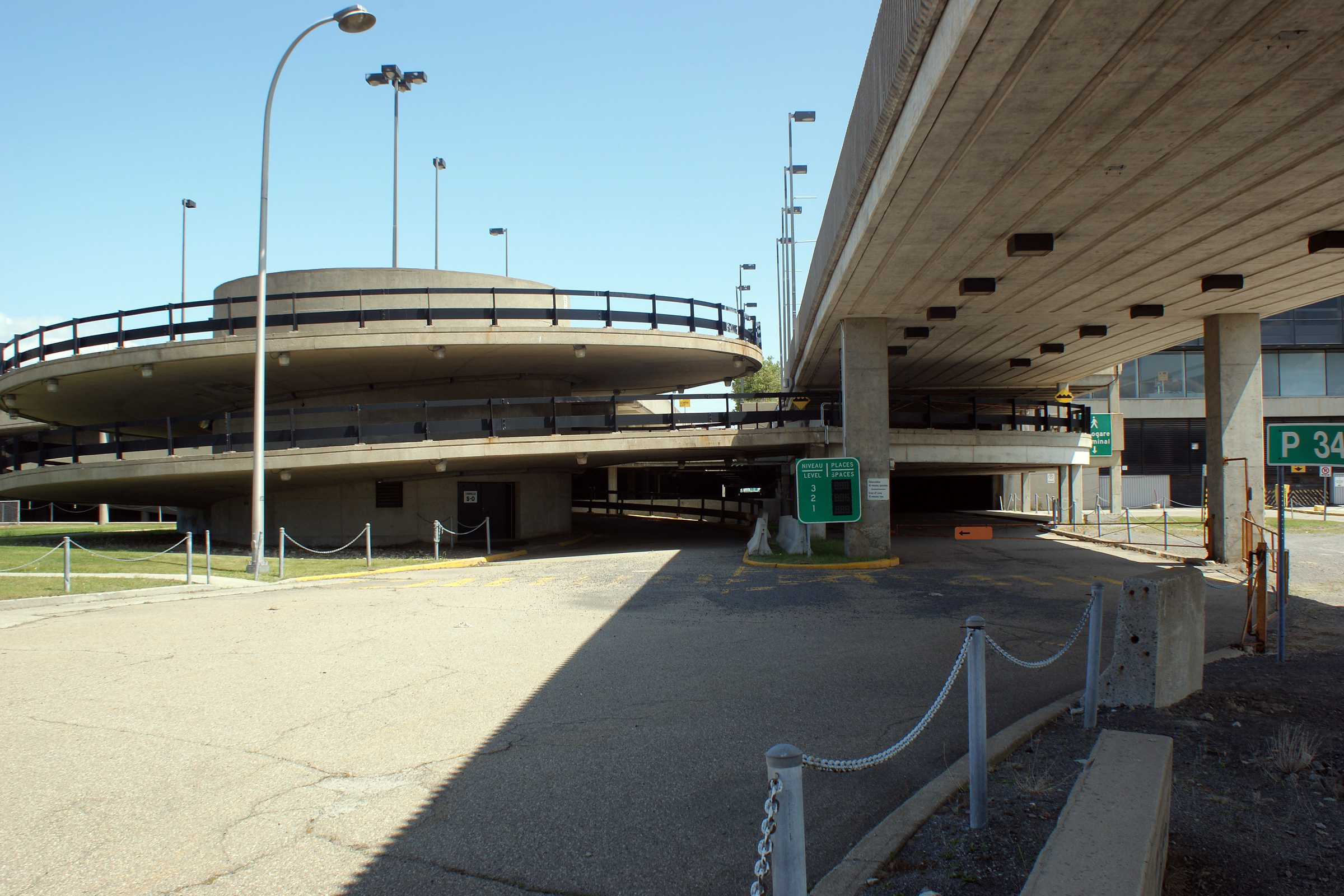
Abandoned spiral ramps servicing the terminal's parking decks.
Vue vers l'est depuis le pont d'étagement de la route 317. La tronçon finale de l'autoroute 50 qui liera Gatineau et Montréal ouvrira dans l'automne de 2012 entre cet échangeur et l'échangeur avec la route 323 au nord de Montebello. |
 |
|
|
Date: 5/24/2010 |
High-res: (1440x960) (2400x1600) | ||
|
MRC D'Argenteuil |
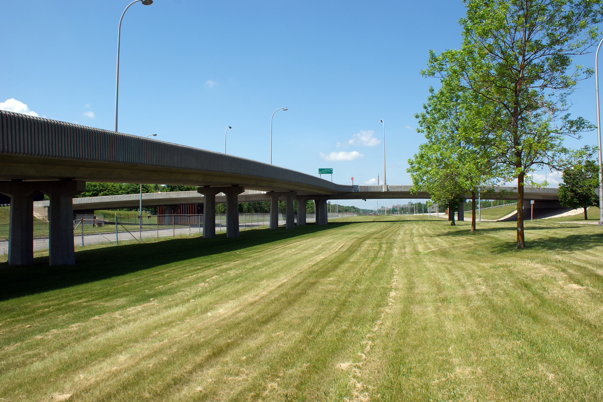
Westerly view along Autoroute 50 from the Route 317 overpass. At the time that this photo was taken, the Gatineau segment of Autoroute 50 ended at an interchange with Route 317.
Vue vers l'ouest le long de l'autoroute 50 depuis le pont d'étagement de la route 317. Quand cette photo a été prise, le tronçon Gatineau de l'autoroute 50 terminé à l'échangeur avec la route 317. |
 |
|
|
Date: 5/24/2010 |
High-res: (1440x960) (2400x1600) | ||
|
MRC D'Argenteuil |
Easterly view from the Route 317 overpass. The final segment of Autoroute 50 is set to open in the Fall of 2012 between this interchange and Route 323 north of Montebello.
Vue vers l'est depuis le pont d'étagement de la route 317. La tronçon finale de l'autoroute 50 qui liera Gatineau et Montréal ouvrira dans l'automne de 2012 entre cet échangeur et l'échangeur avec la route 323 au nord de Montebello. |
 |
|
|
Date: 5/24/2010 |
High-res: (1440x960) | ||
|
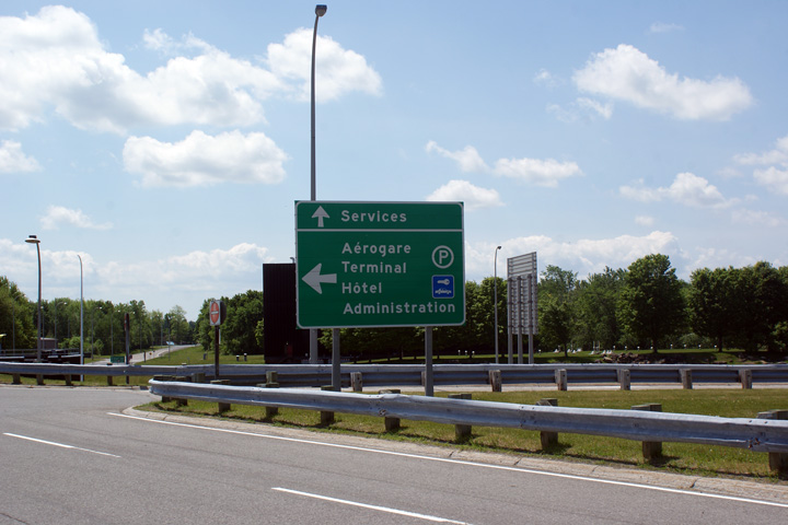
MRC D'Argenteuil |
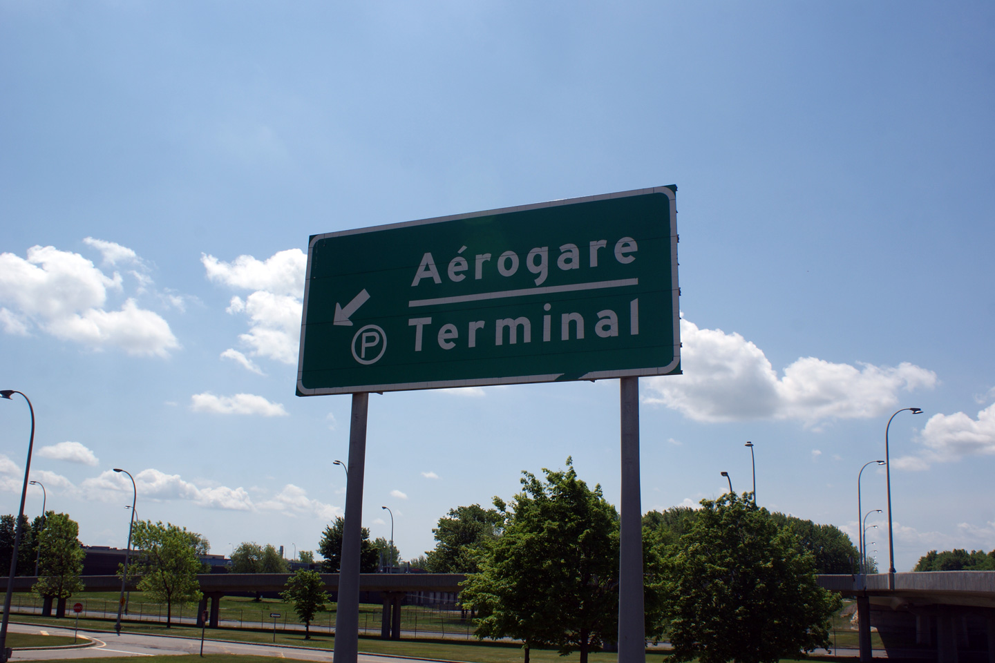
Signage for the airport terminal along a service road.
Vue vers l'ouest le long de l'autoroute 50 depuis le pont d'étagement de la route 317. Quand cette photo a été prise, le tronçon Gatineau de l'autoroute 50 terminé à l'échangeur avec la route 317. |
 |
|
|
Date: 5/24/2010 |
High-res: (1440x960) | ||
|
MRC D'Argenteuil |
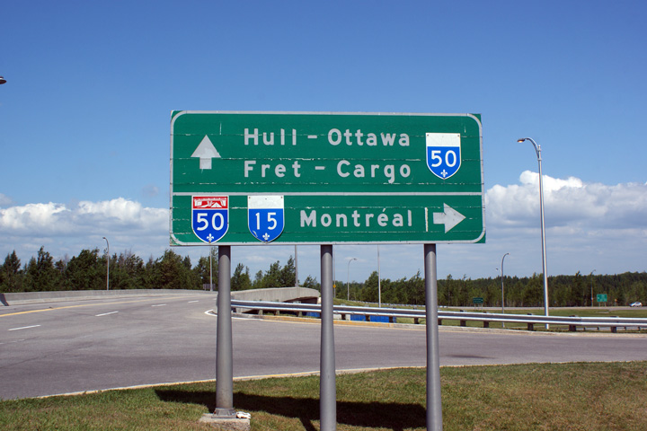
Signage upon leaving the airport terminal for Autoroute 50. Note the use of Hull (Gatineau's former name) on the signage.
Vue vers l'est depuis le pont d'étagement de la route 317. La tronçon finale de l'autoroute 50 qui liera Gatineau et Montréal ouvrira dans l'automne de 2012 entre cet échangeur et l'échangeur avec la route 323 au nord de Montebello. |
 |
|
|
Date: 5/24/2010 |
High-res: (1440x960) | ||
|
Highway 148 is the principal arterial along the north side of the Ottawa River. Click here for R-148 images. |
|||
<- A-40
PQ Highways
A-70 ->
Asphaltplanet.ca
© 2010-2011 AsphaltPlanet.ca.
AsphaltPlanet@asphaltplanet.ca
Page Created: February 5, 2011.
Last Updated: February 5, 2011.