|
|
|
|
|
|
South-
Bound
|
|
Route 303 terminates at Route 301 in
Portage-du-Fort, just north of the Ontario Boundary.
Click here for
R-301 images.
|
|
MRC de Pontiac
Portage-du-Fort
|
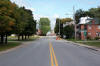
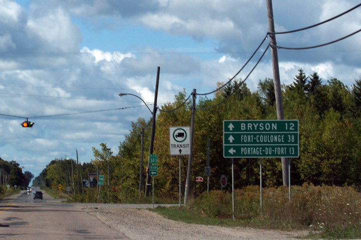
The southern end of Quebec Highway 303 is found at this intersection
with Highway 301 in Portage-du-Fort. Interestingly, Route 303
finds both its southern and northern terminus at Highway 301. |
 |
|
Photographed by: AsphaltPlanet.ca |
Date: 9/12/2009 |
High-res |
|
MRC de Pontiac
Portage-du-Fort
|
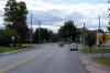
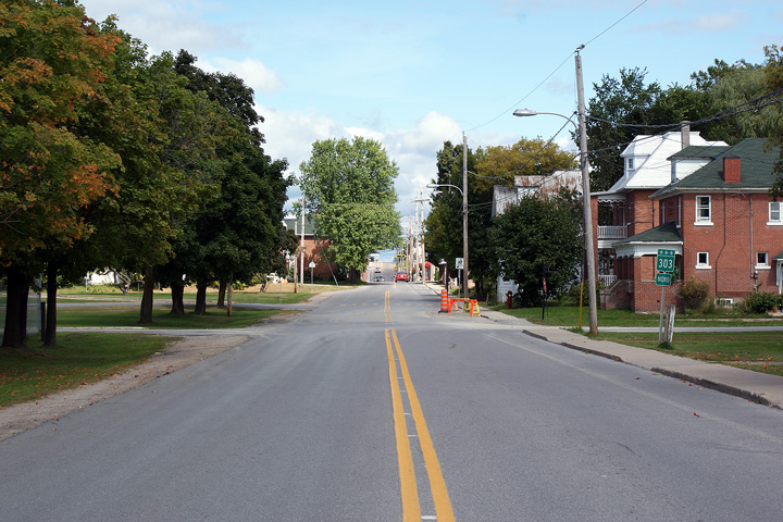
Northerly view as seen from the Highway 301 intersection through
Portage-du-Fort. At the tee junction ahead, Highway 303 turns to
the left bound for Highway 148 and Shawville. |
 |
|
Photographed by: AsphaltPlanet.ca |
Date: 9/12/2009 |
High-res |
|
MRC de Pontiac
Clarendon
|
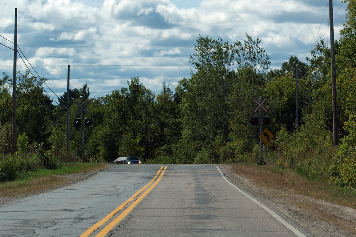
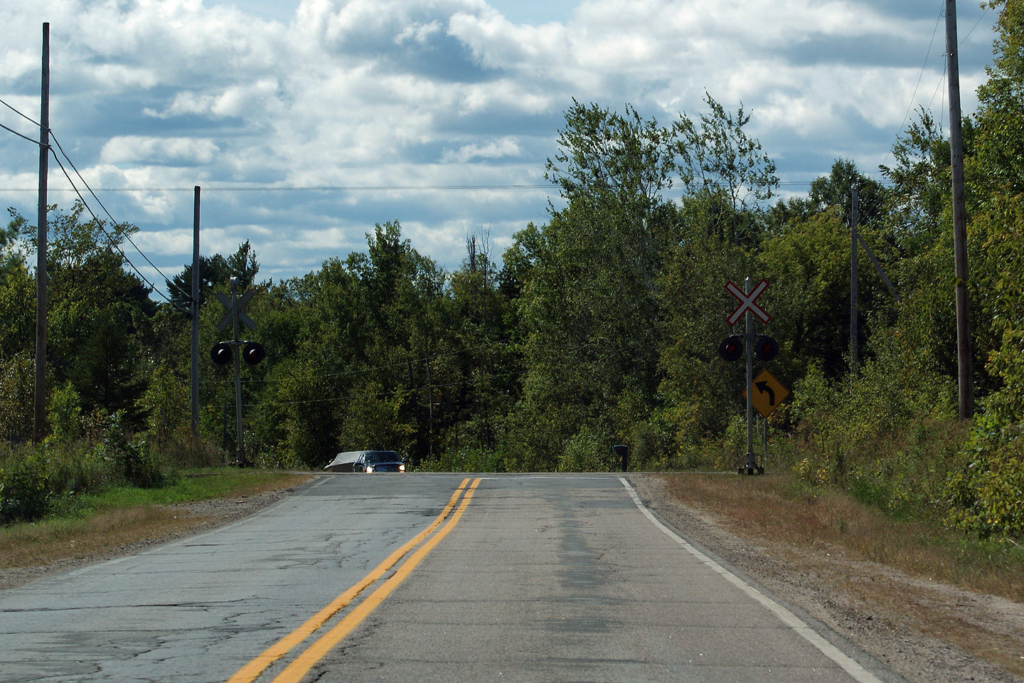
Southerly view as Highway 303 approaches an at-grade crossing for the
Ottawa Central Railway, a CN line which runs through Ontario and Quebec
from Pembroke to Coteau-du-Lac near Montreal. |
|
|
Photographed by: AsphaltPlanet.ca |
Date: 9/12/2009 |
High-res |
|
MRC de Pontiac
Clarendon
|
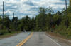
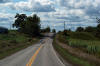
Southerly view along Route 303 roughly 3km south of the Highway 148
junction. The high hills that appear in the distance of this photo
are found on the Ontario side of the Ottawa River Valley, and stretch
between Renfrew and Pembroke. |
 |
|
Photographed by: AsphaltPlanet.ca |
Date: 9/12/2009 |
High-res |
|
MRC de Pontiac
Clarendon
|
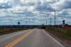
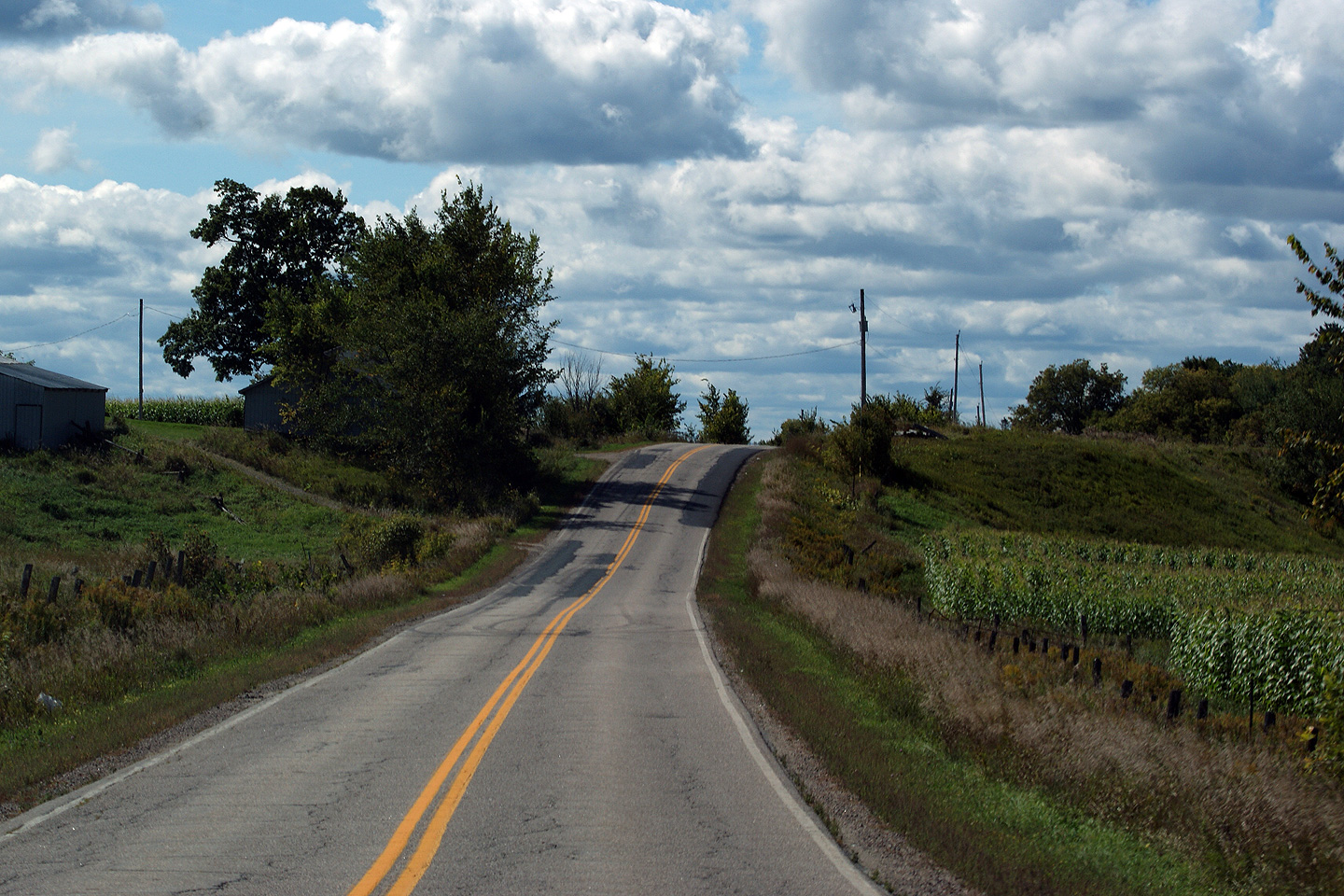
View looking southerly from about a kilometre south of Highway 148.
As is fairly evident from the photo, Highway 303 is not much of a
highway. Little engineering has been conducted to upgrade this
road from a rural farm road, and the driving surface leaves something to
be desired. |
|
|
Photographed by: AsphaltPlanet.ca |
Date: 9/12/2009 |
High-res |
|
MRC de Pontiac
Shawville
|
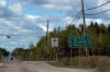
Exit signage for Autoroute 50 and Highway 148
East. There is no direct connection between A-5 and Highway
148-West (Boul des Allumettieres). The A-5/A-50 interchange was
constructed decades before R-148 was extended through Gatineau Park. |
|
|
Photographed by: AsphaltPlanet.ca |
Date: 9/13/2009 |
|
MRC de Pontiac
Shawville
|
Traveling westbound along Route 148/303. I was surprised at the
poor condition of Highway 148. While I only have traveled a short
distance of the route, its condition was exceedingly poor, even when
compared to some of Quebec's other less than stellar principal highways. |
 |
|
Photographed by: AsphaltPlanet.ca |
Date: 9/12/2009 |
High-res |
|
Route 148 is the principal highway along the north
shore of the Ottawa River. Click here for
R-148 images.
|
|
MRC de Pontiac
Shawville
|
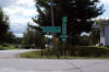
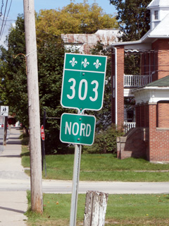
Signage assembly at the eastern Highway 148/303 junction. At this
intersection Highway 303 turns right following Highway 148's routing for
a short distance westerly before turning south again towards
Portage-du-Fort. |
|
|
Photographed by: AsphaltPlanet.ca |
Date: 9/12/2009 |
|
MRC de Pontiac
Shawville
|
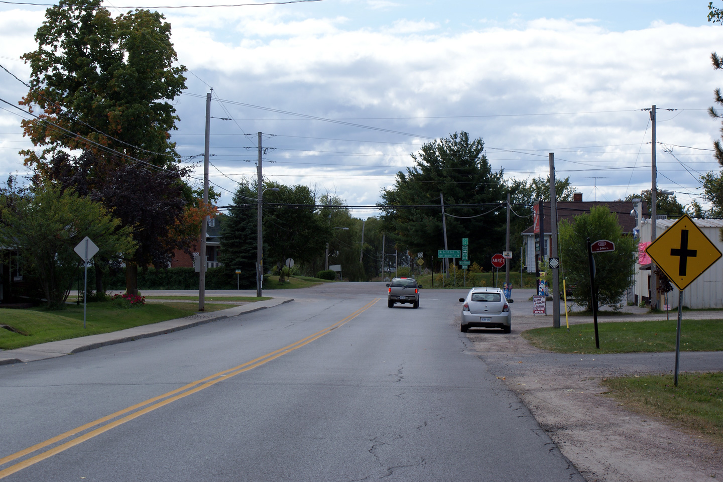
Southbound view approaching the Highway 148 intersection in Shawville. |
 |
|
Photographed by: AsphaltPlanet.ca |
Date: 9/12/2009 |
High-res |
|
MRC de Pontiac
Shawville
|
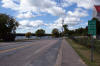
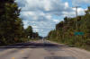
View looking northerly into Shawville from just north of the Highway 148
junction. Shawville is a predominantly Anglophone community.
Over 85% of its 1,500 residents speak English as their first language. |
 |
|
Photographed by: AsphaltPlanet.ca |
Date: 9/12/2009 |
High-res |
|
MRC de Pontiac
Shawville
|
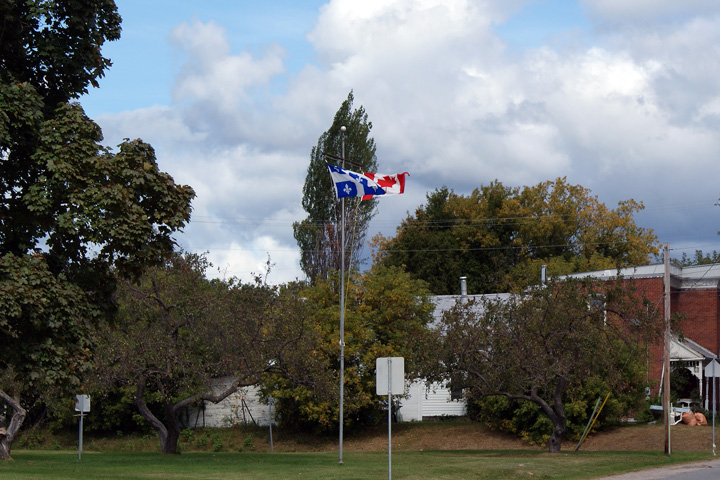
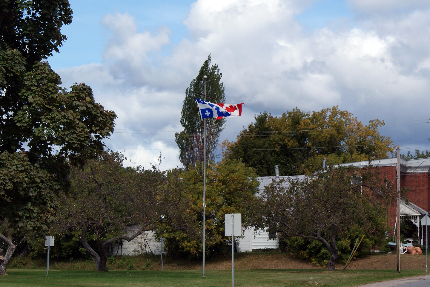
National Unity. Both the Quebec
Provincial and Canadian National Flags are flown proudly in front of an
elementary school just off of Route 303 in Shawville. |
 |
|
Photographed by: AsphaltPlanet.ca |
Date: 9/13/2009 |
High-res |
|
MRC de Pontiac
Shawville
|
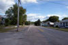
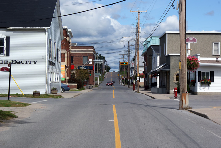
Northerly
view along Route 303 towards Shawville's Main Street. Note how
narrow the roadway is between the buildings. Though, not pictured,
Main Street has an even tighter right of way through town than Route 303
does. I have a sneaking suspicion, that Shawville's Main Street
was once Route 148. |

|
|
Photographed by: AsphaltPlanet.ca |
Date: 9/13/2009 |
High-res |


