AsphaltPlanet.ca > Texas > US-290
|
Western Terminus: I-10, southeast of Junction, Texas.
Eastern Entrance: I-610, in Houston, Texas. Length: 261 Miles (420 km). Links:
|
Pictures on this page are arranged in order from west to east. US-290 East photos are left-aligned in the last column, while US-290 west photos are right-aligned. Center-line pictures are centered within the last column.
|
Location |
Description |
Photo |
||
|
East- |
West- |
|||
|
Travis County Austin |
This view looks easterly along the US-290 freeway approaching Austin from the southwest. |
 |
||
|
Date: 11/1/2012 |
High-res: (1440x960) (2400x1600) | |||
|
Travis County Austin |
Westerly view along US-290 from west of the MoPac Expressway interchange. The left lane of the westbound carriageway has been painted closed as the US-290 freeway ends about a mile ahead. |
 |
||
|
Date: 11/1/2012 |
High-res: (1440x960) (2400x1600) | |||
|
Travis County Austin |
Easterly at the MoPac Expressway (Loop 1) interchange. |
 |
||
|
Date: 11/1/2012 |
High-res: (1440x960) (2400x1600) | |||
|
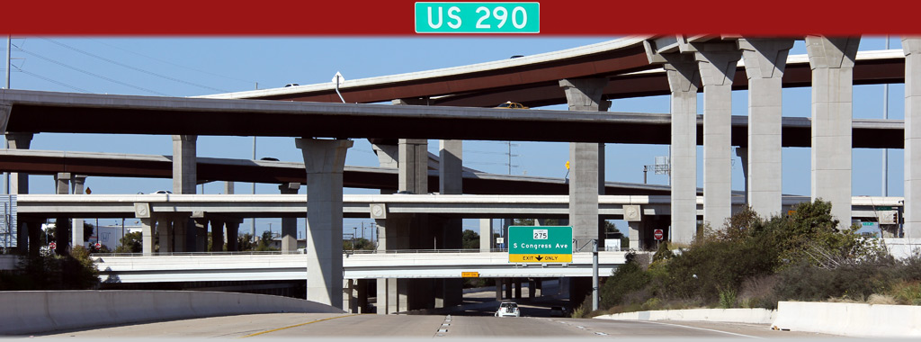
Travis County Austin |
View looking easterly through the four-level stack interchange with the MoPac Expressway. Despite the fact that the interchange with the Mopac Expressway has four levels, the interchange does not provide full unimpeded travel between US-290 and Loop 1 in all directions. |
 |
||
|
Date: 11/1/2012 |
High-res: (1440x960) (2400x1600) | |||
|
Travis County Sunset Valley |
Two views looking westerly along US-290/TX-71 at the MoPac Expressway interchange. The high-speed flyover ramp from US-290 West to the southbound Mopac Expressway had yet to open to traffic when this photo was taken. |
 |
||
| High-res: (1440x960) (2400x1600) | ||||
 |
||||
|
Date: 11/1/2012 |
High-res: (1440x960) (2400x1600) | |||
|
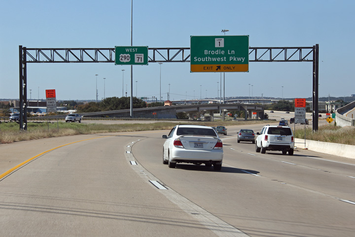
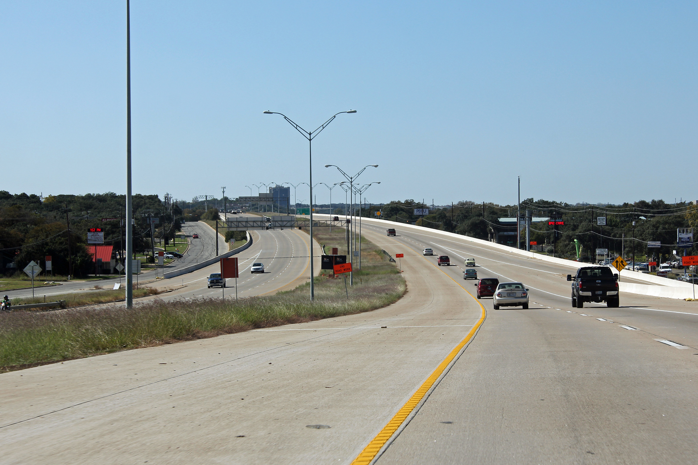
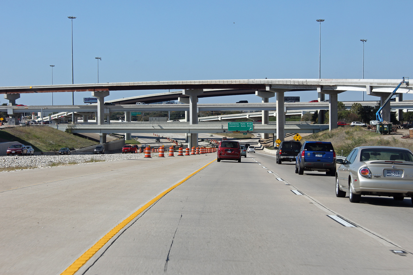
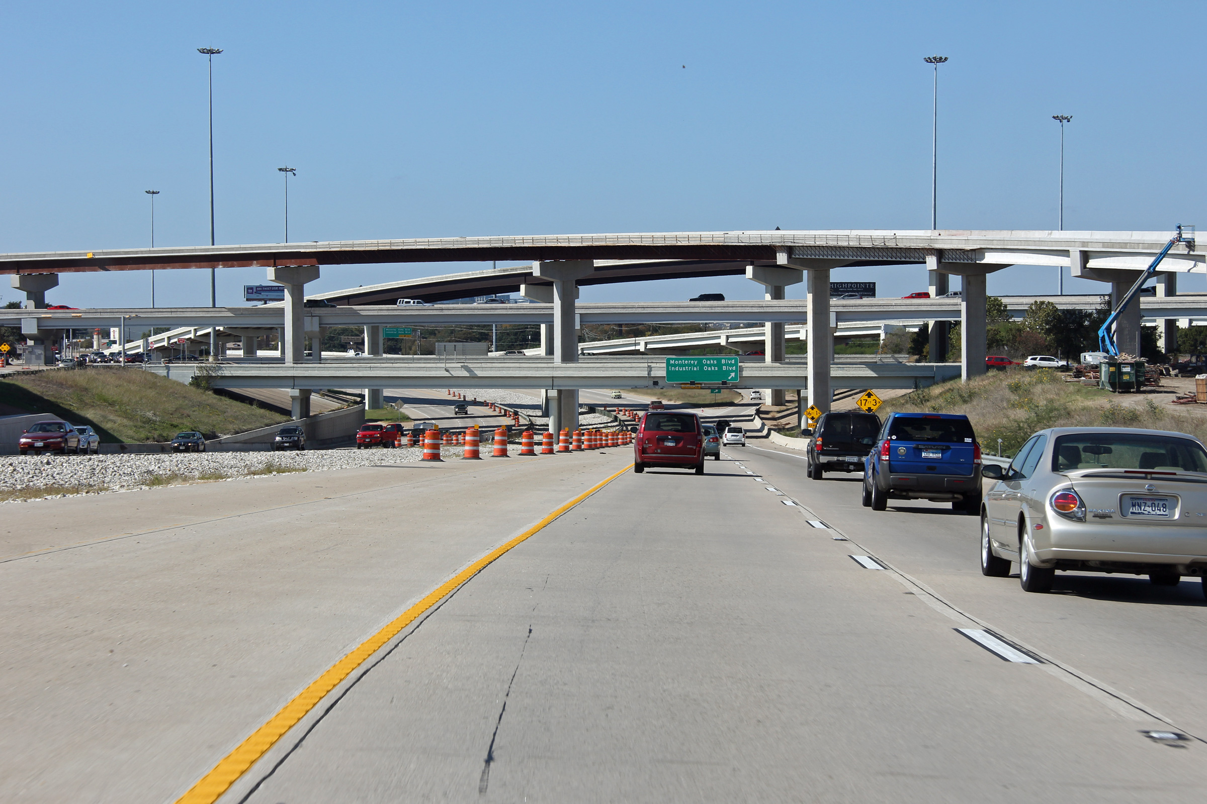
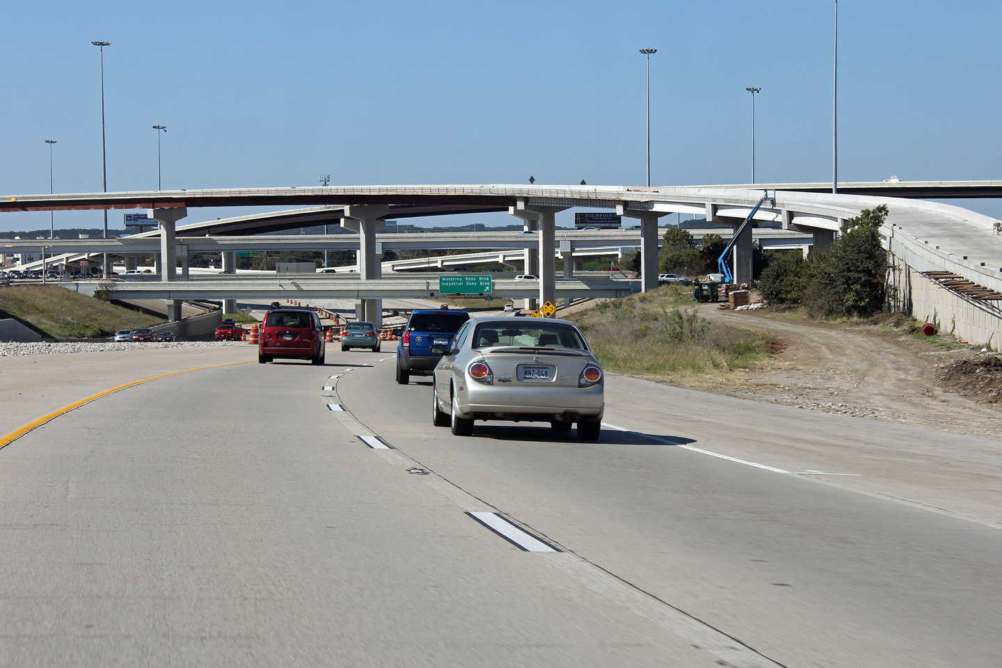
Travis County Sunset Valley |
Easterly view east of the MoPac Expressway interchange. Braided ramps, as are pictured in this photo, are quite common to freeways in Texas. |
 |
||
|
Date: 11/1/2012 |
High-res: (1440x960) (2400x1600) | |||
|
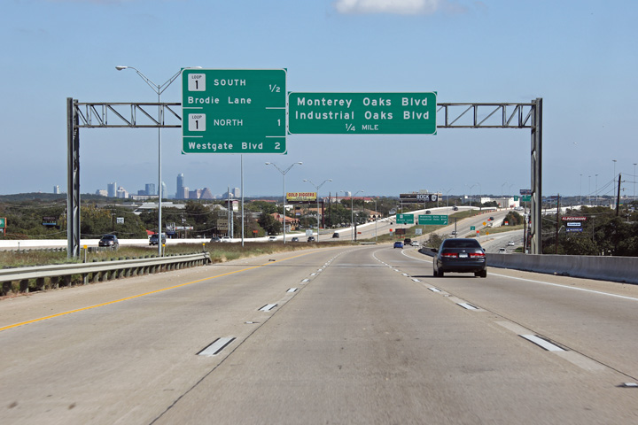
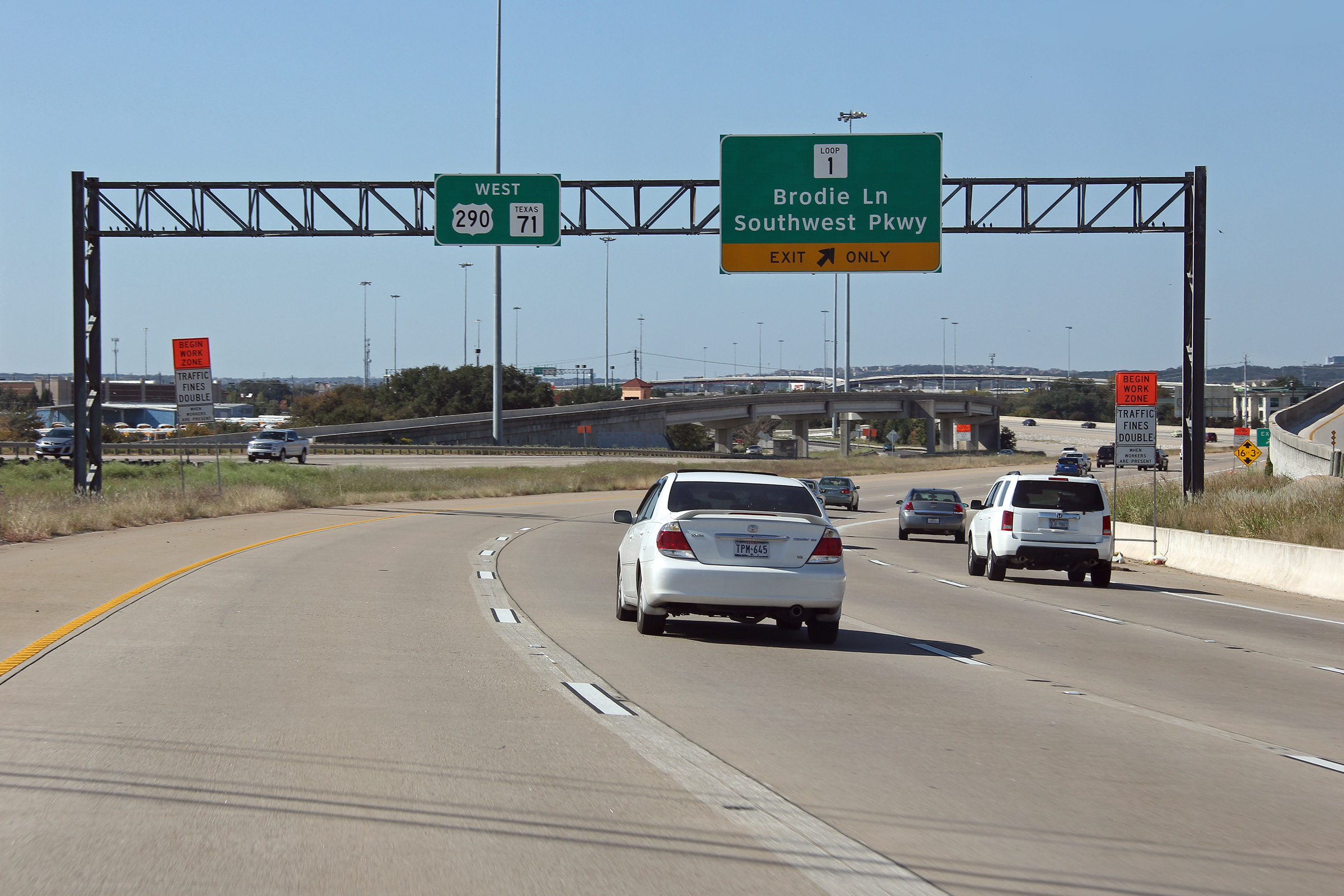
Travis County Sunset Valley |
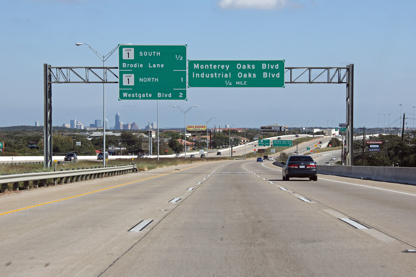
Signage for the MoPac Expressway interchange. From US-290 West, motorists bound to Loop 1 must access the expressway via the frontage road network. When this photo was taken, a new ramp was under construction to link US-290 West to Loop 1 South, but had yet to be completed. |
 |
||
|
Date: 11/1/2012 |
High-res: (1440x960) (2400x1600) | |||
|
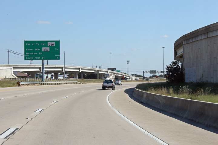
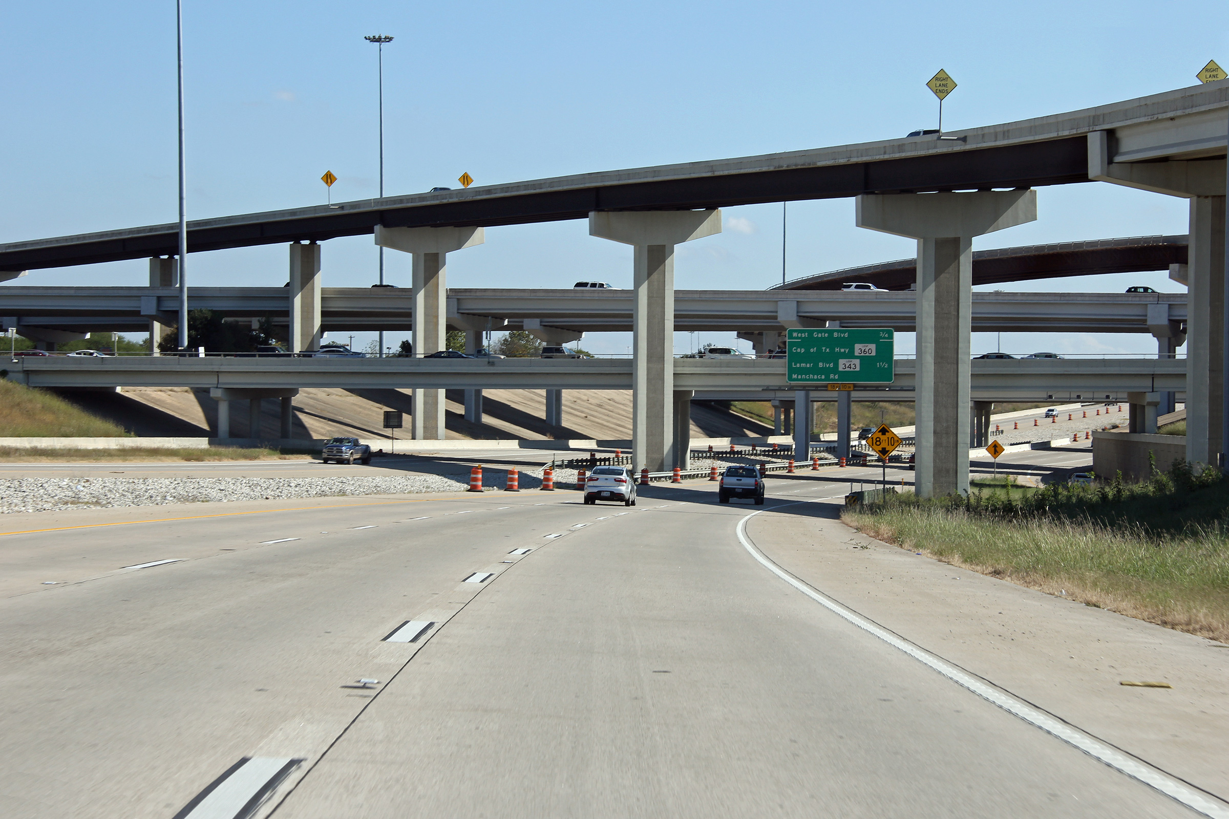
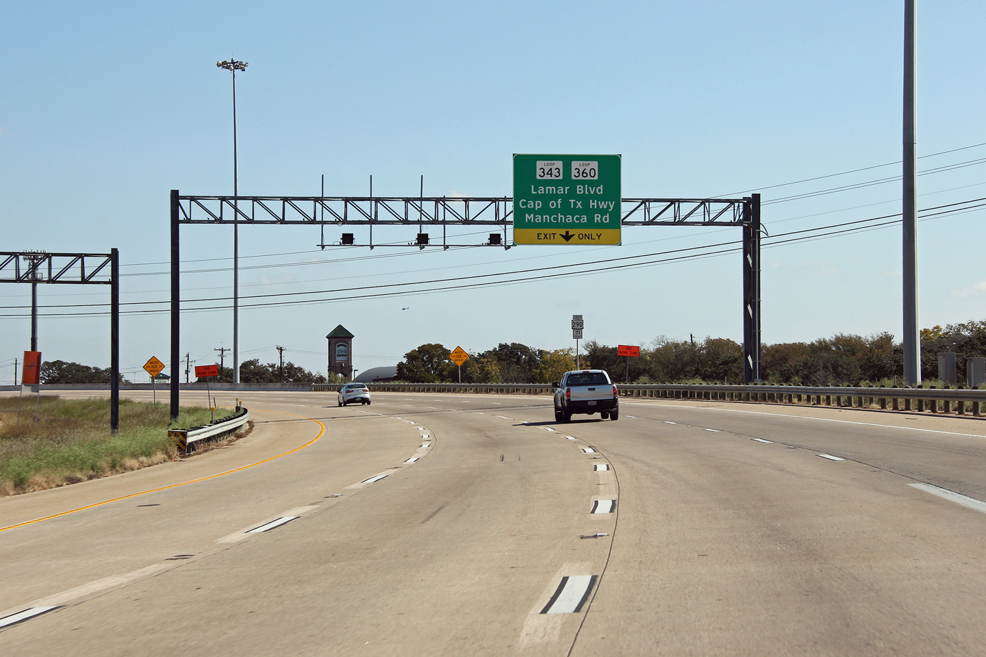
Travis County Austin |
Advanced signage for the ramp to Loops 360 and 343. |
 |
||
|
Date: 11/1/2012 |
High-res: (1440x960) (2400x1600) | |||
|
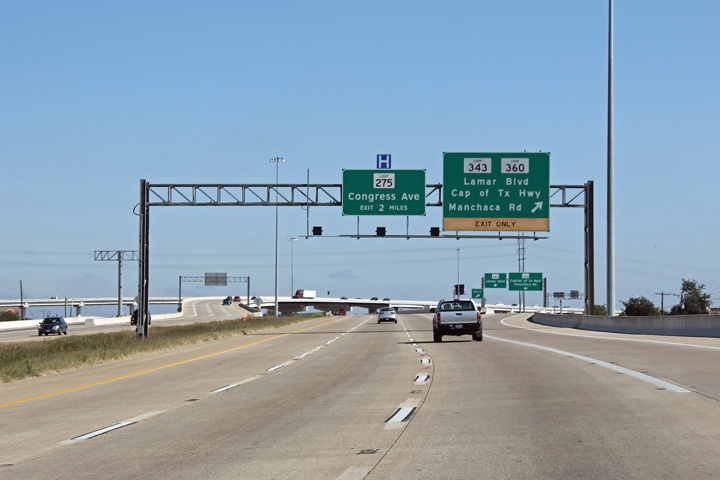
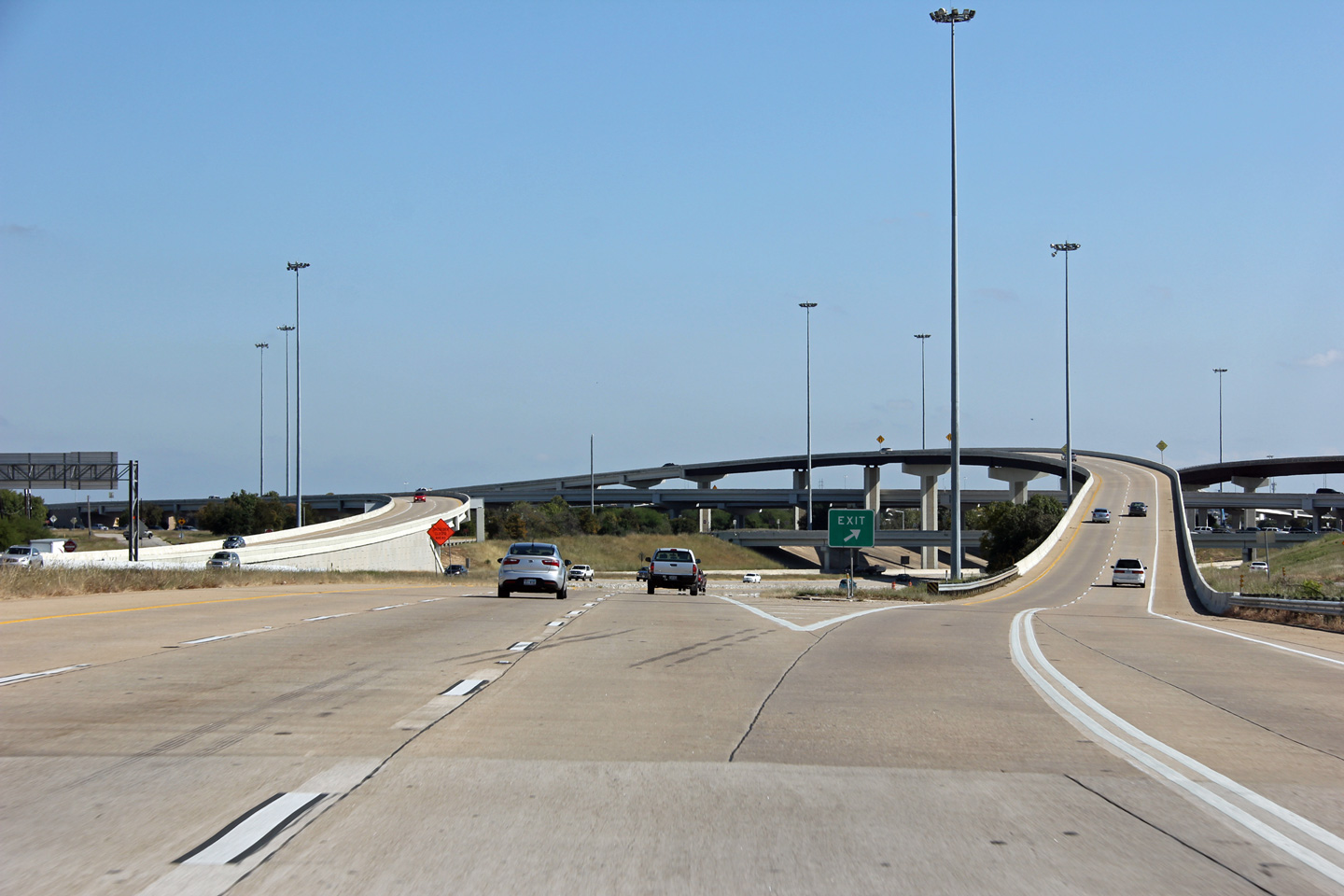
Travis County Austin |
Easterly view at the ramp to Loops 360 and 343. Unlike the at westbound off-ramp, there is no direct connect between US-290 and Loop 360 West. |
 |
||
|
Date: 11/1/2012 |
High-res: (1440x960) | |||
|
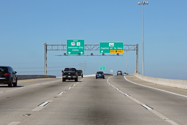
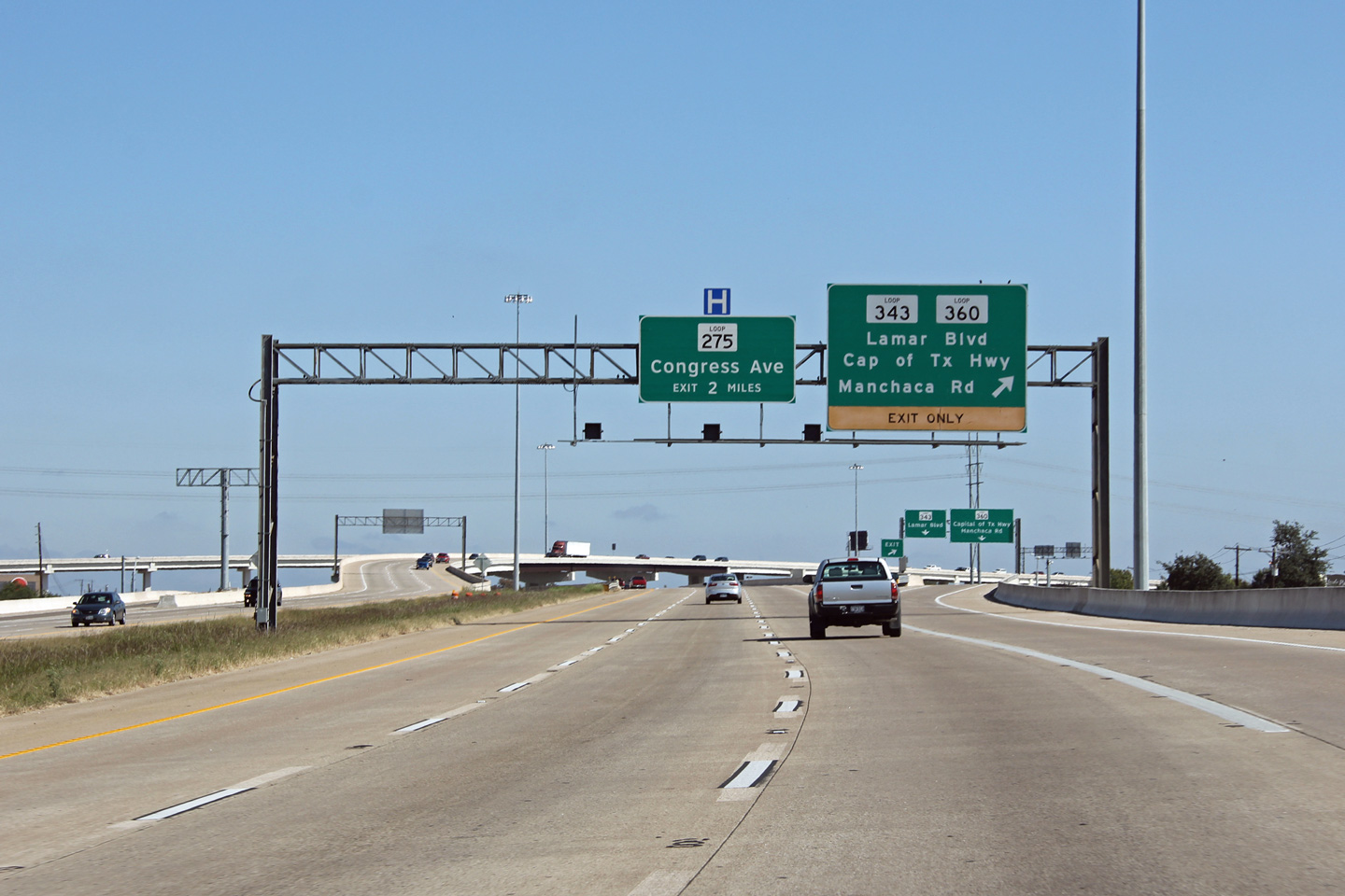
Travis County Austin |
Westerly at the westbound off-ramp to Loop 360. The westbound off-ramp to Loop 360 by-passes the US-290 frontage roads. |
 |
||
|
Date: 11/1/2012 |
High-res: (1440x960) (2400x1600) | |||
|
Travis County Austin |
Advanced signage for the Loop 360 interchange at the off-ramp to Loop 343. |
 |
||
|
Date: 11/1/2012 |
High-res: (1440x960) (2400x1600) | |||
|
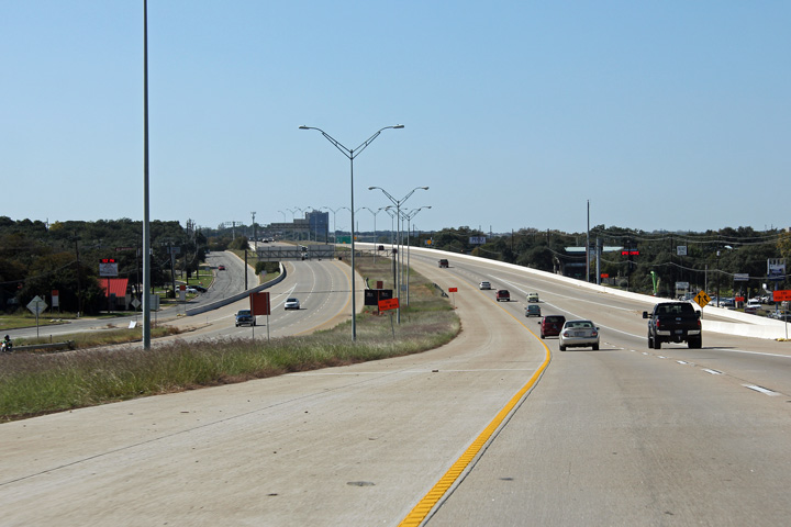
Travis County Austin |
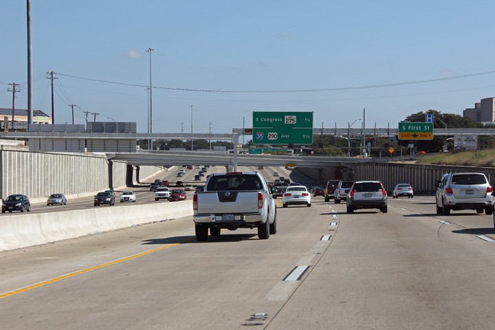
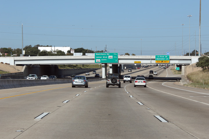
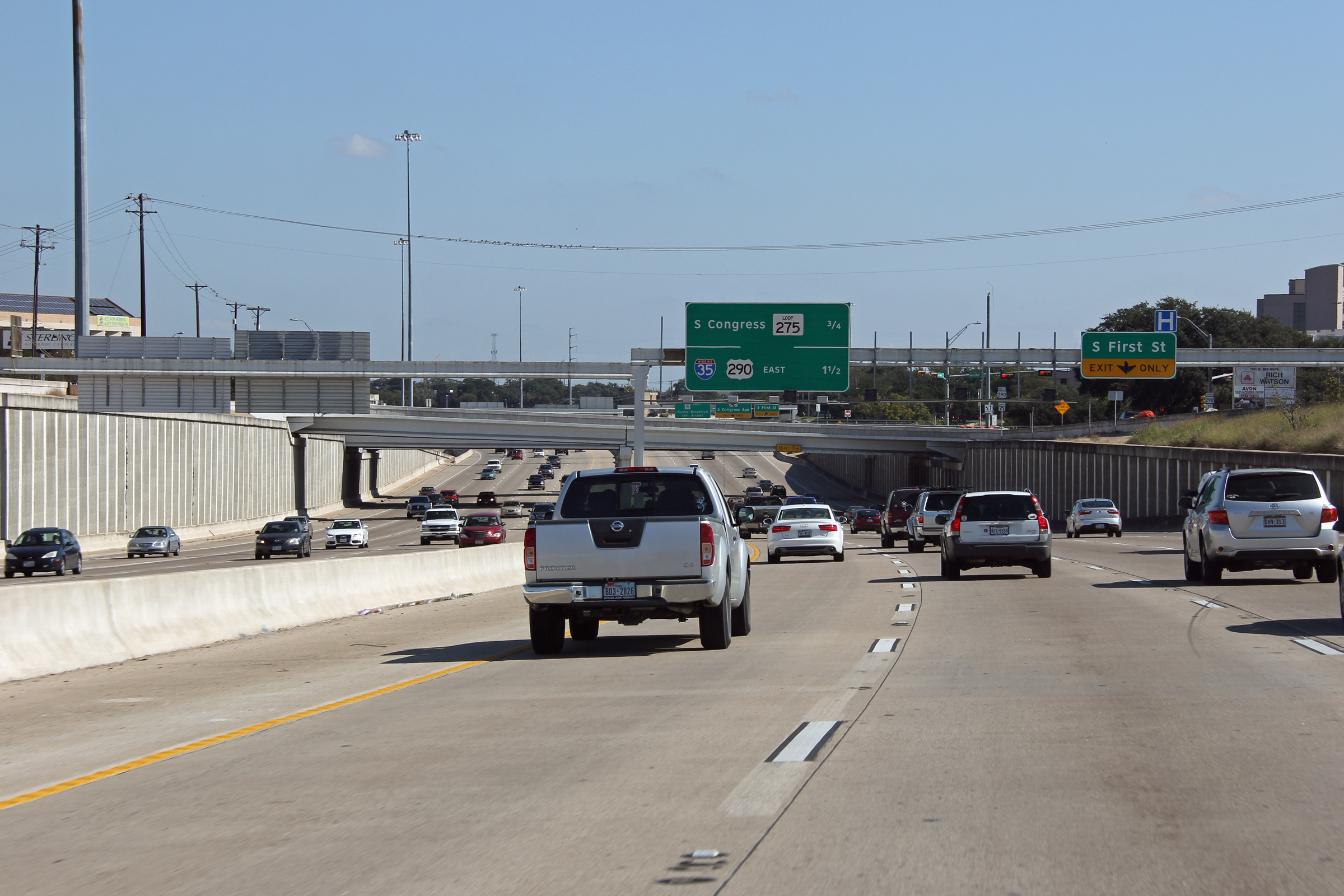
Easterly view approaching First Street. Traffic volumes along US-290 are noticeably higher to the east of the Loop 360 interchange than to the west. |
 |
||
|
Date: 11/1/2012 |
High-res: (1440x960) (2400x1600) | |||
|
Travis County Austin |
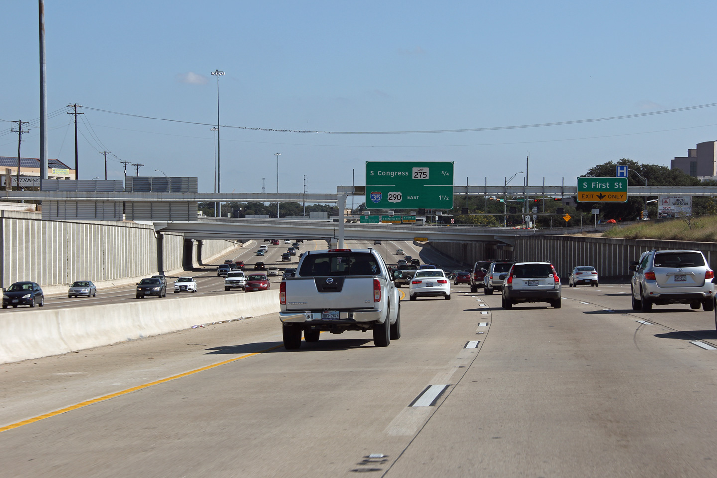
Overhead signs affixed to the First Street overpass. |
 |
||
|
Date: 11/1/2012 |
High-res: (1440x960) (2400x1600) | |||
|
Travis County Austin |
Easterly view through the Congress Avenue overpass. |
 |
||
|
Date: 11/1/2012 |
High-res: (1440x960) (2400x1600) | |||
|
Travis County Austin |
This view looks westerly at the Congress Avenue overpass. |
 |
||
|
Date: 11/1/2012 |
High-res: (1440x960) (2400x1600) | |||
|
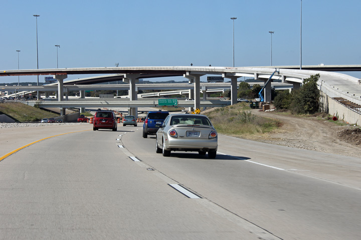
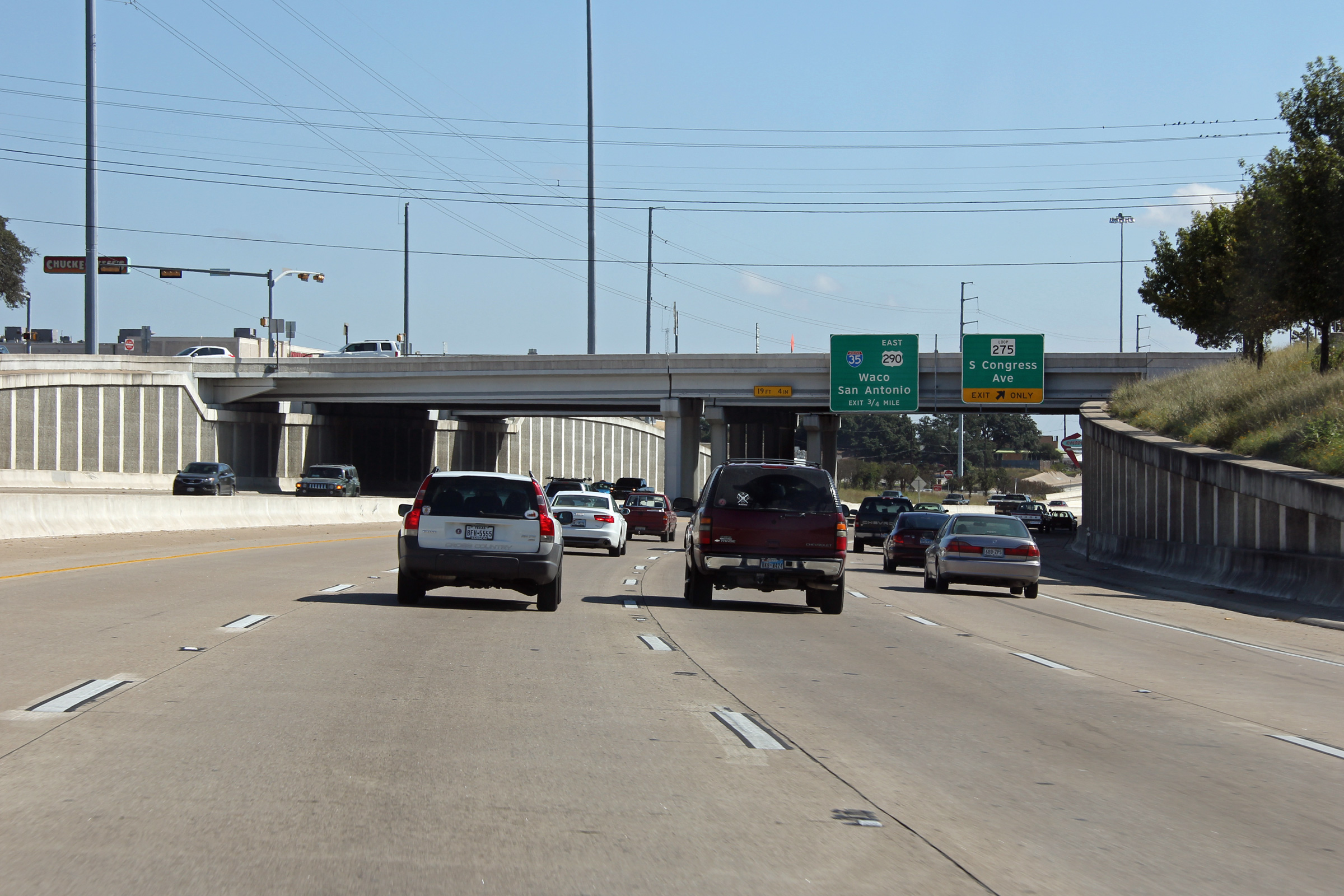
Travis County Austin |
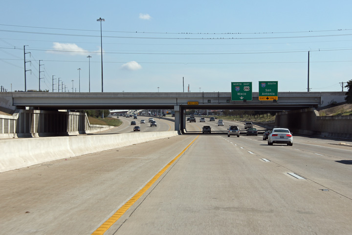
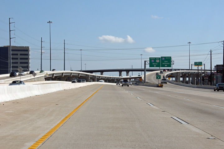
Advanced signage for the five level stack interchange between US-290 and I-35. |
 |
||
|
Date: 11/1/2012 |
High-res: (1440x960) (2400x1600) | |||
|
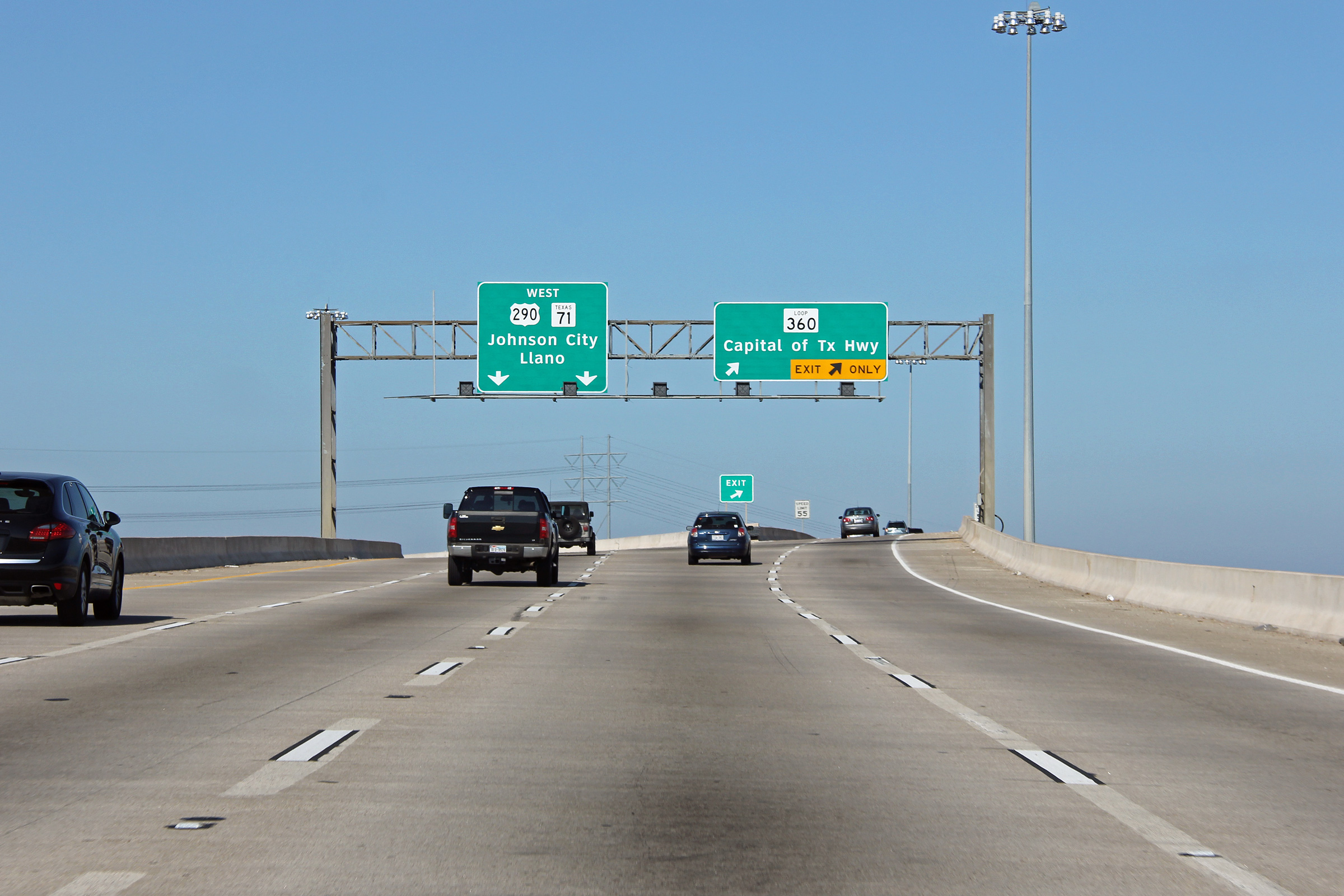
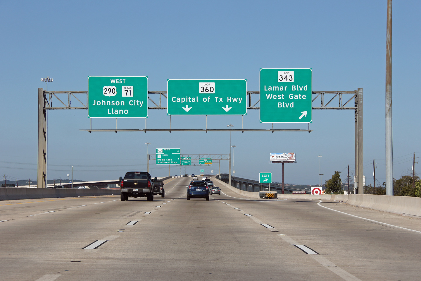
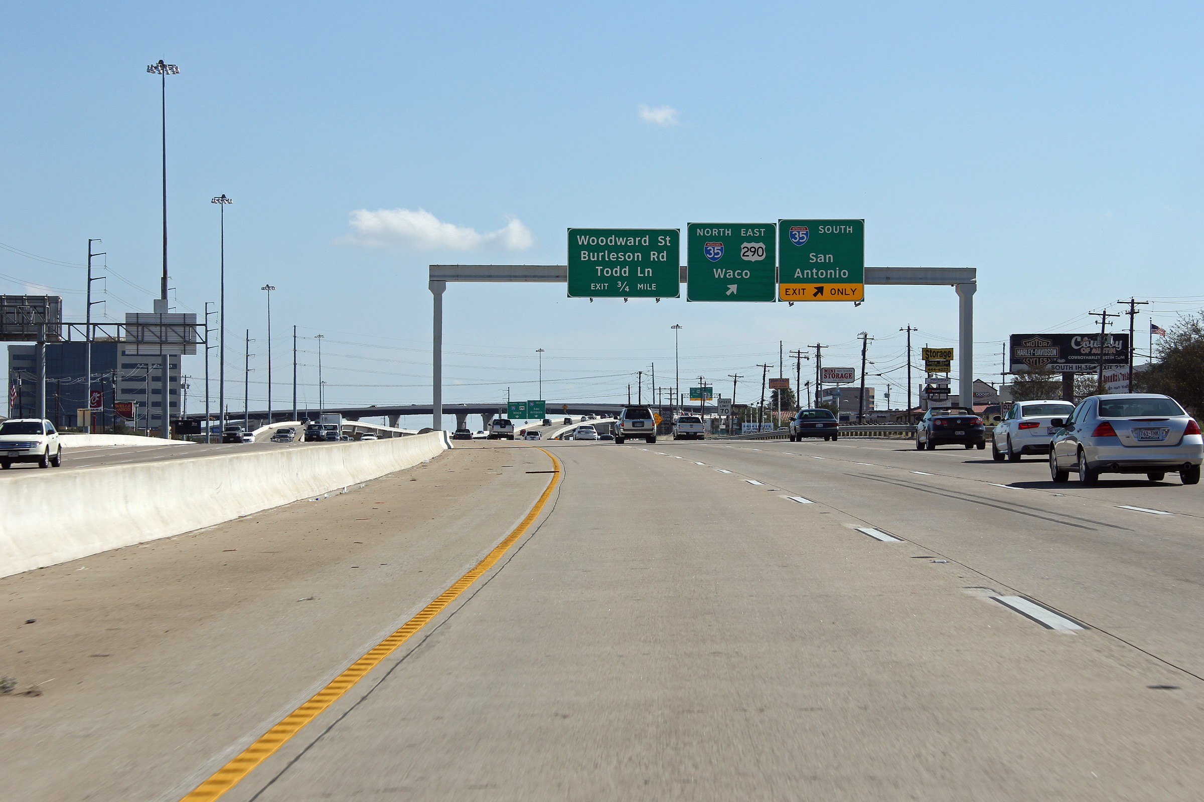
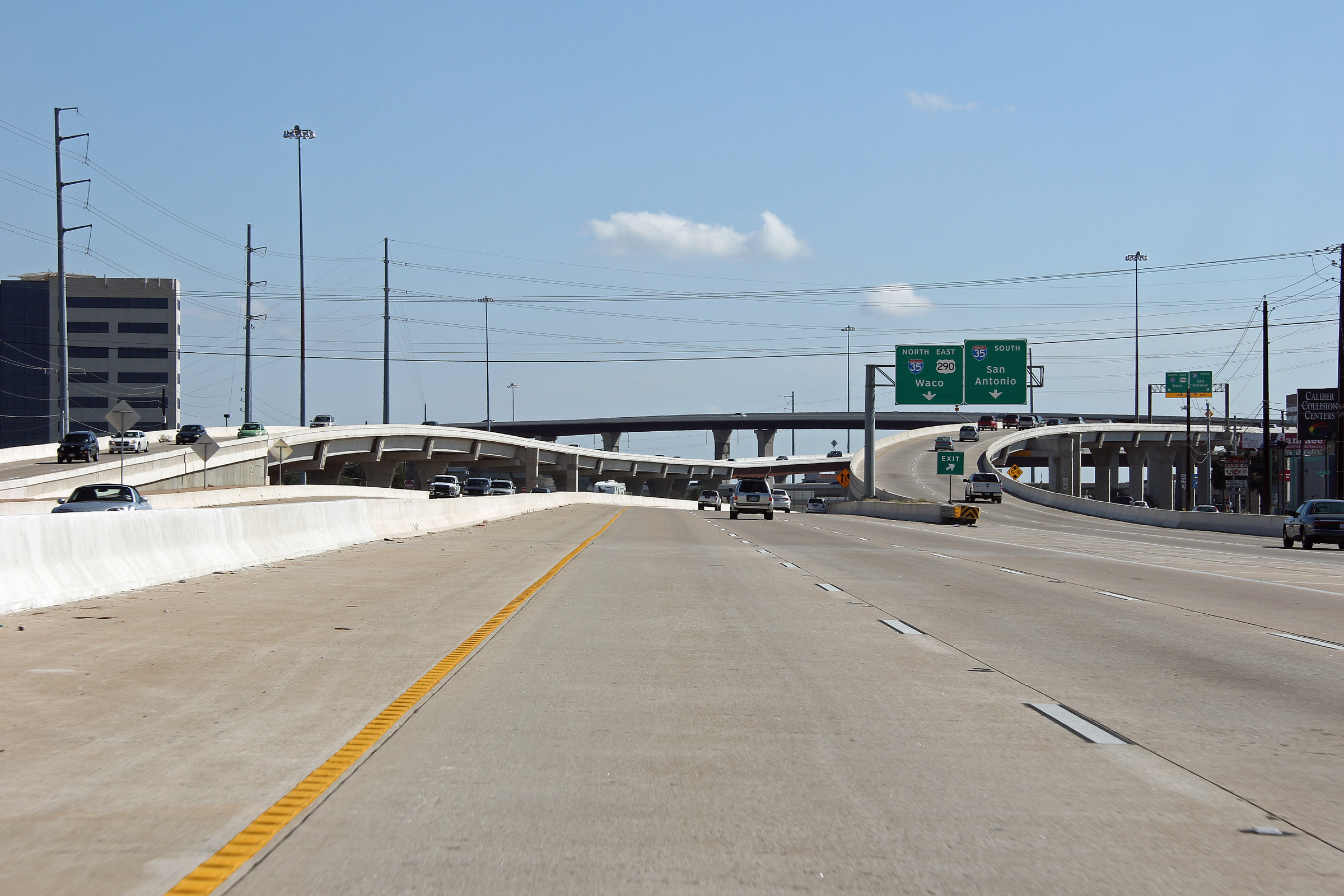
Travis County Austin |
Easterly view at the I-35 interchange. US-290 departs the mainline freeway at this interchange. US-290 runs concurrent with I-35 for several miles from this interchange northerly. |
 |
||
|
Date: 11/1/2012 |
High-res: (1440x960) (2400x1600) | |||
|
Travis County Austin |
Easterly view along US-290 where it runs concurrent with I-35 approaching the southern US-290/I-35 interchange. |
 |
||
|
Date: 11/1/2012 |
High-res: (1440x960) (2400x1600) | |||
<- US-287
TX Highways
US-377 ->
AsphaltPlanet.ca
© 2012-2013 AsphaltPlanet.ca.
AsphaltPlanet@asphaltplanet.ca
Page Created: December 23, 2012.
Last Updated: December 23, 2012.