AsphaltPlanet.ca > California > SR-55
Pictures on this
page are arranged in order from south to north. CA-55 North photos are
left-aligned in the last column, while CA-55 South photos are right-aligned.
Center-line pictures are centered within the last column.
|
Location |
Description |
Photo |
||
|
North- |
South- |
|||
|
Orange County |
Northbound advanced signage for the ramp to the northbound lanes of the 405 Freeway. |
 |
||
|
Date: 12/17/2014 |
High-res: (1440x960) (2400x1600) | |||
|
Orange County |
Northbound signage at the off-ramp to the 405 Freeway. |
 |
||
|
Date: 12/17/2014 |
High-res: (1440x960) (2400x1600) | |||
|
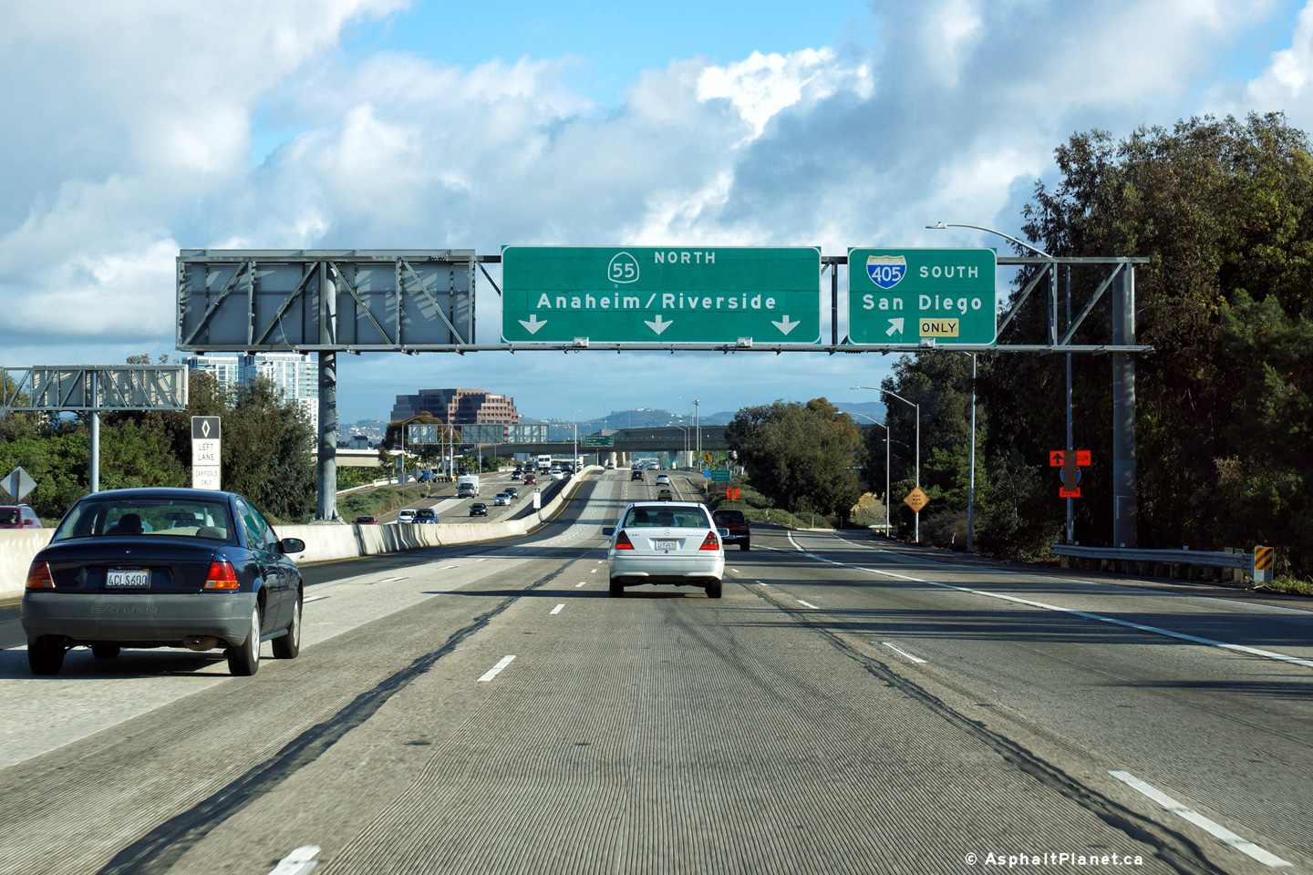
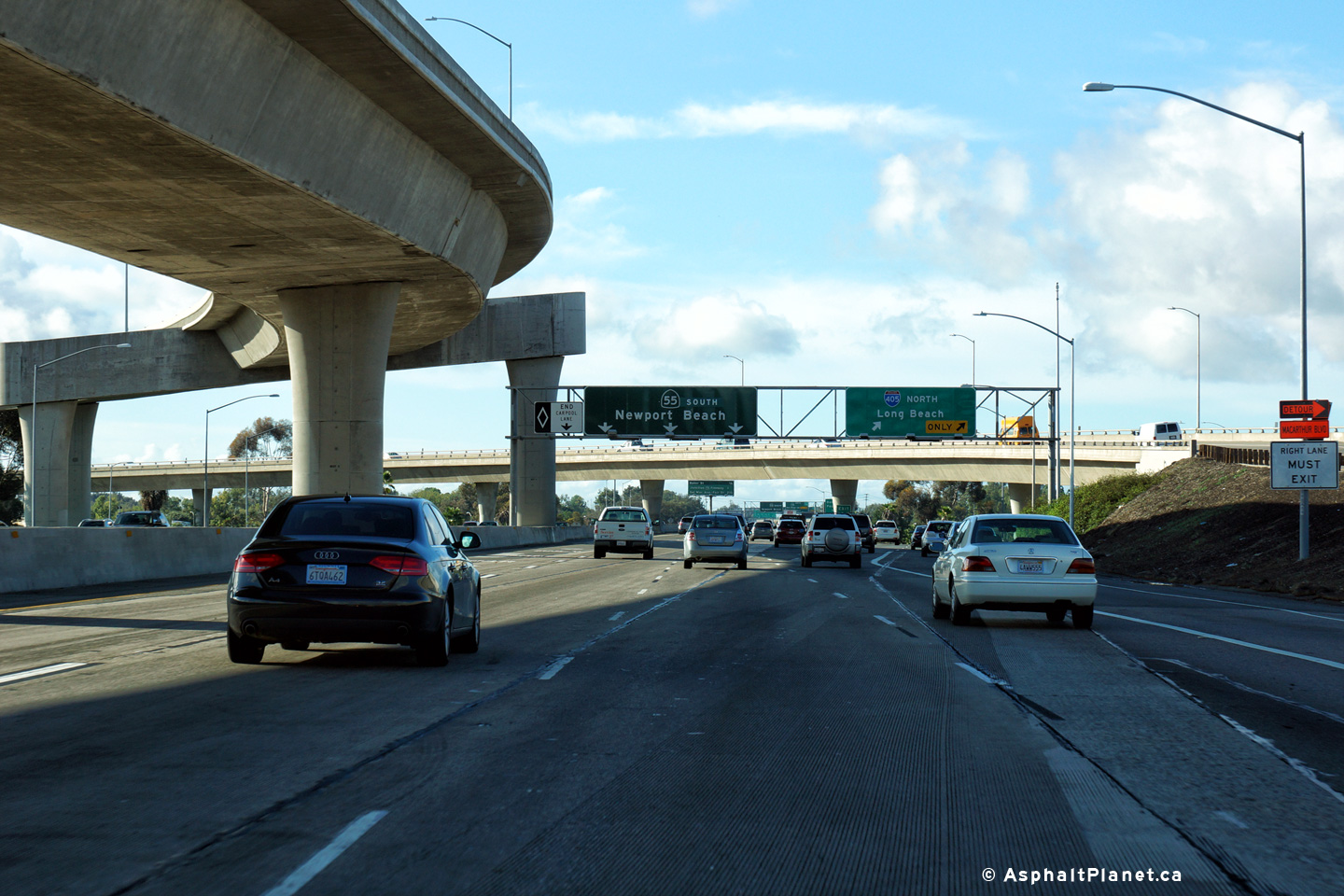
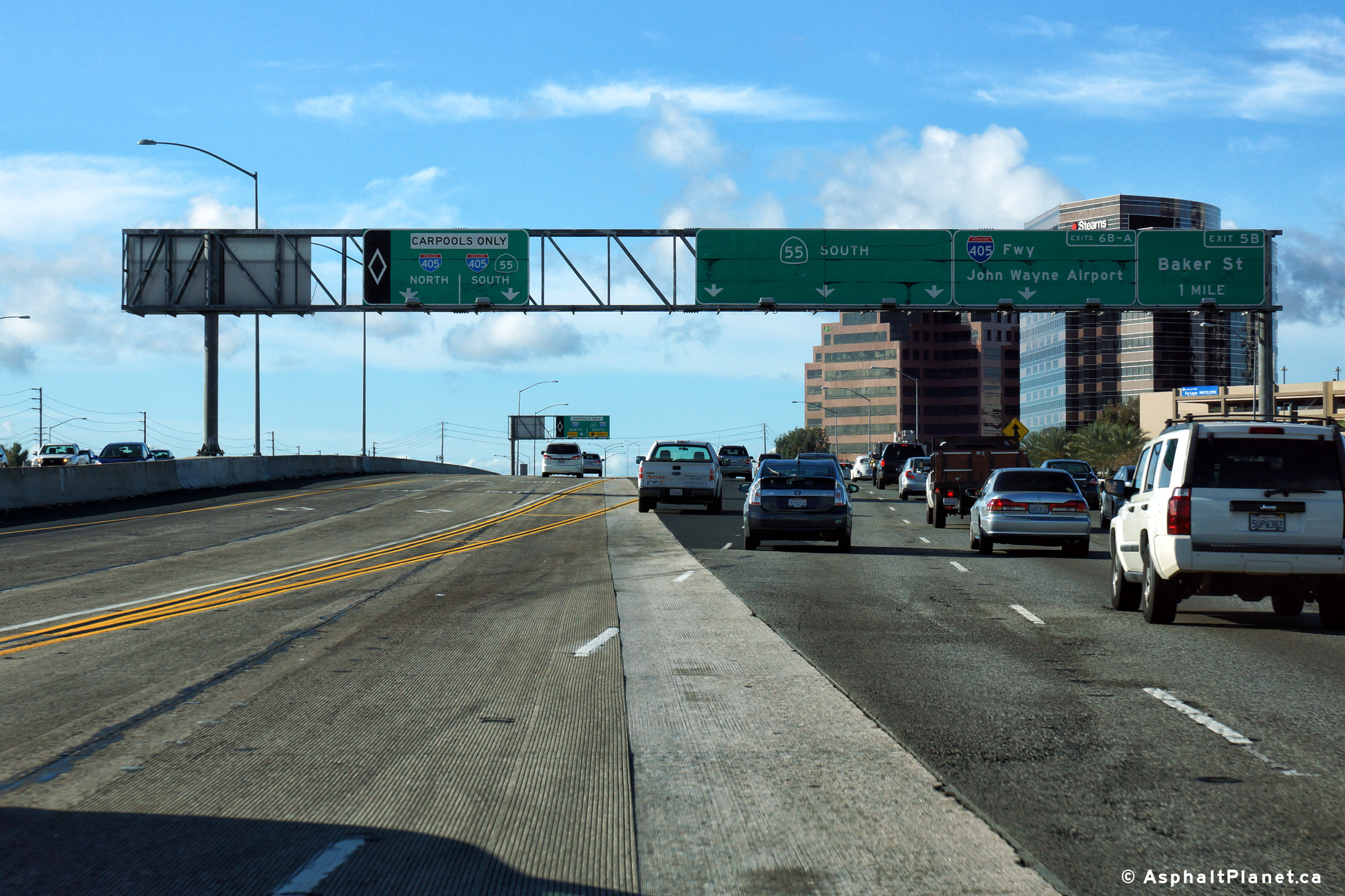
Orange County |
Interchange sequence signage at the I-405 interchange. The ramp that carries traffic from the southbound lanes of the 55 Freeway to the southbound lanes of the 405 freeway can be seen flying over the freeway beyond the median mounted signage. |
 |
||
|
Date: 12/17/2014 |
High-res: (1440x960) (2400x1600) | |||
|
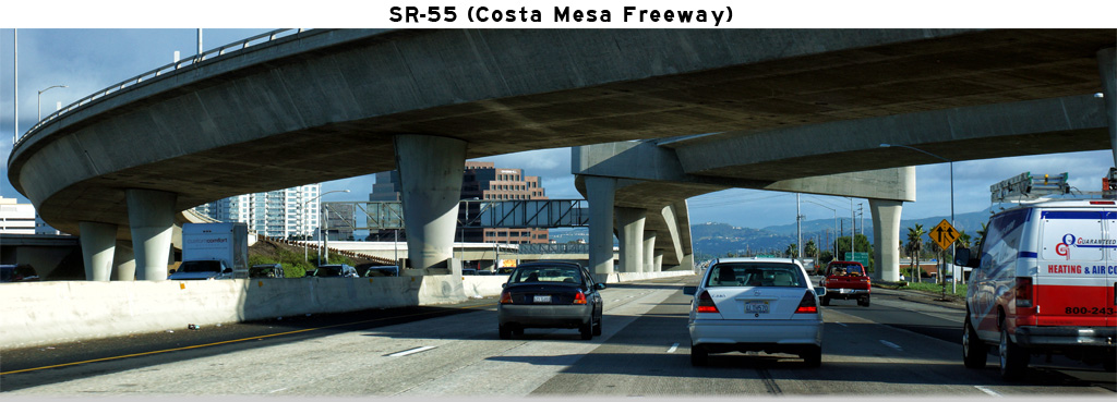
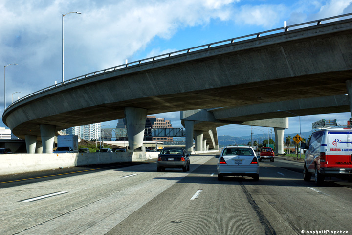
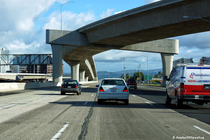
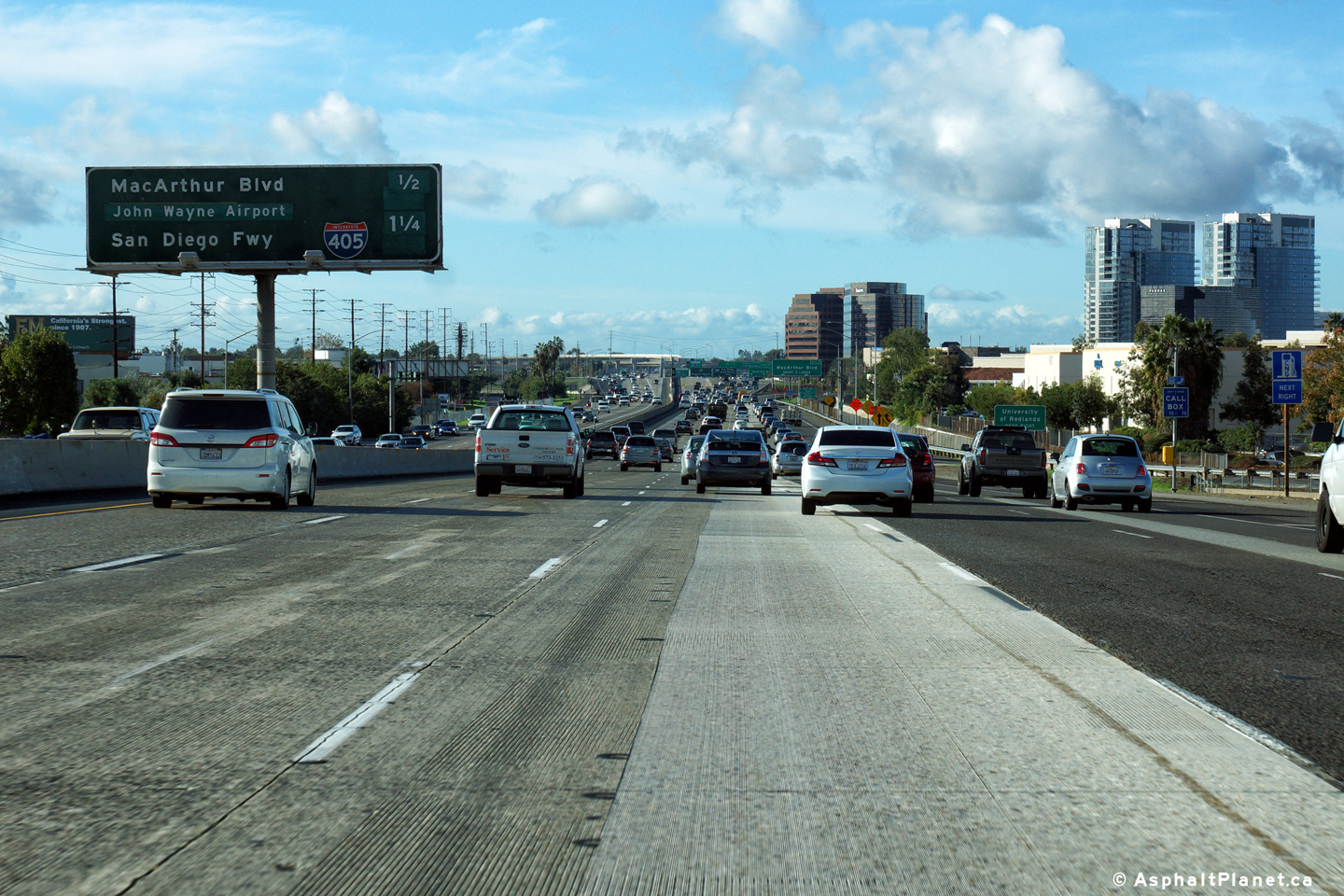
Orange County |
Two views looking northerly along the 55 Freeway as it passes through the 405 Freeway interchange. |
 |
||
| High-res: (1440x960) (2400x1600) | ||||
 |
||||
|
Date: 12/17/2014 |
High-res: (1440x960) (2400x1600) | |||
| Interstate 405 is the San Diego Freeway, and runs through both Los Angeles and Orange Counties. Click here for I-405 Images. | ||||
|
Orange County |
View looking southerly as the ramp to the northbound lanes of the 405 Freeway departs the freeway. |
 |
||
|
Date: 12/17/2014 |
High-res: (1440x960) (2400x1600) | |||
|
Orange County |
Southbound signage at the off-ramp to the 405 South. |
 |
||
|
Date: 12/17/2014 |
High-res: (1440x960) (2400x1600) | |||
|
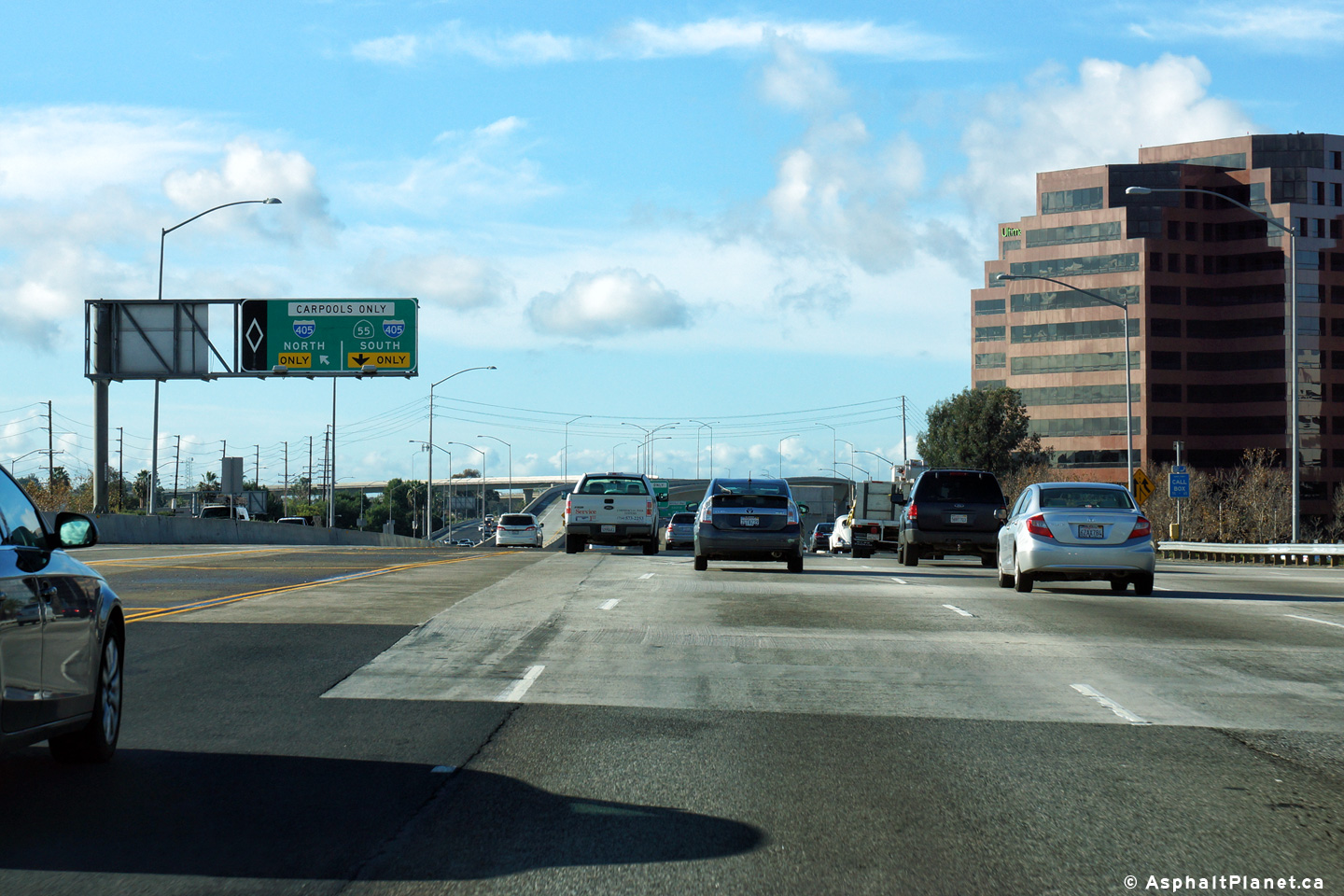
Orange County |
Southbound signage situated as the Carpool Lane ramp |
 |
||
|
Date: 12/17/2014 |
High-res: (1440x960) (2400x1600) | |||
|
Orange County |
Advanced signage for the Carpool Lane ramp to the southbound lanes of the 405 Freeway. The Carpool Lane ramp to the northbound lanes of the 405 Freeway can be seen departing the freeway directly beyond the pictured signage. |
 |
||
|
Date: 12/17/2014 |
High-res: (1440x960) (2400x1600) | |||
|
Orange County |
Northbound next exit signage approaching the Sunset Hills Boulevard interchange. |
 |
||
|
Date: 12/17/2014 |
High-res: (1440x960) (2400x1600) | |||
|
Orange County |
Signage at the Carpool Lane ramp to the 405 Freeway north. |
 |
||
|
Date: 12/17/2014 |
High-res: (1440x960) (2400x1600) | |||
|
Orange County |
Southbound lane assignment signage approaching the 405 Freeway interchange. |
 |
||
|
Date: 12/17/2014 |
High-res: (1440x960) (2400x1600) | |||
|
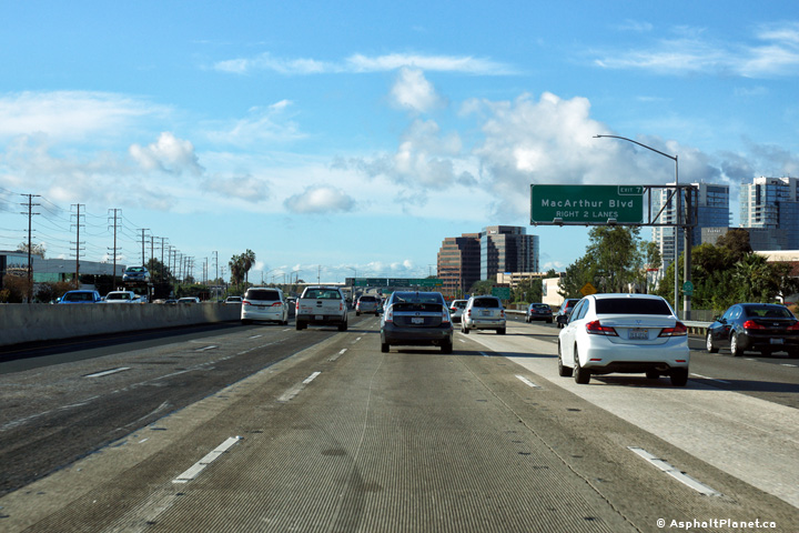
Orange County |
Southbound signage at the off-ramp to MacArthur Boulevard. |
 |
||
|
Date: 12/17/2014 |
High-res: (1440x960) (2400x1600) | |||
|
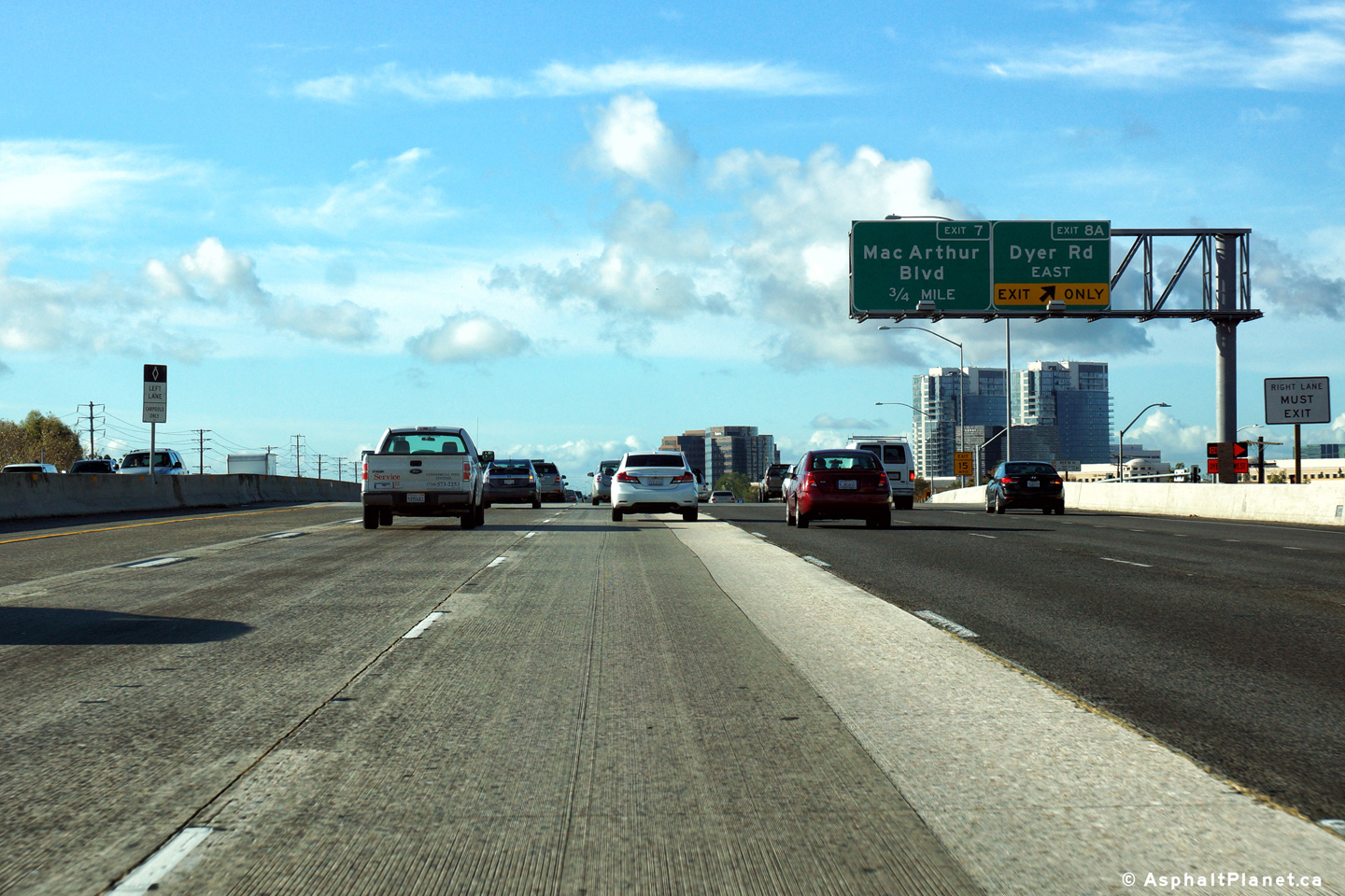
Orange County |
Southbound advanced signage for the off-ramp to MacArthur Boulevard. |
 |
||
|
Date: 12/17/2014 |
High-res: (1440x960) (2400x1600) | |||
|
Orange County |
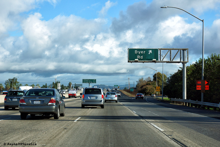
Northbound signage at the off-ramp to the Dyer Road interchange. |
 |
||
|
Date: 12/17/2014 |
High-res: (1440x960) (2400x1600) | |||
|
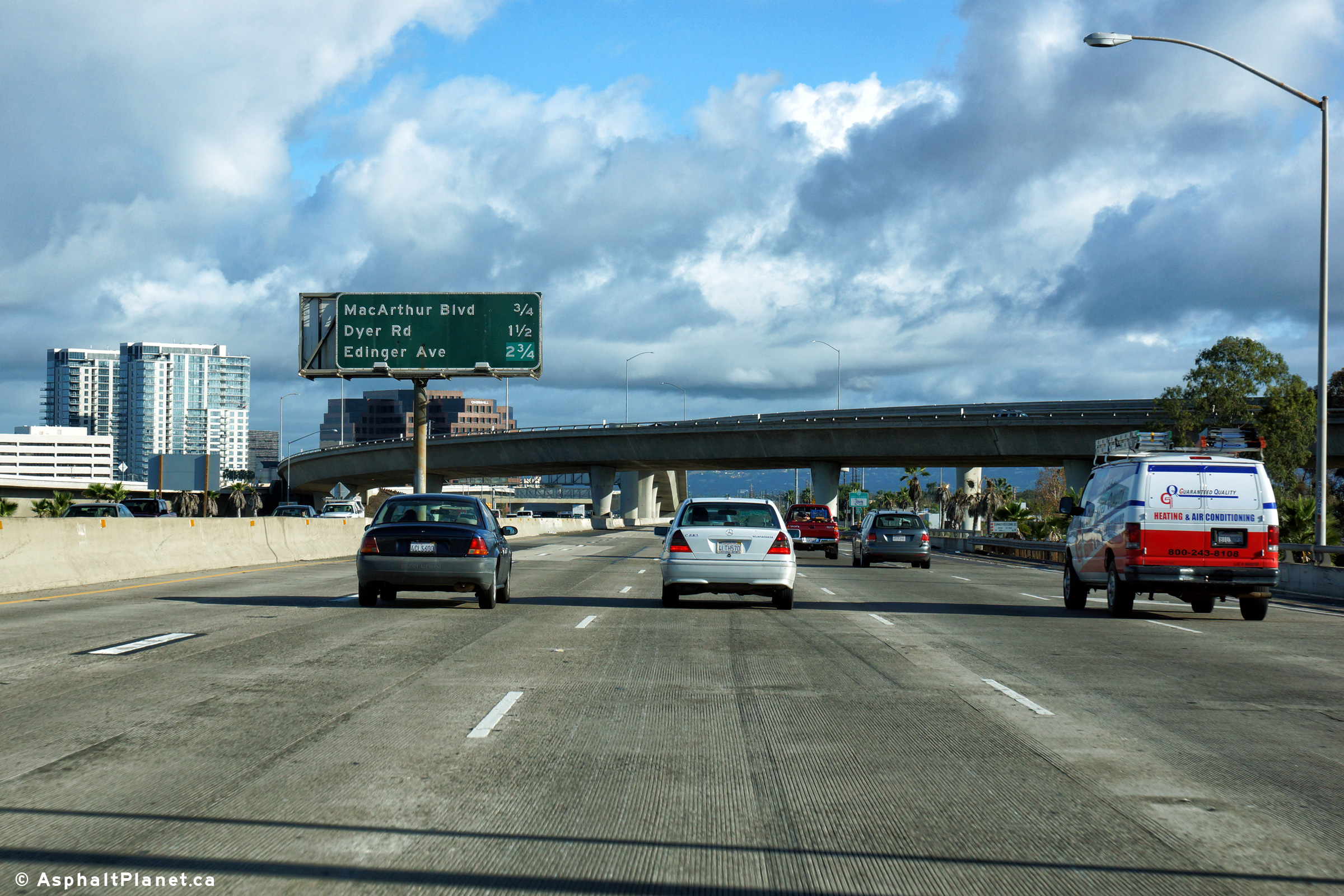
Orange County |
Southbound signage listing the next three upcoming interchanges located within the footprint of the Dyer Road interchange. |
 |
||
|
Date: 12/17/2014 |
High-res: (1440x960) (2400x1600) | |||
|
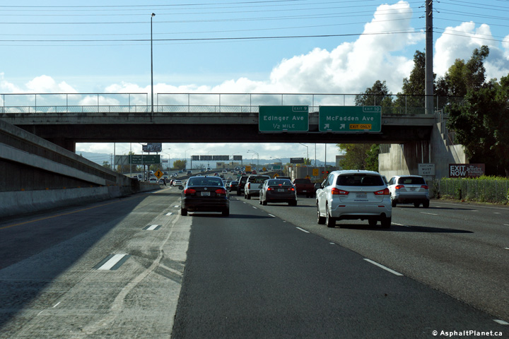
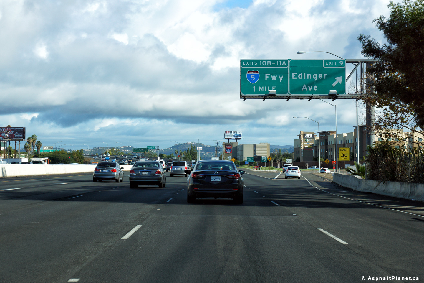
Orange County |
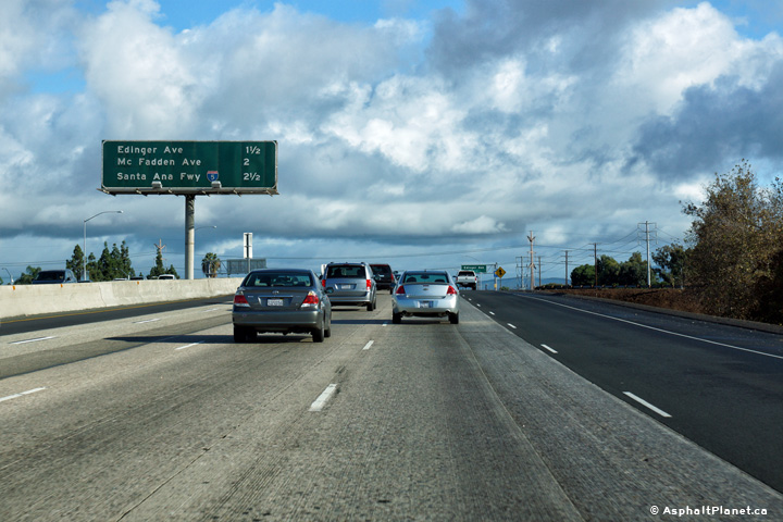
Advanced signage for the off-ramp to Edinger Avenue. |
 |
||
|
Date: 12/17/2014 |
High-res: (1440x960) (2400x1600) | |||
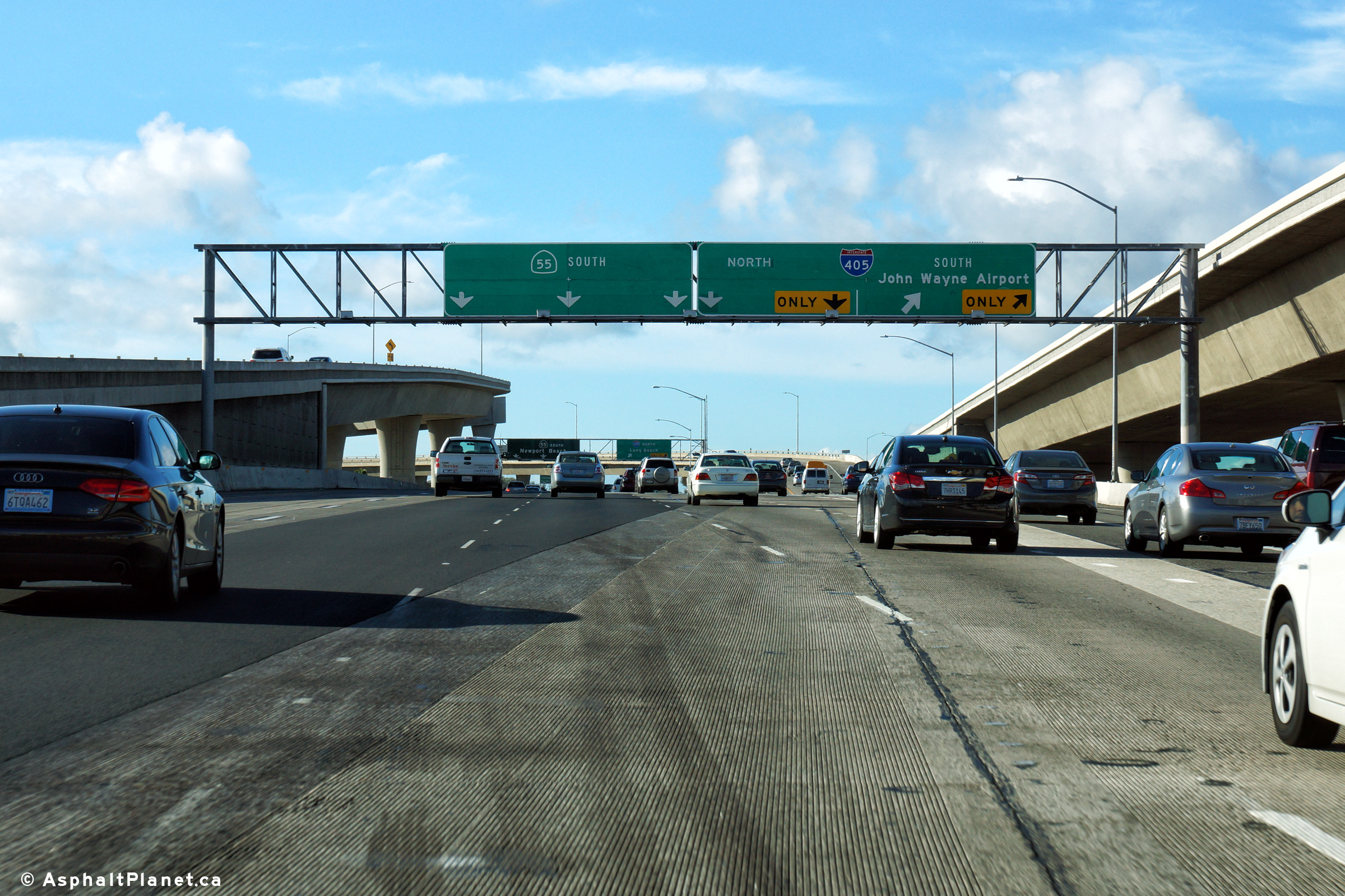
|
Orange County |
Southbound interchange sequence signage located beyond the Dyer Road interchange. Traffic bound to John Wayne Airport was formerly directed to follow MacArthur Boulevard, but due to interchange modifications at the 405 Freeway interchange traffic bound to the airport are not directed to follow the ramp to I-405 South. |
 |
||
|
Date: 12/17/2014 |
High-res: (1440x960) (2400x1600) | |||
|
Orange County |
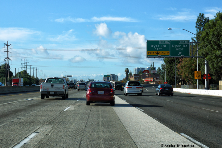
Southbound signage at the off-ramp to Dyer Road East. |
 |
||
|
Date: 12/17/2014 |
High-res: (1440x960) (2400x1600) | |||
|
Orange County |
Signage at the off-ramp to Dyer Road West. |
 |
||
|
Date: 12/17/2014 |
High-res: (1440x960) (2400x1600) | |||
|
Orange County |
Southbound advanced signage for the Dyer Road interchange. The on-ramp from Edinger Avenue remains as an auxiliary lane along the southbound lanes of the 55 Freeway exiting at the Dyer Road interchange. |
 |
||
|
Date: 12/17/2014 |
High-res: (1440x960) (2400x1600) | |||
|
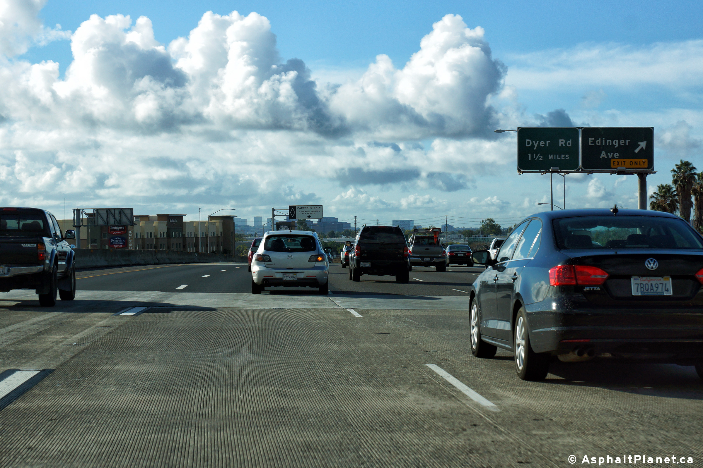
Orange County |
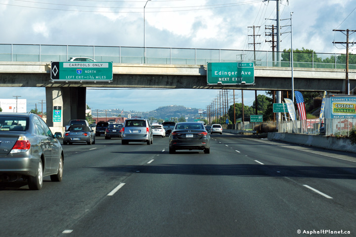
Northbound advanced signage for the off-ramp to Edinger Avenue. |
 |
||
|
Date: 12/17/2014 |
High-res: (1440x960) (2400x1600) | |||
|
Orange County |
Northbound signage at the off-ramp to Edinger Avenue. |
 |
||
|
Date: 12/17/2014 |
High-res: (1440x960) (2400x1600) | |||
|
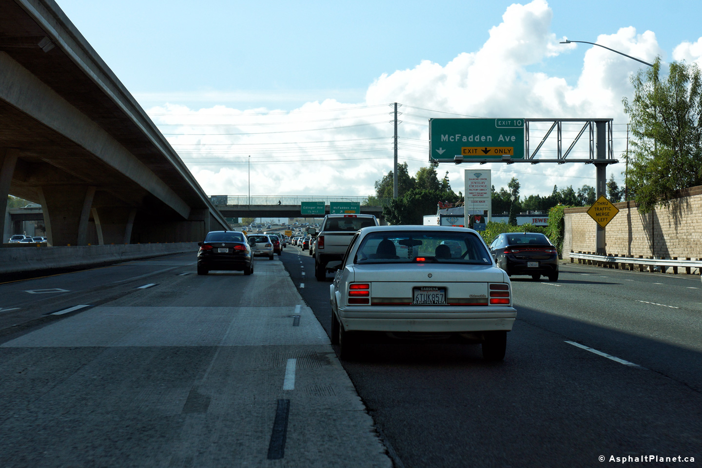
Orange County |
Northbound interchange sequence signage approaching the McFadden Avenue interchange. |
 |
||
|
Date: 12/17/2014 |
High-res: (1440x960) (2400x1600) | |||
|
Orange County |
Southbound interchange sequence signage located within the footprint of the Edinger Avenue interchange. |
 |
||
|
Date: 12/17/2014 |
High-res: (1440x960) (2400x1600) | |||
|
Orange County |
Southbound signage at the off-ramp to Edinger Avenue. |
 |
||
|
Date: 12/17/2014 |
High-res: (1440x960) (2400x1600) | |||
|
Orange County |
Northbound signage at the off-ramp to McFadden Avenue. |
 |
||
|
Date: 12/17/2014 |
High-res: (1440x960) (2400x1600) | |||
|
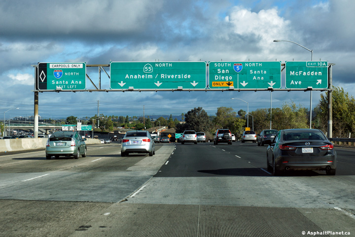
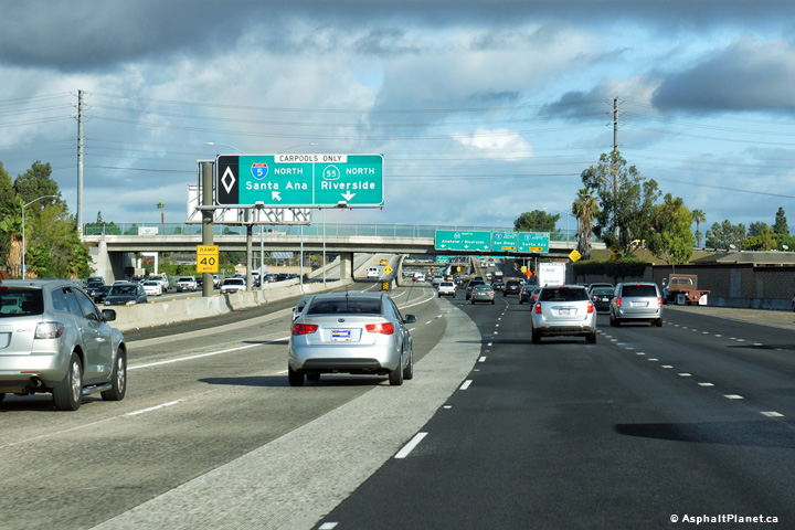
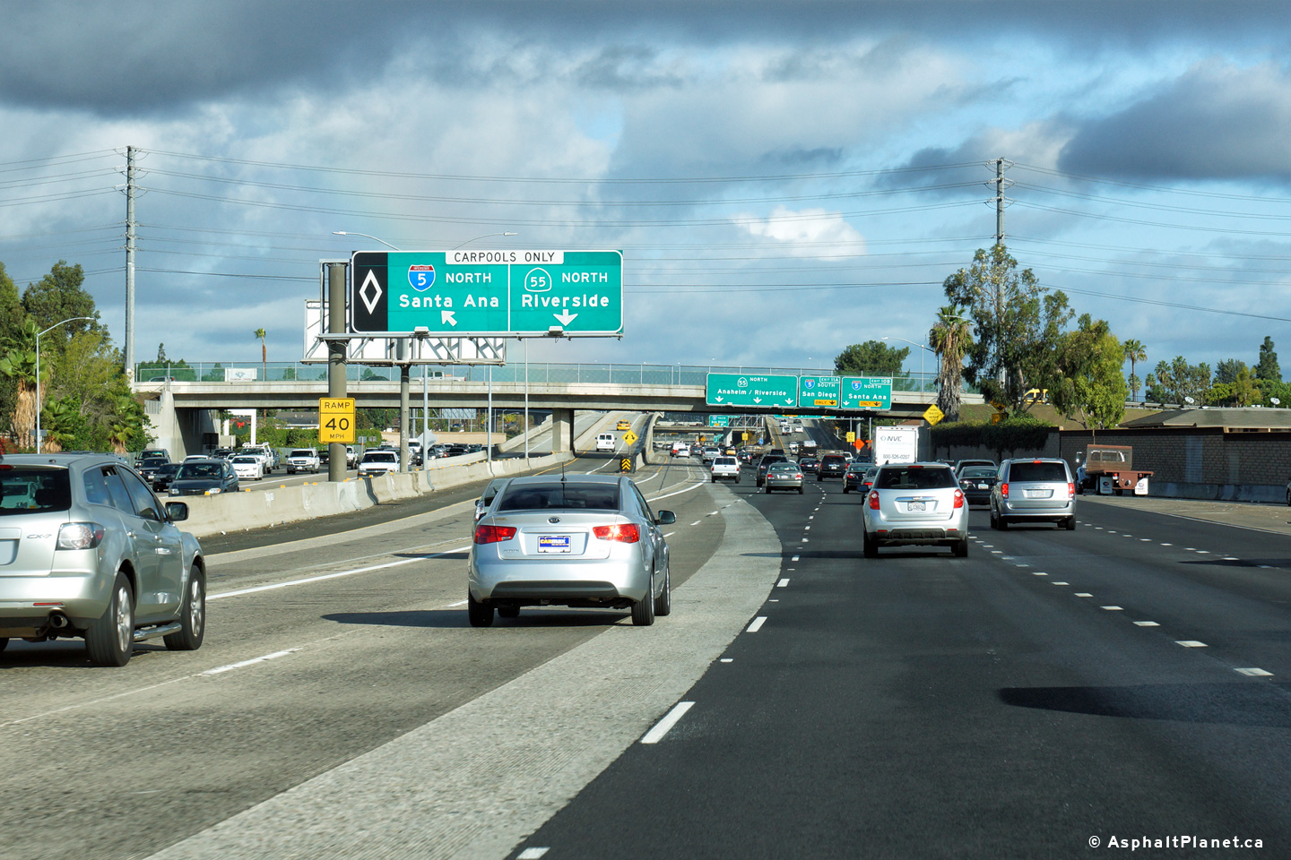
Orange County |
Northbound signage for the carpool lane ramp to the northbound lanes of the 5 Freeway. |
 |
||
|
Date: 12/17/2014 |
High-res: (1440x960) (2400x1600) | |||
|
Orange County |
Northbound lane assignment signage in advance of the 5 Freeway interchange. |
 |
||
|
Date: 12/17/2014 |
High-res: (1440x960) (2400x1600) | |||
|
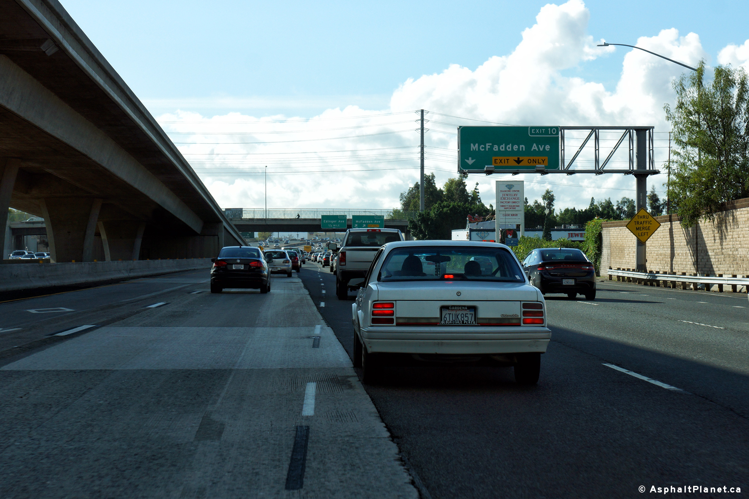
Orange County |
Southbound signage at the off-ramp to McFadden Avenue. |
 |
||
|
Date: 12/17/2014 |
High-res: (1440x960) (2400x1600) | |||
|
Orange County |
Southbound advanced signage for the ramp to McFadden Avenue. |
 |
||
|
Date: 12/17/2014 |
High-res: (1440x960) (2400x1600) | |||
|
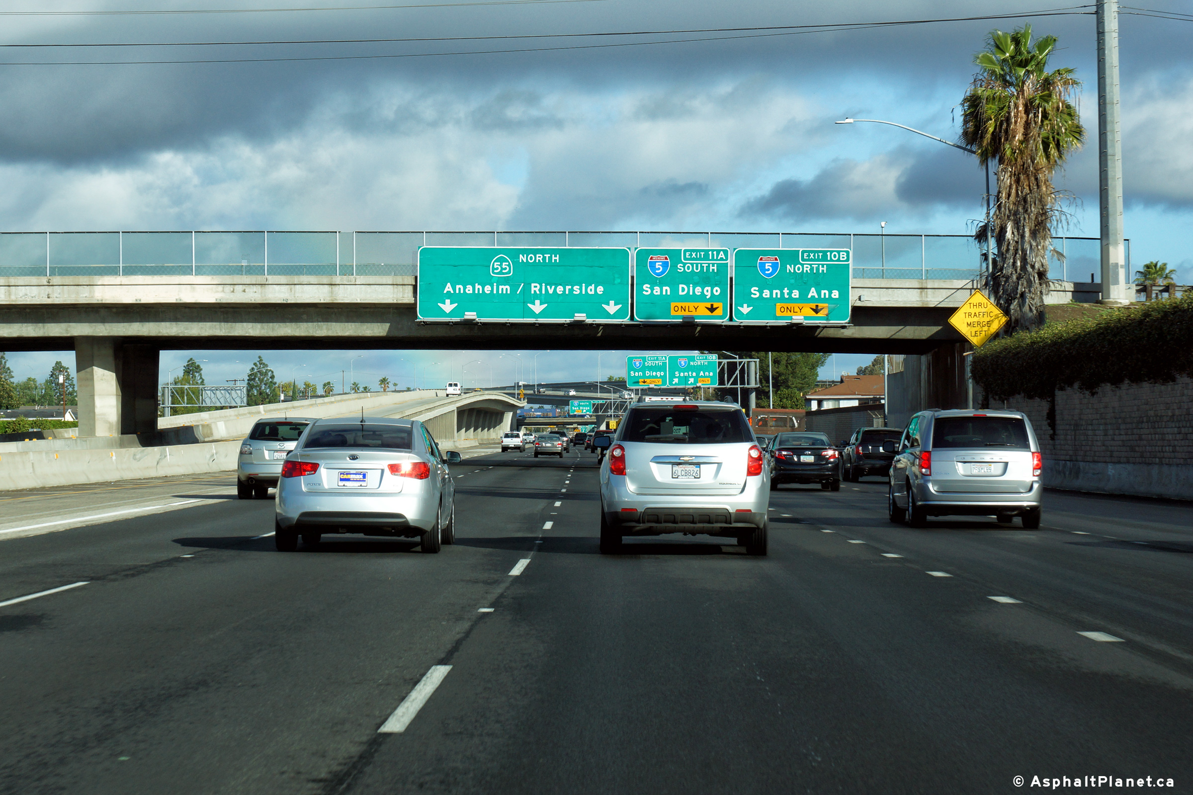
Orange County |
Northbound signage at the departure to the ramp to the northbound side of the 5 Freeway. |
 |
||
|
Date: 12/17/2014 |
High-res: (1440x960) (2400x1600) | |||
|
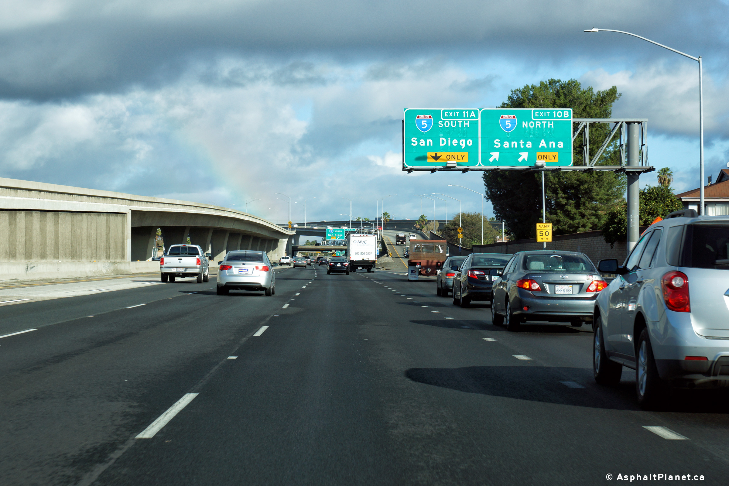
Orange County |
Northbound signage at the ramp to I-5 South. |
 |
||
|
Date: 12/17/2014 |
High-res: (1440x960) (2400x1600) | |||
|
Orange County |
View looking southerly along the 55 Freeway as the Carpool Lane ramp from the 5 Freeway passes overhead. |
 |
||
|
Date: 12/17/2014 |
High-res: (1440x960) (2400x1600) | |||
| Interstate 5 is the Santa Ana Freeway, and is the principle north-south freeway through California. Click here for I-5 Images. | ||||
<- CA-54
CA Highways
CA-56 ->
AsphaltPlanet.ca
© 2010-17 AsphaltPlanet.ca.
Scott@asphaltplanet.ca
Page Created: December 17, 2016.
Last Updated: December 17, 2016.