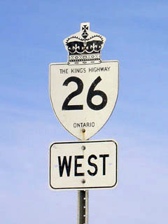
|
Proper Municipality Name |
Community Name |
Distance* |
Intersecting Road |
| Town of Owen Sound |
Owen Sound |
0 km / 117.0 km |
King's Highway 6 &
King's Highway 10 &
King's
Highway 21 |
|
EB: Take the short ramp to
the right onto 16th Street. WB: Turn
left onto 9th Avenue as 16th Street Ends |
| Owen Sound - Meaford Boundary |
----- |
3.1km / 112.6km (113.9km) |
20th Avenue (Formerly Grey Road 21) |
| Municipality of Meaford |
----- |
4.5km / 111.2km (112.5km) |
Grey Road 15 |
| Municipality of Meaford |
----- |
5.8km / 109.9km (111.2km) |
Grey Road 11 |
| Municipality of Meaford |
Woodford |
15.5km / 100.2km (101.5km) |
Grey Road 18 |
| Municipality of Meaford |
Bayview |
19.8km / 95.9km (97.2km) |
----- |
| Municipality of Meaford |
----- |
22.6km / 93.1km (94.4km) |
Meaford Range Road (Grey Road 112) |
| Municipality of Meaford |
----- |
25.4km / 90.3km (91.6km) |
----- |
| Municipality of Meaford |
Meaford West Limits |
26.7km / 89.0km (90.3km) |
----- |
| Municipality of Meaford |
Meaford |
--- |
Nelson Street (Grey Road 12) |
| Municipality of Meaford |
Meaford |
29.7km / 86km (87.3km) |
Grey Road 7 |
| Municipality of Meaford |
Meaford East Limits |
30.0km / 85.7km (87.0km) |
----- |
| Meaford - The Blue Mountains Boundary |
----- |
35.8km / 79.9km (81.2km) |
----- |
| Town of the Blue Mountains |
----- |
39.0km / 76.7km (78.0km) |
Grey Road 113 |
| Town of the Blue Mountains |
Thornbury West Limits |
39.8km / 74.9km (77.2km) |
----- |
| Town of the Blue Mountains |
Thornbury |
--- |
Grey Road 13 |
| Town of the Blue Mountains |
Thornbury East Limits |
42.4km / 73.3km (74.6km) |
----- |
| Town of the Blue Mountains |
----- |
43.0km / 72.7km (74.0km) |
Grey Road 2 |
| Town of the Blue Mountains |
----- |
45.6km / 70.1km (71.4km) |
Grey Road 40 |
| Town of the Blue Mountains |
Camperdown |
--- |
----- |
| Town of the Blue Mountains |
Craigleith |
52.7km / 63.0km (64.3km) |
Blue Mountain Road (Grey Road 19) |
| The Blue Mountains - Collingwood Boundary |
Collingwood West Limits |
55.5km / 60.2km (61.5km) |
Osler Bluff Road (Grey-Simcoe Road 21) |
|
At the First Street Extn:
EB: Turn Left onto First Street. WB: Take the ramp to the right onto
High Street |
| Town of Collingwood |
Collingwood |
--- |
First Street Extn & High Street (South) |
| Town of Collingwood |
Collingwood |
62.5km / 53.2km (54.5km) |
Highway 24 (Simcoe Road 124, Hurontario Street)) |
|
At the end of the Pretty River
Parkway. EB: Turn Left towards Barrie. WB: Turn right towards
downtown Collingwood |
| Town of Collingwood |
Collingwood South Limits |
66.8km / 48.9km (50.2km) |
Hume Street |
| Town of Collingwood |
Bowers Beach |
68.9km / 46.8km (48.1km) |
----- |
| Collingwood - Wasaga Beach Boundary |
Wasaga Beach North Limits |
71.6km / 44.1km (45.4km) |
----- |
| Town of Wasaga Beach |
Wasaga Beach |
72.9km / 42.8km (44.1km) |
Highway 92 (Mosley Street) |
| Wasaga Beach - Clearview Boundary |
Wasaga Beach South Limits |
73.8km / 41.9km (43.2km) |
----- |
| Township of Clearview |
----- |
74.5km / 40.2km (41.5km) |
Simcoe Road 64 |
|
At Highway 91 in Stayner:
EB: Turn Left towards Barrie. WB: Turn Right towards Collingwood |
| Township of Clearview |
Stayner |
78.3km / 37.4km (38.7km) |
Highway 91 (Simcoe Road 91) & Airport Road
(Simcoe Road 42) |
| Township of Clearview |
----- |
80.8km / 34.9km (36.2km) |
Townline Road (Simcoe Road 7) |
| Township of Clearview |
Sunnidale Corners |
85.0km / 30.7km (32.0km) |
Sunnidale Road (Simcoe Road 10) |
| Township of Springwater |
Edenvale |
--- |
----- |
| Township of Springwater |
----- |
98.2km / 17.5km (18.8km) |
Horseshoe Valley Road (Simcoe Road 22) |
| Township of Springwater |
Minesing |
101.1km / 14.6km (15.9km) |
George Johnston Road (Simcoe Road 28) |
| Township of Springwater |
Midhurst Station |
--- |
----- |
|
At Midhurst: EB: Take the
Ramp to the Right towards Barrie. WB: Turn Left towards Collingwood |
| Township of Springwater |
Midhurst |
109.8km / 5.9km (7.2km) |
Highway 27-North |
| Township of Springwater |
----- |
110.6km / 5.1km (6.4km) |
Simcoe Road 43 |
| City of Barrie |
Barrie |
115.7km / 0km (1.3km) |
Kings Highway 400 |
|
CURRENT (Since 1997) EASTERN END OF
HIGHWAY 26 |
|
East of Highway 400, Highway 26
is now known only as Bayfield Street. |
| City of Barrie. |
Barrie |
--- |
Ross Street |
|
Approaching the Highway 11
junction. Highway 26 splits into two unidirectional routes.
Traveling EB Stay on Bayfield Street to Dunlop Street. WB: From
Highway 11, Head north, on Clapperton Street, turn left onto Collier Street,
then a quick right onto Bayfield Street. |
| City of Barrie |
Barrie |
--- (117.0km) / (0km) |
Highway 11 &
Highway 27-South (Dunlop Street) |
|
Highway 26 ENDS |
