|
Proper Municipality Name |
Community Name |
Distance |
Intersecting Road |
|
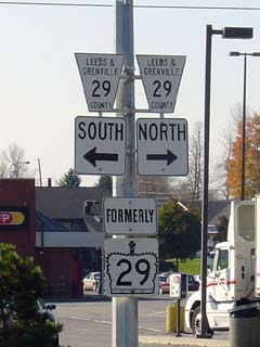
Leeds & Grenville County has
numbered downloaded Highway 29 to: Leeds & Grenville Road 29 |
| City of Brockville |
Brockville |
0 km / 51.7 km |
Highway 2 (King
Street, Leeds & Grenville Road 2) |
|
Highway 29 Splits into two unidirectional roadways
around the courthouse:
NB: Ramp right from the hill heading away from
downtown, keep left at Pine Street. Turn left at Pearl Street stop
sign. Turn Right at Steward Street.
SB: Keep left at pine street, then keep right away
from Highway 29NB traffic. |
| City of Brockville |
Brockville |
2.4 km / 49.3 km |
King's Highway 401 (Autoroute M-C Freeway) |
| City of Brockville |
Brockville |
--- |
Parkdale Avenue |
| City of Brockville |
Loyalist Park |
--- |
Centennial Road |
| Township of Elizabethtown- Kitley |
Tin Cap |
--- |
----- |
| Township of Elizabethtown- Kitley |
Spring Valley |
--- |
----- |
| Township of Elizabethtown- Kitley |
----- |
10.6 km / 41.1 km |
Leeds & Grenville Road 7 |
| Township of Elizabethtown- Kitley |
----- |
12.4 km / 39.3 km |
Leeds & Grenville Road 46 |
| Township of Elizabethtown- Kitley |
Glen Buell |
14.3 km / 37.4 km |
Leeds & Grenville Road 28 |
| Township of Elizabethtown- Kitley |
Forthton |
15.6 km / 36.1 km |
Highway 42 (Leeds & Grenville Road 42) |
| Township of Elizabethtown- Kitley |
Addison |
18.7 km / 33.0 km |
Addison-Greenbush Road (Leeds & Grenville Road
30) |
| Township of Elizabethtown- Kitley |
Hawkes |
--- |
----- |
| Township of Elizabethtown- Kitley |
Lehighs Corners |
--- |
----- |
| Township of Elizabethtown- Kitley |
Frankville |
--- |
----- |
| Township of Elizabethtown- Kitley |
----- |
--- |
Leeds & Grenville Road 8 |
| Township of Elizabethtown- Kitley |
----- |
30.6 km / 21.1 km |
Leeds & Granville Road 1 |
| Township of Elizabethtown- Kitley |
Newbliss |
--- |
----- |
| Township of Elizabethtown- Kitley |
----- |
38.3 km / 13.4 km |
Leeds & Grenville Road 16 |
| Rideau Lakes - Elizabethtown- Kitley Boundary |
Shanes |
--- |
----- |
|
In the Town of Smith Falls,
Highway 29 is now known only as Brockville Street |
| Town of Smith Falls |
Smith Falls |
51.7 km / 0 km |
King's Highway 15 & Jasper Avenue |
|
Highway 29 ENDS |
