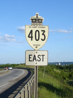
|
Proper
Municipality Name |
Exit # |
Intersecting Road |
North /
West Control City |
South /
East Control City |
| Township of Norwich |
--- |
King's Highway 401 (Autoroute M-C Freeway) - WB only |
London |
|
| Township of Norwich |
5 |
Highway 53 (Oxford Road 55) |
Eastwood |
Burford |
| County of Brant |
21 |
Middle Townline Road (Brant Road 25) |
Princeton |
----- |
| County of Brant |
27 |
King's Highway 24-South & Rest Acres Road (Brant Highway 24) |
Paris |
Simcoe |
| County of Brant |
30 |
Oak Park Road (Brant Road 27) |
----- |
----- |
| County of Brant |
34 |
Highway 2 (Paris Road) |
Paris |
Brantford |
| City of Brantford |
36 |
King's Highway 24-North & King George Road |
Cambridge |
| City of Brantford |
38 |
Wayne Gretzky Drive |
City of
Brantford, 4 Interchanges
Brantford Downtown Via King George Road |
| County of Brantford |
41 |
Garden Avenue |
| City of Hamilton |
55 |
Highway 52 (Hamilton Road 52) |
Copetown |
Hamilton |
| City of Hamilton |
58 |
Highway 2 (Wilson Street) |
Hamilton
Population: 503 000
__
Interchanges
Hamilton Downtown via Highway 8 East (King
Street) |
| City of Hamilton |
60 (WB partial Interchange) |
Fiddlers Green Road (Hamilton Road 216) |
| City of Hamilton |
61 |
King's Highway
6-South & Rymal Road-WB |
| City of Hamilton |
64 |
Lincoln M. Alexander Parkway & Rousseaux Street-WB |
| City of Hamilton |
69 |
Aberdeen Avenue (EB) &
Highway 8 West |
| City of Hamilton |
70 |
Highway 8 East (Hamilton
Road 8, King Street) |
| City of Hamilton |
73 (WB Partial Interchange) |
Highway 2 (York
Boulevard) |
| City of Hamilton |
74 |
King's Highway 6-North |
Guelph |
|
| City of Burlington |
78 (EB Partial Interchange) |
Waterdown Road |
Burlington |
| City of Burlington |
82 |
Queen Elizabeth Way-Niagara Bound &
Highway 407 ETR |
Toronto via QEW/403 |
Niagara via QEW Niagara Bound |
|
EB: Multiplex with QEW Begins (Interchange numbers coincide
with the QEWs mileage). WB: Keep to the right to stay on Hamilton Bound
403. |
| City of Burlington |
101 |
Brant Street (Halton Road 18) |
City of
Burlington
Population: 151 000
__
Interchanges
Burlington Downtown via Brant Street |
| City of Burlington |
102 |
Guelph Line |
| City of Burlington |
105 |
Walkers Line |
| City of Burlington |
107 |
Appleby Line |
| Burlington - Oakville Boundary |
109 |
Burloak Drive |
|
Town of
Oakville
Population: 145 000
__
Interchanges
Oakville
Town Centre via Dorval Drive |
| Town of Oakville |
111 |
Highway 25 (Bronte Street,
Halton Road 25) |
| Town of Oakville |
113 |
Third Line |
| Town of Oakville |
116 |
Dorval Drive |
| Town of Oakville |
117 (WB Partial Interchange) |
Kerr Street |
| Town of Oakville |
118 |
Trafalgar Road (Halton Road 3) |
| Town of Oakville |
119 |
Royal Windsor Drive |
|
Town of Oakville |
--- (EB Partial Interchange) |
Queen Elizabeth Way-Toronto (Downtown) Bound |
Toronto (Downtown) via QEW
Toronto |
|
|
EB: Highway 403 Exits the QEW at exit 123. WB:
Highway 403 merges with the QEW. |
| Town of Oakville |
--- (EB Partial Interchange) |
Ford Drive |
Oakville |
| Town of Oakville |
104 (WB Partial Interchange) |
Upper Middle Drive |
| Oakville - Mississauga Boundary |
106 |
Highway 5 (Halton Road 5, Dundas Street) |
Oakville |
Mississauga |
| City of Mississauga |
109 |
Highway 407 ETR |
----- |
----- |
| City of Mississauga |
111 |
Winston Churchill Boulevard |
City of
Mississauga
Population: 704 000
7
Interchanges
Mississauga City Centre via Highway 10 South |
| City of Mississauga |
112 |
Erin Mills Parkway (Peel Road 1) |
| City of Mississauga |
117 |
Mavis Road |
| City of Mississauga |
119 |
Highway 10 (Hurontario Street) |
| City of Mississauga |
121 |
Eastgate Parkway & Cawthra Road (Peel Road 17) |
| City of Mississauga |
122 |
Eglinton Avenue |
| City of Mississauga |
--- |
King's Highway 401 (Autoroute Macdonald
Cartier Freeway) & King's Highway 410) |
Brampton via 410 |
Toronto via 401 |
|
Highway 403 ENDS |
