King's Highway 93 - www.OntHighways.com

Before downloading, Highway 93 ran from Highway 11 northerly to Nelson Street in Penetanguishene.  In 1997 Highway 93 was logically transferred to the County of Simcoe.  In 1998, the section of Highway 93 north of Highway 12 was also transferred to local municipalities.  Highway 93 now runs from Highway 400 northerly to Highway 12.  The downloaded sections of Highway 93 have been designated Simcoe Road 93.


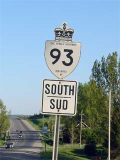
Old Style King's Highway 93 Shield


Southern Terminus:  Pre-1997: At the Highway 11 interchange near Crown Hill.

                                         Current: At the Highway 400 interchange north of Craighurst.

Northern Terminus:  Pre-1997: At the Robert Street intersection in Penetanguishene.

                                        Current: Junction Highway 12 south of Penetanguishene.

Length:  Pre-1997: 138.1km.  Current: 23.9 km.

Multiplexes:  None

Freeway:  No

AADT (2002):  Highest:  9,400, from Highway 400 northerly to the Highway 27 junction at Waverly;

                             Lowest:  7,600, from Highway 27 northerly to Highway 12.

Road info:  Highway 93 is in excellent condition for its entire length.  Traffic volumes are for the most part moderate (with the exception of areas north of Highway 12, which are significantly busier.  Traffic is also much busier during the summer months, due to the recreational nature of the area).  Rural speed limits along Highway 93 are 80km/h.


Highway 93 information:


OntHighways.com  

Detailed Route information available below
Virtual Tour of Highway 93


TheKingsHighway.ca   History of Highway 93
Photographic History of Highway 93


Click here to scroll to Current Route information

Communities and Major Intersections along Highway 93 from South to North:

Proper Municipality Name

Community Name Distance

Major Intersection

Highway 77 was downloaded south of the Leamington Bypass.  It is now known only as Erie Street

Springwater - Oro- Medonte Boundary ----- --- (0km) / --- (46.5km) Kings Highway 11 (Pre-1997: Kings Highway 11 & King's Highway 400A)
Springwater - Oro- Medonte Boudnary Crown Hill --- -----
Springwater - Oro- Medonte Boundary Dalston --- (6.4km) / --- (40.1km) Old Barrie Road (Simcoe Road 11)
Township of Oro- Medonte Craighurst --- (12.2km) / --- (34.3km) Horseshoe Valley Road (Simcoe Road 22)

Current Southern Terminus of Highway 93 is located at Highway 400.

Oro- Medonte - Springwater Boundary ----- 0km (15.3km) / 31.2 km (23.9km) King's Highway 400
Township of Springwater Hillsdale --- -----
Township of Springwater ----- 7.6km (22.9km) / 15.0km (23.6km) Simcoe Road 19 (South Orr Lake Road & Moonstone Road)
Township of Springwater Orr Lake --- -----
Township of Oro- Medonte Waverly 12.7km (28.0km) / 11.2km (18.5km) Highway 27 (Simcoe Road 27) & Vasey Road (Simcoe Road 23)
Township of Tiny Wyebridge --- -----
Tiny - Midland Boundary ----- 23.9km (39.2km) / 0km (7.3 km) King's Highway 12

Current Northern Terminus of Highway 93 is located at Highway 12.

Town of Midland Firth's Corners (Midland) --- Balm Beach Road (Simcoe Road 2) & Yonge Street
Town of Midland ----- --- (43.7km) / --- (2.8km) (Simcoe Road 2) Golf Link Road & Virden Road
Midland - Penetanguishene Boundary Penetanguishene South Limits --- (45.0km) / --- (1.5km) -----
Town of Penetanguishene Penetanguishene --- (46.5km) / --- (0km) Robert Street

Highway 93 ENDS


<- Highway 92         www.OntHighways.com - Home         Highway 94 ->


Copyright (c) 2004-2010, AsphaltPlanet.ca  AsphaltPlanet@asphaltplanet.ca

Page last updated:  March 22nd, 2007

Page created:  February 12th, 2004