Pictures on this page are arranged in order from south to north. I-215 North photos are left-aligned in the last column, while I-215 South photos are right-aligned. Center-line pictures are centered within the last column.
AsphaltPlanet.ca > California > Interstate 215
Pictures on this
page are arranged in order from south to north. I-215 North photos are
left-aligned in the last column, while I-215 South photos are right-aligned.
Center-line pictures are centered within the last column.
|
Location |
Description |
Photo |
||
|
North- |
South- |
|||
|
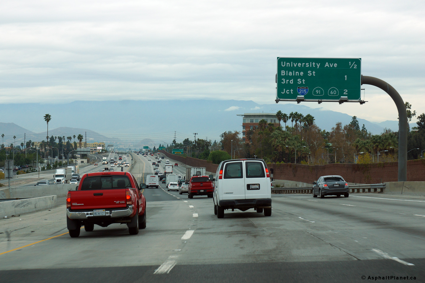
Riverside County |
Northerly view approaching the 91 Freeway interchange in Riverside. |
 |
||
|
Date: 12/16/2014 |
High-res: (1440x960) (2400x1600) |
|||
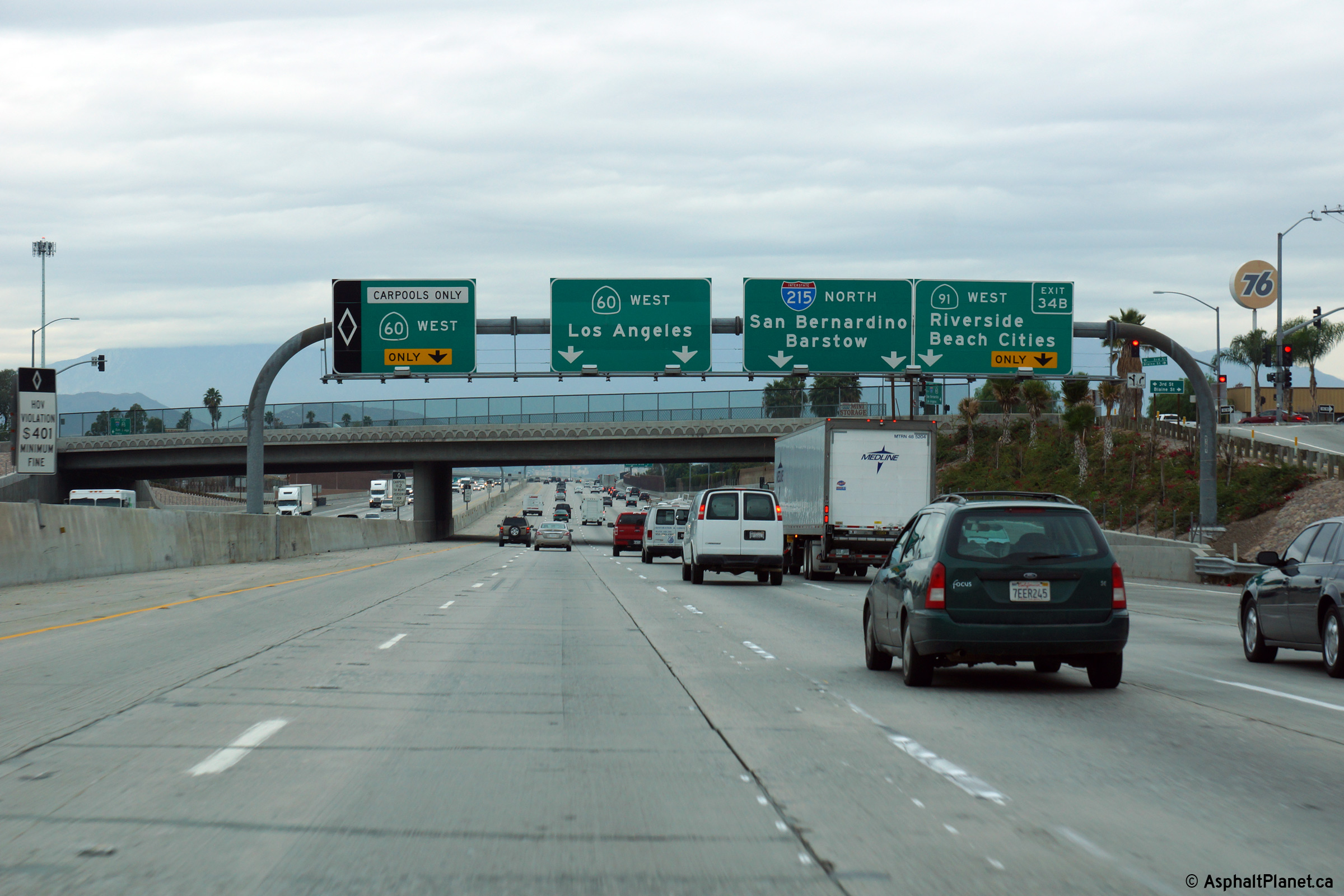
|
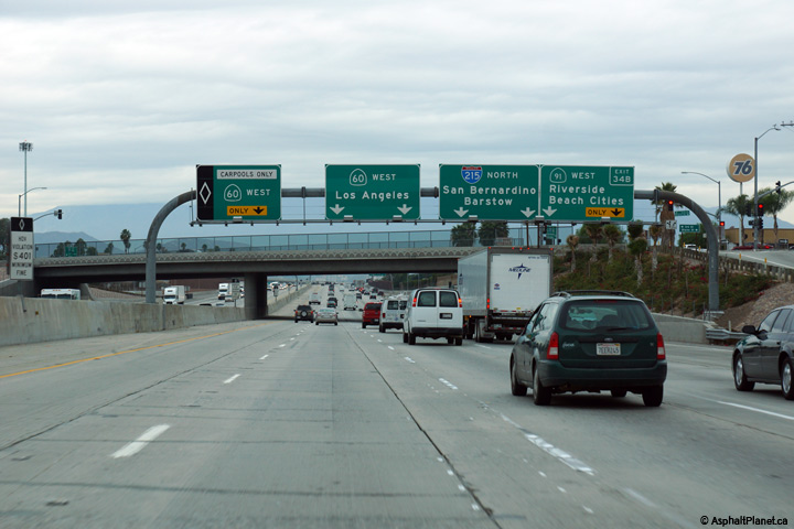
Riverside County |
Advanced lane assignment signage for the 91 Freeway interchange. The 91 Freeway is the first east-west freeway to link Interstates 5 and 15 north of the 78 Freeway at Escondido. |
 |
||
|
Date: 12/16/2014 |
High-res: (1440x960) (2400x1600) | |||
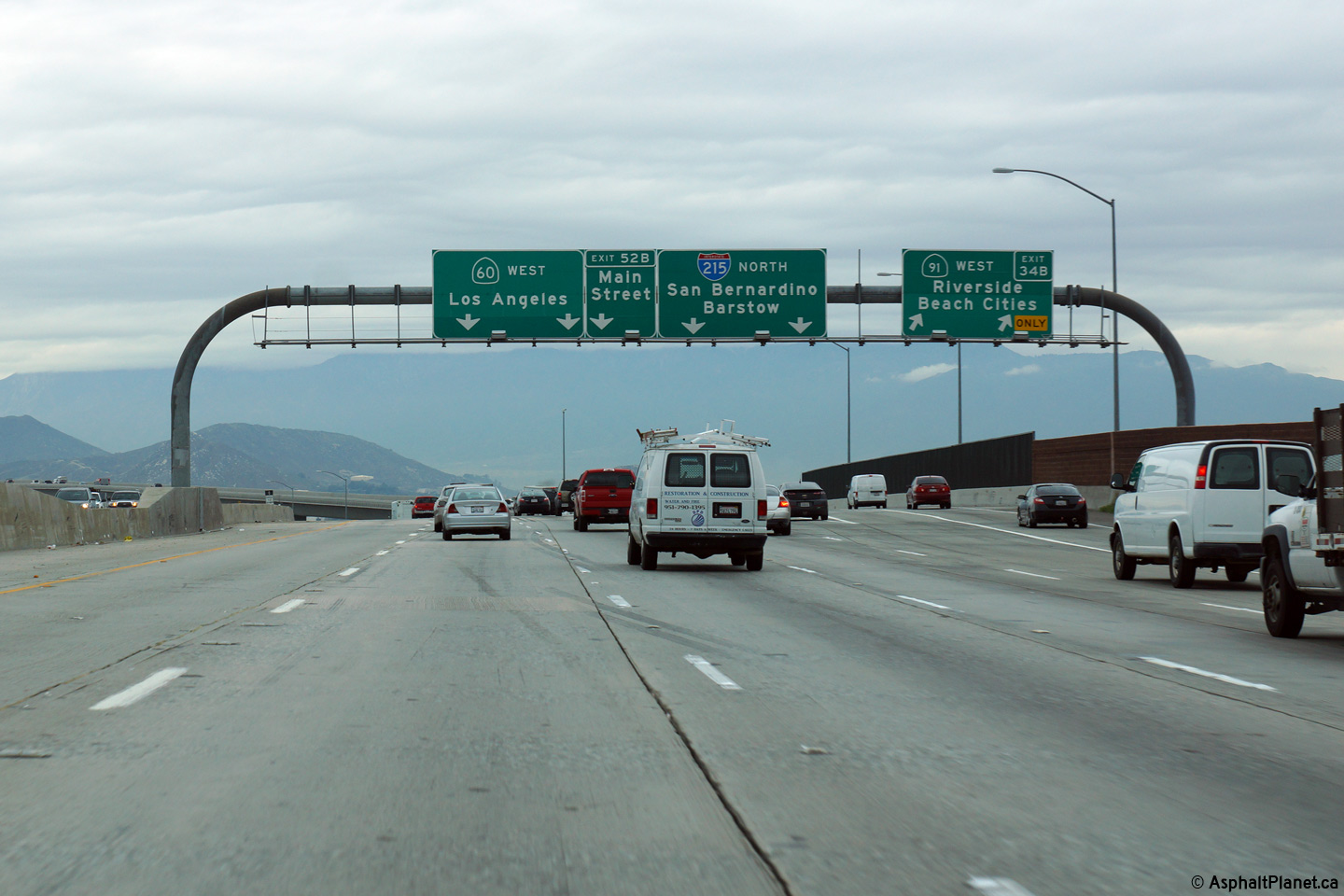
|
Riverside County |
Overhead signage at the ramp to SR-91 West. |
 |
||
|
Date: 12/16/2014 |
High-res: (1440x960) (2400x1600) |
|||
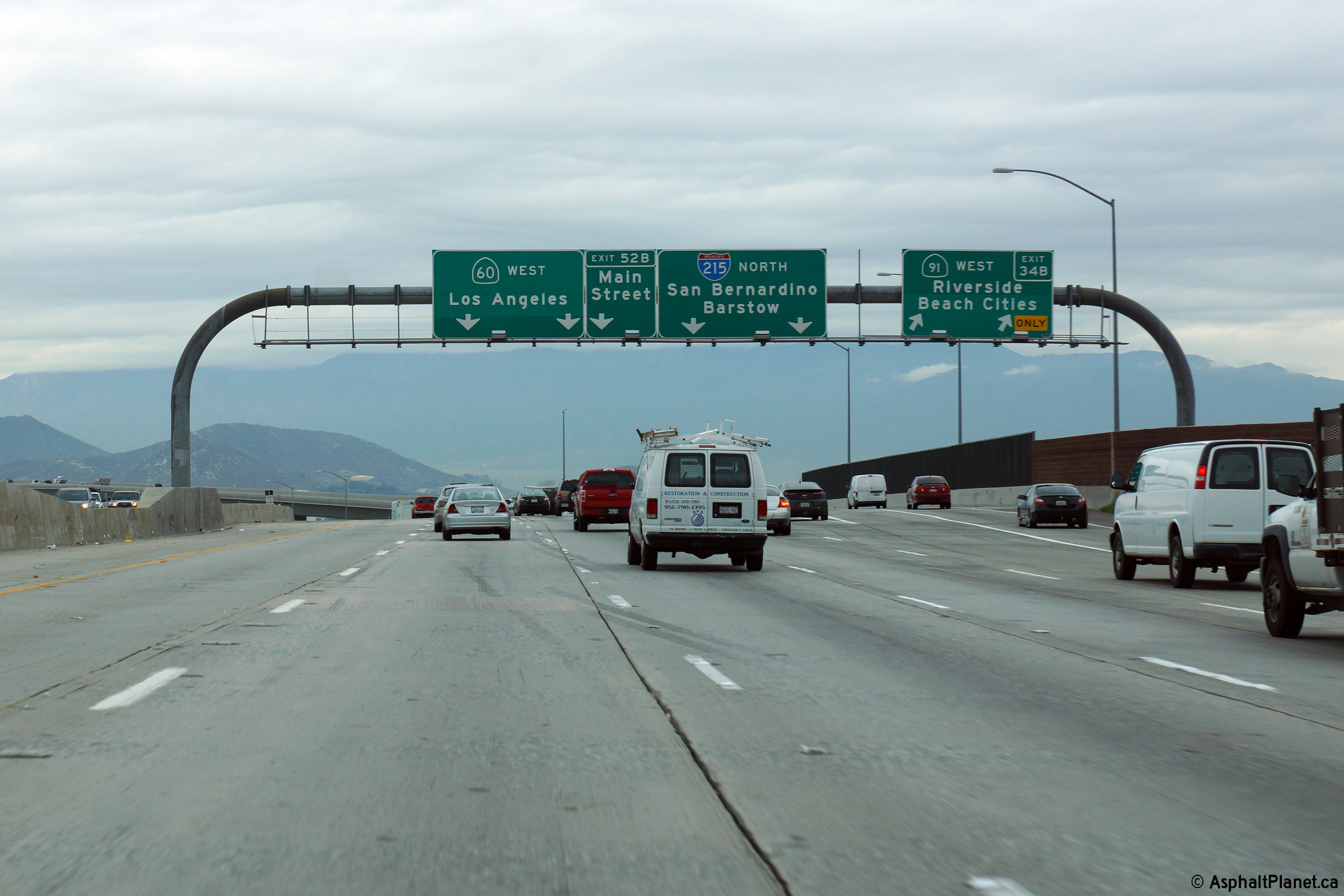
|
Riverside County |
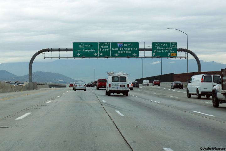
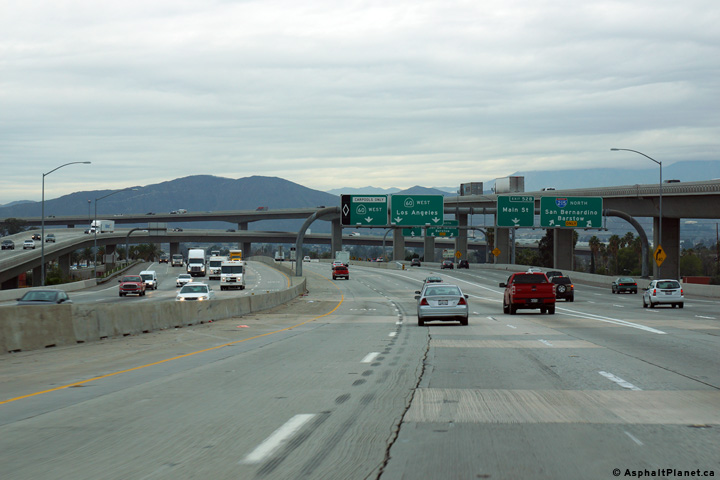
View looking northerly as the ramp to I-215 north departs the mainline lanes of SR-60. |
 |
||
|
Date: 12/16/2014 |
High-res: (1440x960) (2400x1600) |
|||
| State Route 91 is the Riverside Freeway, while Route 60 is the Pomona Freeway. Click here for State Route 60-West Images and here for State Route 91 Images. | ||||
|
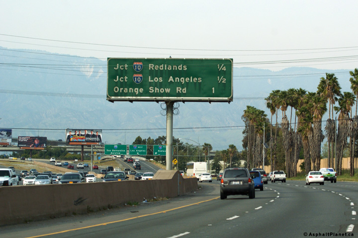
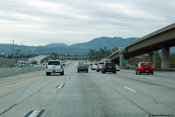
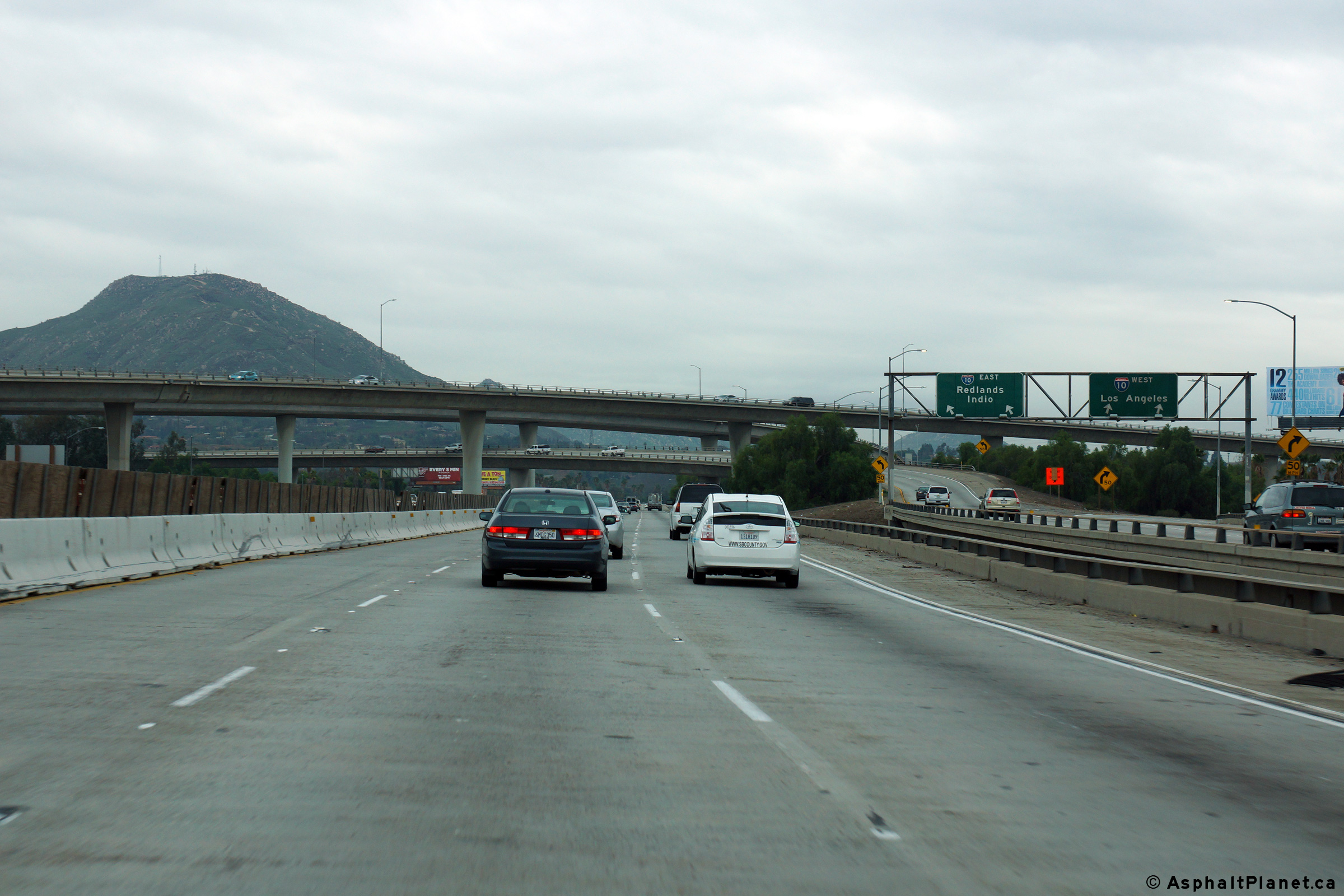
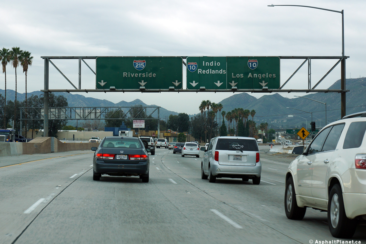
San Bernardino County |
View looking northerly approaching the I-10 interchange. |
 |
||
|
Date: 03/28/2010 |
High-res: (1440x960) |
|||
| Interstate 10 is the principal east-west freeway running easterly from Los Angeles through San Bernardino, Coachella, towards Arizona and Phoenix. Click here for Interstate 10 Images. | ||||
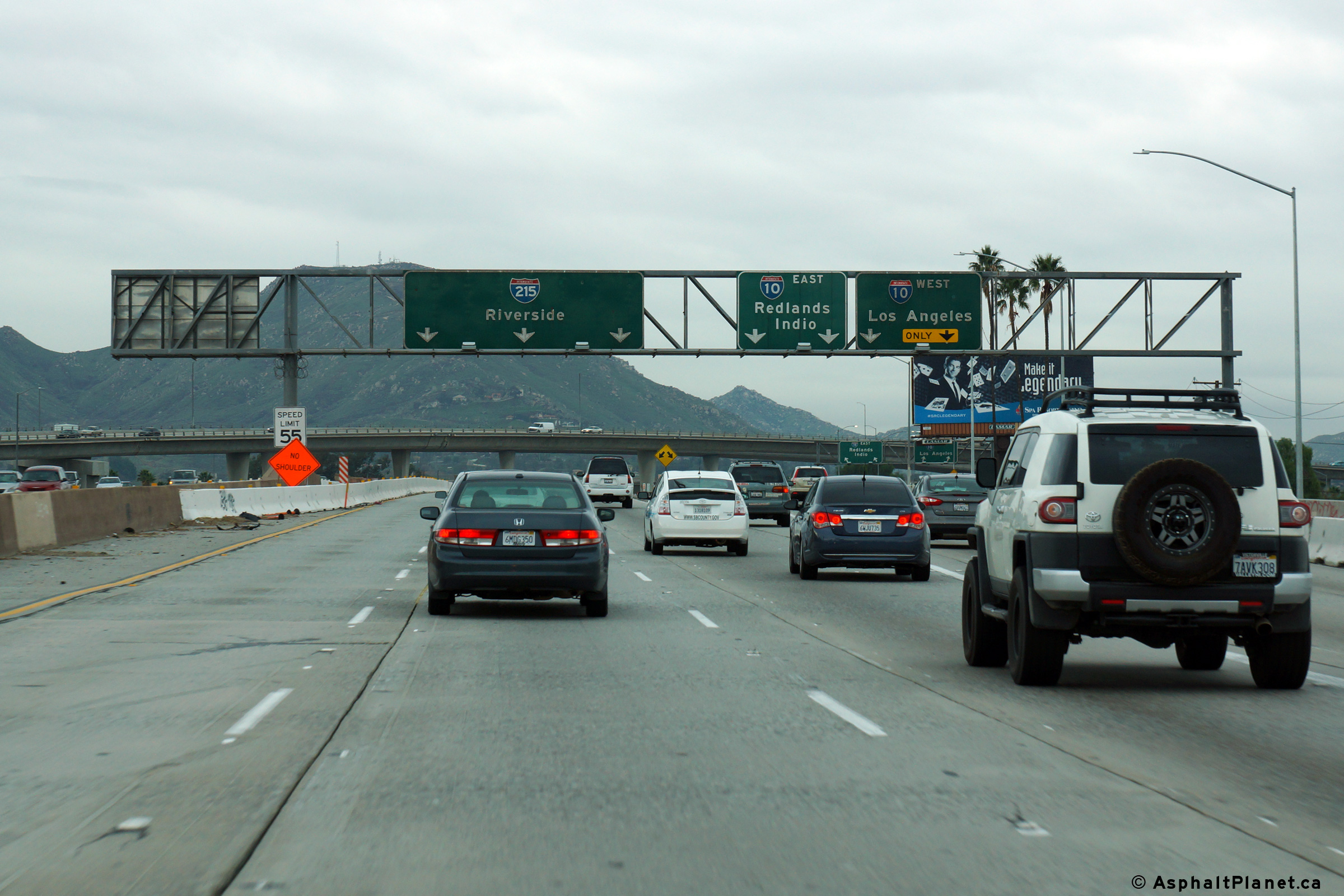
|
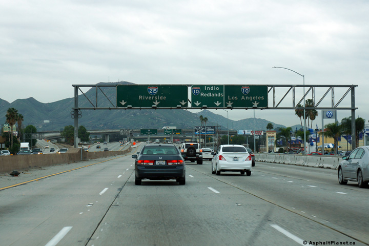
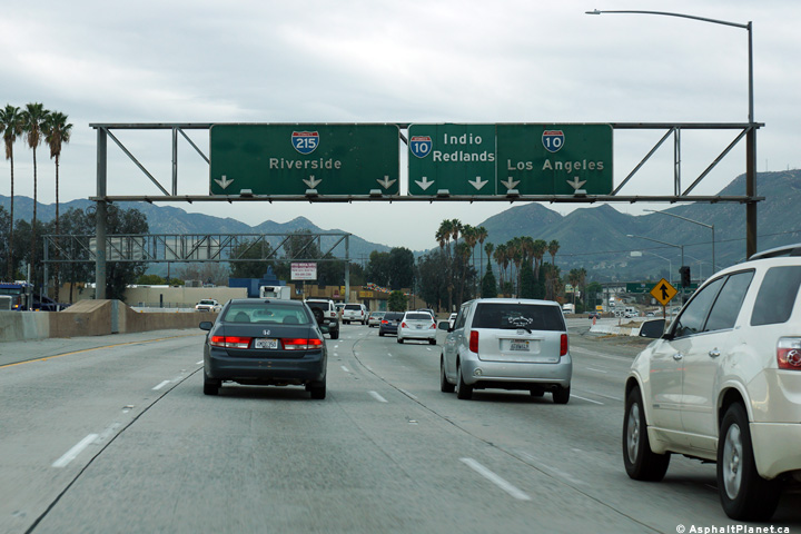
San Bernardino County |
Southerly view along Interstate 215 at the Interstate 10 interchange. The mainline lanes of I-215 are the second level of the four level stack Interstate 10 interchange. |
 |
||
|
Date: 12/16/2014 |
High-res: (1440x960) (2400x1600) |
|||
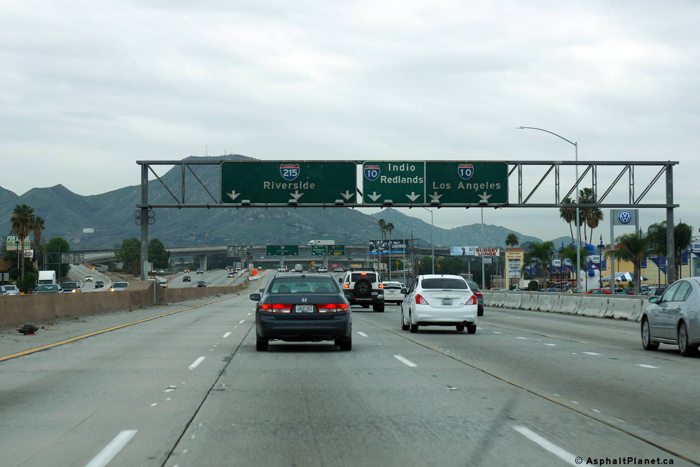
|
San Bernardino County |
Southbound signage as the off-ramp to Interstate 10 departs the freeway mainline. |
 |
||
|
Date: 12/16/2014 |
High-res: (1440x960) (2400x1600) |
|||
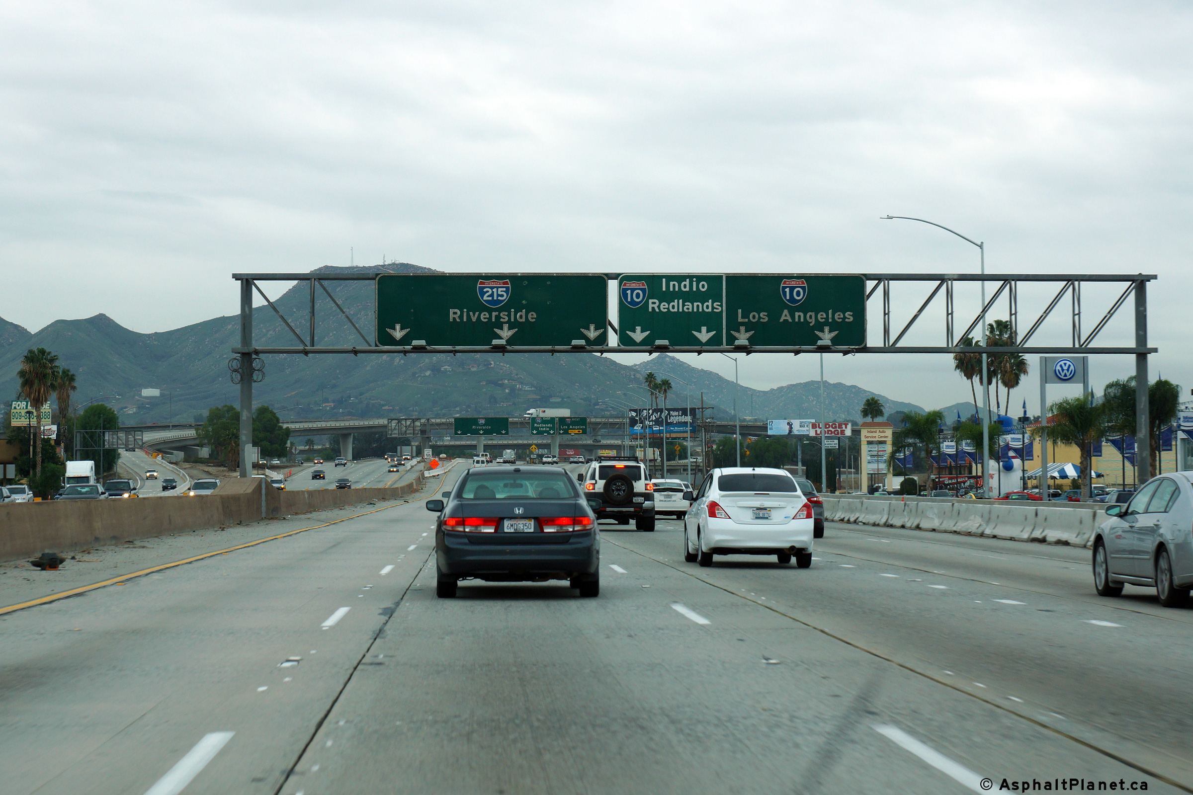
|
San Bernardino County |
Advanced signage for the Interstate 10 interchange. |
 |
||
|
Date: 12/16/2014 |
High-res: (1440x960) (2400x1600) |
|||
|
San Bernardino County |
First of a series of three overhead pull-through signs outlining the lane assignments for the upcoming I-10 interchange. |
 |
||
|
Date: 12/16/2014 |
High-res: (1440x960) (2400x1600) |
|||
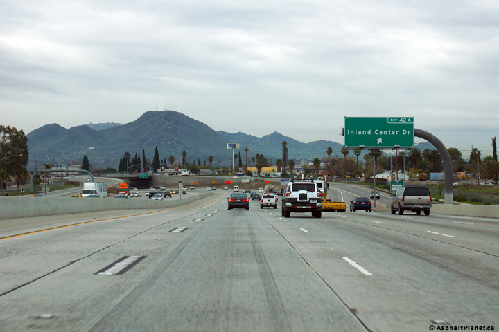
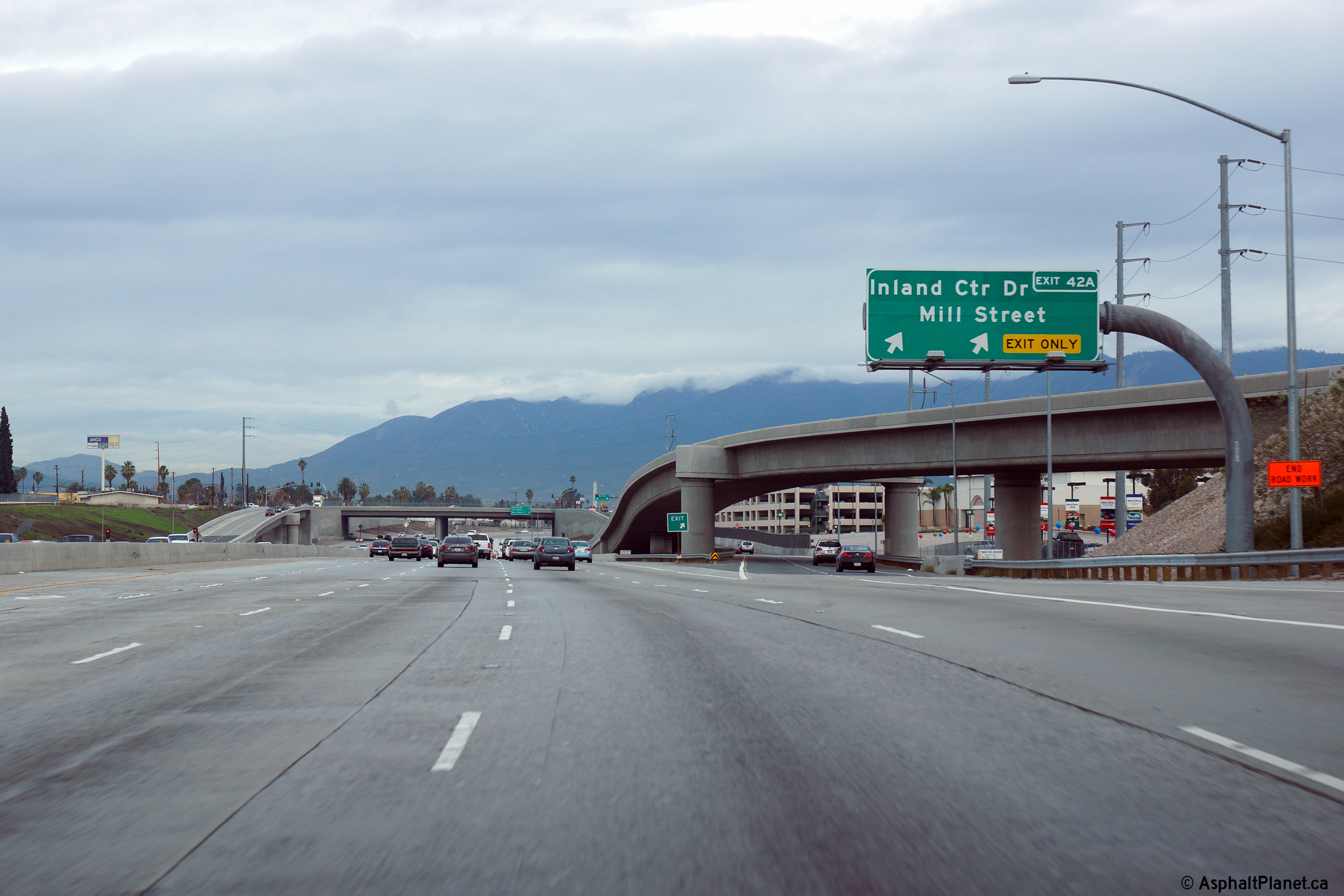
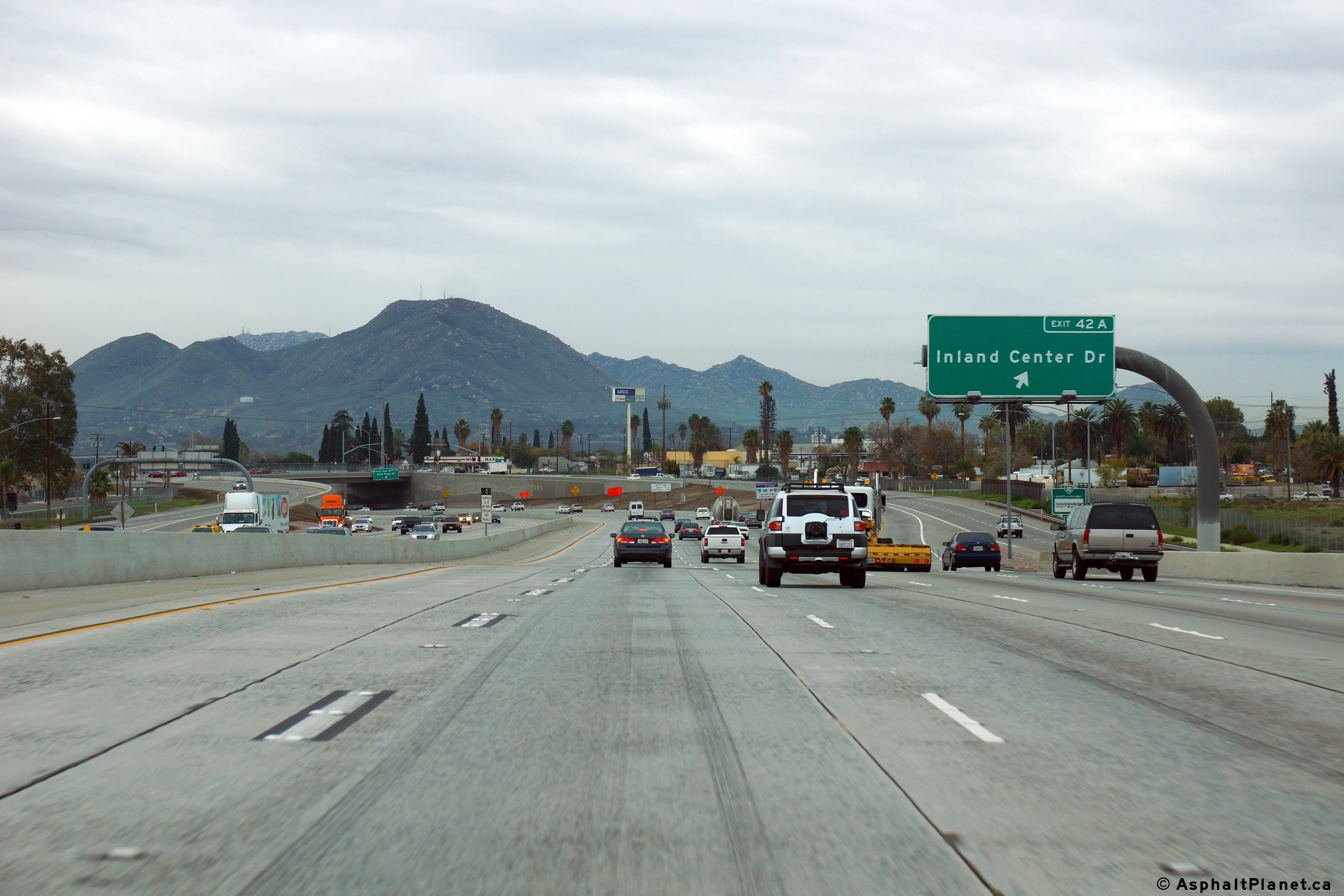
|
San Bernardino County |
View looking northerly at the off-ramp to Inland Center Drive and Mill Street. The ramp to Inland Center Drive passes beneath the northbound on-ramp from Orange Show Road and Auto Plaza Drive. |
 |
||
|
Date: 12/16/2014 |
High-res: (1440x960) (2400x1600) |
|||
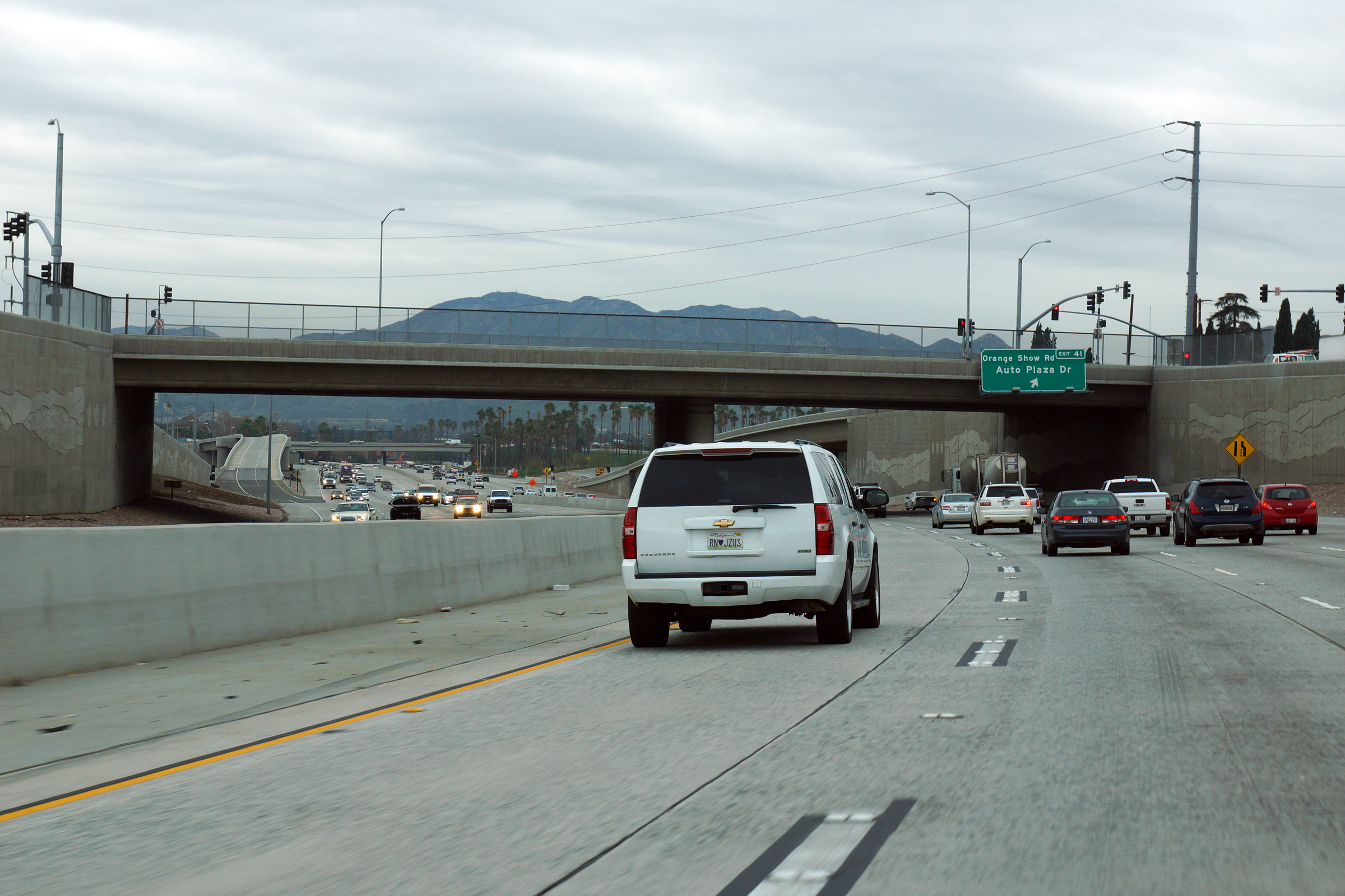
|
San Bernardino County |
Southerly view as the off-ramp from Orange Show Road and Auto Plaza Drive passes beneath the incoming on-ramp from Inland Center Drive and Mill Street. |
 |
||
|
Date: 12/16/2014 |
High-res: (1440x960) (2400x1600) |
|||
|
San Bernardino County |
View looking southerly as I-215 passes beneath the Inland Centre Drive overpass. |
 |
||
|
Date: 12/16/2014 |
High-res: (1440x960) (2400x1600) |
|||
|
San Bernardino County |
View looking southerly along I-215 at the off-ramp to Inland Center Drive. |
 |
||
|
Date: 12/16/2014 |
High-res: (1440x960) (2400x1600) |
|||
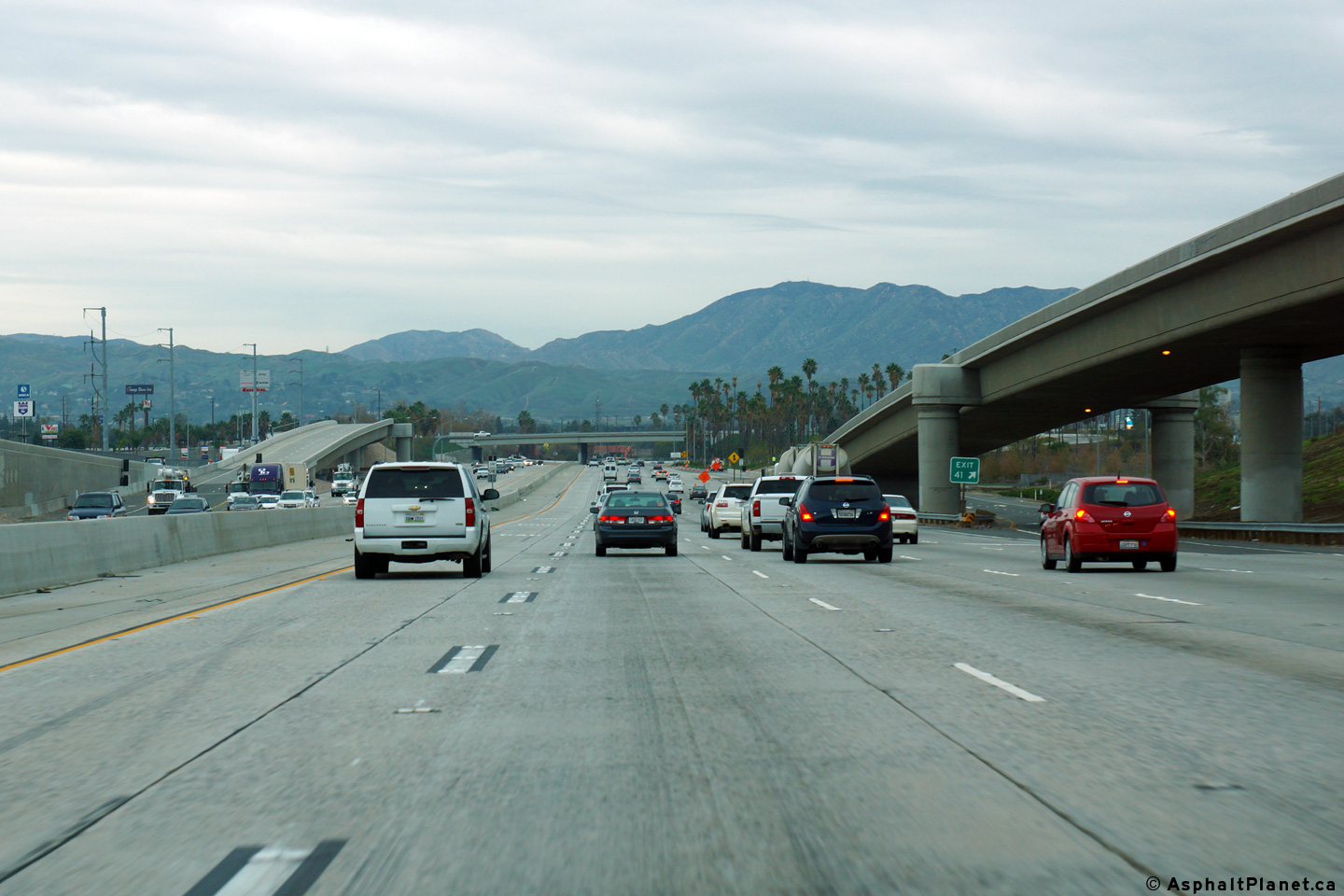
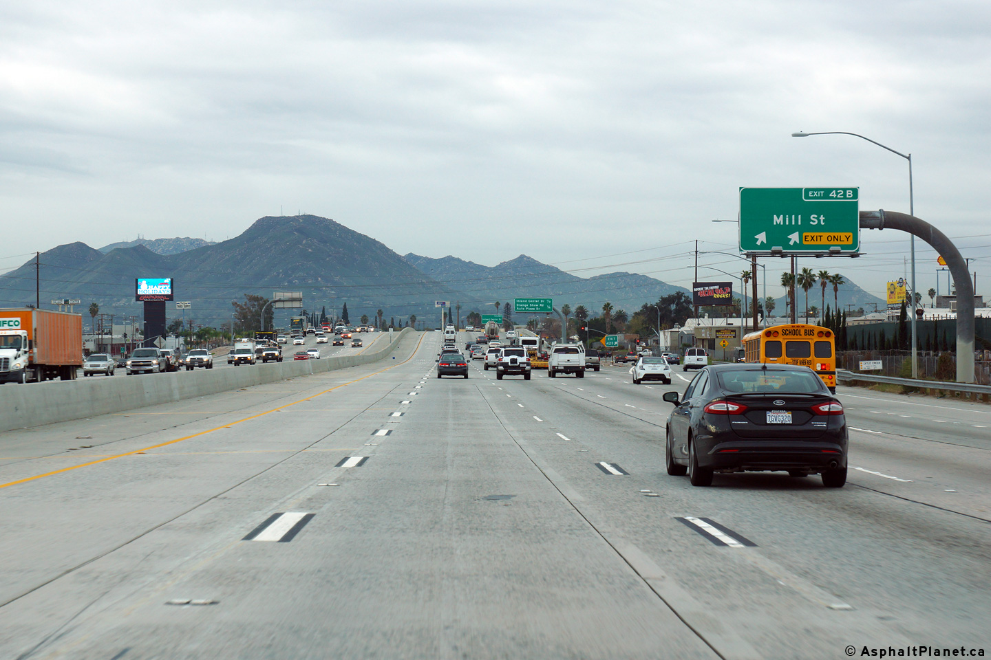
|
San Bernardino County |
View looking northerly along I-215 from just north of the Mill Street undercrossing. |
 |
||
|
Date: 12/16/2014 |
High-res: (1440x960) (2400x1600) |
|||
|
San Bernardino County |
Southerly view at the southbound off-ramp to Mill Street. |
 |
||
|
Date: 12/16/2014 |
High-res: (1440x960) (2400x1600) |
|||
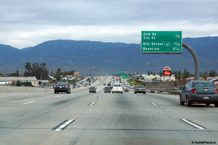
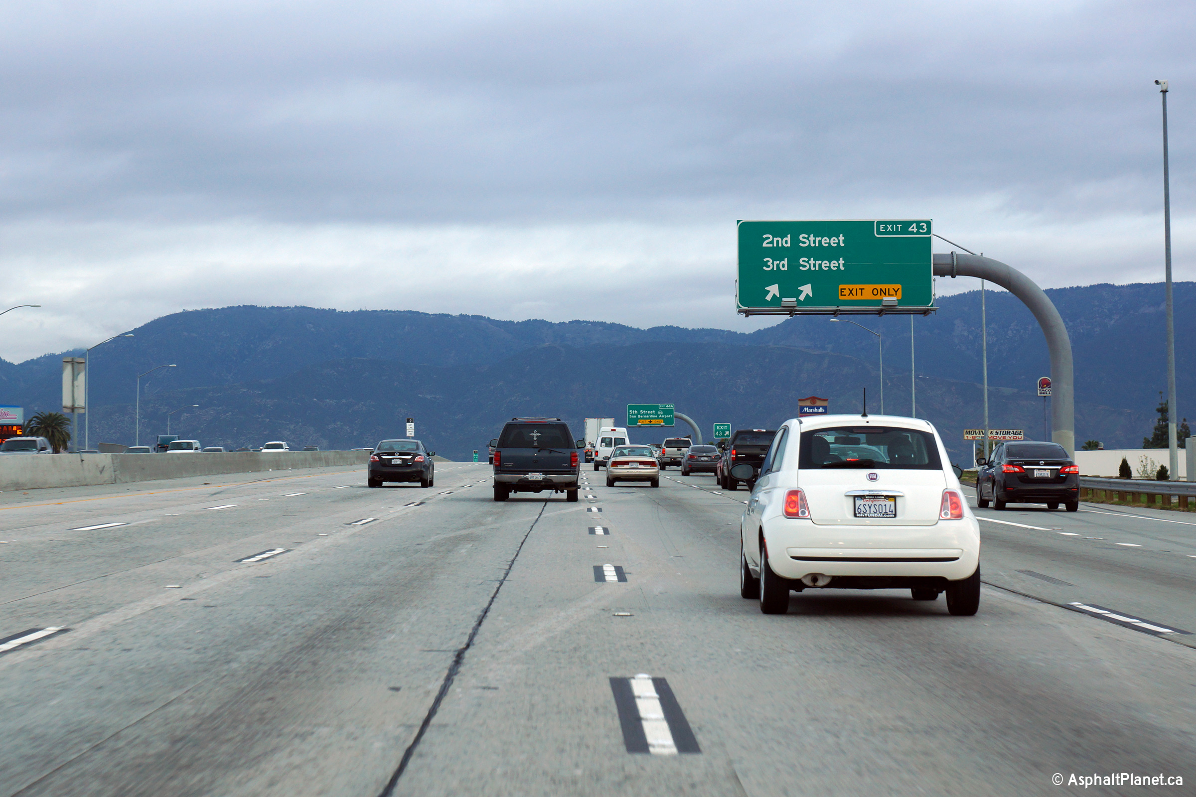
|
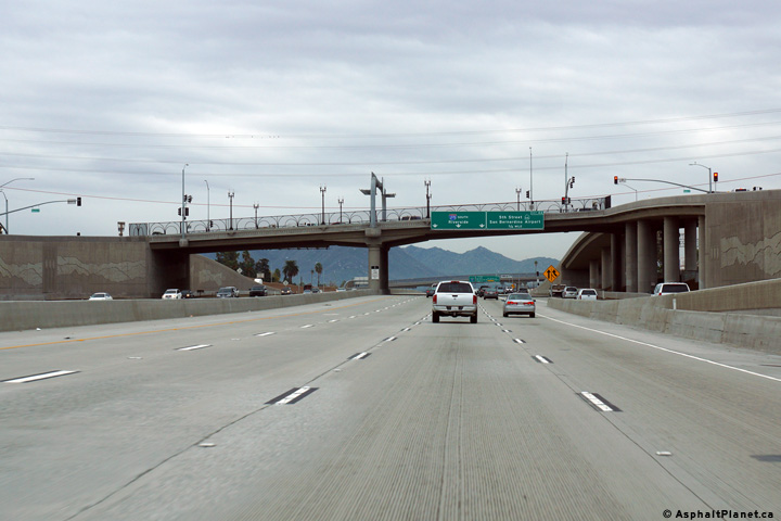
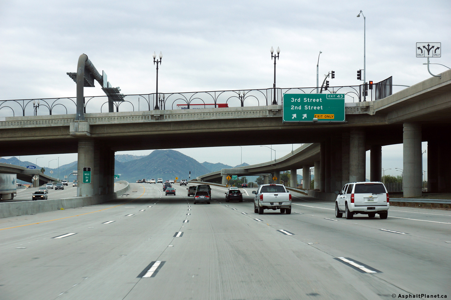
San Bernardino County |
Northbound view at the off-ramp to both 2nd and 3rd Streets. |
 |
||
|
Date: 12/16/2014 |
High-res: (1440x960) (2400x1600) |
|||
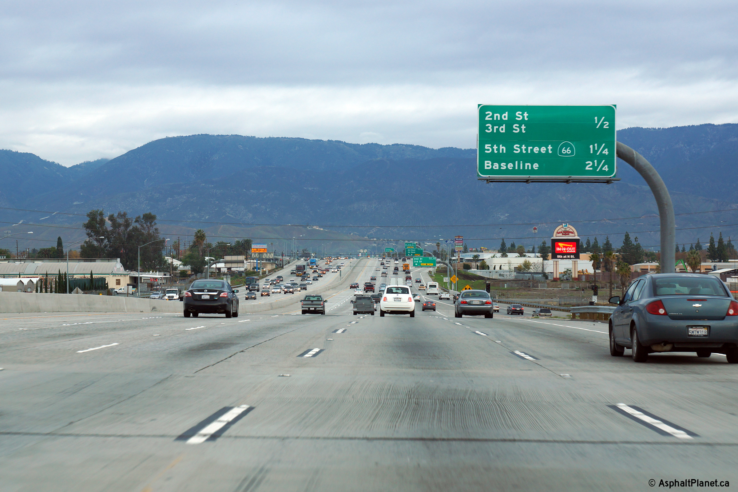
|
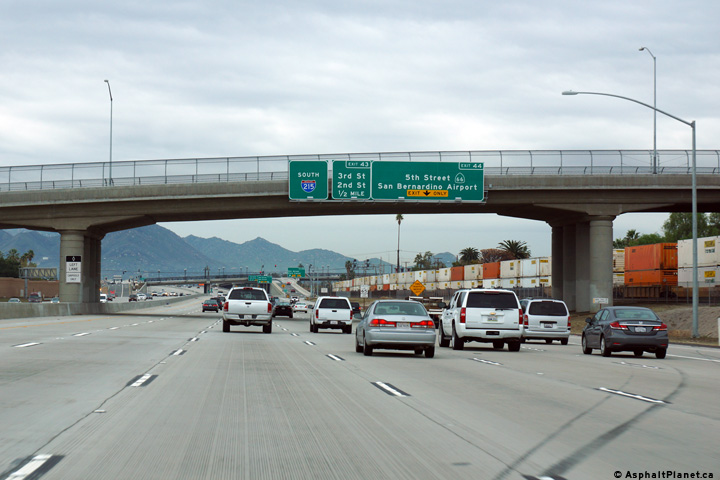
San Bernardino County |
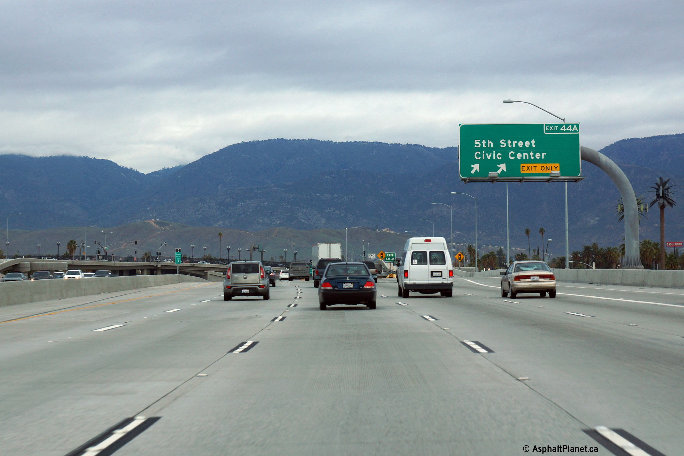
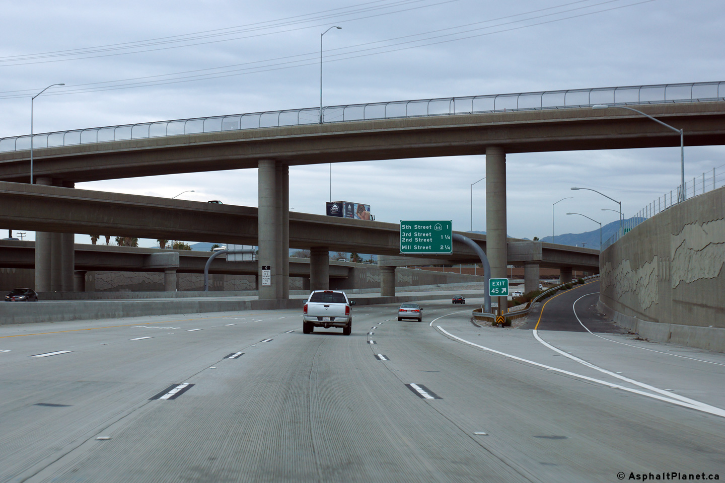
Northbound signage at the off-ramp to 5th Street. |
 |
||
|
Date: 12/16/2014 |
High-res: (1440x960) (2400x1600) |
|||
|
San Bernardino County |
Northerly view through the 5th Street underpass. |
 |
||
|
Date: 12/16/2014 |
High-res: (1440x960) (2400x1600) |
|||
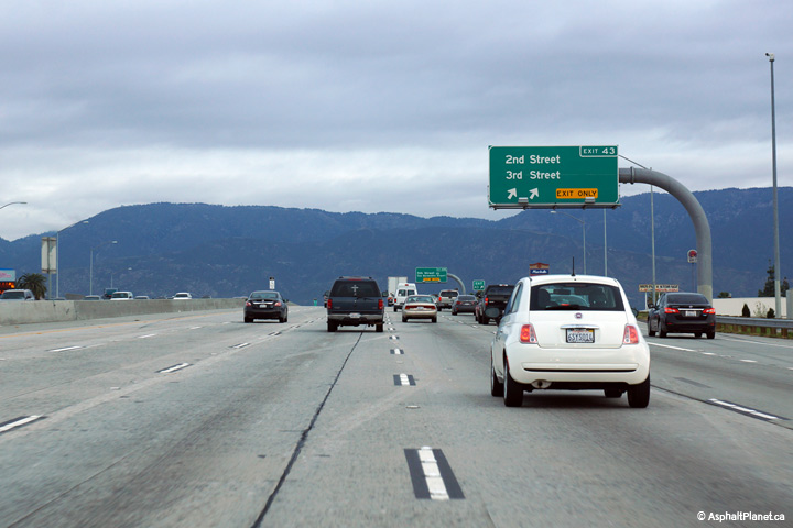
|
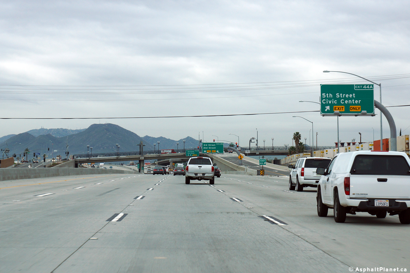
San Bernardino County |
View looking southerly at the off-ramp to both 3rd Street and 2nd Street. The off-ramp departs I-215 at the 5th Street overpass, and quickly passes beneath the southbound on-ramp from the I-215 overpass. |
 |
||
|
Date: 12/16/2014 |
High-res: (1440x960) (2400x1600) |
|||
|
San Bernardino County |
Southbound signage at the off-ramp to 5th Street. |
 |
||
|
Date: 12/16/2014 |
High-res: (1440x960) (2400x1600) |
|||
|
San Bernardino County |
This northbound advanced signage is affixed to the Ninth Street overpass. |
 |
||
|
Date: 12/16/2014 |
High-res: (1440x960) (2400x1600) |
|||
|
San Bernardino County |
Southbound signage affixed to the Ninth Street overpass. |
 |
||
|
Date: 12/16/2014 |
High-res: (1440x960) (2400x1600) |
|||
|
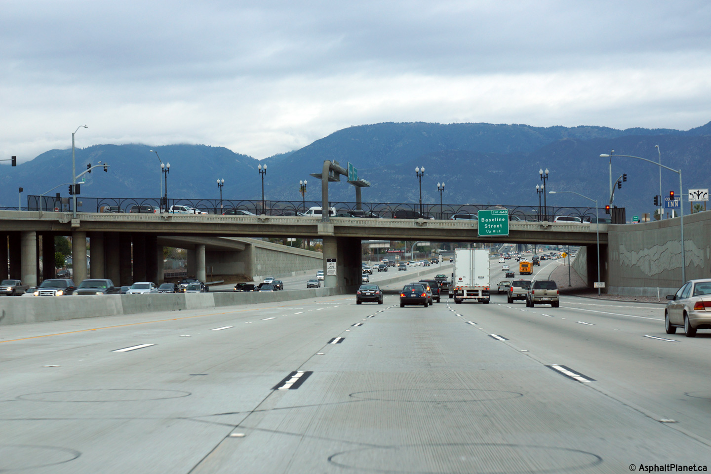
San Bernardino County |
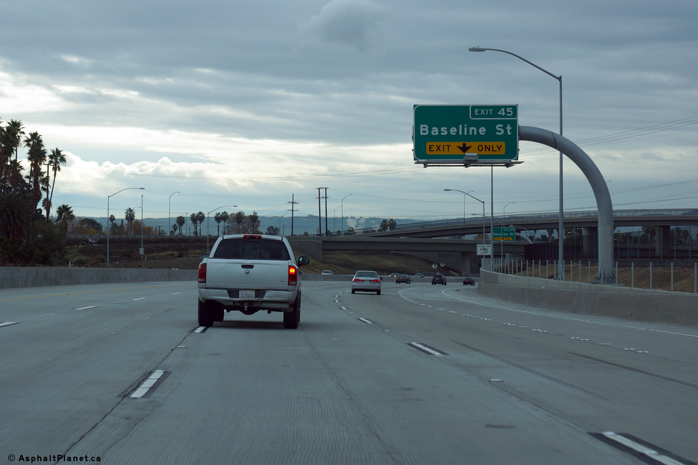
Northbound view at the off-ramp to Baseline Street. |
 |
||
|
Date: 12/16/2014 |
High-res: (1440x960) (2400x1600) |
|||
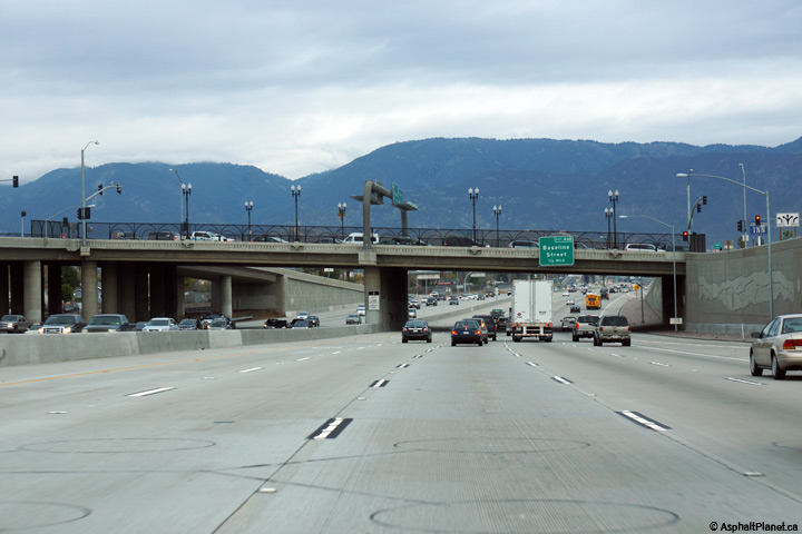
|
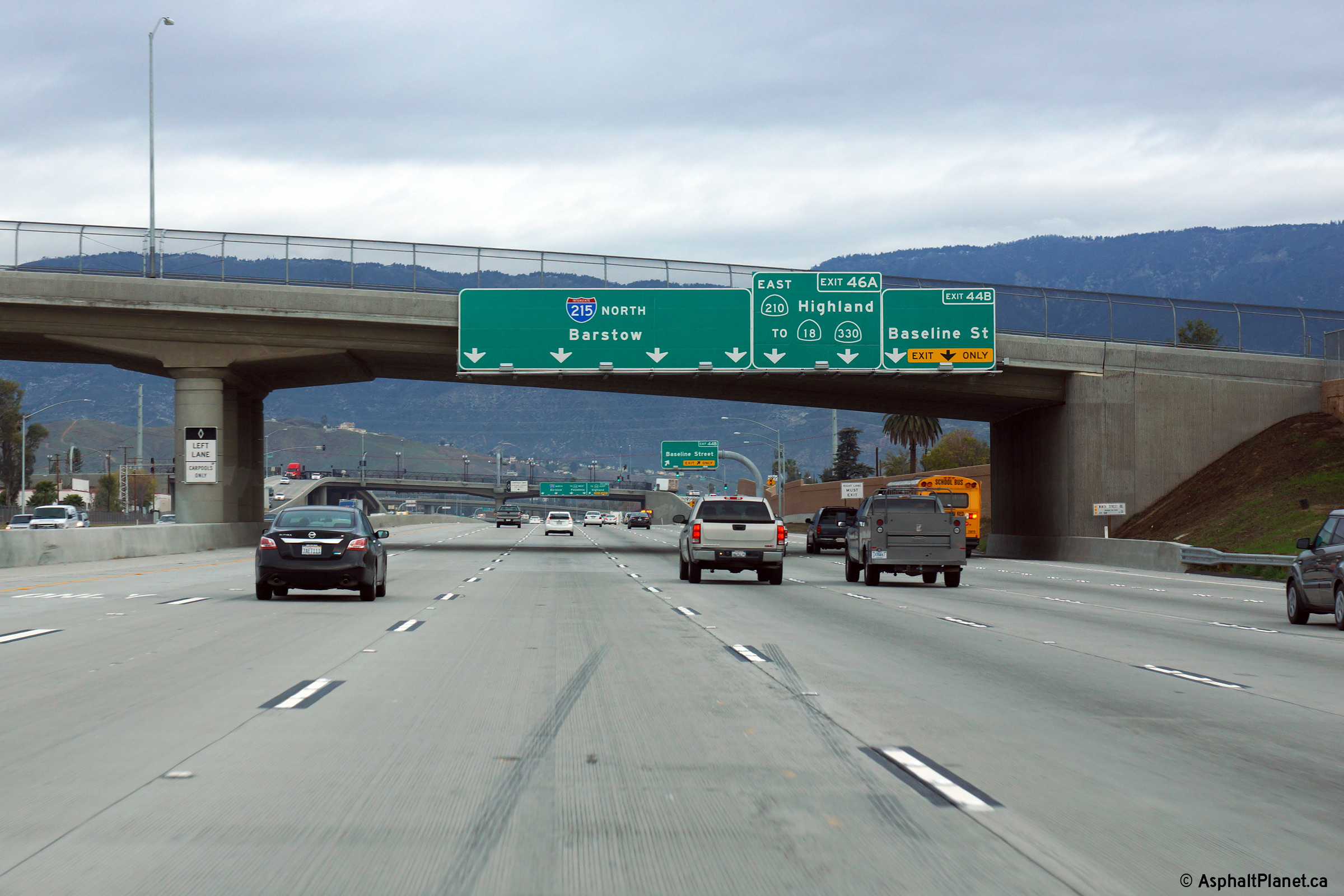
San Bernardino County |
Two views looking northerly as I-215 passes beneath the Baseline Street overpass. The ramp to SR-210 East departs from the northbound lanes of I-215 shortly north of the Baseline Road overpass. The eastbound lanes of SR-210 are not directly accessible from I-215 north. To make the connection, traffic must follow the now unsigned SR-259 between the two freeways. |
 |
||
|
High-res: (1440x960) (2400x1600) |
||||
 |
||||
|
Date: 12/16/2014 |
High-res: (1440x960) (2400x1600) |
|||
|
San Bernardino County |
View looking southerly approaching the Baseline Street overpass. The ramp from SR-259 South can be seen joining the southbound lanes of the freeway at right. |
 |
||
|
Date: 12/16/2014 |
High-res: (1440x960) (2400x1600) | |||
|
San Bernardino County |
Northbound signage as I-215 passes beneath the 16th Street overpass. |
 |
||
|
Date: 12/16/2014 |
High-res: (1440x960) (2400x1600) | |||
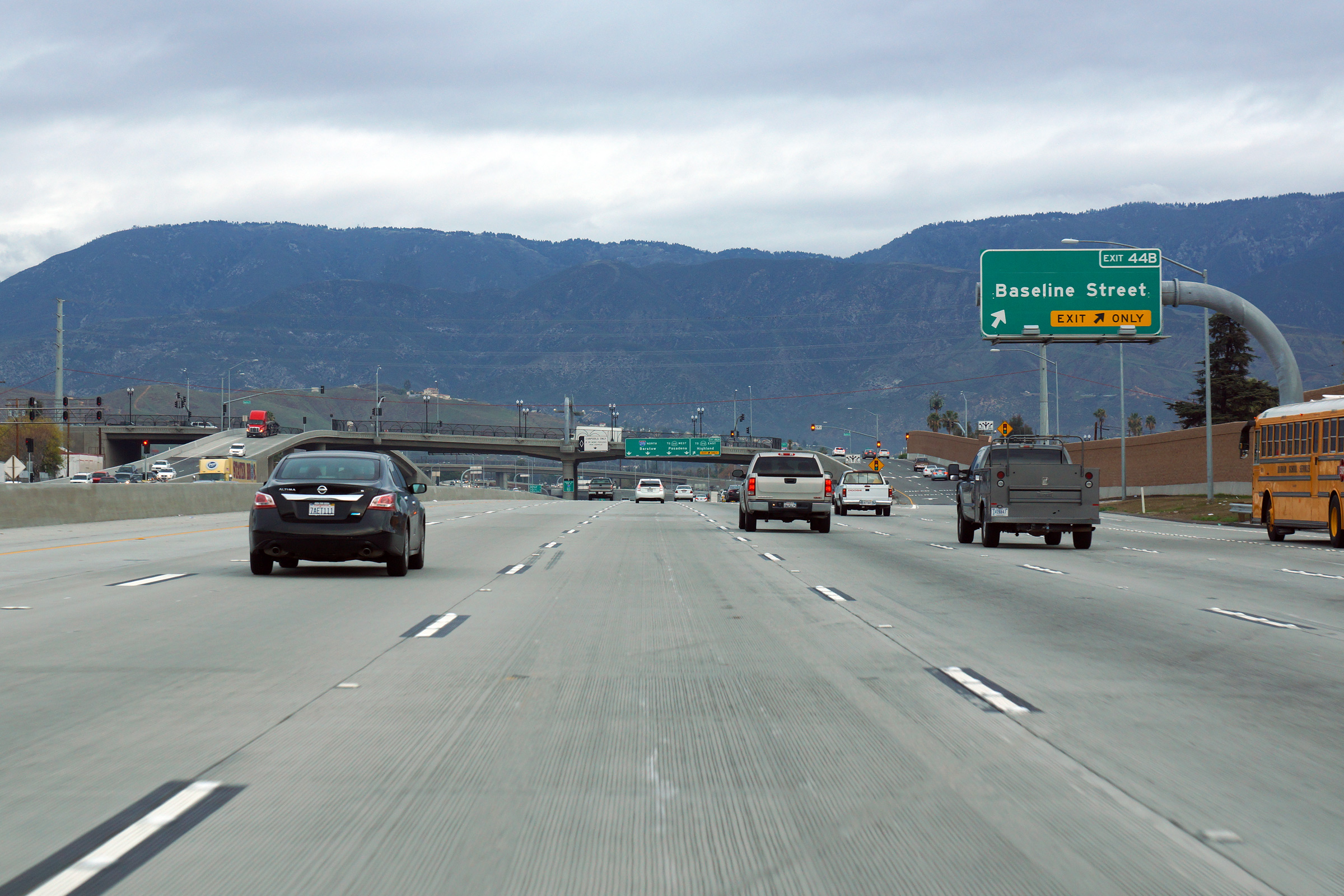
|
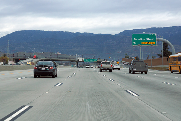
San Bernardino County |
View looking southerly as the ramp to Baseline Street exits the freeway mainline. |
 |
||
|
Date: 12/16/2014 |
High-res: (1440x960) (2400x1600) | |||
|
San Bernardino County |
Southbound advanced signage approaching the off-ramp to Baseline Street. |
 |
||
|
Date: 12/16/2014 |
High-res: (1440x960) (2400x1600) | |||
|
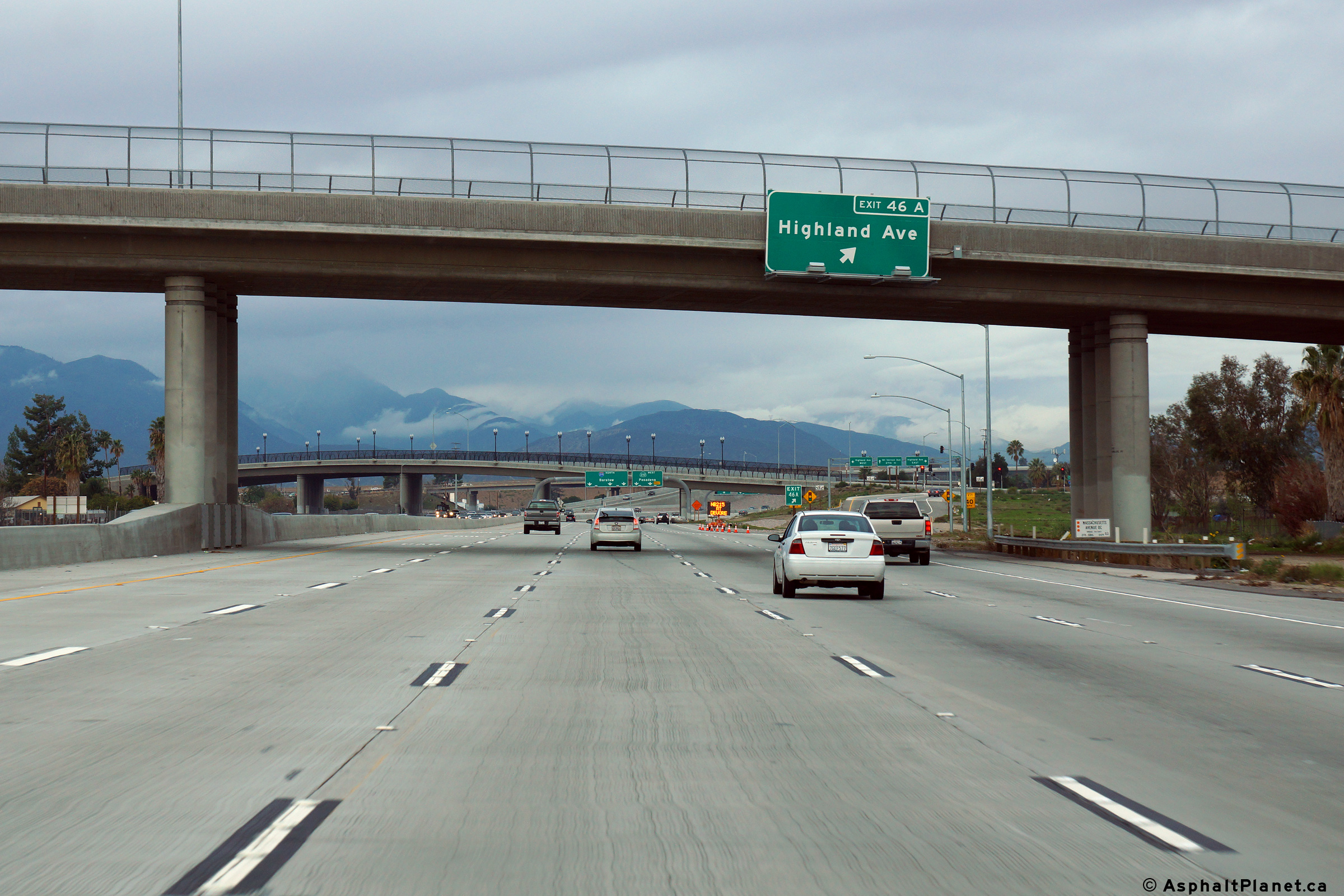
San Bernardino County |
Northbound advanced signage for the off-ramp to Highland Avenue. |
 |
||
|
Date: 12/16/2014 |
High-res: (1440x960) (2400x1600) | |||
|
San Bernardino County |
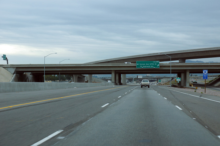
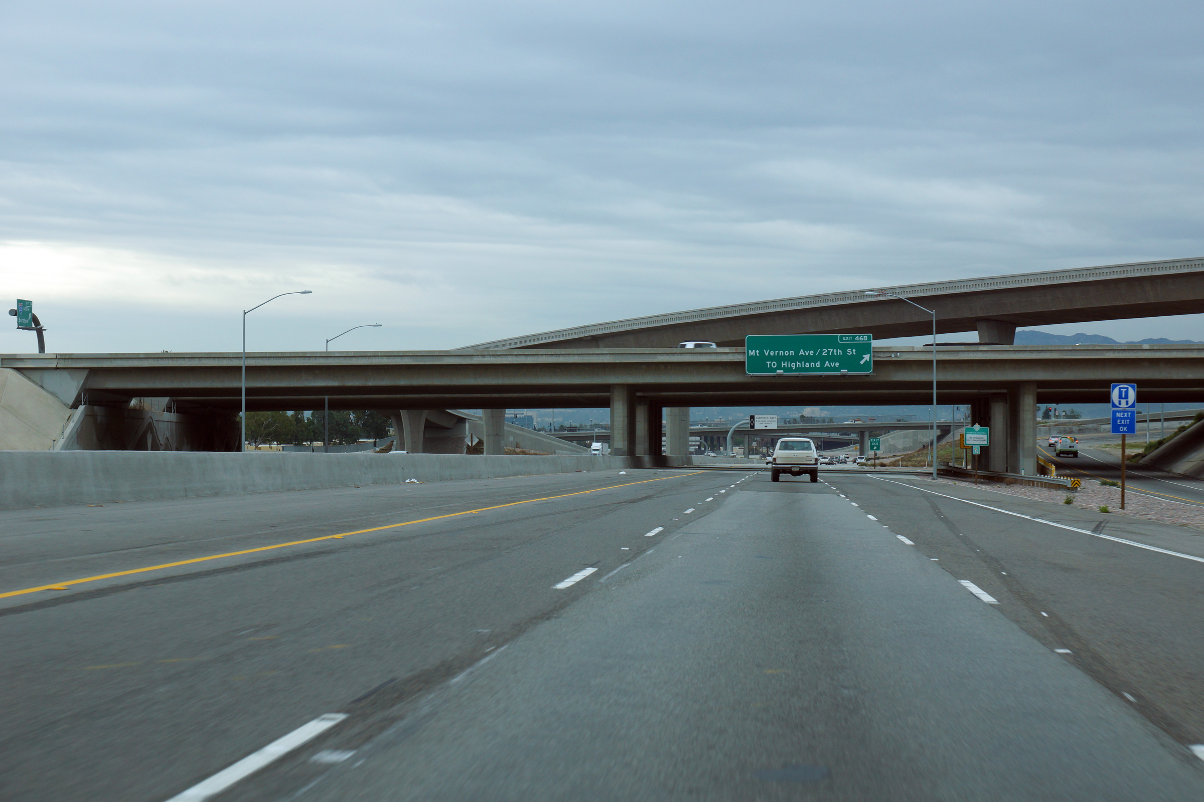
The signage for the northbound off-ramp to Highland Avenue is affixed to the Massachusetts Avenue overcrossing. |
 |
||
|
Date: 12/16/2014 |
High-res: (1440x960) (2400x1600) | |||
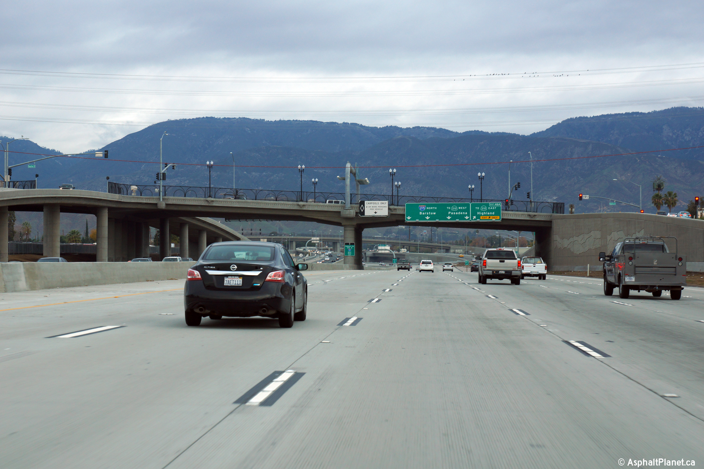
|
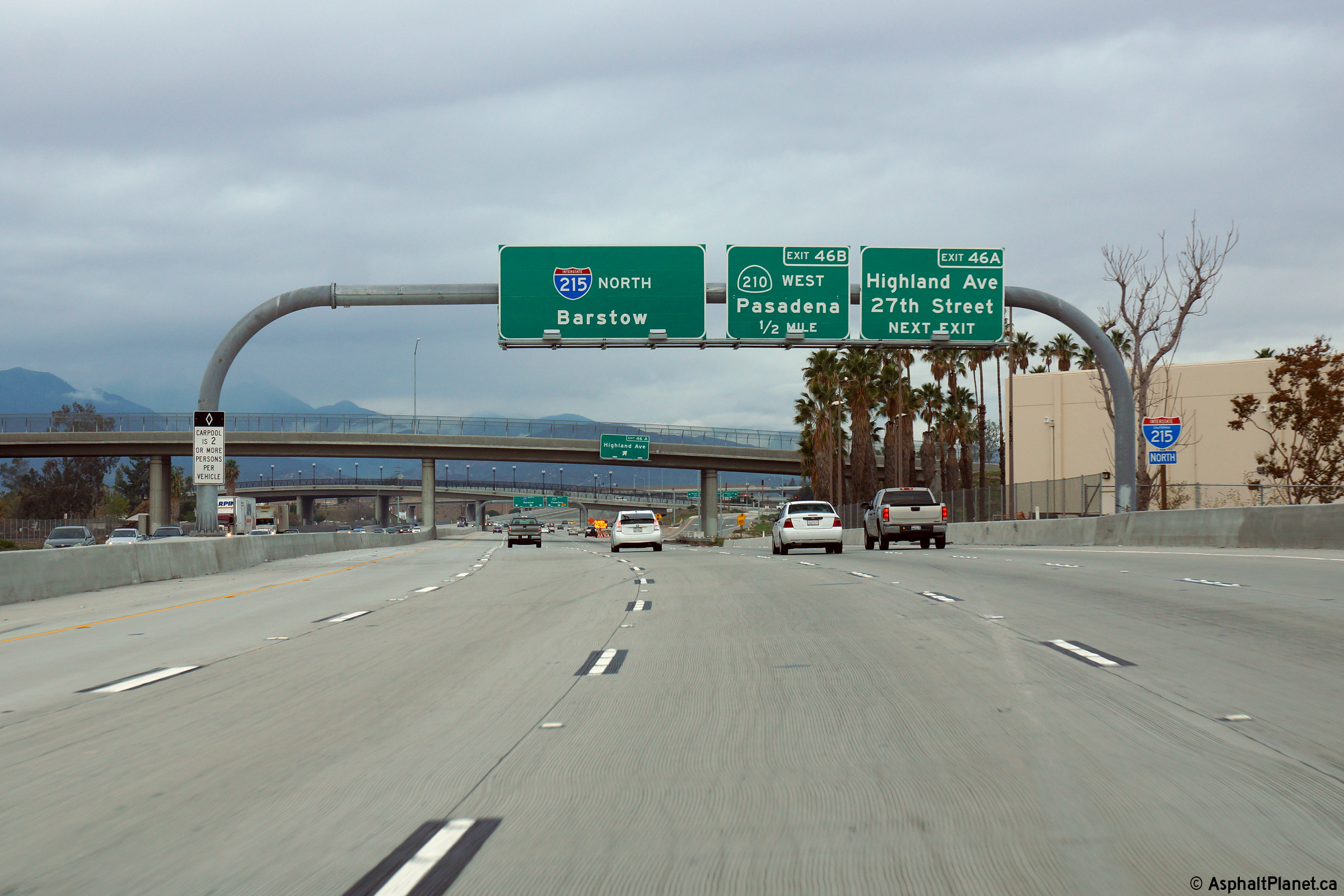
San Bernardino County |
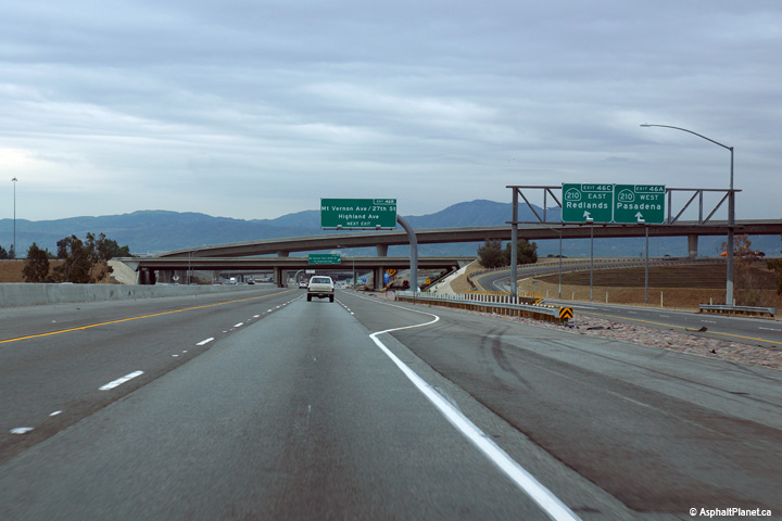
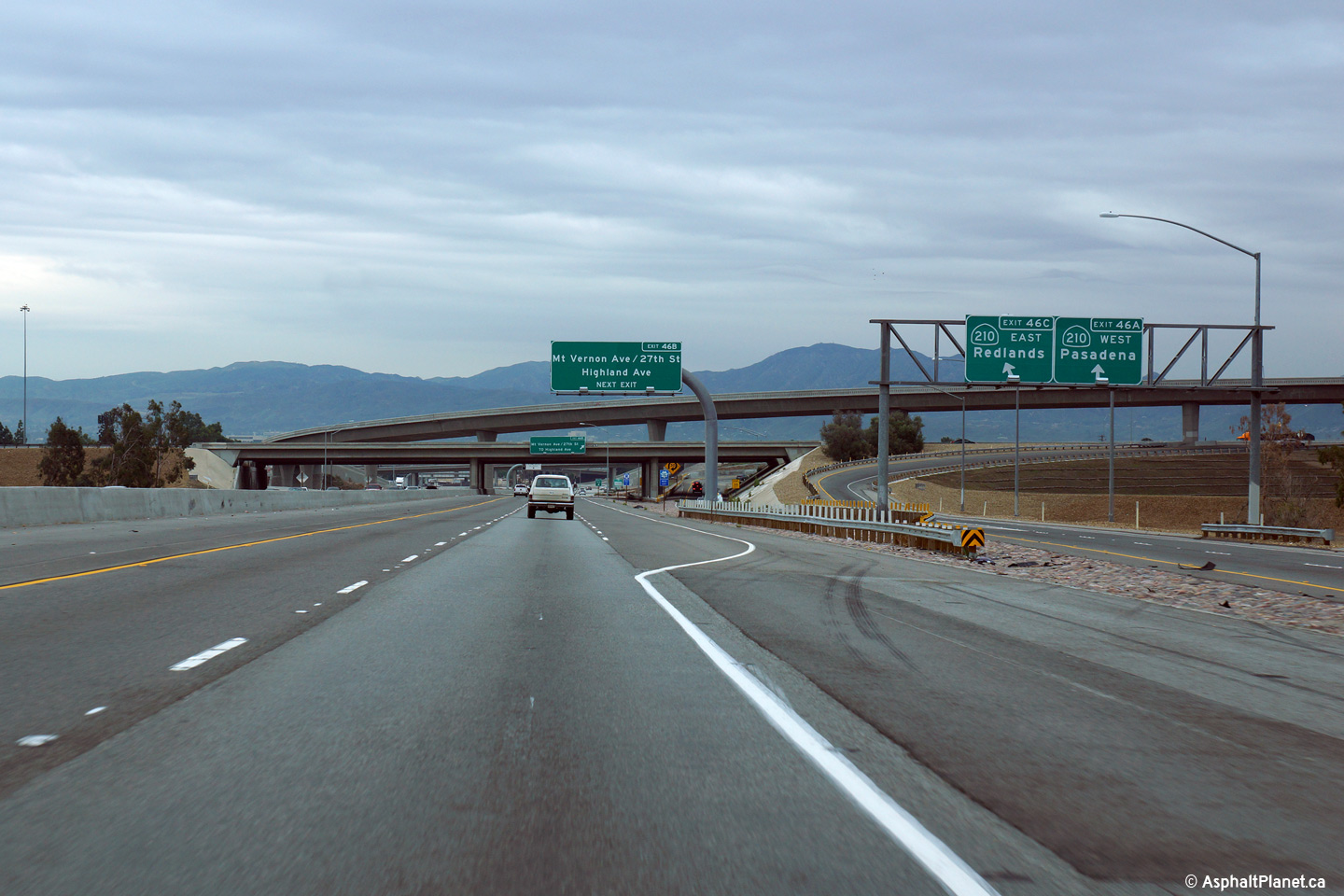
Northbound advanced signage approaching the SR-210 West interchange. |
 |
||
|
Date: 12/16/2014 |
High-res: (1440x960) (2400x1600) | |||
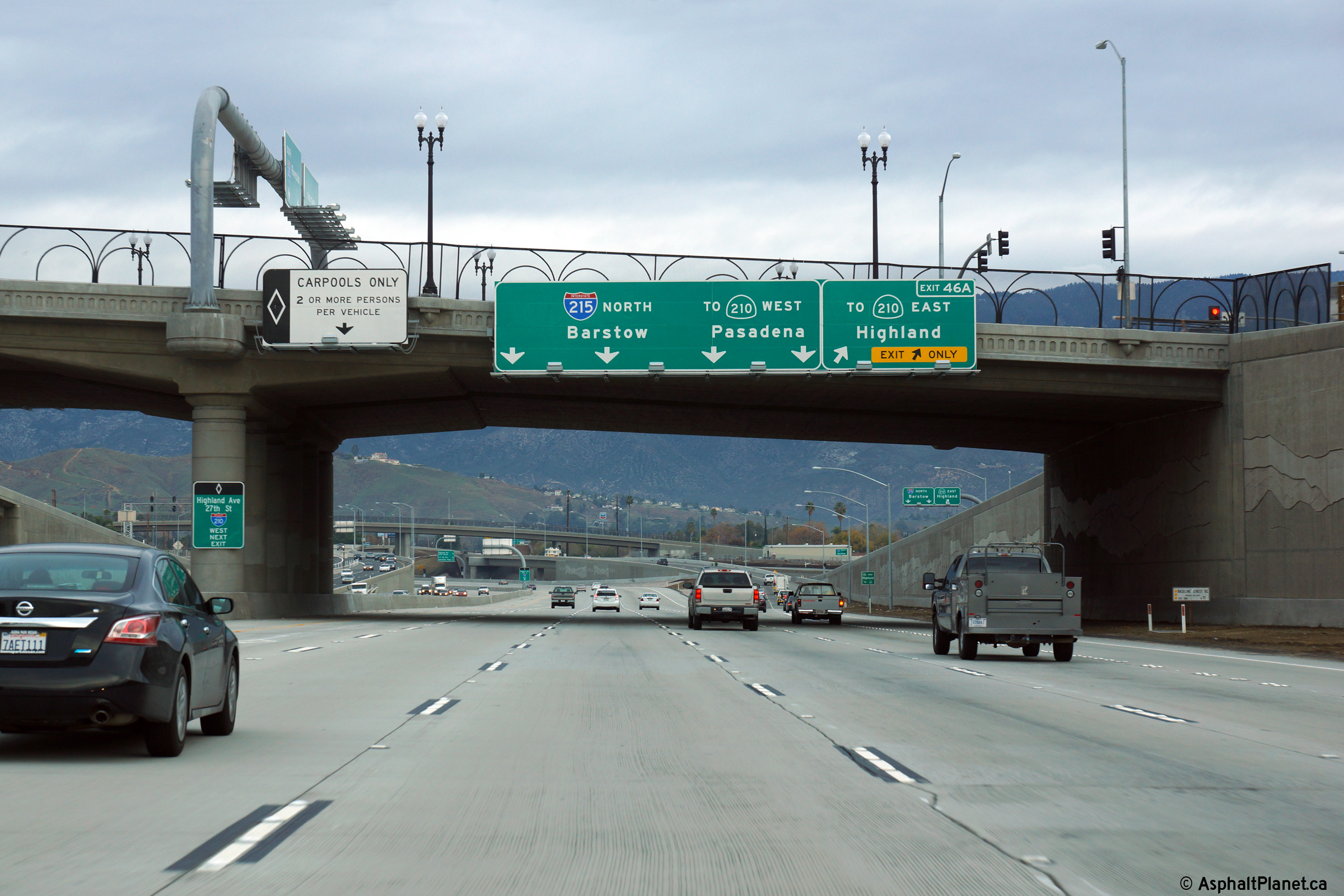
|
San Bernardino County |
Northbound view as the ramp to SR-210 West departs from the northbound lanes of I-215 |
 |
||
|
Date: 12/16/2014 |
High-res: (1440x960) (2400x1600) | |||
|
San Bernardino County |
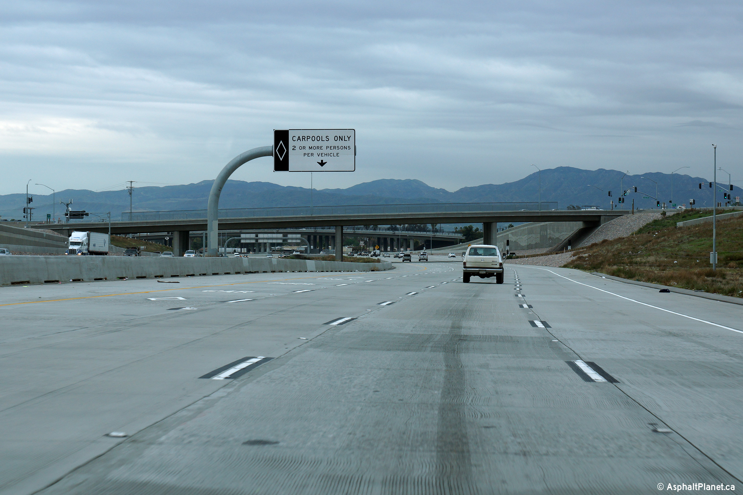
View looking southerly just south of the SR-210 interchange as the southbound carpool lane begins. |
 |
||
|
Date: 12/16/2014 |
High-res: (1440x960) (2400x1600) |
|||
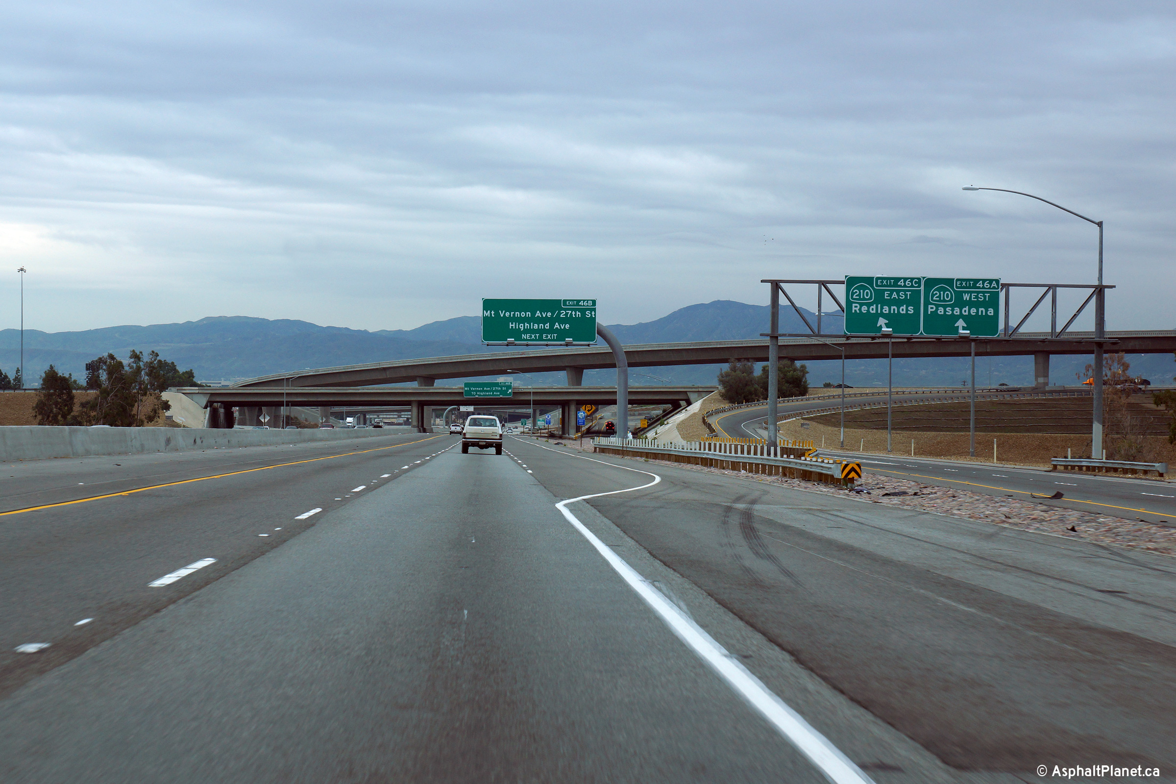
|
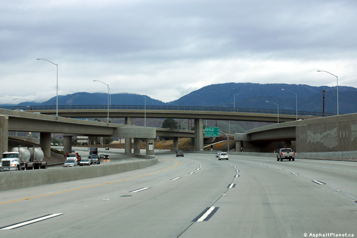
San Bernardino County |
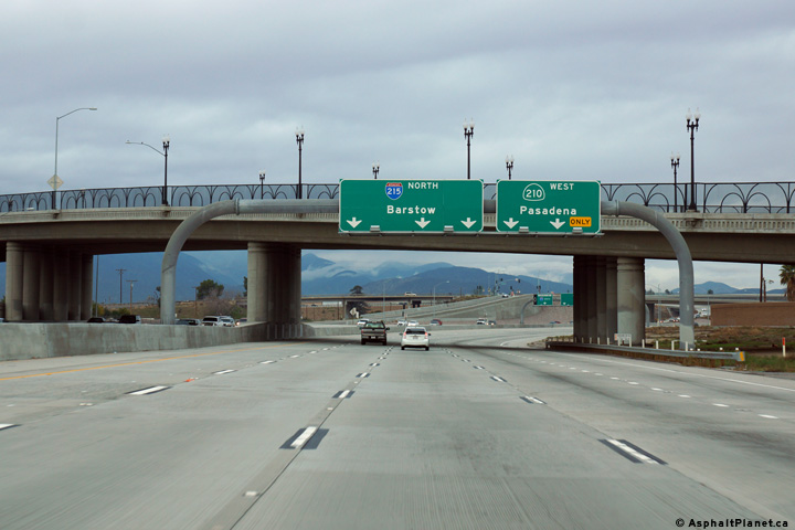
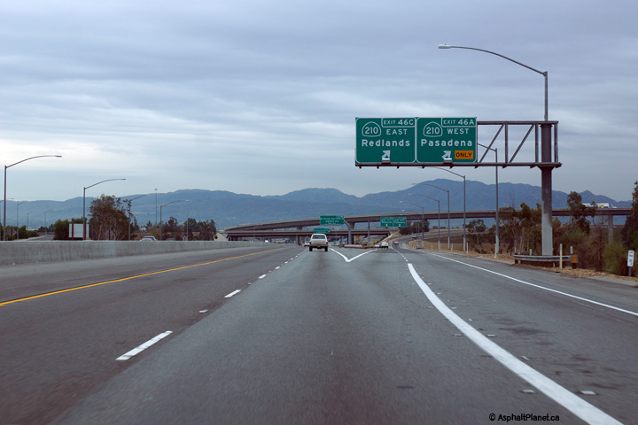
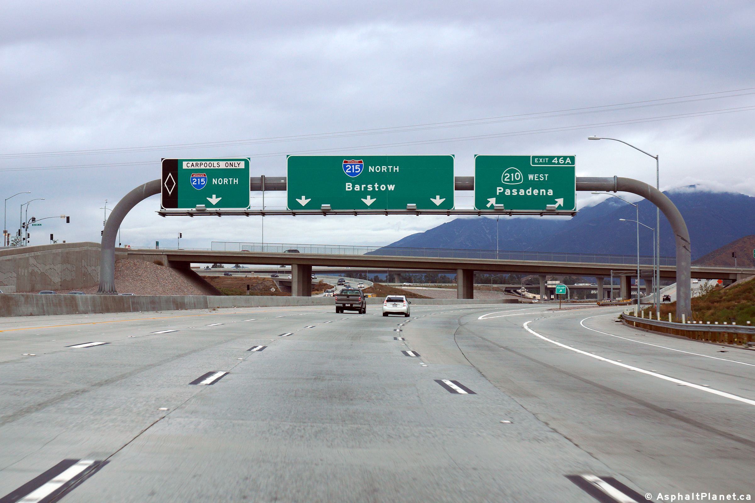
Northerly view approaching the SR-210 interchange. The high-speed flyover ramp that links I-215 North to SR-210 West was completed during the early 2010s. |
 |
||
|
Date: 12/16/2014 |
High-res: (1440x960) (2400x1600) | |||
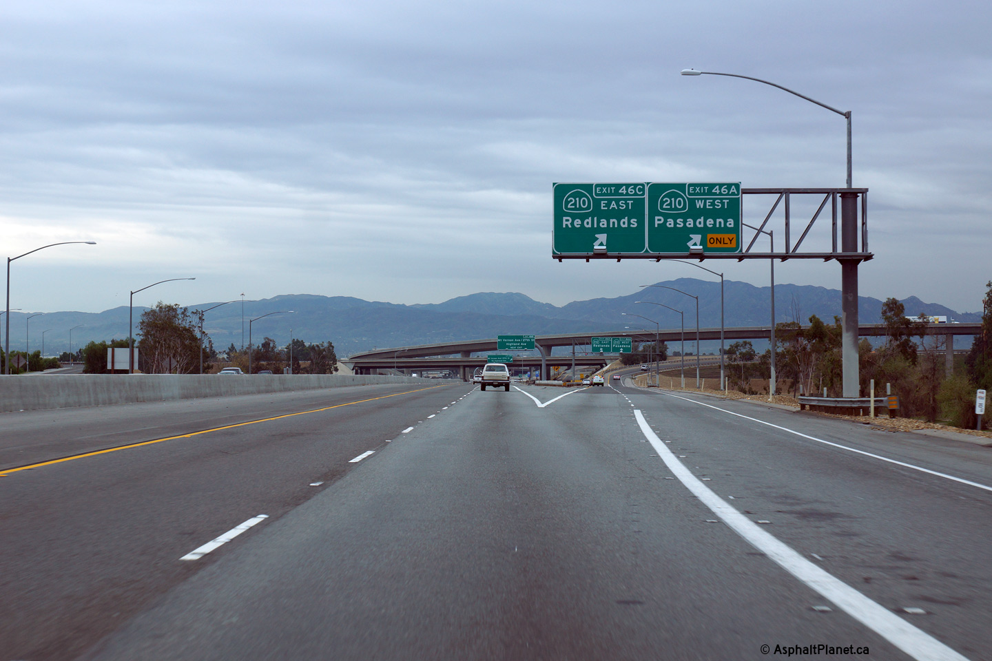
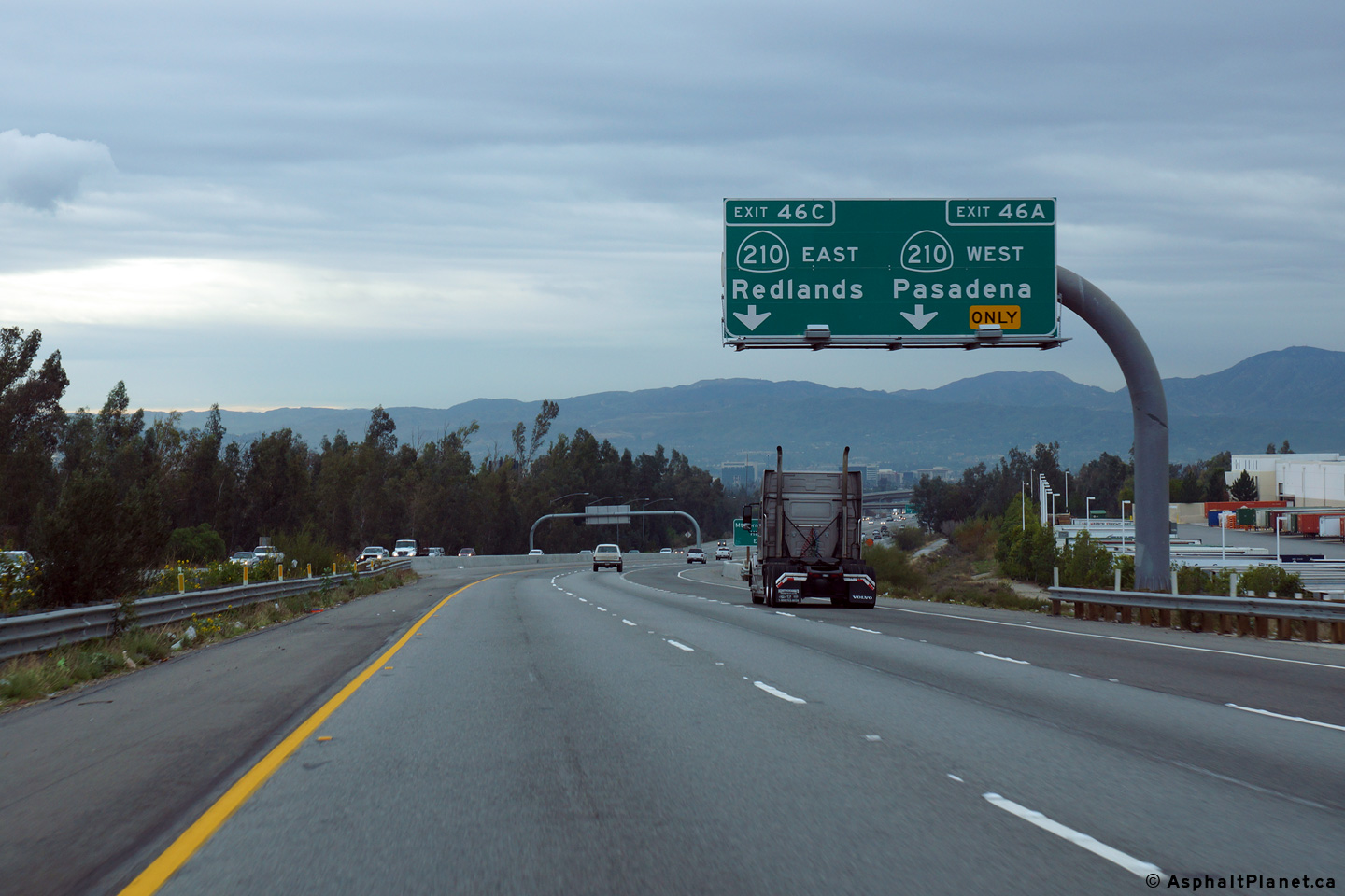
| Interstate and State Route 210 forms a northern by-pass of I-10 between I-5 near Newhall Pass and I-10 in Redlands. Click here for Interstate 210 Images. | ||||
|
San Bernardino County |
The southbound signage for the off-ramp to Highland Avenue is affixed to the structure that carries the mainline lanes of SR-210 overtop of I-215. |
 |
||
|
Date: 12/16/2014 |
High-res: (1440x960) (2400x1600) |
|||
|
San Bernardino County |
Southbound view approaching the Highland Avenue off-ramp |
 |
||
|
Date: 12/16/2014 |
High-res: (1440x960) (2400x1600) |
|||
|
San Bernardino County |
View looking southerly at the off-ramp to SR-210. |
 |
||
|
Date: 12/16/2014 |
High-res: (1440x960) (2400x1600) |
|||
|
San Bernardino County |
Southbound advanced signage approaching the SR-210 interchange. |
 |
||
|
Date: 12/16/2014 |
High-res: (1440x960) (2400x1600) | |||
| Interstate 15 continues northerly through Cajon Pass towards Barstow and eventually Las Vegas. Click here for Interstate 15 Images. | ||||
<- I-210
CA Highways
I-280 ->
AsphaltPlanet.ca
© 2010-14 AsphaltPlanet.ca.
AsphaltPlanet@asphaltplanet.ca
Page Created: March 30, 2015.
Last Updated: March 30, 2015.