AsphaltPlanet.ca > California > Interstate 10
Pictures on this page are arranged in order from west to east. I-10 East photos are left-aligned in the last column, while I-10 West photos are right-aligned. Center-line pictures are centered within the last column.
|
Location |
Description |
Photo |
||
|
East- |
West- |
|||
|
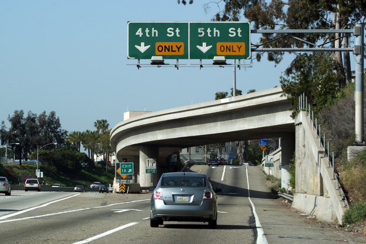
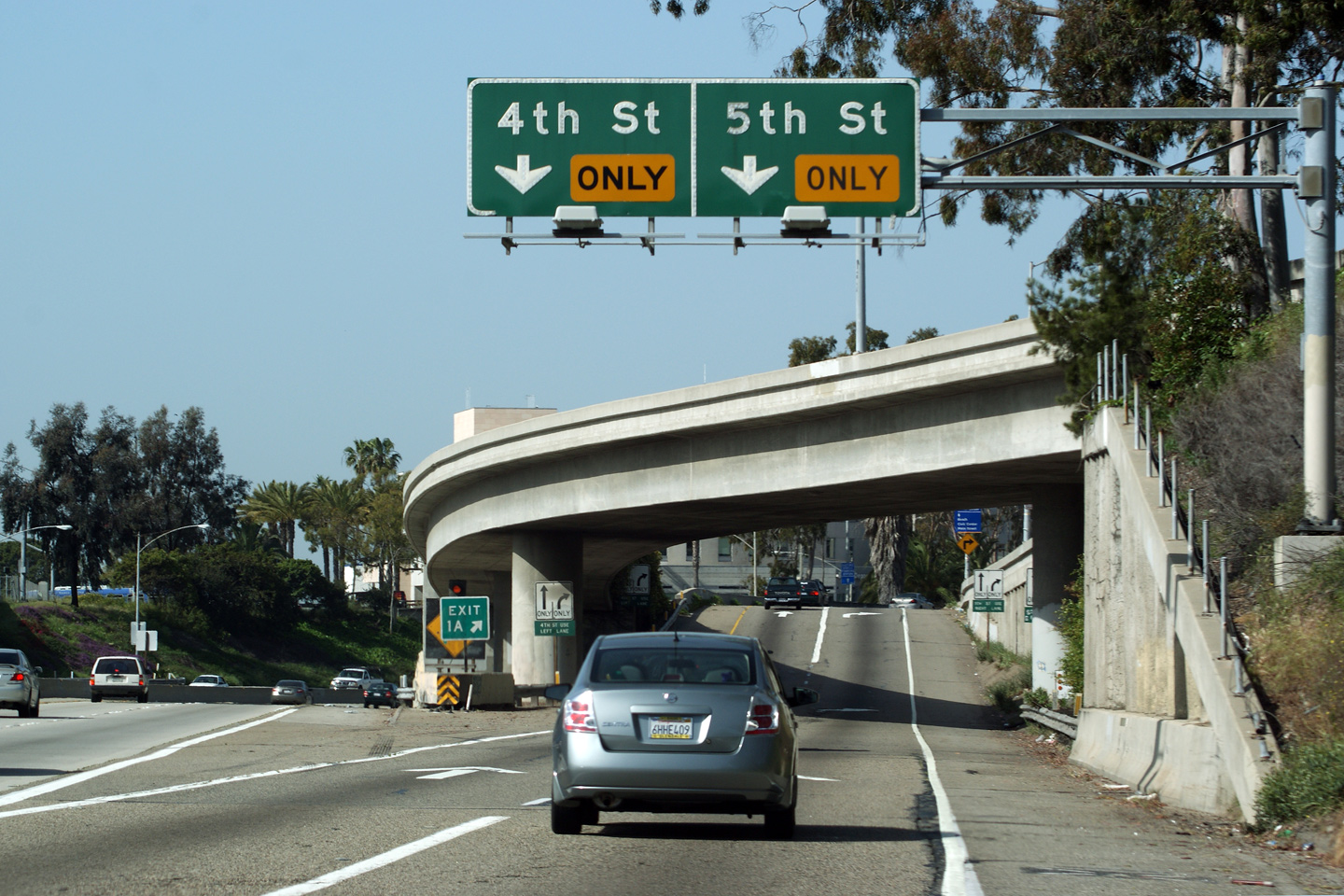
Los Angeles County City of Santa Monica |
Button-copy signs situated overtop of the westbound exit ramp to 4th Avenue and 5th Avenue in Santa Monica. This is the western-most interchange along Interstate 10, Beyond this, Interstate 10 ends, becoming the Pacific Coast Highway -- heading north towards Malibu. |
 |
||
|
Date: 3/27/2010 |
||||
|
Los Angeles County City of Santa Monica |
Advanced signage for the interchange to Interstate 405. The eastbound pull-through signage for Interstate 10 indicates the control city as Los Angeles. I find this somewhat odd, as while technically Interstate 10 begins in Santa Monica, for all intents and purposes the western terminus of Interstate 10 is Los Angeles. |
 |
||
|
Date: 3/27/2010 |
||||
| North of the East Los Angeles Interchange, I-5 is known as the Golden State Freeway. Click here for Interstate 5-North Images. | ||||
|
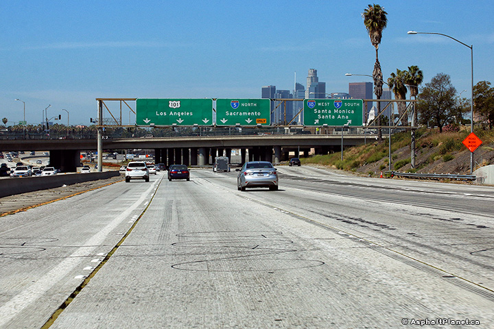
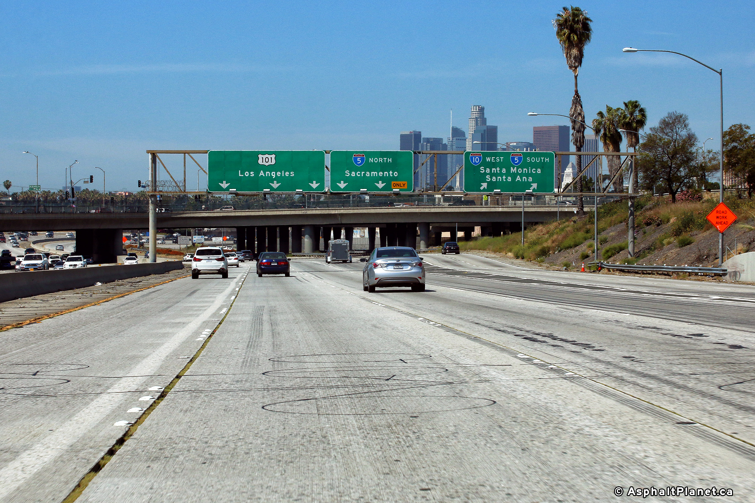
Los Angeles County City of Los Angeles |
Signage at the East Los Angeles Interchange for Interstate 5 and US-101. I-10 exits the freeway mainline at this interchange to follow I-5 for a short distance to the south. |
 |
||
|
Date: 3/30/2010 |
High-res: (1440x960) (2400x1600) | |||
|
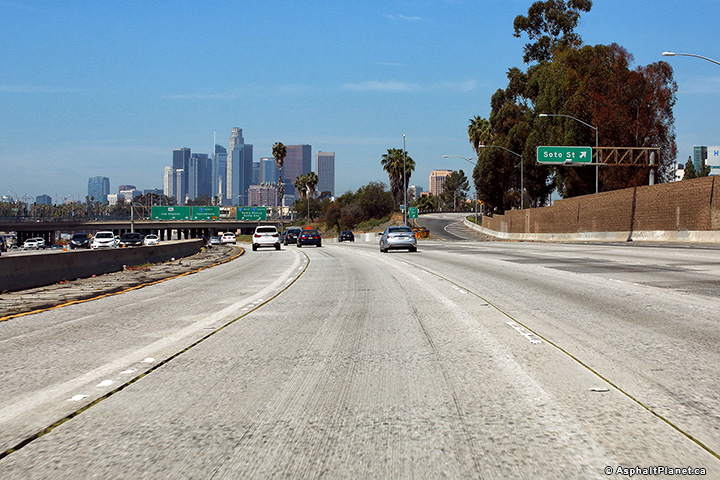
Los Angeles County City of Los Angeles |
Signage at the westbound off-ramp to Soto Street. |
 |
||
|
Date: 3/30/2010 |
High-res: (1440x960) (2400x1600) | |||
|
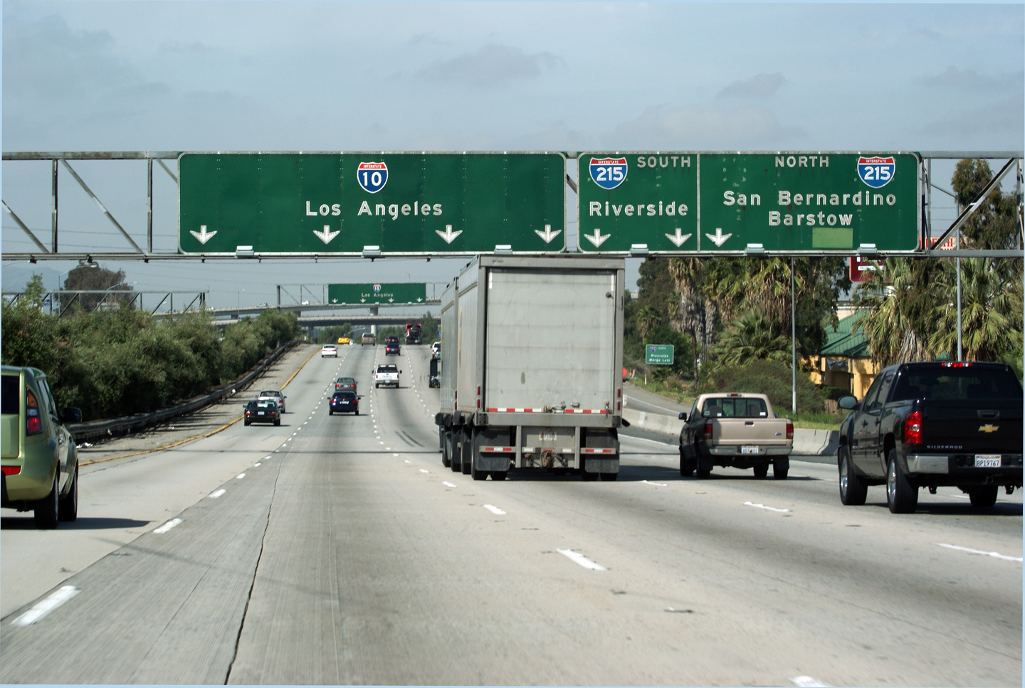
San Bernardino County City of San Bernardino |
Westerly view as the 10 Freeway passes underneath of the Interstate 215 interchange in San Bernardino. Massive interchanges are a dime a dozen in Southern California. Aside from maybe Texas, no other freeway network in the world rivals that of Southern California's. |
 |
||
|
Date: 3/30/2010 |
High-res: (1440x960) (2400x1600) |
|||
|
San Bernardino County City of San Bernardino |
Button-copy signage at the ramp to Interstate 215 from Interstate 10 Westbound. Note the on-ramp beside to the right of the jersey barrier. The westbound on-ramp from Waterman Avenue only serves Interstate 215-bound travelers, despite the fact that it runs parallel to Interstate 10 for a few hundred metres. |
 |
||
|
Date: 3/30/2010 |
High-res | |||
|
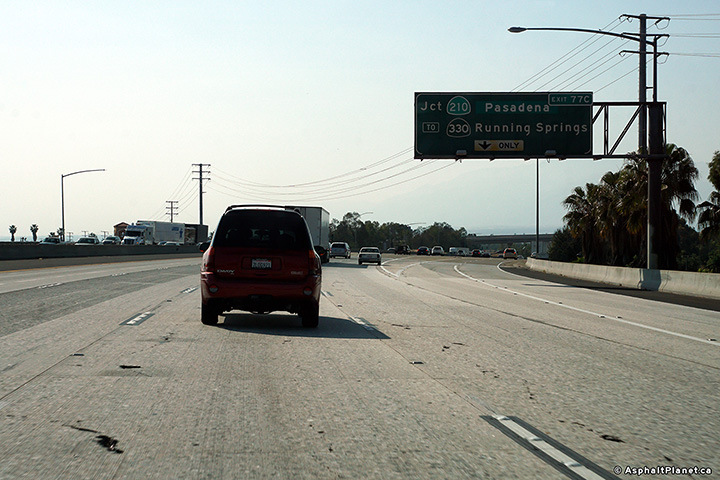
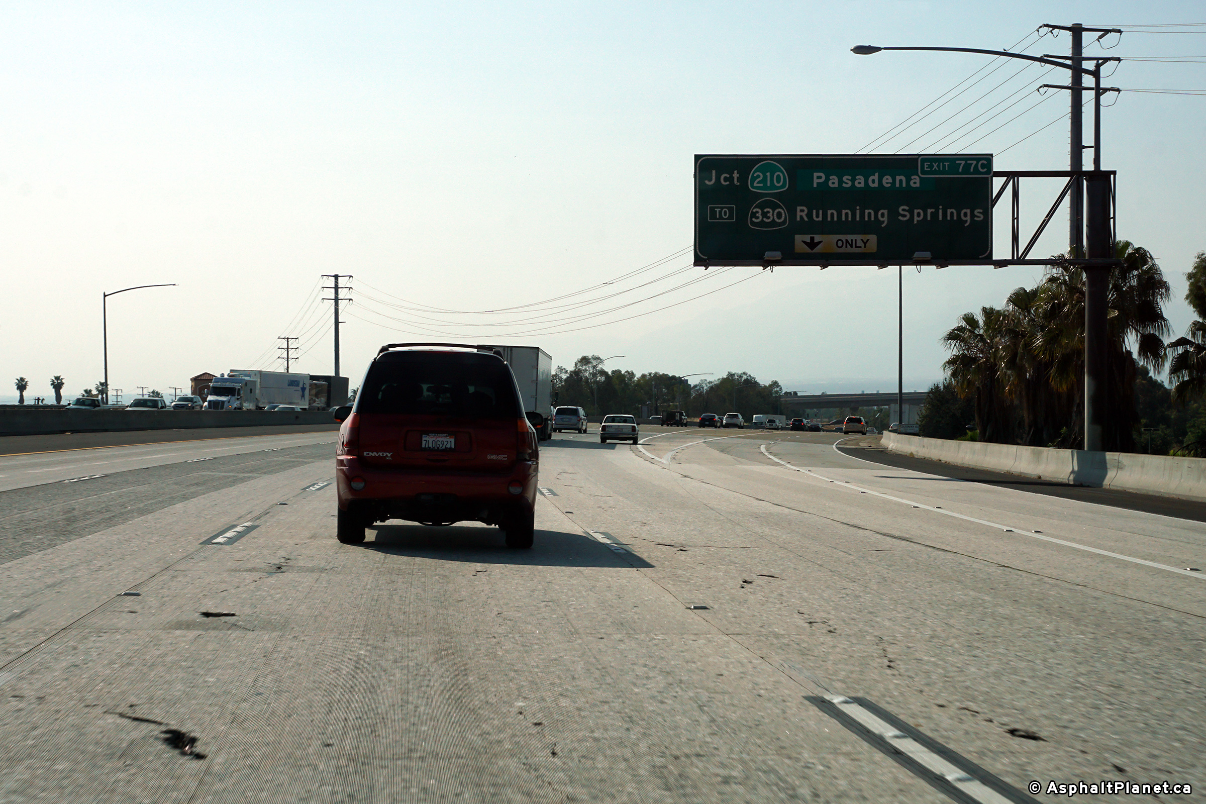
San Bernardino County |
Signage at the westbound off-ramp to SR-210. Despite being indicated as only a single lane off-ramp, two lanes in fact depart the westbound 10 for the 210 Freeway. |
 |
||
|
Date: 4/11/2017 |
High-res: (1440x960) (2400x1600) | |||
|
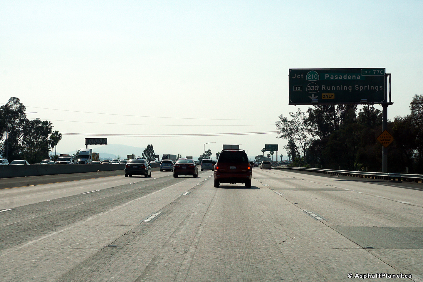
San Bernardino County |
Westbound advanced signage for the off-ramp to SR-210. |
 |
||
|
Date: 4/11/2017 |
High-res: (1440x960) (2400x1600) | |||
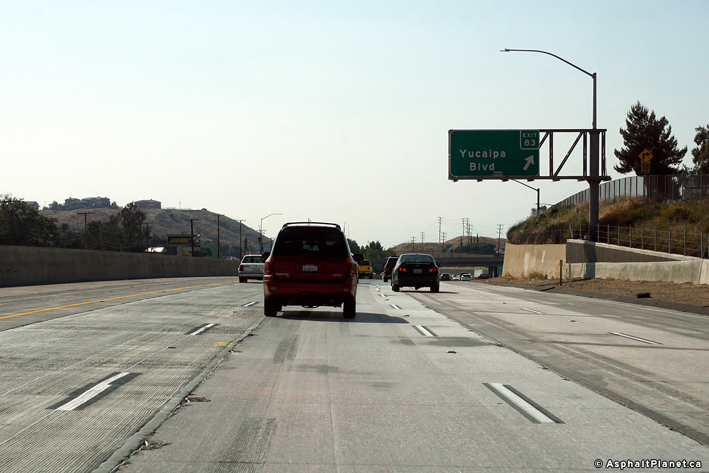
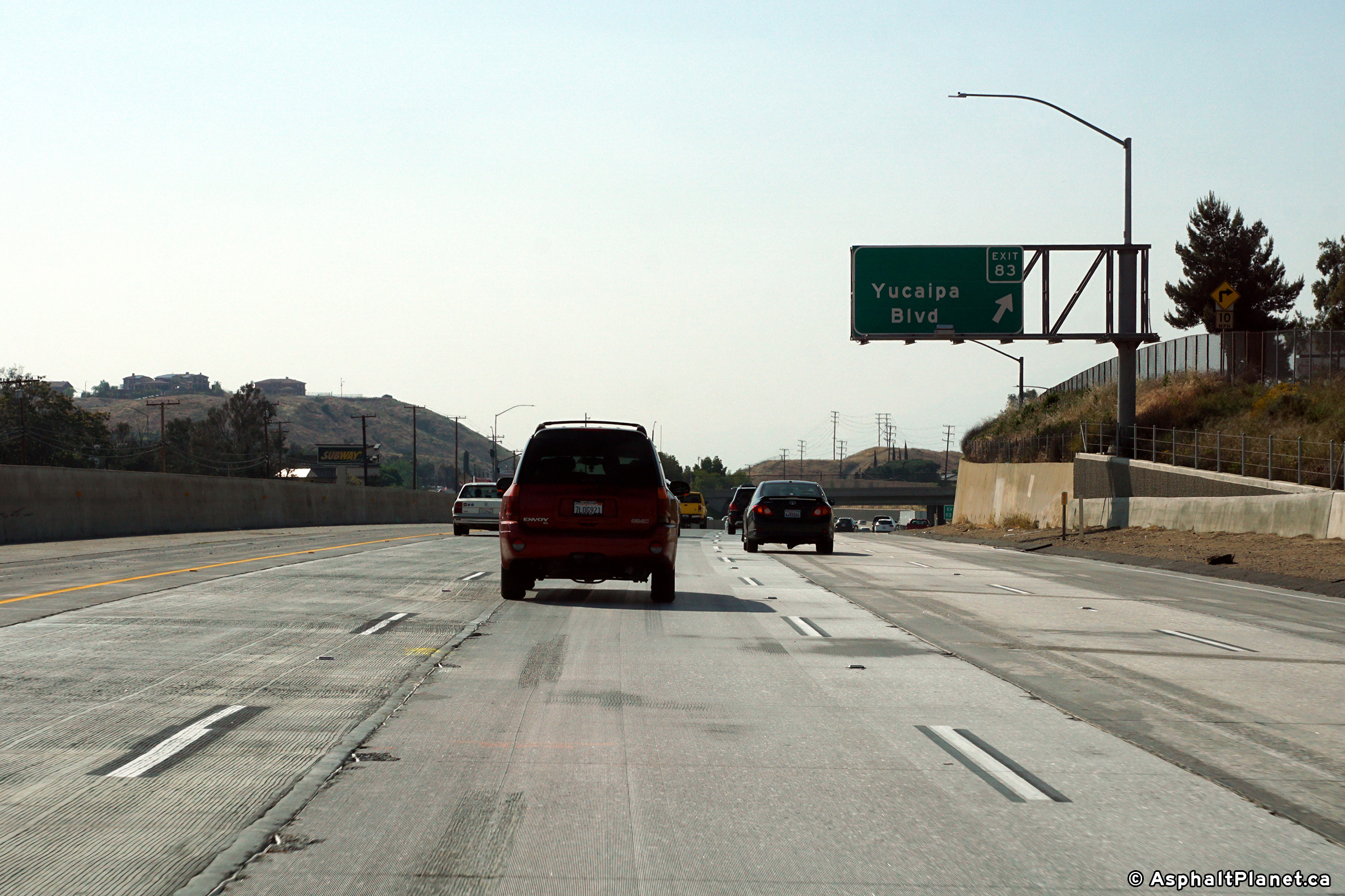
|
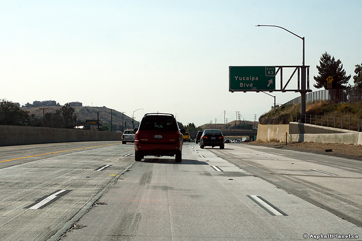
San Bernardino County |
Signage at the westbound off-ramp to Yucaipa Boulevard. |
 |
||
|
Date: 4/11/2017 |
High-res: (1440x960) (2400x1600) | |||
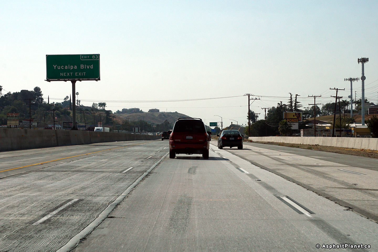
|
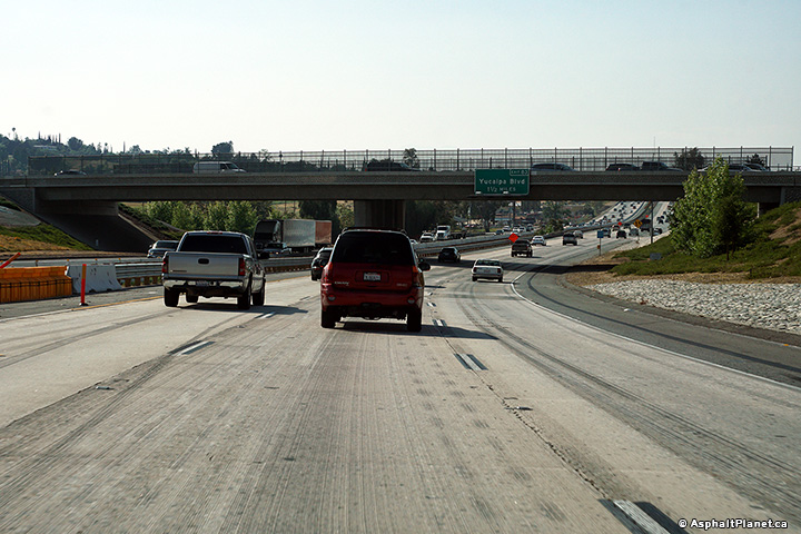
San Bernardino County |
Median mounted advanced signage for the Yucaipa Boulevard interchange. |
 |
||
|
Date: 4/11/2017 |
High-res: (1440x960) (2400x1600) | |||
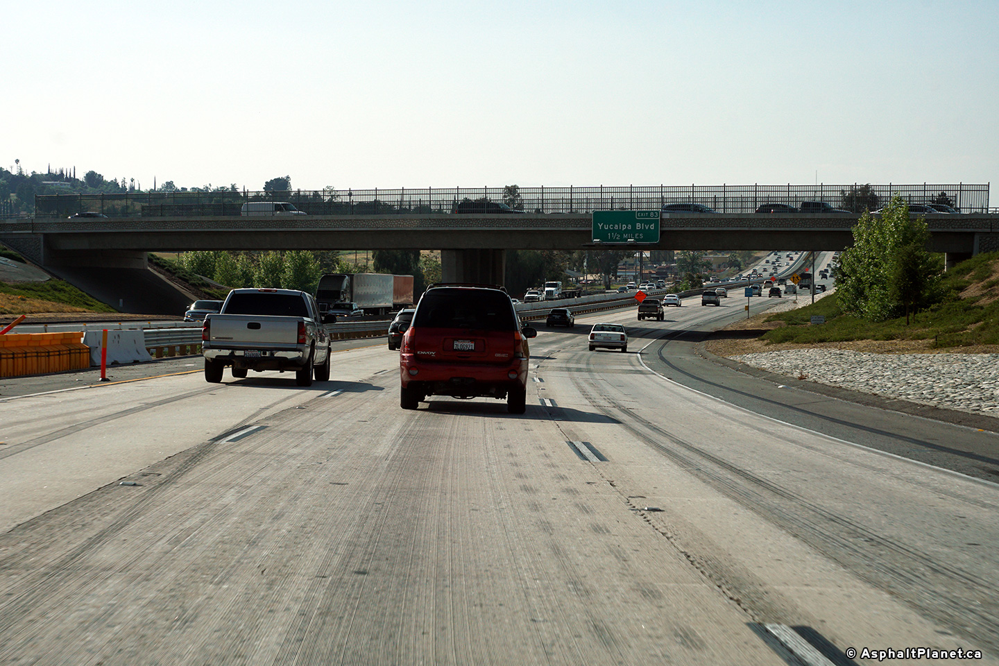
|
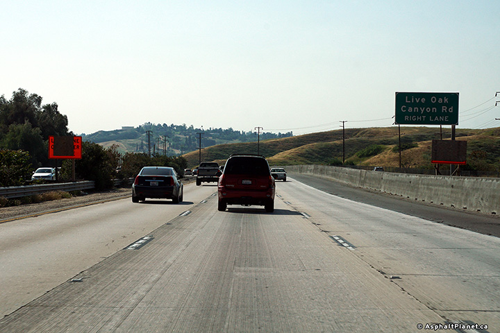
San Bernardino County |
An advanced sign for the Yucaipa Boulevard interchange has been affixed to the Live Oak Canyon Road overpass. |
 |
||
|
Date: 4/11/2017 |
High-res: (1440x960) (2400x1600) | |||
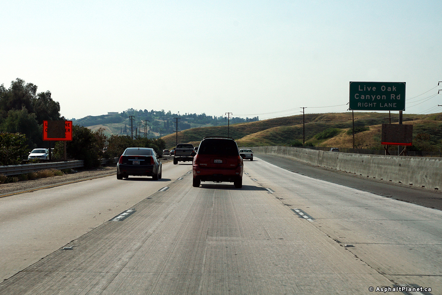
|
San Bernardino County |
Signage for the westbound off-ramp to Live Oak Canyon Road. |
 |
||
|
Date: 4/11/2017 |
High-res: (1440x960) (2400x1600) | |||
|
San Bernardino County |
Westbound advanced signage for the off-ramp to Live Oak Canyon Road. |
 |
||
|
Date: 4/11/2017 |
High-res: (1440x960) (2400x1600) | |||
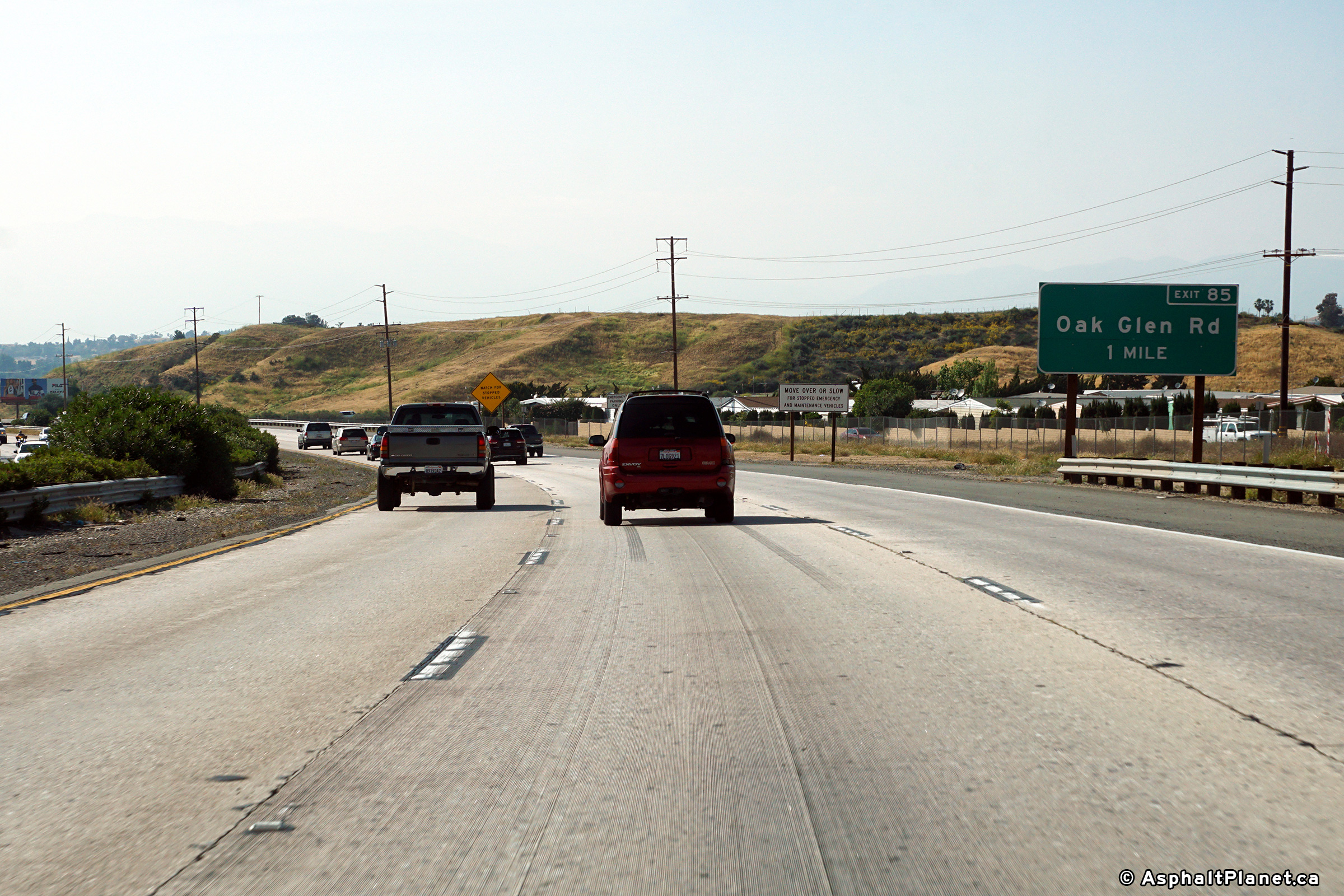
|
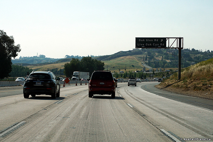
San Bernardino County |
One mile westbound advanced signage for the Oak Glen (and Live Oak Canyon) Road interchange. |
 |
||
|
Date: 4/11/2017 |
High-res: (1440x960) (2400x1600) | |||
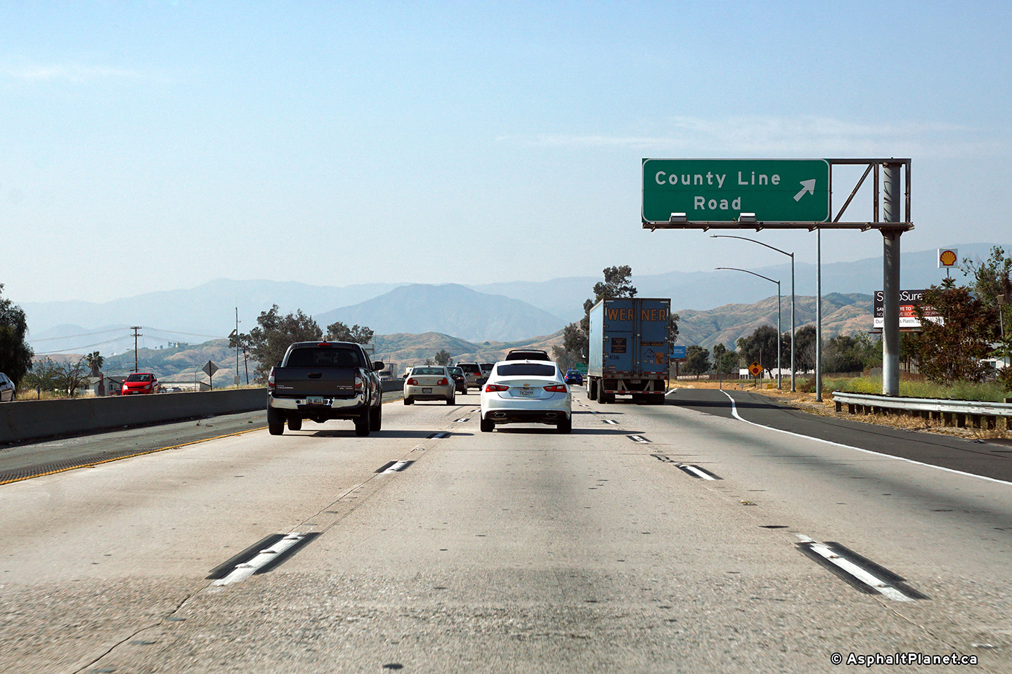
|
San Bernardino County |
Signage at the westbound off-ramp to County Line Road. |
 |
||
|
Date: 4/11/2017 |
High-res: (1440x960) (2400x1600) | |||
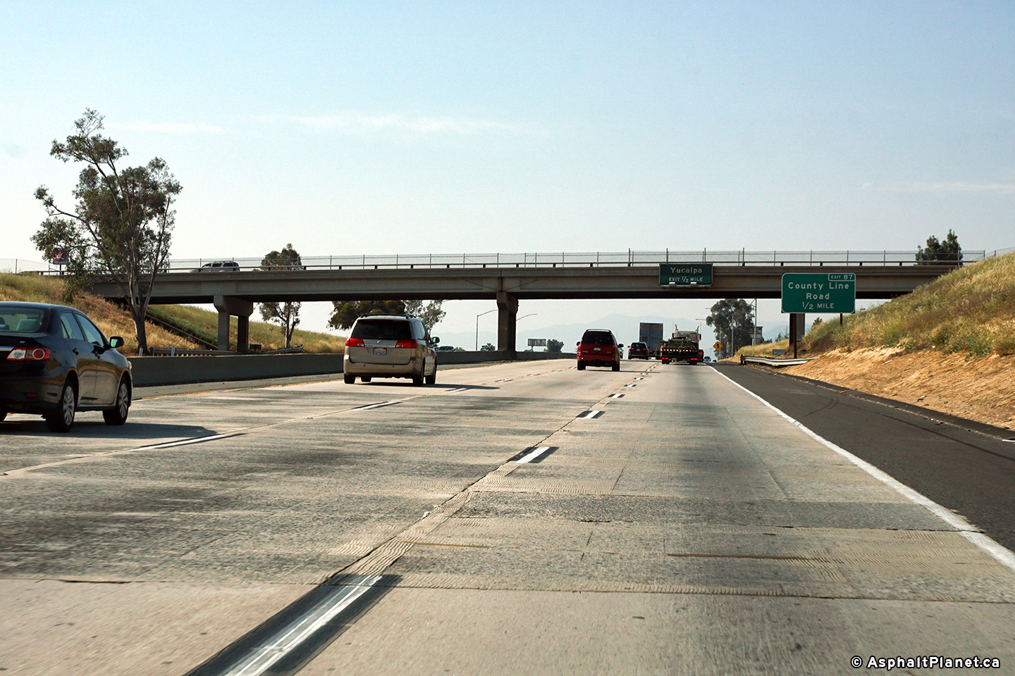
|
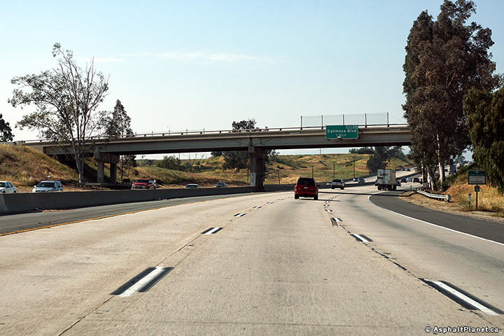
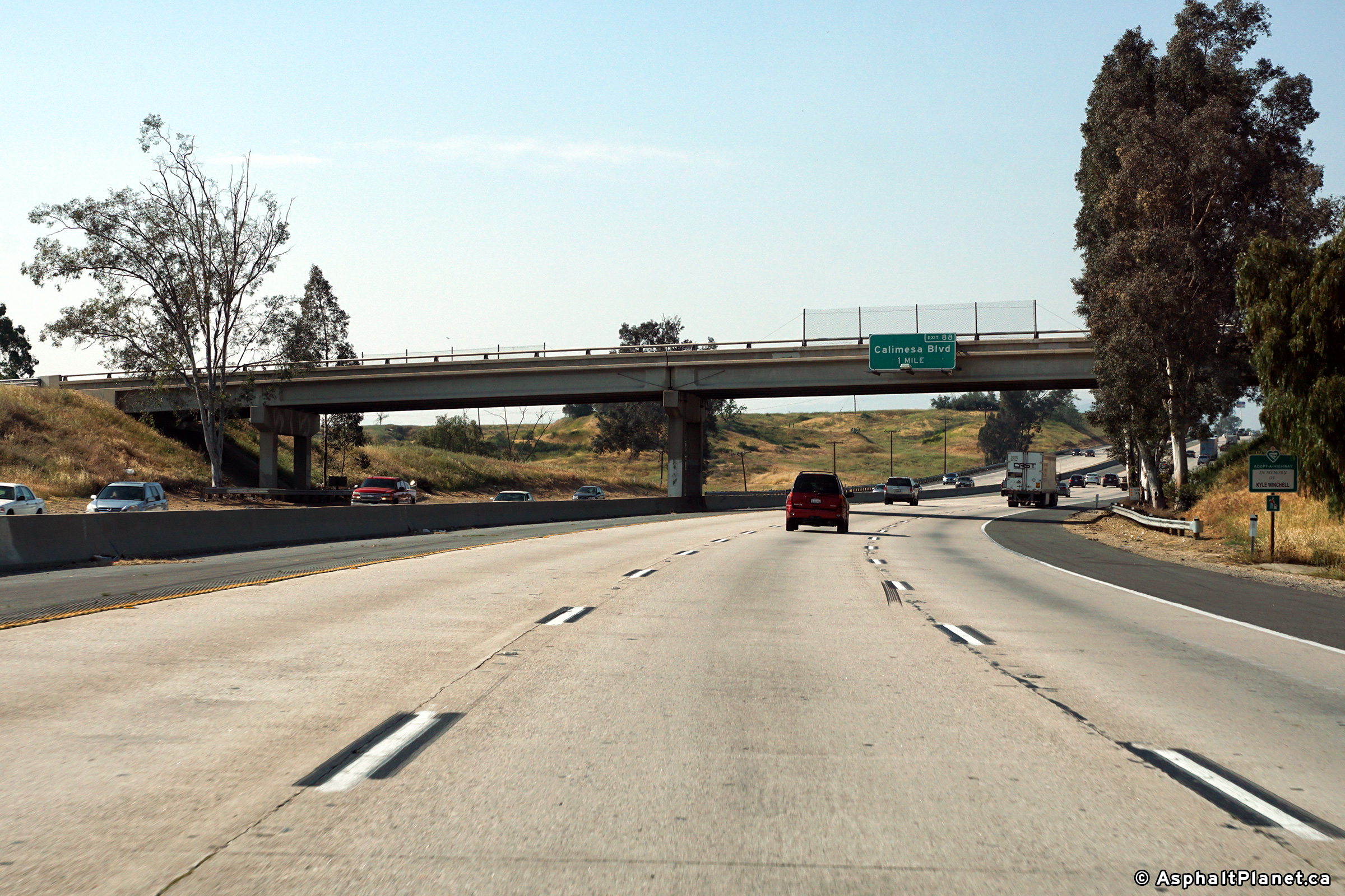
San Bernardino County |
This view looks westerly through the Calimesa Boulevard overpass. |
 |
||
|
Date: 4/11/2017 |
High-res: (1440x960) (2400x1600) | |||
|
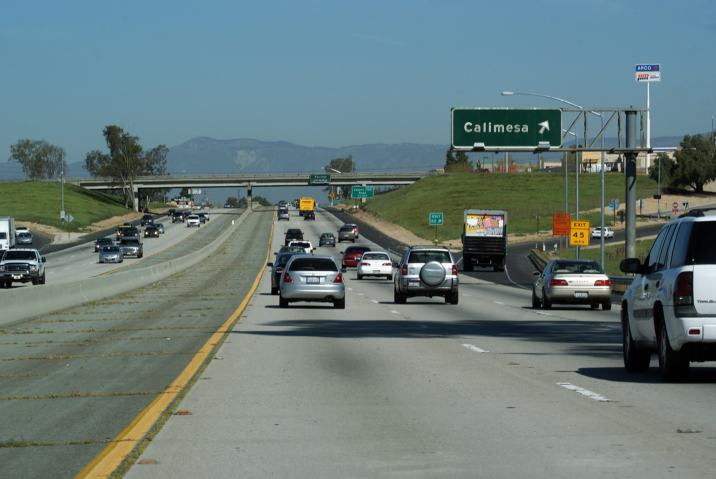
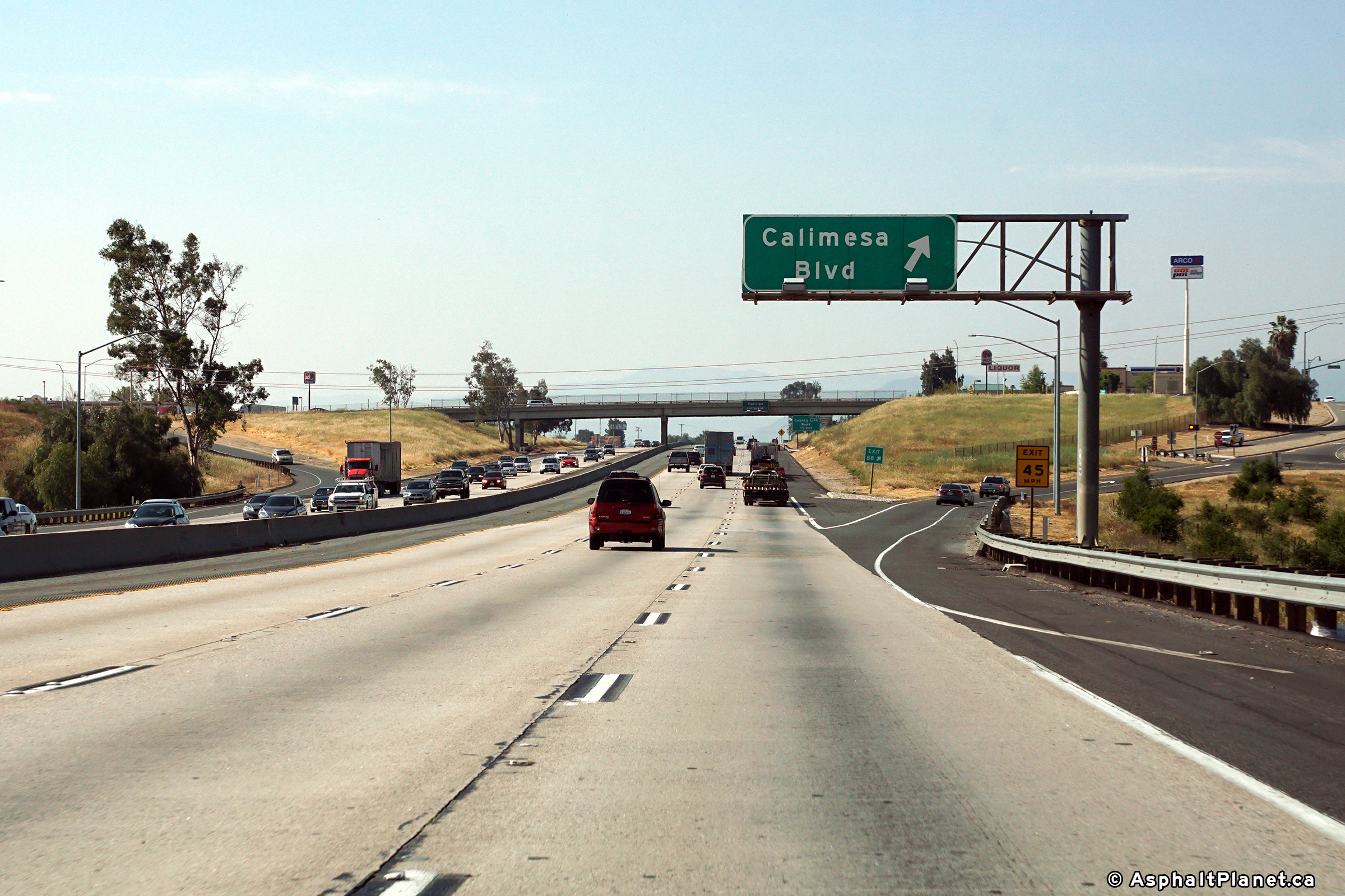
Riverside County |
Westbound off-ramp to Calimesa -- exit 88. In the years that followed 2010, the former button copy signage has been replaced. |
 |
||
| High-res: (1440x960) | ||||
 |
||||
|
Date: 4/11/2010 |
High-res: (1440x960) (2400x1600) | |||
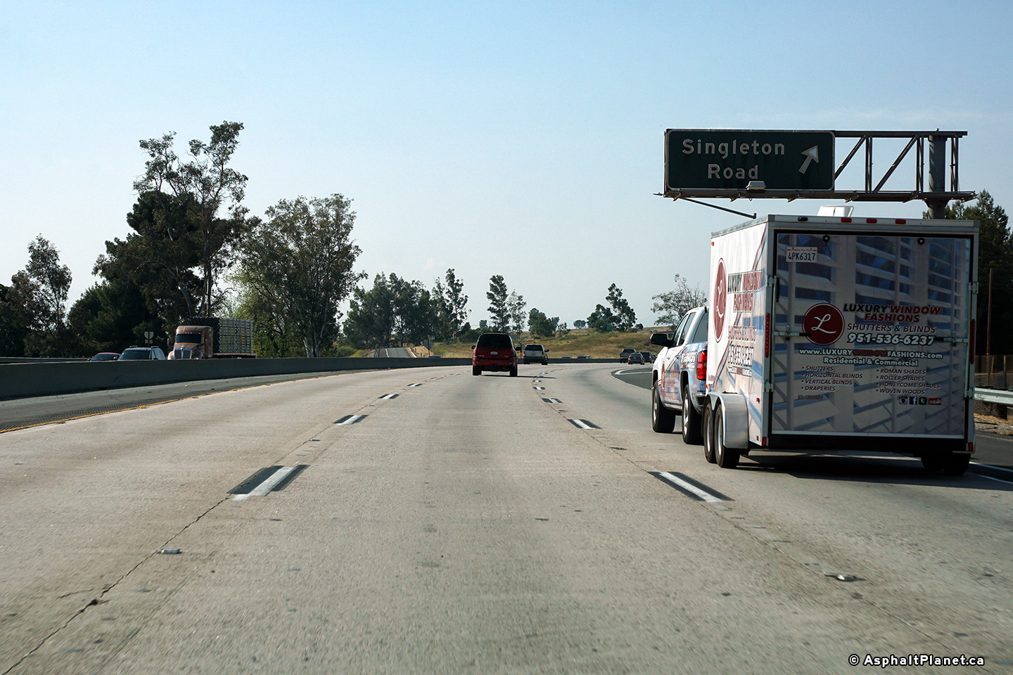
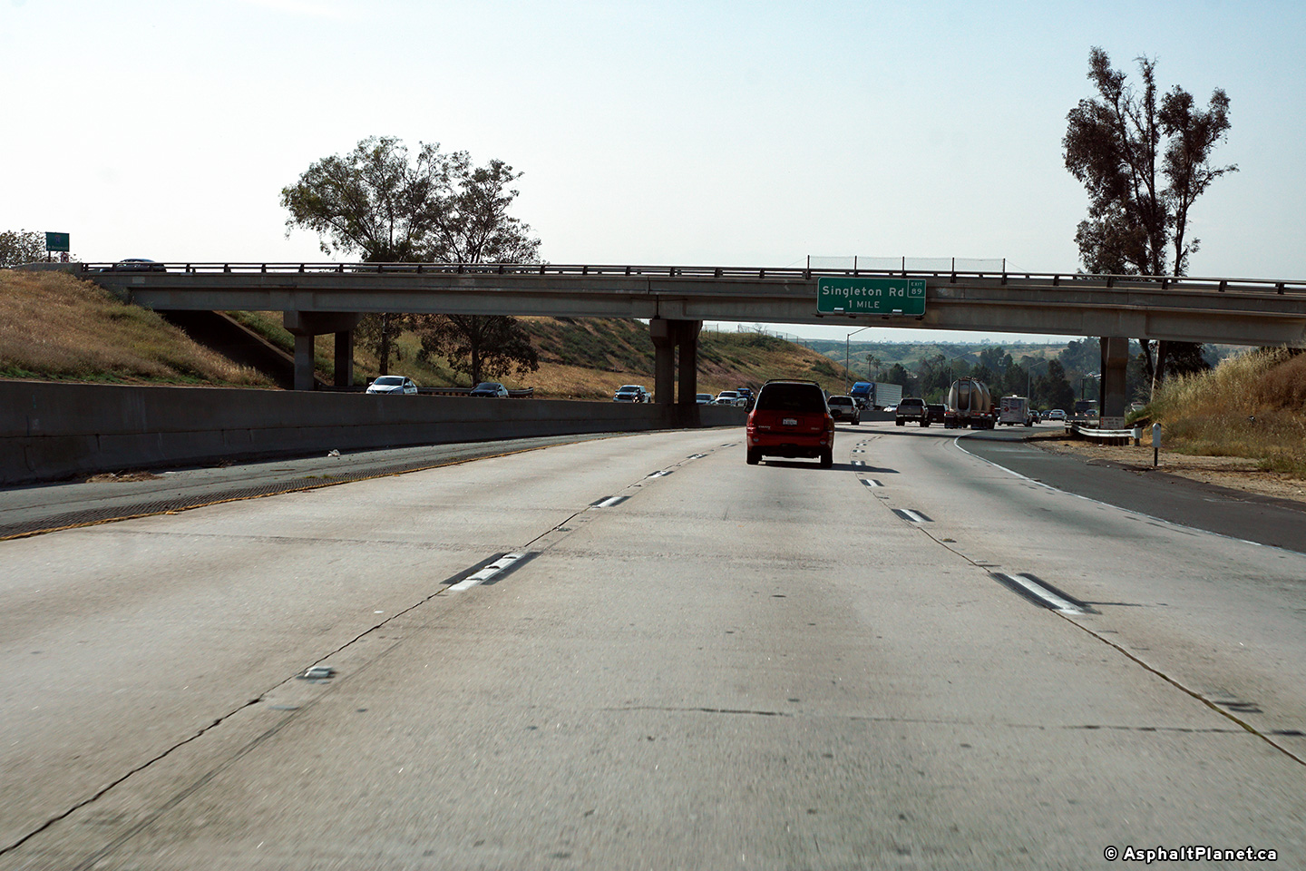
|
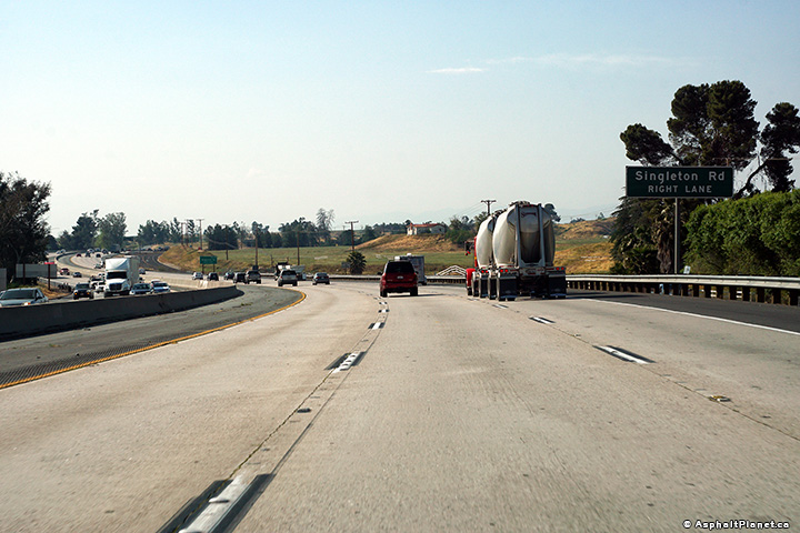
Riverside County |
View looking through the Singleton Road overpass. |
 |
||
|
Date: 4/11/2017 |
High-res: (1440x960) (2400x1600) | |||
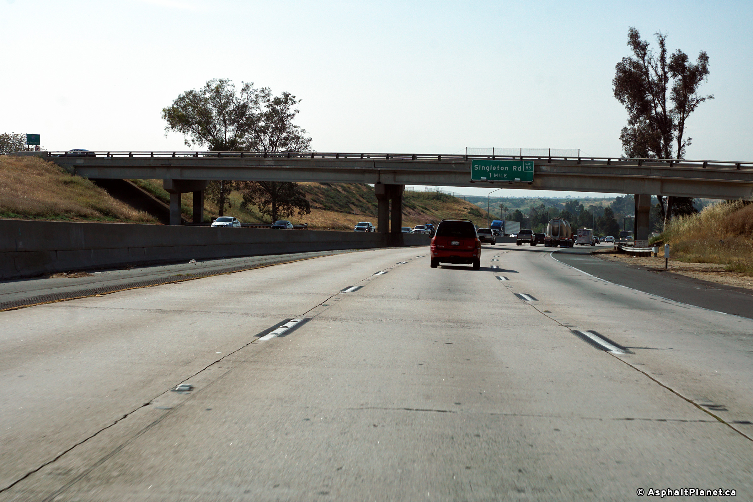
|
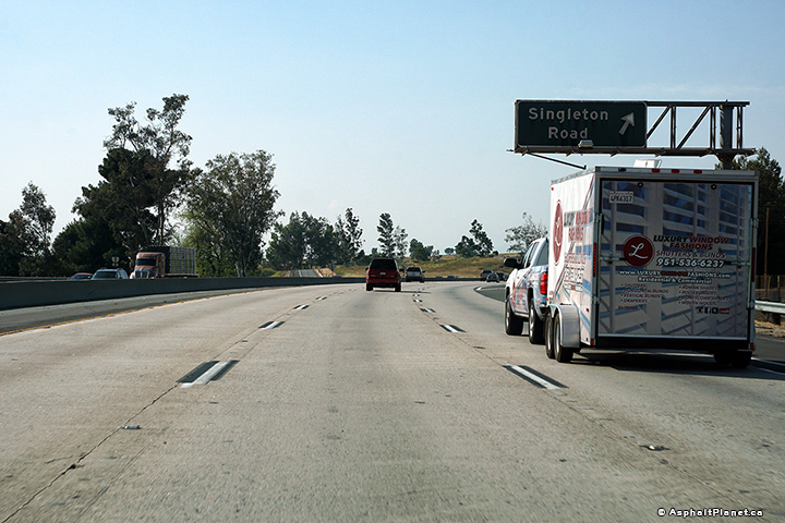
Riverside County |
View looking westerly at the off-ramp to Singleton Road. |
 |
||
|
Date: 4/11/2017 |
High-res: (1440x960) (2400x1600) | |||
|
Riverside County |
Westbound advanced signage approaching the Singleton Road interchange. |
 |
||
|
Date: 4/11/2017 |
High-res: (1440x960) (2400x1600) | |||
|
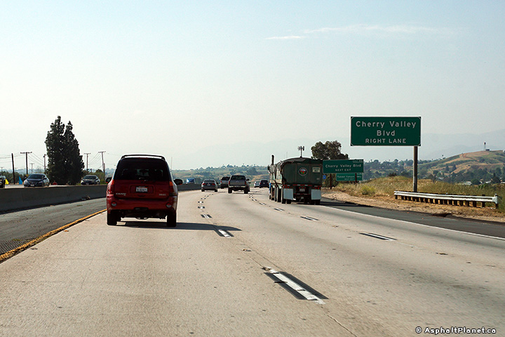
Riverside County |
A sign for the Singleton Road interchange has been affixed to the Cherry Valley Road interchange. |
 |
||
|
Date: 4/11/2017 |
High-res: (1440x960) (2400x1600) | |||
|
Riverside County |
Signage at the westbound off-ramp to County Line Road. Click here for an older photo of this sign, taken all the way back in 2010. |
 |
||
|
Date: 4/11/2017 |
High-res: (1440x960) (2400x1600) | |||
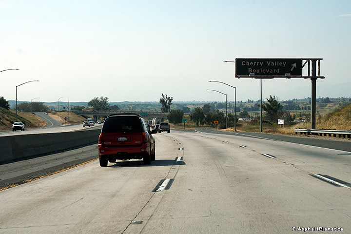
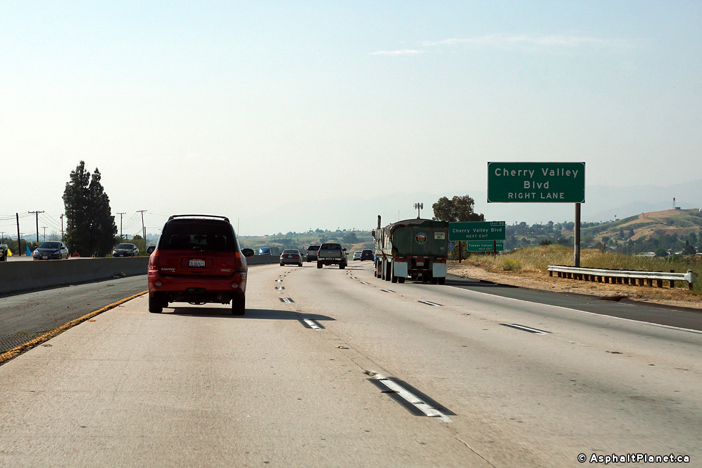
|
Riverside County |
Westbound signage in advance of the Cherry Valley Road interchange. |
 |
||
|
Date: 4/11/2017 |
High-res: (1440x960) (2400x1600) | |||
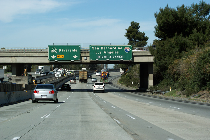
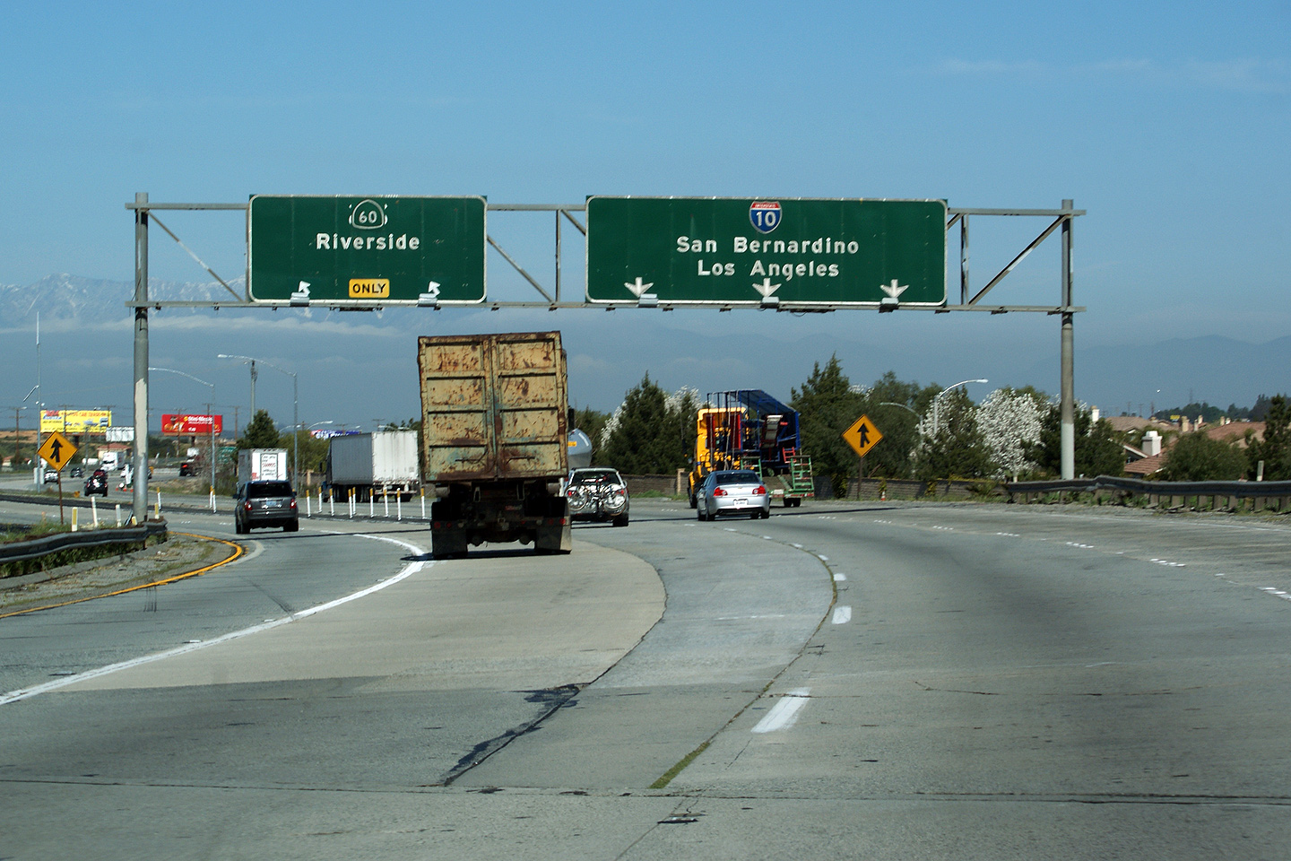
| SR-60 runs to the south of I-10 between Beaumont and the East Los Angeles Interchange. Click here for SR-60 Images. | ||||
|
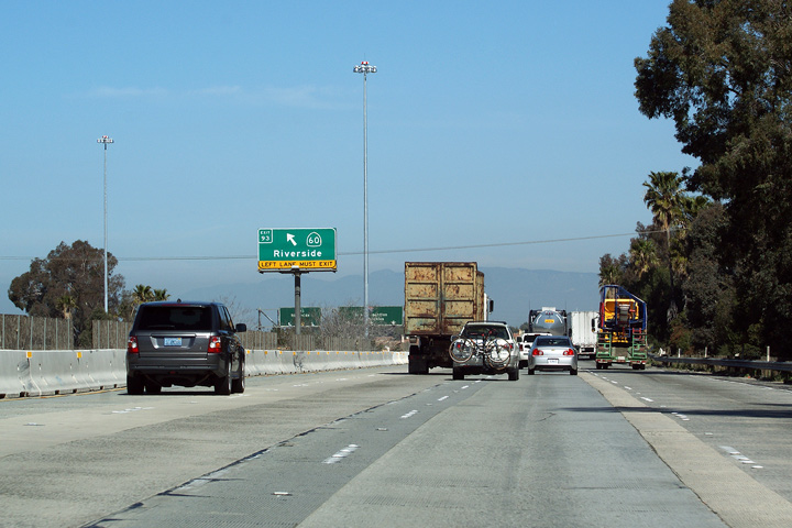
Riverside County City of Beaumont |
Westerly shot as Highway 60 departs Interstate 10 bound for Riverside. As evidence by the old US-route 60 shield that is poking out from either side of the Highway 60 overlay, Highway 60 was once US-60. US-60 followed what is now the Moreno Valley Freeway towards Riverside, and eventually to the East Los Angeles Interchange, while US-70, and US-99 continued on what is today's Interstate 10 alignment. |
 |
||
|
Date: 3/30/2010 |
High-res | |||
|
Riverside County City of Beaumont |
Westbound advanced sign for Highway 60 in Beaumont. |
 |
||
|
Date: 3/30/2010 |
High-res | |||
|
Riverside County City of Beaumont |
Westbound diagram sign for the Highway 60 split. This diagram sign is button-copy. Button copy diagram signs were kept very simple as it was simply uneconomical to stock fancy a variety of fancy arrowboards to delineate different interchange designs. |
 |
||
|
Date: 3/30/2010 |
||||
|
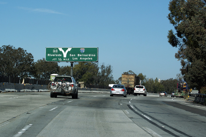
Riverside County City of Beaumont |
Pass-through signage in advance of the Highway 60 interchange. The left-most lane defaults from Interstate 10 to Highway 60-West at this interchange. Beyond Highway 60 at Beaumont, Interstate 10 is a six lane freeway westerly into Redlands. |
 |
||
|
Date: 3/30/2010 |
||||
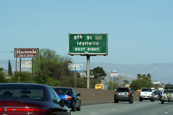
|
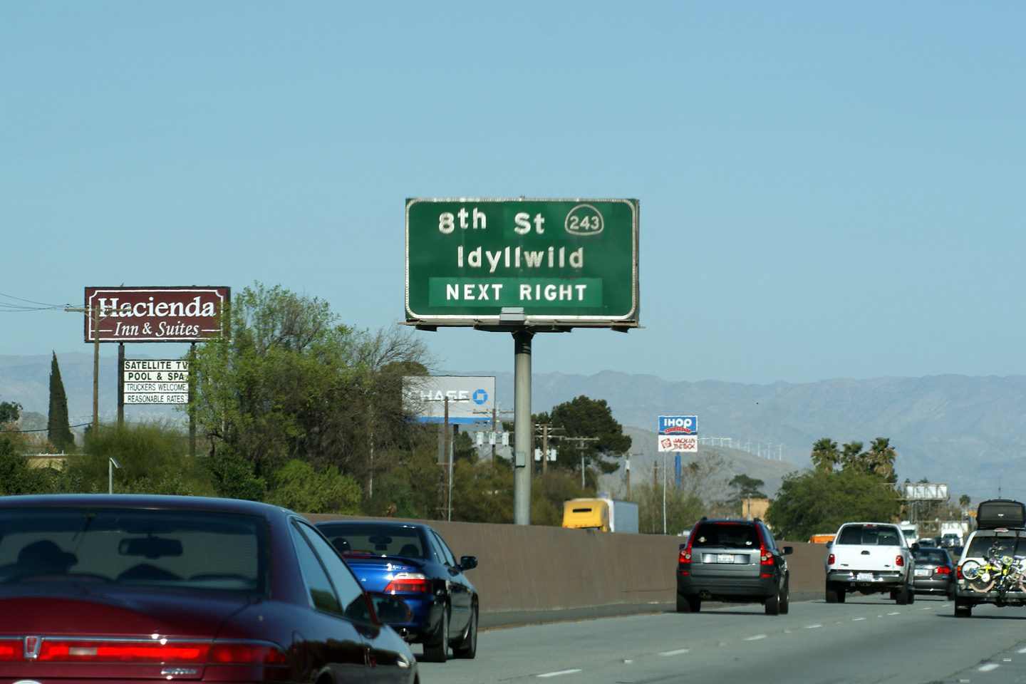
Riverside County City of Banning |
Eastbound advanced signage for Highway 243. Highway 243 is a mountain highway that leads into the San Jacinto Mountains almost immediately south of Interstate 10. |
 |
||
|
Date: 3/28/2010 |
High-res | |||
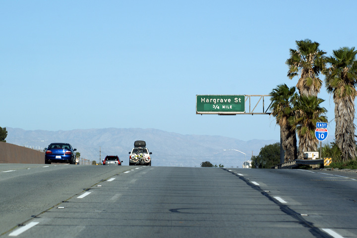
|
Riverside County City of Banning |
Advanced signage for Hargrave Street situated just beyond a vertical crest curve in Interstate 10. The San Gorgonio Mountains are visible in the distance. |
 |
||
|
Date: 3/28/2010 |
||||
|
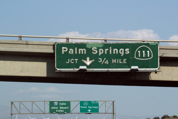
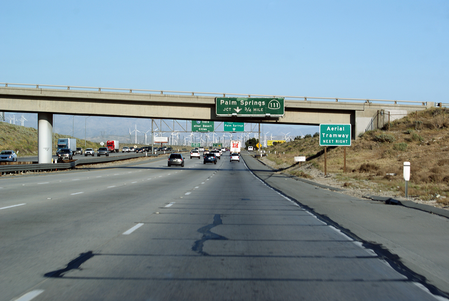
Riverside County |
Advanced signage for Highway 111 as Interstate 10 begins its ascent up the San Gorgonio Pass. |
 |
||
|
Date: 3/28/2010 |
High-res: (1440x960) (2400x1600) |
|||
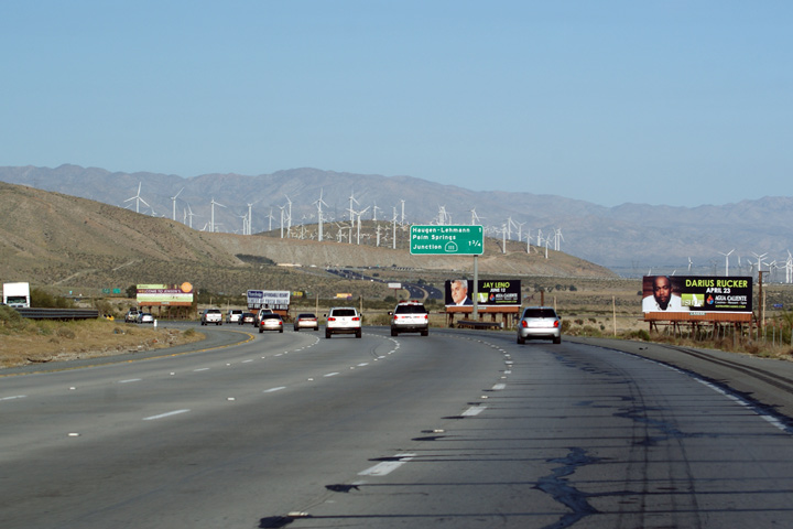
|
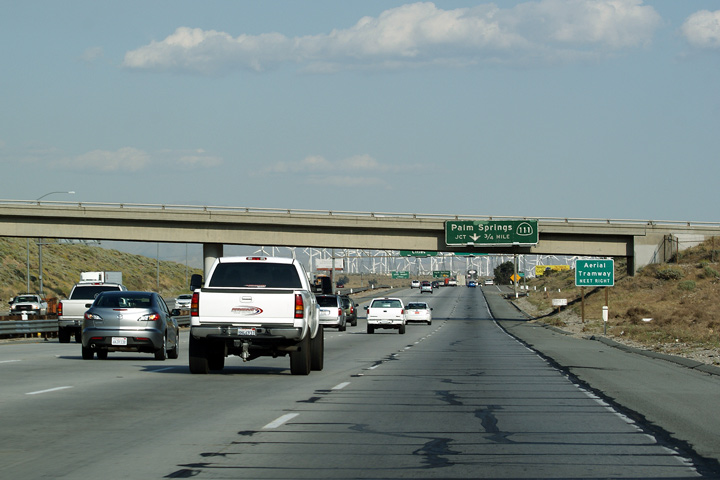
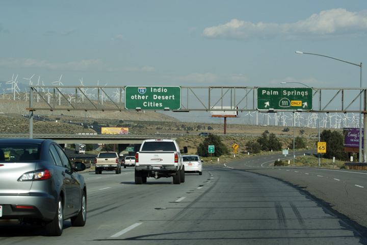
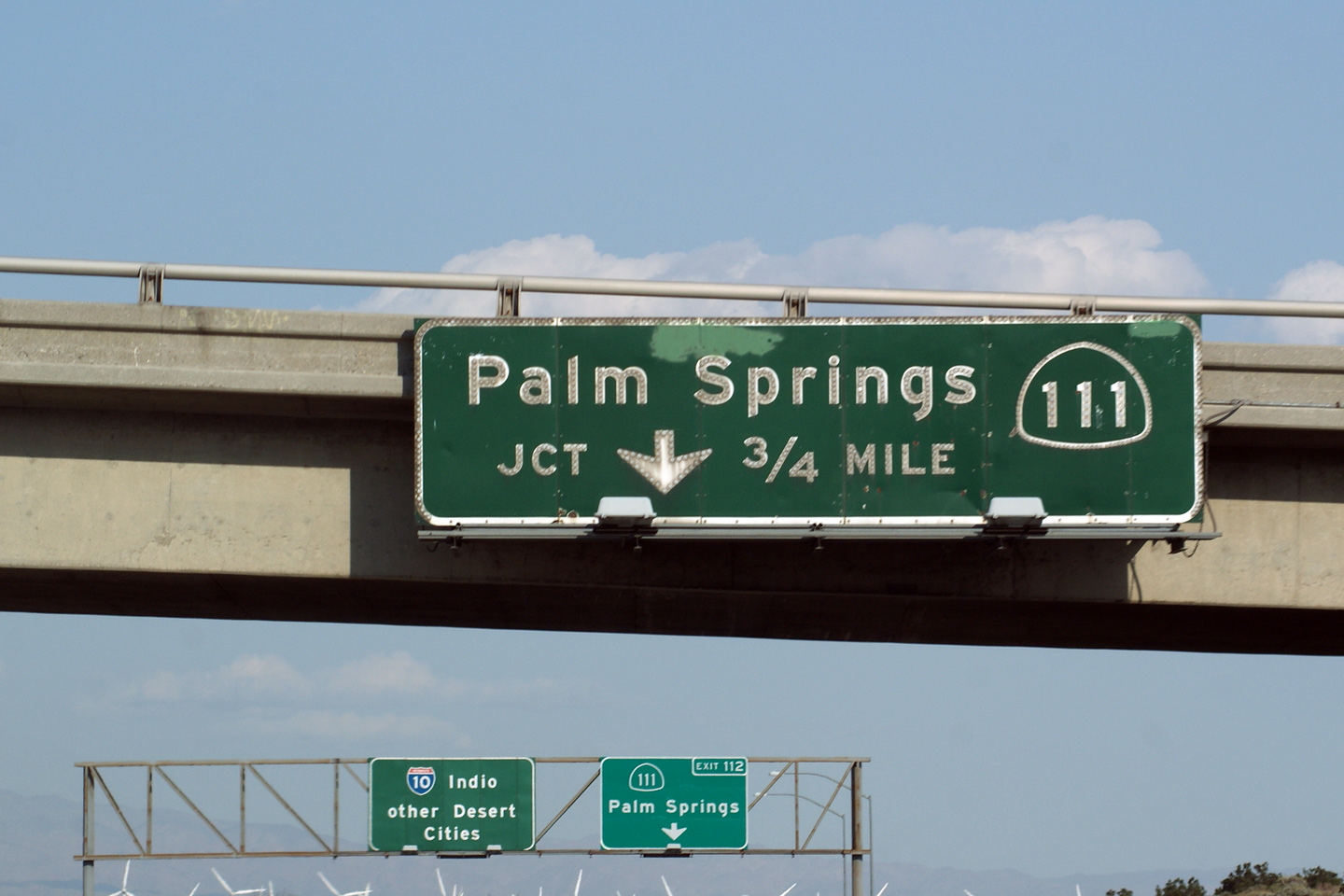
Riverside County |
An advanced sign for Highway 111 affixed to the Haugen Leman Way overpass. I have included a shot that shows the general lay of the land approaching the Highway 111 interchange as well as a close up of the button copy sign to highlight the detail that went into making every button copy sign that stands along any highway in the United States. |
 |
||
 |
||||
|
Date: 4/01/2010 |
High-res | |||
|
Riverside County |
Button copy advanced signage for the ramp to Highway 111. |
 |
||
|
Date: 3/28/2010 |
High-res | |||
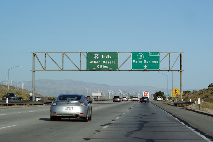
|
Riverside County |
The ramp to Highway 111. Highway 111 runs into Palm Springs, and various desert communities before it too ends up in Indio. While Highway 111 runs generally parallel to the 10 Freeway, it is a considerably longer route than the freeway. |
 |
||
|
Date: 4/01/2010 |
High-res | |||
|
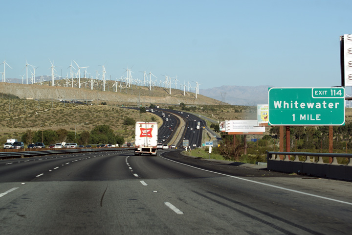
Riverside County City of Palm Springs |
Advanced signage for Whitewater Road Whitewater Road intersects Interstate 10 at the top of San Gorgonio Pass. |
 |
||
|
Date: 3/28/2010 |
||||
|
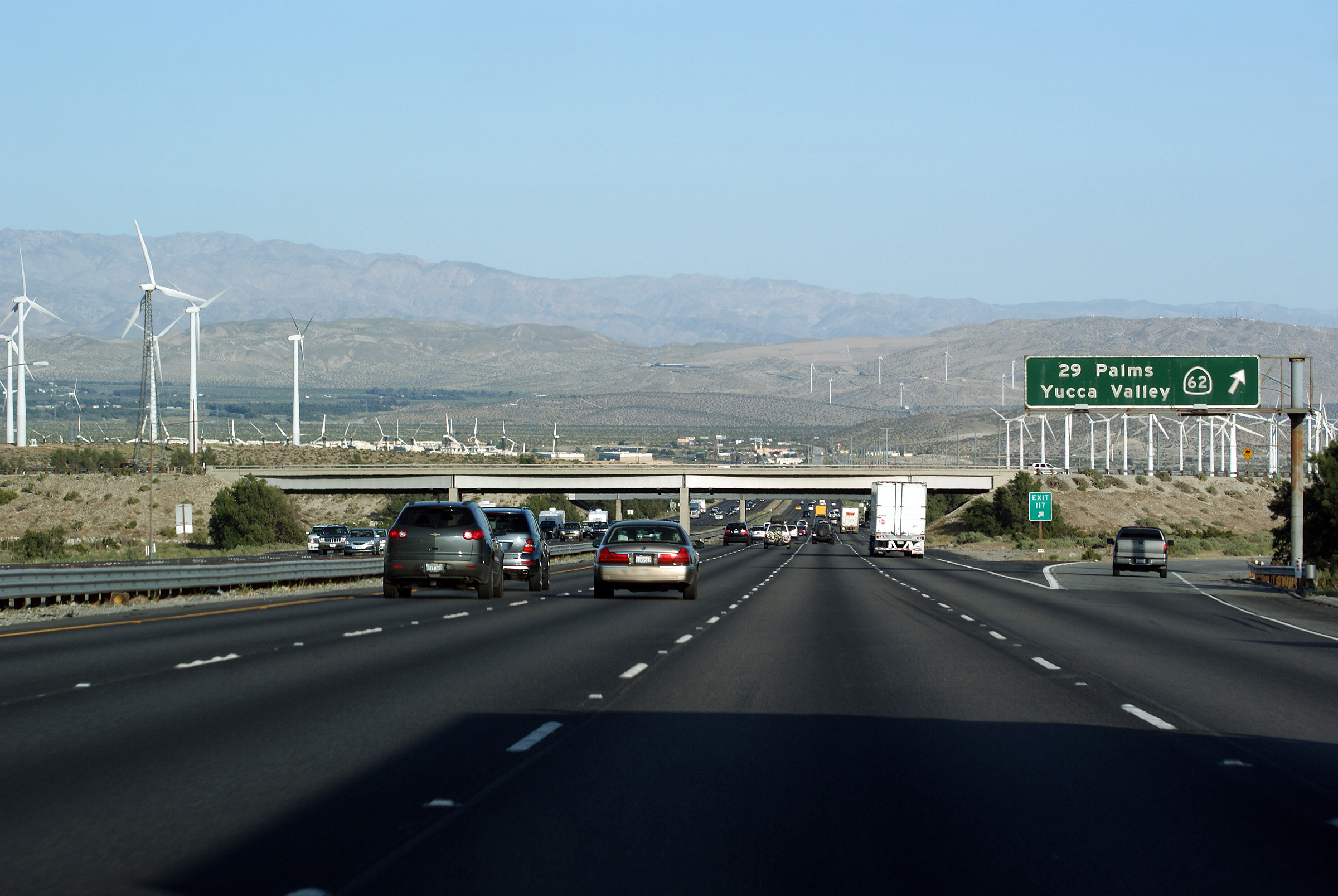
Riverside County |
Advanced sign for Highway 62 found on the east side of San Gorgonio Pass. |
 |
||
|
Date: 3/28/2010 |
||||
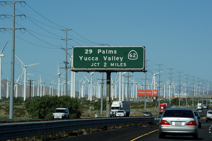
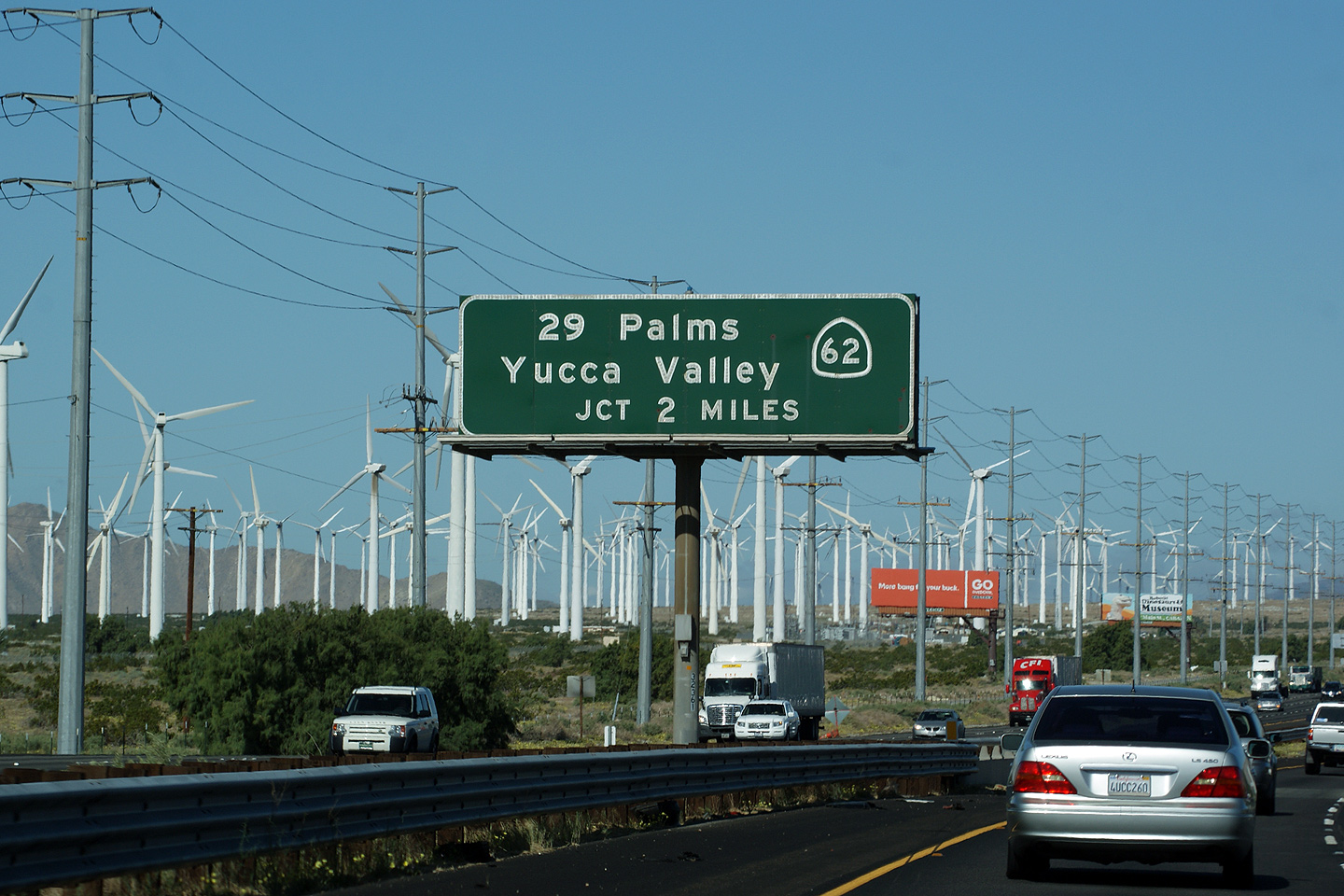
|
Riverside County |
Partial overhead gantry for the eastbound ramp to Highway 62. Highway 62 is an important four-lane highway that serves the Morongo and Yucca Valley's. |
 |
||
|
Date: 3/28/2010 |
High-res: (1440x960) (2400x1600) |
|||
|
Riverside County |
Westbound advanced signage for the Highway 62 interchange. |
 |
||
|
Date: 3/30/2010 |
High-res | |||
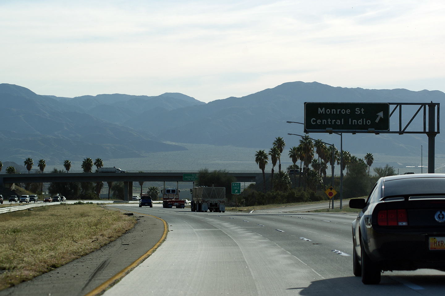
|
Riverside County City of Indio |
Partial overhead gantry for Monroe Street which leads travelers from the interstate into Central Indo. Indio is the oldest of the desert cities in the Coachella Valley. Indio is home to the world renowned Coachella Valley Music and Arts Festival, one of the largest music festivals held in North America. The festival is held every April. |
 |
||
|
Date: 3/29/2010 |
||||
|
Riverside County City of Indio |
First advanced signage for the Highway 86S Expressway interchange affixed to the Jackson Street overpass. It is common for CalTrans to place a reassurance marker alongside an advanced sign for a major junction. I don't understand this practice. |
 |
||
|
Date: 3/29/2010 |
||||
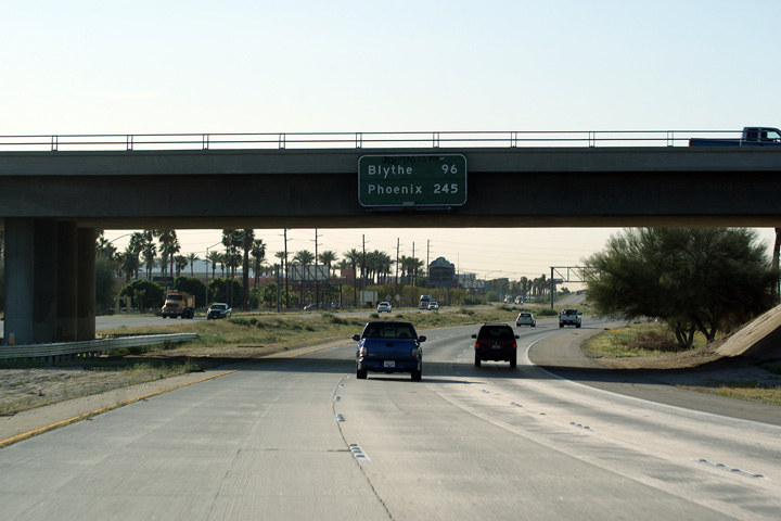
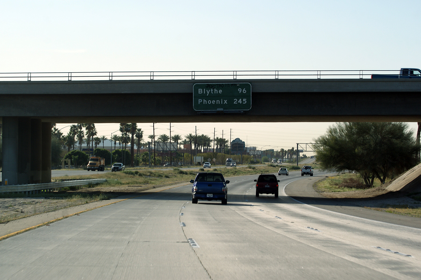
|
Riverside County City of Indio |
Eastbound distance signage for Blythe and Phoenix. This is the first easterly reassurance sign for Phoenix along Highway 10. |
 |
||
|
Date: 3/29/2010 |
||||
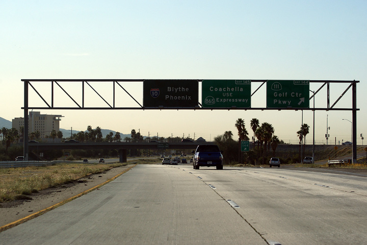
|
Riverside County City of Indio |
Signage for the ramp to Golf Centre Road. As far as I can tell, Golf Centre Road is not actually part of Highway 111, rather is a connector route that links the interstate with the highway. Highway 111 has been chopped up over the past few years as CalTrans relinquishes control of the urban sections of highway through the various desert cities. (Sound familiar?). |
 |
||
|
Date: 3/29/2010 |
High-res | |||
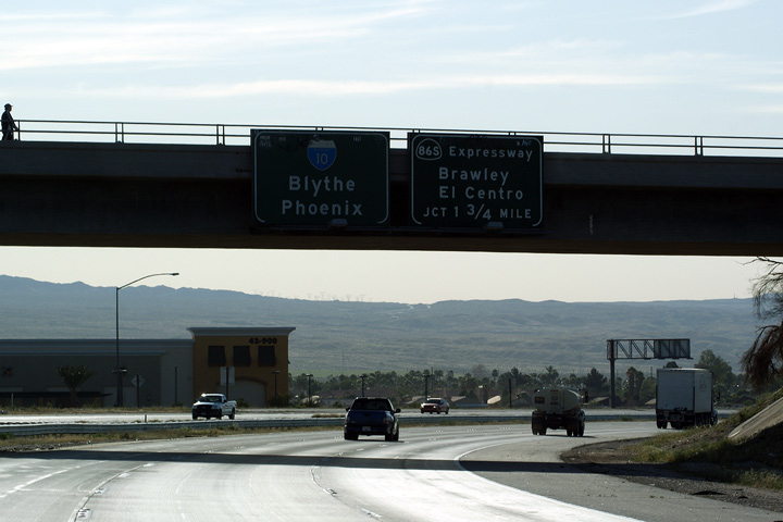
|
Riverside County City of Indio |
Eastbound signage for the ramp to Highway 86S Expressway. Highway 86S links Interstate 10 to Highway 86 near Salton City. Historically Highway 86 followed a more circuitous alignment beginning in Downtown Coachella, and running through Sandy Korner and 100 Palms before becoming a four lane highway to the west of the Salton Sea. |
 |
||
|
Date: 3/29/2010 |
High-res | |||
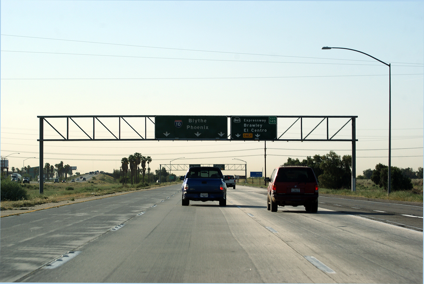
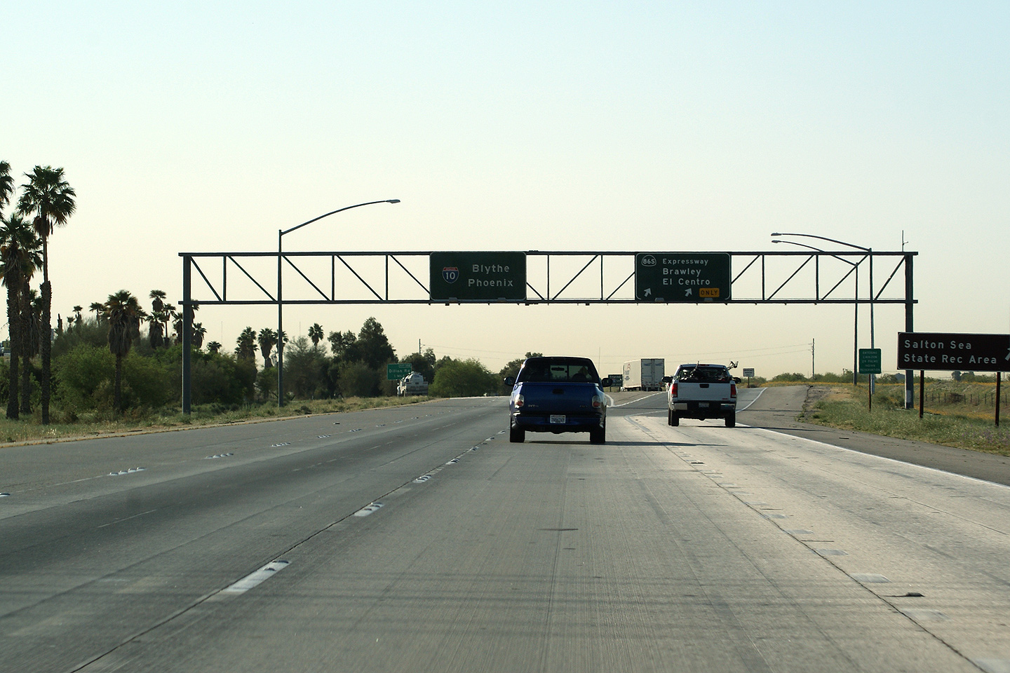
|
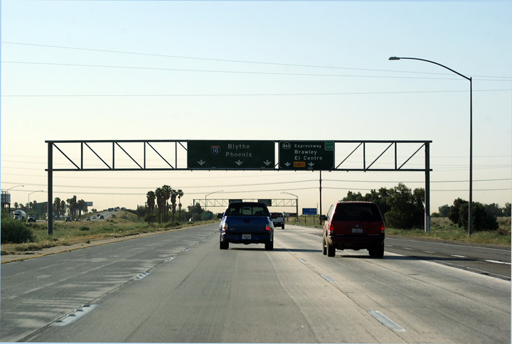
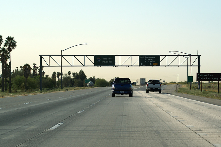
Riverside County City of Indio |
Eastbound signage at the exit to Highway 86S Expressway. Highway 86S Expressway leads south-easterly along the west bank of the Salton Sea towards Brawley, El Centro and the Mexican Border. Interstate 10 leads easterly towards Blythe and Arizona. Just beyond the ramp to Highway 86S Expressway, Interstate 10's right most lane ends -- I-10 is a four lane freeway easterly into the Phoenix Metro area of Arizona from this interchange on. |
 |
||
|
Date: 3/29/2010 |
||||
<- I-8
CA Highways
I-15 ->
AsphaltPlanet.ca
© 2010-18 AsphaltPlanet.ca.
Scott@asphaltplanet.ca
Page Created: June 17, 2010.
Last Updated: October 7, 2018.