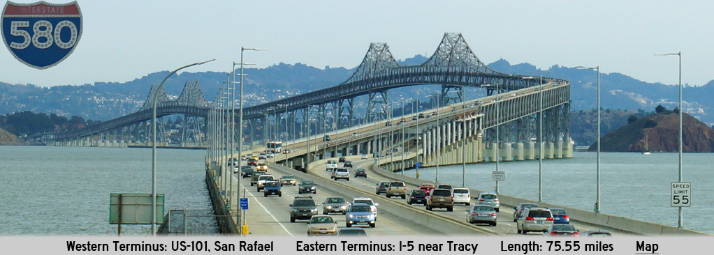
AsphaltPlanet.ca > California > Interstate 580
Pictures on this
page are arranged in order from west to east. I-580 East photos are
left-aligned in the last column, while I-580 West photos are right-aligned.
Center-line pictures are centered within the last column.
|
Location |
Description |
Photo |
||
|
East- |
West- |
|||
|
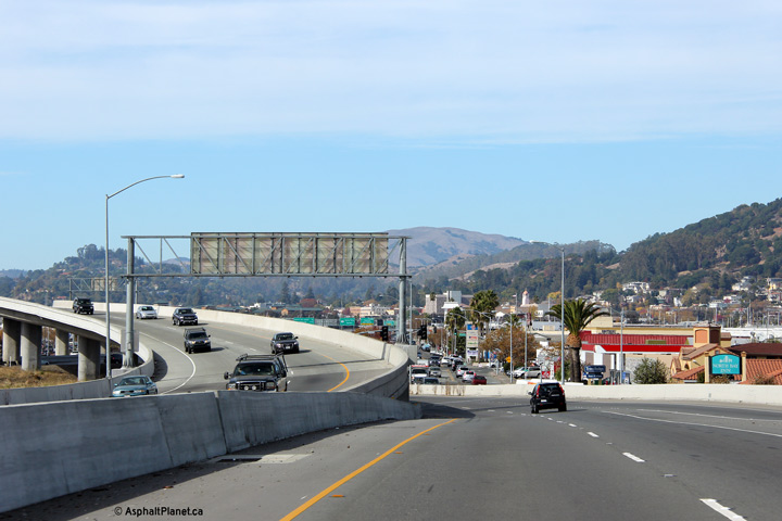
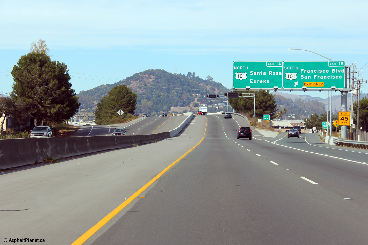
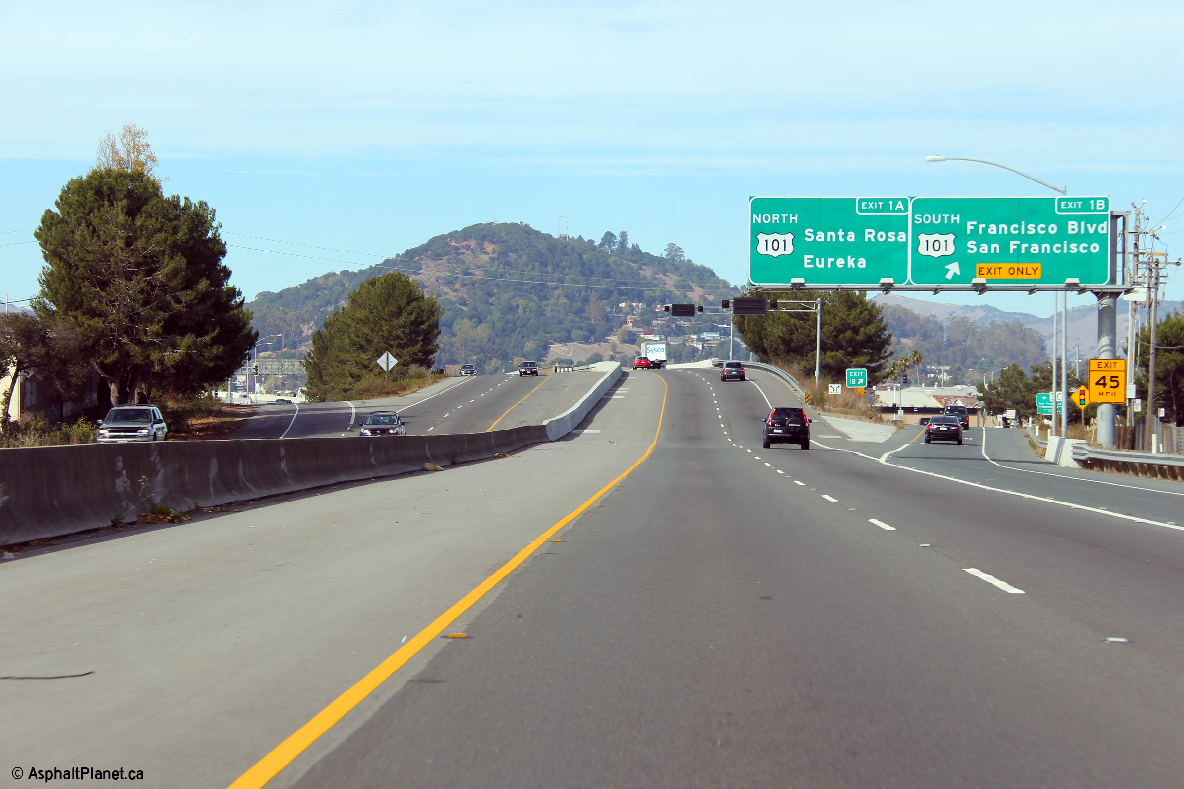
Marin County |
View looking southbound as I-580 departs from US-101, bound for the Richmond-San Rafael Bridge and Oakland. |
 |
||
|
Date: 11/03/2013 |
High-res: (1440x960) (2400x1600) |
|||
| US-101 is the Redwoods Highway, and serves as the principle north-south access through Marin County, north of San Francisco. Click here for US-101 Images. | ||||
|
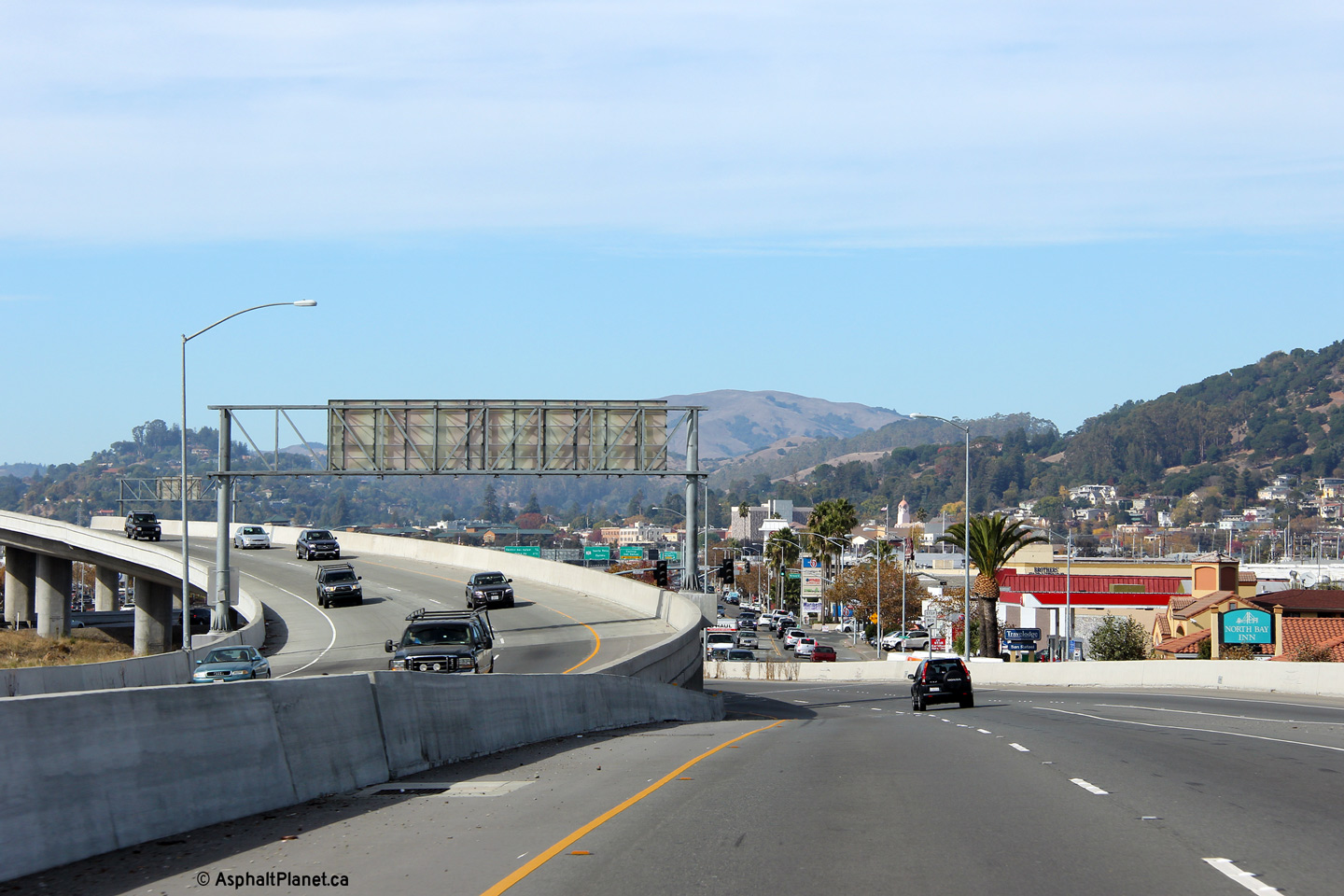
Marin County |
Northerly view approaching the US-101 interchange. The northbound ramp to US-101 is metered with traffic signals during peak periods. |
 |
||
|
Date: 11/03/2013 |
High-res: (1440x960) (2400x1600) | |||
|
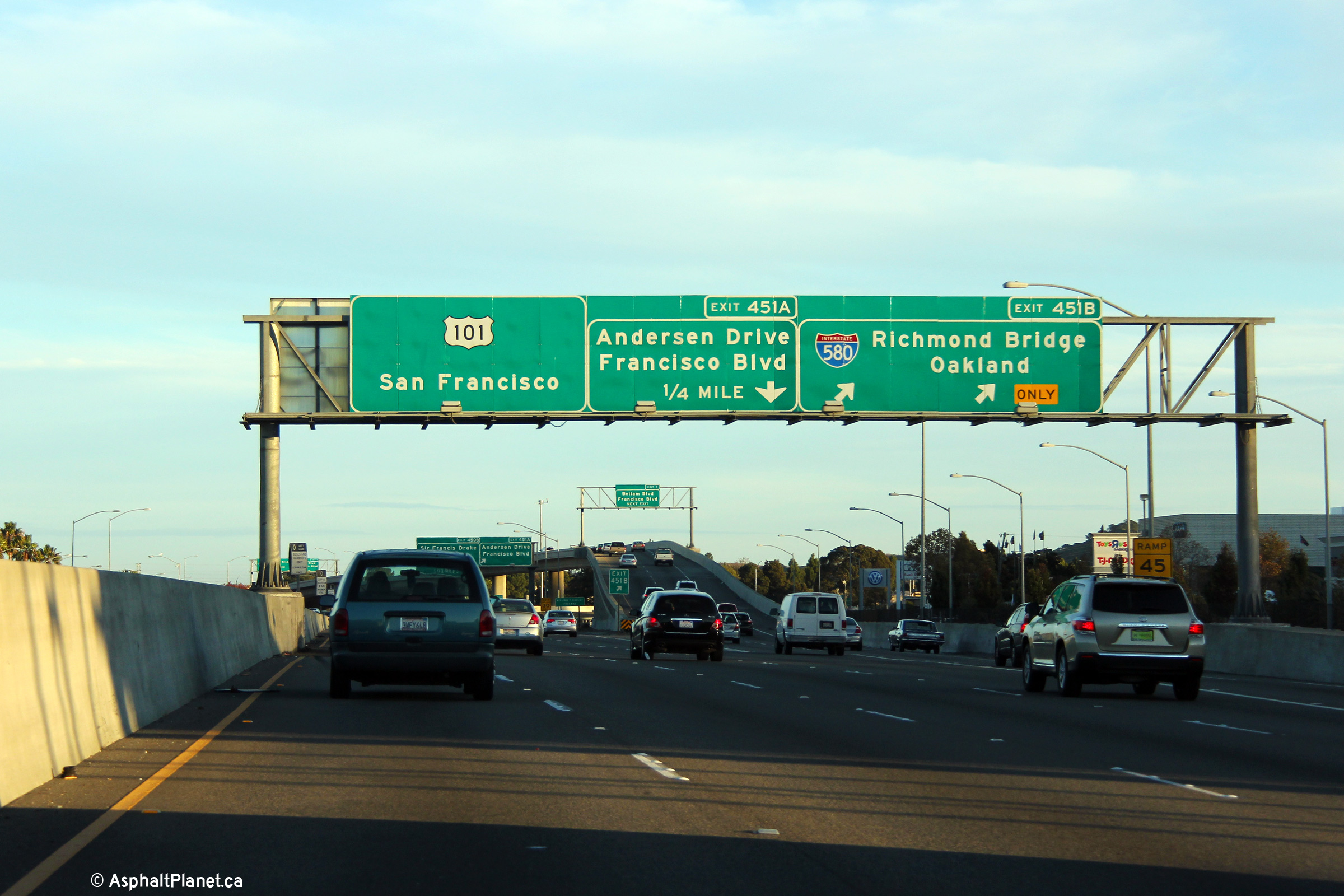
Marin County |
Northbound exit to Francisco Boulevard, which is the frontage road for the US-101 freeway. Traffic bound for US-101 South is directed to use this interchange as there is no direct freeway to freeway connection between I-580 West and US-101 South. |
 |
||
|
Date: 11/03/2013 |
High-res: (1440x960) (2400x1600) | |||
|
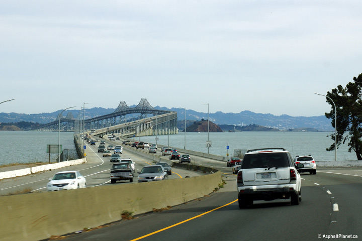
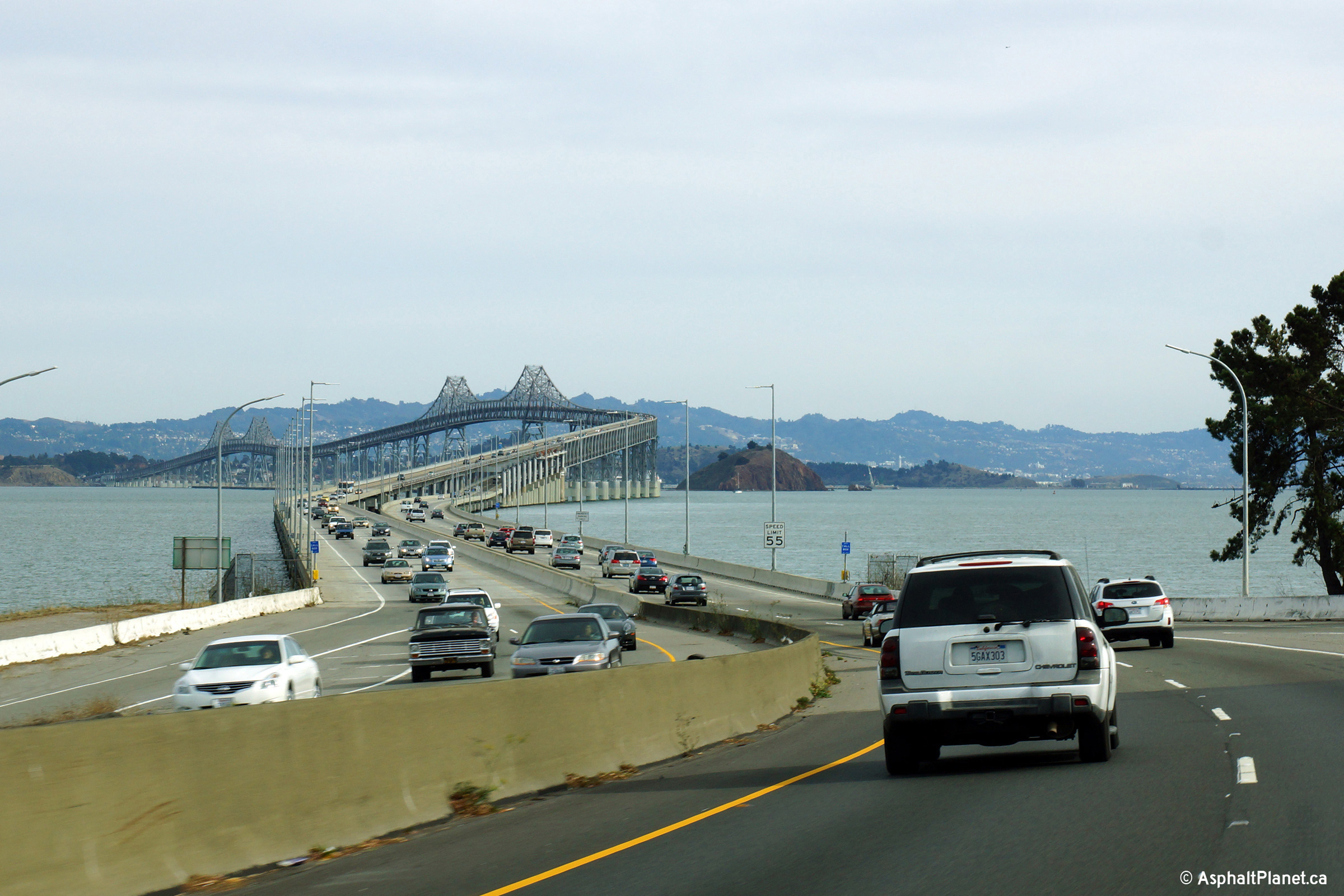
Marin County |
Eastbound view from the San Rafael touchdown of the Richmond-San Rafael bridge that carries I-580 across San Francisco Bay. |
 |
||
|
Date: 11/03/2013 |
High-res: (1440x960) (2400x1600) |
|||
|
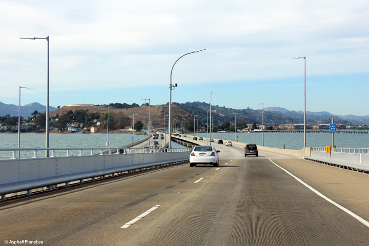
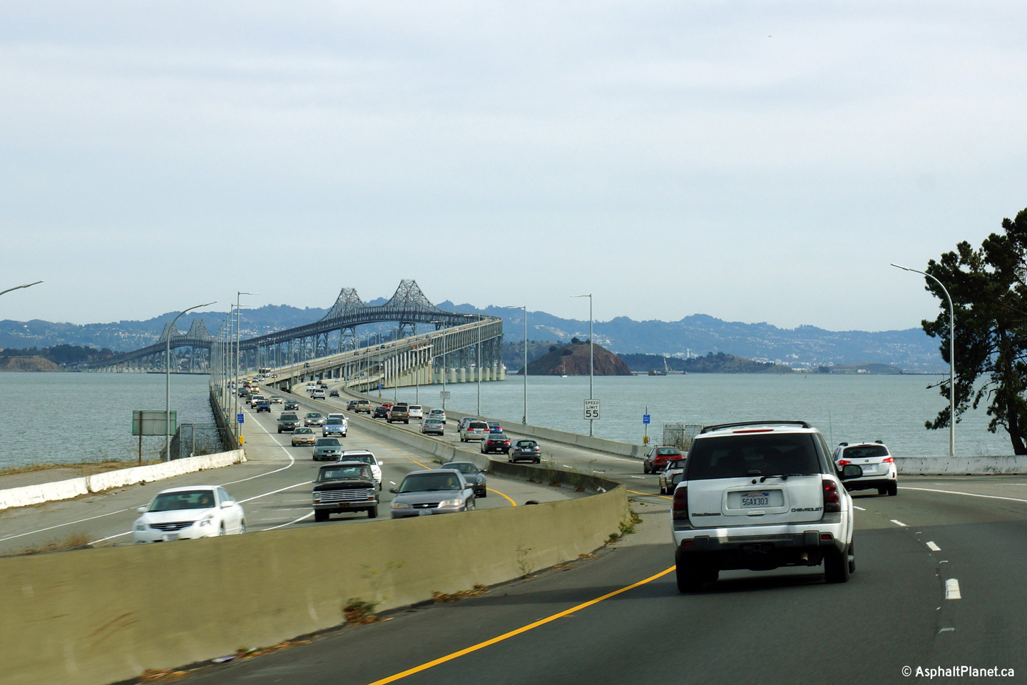
Marin County |
Westerly view approaching San Rafael along the Richmond-San Rafael bridge. |
 |
||
|
Date: 11/03/2013 |
High-res: (1440x960) (2400x1600) | |||
|
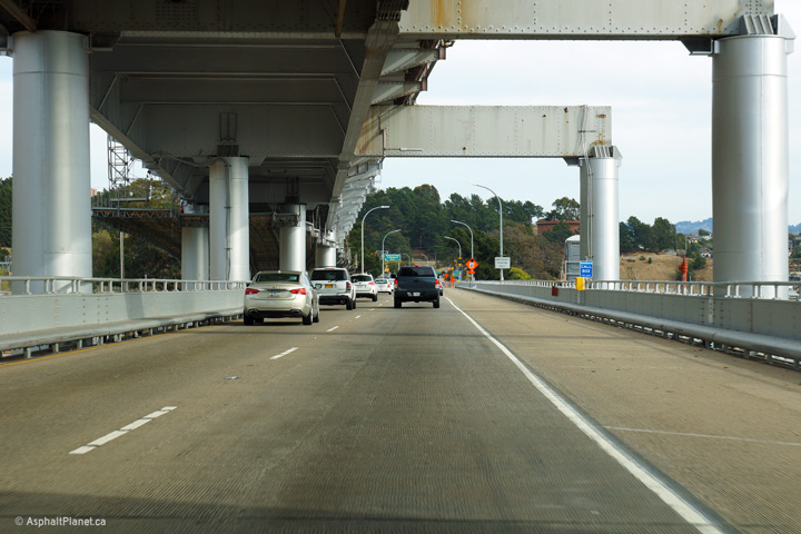
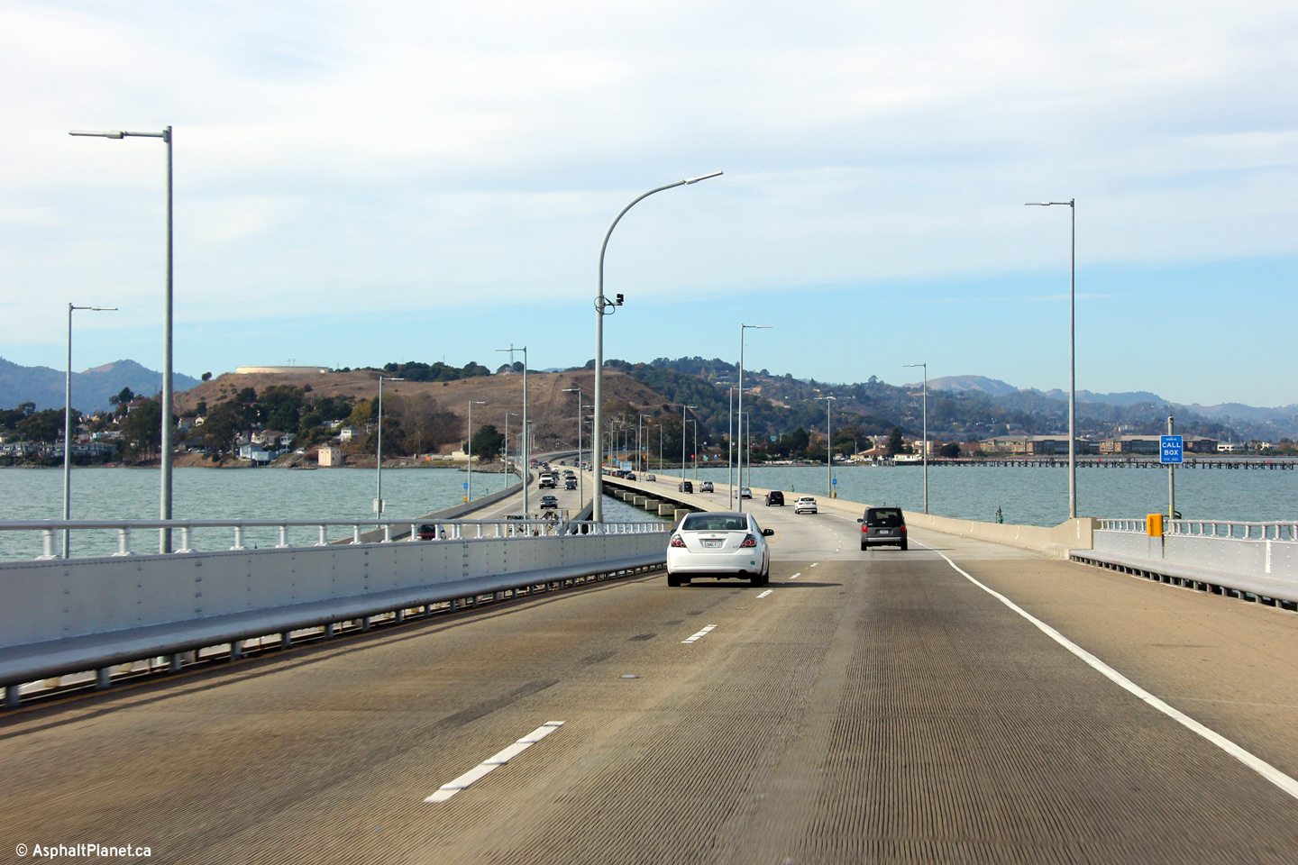
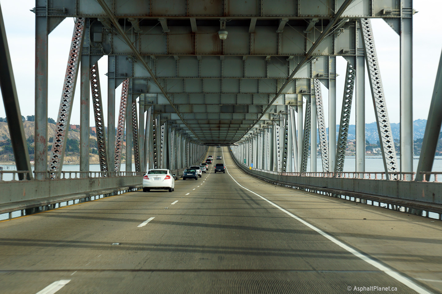
Contra Costa County Richmond |
Easterly view along the lower deck of the Richmond-San Rafael bridge. |
 |
||
|
Date: 11/03/2013 |
High-res: (1440x960) (2400x1600) |
|||
|
Contra Costa County Richmond |
Easterly view approaching the eastern touchdown of the Richmond-San Rafael bridge in Richmond. |
 |
||
|
Date: 11/03/2013 |
High-res: (1440x960) (2400x1600) |
|||
|
Contra Costa County Richmond |
Westerly view through the toll plaza for the Richmond-San Rafael bridge. At the time that this photo was taken, tolls were collected only in the westbound direction at the Richmond-San Rafael crossing, and the toll was $5 for autos. |
 |
||
|
Date: 11/03/2013 |
High-res: (1440x960) (2400x1600) | |||
|
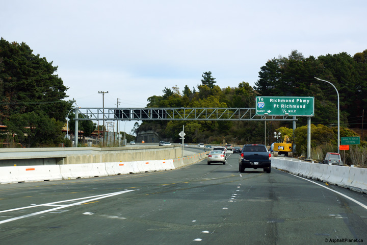
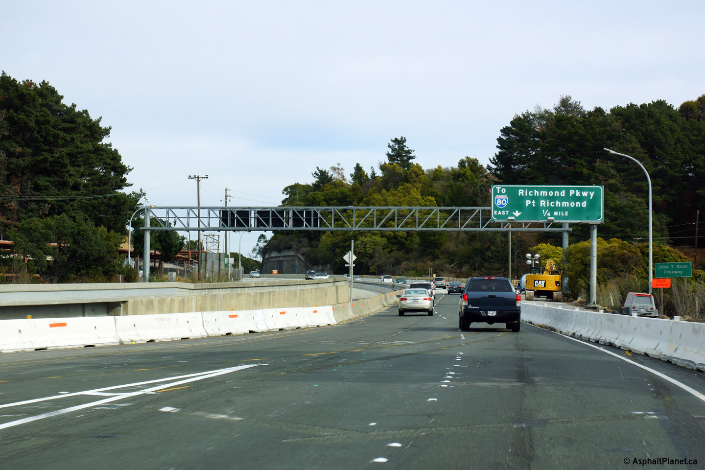
Contra Costa County Richmond |
Just east of the eastern touchdown of the Richmond-San Rafael bridge stands this advanced signage for the ramp to the Richmond Parkway. The Richmond Parkway is primarily an at-grade arterial highway that by-passes downtown Richmond linking Interstates 80 and 580. |
 |
||
|
Date: 11/03/2013 |
High-res: (1440x960) (2400x1600) |
|||
|
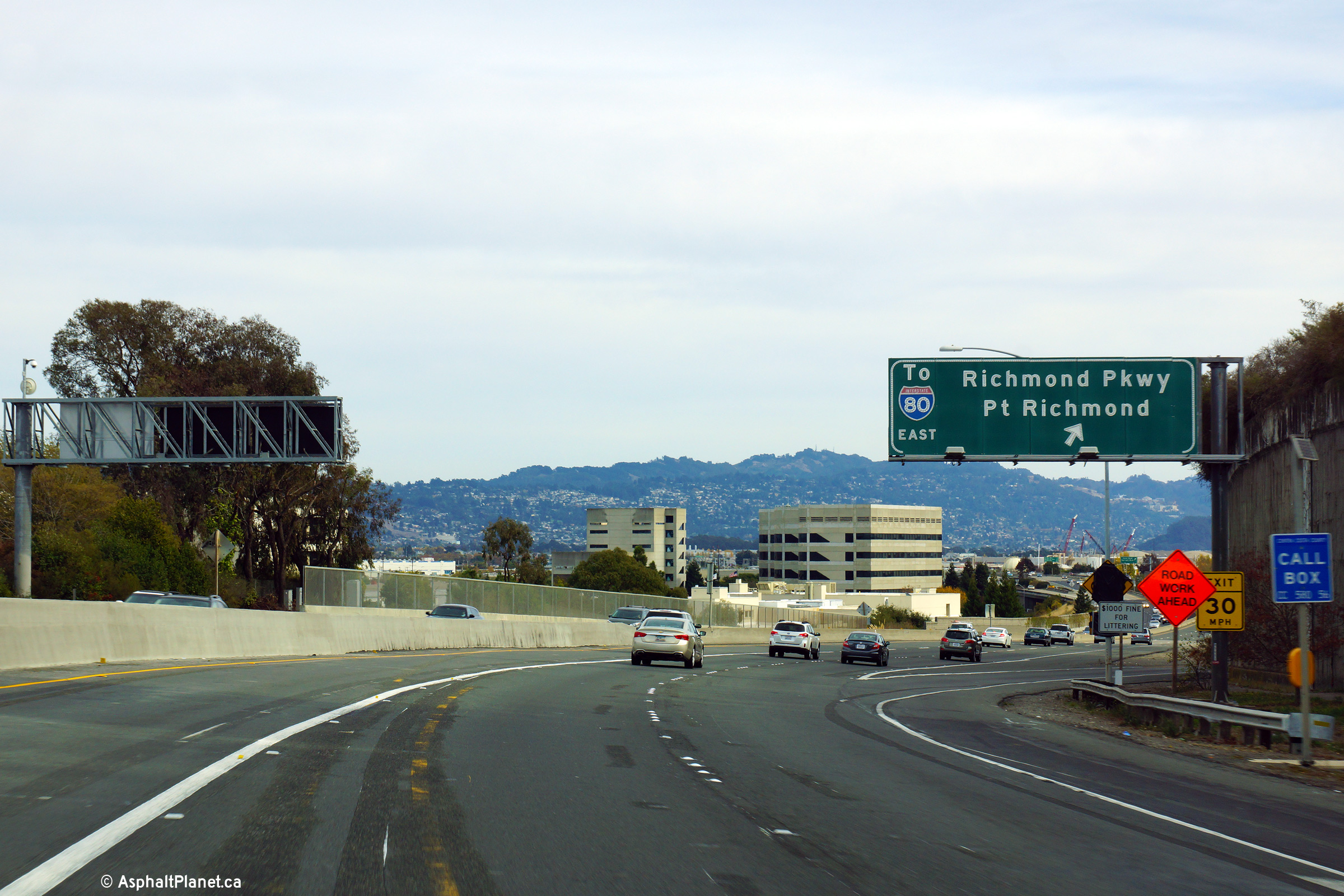
Contra Costa County Richmond |
Eastbound signage at the off-ramp to the Richmond Parkway |
 |
||
|
Date: 11/03/2013 |
High-res: (1440x960) (2400x1600) |
|||
|
Contra Costa County Richmond |
Interchange sequence signage just beyond the off-ramp to Richmond Parkway. |
 |
||
|
Date: 11/03/2013 |
High-res: (1440x960) (2400x1600) |
|||
|
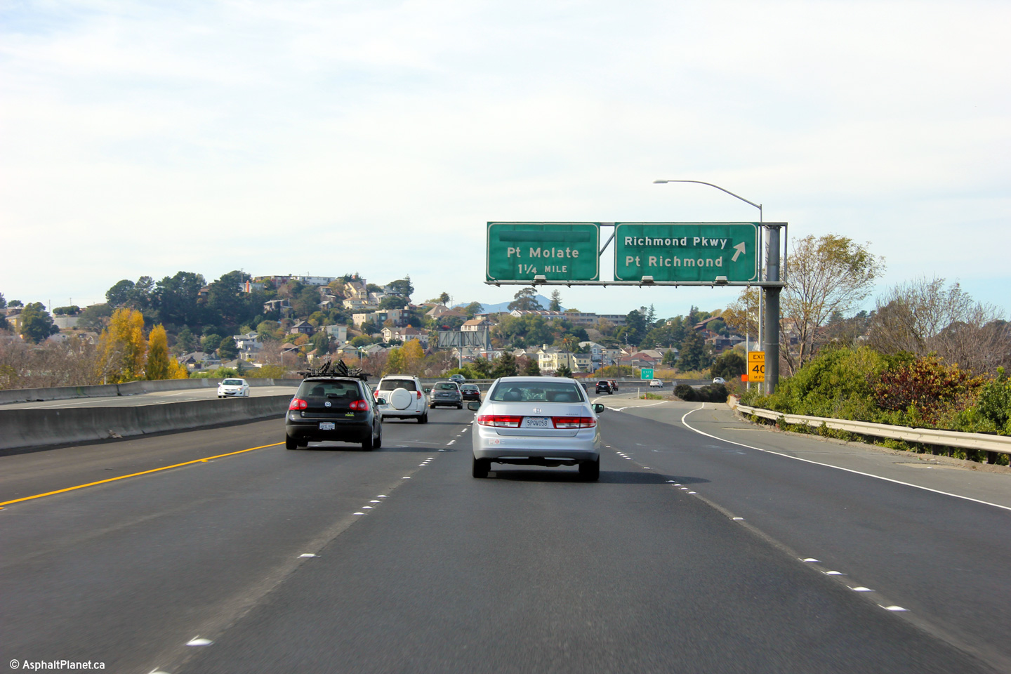
Contra Costa County Richmond |
Westerly view at the exit to the Richmond Parkway. |
 |
||
|
Date: 11/03/2013 |
High-res: (1440x960) (2400x1600) | |||
|
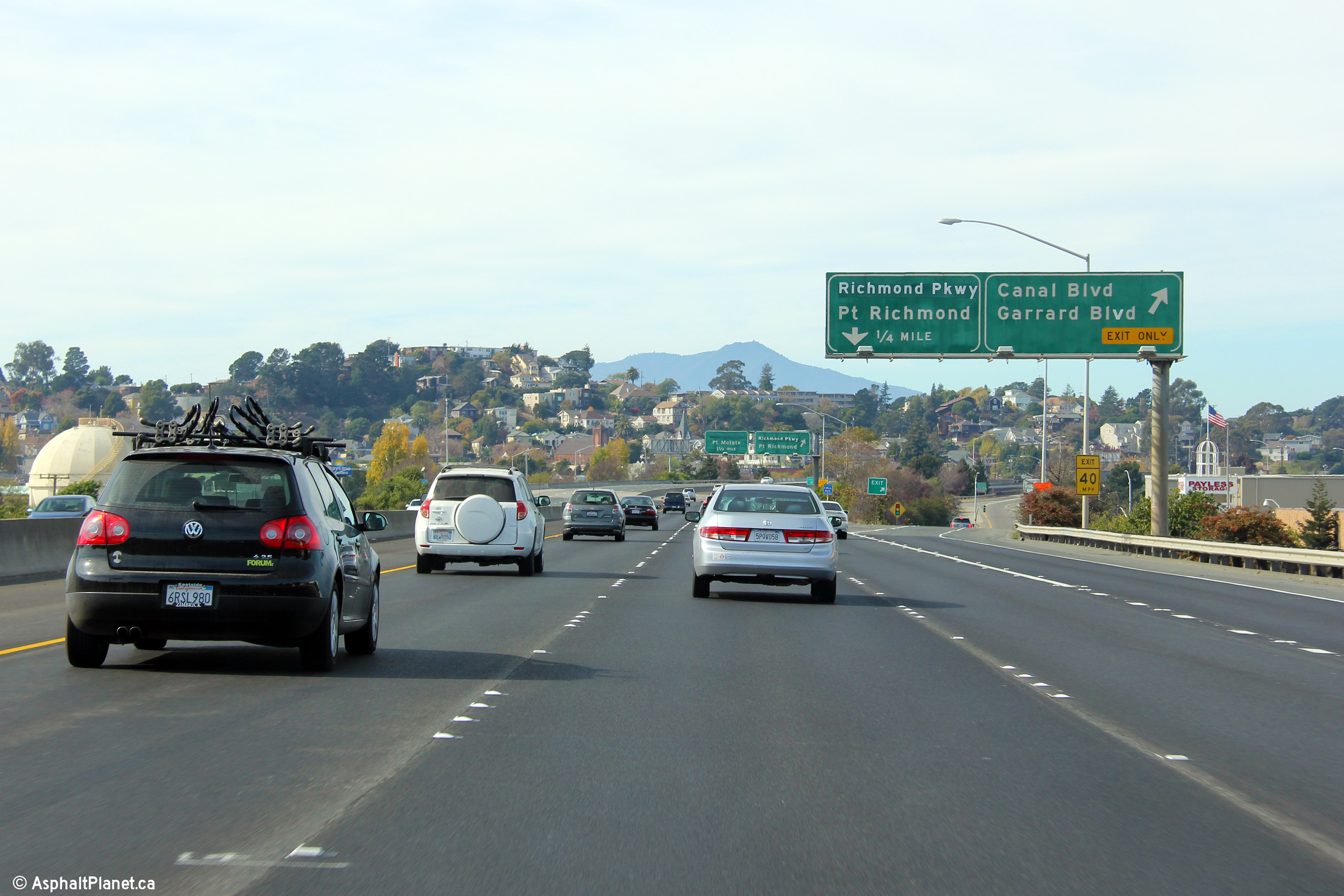
Contra Costa County Richmond |
Westbound off-ramp to Canal Boulevard. |
 |
||
|
Date: 11/03/2013 |
High-res: (1440x960) (2400x1600) | |||
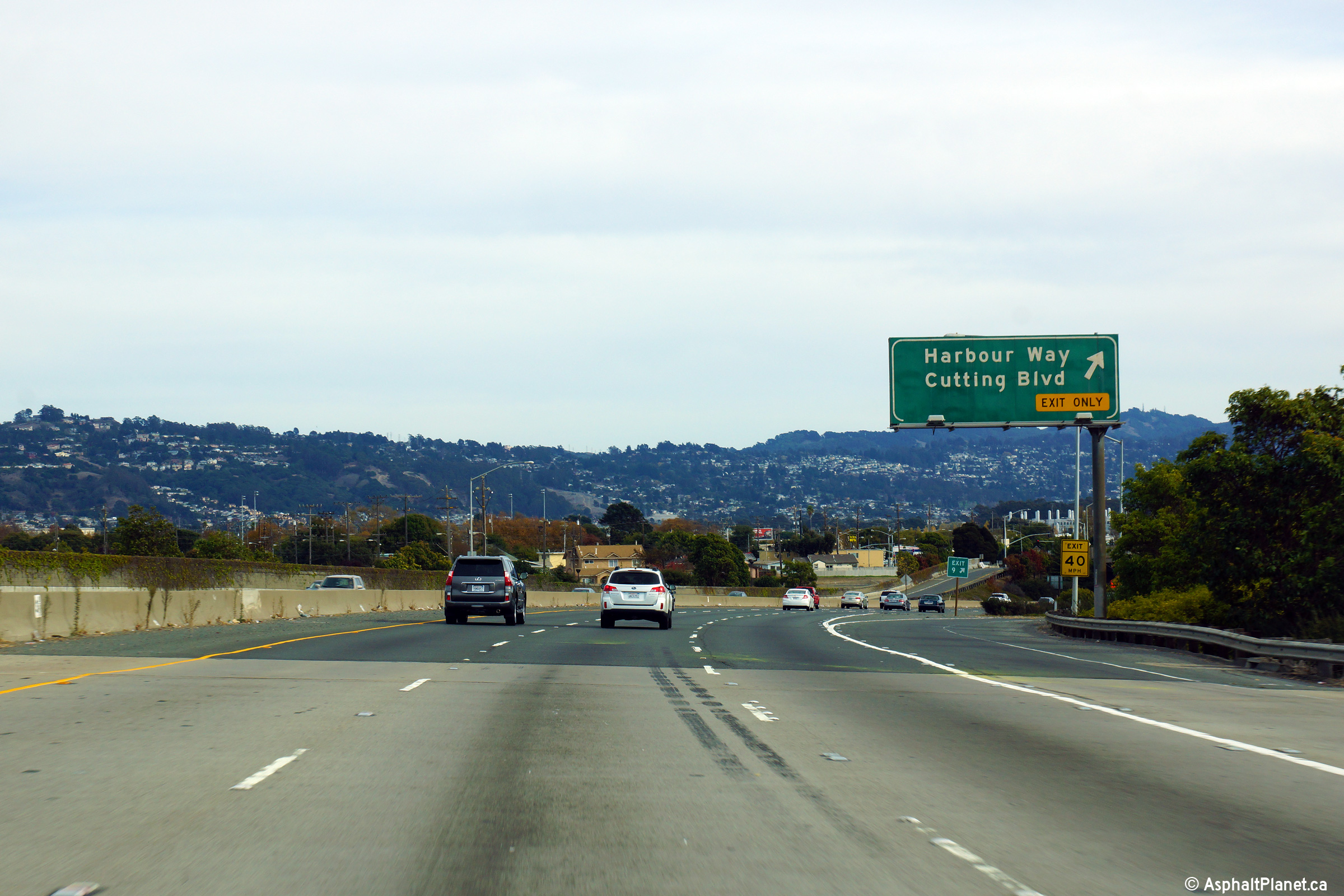
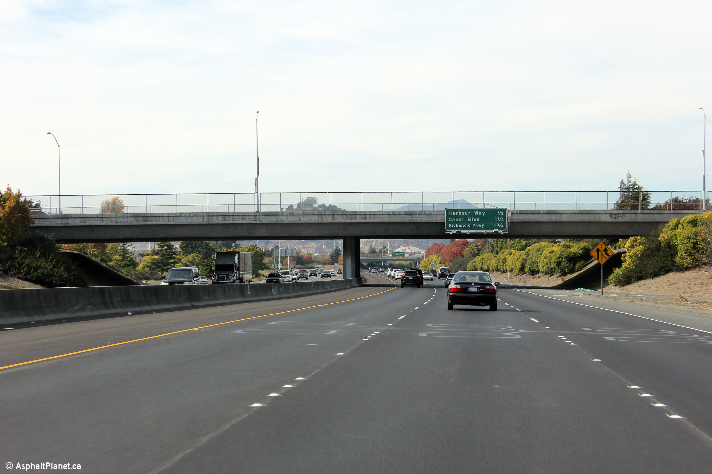
|
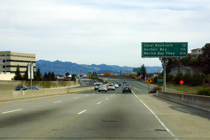
Contra Costa County Richmond |
Eastbound exit bound for Harbor Way and Cutting Boulevard. |
 |
||
|
Date: 11/03/2013 |
High-res: (1440x960) (2400x1600) |
|||
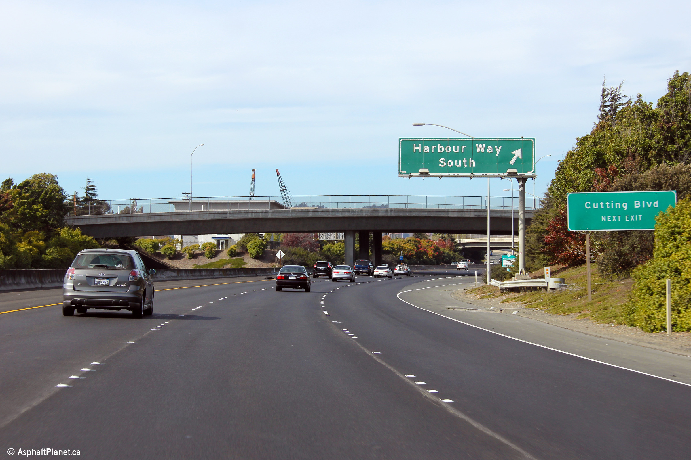
|
Contra Costa County Richmond |
Westbound signage at the ramp to Harbor Way South. Despite the face that this ramp actually deposits motorists onto Cutting Boulevard, it is not listed on the signage. |
 |
||
|
Date: 11/03/2013 |
High-res: (1440x960) (2400x1600) | |||
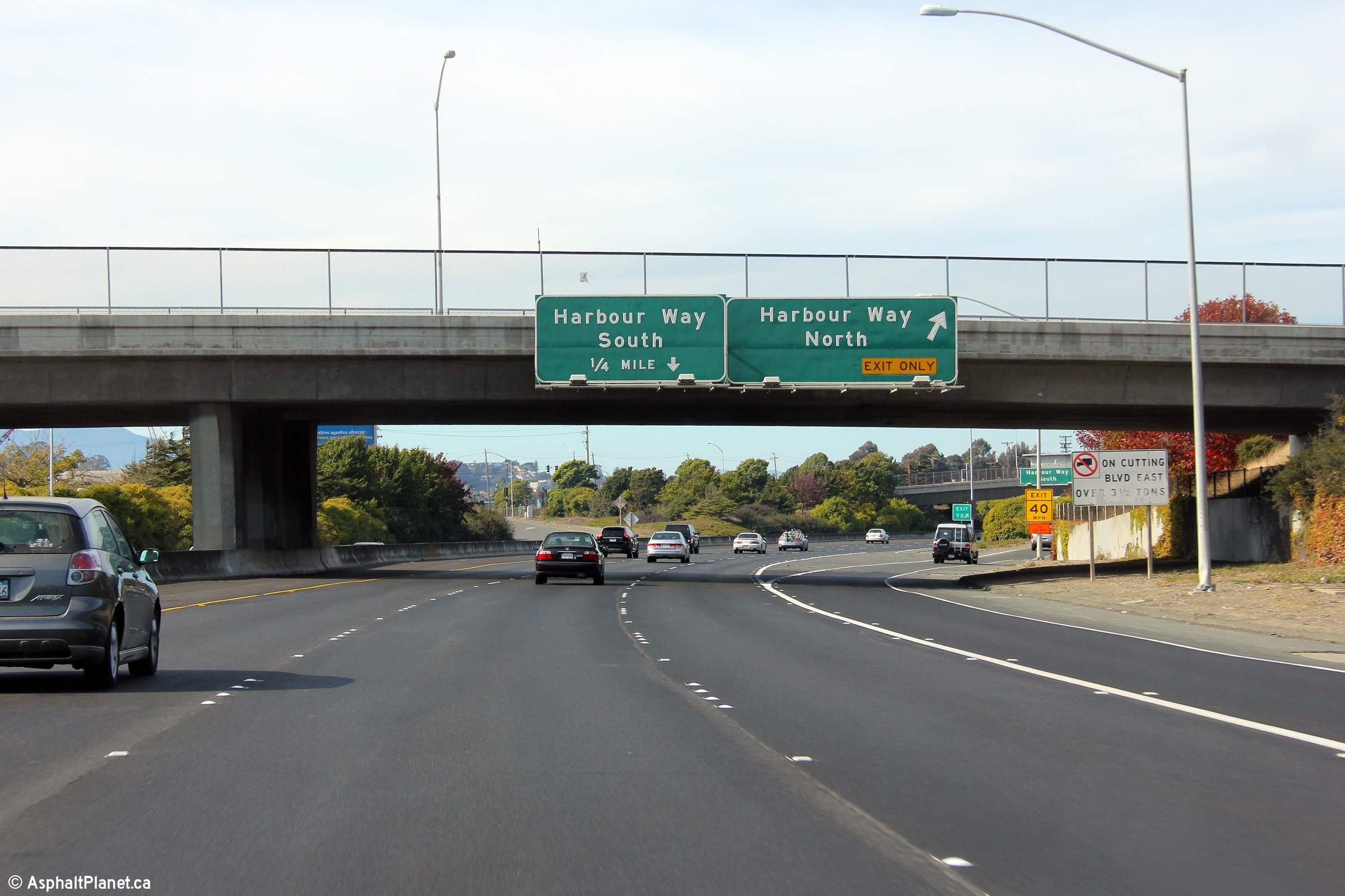
|
Contra Costa County Richmond |
The northbound signage for the ramp to Harbor Way North is affixed to the Marina Way overcrossing. |
 |
||
|
Date: 11/03/2013 |
High-res: (1440x960) (2400x1600) | |||
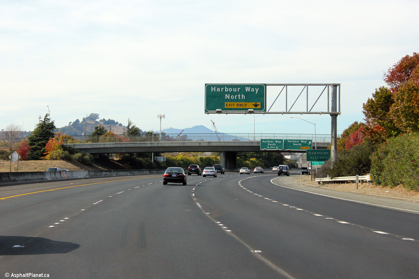
|
Contra Costa County Richmond |
Advanced signage for the ramp to Harbour Way North. |
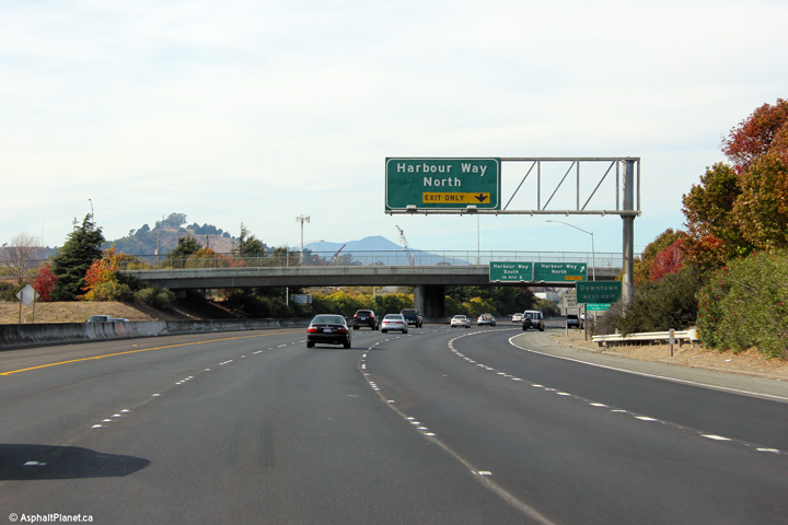 |
||
|
Date: 11/03/2013 |
High-res: (1440x960) (2400x1600) | |||
|
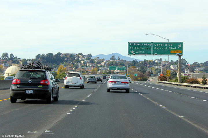
Contra Costa County Richmond |
Eastbound signage for Exit 10A to the Marina Bay Parkway. |
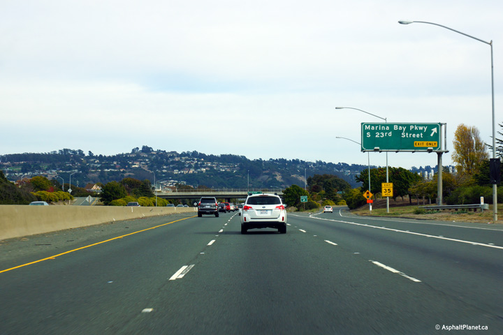 |
||
|
Date: 11/03/2013 |
High-res: (1440x960) (2400x1600) |
|||
|
Contra Costa County Richmond |
Westbound interchange sequence signage affixed to the Marina Bay Parkway overcrossing. |
 |
||
|
Date: 11/03/2013 |
High-res: (1440x960) (2400x1600) | |||
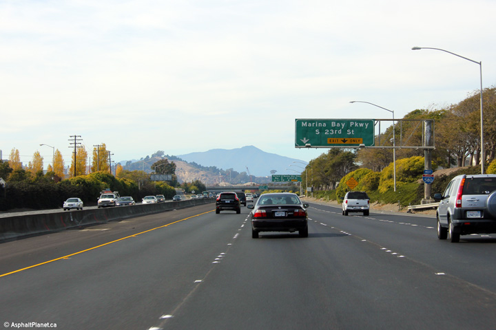
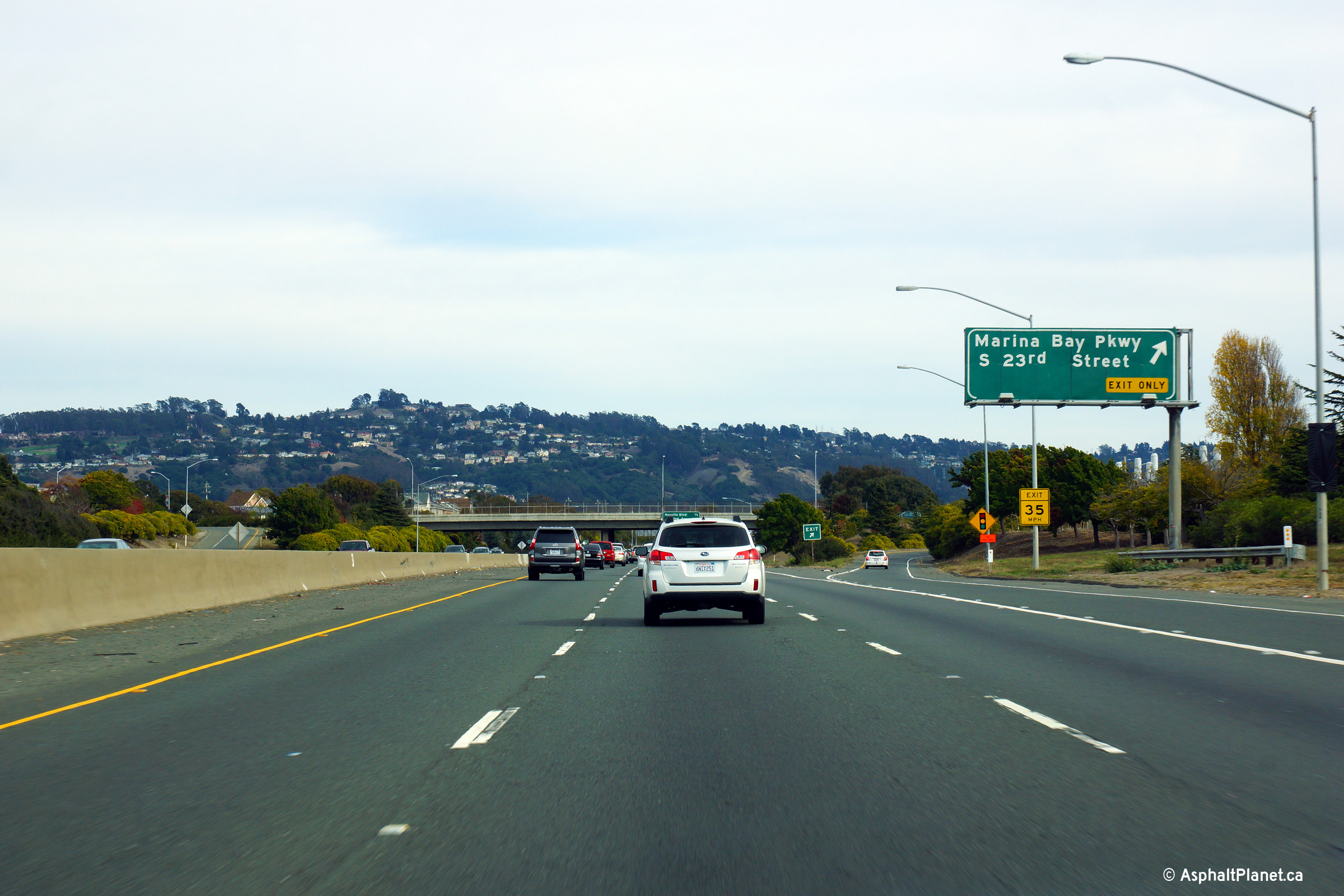
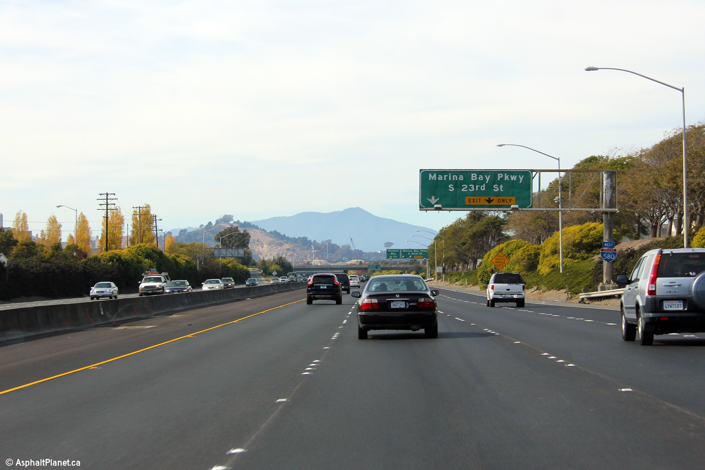
|
Contra Costa County Richmond |
Westbound signage for the ramp to the Marina Bay Parkway. |
 |
||
|
Date: 11/03/2013 |
High-res: (1440x960) (2400x1600) | |||
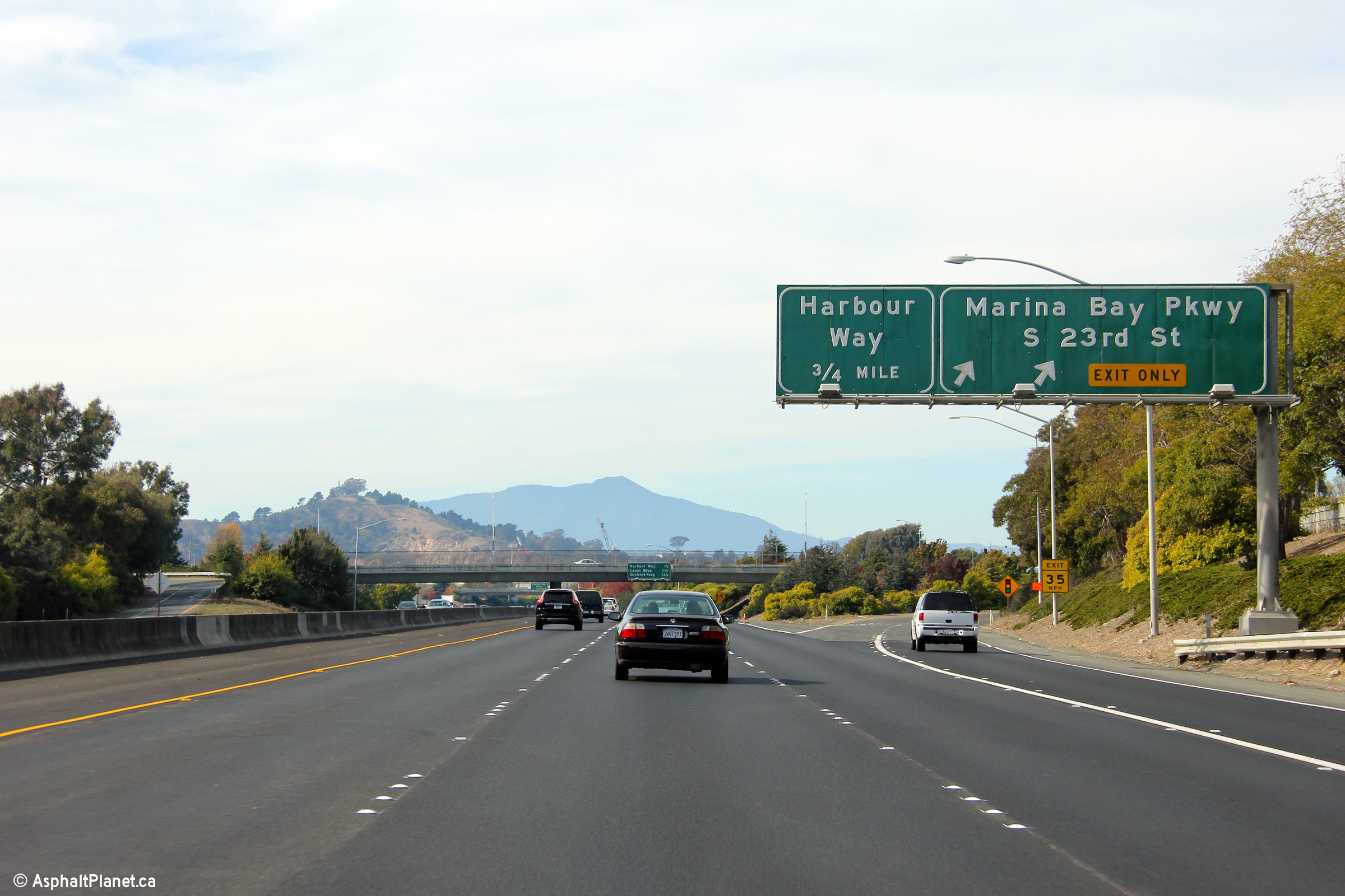
|
Contra Costa County Richmond |
Advanced signage for the westbound off-ramp to Marina Bay Parkway. |
 |
||
|
Date: 11/03/2013 |
High-res: (1440x960) (2400x1600) | |||
|
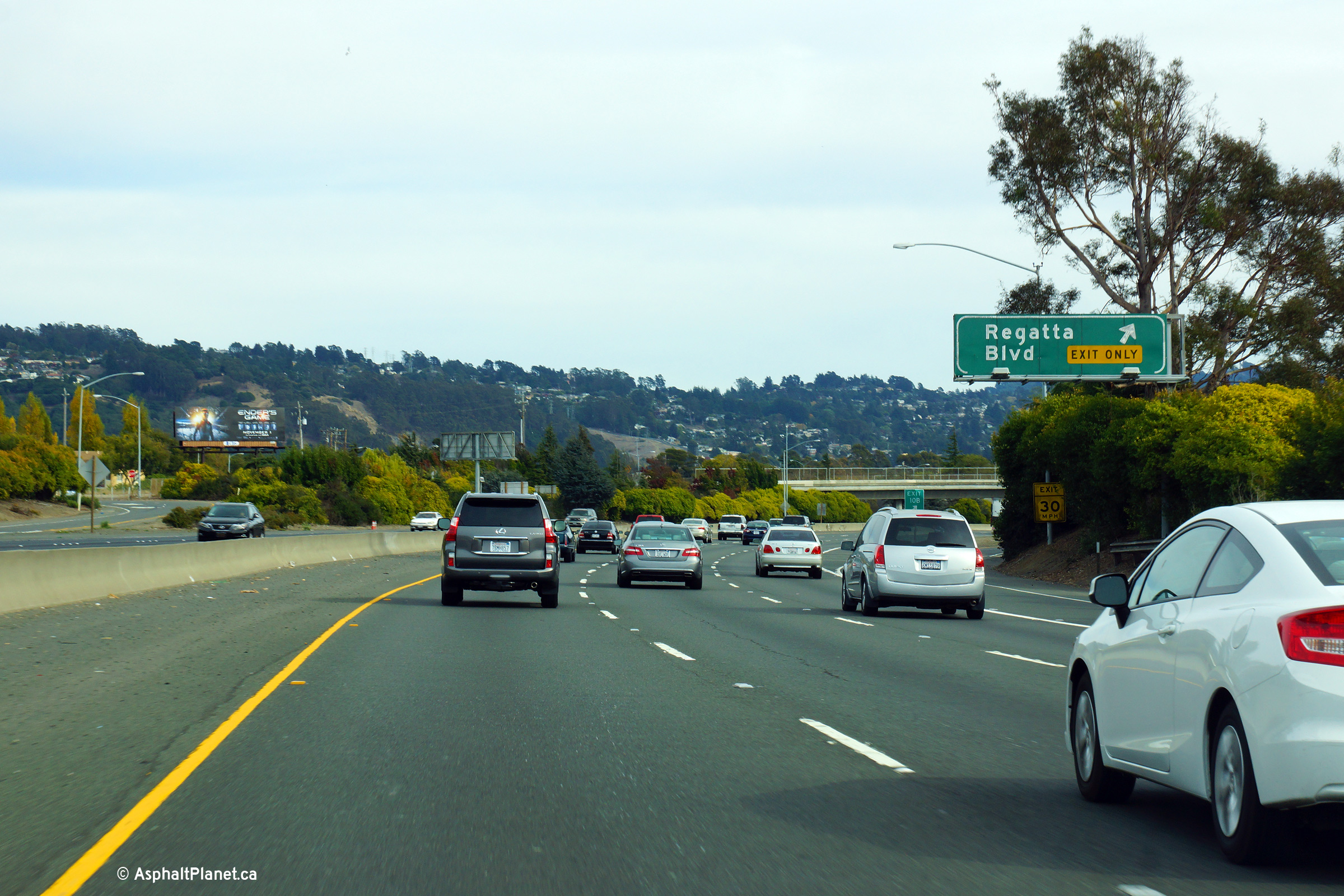
Contra Costa County Richmond |
Eastbound signage for the ramp to Exit 10B, Regatta Boulevard. |
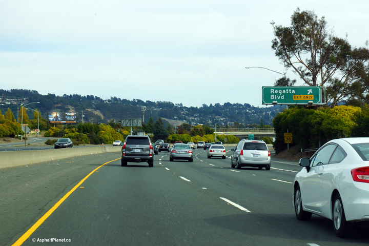 |
||
|
Date: 11/03/2013 |
High-res: (1440x960) (2400x1600) |
|||
|
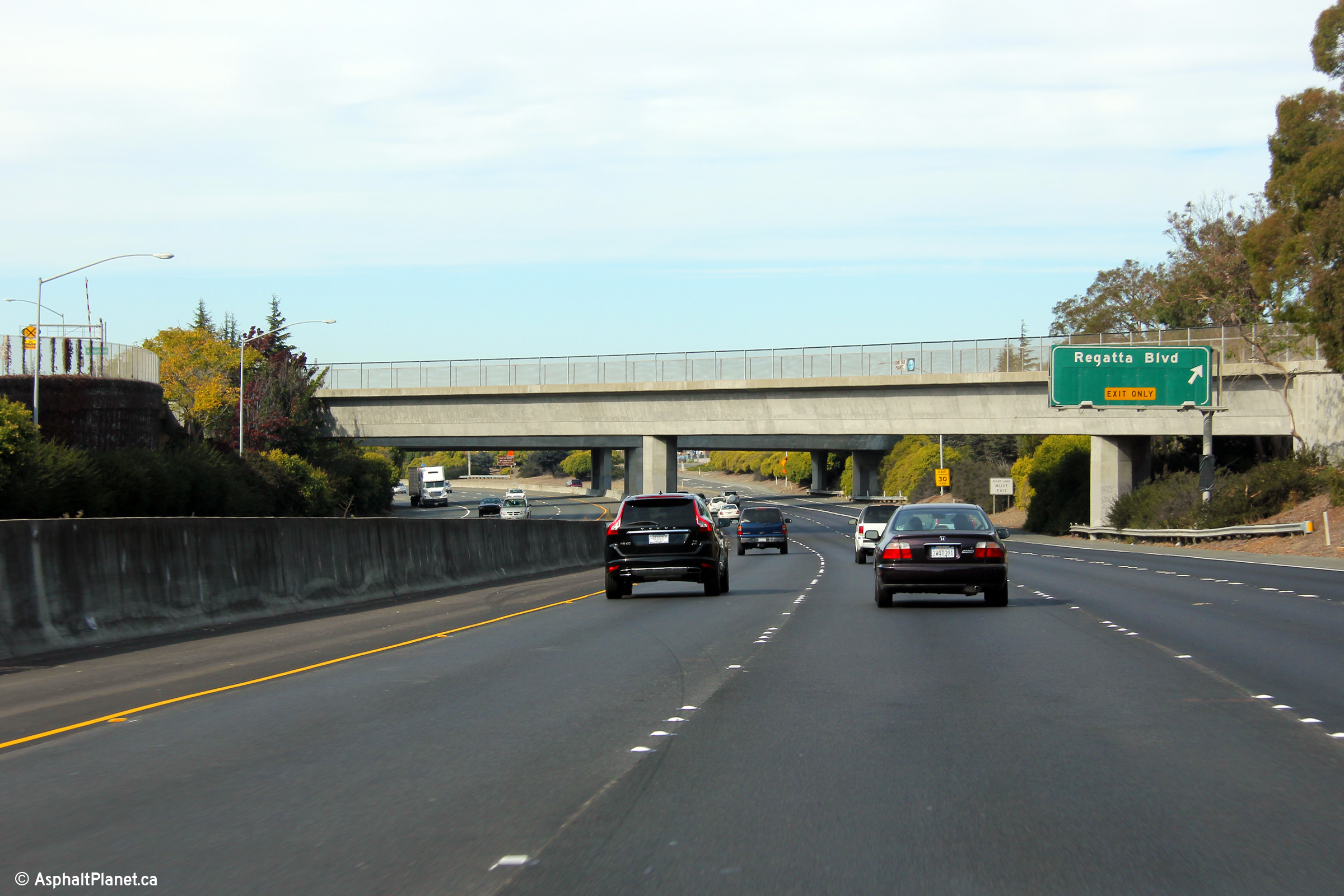
Contra Costa County Richmond |
View looking westbound at the off-ramp to Regatta Boulevard. |
 |
||
|
Date: 11/03/2013 |
High-res: (1440x960) (2400x1600) | |||
|
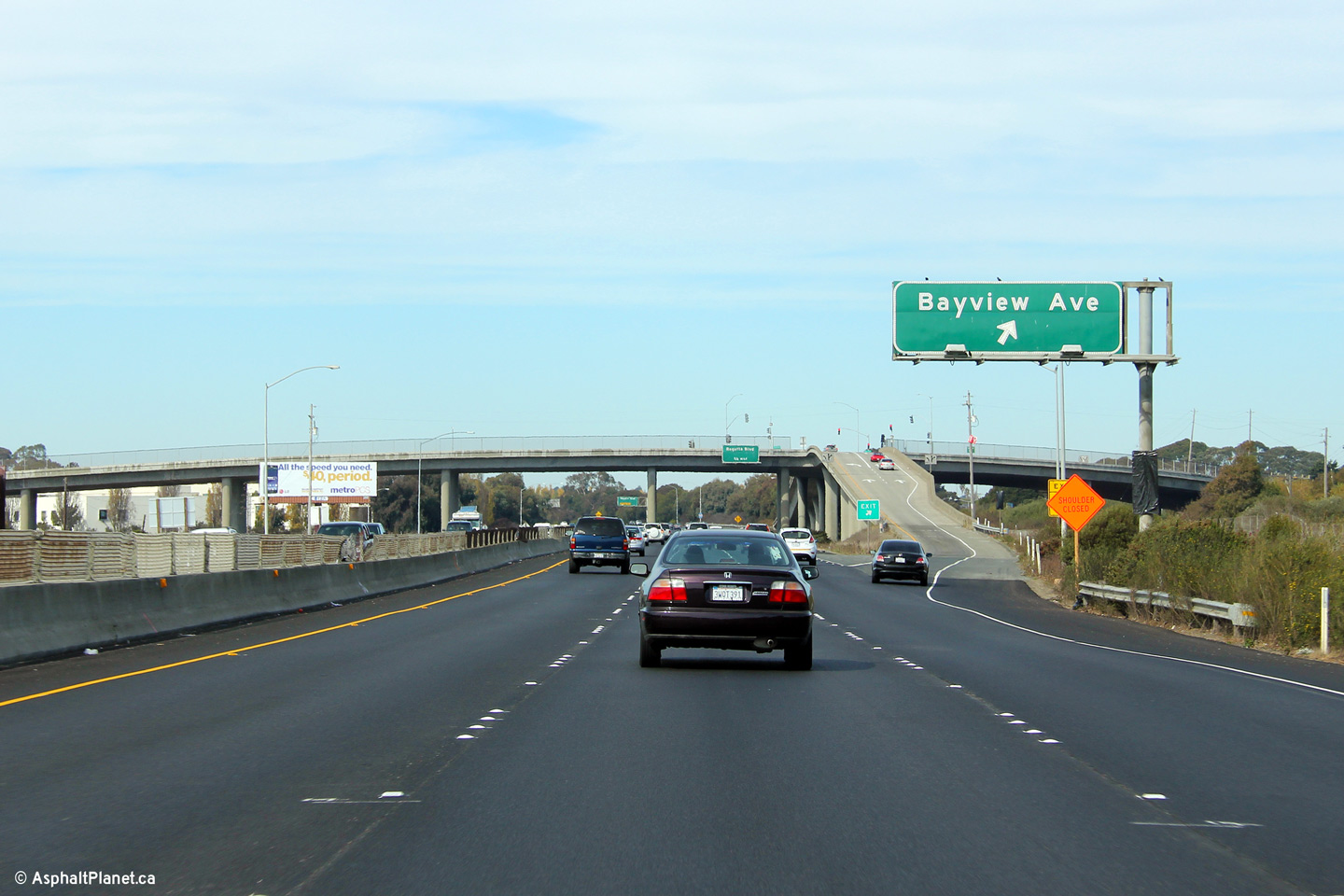
Contra Costa County Richmond |
Westerly view at the Bayview Avenue off-ramp. This section of I-580 runs adjacent to a set of railway tracks, explaining the extra high overcrossings at both Bayview and Central Avenues. |
 |
||
|
Date: 11/03/2013 |
High-res: (1440x960) (2400x1600) | |||
|
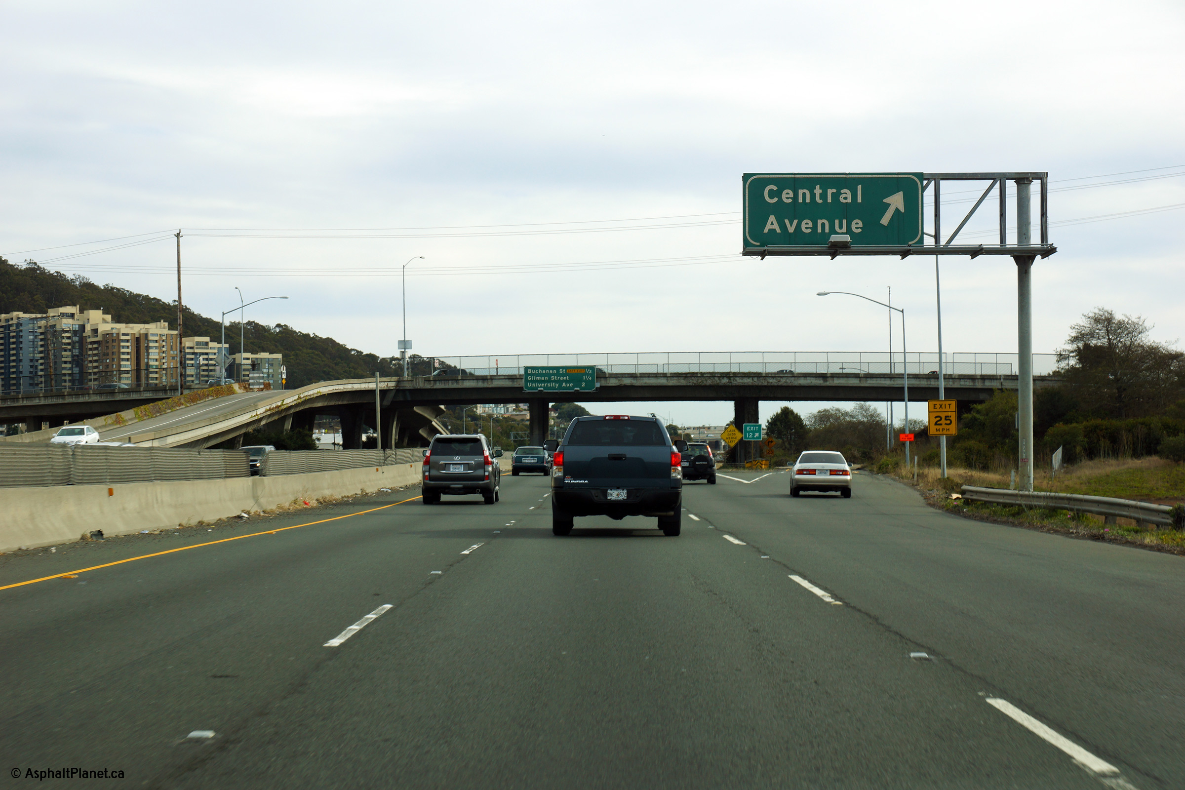
Contra Costa County Richmond |
Easterly view at the off-ramp to Central Avenue. The eastbound I-580 carriageway narrows to two lanes beyond the Central Avenue interchange. |
 |
||
|
Date: 11/03/2013 |
High-res: (1440x960) (2400x1600) |
|||
|
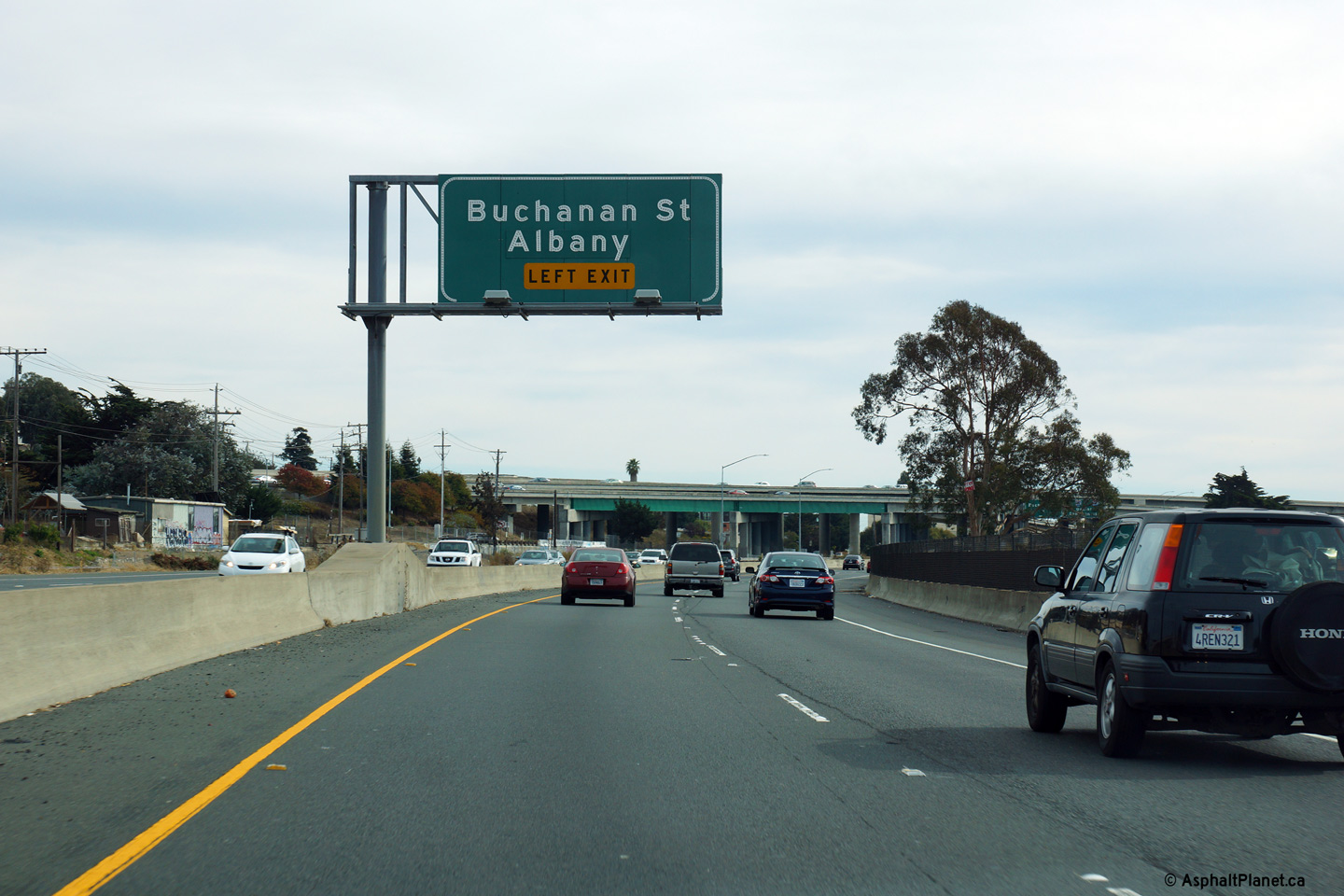
Alameda County Albany |
Advanced signage for the left exit to Buchanan Street. |
 |
||
|
Date: 11/03/2013 |
High-res: (1440x960) (2400x1600) |
|||
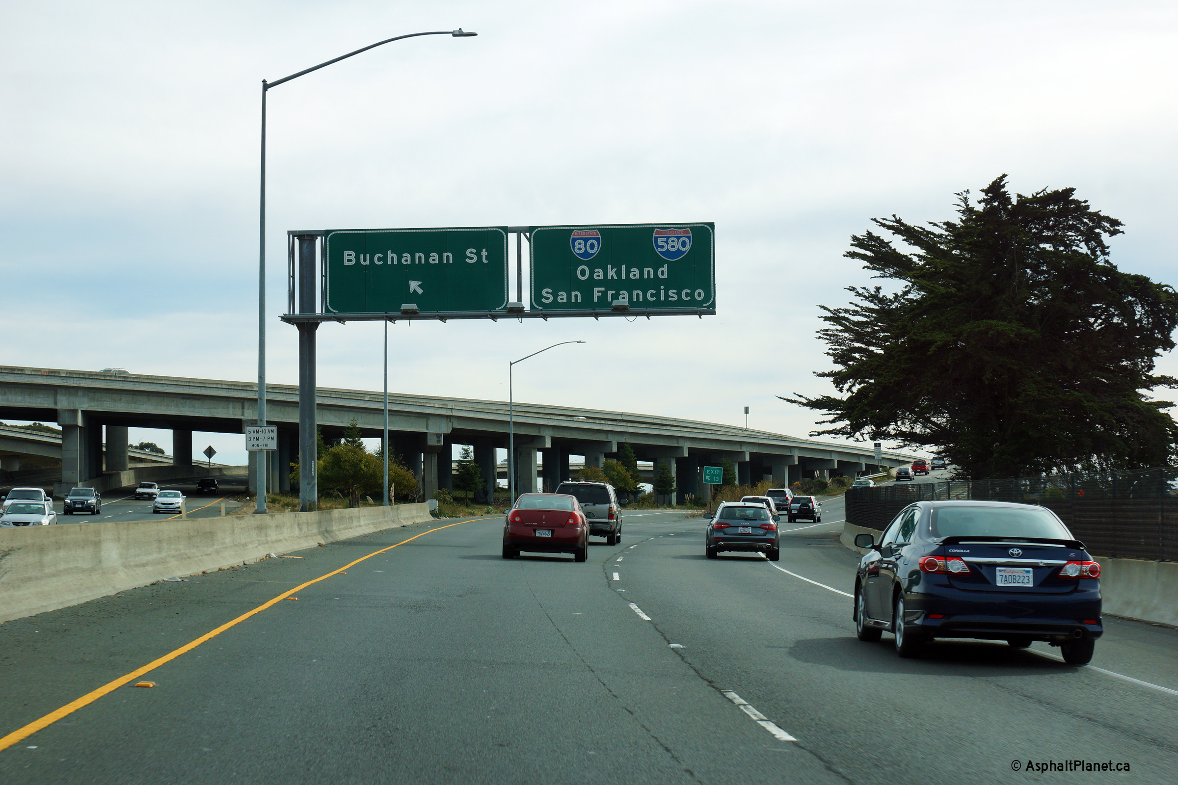
|
Alameda County Albany |
Signage for the ramp to Buchanan Street. The ramp to Buchanan Street departs from the left side of I-580 and immediately passes beneath the mainline lanes of I-80. |
 |
||
|
Date: 11/03/2013 |
High-res: (1440x960) (2400x1600) |
|||
|
Alameda County Albany |
Overhead signage at the western split between the I-80 and I-580 freeways. Beyond this interchange, I-80 continues bound easterly eventually leading to New York City, while I-580 continues to the west crossing San Francisco Bay atop the dual level Richmond-San Rafael Bridge towards US-101. |
 |
||
|
Date: 11/03/2013 |
High-res: (1440x960) (2400x1600) | |||
|
Alameda County Albany |
This view looks east along I-580 (west along I-80) from just beyond the convergence of the I-80 and I-580 carriageways. |
 |
||
|
Date: 11/03/2013 |
High-res: (1440x960) (2400x1600) |
|||
|
Alameda County Albany |
Signage at the Buchanan Street off-ramp. The Buchanan Street off-ramp is located immediately in advance of the western I-80/580 split. |
 |
||
|
Date: 11/03/2013 |
High-res: (1440x960) (2400x1600) | |||
|
Alameda County Berkeley |
Median mounted advanced signage in advance of the I-580 split. |
 |
||
|
Date: 11/03/2013 |
High-res: (1440x960) (2400x1600) | |||
|
Alameda County Berkeley |
Overhead signage at the Gilman Street off-ramp. |
 |
||
|
Date: 11/03/2013 |
High-res: (1440x960) (2400x1600) | |||
|
Alameda County Emeryville |
Interchange sequence signage affixed to the University Avenue overpass. |
 |
||
|
Date: 11/03/2013 |
High-res: (1440x960) | |||
|
Alameda County Emeryville |
Eastbound signage at the ramp to SR-13. |
 |
||
|
Date: 11/03/2013 |
High-res: (1440x960) (2400x1600) | |||
|
Alameda County Emeryville |
View as I-80/580 passes beneath the SR-13 overcrossing. |
 |
||
|
Date: 11/03/2013 |
High-res: (1440x960) (2400x1600) | |||
|
Alameda County Emeryville |
Signage at the ramp to Highway 13. Highway 13 follows surface streets from I-80 to I-580 easterly to the Highway 24 interchange. During the height of California's freeway era, a freeway by-pass of Highway 13 was proposed through central Berkley. A Highway 13 freeway would have had considerable property impacts through Berkley. |
 |
||
|
Date: 11/03/2013 |
High-res: (1440x960) (2400x1600) | |||
|
Alameda County Emeryville |
Median mounted signage along I-80/580 in advance of the Highway 13 interchange. |
 |
||
|
Date: 11/03/2013 |
High-res: (1440x960) (2400x1600) | |||
|
Alameda County Emeryville |
Advanced signage in advance of the split between I-80 and I-580 at the MacArthur Maze interchange. The MacArthur Maze was first constructed during the 1930s during the initial construction of the Oakland Bay Bridge. At the dawn of the interstate age, the interchange was reconfigured and expanded in order to support the then newly constructed freeways that were feeding traffic into it. |
 |
||
|
Date: 11/03/2013 |
High-res: (1440x960) (2400x1600) | |||
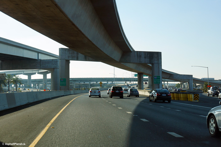
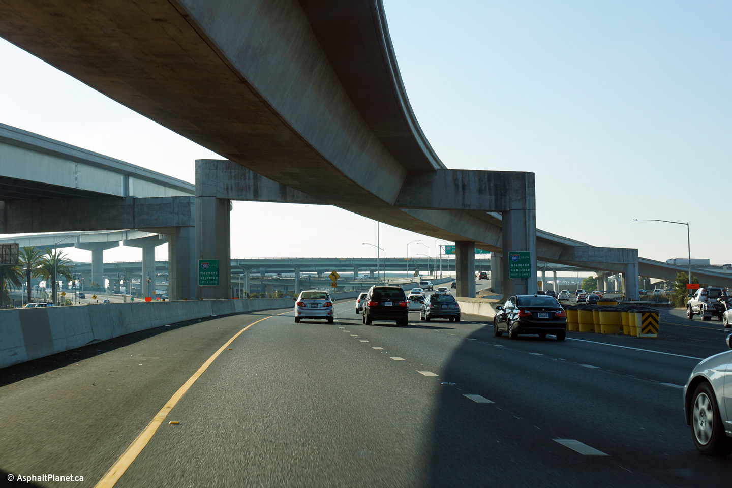
|
Alameda County Emeryville |
Overhead signage as the ramp to I-80 West peels away from the mainline lanes of I-580 East. The ramp to I-880 splits from the mainline lanes of I-580 about a quarter mile downstream of this location. |
 |
||
|
Date: 11/02/2013 |
High-res: (1440x960) (2400x1600) | |||
|
Alameda County Emeryville |
Easterly view along I-580 just east of the I-80 split. The HOV lane flyover linking the Bay Bridge to the I-80/580 freeway is visible passing overhead in this photo. |
 |
||
|
Date: 11/02/2013 |
High-res: (1440x960) (2400x1600) | |||
|
Alameda County Emeryville |
The ramp to I-880 diverges from I-580 shortly east of the eastbound I-80 split. |
 |
||
|
Date: 11/02/2013 |
High-res: (1440x960) (2400x1600) | |||
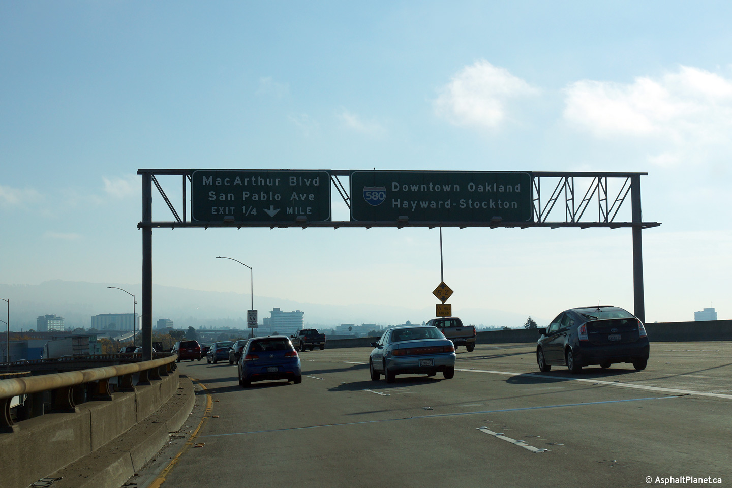
|
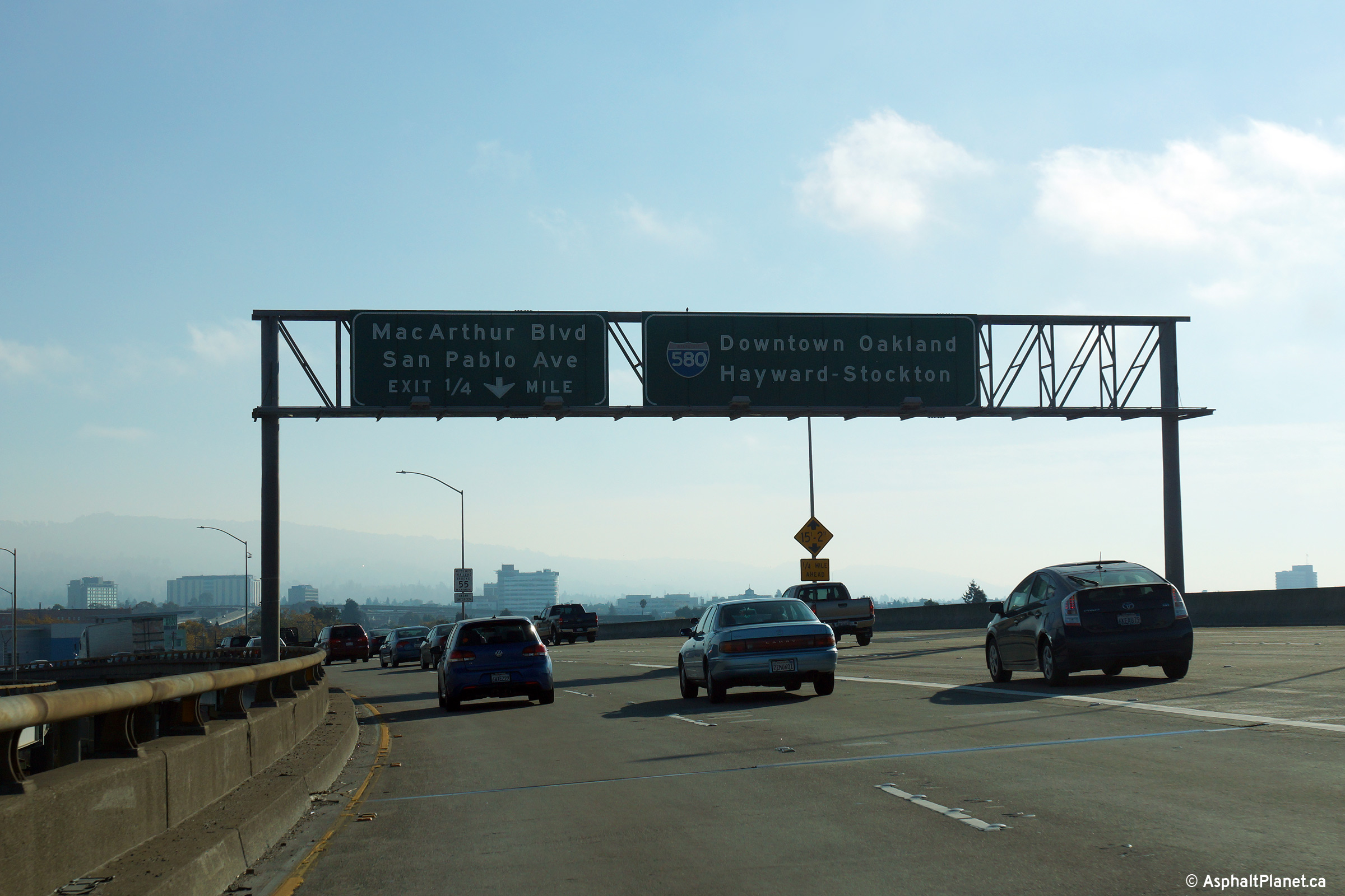
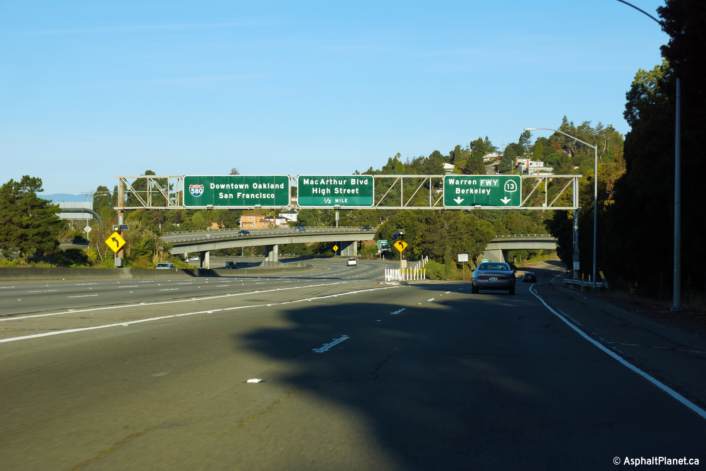
Alameda County Oakland |
Advanced signage for the left exit to MacArthur Boulevard. East of the MacArthur Maze as far easterly as I-238 at Castro Valley, I-580 is known as the MacArthur Freeway, derived from nearby MacArthur Boulevard which parallels I-580 throughout the freeways length between Oakland and Castro Valley. |
 |
||
|
Date: 11/02/2013 |
High-res: (1440x960) (2400x1600) | |||
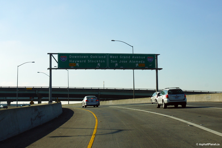
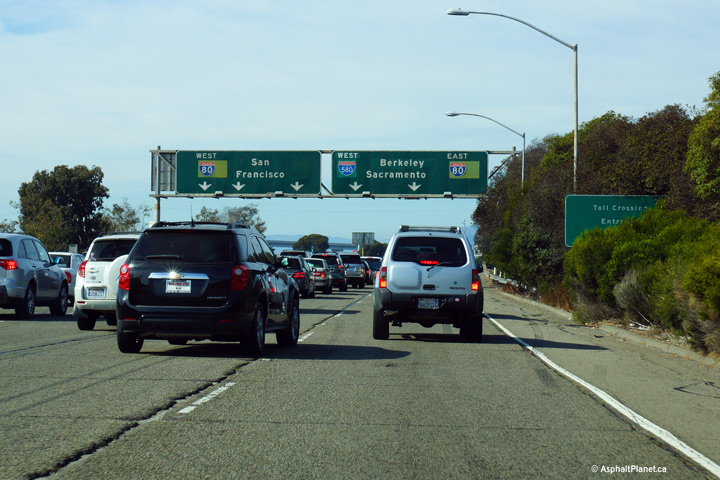
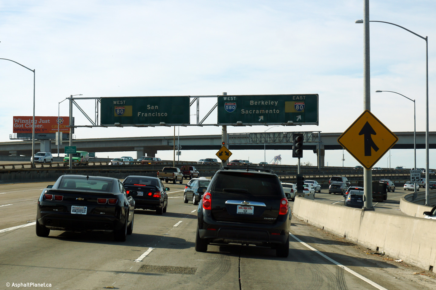
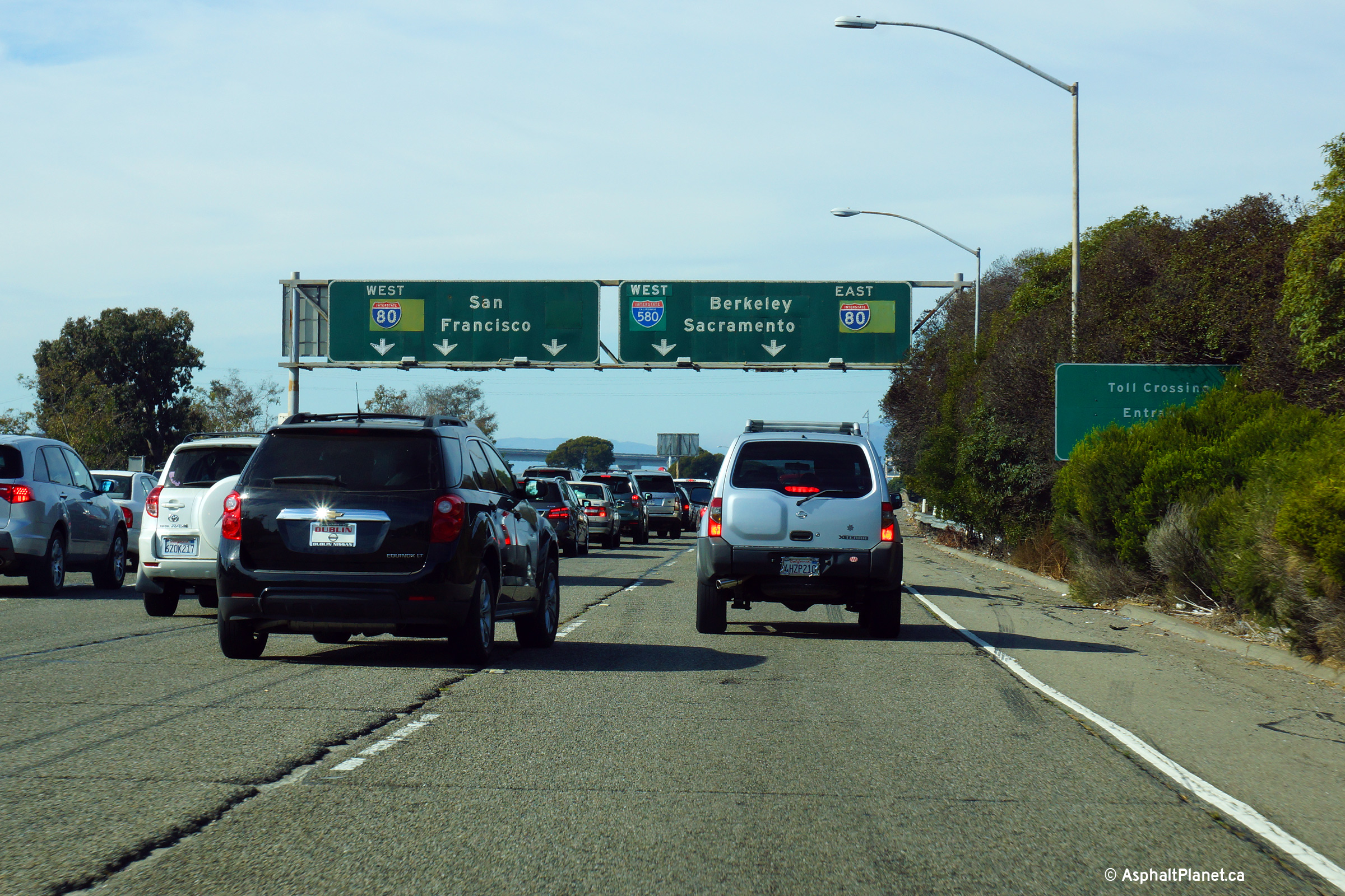
|
Alameda County Oakland |
Overhead signage at the ramp to the Bay Bridge from I-580 West. I-580 West runs concurrently with I-80 East for several miles east of this interchange and is known as the Eastshore Freeway. As it is when this photo was taken, the Eastshore Freeway is chronically congested for the many hours throughout the day. The Eastshore Freeway is effectively the only high-speed north-south through route through the San Francisco area. |
 |
||
|
Date: 4/07/2010 |
High-res: (1440x960) (2400x1600) | |||
|
Alameda County Oakland |
Westbound advanced lane assignment signage for the western I-80 interchange. |
 |
||
|
Date: 11/02/2013 |
High-res: (1440x960) (2400x1600) | |||
|
Alameda County Oakland |
Overhead signage at the off-ramp to MacArthur Boulevard. Before the freeway era, MacArthur Boulevard carried the US-50 designation. |
 |
||
|
Date: 11/02/2013 |
High-res: (1440x960) (2400x1600) | |||
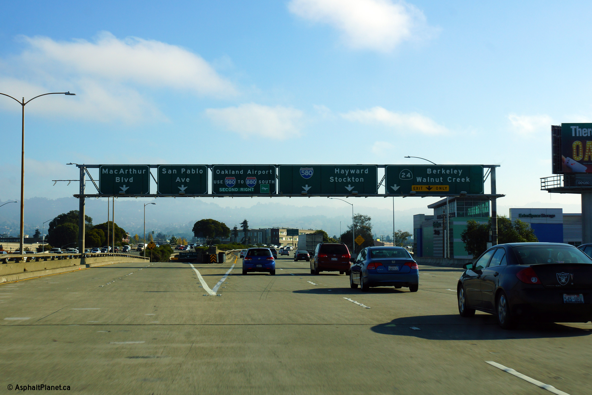
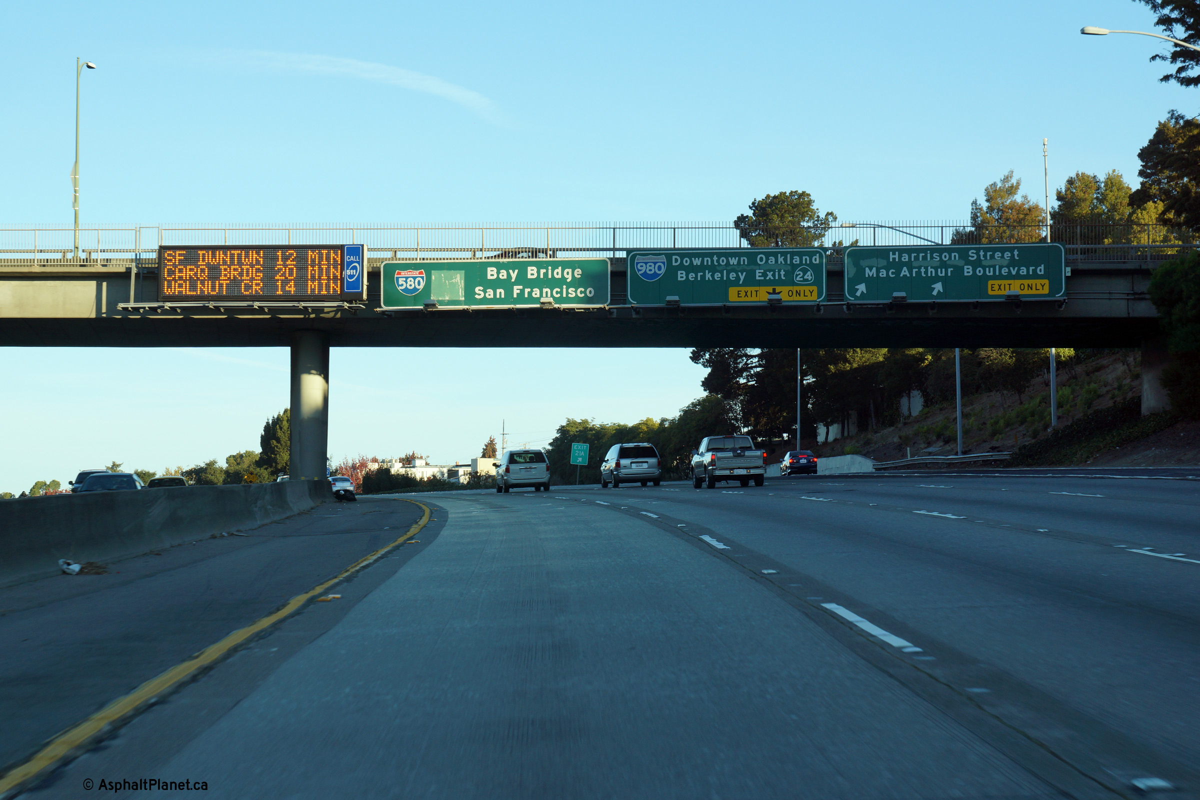
|
Alameda County Oakland |
Easterly view into the morning sun at the off-ramp to State Route 24. The I-980/CA-24 interchange is located in very close proximity to the MacArthur Maze interchange. |
 |
||
|
Date: 11/02/2013 |
High-res: (1440x960) (2400x1600) | |||
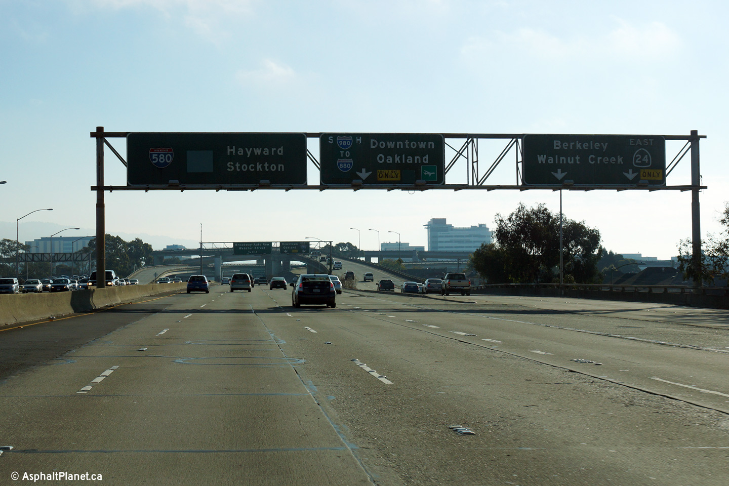
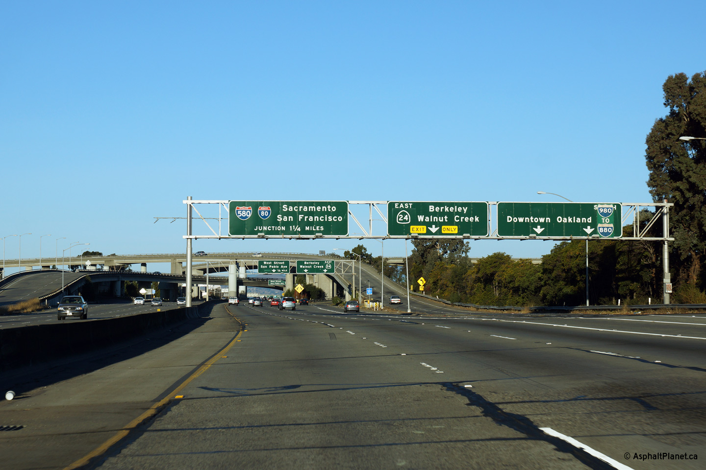
|
Alameda County Oakland |
Just beyond the off-ramp to State Route 24 is the eastbound off-ramp to Interstate 980. I-980 is the southern continuation of the State Route 24 freeway. |
 |
||
|
Date: 11/02/2013 |
High-res: (1440x960) (2400x1600) | |||
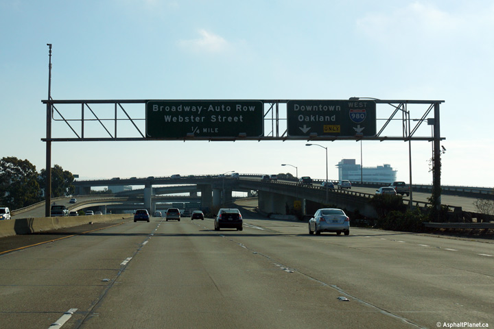
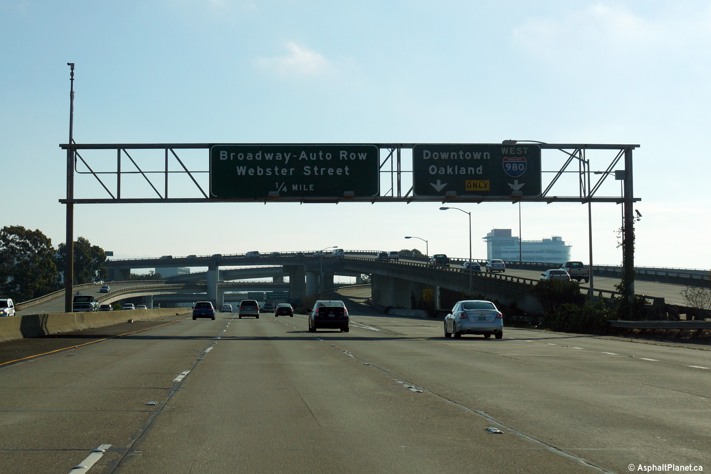
|
Alameda County Oakland |
The eastbound off-ramp to Broadway and Webster Street is located within the footprint of the I-980/CA-24 interchange. |
 |
||
|
Date: 11/02/2013 |
High-res: (1440x960) (2400x1600) | |||
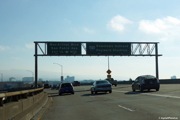
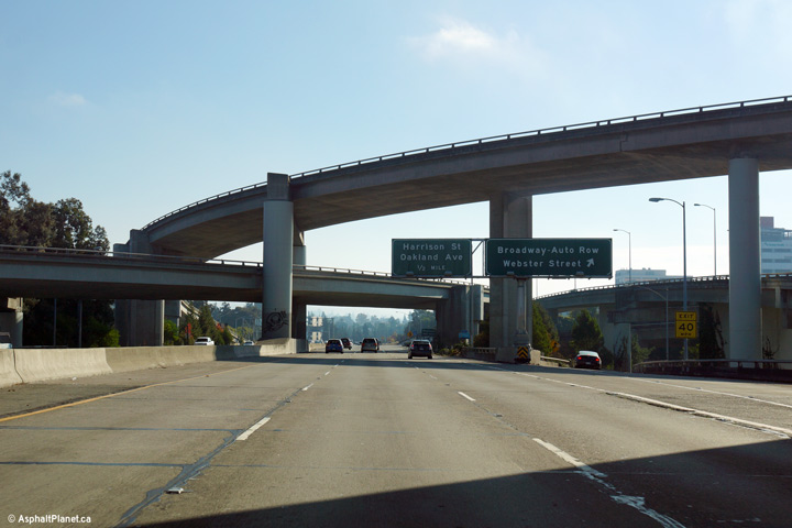
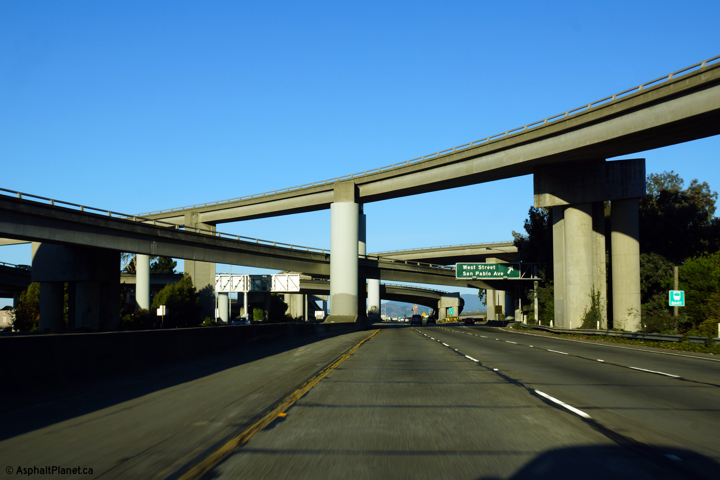
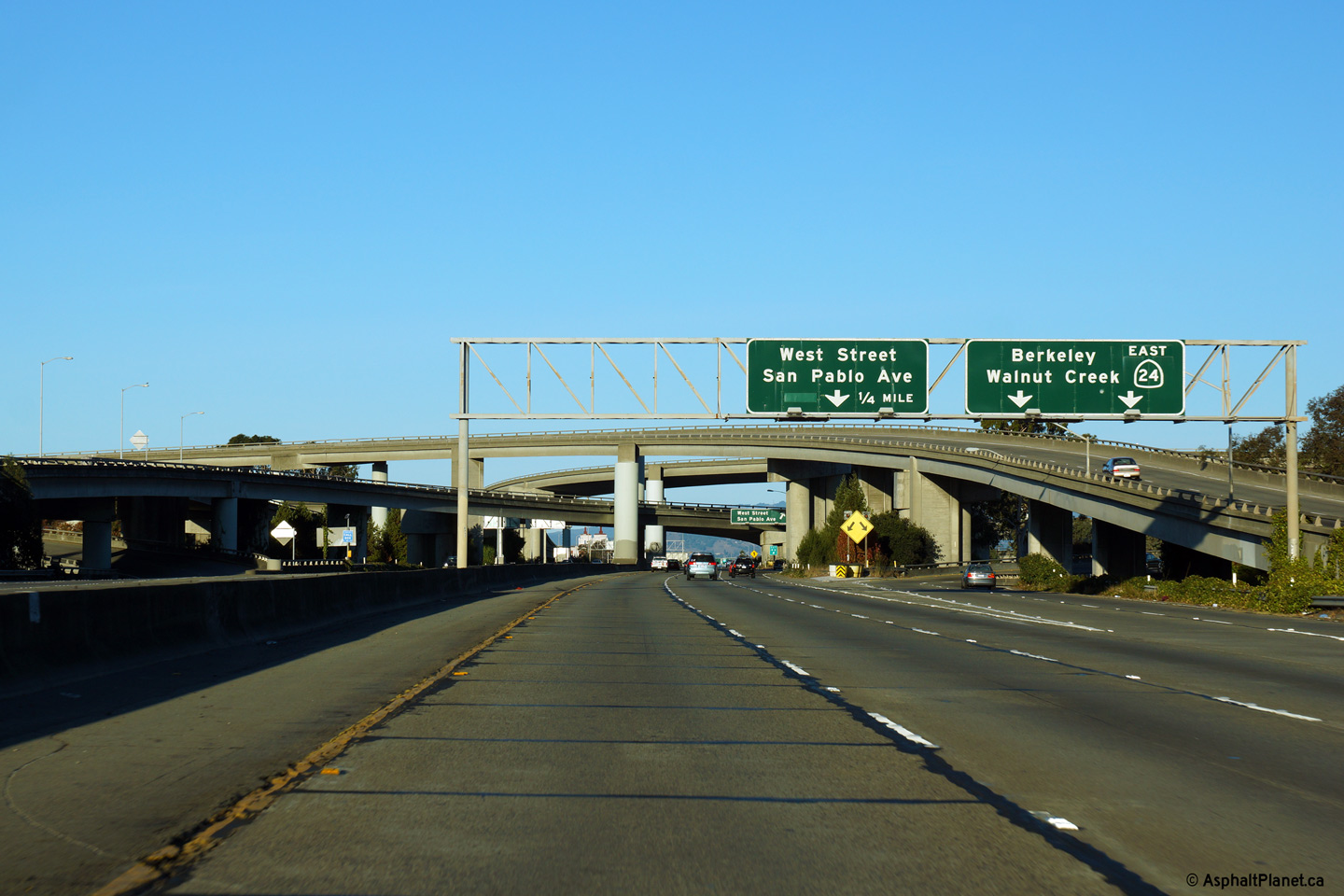
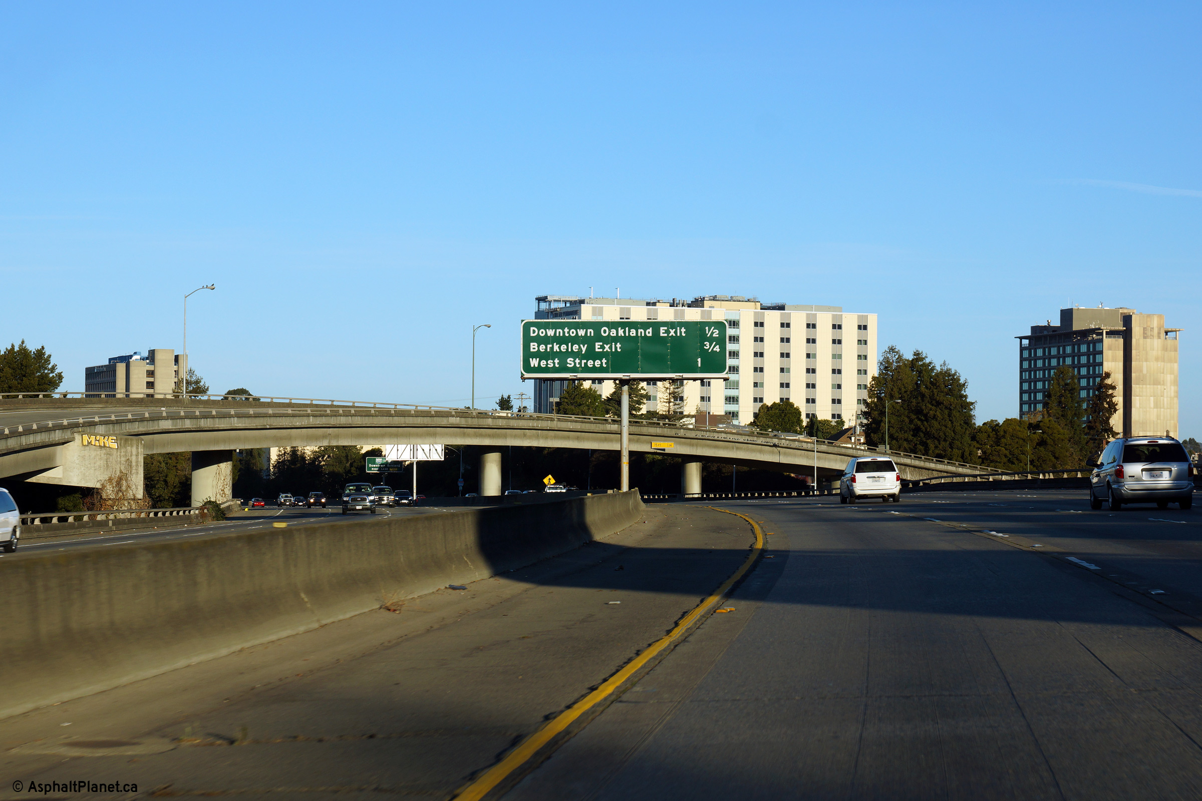
|
Alameda County Oakland |
View looking westerly through the I-980/CA-24 interchange as the ramp to both West Street and San Pablo Avenue departs the freeway. |
 |
||
|
Date: 11/03/2013 |
High-res: (1440x960) (2400x1600) | |||
|
Alameda County Oakland |
Signage at the ramp to State Route 24 East. |
 |
||
|
Date: 11/03/2013 |
High-res: (1440x960) (2400x1600) | |||
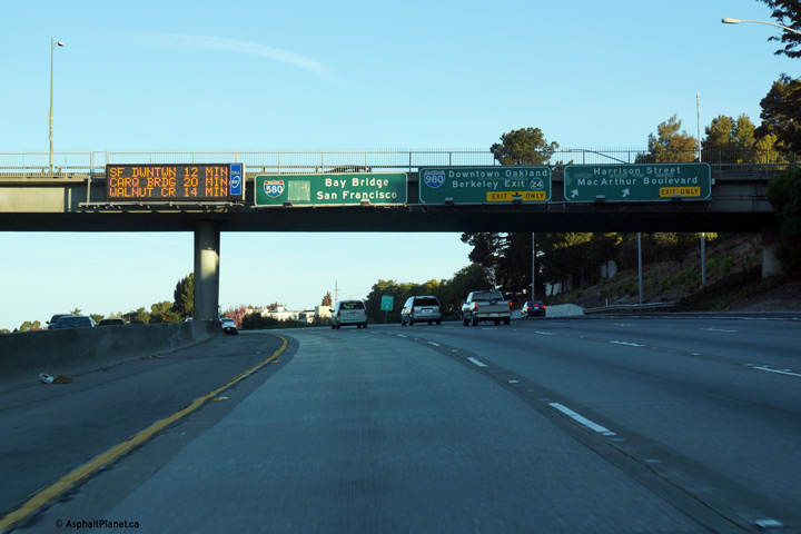
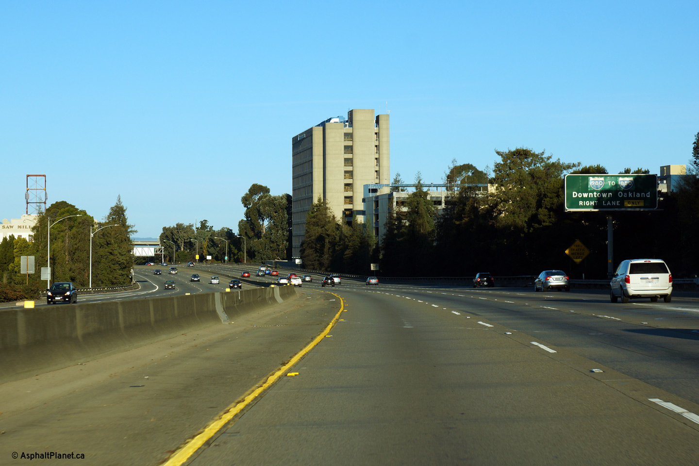
|
Alameda County Oakland |
Overhead signage at the ramp to I-980 South from I-580 West. What Is I-980 South of I-580 is CA-24 East of I-580. |
 |
||
|
Date: 11/03/2013 |
High-res: (1440x960) (2400x1600) | |||
|
Alameda County Oakland |
Westbound advanced signage for the I-980 interchange. As is evident from the signage, no reference is made to CA-24, I-980's eastern continuation, on this signage. |
 |
||
|
Date: 11/03/2013 |
High-res: (1440x960) (2400x1600) | |||
|
Alameda County Oakland |
Median mounted interchange sequence signage in advance of the southbound MacArthur Boulevard overcrossing. |
 |
||
|
Date: 11/03/2013 |
High-res: (1440x960) (2400x1600) | |||
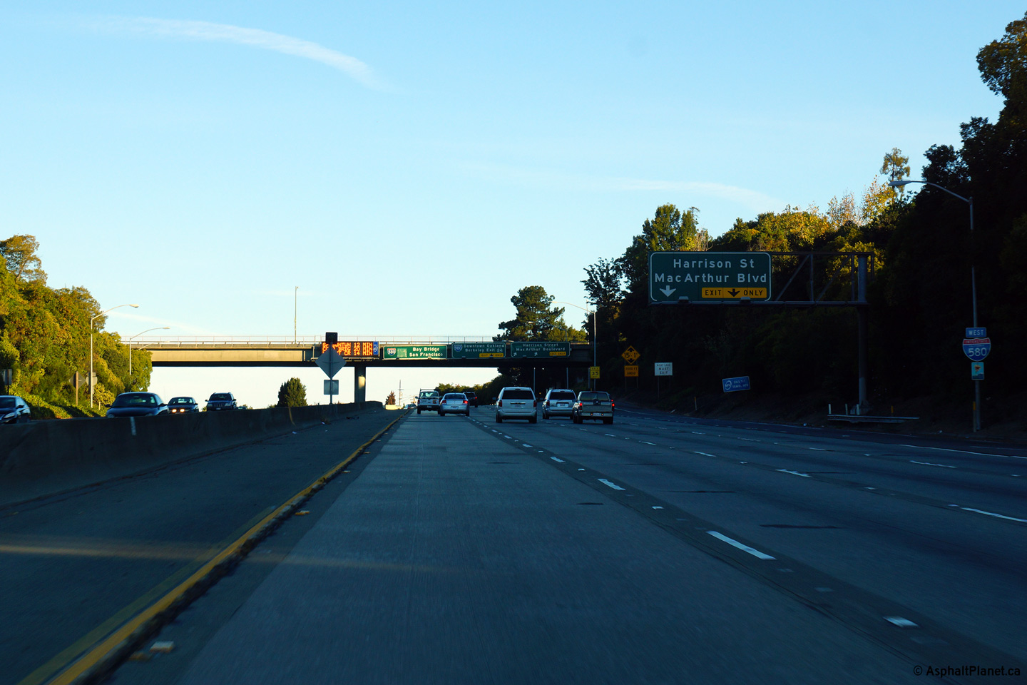
|
Alameda County Oakland |
The signage for Harrison Street and MacArthur Boulevard is affixed to the Adams Street overcrossing. |
 |
||
| High-res: (1440x960) (2400x1600) | ||||
 |
||||
|
Date: 11/03/2013 |
High-res: (1440x960) (2400x1600) | |||
|
Alameda County Oakland |
Westerly view as the MacArthur Freeway passes beneath the 13th Avenue overcrossing. |
 |
||
|
Date: 11/03/2013 |
High-res: (1440x960) (2400x1600) | |||
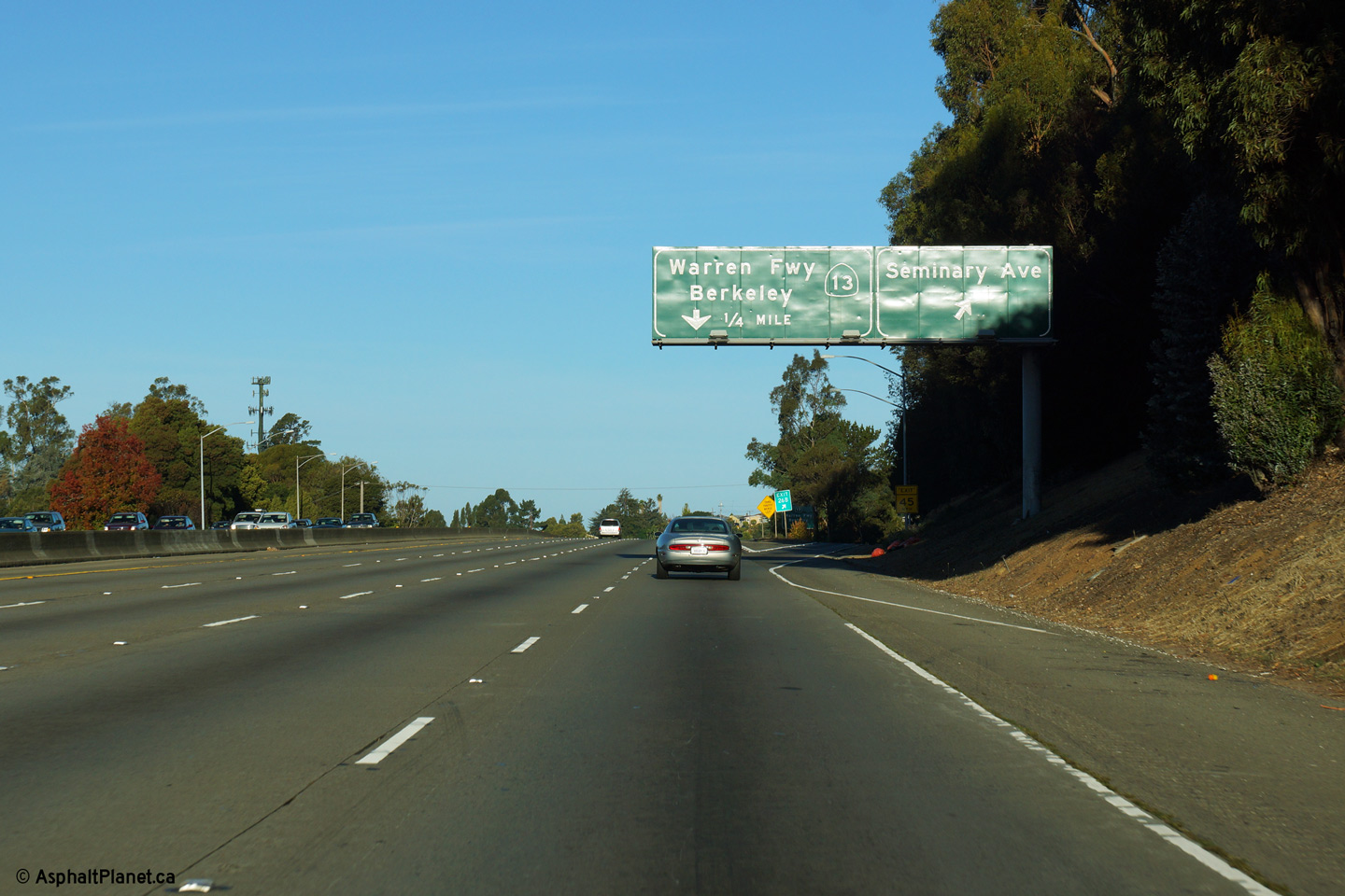
|
Alameda County Oakland |
View looking easterly as SR-13 departs from the mainline lanes of I-580 West. |
 |
||
|
Date: 11/03/2013 |
High-res: (1440x960) (2400x1600) | |||
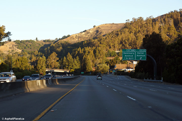
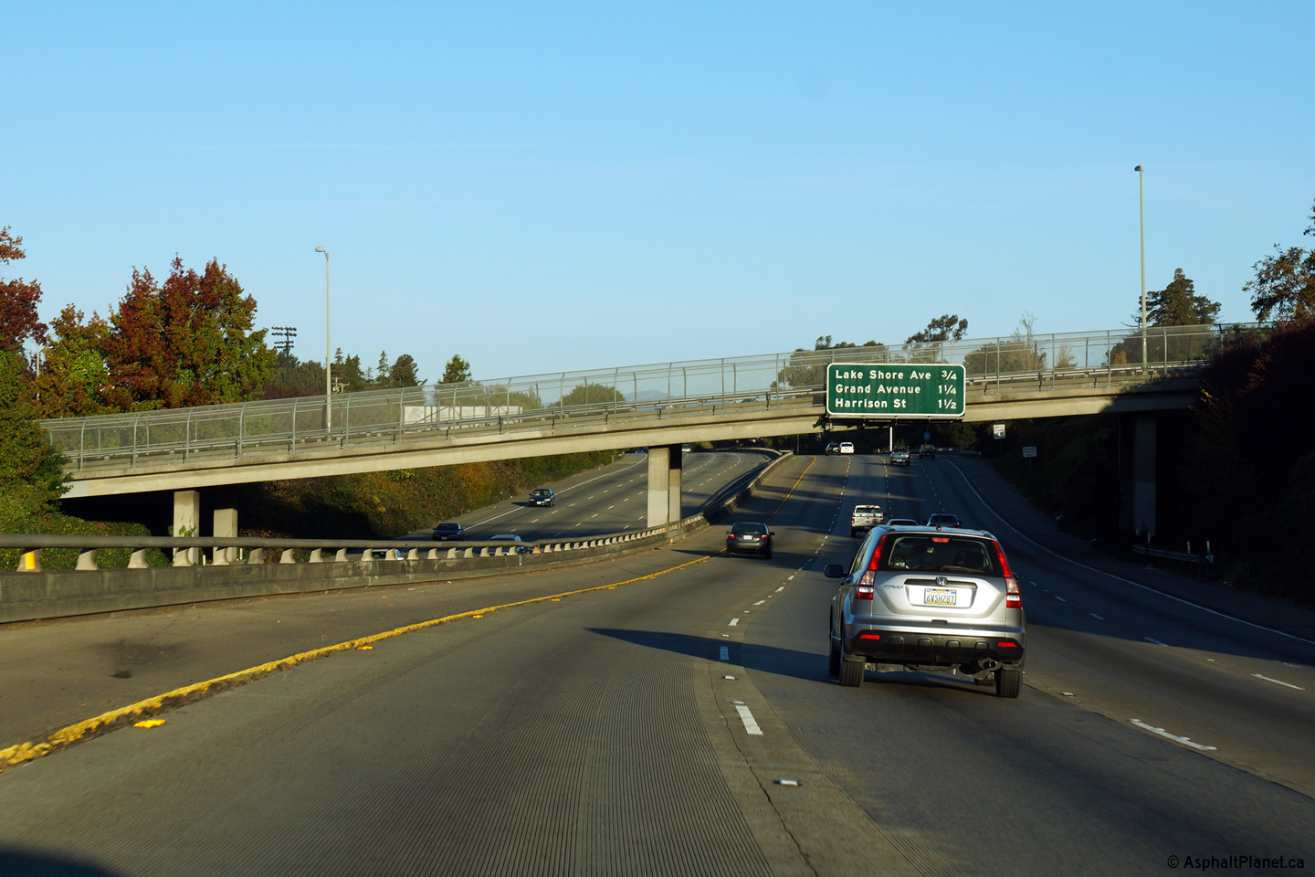
|
Alameda County Oakland |
View looking easterly at the off-ramp to Seminary Avenue. |
 |
||
|
Date: 11/03/2013 |
High-res: (1440x960) (2400x1600) | |||
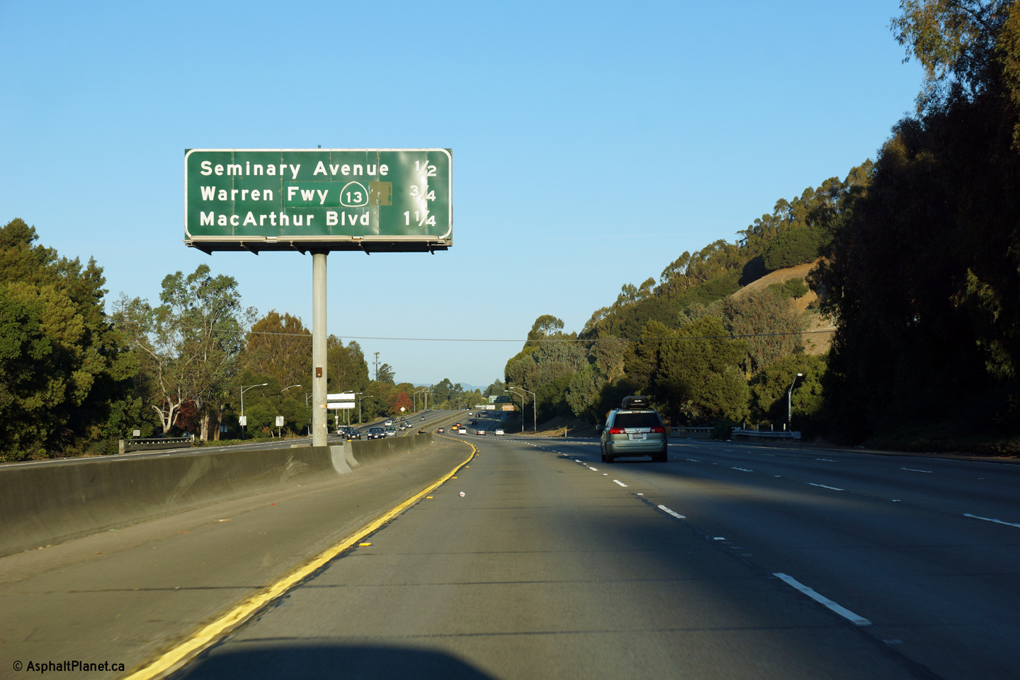
|
Alameda County Oakland |
Interchange sequence signage in advance of the Seminary Avenue interchange. |
 |
||
|
Date: 11/03/2013 |
High-res: (1440x960) (2400x1600) | |||
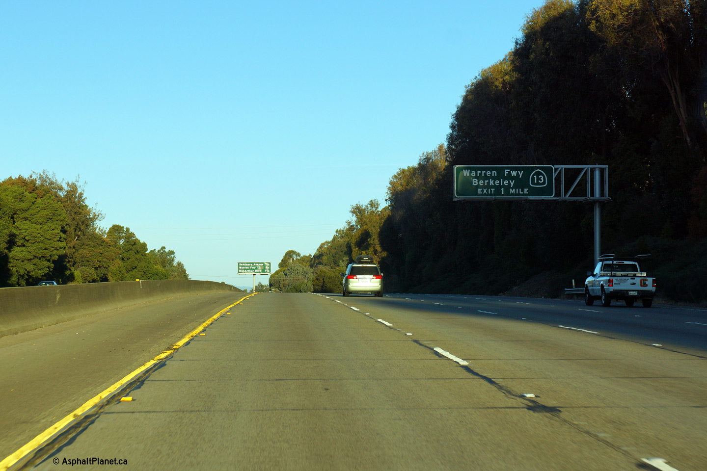
|
Alameda County Oakland |
I mile advanced signage for the westbound off-ramp to State Route 13. |
 |
||
|
Date: 11/03/2013 |
High-res: (1440x960) (2400x1600) | |||
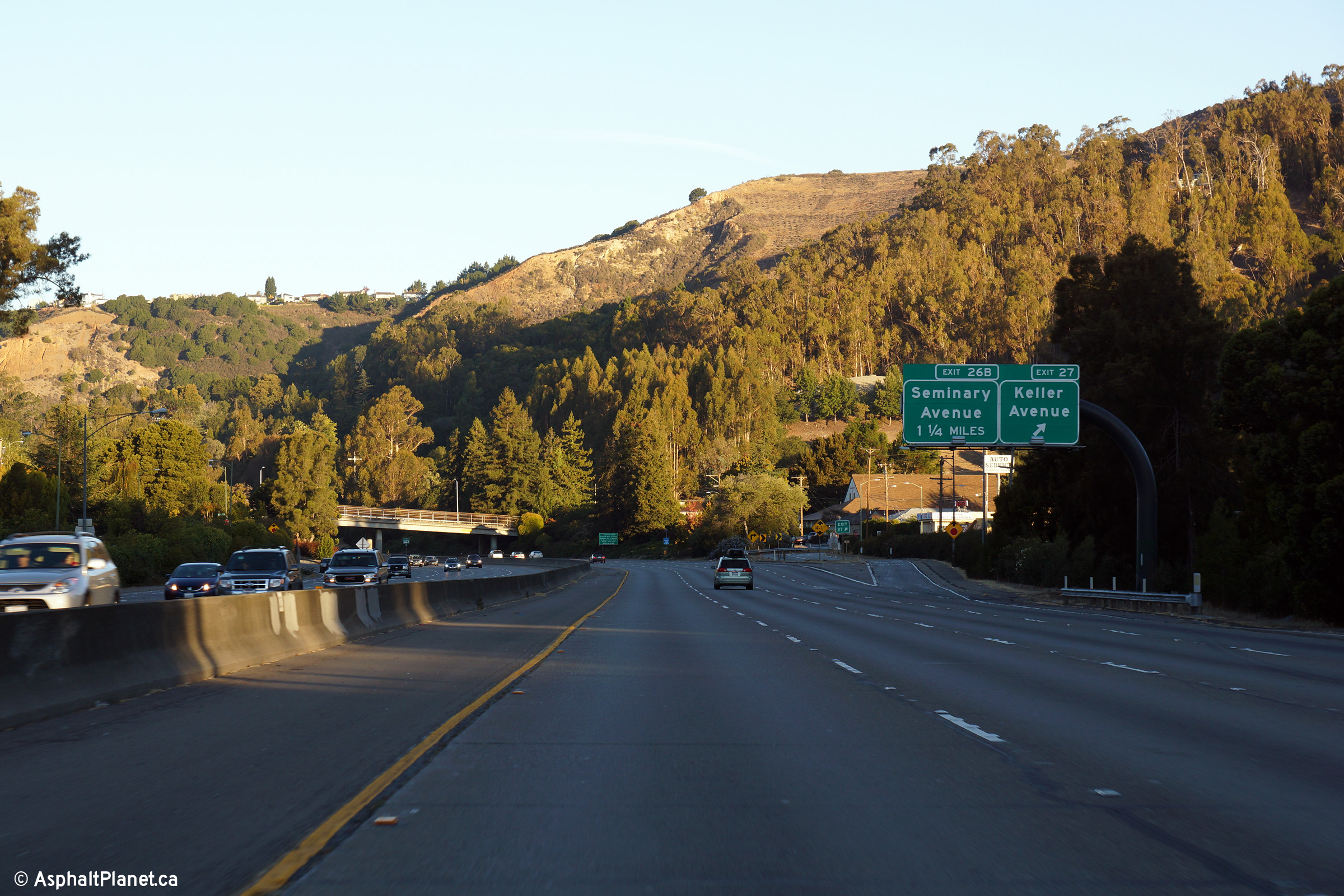
|
Alameda County Oakland |
Westerly view as the off-ramp to Keller Avenue |
 |
||
|
Date: 11/03/2013 |
High-res: (1440x960) (2400x1600) | |||
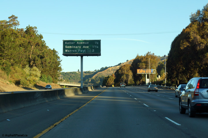
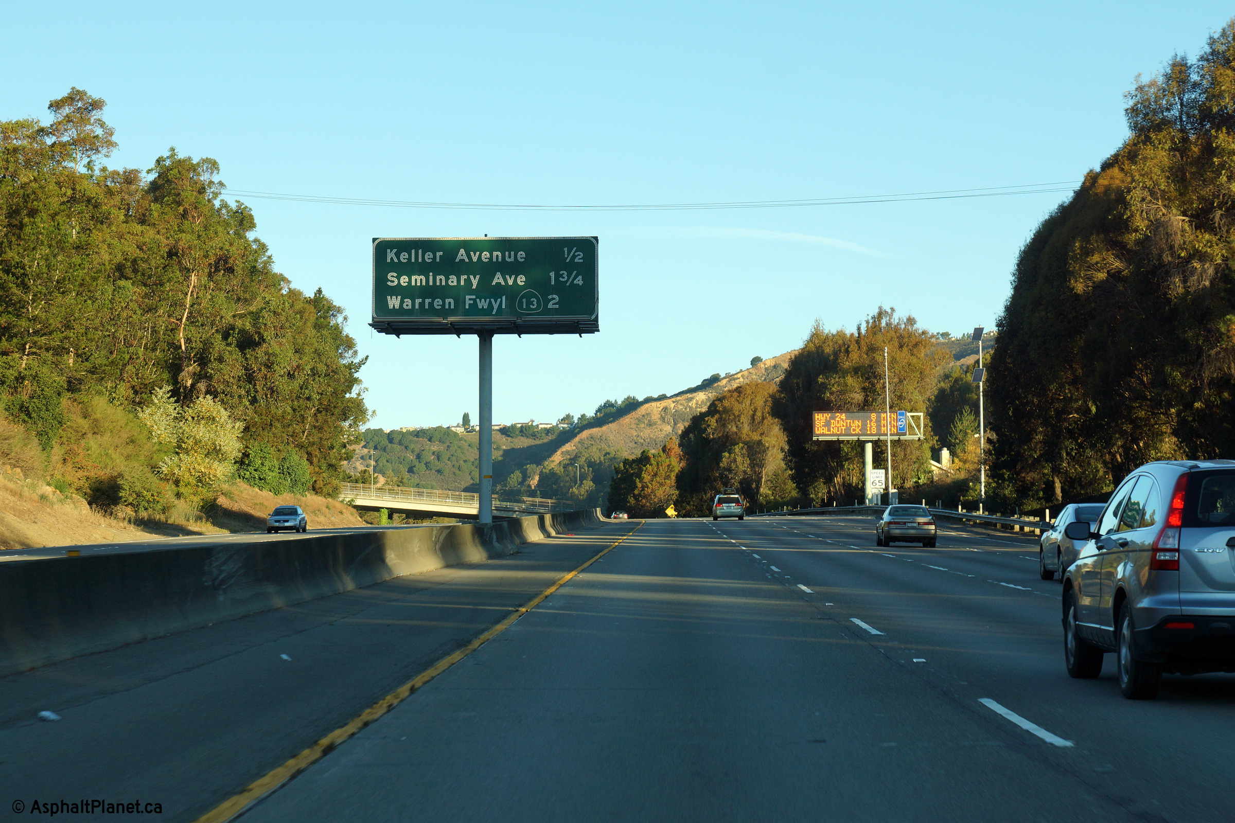
|
Alameda County Oakland |
Median mounted interchange sequence signage in advance of the Keller Avenue interchange. |
 |
||
|
Date: 11/03/2013 |
High-res: (1440x960) (2400x1600) | |||
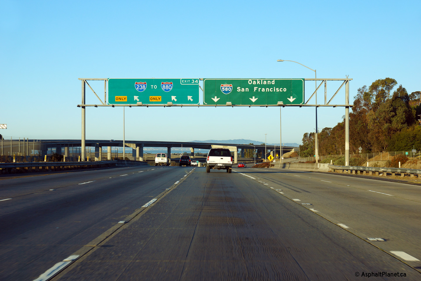
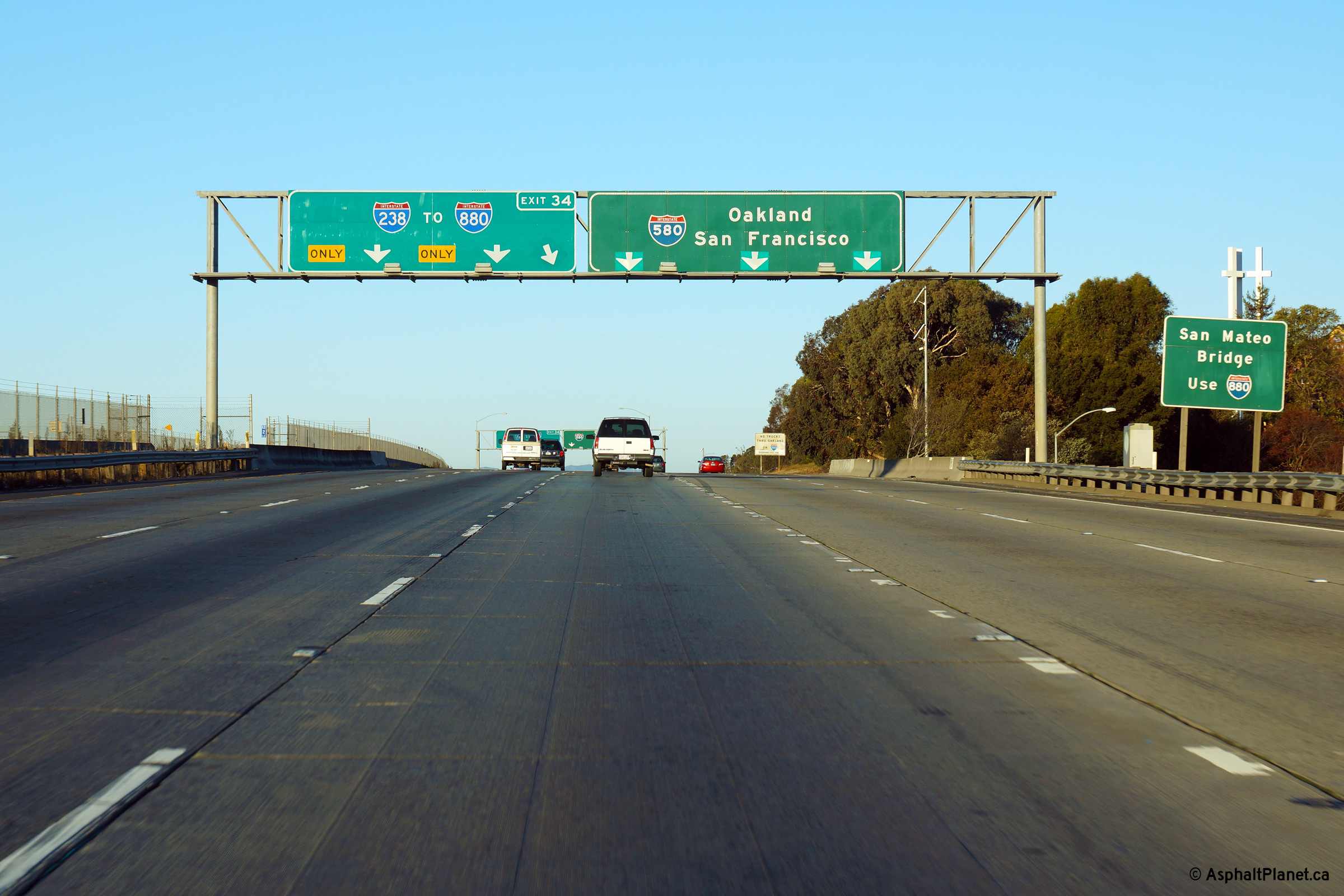
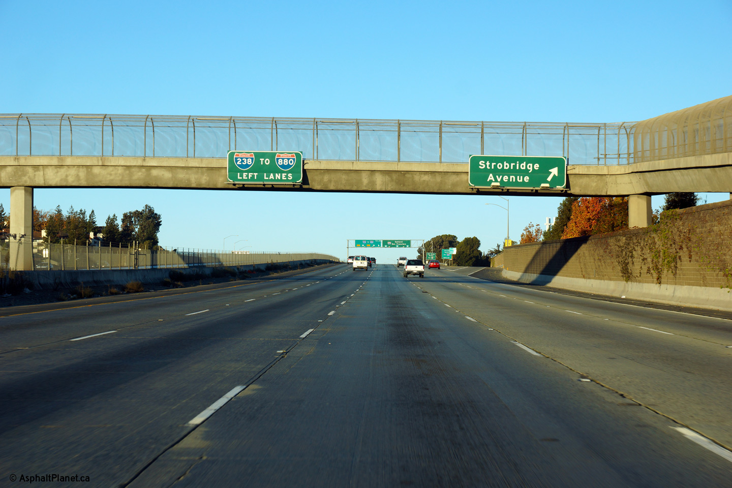
|
Alameda County Castro Valley |
Westbound signage at the left-exit to I-238. |
 |
||
|
Date: 11/03/2013 |
High-res: (1440x960) (2400x1600) | |||
|
Alameda County Castro Valley |
Advanced signage for the I-238 interchange. The numerical designation of I-238 is the source of vexation for numerous roadgeeks as there is no corresponding Interstate 38 for I-238 to be a loop of. In this case, I-238 gets its number from its continuation as California Highway 238. |
 |
||
|
Date: 11/03/2013 |
High-res: (1440x960) (2400x1600) | |||
|
Alameda County Castro Valley |
Westerly view as I-580 passes beneath the Nunes Avenue pedestrian overcrossing. |
 |
||
|
Date: 11/03/2013 |
High-res: (1440x960) (2400x1600) | |||
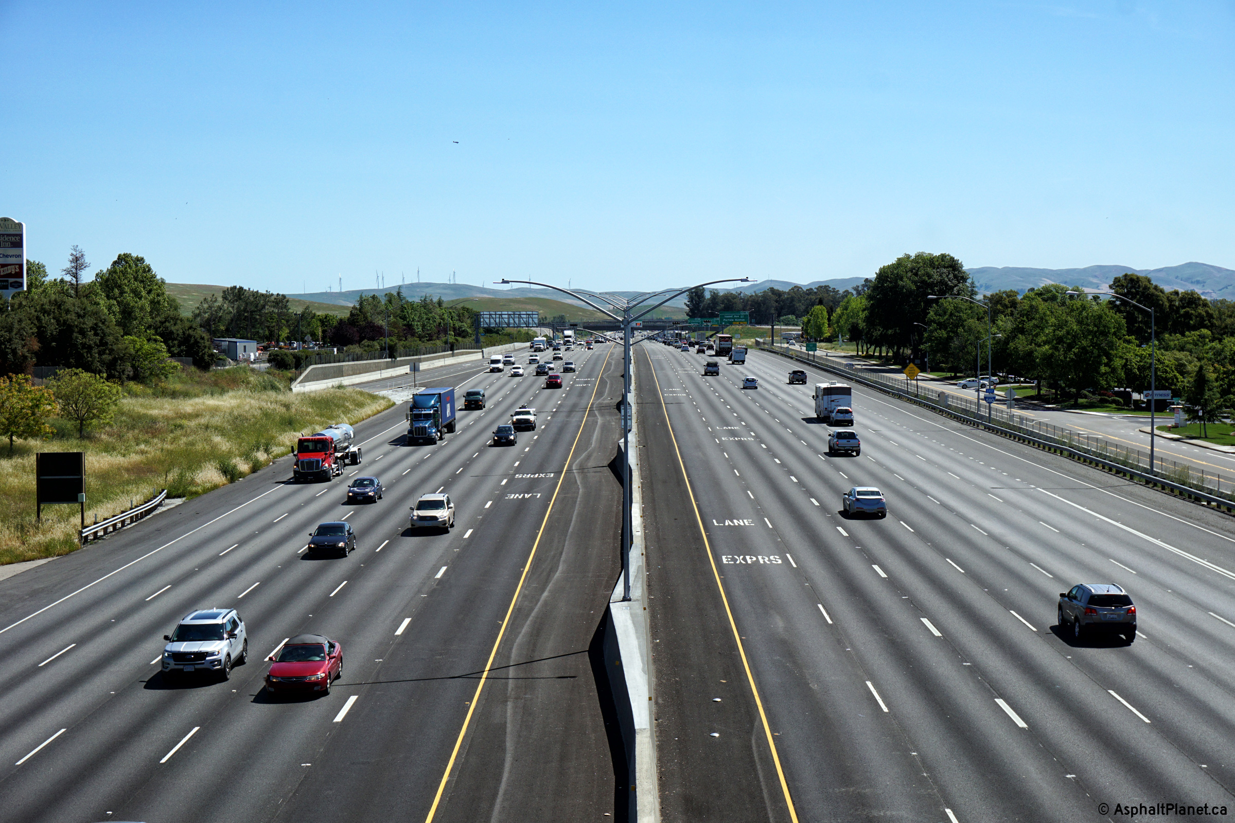
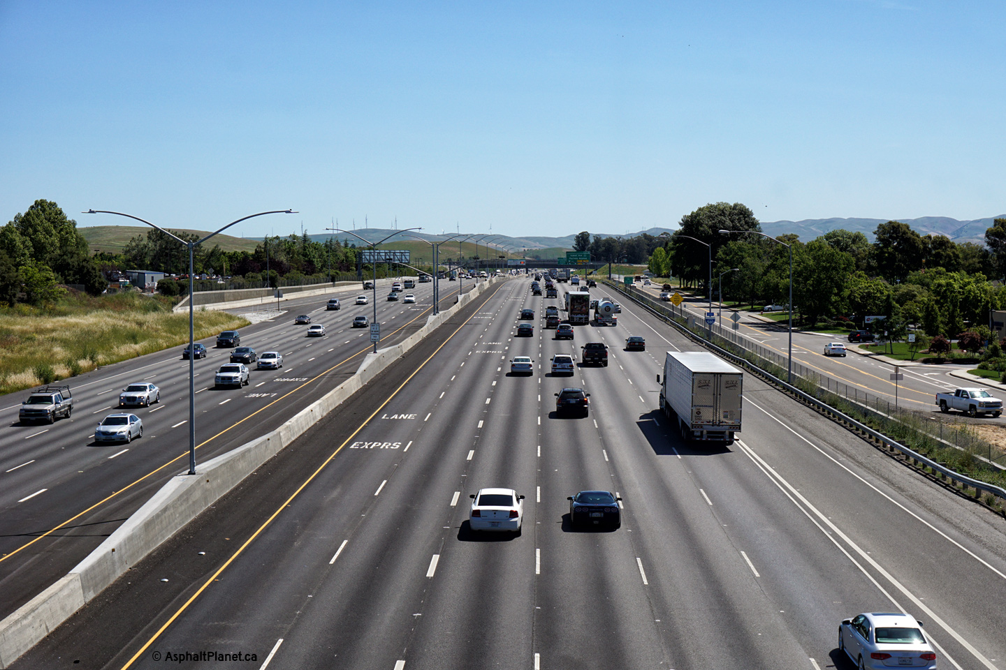
|
Alameda County Castro Valley |
Westerly view as I-580 passes beneath the Nunes Avenue pedestrian overcrossing. |
|||
|
Date: 11/03/2013 |
High-res: (1440x960) (2400x1600) | |||
|
Alameda County Castro Valley |
Westerly view as I-580 passes beneath the Nunes Avenue pedestrian overcrossing. |
|||
|
Date: 11/03/2013 |
High-res: (1440x960) (2400x1600) | |||
|
Alameda County Castro Valley |
Westerly view as I-580 passes beneath the Nunes Avenue pedestrian overcrossing. |
 |
||
|
Date: 11/03/2013 |
High-res: (1440x960) (2400x1600) | |||
|
Alameda County Castro Valley |
Westerly view as I-580 passes beneath the Nunes Avenue pedestrian overcrossing. |
 |
||
|
Date: 11/03/2013 |
High-res: (1440x960) (2400x1600) | |||
|
Alameda County Castro Valley |
Westerly view as I-580 passes beneath the Nunes Avenue pedestrian overcrossing. |
 |
||
|
Date: 11/03/2013 |
High-res: (1440x960) (2400x1600) | |||
|
Alameda County Castro Valley |
Westerly view as I-580 passes beneath the Nunes Avenue pedestrian overcrossing. |
 |
||
|
Date: 11/03/2013 |
High-res: (1440x960) (2400x1600) | |||
|
Alameda County Castro Valley |
Westerly view as I-580 passes beneath the Nunes Avenue pedestrian overcrossing. |
 |
||
|
Date: 11/03/2013 |
High-res: (1440x960) (2400x1600) | |||
|
Alameda County Castro Valley |
Westerly view as I-580 passes beneath the Nunes Avenue pedestrian overcrossing. |
 |
||
|
Date: 11/03/2013 |
High-res: (1440x960) (2400x1600) | |||
|
Alameda County Castro Valley |
Westerly view as I-580 passes beneath the Nunes Avenue pedestrian overcrossing. |
|||
|
Date: 11/03/2013 |
High-res: (1440x960) (2400x1600) | |||
|
Alameda County Castro Valley |
Westerly view as I-580 passes beneath the Nunes Avenue pedestrian overcrossing. |
 |
||
|
Date: 11/03/2013 |
High-res: (1440x960) (2400x1600) | |||
|
Alameda County Castro Valley |
Westerly view as I-580 passes beneath the Nunes Avenue pedestrian overcrossing. |
 |
||
|
Date: 11/03/2013 |
High-res: (1440x960) (2400x1600) | |||
|
Alameda County Castro Valley |
Westerly view as I-580 passes beneath the Nunes Avenue pedestrian overcrossing. |
 |
||
|
Date: 11/03/2013 |
High-res: (1440x960) (2400x1600) | |||
<- I-505
CA Highways
I-605 ->
AsphaltPlanet.ca
© 2010-14 AsphaltPlanet.ca.
AsphaltPlanet@asphaltplanet.ca
Page Created: April 3, 2014.
Last Updated: April 3, 2014.