
AsphaltPlanet.ca > California > Interstate 605
Pictures on this
page are arranged in order from south to north. I-605 North photos are
left-aligned in the last column, while I-605 South photos are right-aligned.
Center-line pictures are centered within the last column.
|
Location |
Description |
Photo |
||
|
North- |
South- |
|||
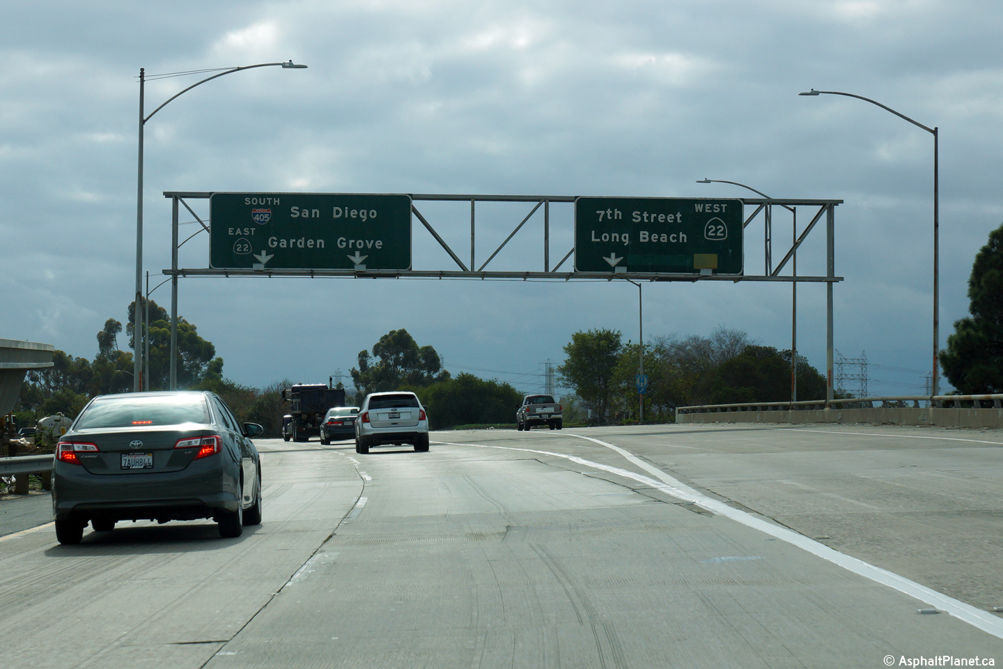
| The 605 ends at the 405 Freeway. The 405 is the San Diego Freeway, paralleling Interstate 5 through the western Los Angeles suburbs. Click here for Interstate 405 Images. | ||||
|
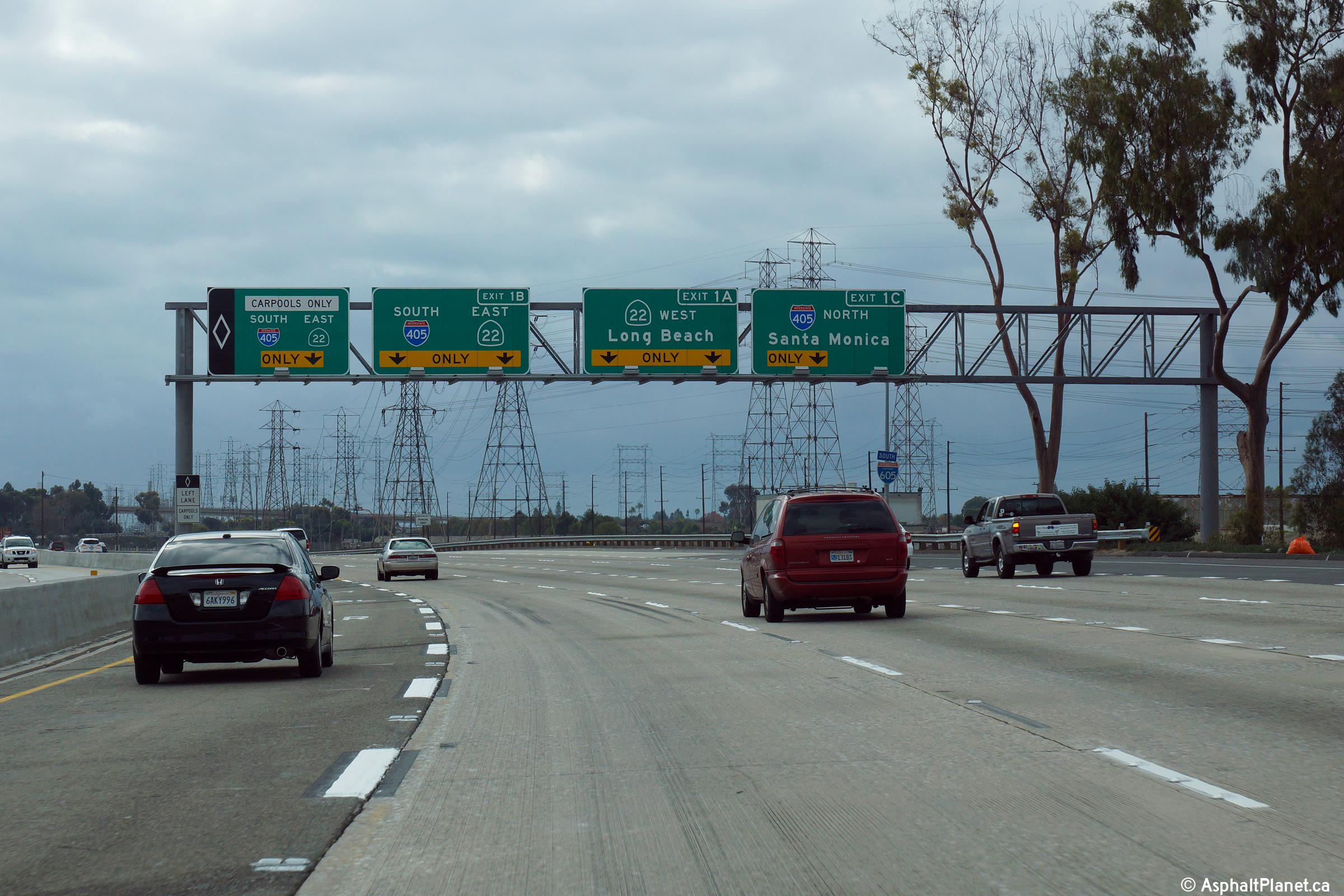
Los Angeles County |
Southbound signage along I-605 at the ramp to the southbound lanes to the 405 and to both directions of the 22 Freeway. |
 |
||
|
Date: 4/07/2010 |
High-res: (1440x960) (2400x1600) | |||
|
Los Angeles County |
Southbound signage at the off-ramp to the northbound lanes of the 405 Freeway. |
 |
||
|
Date: 4/07/2010 |
High-res: (1440x960) (2400x1600) | |||
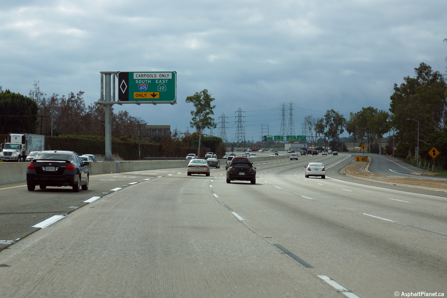
|
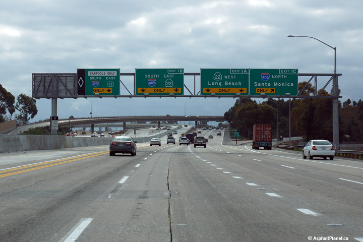
Los Angeles County |
Southbound advanced signage approaching the interchange with both the 405 and 22 Freeway interchanges. |
 |
||
|
Date: 4/07/2010 |
High-res: (1440x960) (2400x1600) | |||
|
Los Angeles County |
Overhead signage indicating that the southbound carpool lane continues on to join the 405 and 22 Freeways beyond the southern terminus of I-605. This carpool ramp was completed and opened to traffic late in 2014. |
 |
||
|
Date: 4/07/2010 |
High-res: (1440x960) (2400x1600) | |||
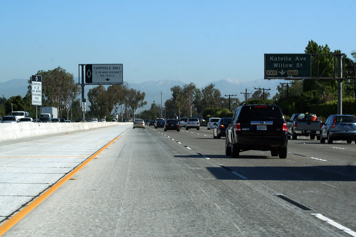
|
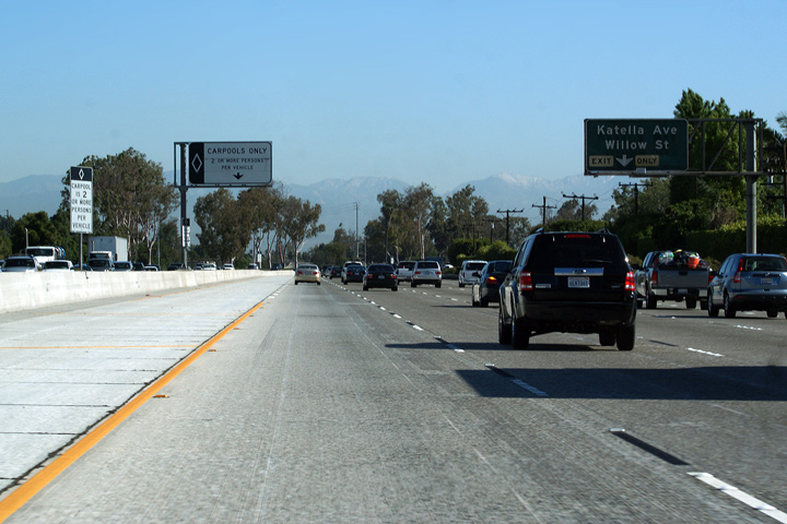
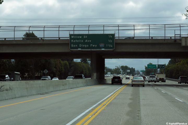
Orange County |
Exit signage heading north along the 605 Freeway for Katella Avenue and Willow Street. Katella Avenue and Willow Street is the first exit northbound along the 605 Freeway. The northbound carpool lane also begins in this photo. Starting in 2010, Caltrans will commence construction of a direct link between the carpool lanes on the 22 and 405 freeways to the carpool lane that starts here on the 605 freeway. This will make an already large and complex I-405/I-605/CA-22 interchange even more massive. |
 |
||
|
Date: 4/07/2010 |
||||
|
Los Angeles County |
Southbound signage along I-605 for the Foothills Freeway interchange. |
 |
||
|
Date: 4/07/2010 |
High-res: (1440x960) (2400x1600) | |||
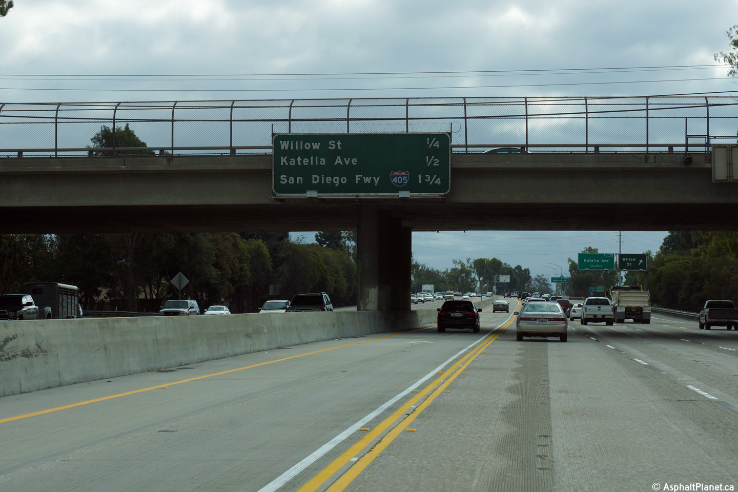
|
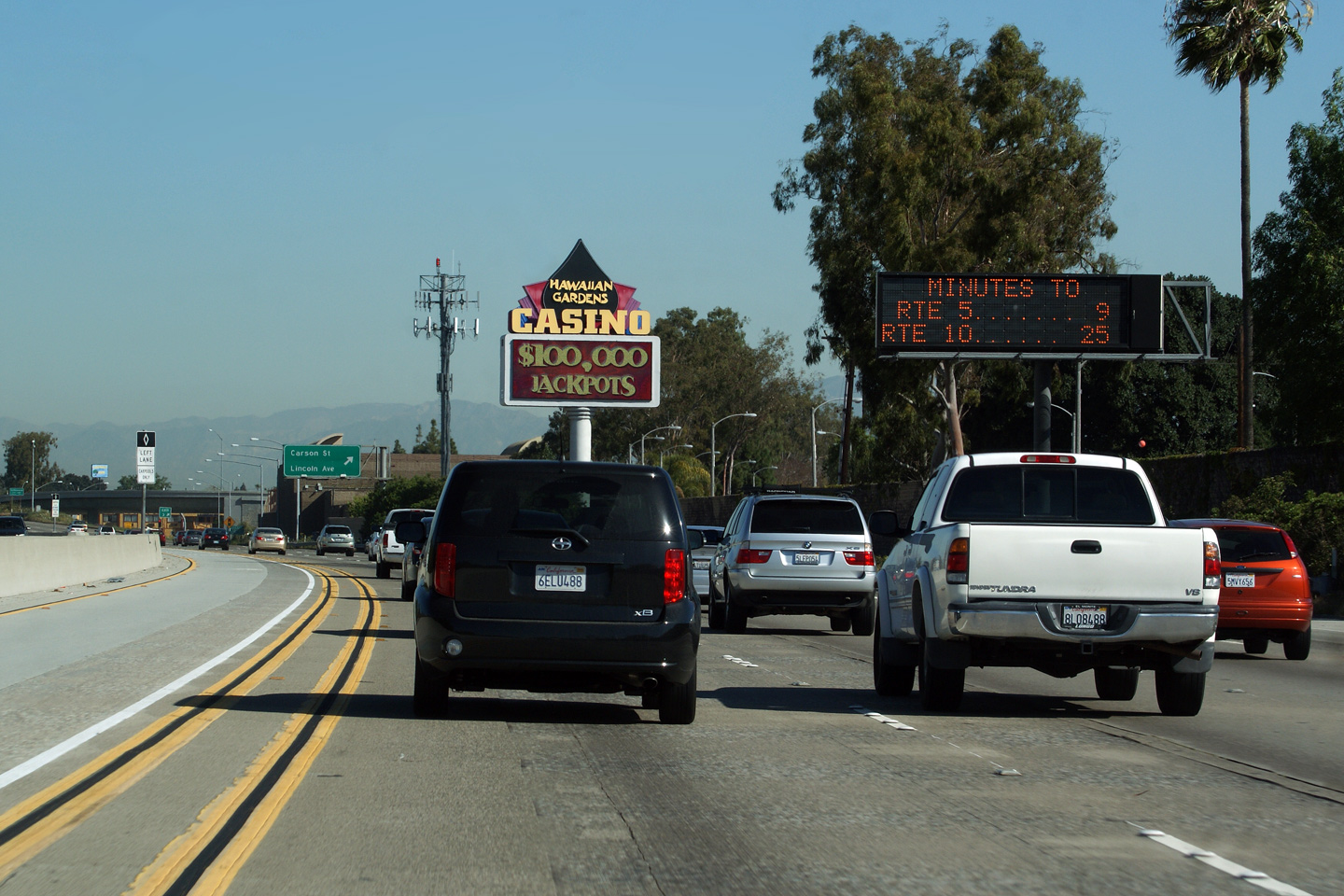
Los Angeles County |
Travel time sign northbound after the Katella Avenue and Willow Street interchange. From this point in the freeway it is just over 20 Miles to the 10 freeway; so, this sign indicates that the 605 is moving congestion free for most of its length. |
 |
||
|
Date: 4/07/2010 |
||||
|
Los Angeles County |
Median mounted next exit signage after the Carson Street interchange. |
 |
||
|
Date: 4/07/2010 |
||||
|
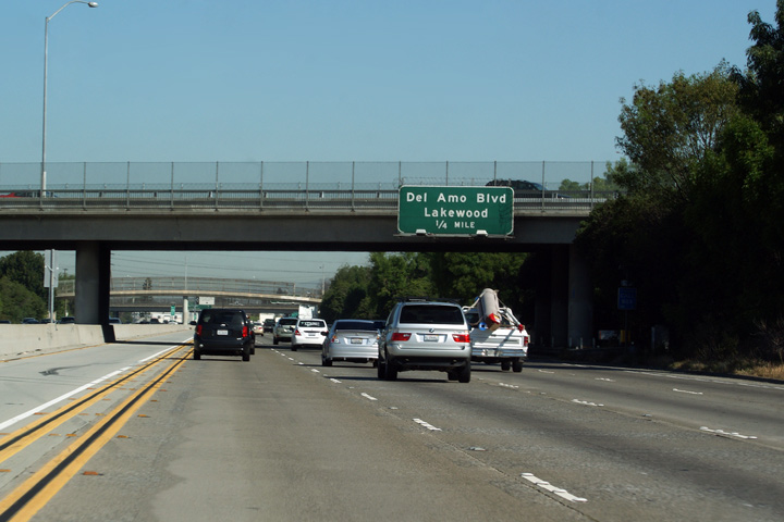
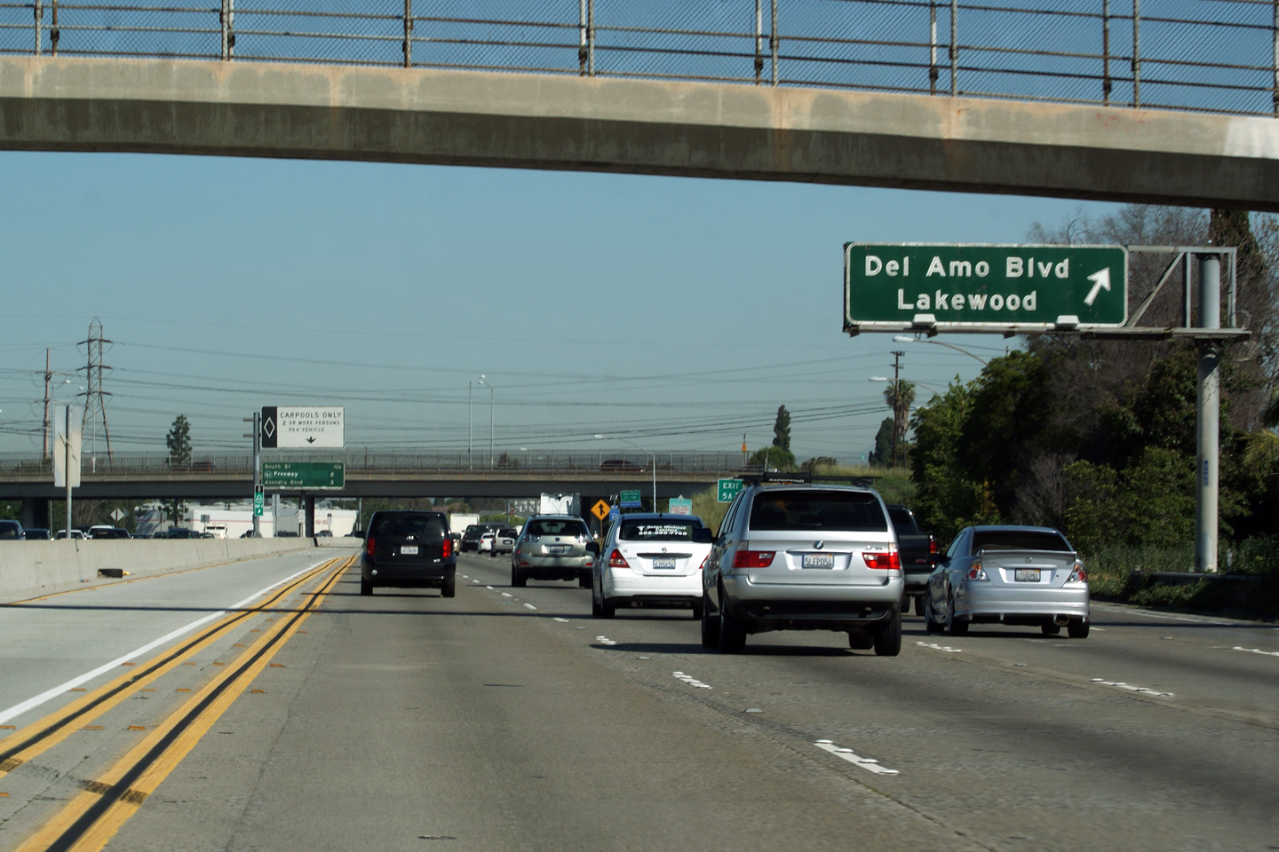
Los Angeles County |
Advanced exit signage for Del Amo Boulevard. |
 |
||
|
Date: 4/07/2010 |
||||
|
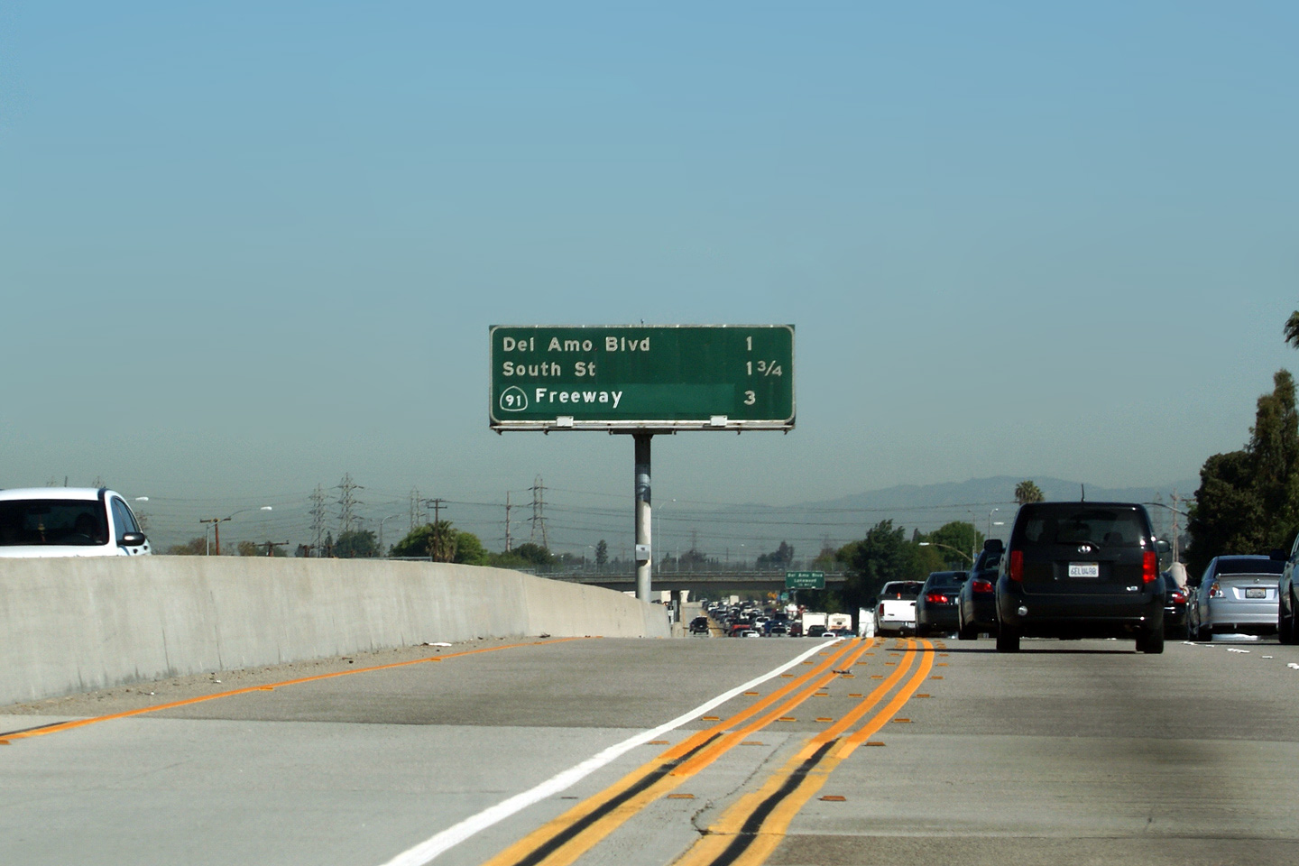
Los Angeles County |
Exit signage for Del Amo Boulevard situated just beyond a pedestrian overpass. Pedestrian overpasses are not particularly common on Californian Freeways. |
 |
||
|
Date: 4/07/2010 |
||||
|
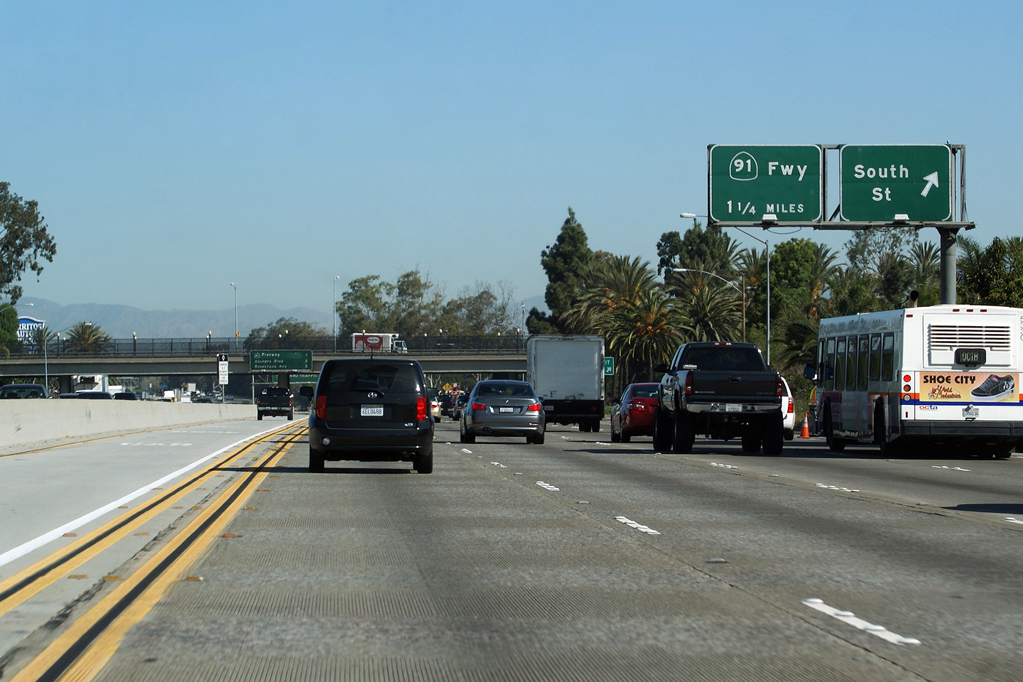
Los Angeles County |
Overhead signage at South Street for the South Street exit and in advance of the 91 Freeway. |
 |
||
|
Date: 4/07/2010 |
High-res | |||
|
Los Angeles County |
Pull-through signage in advance of the interchanged to the 91 Freeway. The 605 Freeway is never posted with a northbound control city. The freeway ends in Duarte, a small suburb in the foothills of the San Gabriel Mountains. |
 |
||
|
Date: 4/07/2010 |
||||
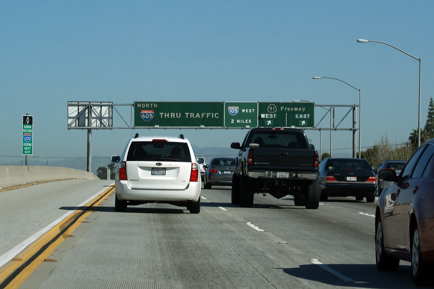
|
Los Angeles County |
Pull through signage at the Highway 91 interchange. Take notice of the fact that the interchange with the Century Freeway (Interstate 105) is also indicated on the pull through signage. The Century Freeway is the next major east-west highway through Los Angeles, and as the sign indicates, is only two miles north of the 91 Freeway. |
 |
||
|
Date: 4/07/2010 |
||||
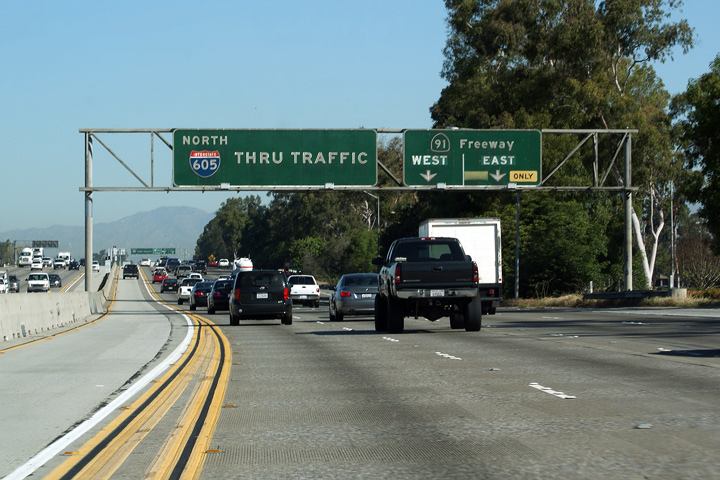
|
Los Angeles County |
Next exit signage found in front of the flyover from Highway 91-East to Interstate-605 North. |
 |
||
|
Date: 4/07/2010 |
||||
| Highway 91 is an east-west freeway that links Southern Los Angeles County to Riverside County. Click here for Highway 91 Images. | ||||
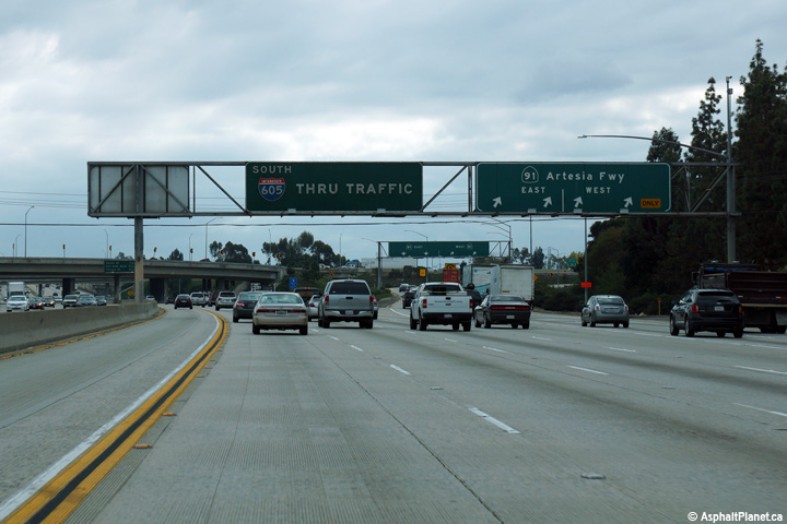
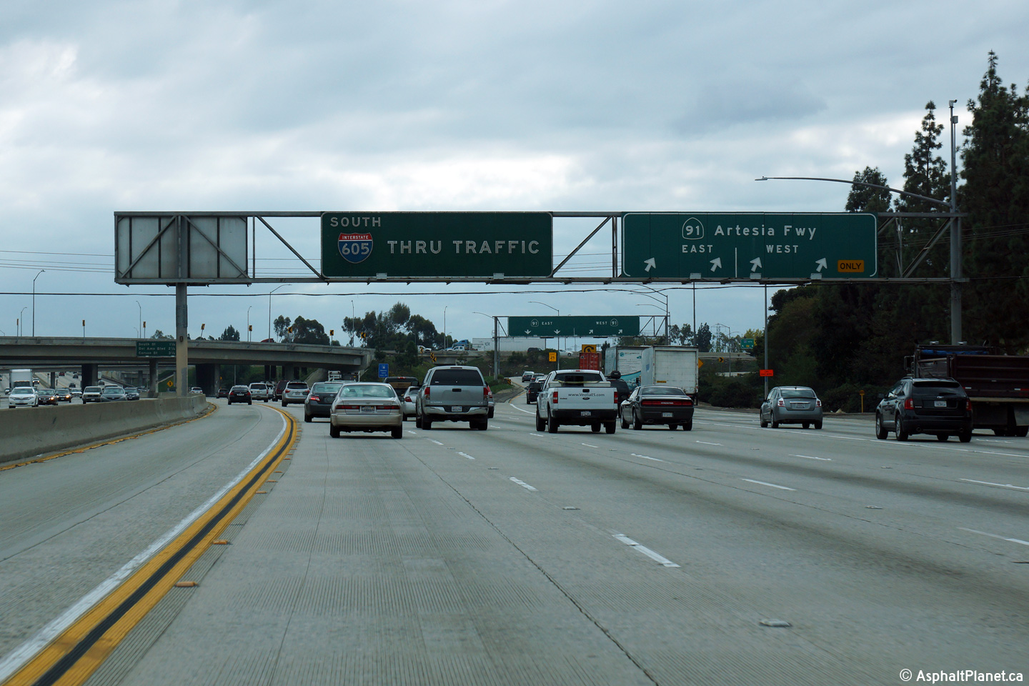
|
Los Angeles County |
Southbound signage at the off-ramp to the 91 Freeway. Note that this signage indicates this portion of the 91 Freeway as the Artesia Freeway. Few signs indicating the 91 Freeway as the Artesia Freeway remain. |
 |
||
|
Date: 4/07/2010 |
High-res: (1440x960) (2400x1600) | |||
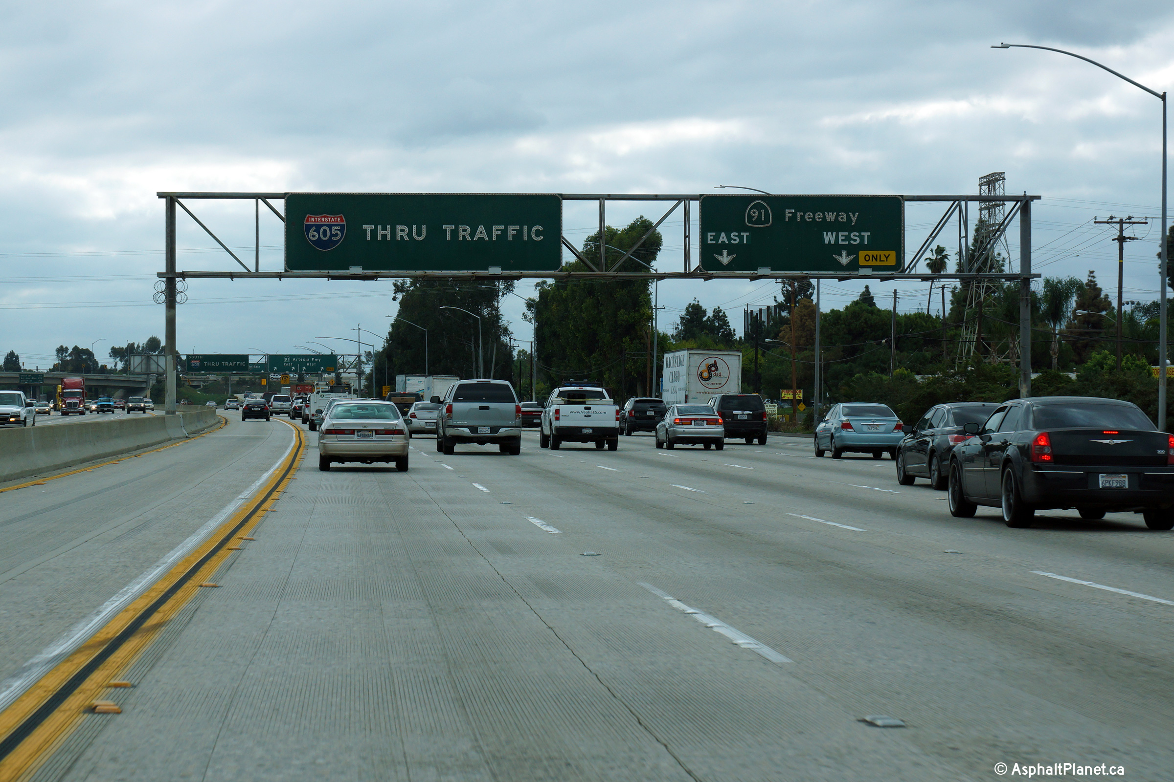
|
Los Angeles County |
Southbound advanced signage approaching the 91 Freeway interchange. |
 |
||
|
Date: 4/07/2010 |
High-res: (1440x960) (2400x1600) | |||
|
Los Angeles County |
Southbound signage along I-605 for the Foothills Freeway interchange. |
 |
||
|
Date: 4/07/2010 |
High-res: (1440x960) (2400x1600) | |||
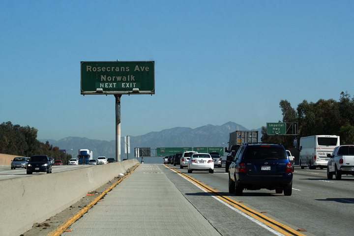
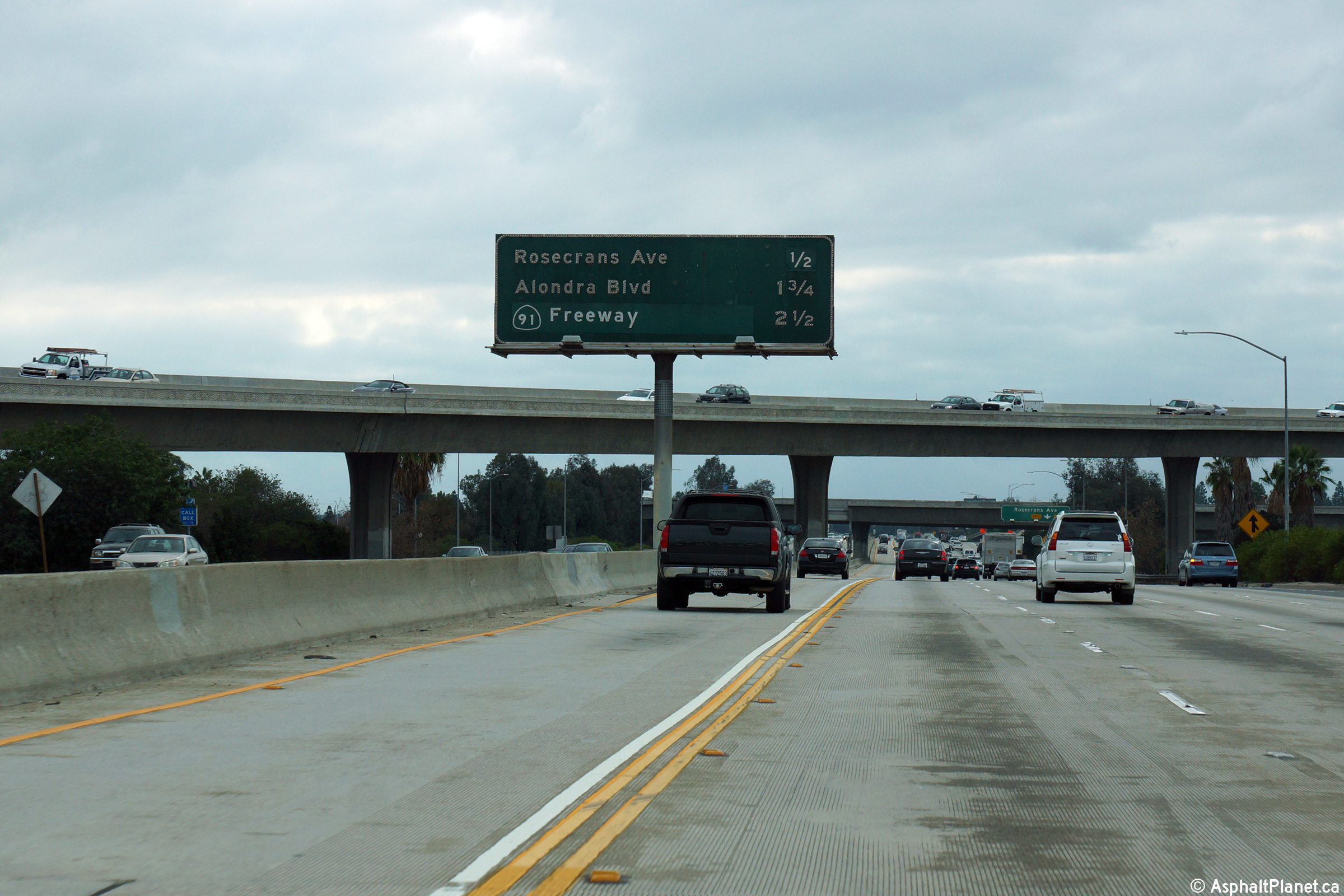
|
Los Angeles County |
Median mounted next exit signage for Rosecrans Avenue. Due to the shear width of some Los Angeles area freeways, these median mounted signs prove to be really helpful. |
 |
||
|
Date: 4/07/2010 |
High-res | |||
|
Los Angeles County |
Exit signage for Rosecrans Avenue with an advanced pull through sign for the Century Freeway. |
 |
||
|
Date: 4/07/2010 |
||||
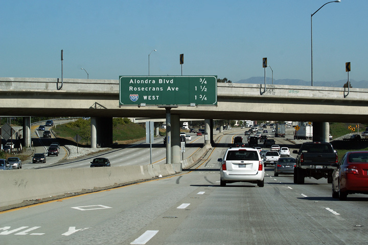
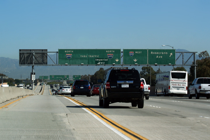
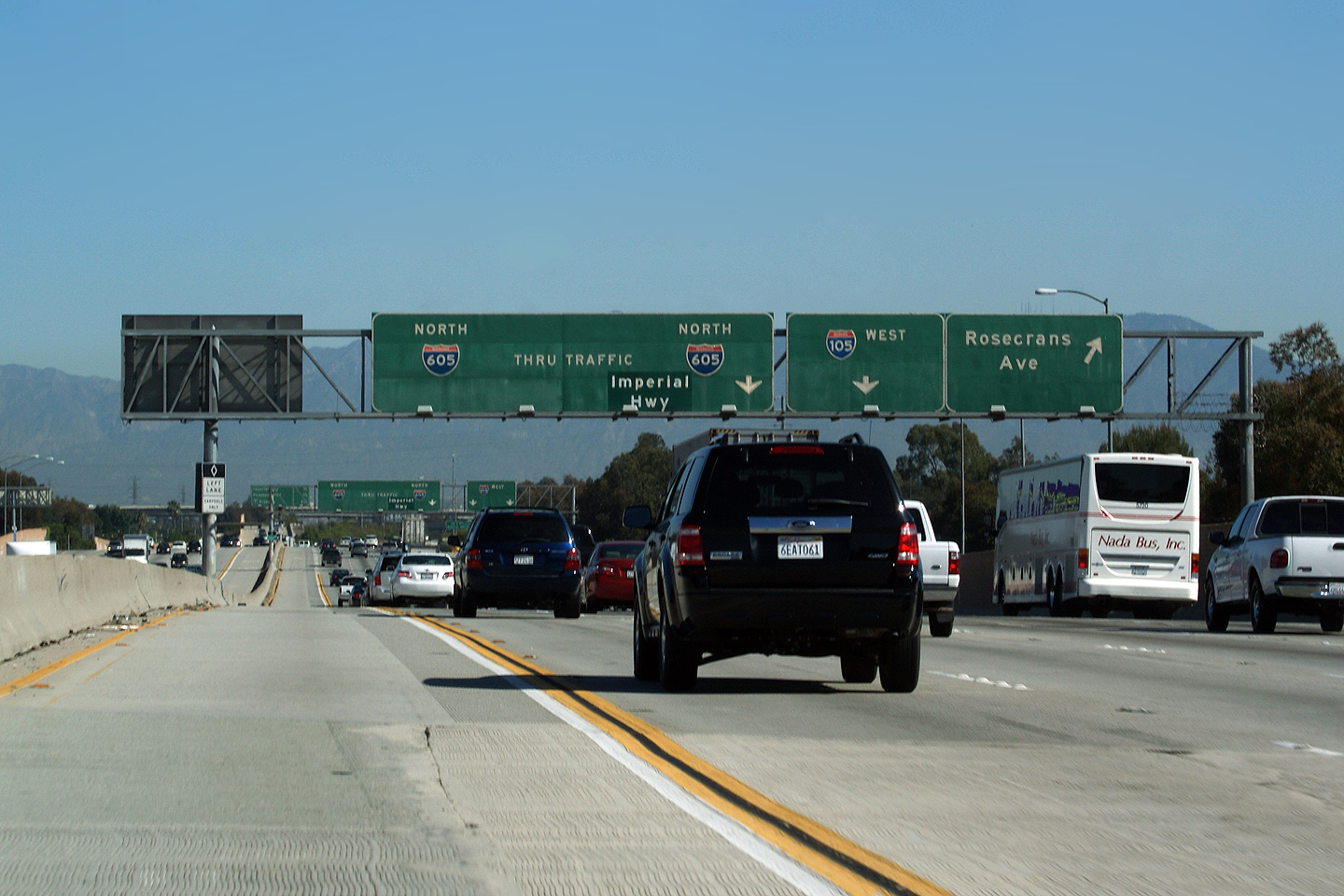
|
Los Angeles County |
Exit signage for the Century Freeway (I-105) from the northbound 605 Freeway. The reference to Imperial Highway on the pull-through signage is obviously a retrofit. The ramp for the Imperial Highway departs the 605 Freeway shortly after this interchange. |
 |
||
|
Date: 4/07/2010 |
||||
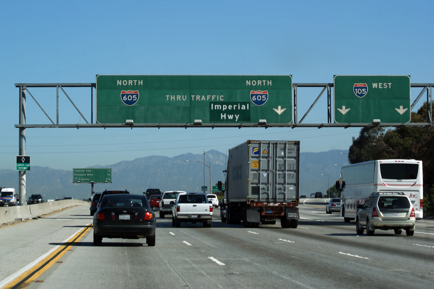
|
Los Angeles County |
Next exit signage after the ramp to the Century Freeway. |
 |
||
|
Date: 4/07/2010 |
High-res | |||
| The 105 (Century Freeway) begins westerly from the 605 Freeway by-passing Downtown LA to the south, bound for LAX Airport. Click here for Interstate 105 Images. | ||||
|
Los Angeles County |
Southbound interchange sequence signage along 605 Freeway located within the Century Freeway interchange. |
 |
||
|
Date: 4/07/2010 |
High-res: (1440x960) (2400x1600) | |||
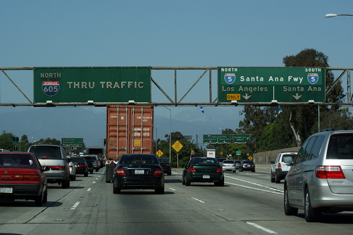
|
Los Angeles County |
Button copy advanced signage for the Interstate 5 Freeway interchange. The 605 Freeway serves as an important link between The 105 and 5 Freeways. The 105 Freeway ends at the 605 Freeway about 2 Miles west of The Santa Ana Freeway (Interstate 5). There is no easy way to link the 105 and 5 Freeways without destroying a good chunk of the City of Norwalk. |
|
||
|
Date: 3/27/2010 |
||||
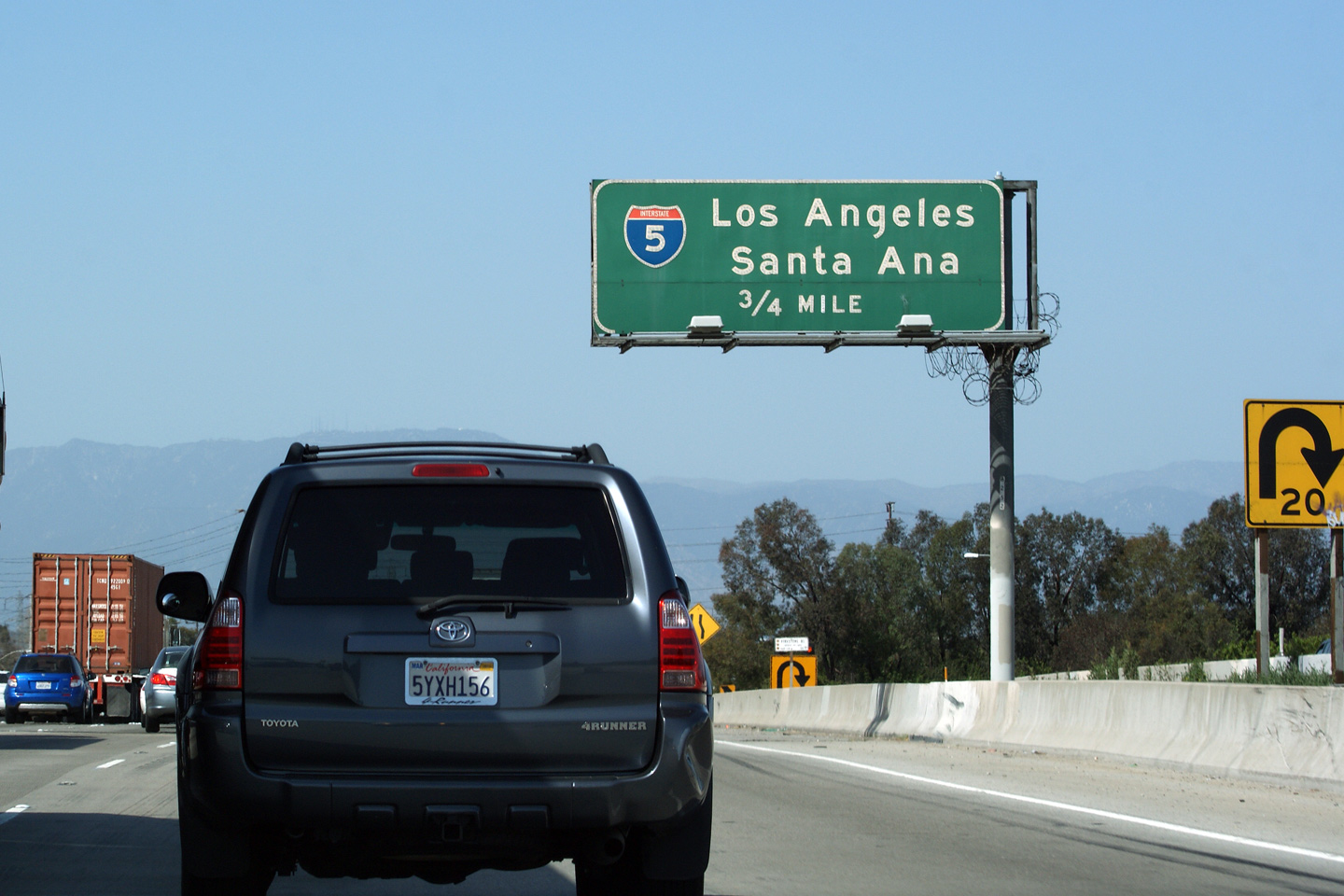
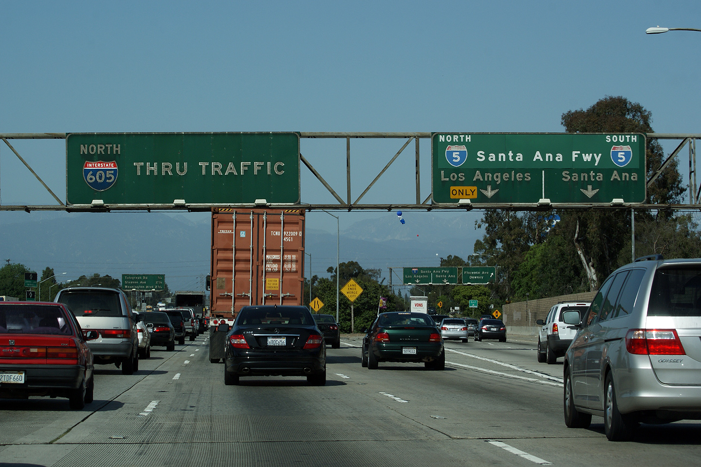
|
Los Angeles County |
Signage at the ramp to Interstate 5 from The 605 heading north. Interstate 5 meets The 605 Freeway at a clover-stack interchange. The 605 is the top level of the two level interchange. |
 |
||
|
Date: 3/27/2010 |
High-res | |||
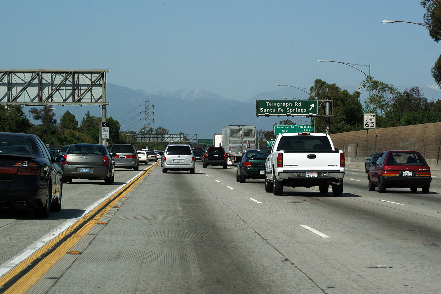
|
Los Angeles County |
Partial overhead sign for Telegraph Road. |
 |
||
|
Date: 3/27/2010 |
||||
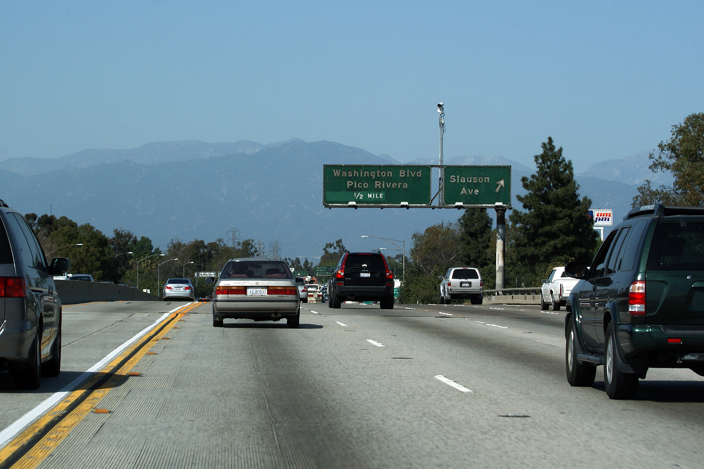
|
Los Angeles County |
Exit signage for Slauson Avenue. |
|
||
|
Date: 3/27/2010 |
||||
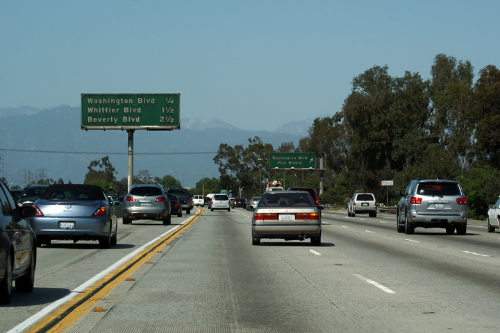
|
Los Angeles County |
Next exit signage in almost directly opposite the exit to Washington Boulevard. It is not unusual for next exit signage to be placed absurdly close to the next exit. In this situation, the next exit signage doubles as an advanced sign for Washington Boulevard. |
 |
||
|
Date: 3/27/2010 |
||||
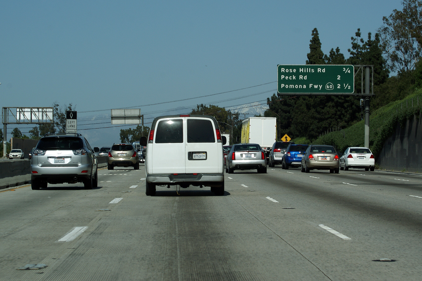
|
Los Angeles County |
Next exit signage approaching the Rose Hills Road interchange along I-605 North. This is the first northbound sign to reference to Pomona Freeway. |
 |
||
|
Date: 3/27/2010 |
High-res | |||
|
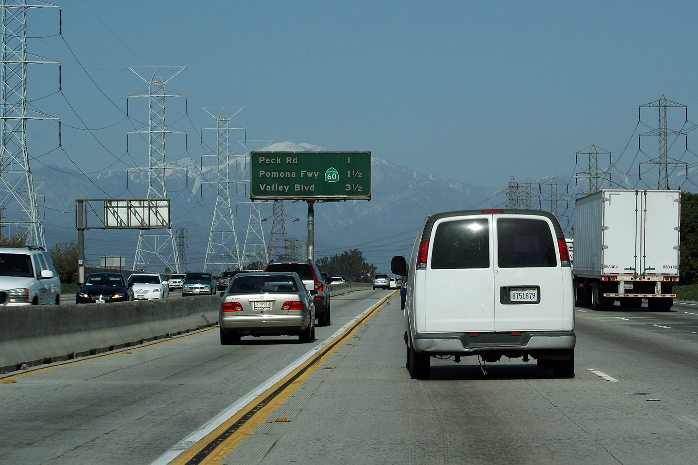
Los Angeles County |
Another next exit sign, this time approaching the Peck Road interchange. This sign is interesting since the California Highway 60 sign was obviously added to the sign after it was installed. During the early days of the freeway era in Los Angeles, freeways were often just designated by a name, not by a number. |
 |
||
|
Date: 3/27/2010 |
||||
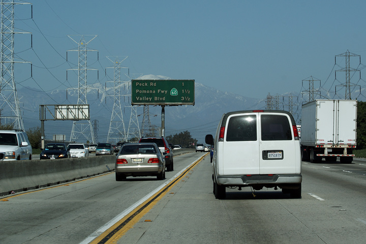
|
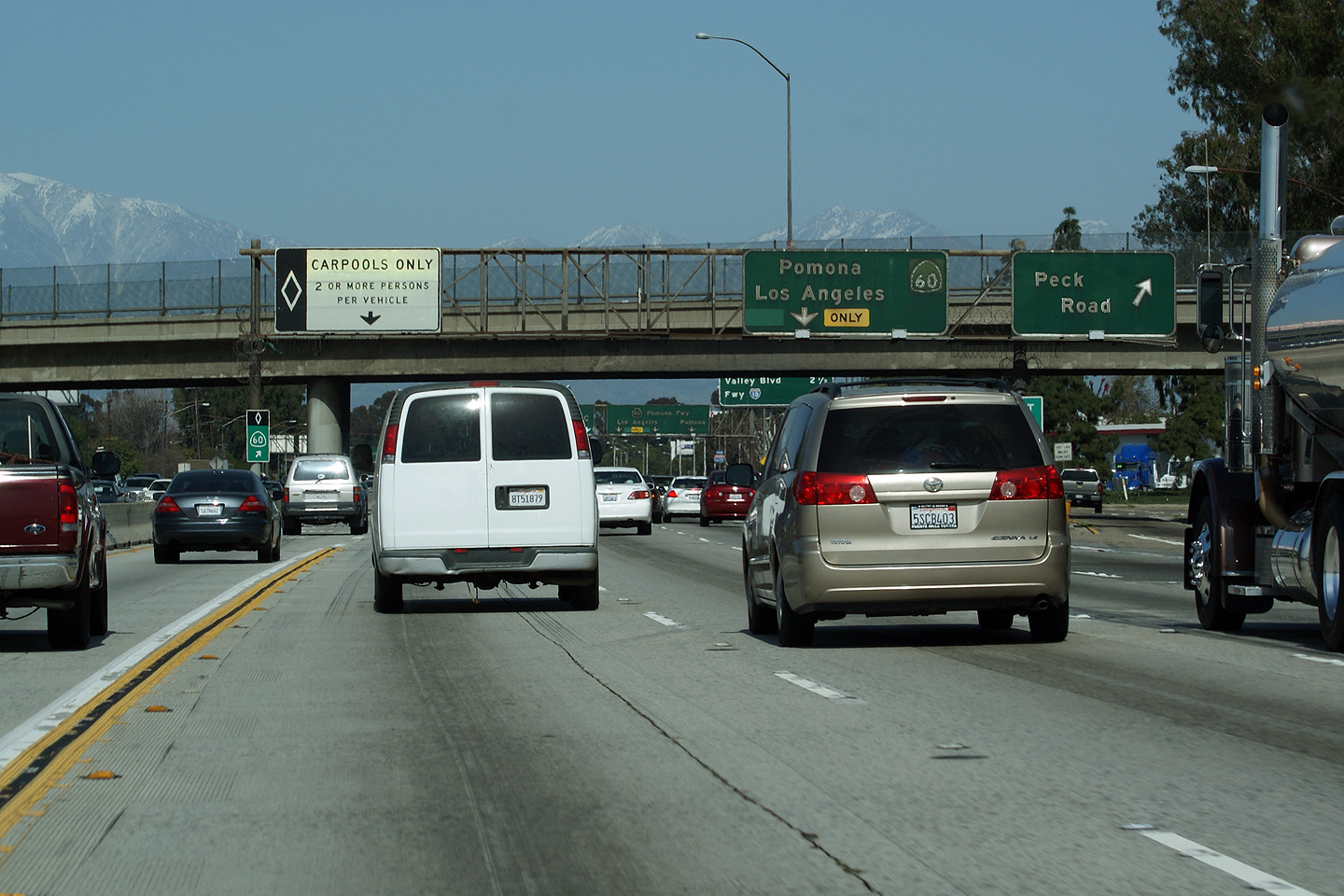
Los Angeles County |
Overhead signage at the Peck Road interchange. |
 |
||
|
Date: 3/27/2010 |
||||
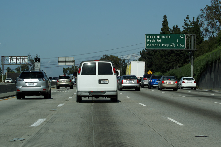
|
Los Angeles County |
Next exit signage after the Peck Road interchange. This sign references both the Pomona Freeway (Highway 60) and the San Bernardino Freeway (Interstate 10). The 10 Freeway is just over three miles past the Pomona Freeway. |
|
||
|
Date: 3/27/2010 |
||||
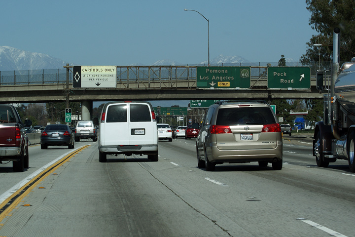
|
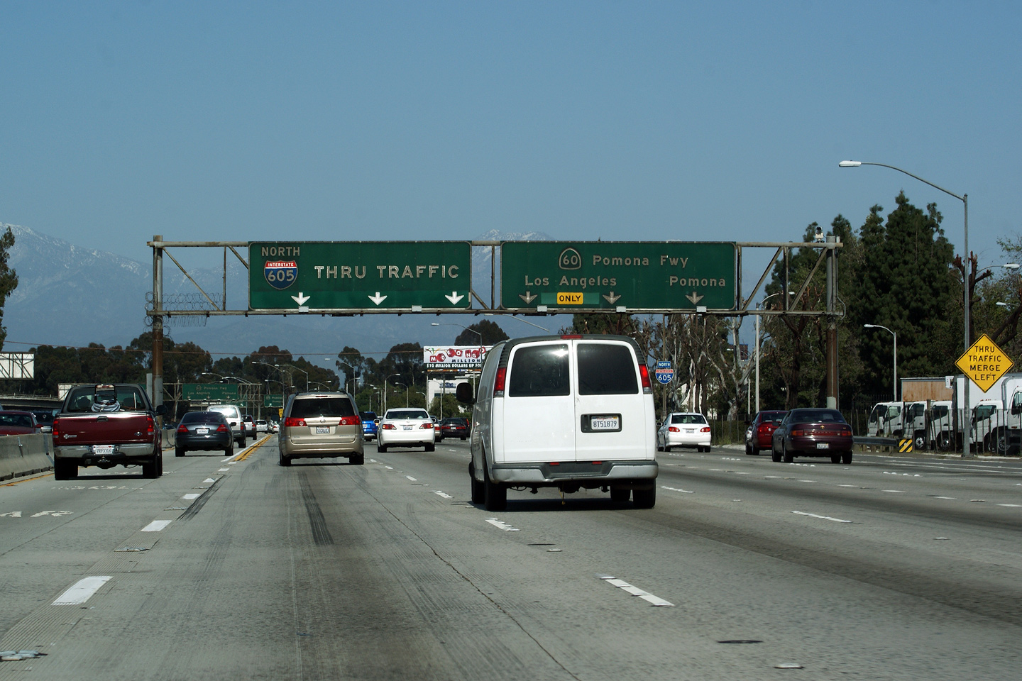
Los Angeles County |
Advanced signage for the ramp to the Pomona Freeway from the 605 Freeway north. Three right lanes depart from the 605 Freeway for the Pomona Freeway. |
 |
||
|
Date: 3/27/2010 |
High-res: (1440x960) (2400x1600) |
|||
|
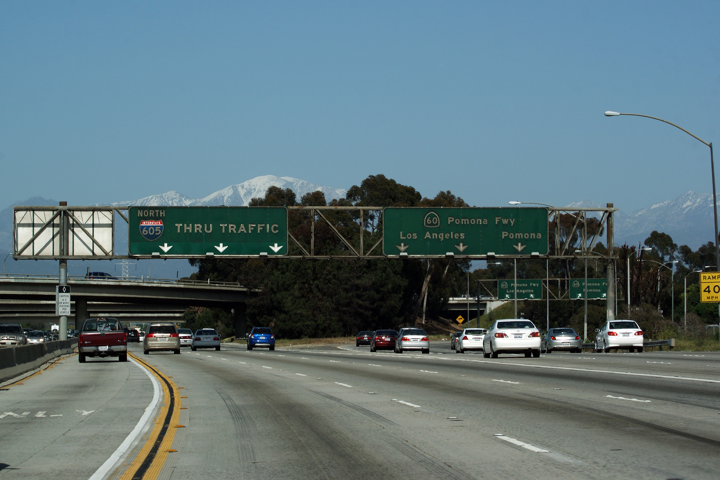
Los Angeles County |
Pull-through signage at the northbound ramp from Interstate 605 to the Pomona Freeway. The Pomona Freeway (or the 60 Freeway as it is sometimes known) is the most southern of three parallel east-west freeways that link Los Angeles and San Bernardino Counties together. |
 |
||
|
Date: 3/27/2010 |
High-res: (1440x960) (2400x1600) | |||
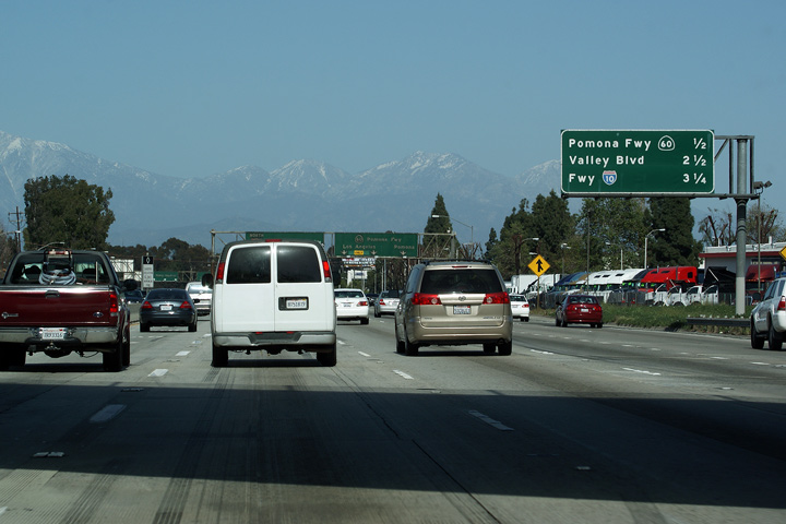
|
Los Angeles County |
Median mounted next exit signage just north of the Pomona Freeway. The 10 Freeway is only the second interchange north of the Pomona Freeway along the 605. |
 |
||
|
Date: 3/27/2010 |
||||
|
Los Angeles County |
First overhead pull-through assembly for the San Bernardino Freeway along the 605 North. |
 |
||
|
Date: 3/27/2010 |
||||
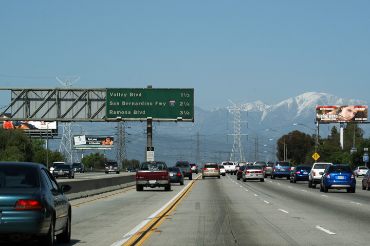
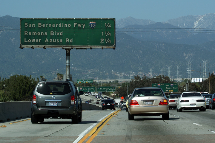
|
Los Angeles County |
Median mounted next exit signage in advance of the San Bernardino Freeway interchange. |
|
||
|
Date: 3/27/2010 |
||||
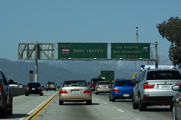
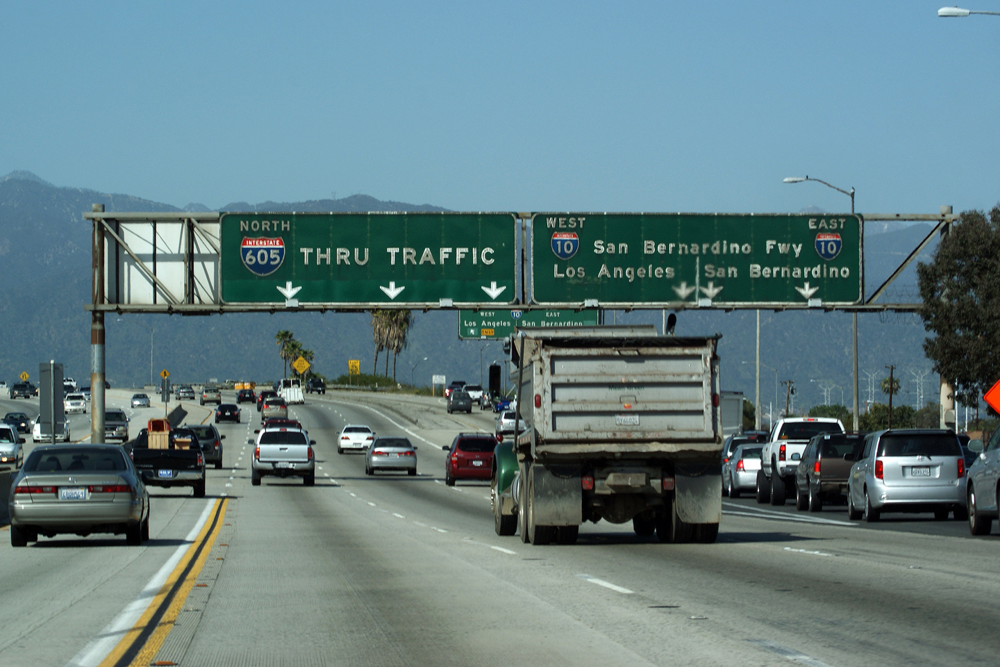
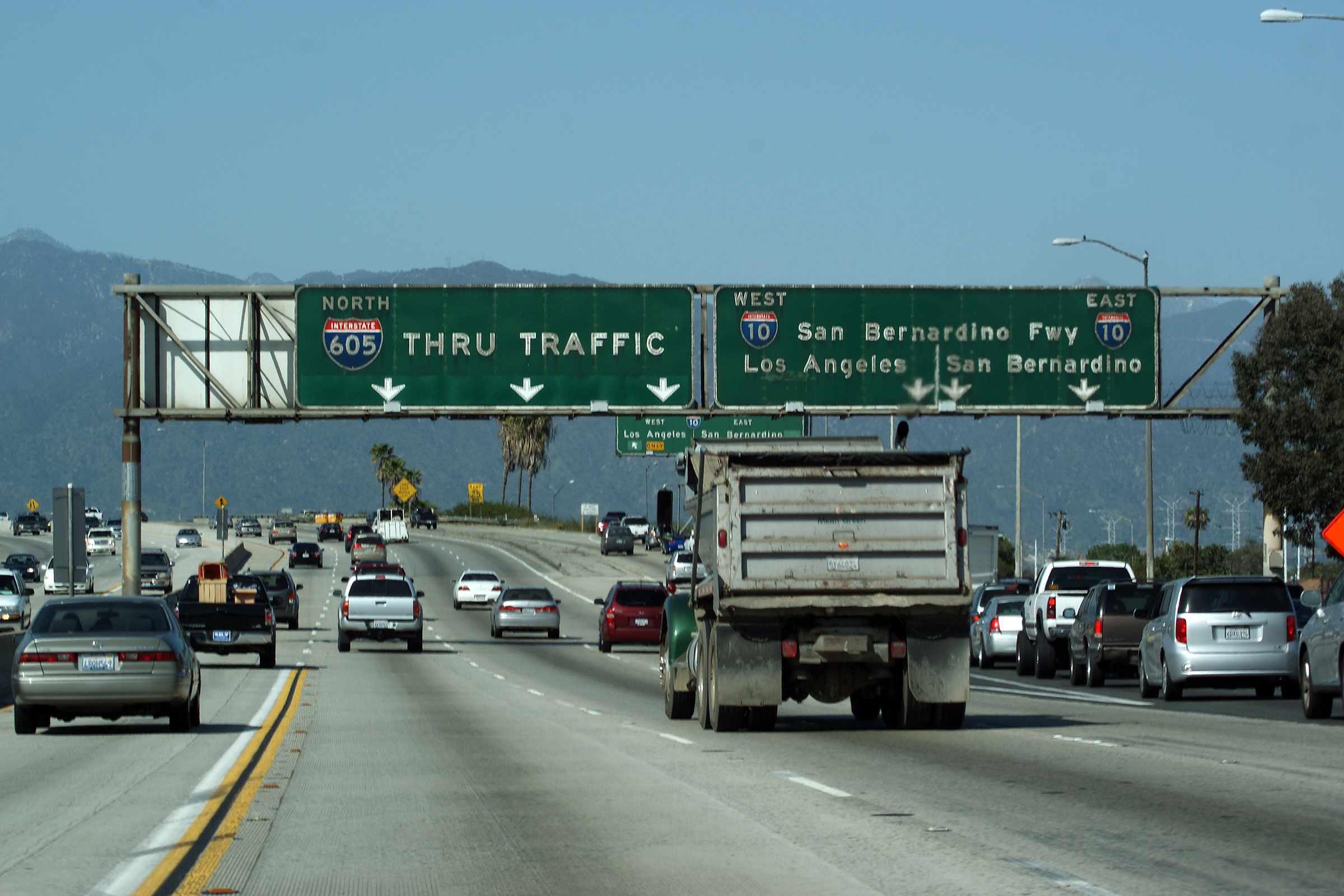
|
Los Angeles County |
Pull-through signage at the San Bernardino Freeway interchange. The 605 Freeway meets the 10 at a rather under-designed modified half cloverleaf design. The San Bernardino Freeway (I-10) is one of the older freeways in Los Angeles County, and its interchange design certainly reflects the freeway's age. |
 |
||
|
Date: 3/27/2010 |
High-res: (1440x960) (2400x1600) | |||
| The San Bernardino Freeway is the principal highway linking Las Angeles and San Bernardino Counties. Click here for Interstate 10 Images. | ||||
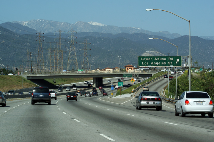
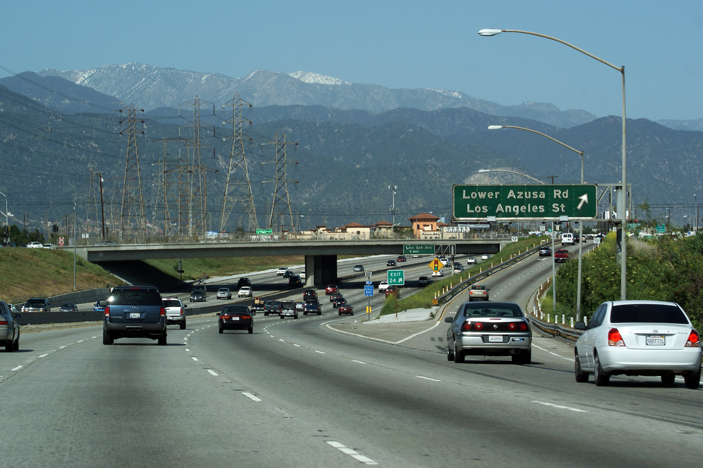
|
Los Angeles County |
Approaching the Los Angeles Street interchange in Irwindale. This is the image that appears in title picture for this webpage. |
 |
||
|
Date: 3/27/2010 |
High-res: (1440x960) (2400x1600) | |||
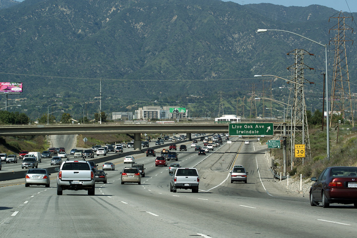
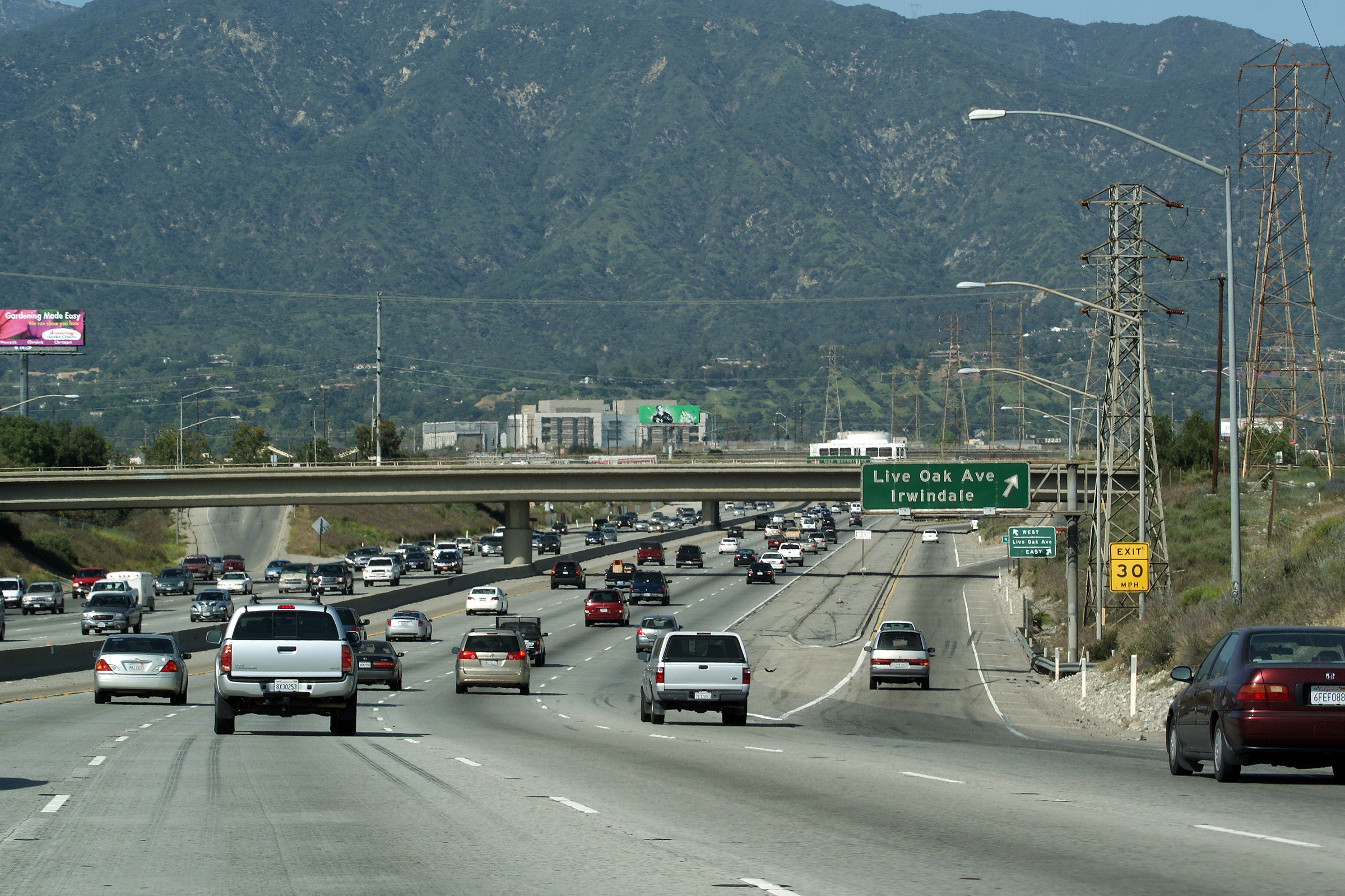
|
Los Angeles County |
Northbound view as the 605 Freeway approaches the Live Oak Road interchange. |
 |
||
|
Date: 3/27/2010 |
High-res: (1440x960) (2400x1600) |
|||
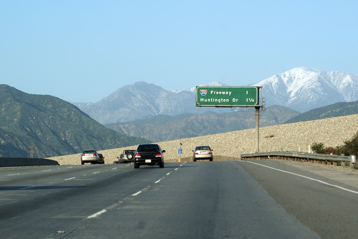
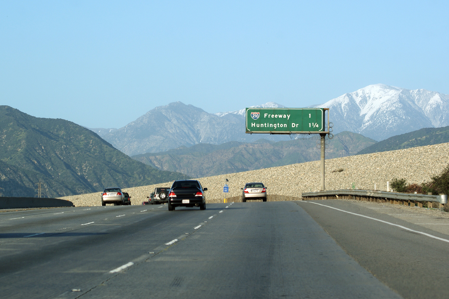
|
Los Angeles County |
Advanced signage for the Foothills Freeway interchange. The snow-capped San Gabriel Mountains frame this sign photo quite nicely. |
 |
||
|
Date: 3/27/2010 |
High-res: (1440x960) (2400x1600) |
|||
|
Los Angeles County |
Northbound lane assignment overhead sign denoting the upcoming Foothill Freeway interchange. The ramp to Huntington Boulevard is notably absent from this overhead sign. |
 |
||
|
Date: 3/27/2010 |
High-res | |||
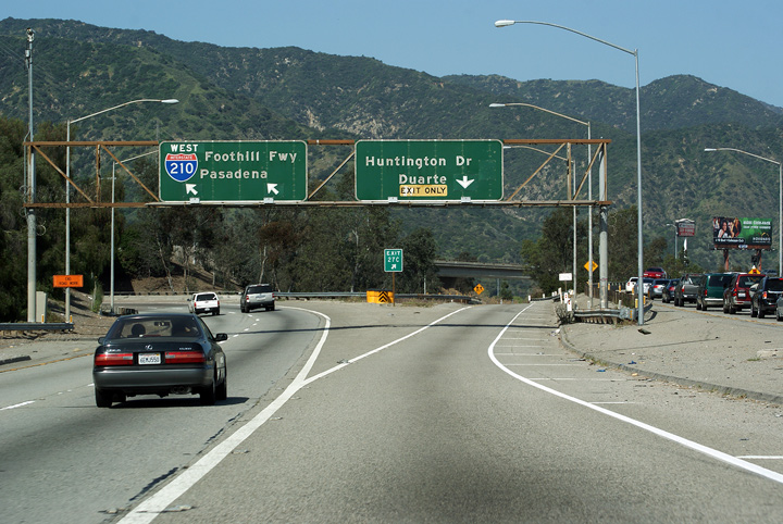
|
Los Angeles County |
Overhead signage at the Foothills Freeway interchange including signage to the ramp to Huntington Boulevard. |
 |
||
|
Date: 3/27/2010 |
High-res: (1440x960) (2400x1600) |
|||
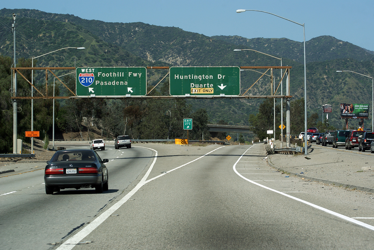
|
Los Angeles County |
The ramp to Huntington Drive departs from the ramp to the Pasadena-bound Foothills Freeway. Huntington Drive is the historic alignment of US Route 66 through Eastern Los Angeles County. |
 |
||
|
Date: 3/27/2010 |
||||
| The Foothill Freeway follows the southern side of the San Gabriel Mountains through Los Angeles and San Bernardino Counties. Click here for Interstate 210 Images. | ||||
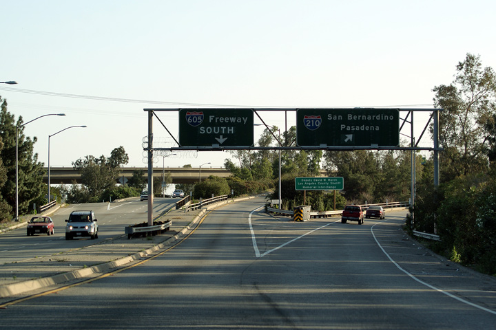
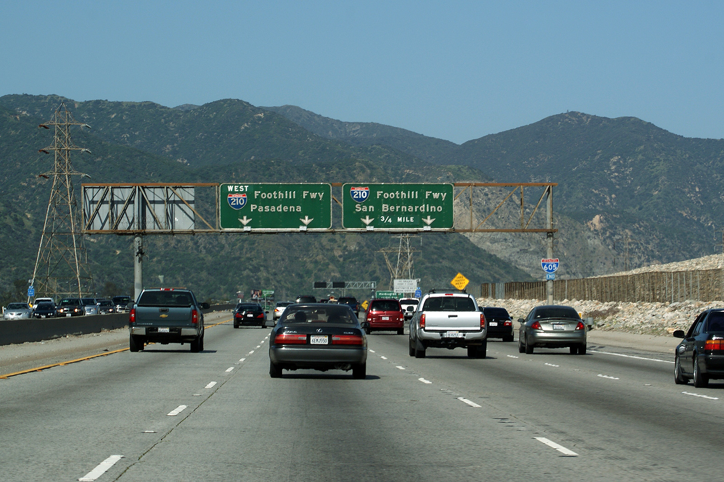
|
Los Angeles County |
Southbound signage along I-605 for the Foothills Freeway interchange. |
 |
||
|
Date: 4/07/2010 |
||||
<- I-380
CA Highways
I-680 ->
AsphaltPlanet.ca
© 2010-15 AsphaltPlanet.ca.
AsphaltPlanet@asphaltplanet.ca
Page Created: June 21, 2010.
Last Updated: March 30, 2016

