AsphaltPlanet.ca > California > Interstate 105
Pictures on this
page are arranged in order from west to east. I-105 East photos are
left-aligned in the last column, while I-105 West photos are right-aligned.
Center-line pictures are centered within the last column.
|
Location |
Description |
Photo |
||
|
East- |
West- |
|||
|
Los Angeles County |
Eastbound signage at the start of Interstate 105 (Century Freeway) west of LAX. Between this point and the 405 Freeway, the Century Freeway runs on an elevated structure overtop of Imperial Boulevard. Much of the car chase scene at the end of the Die Hard 4 movie were filmed on Imperial Boulevard underneath the Century Freeway. |
 |
||
|
Date: 4/07/2010 |
High-res: (1440x960) (2400x1600) |
|||
|
Los Angeles County |
Guide signage denoting the western end of the Century Freeway located just west of the Interstate 405 interchange. The Century Freeway sits high atop an elevated structure from the 405 interchange to west to the Imperial Highway. |
 |
||
|
Date: 4/07/2010 |
||||
|
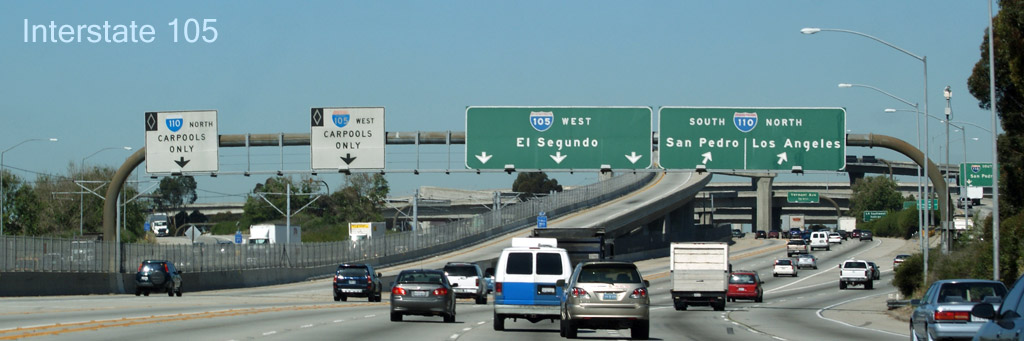
Los Angeles County |
Eastbound advanced signage for the ramp to the 405 Freeway from the Interstate 105. |
 |
||
|
Date: 4/07/2010 |
High-res: (1440x960) (2400x1600) |
|||
|
Los Angeles County City of El Segundo |
View easterly at the off-ramp to the 405 Freeway. The Century Freeway is considerably busier to the east of the 405 than it is to the west. |
 |
||
|
Date: 4/07/2010 |
High-res: (1440x960) (2400x1600) |
|||
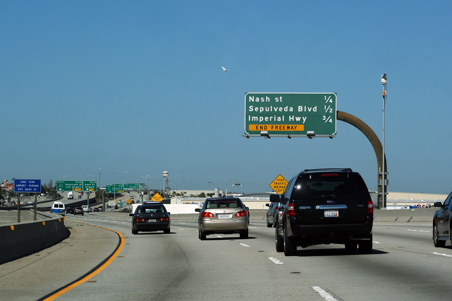
| The Santa Monica Freeway is Interstate 405. Interstate 405 carries traffic north and south around Interstate 5 between El Toro and Santa Clarita. Click here for Interstate 405 Images. | ||||
|
Los Angeles County |
Signage at the ramp to I-405 from the Century Freeway West. I-105's carpool lanes end at the upcoming 405 Freeway interchange, hence traffic is permitted to exit the carpool lane, but not to enter it. |
 |
||
|
Date: 4/07/2010 |
High-res: (1440x960) (2400x1600) | |||
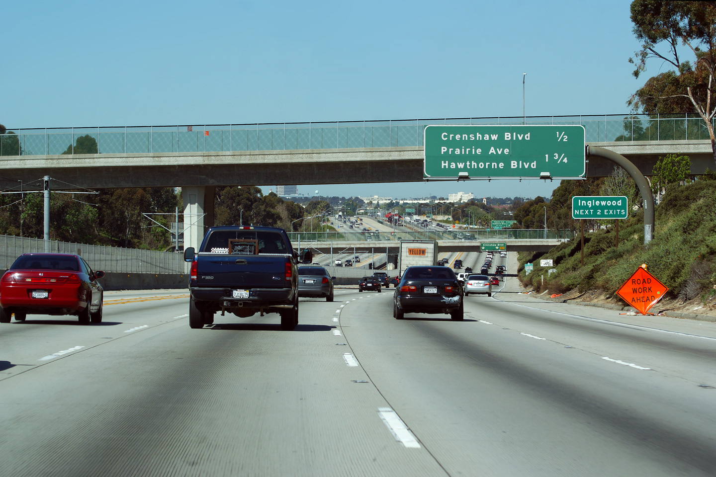
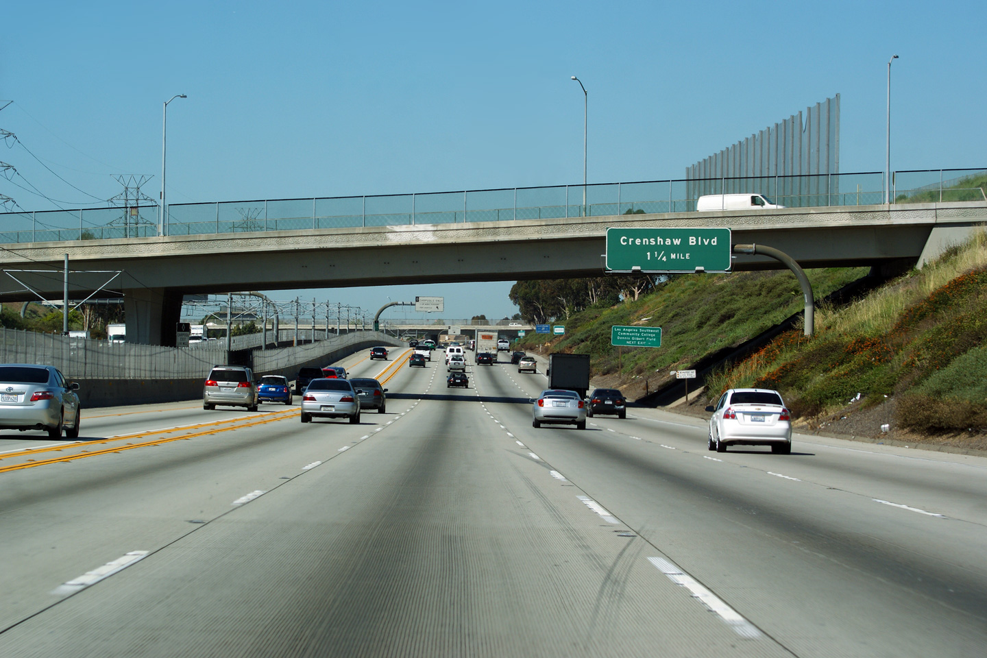
|
Los Angeles County |
View looking westerly as the Century Freeway descends a short hill to Crenshaw Boulevard at the Wilton Place overpass. |
 |
||
|
Date: 4/07/2010 |
High-res: (1440x960) (2400x1600) | |||
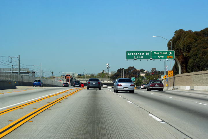
|
Los Angeles County |
Advanced signage for the Crenshaw Boulevard interchange located just before the Normandie Avenue overpass. |
 |
||
|
Date: 4/07/2010 |
High-res: (1440x960) (2400x1600) | |||
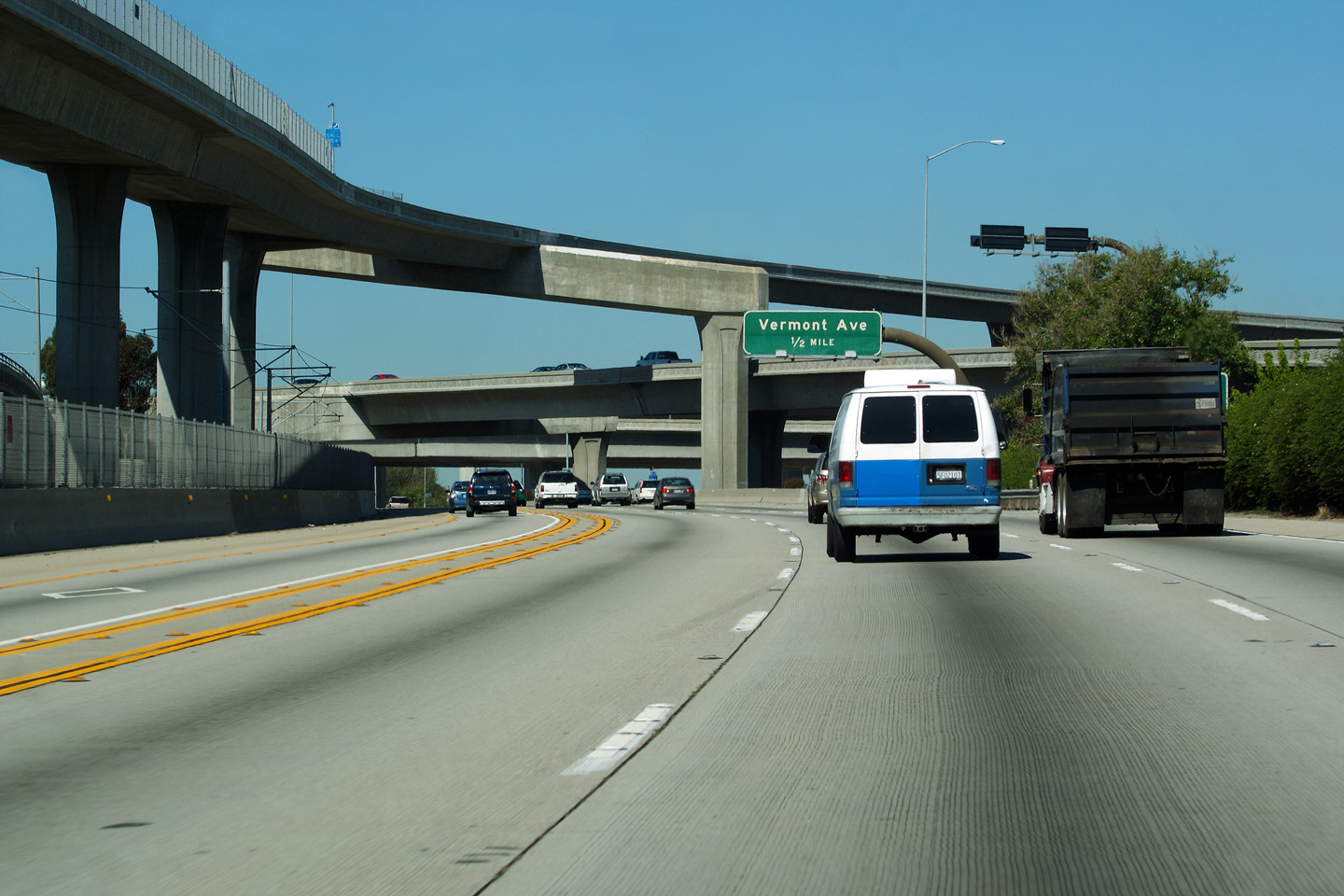
|
Los Angeles County |
The exit to Vermont Avenue is located immediately west of the Harbor Freeway interchange. |
 |
||
|
Date: 4/07/2010 |
High-res: (1440x960) (2400x1600) | |||
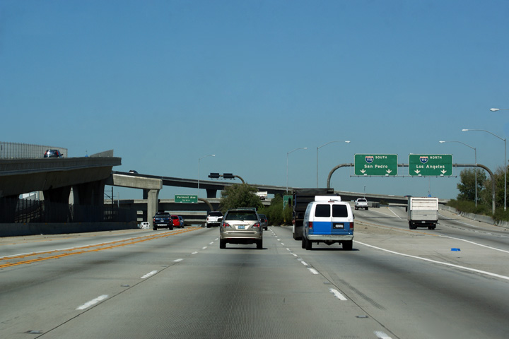
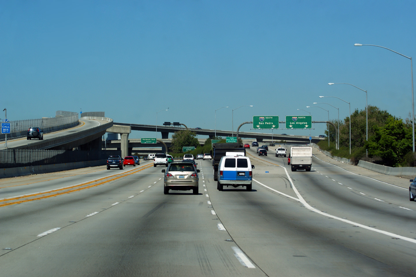
|
Los Angeles County |
Advanced signage for the Vermont Avenue interchange located within the Harbor Freeway interchange. |
 |
||
|
Date: 4/07/2010 |
High-res: (1440x960) (2400x1600) | |||
|
Los Angeles County |
Two views looking westerly through the Harbor Freeway interchange. |
 |
||
| High-res: (1440x960) (2400x1600) | ||||
 |
||||
|
Date: 4/07/2010 |
High-res: (1440x960) (2400x1600) | |||
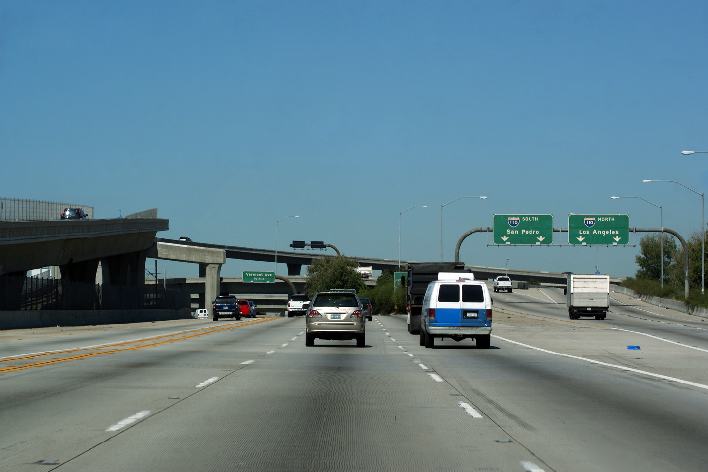
|
Los Angeles County |
Westerly view approaching the Harbor Freeway interchange. As there is for eastbound traffic, there is a direct ramp from west I-105 to the Harbor Freeway north. The interchange between the Century and Harbor Freeways is one of the largest and most complicated freeway interchanges in the world. |
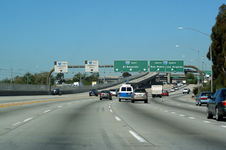 |
||
|
Date: 4/07/2010 |
High-res: (1440x960) (2400x1600) | |||
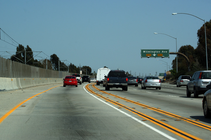
|
Los Angeles County |
Exit signage for Wilmington Avenue. |
 |
||
|
Date: 3/26/2010 |
||||
|
Los Angeles County |
Signage past the Wilmington Avenue interchange, denoting the next three interchanges along the 105 Freeway. |
 |
||
|
Date: 3/26/2010 |
High-res | |||
|
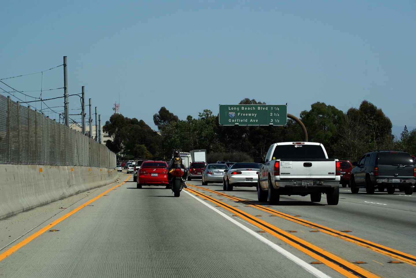
Los Angeles County |
Exit signage for Long Beach Boulevard with an advanced sign for the upcoming Long Beach Freeway interchange. |
 |
||
|
Date: 3/26/2010 |
||||
|
Los Angeles County |
A unique situation where there is a partial gantry on the left side of the road mounted almost perfectly opposite a partial gantry mounted to the right of the road. California generally does not use full width overhead gantrys unless approaching a freeway to freeway interchange. |
 |
||
|
Date: 3/26/2010 |
||||
|
Los Angeles County |
Pass-through signage in advance of the Long Beach Freeway interchange. Of note, the button-copy signage has been replaced with reflective signage during recent years. It is surprising to see new signage on the Century Freeway given California's tight fiscal budget's during the past few years (as of 2010), coupled with the fact that the Century Freeway isn't really that old. |
 |
||
|
Date: 3/26/2010 |
||||
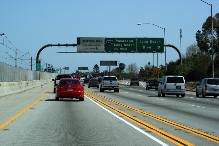
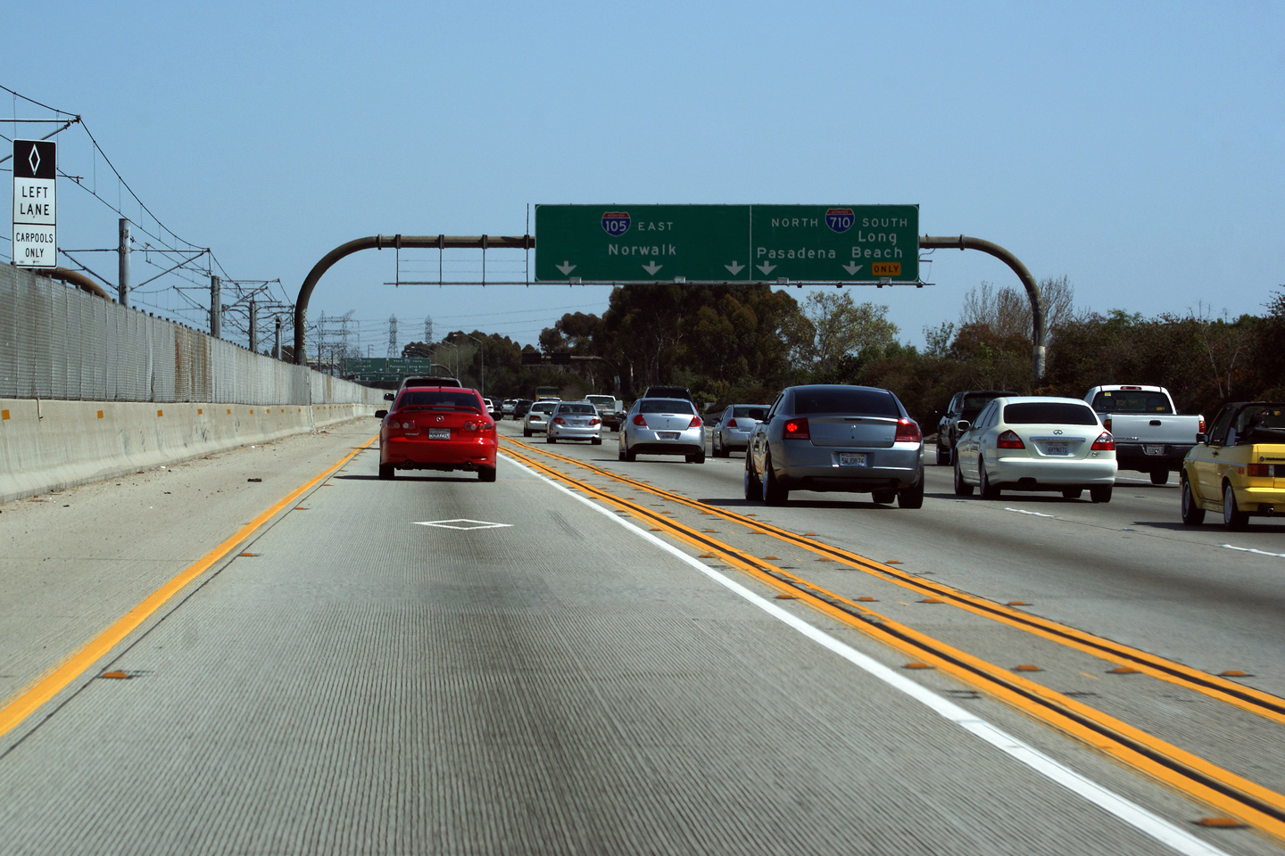
|
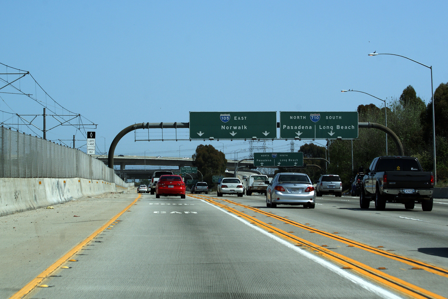
Los Angeles County |
Signage at the departure of the eastbound ramp to the 710 Freeway. Interstate 710 meets I-105 at a directional stack interchange. The Century Freeway is the second level of the stack. |
 |
||
|
Date: 3/26/2010 |
High-res: (1440x960) (2400x1600) |
|||
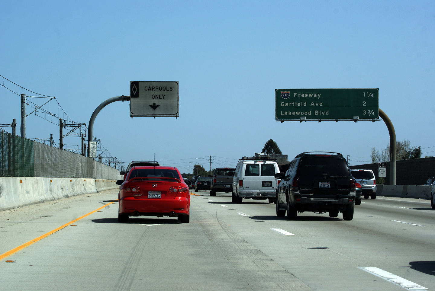
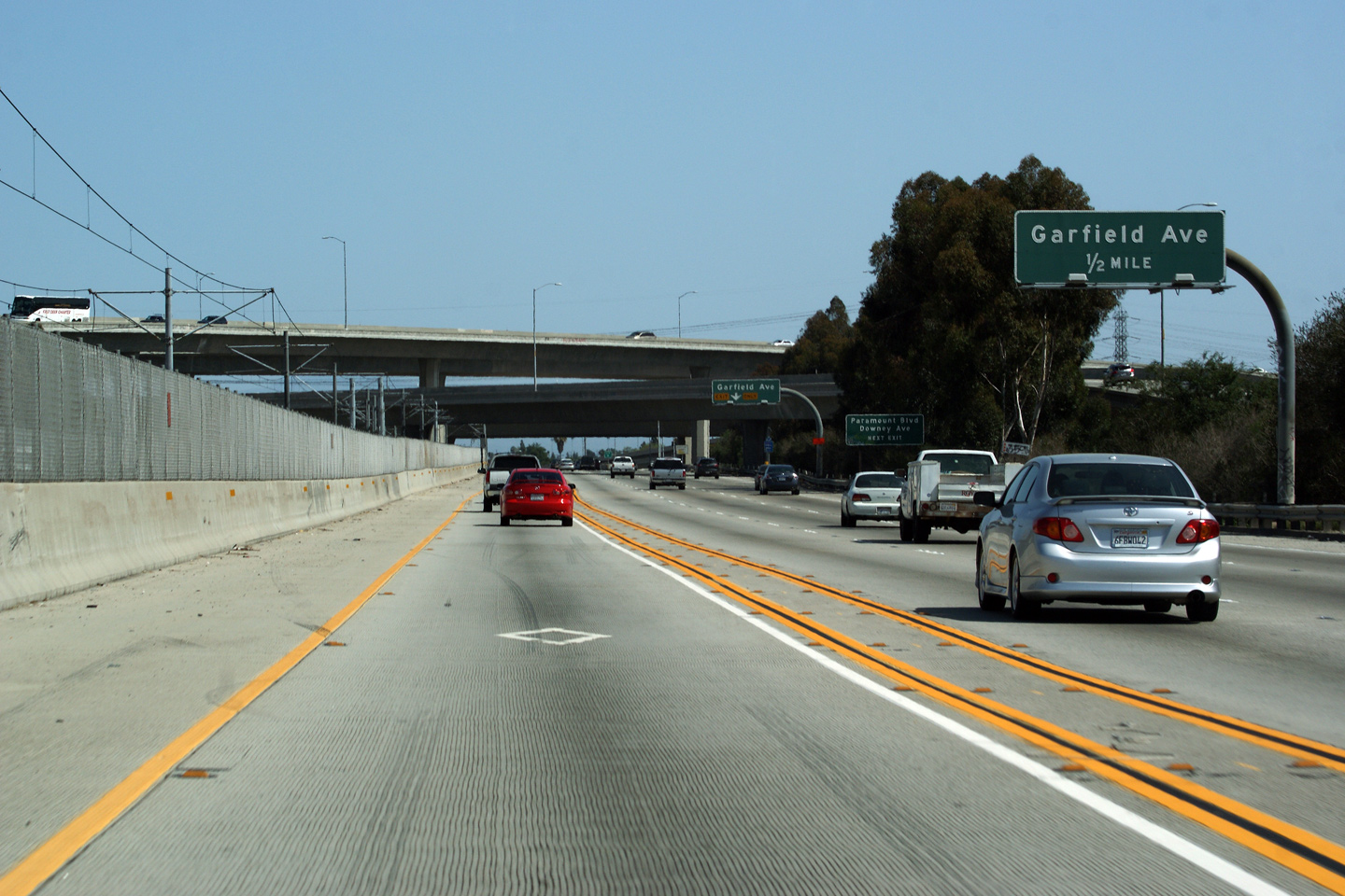
|
Los Angeles County |
The advanced sign for the Garfield Avenue ramp is conveniently located right in front of the high-speed ramps that carry traffic to and from I-710 from the Century Freeway. |
|
||
|
Date: 3/26/2010 |
||||
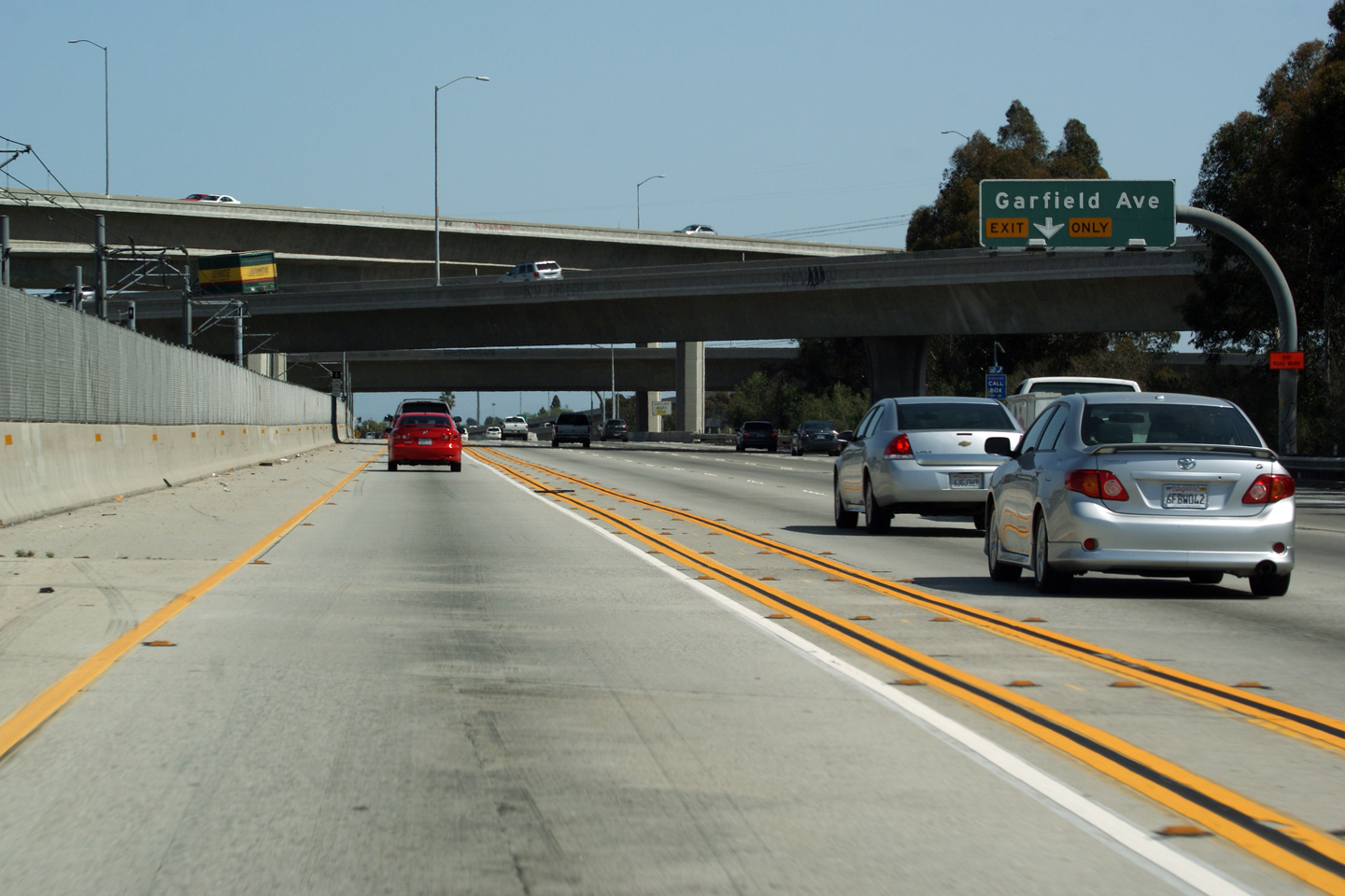
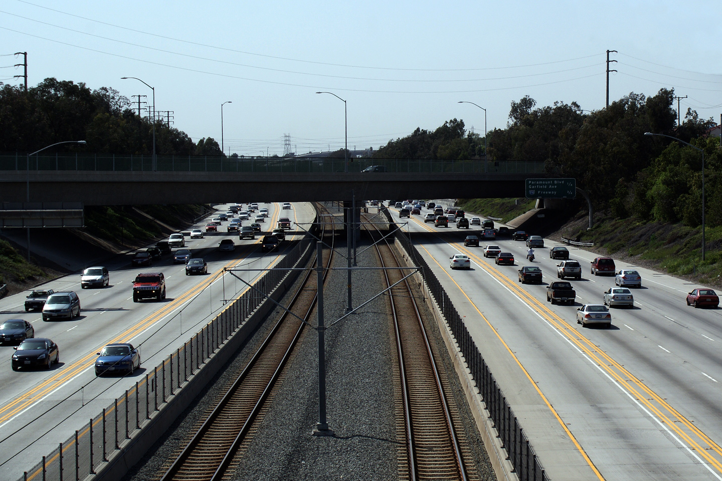
|
Los Angeles County |
Signage for Garfield Avenue. Interstate 105 passes over the Long Beach Freeway and the Los Angeles River on the structure pictured ahead. |
 |
||
|
Date: 3/26/2010 |
High-res | |||
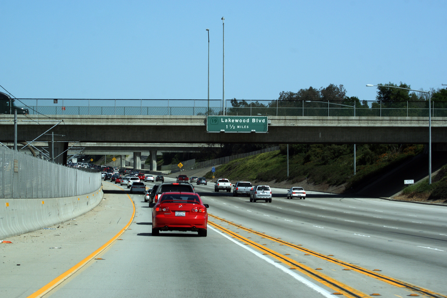
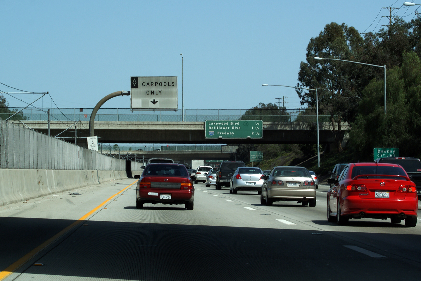
|
Los Angeles County |
Advanced signage for Lakewood Boulevard. Button-copy signs offer a convenient and accidental way for jurisdictions to highlight a streets former designation. |
 |
||
|
Date: 3/26/2010 |
||||
|
Los Angeles County |
Overhead sign reassuring drives in the left-most freeway lane that it is indeed a carpool lane. Signs like this are posted at every transfer between the carpool and general purpose lanes. |
 |
||
|
Date: 3/26/2010 |
||||
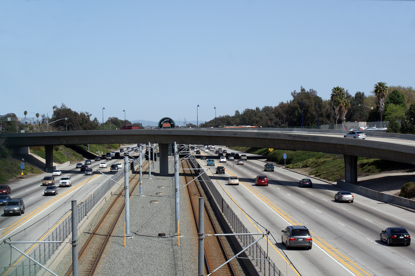
|
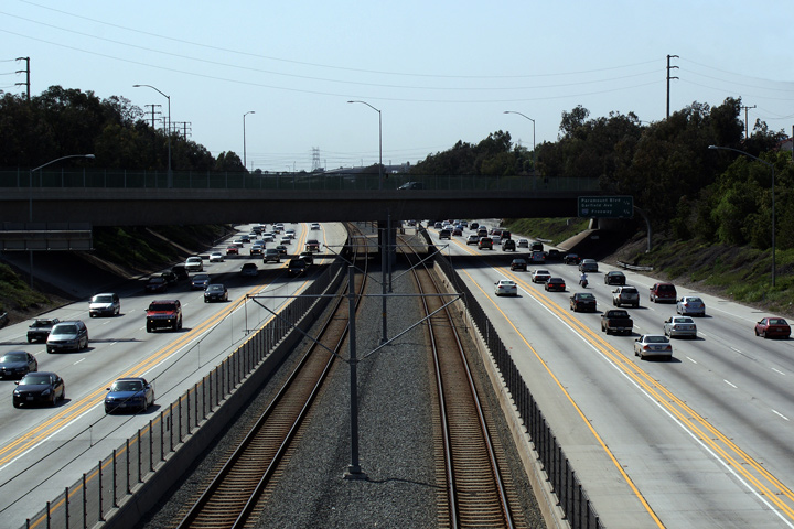
Los Angeles County |
Westerly view from Barlin Avenue. Note the proximity of the next overpass to Barlin Avenue -- in general the 105 Freeway was constructed with numerous residential overpasses so as to minimize the disruption to the surrounding neighbourhoods. |
 |
||
|
Date: 3/26/2010 |
High-res | |||
|
Los Angeles County |
Easterly view from Barlin Avenue. Note the Metro Green Line station in the median at Lakewood Boulevard. |
 |
||
|
Date: 3/26/2010 |
||||
|
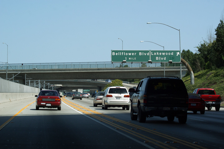
Los Angeles County |
Exit signage for Lakewood Boulevard. As is obvious from the button copy signage, Highway 19 was recently decommissioned form Lakewood Boulevard. Like Ontario, California has been divesting itself of highways through urban areas. Though the lack of a continuous route number can be confusing to traffic, it often makes sense for urban roads to be maintained by the local city or county. |
 |
||
|
Date: 3/26/2010 |
||||
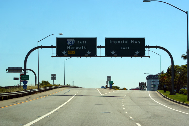
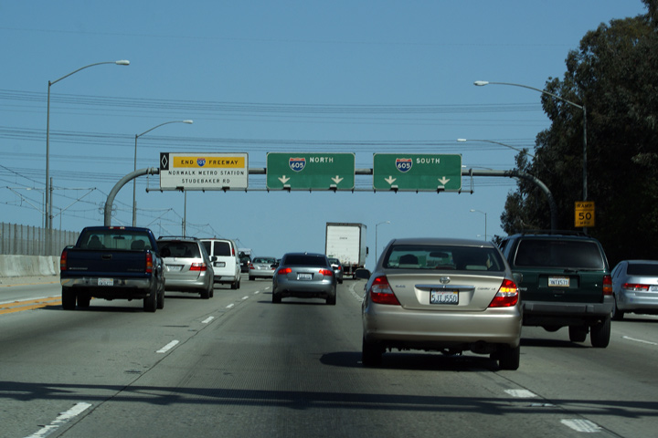
|
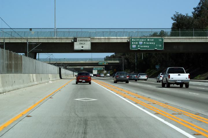
Los Angeles County |
An annoyingly slightly blurry photo of the signage that announces the eastern end of the 105 freeway in conjunction with the exits to Bellflower Boulevard and the 605 Freeway. |
 |
||
|
Date: 3/26/2010 |
High-res | |||
|
Los Angeles County |
Overhead signage overtop of the Carpool Lane informing travelers that they must exit the carpool lane for Interstate 605. The Carpool Lane continues past the end of the Century Freeway to Studebaker Road and the Green Line Transit Park and Ride. |
 |
||
|
Date: 3/26/2010 |
||||
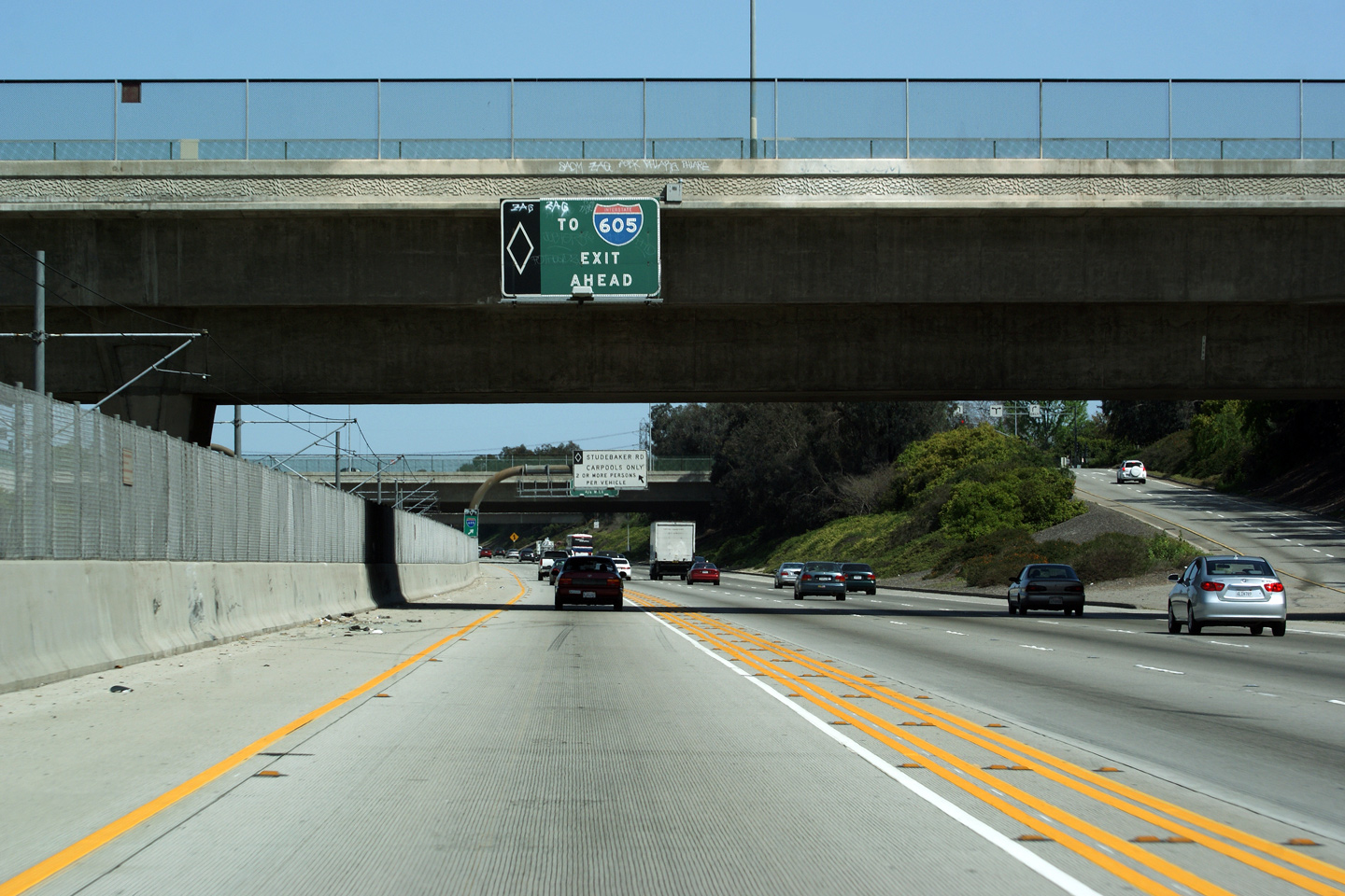
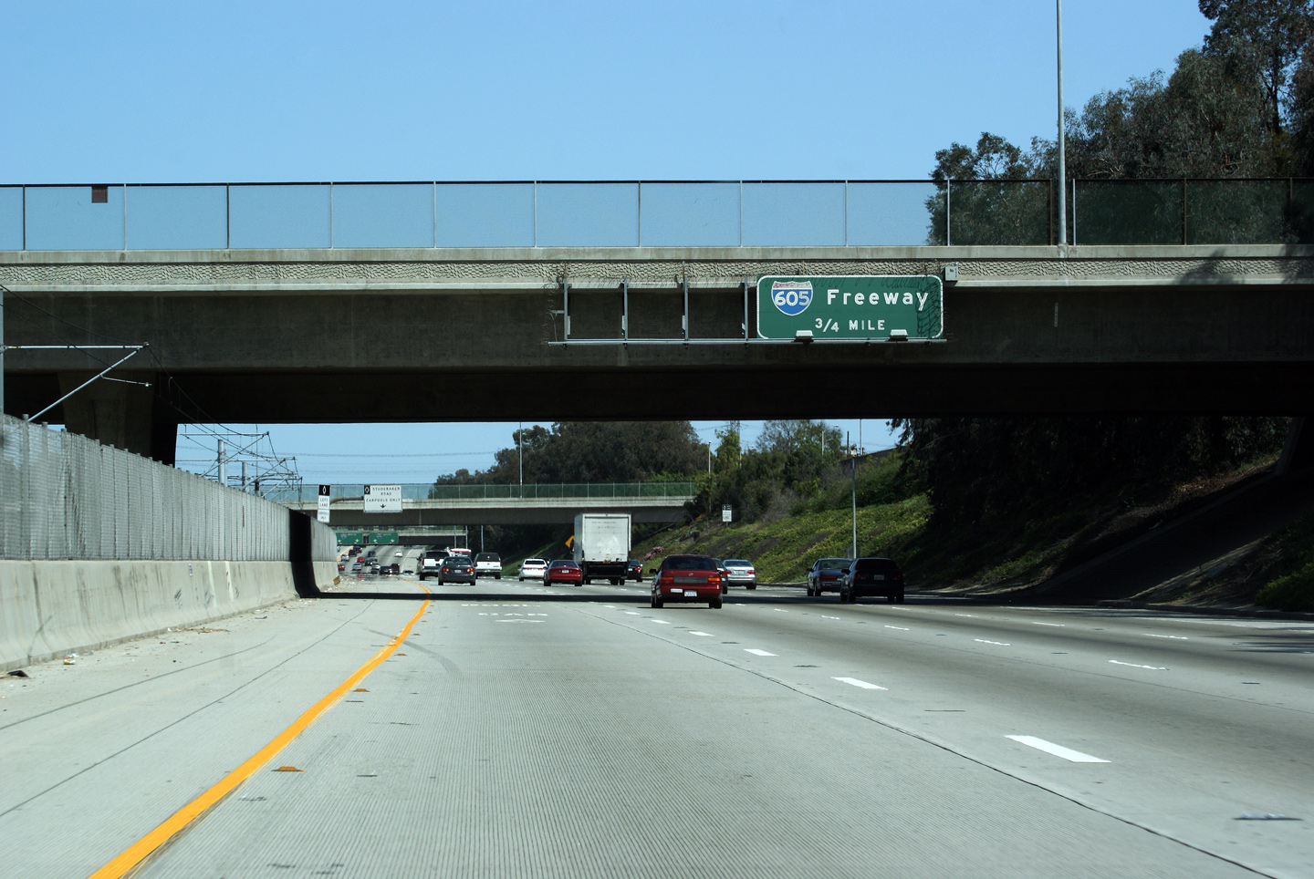
|
Los Angeles County |
Advanced signage for the Highway 605 interchange. |
 |
||
|
Date: 3/26/2010 |
||||
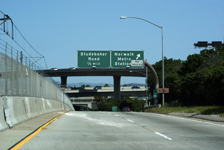
|
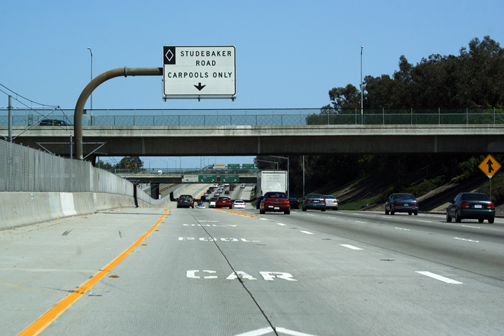
Los Angeles County |
Carpool Lane signage signalling that the Carpool Lane heads only to Studebaker Road. |
 |
||
|
Date: 3/26/2010 |
High-res | |||
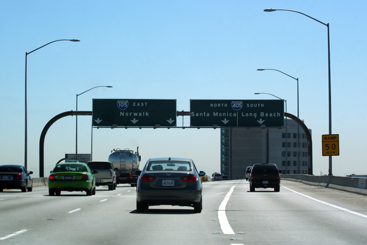
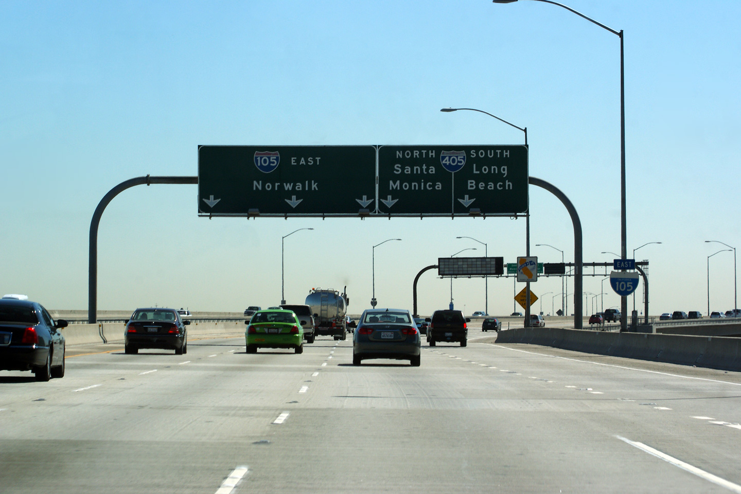
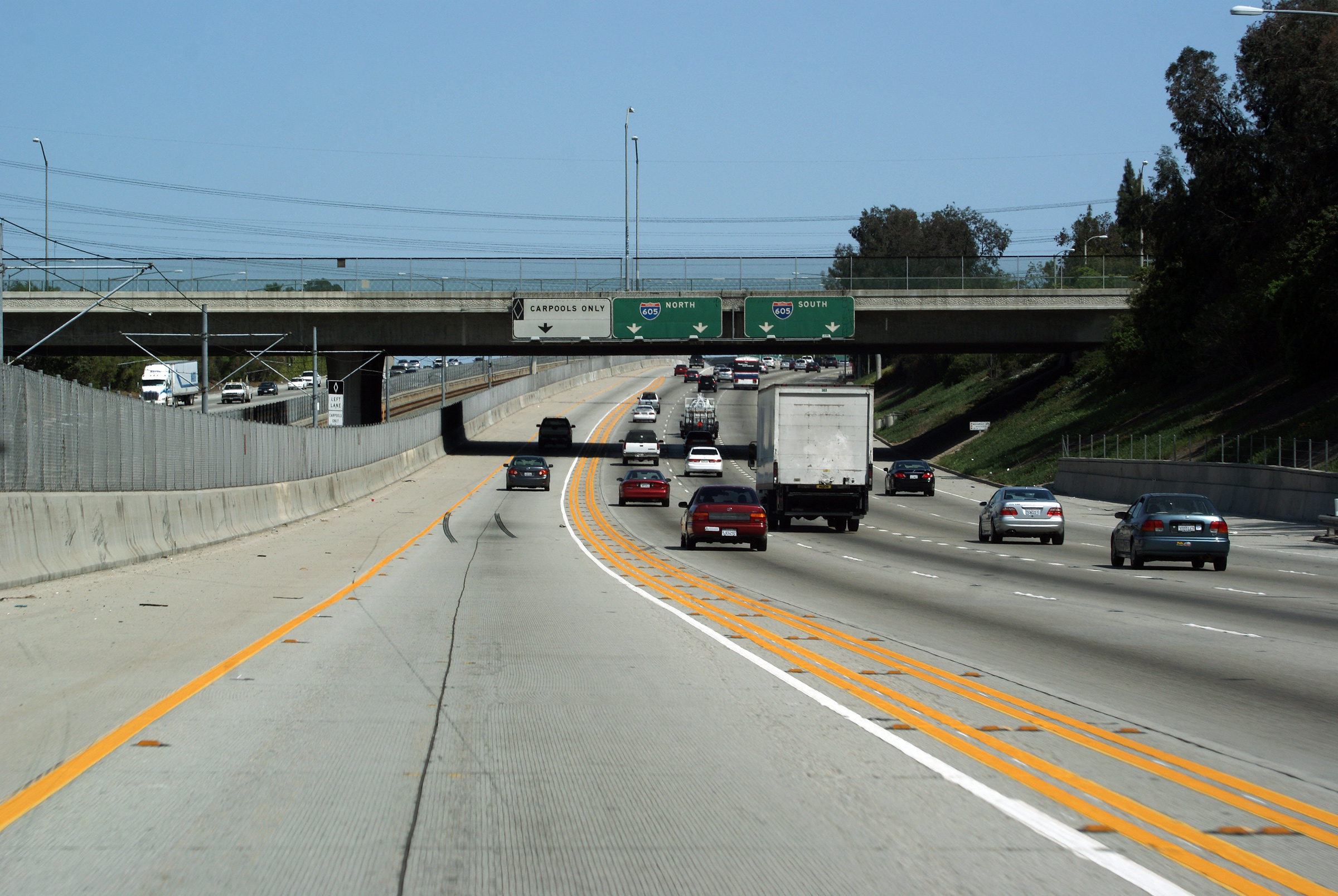
|
Los Angeles County |
Overhead signage in advance of the Interstate 605 interchange. The Century Freeway ends at the 605 Freeway. |
 |
||
|
Date: 7/10/2009 |
High-res: (1440x960) (2400x1600) | |||
|
Los Angeles County |
Overhead signage at the I-605 interchange. Two lanes to I-605 North and two lanes to I-605 South. |
 |
||
|
Date: 7/10/2009 |
||||
|
Los Angeles County |
Signage just past the bull-nose for the Interstate 605 interchange. The Green LRT Line that runs in the median of the Century Freeway also terminates at the 605 Freeway in Norwalk. The Green Line is underutilized despite its relatively short headway between trains and grade separated right of way. Because transit lines offer far less route flexibility then passenger cars, transit planners must be careful to ensure that a transit line passes through several origins and destinations along its route. As has been seen with LA's Green Line, transit trips that involve multi-seat rides do not attract significant ridership. |
 |
||
|
Date: 7/10/2009 |
||||
| The San Gabriel River Freeway is Interstate 605. Interstate 605 carries traffic north and south from Interstate 5 between Seal Beach and Duarte. Click here for Interstate 605 Images. | ||||
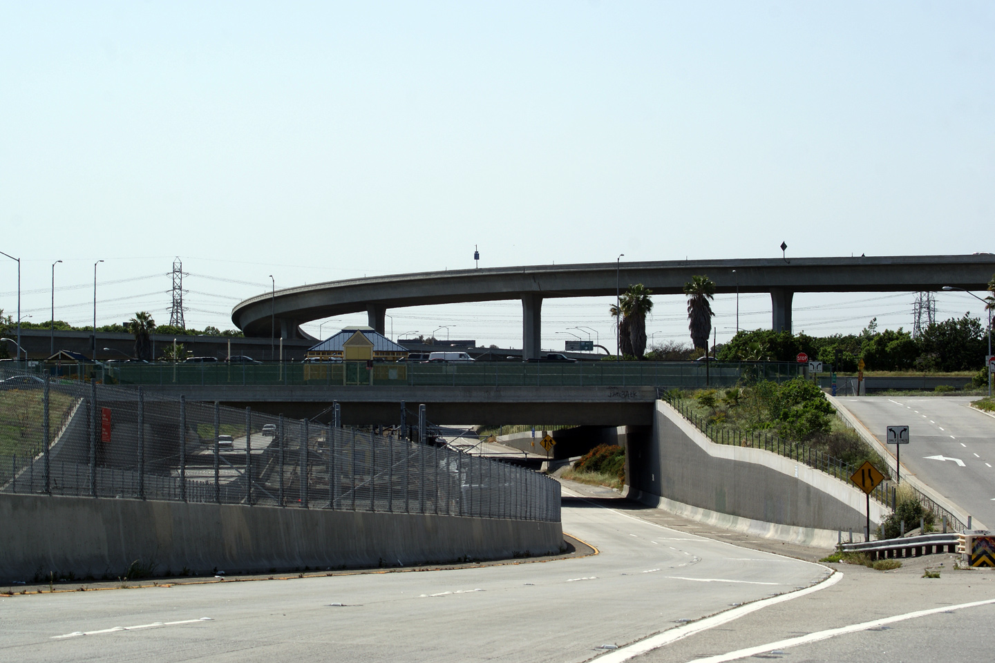
|
Los Angeles County |
View of the 105/605 Freeway interchange from the Carpools Only ramp from Studebaker Road. The Carpools Only link is a clever way of providing access to the surrounding community without inundating Studebaker Road (and Norwalk in general) with errant freeway traffic. |
 |
||
|
Date: 7/10/2009 |
||||
<- I-80
CA Highways
I-110 ->
AsphaltPlanet.ca
© 2010 AsphaltPlanet.ca.
Scott@asphaltplanet.ca
Page Created: April 22, 2010.
Last Updated: April 22, 2010.
