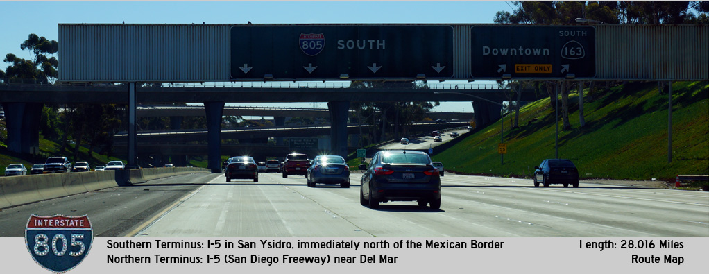
AsphaltPlanet.ca > California > Interstate 805
Pictures on this
page are arranged in order from south to north. I-805 North photos are
left-aligned in the last column, while I-805 South photos are right-aligned.
Center-line pictures are centered within the last column.
|
Location |
Description |
Photo |
||
|
North- |
South- |
|||
|
San Diego County |
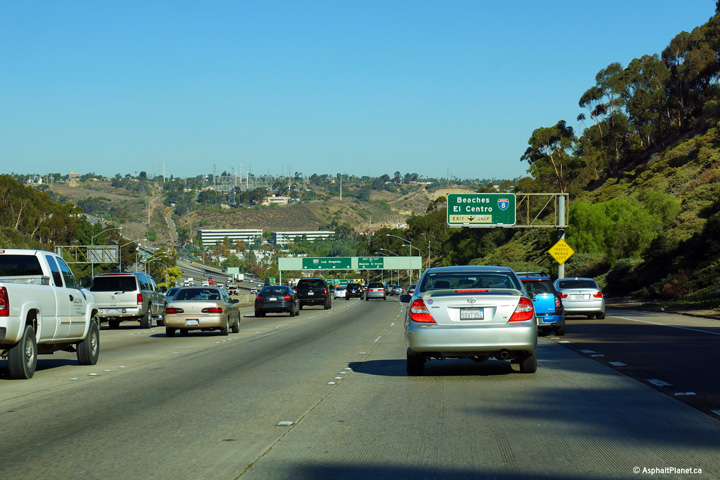
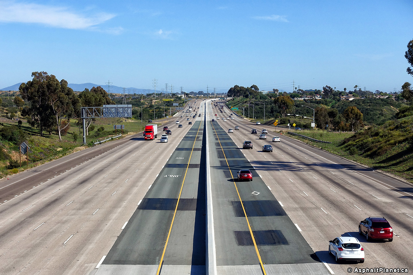
View looking northerly through the Highway 94 interchange. I-805 is the lowest level of this four-level stack interchange. Despite the large scale of this interchange, there is no direct connection between CA-94 East and I-805 North. This movement is provided by the Highway 15 Freeway a short distance to the west. |
 |
||
|
Date: 10/31/2013 |
High-res: (1440x960) (2400x1600) |
|||
|
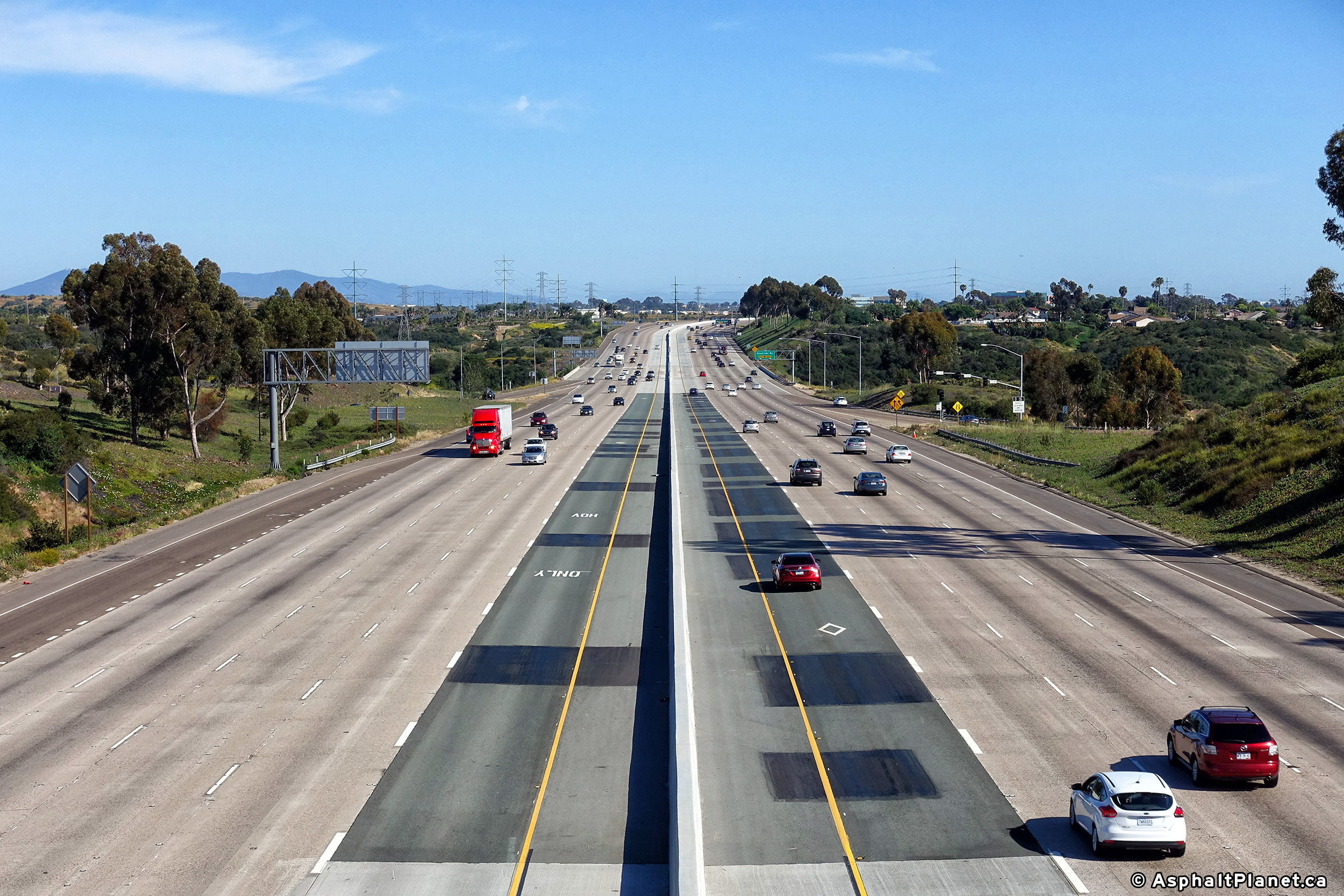
San Diego County |
View looking northerly through the Highway 94 interchange. I-805 is the lowest level of this four-level stack interchange. Despite the large scale of this interchange, there is no direct connection between CA-94 East and I-805 North. This movement is provided by the Highway 15 Freeway a short distance to the west. |
|||
|
Date: 10/31/2013 |
High-res: (1440x960) (2400x1600) |
|||
|
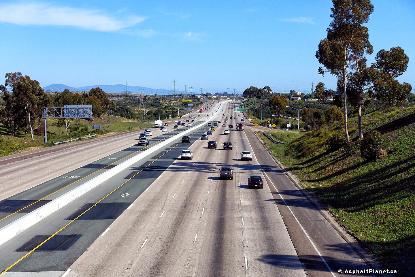
San Diego County |
View looking northerly through the Highway 94 interchange. I-805 is the lowest level of this four-level stack interchange. Despite the large scale of this interchange, there is no direct connection between CA-94 East and I-805 North. This movement is provided by the Highway 15 Freeway a short distance to the west. |
 |
||
|
Date: 10/31/2013 |
High-res: (1440x960) (2400x1600) |
|||
|
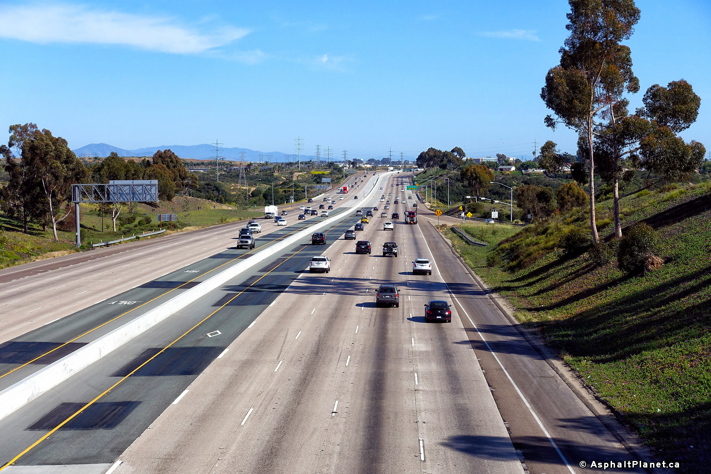
San Diego County |
View looking northerly through the Highway 94 interchange. I-805 is the lowest level of this four-level stack interchange. Despite the large scale of this interchange, there is no direct connection between CA-94 East and I-805 North. This movement is provided by the Highway 15 Freeway a short distance to the west. |
 |
||
|
Date: 10/31/2013 |
High-res: (1440x960) (2400x1600) |
|||
|
San Diego County |
Overhead signage at the ramp to Home Avenue along I-805 North. The off-ramp to Home Avenue passes underneath the on-ramp joining I-805 from the CA-94 interchange. |
 |
||
|
Date: 10/31/2013 |
High-res: (1440x960) (2400x1600) |
|||
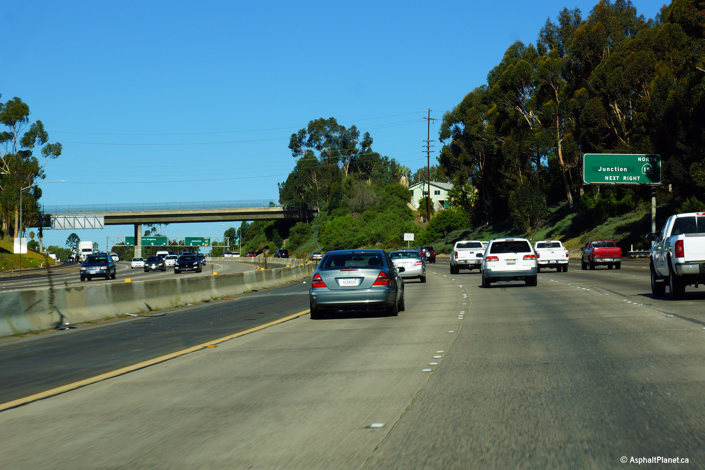
|
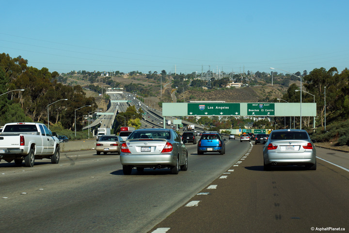
San Diego County |
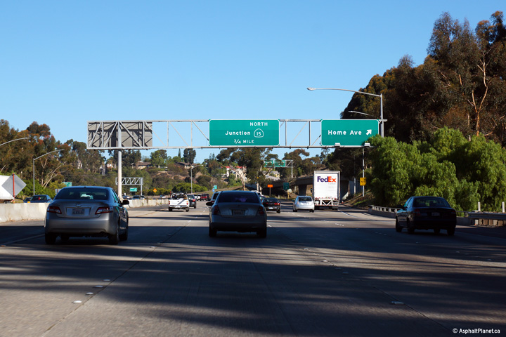
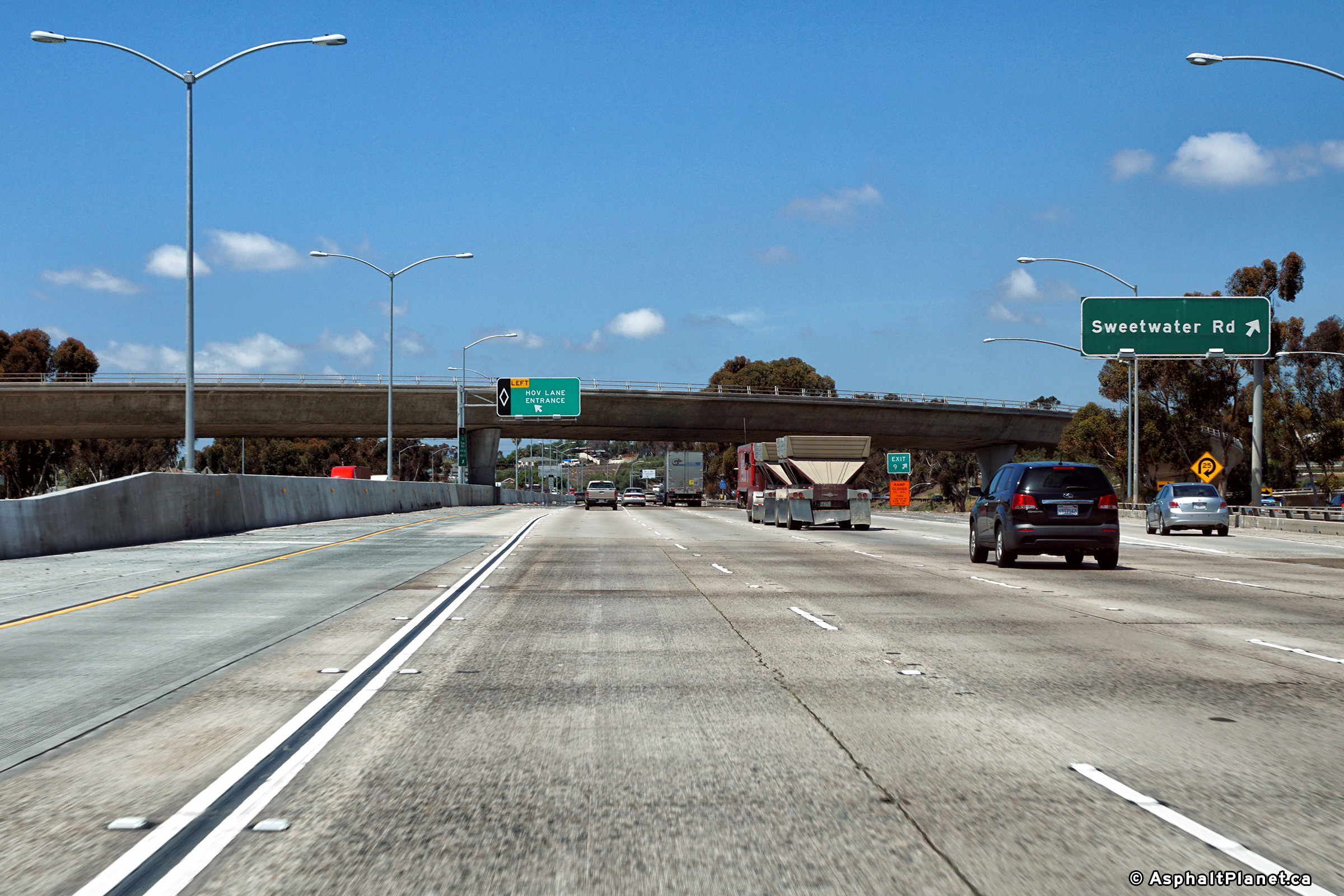
Advanced signage for the ramp to Highway 15 North. |
 |
||
|
Date: 30/31/2013 |
High-res: (1440x960) (2400x1600) |
|||
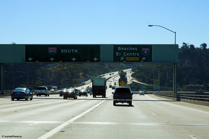
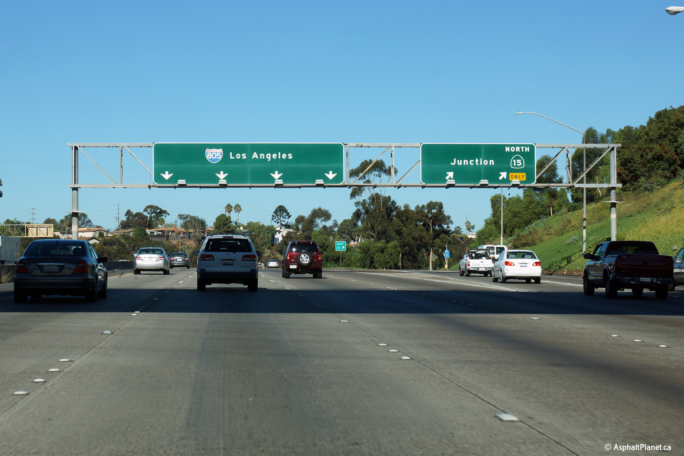
|
San Diego County |
Signage at the ramp to the 15 Freeway from I-805 North. Because CA-15 and I-805 run in the same direction, there is not a direct ramp from I-805 North to Highway 15 South of vice versa. |
 |
||
|
Date: 30/31/2013 |
High-res: (1440x960) (2400x1600) | |||
|
San Diego County |
Median mounted interchange sequence signage located within the CA-15 interchange. |
 |
||
|
Date: 30/31/2013 |
High-res: (1440x960) (2400x1600) |
|||
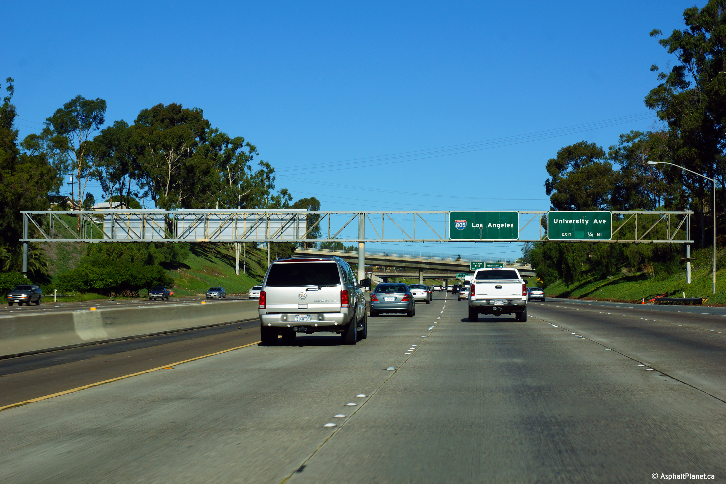
|
San Diego County |
Full width overhead gantry in advance of the University Avenue exit. |
 |
||
|
Date: 30/31/2013 |
High-res: (1440x960) (2400x1600) |
|||
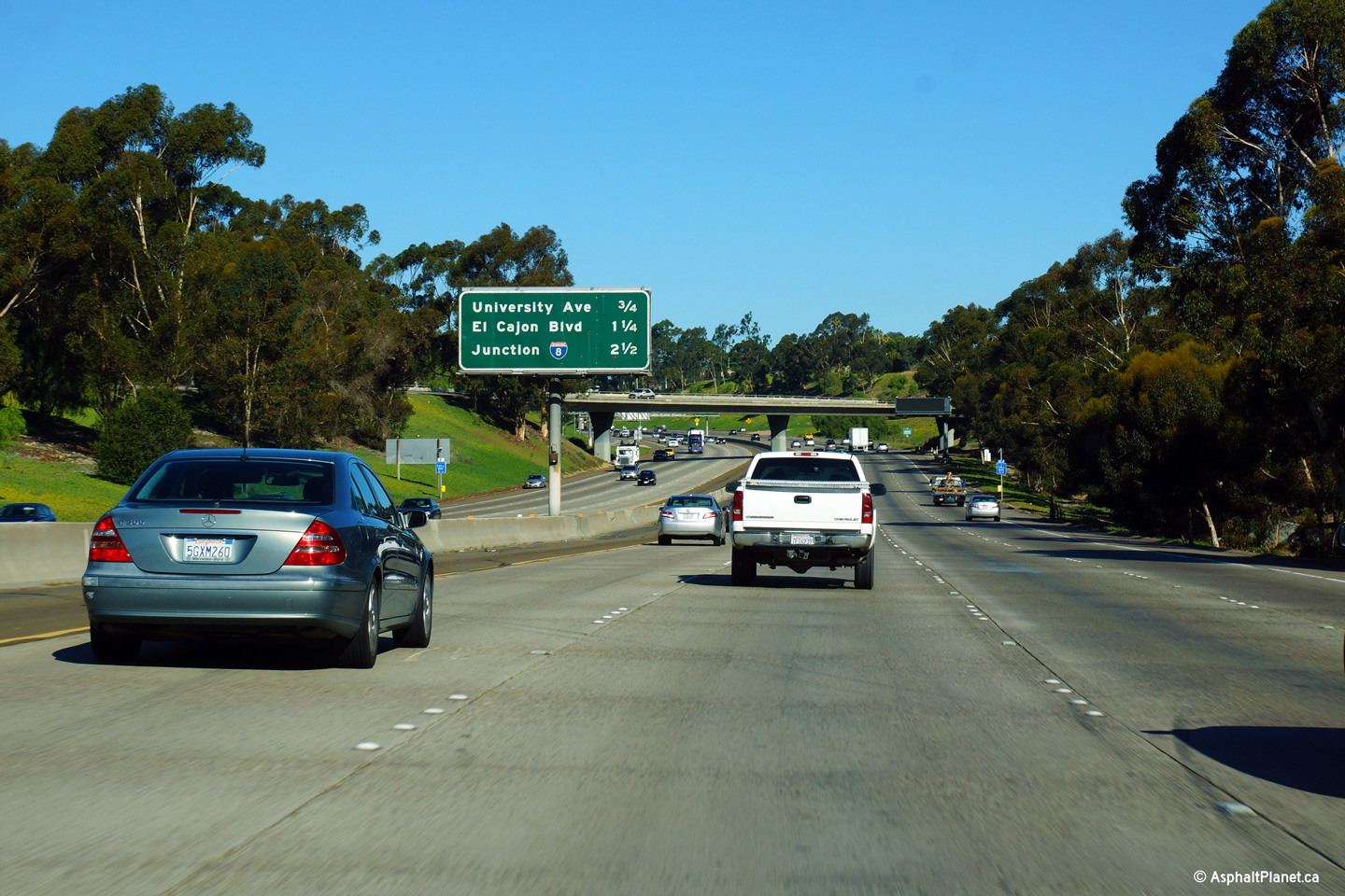
|
San Diego County |
Overhead signage affixed to the Landis Street overpass for the University Avenue exit. |
 |
||
|
Date: 30/31/2013 |
High-res: (1440x960) (2400x1600) |
|||
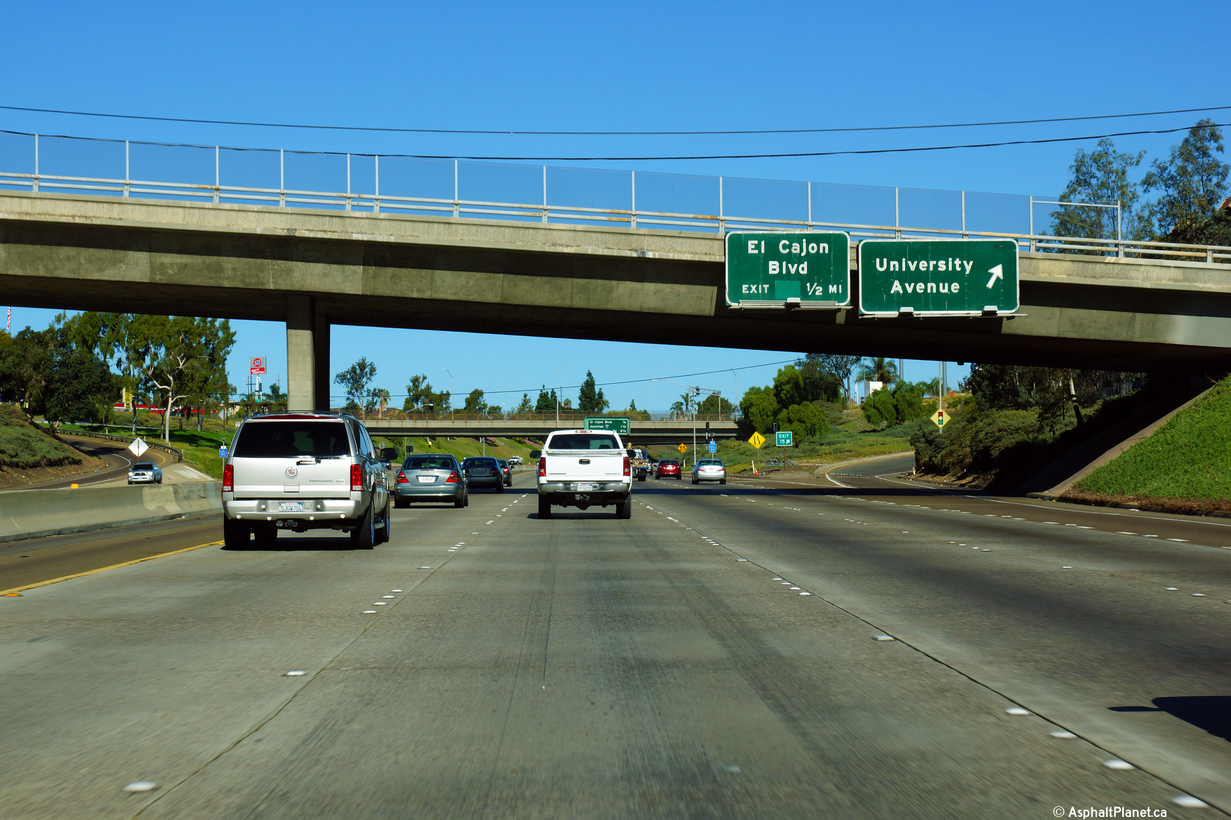
|
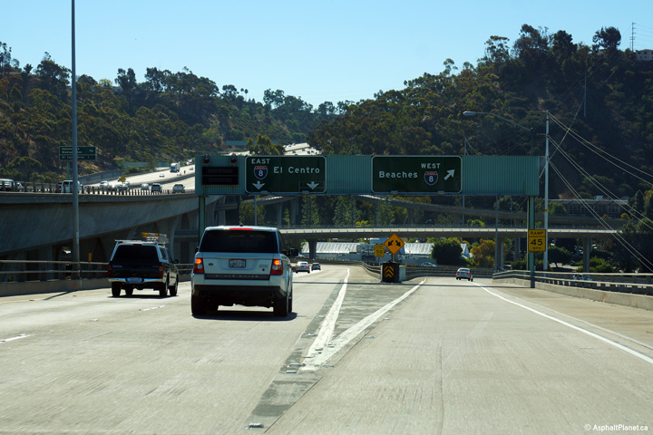
San Diego County |
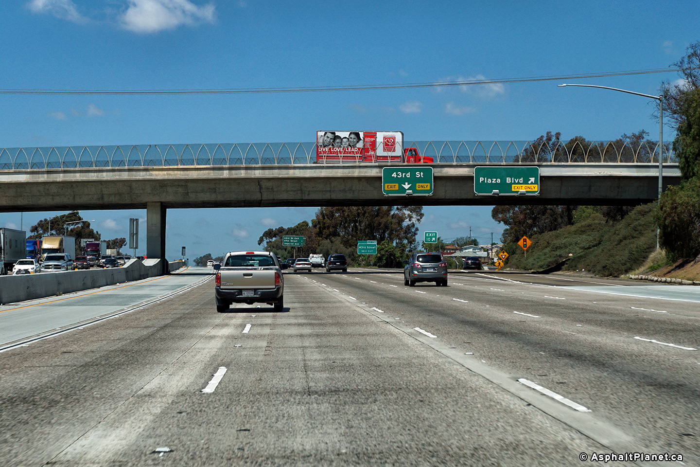
Overhead signage at the off-ramp to El Cajon Boulevard from I-805. Before I-8 was finished through San Diego, El Cajon Boulevard was part of US-80. |
 |
||
|
Date: 30/31/2013 |
High-res: (1440x960) (2400x1600) |
|||
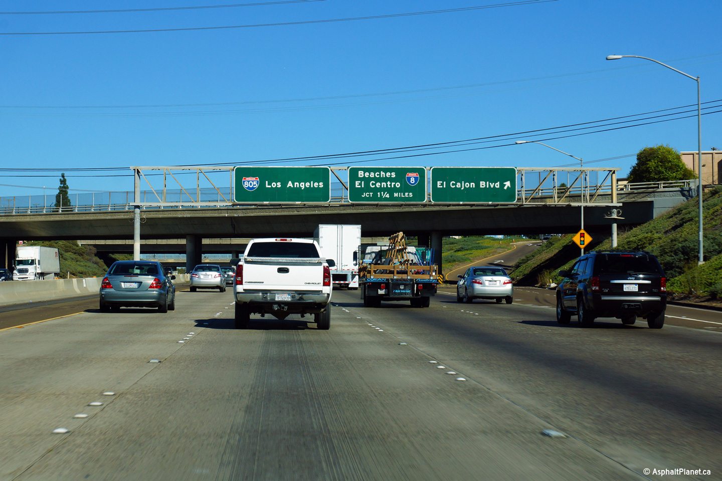
|
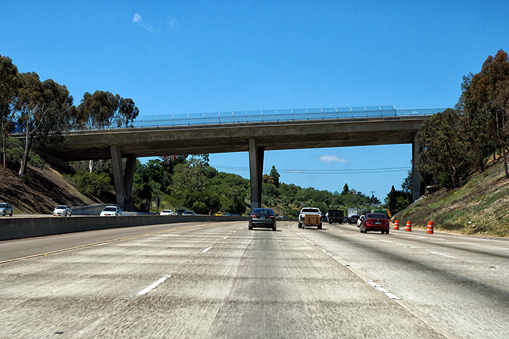
San Diego County |
Partial overhead signage in advance of the I-8 interchange. The large overpass spanning the freeway is the Adams Boulevard overpass. |
 |
||
|
Date: 30/31/2013 |
High-res: (1440x960) (2400x1600) |
|||
|
San Diego County |
Exit signage for Lakewood Boulevard. Unlike at the Century Freeway crossign, Lakewood Boulevard is still part of CA-19 where it crosses the 405. |
|
||
|
Date: 3/26/2010 |
High-res: (1440x960) (2400x1600) |
|||
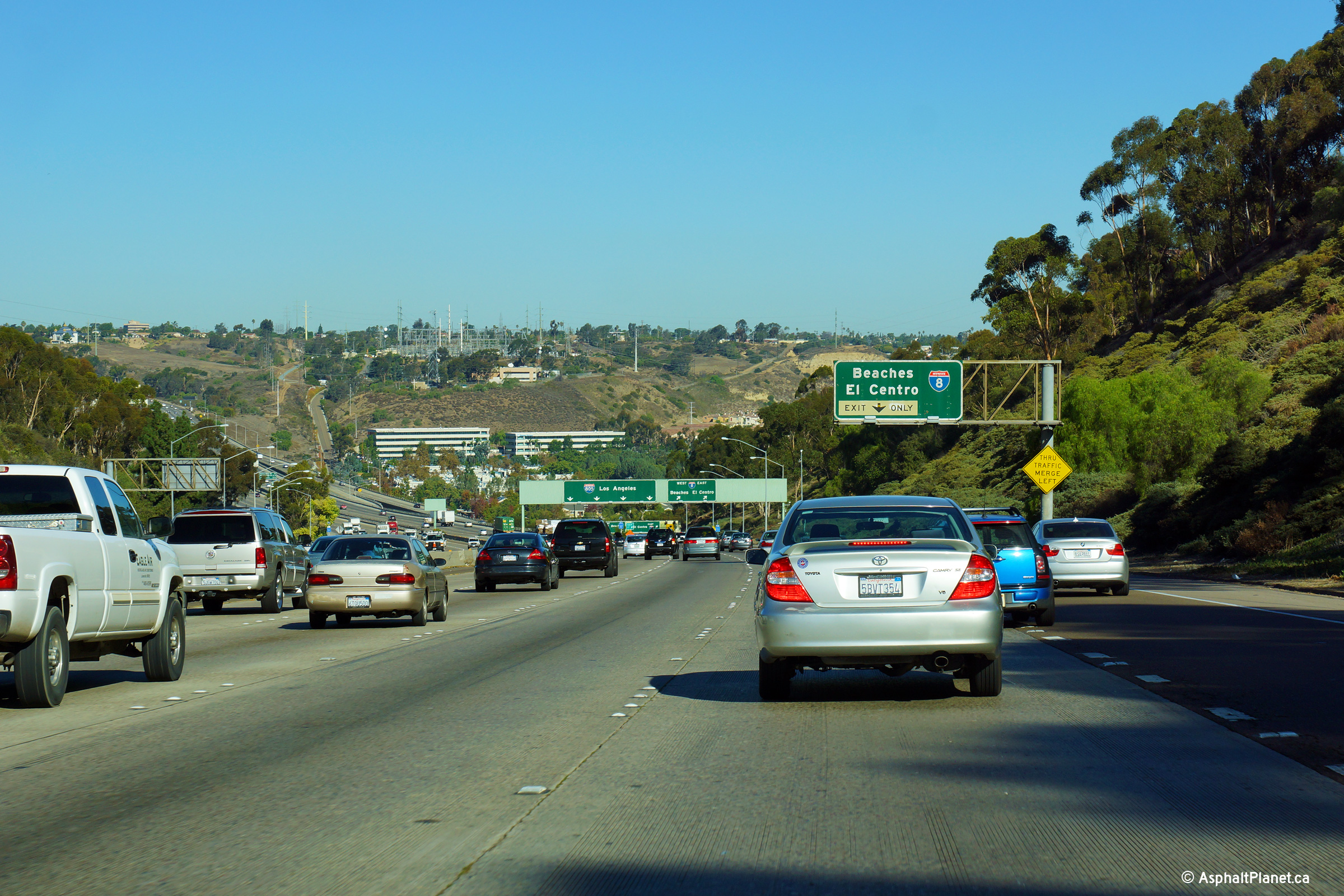
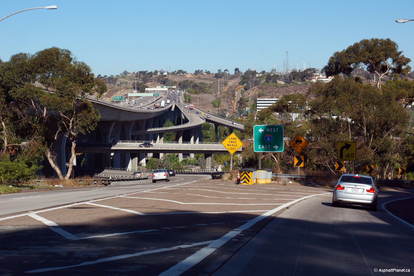
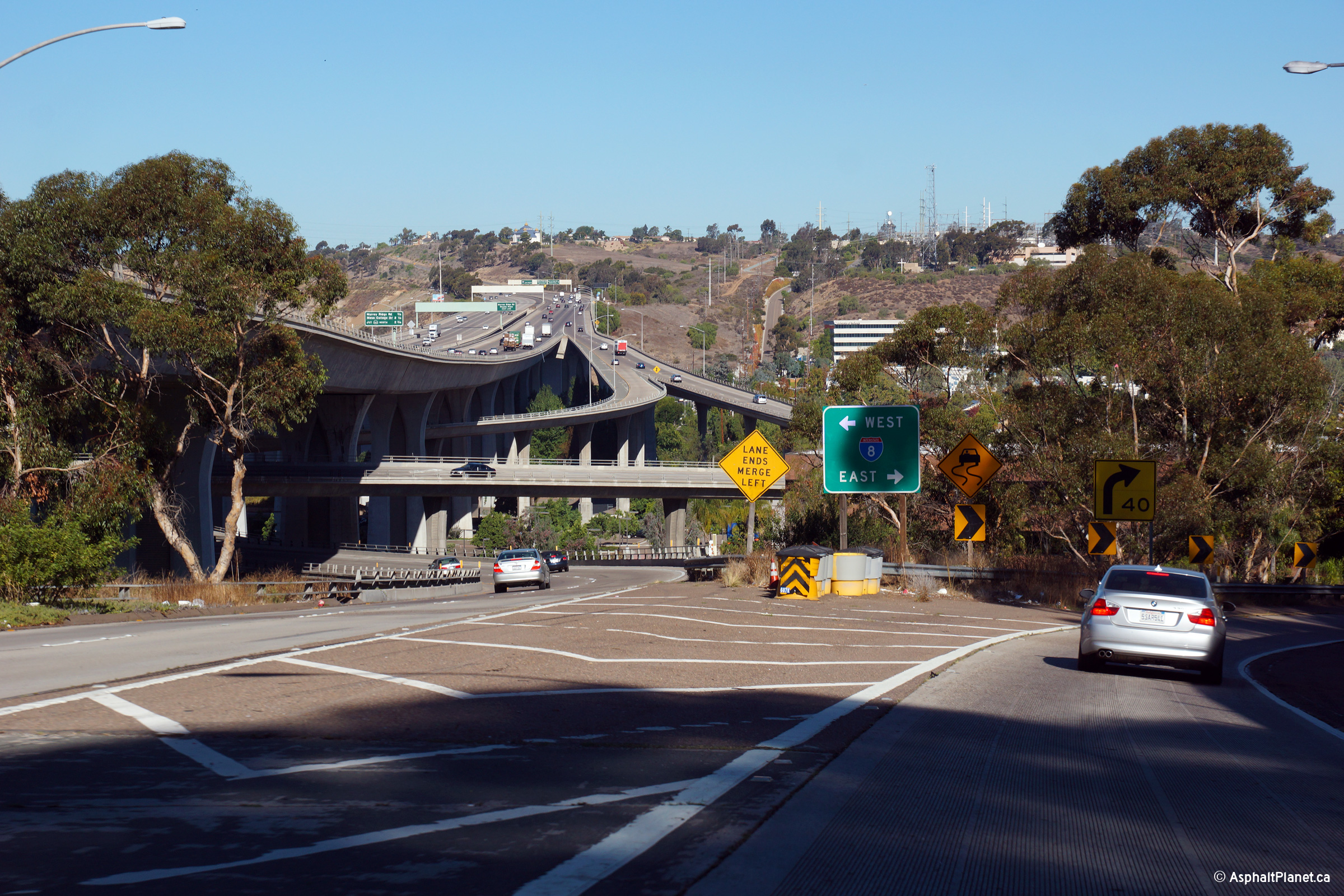
|
San Diego County |
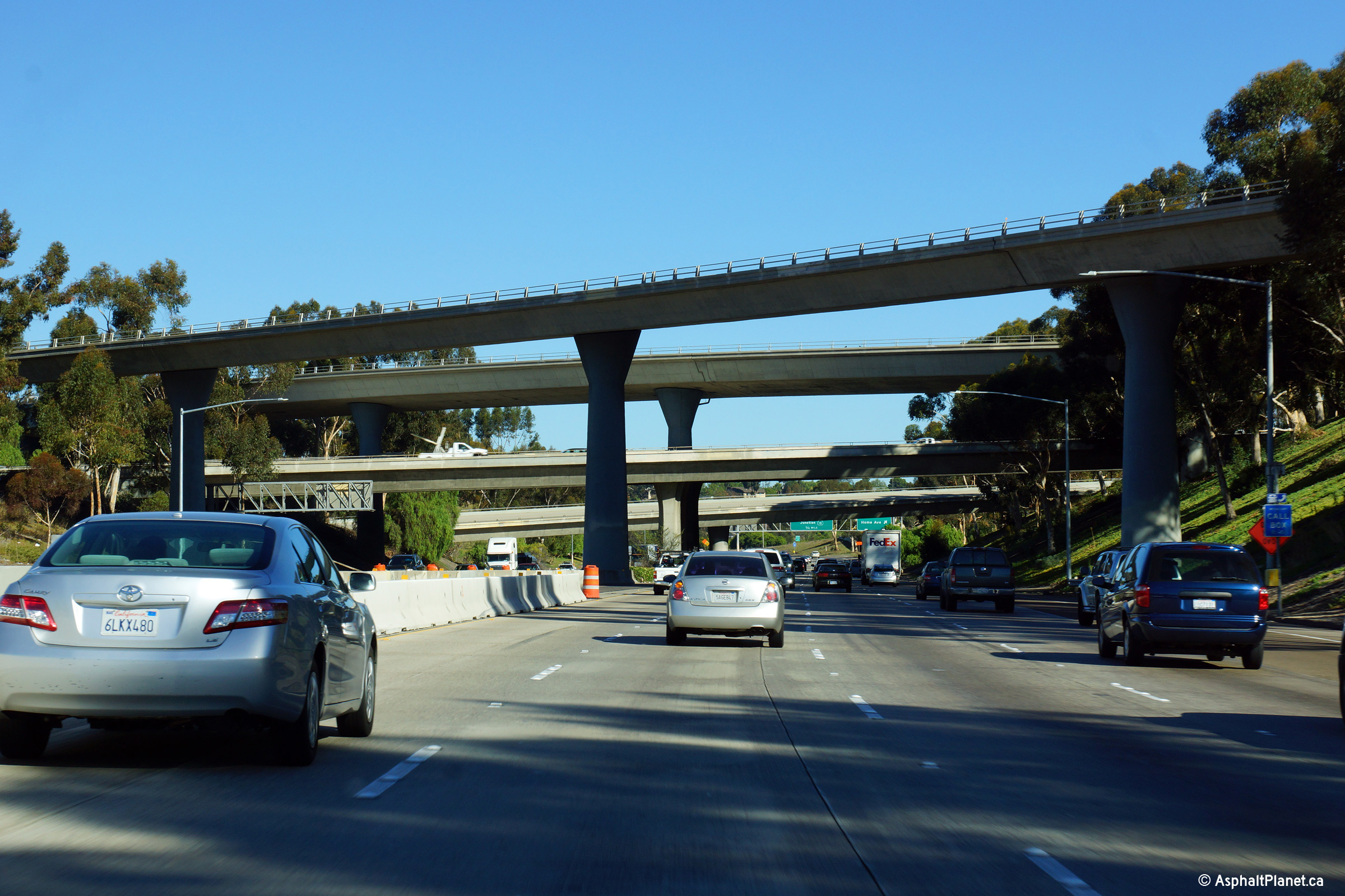
Southerly view as I-805 passes through the massive stack interchange with I-8. I-805 is the highest level of the four level stack interchange between the two freeways, passing over I-8 (the Mission Valley Freeway) on two large viaducts. |
 |
||
|
Date: 30/31/2013 |
High-res: (1440x960) (2400x1600) | |||
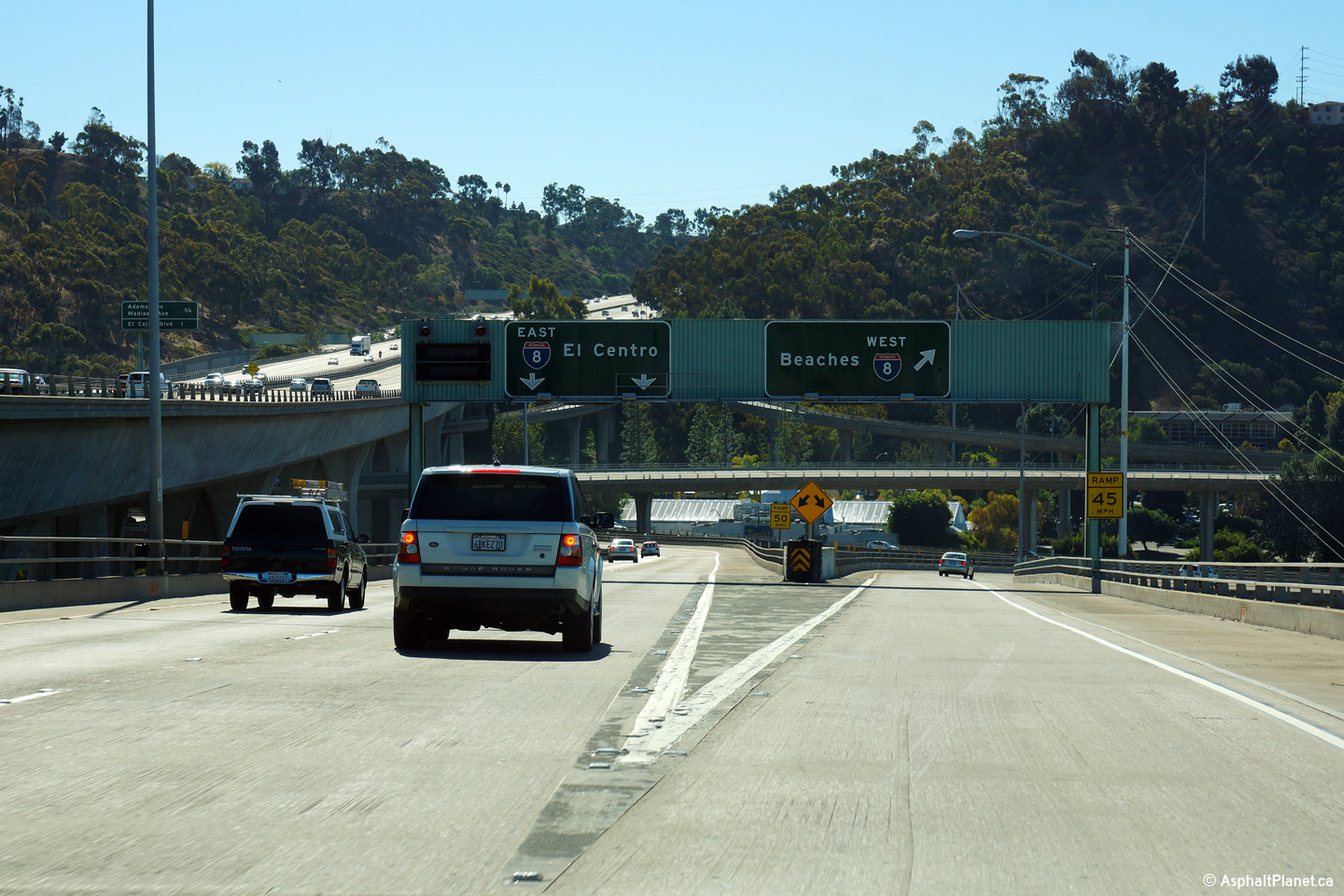
|
San Diego County |
Signage where the ramp to the Mission Valley Freeway separates to independant ramps to the east- and west-bound freeway. |
 |
||
|
Date: 30/31/2013 |
High-res: (1440x960) (2400x1600) |
|||
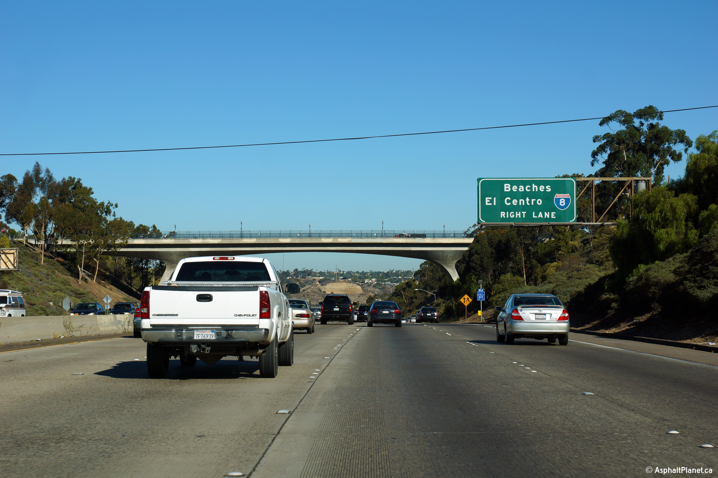
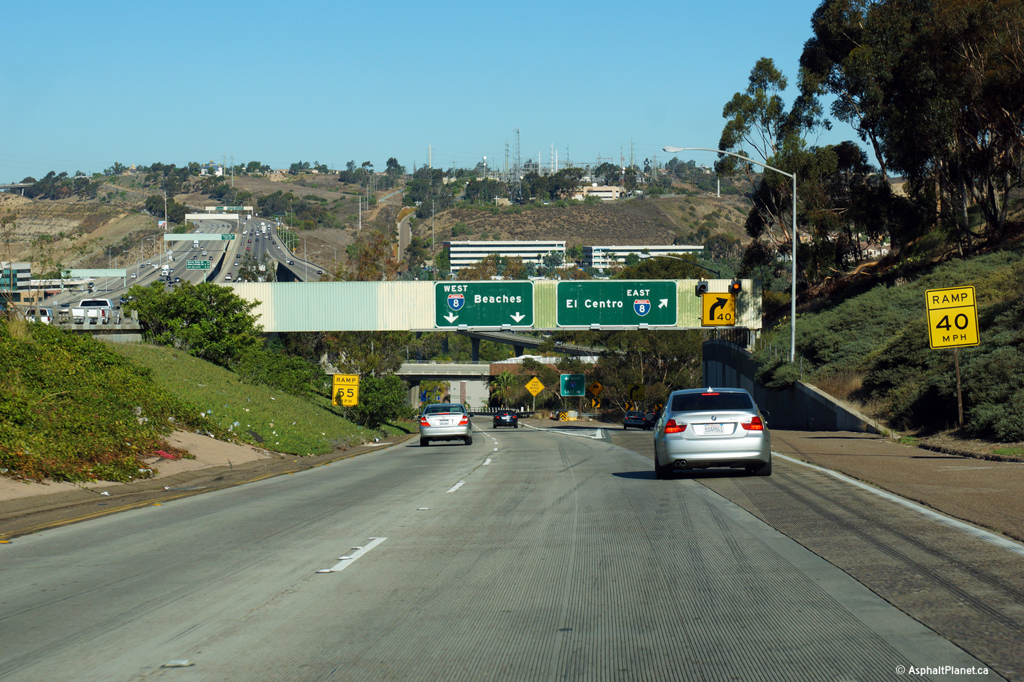
|
San Diego County |
Southerly view from the ramp to I-8 from I-805. This photo shows three of the four levels of this large interchange complex as well as the massive viaduct that carries I-805 over Mission Valley. |
 |
||
|
Date: 30/31/2013 |
High-res: (1440x960) (2400x1600) |
|||
| I-8 leads easterly from I-5 in San Diego through the San Diego suburbs towards Brawly and continues easterly into Arizona. Click here for Interstate 8 Images. | ||||
|
San Diego County |
Southbound ramp signage to the Mission Valley Freeway. |
 |
||
|
Date: 30/31/2013 |
High-res: (1440x960) (2400x1600) | |||
|
San Diego County |
Southbound signage at the departure of the ramp to I-8 from the mainline lanes of I-805. |
 |
||
|
Date: 30/31/2013 |
High-res: (1440x960) (2400x1600) | |||
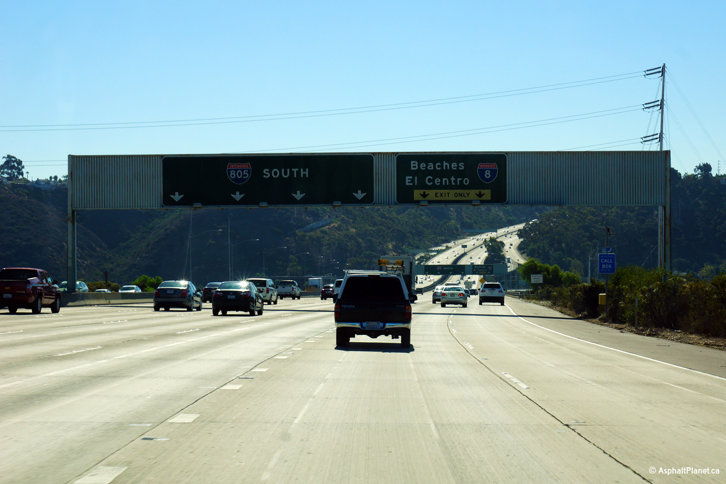
|
San Diego County |
Advanced signage for the ramp to I-8. |
 |
||
|
Date: 30/31/2013 |
High-res: (1440x960) (2400x1600) | |||
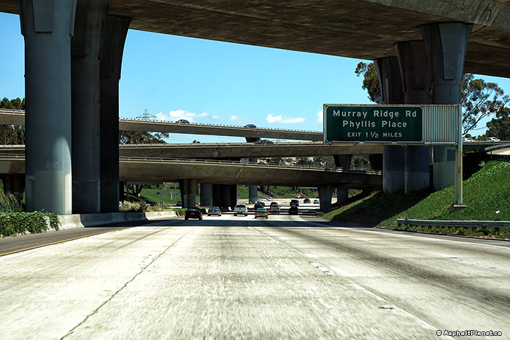
|
San Diego County |
Northbound signage at the off-ramp to Murray Ridge Road. |
 |
||
|
Date: 4/16/2017 |
High-res: (1440x960) (2400x1600) | |||
|
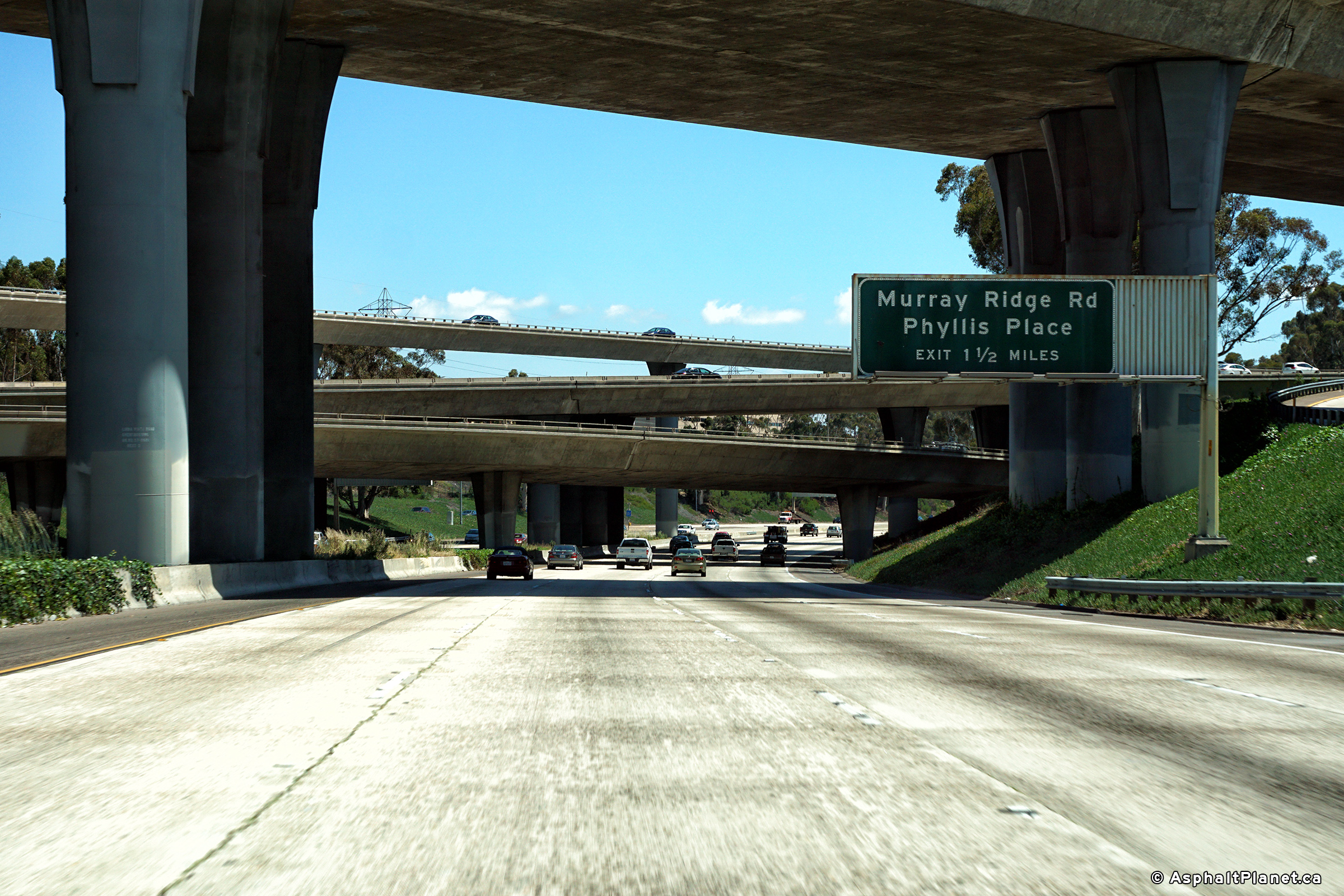
San Diego County |
View looking northerly along I-805 as it passes beneath the Murray Ridge Road overpass. |
 |
||
|
Date: 4/16/2017 |
High-res: (1440x960) (2400x1600) | |||
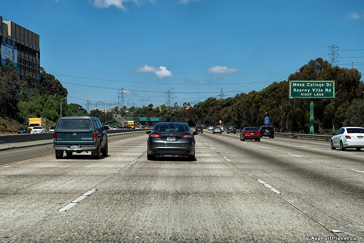
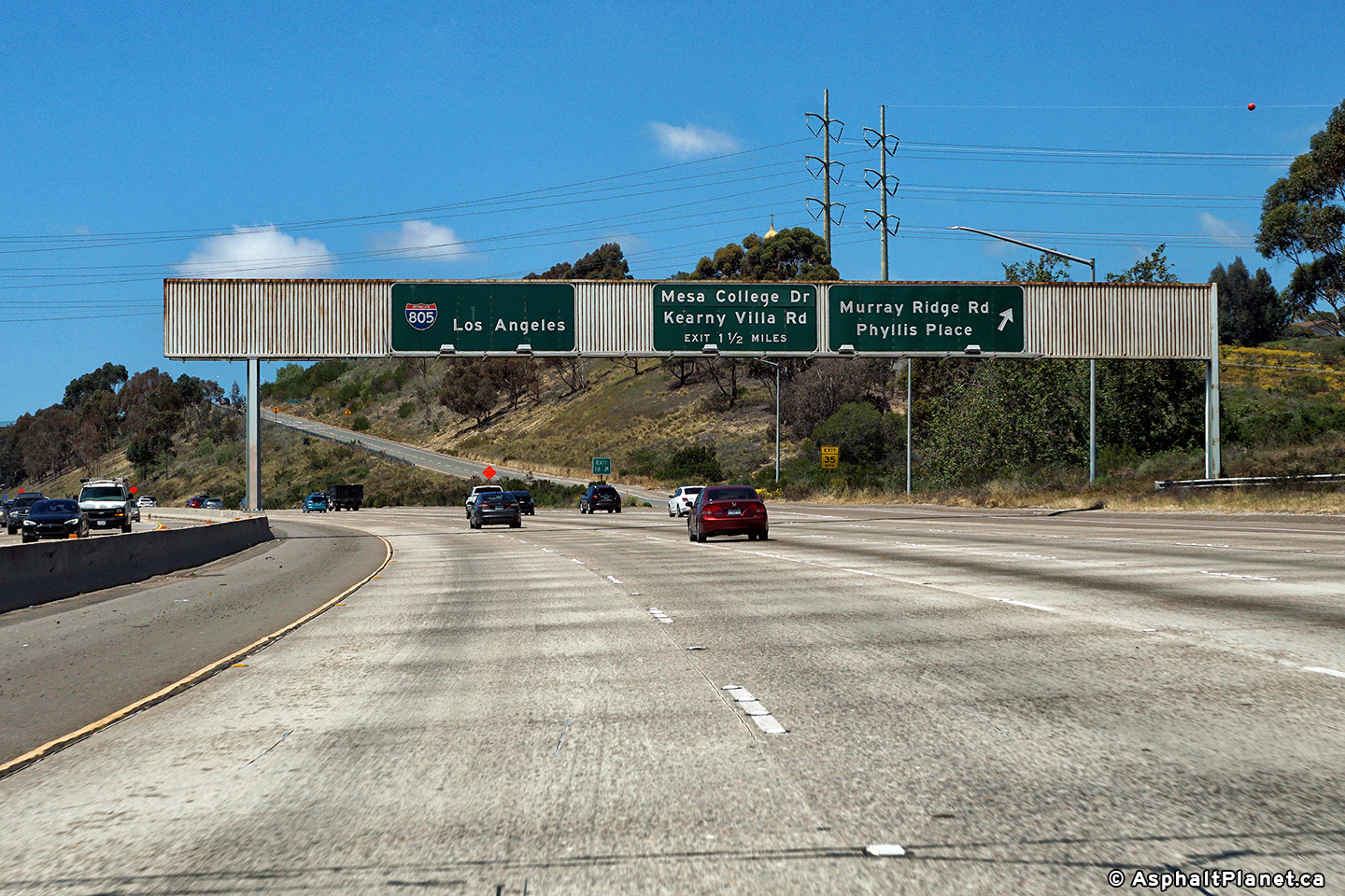
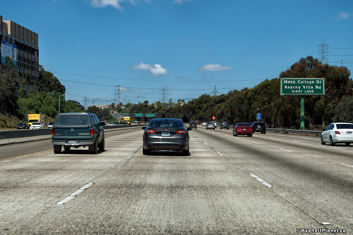
|
San Diego County |
An interchange sequence signage in advance of the Kearny Valley Road interchange sits on the back of a southbound sign for the _________________. |
 |
||
|
Date: 4/16/2017 |
High-res: (1440x960) (2400x1600) | |||
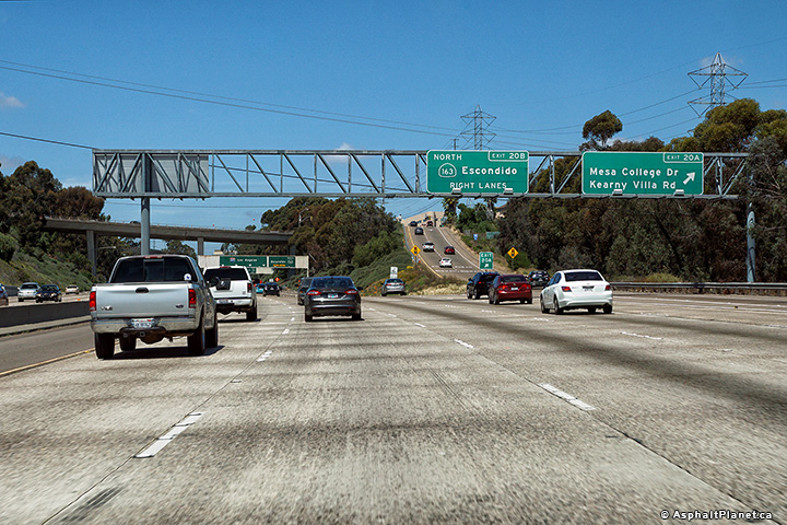
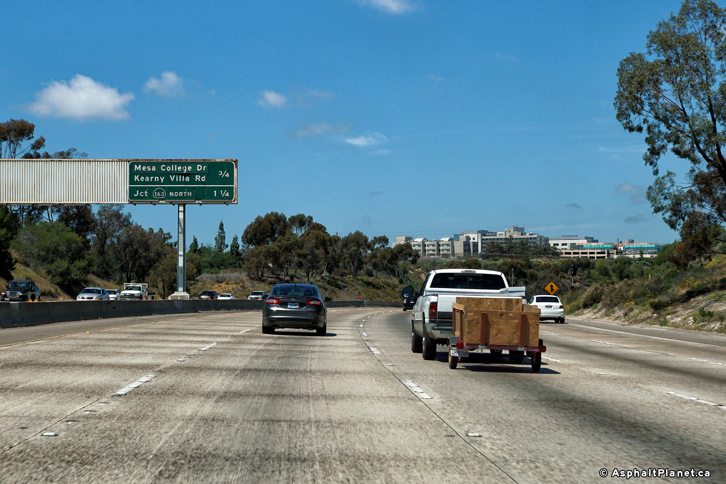
|
San Diego County |
Northbound advanced signage for the Kearny Valley Road off-ramp. |
 |
||
|
Date: 4/16/2017 |
High-res: (1440x960) (2400x1600) | |||
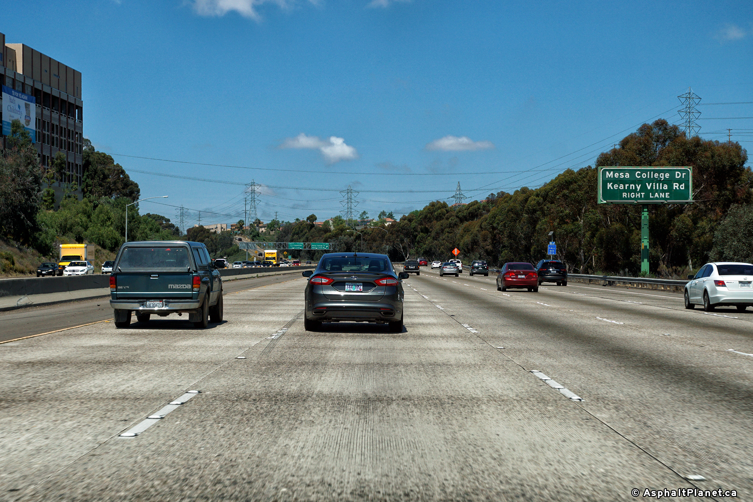
|
San Diego County |
Northbound signage at the off-ramp to Kearny Valley Road. |
 |
||
|
Date: 4/16/2017 |
High-res: (1440x960) (2400x1600) | |||
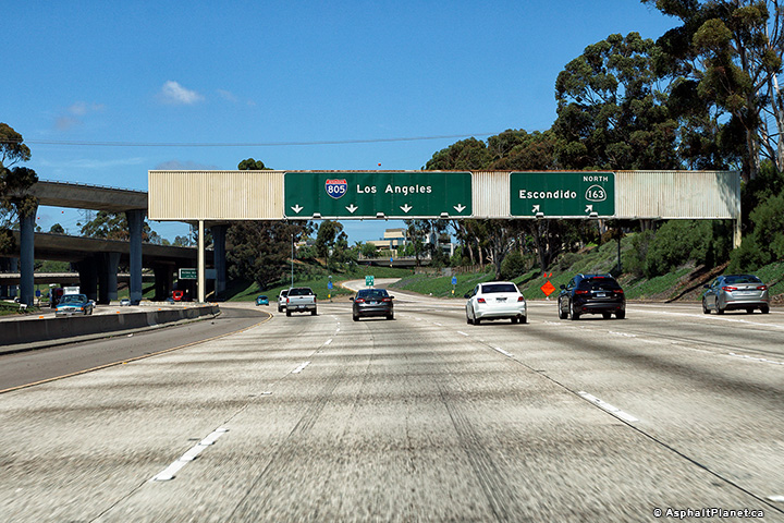
|
San Diego County |
Median mounted advanced signage for the Interstate 5 interchange. |
|||
|
Date: 4/16/2017 |
High-res: (1440x960) (2400x1600) | |||
|
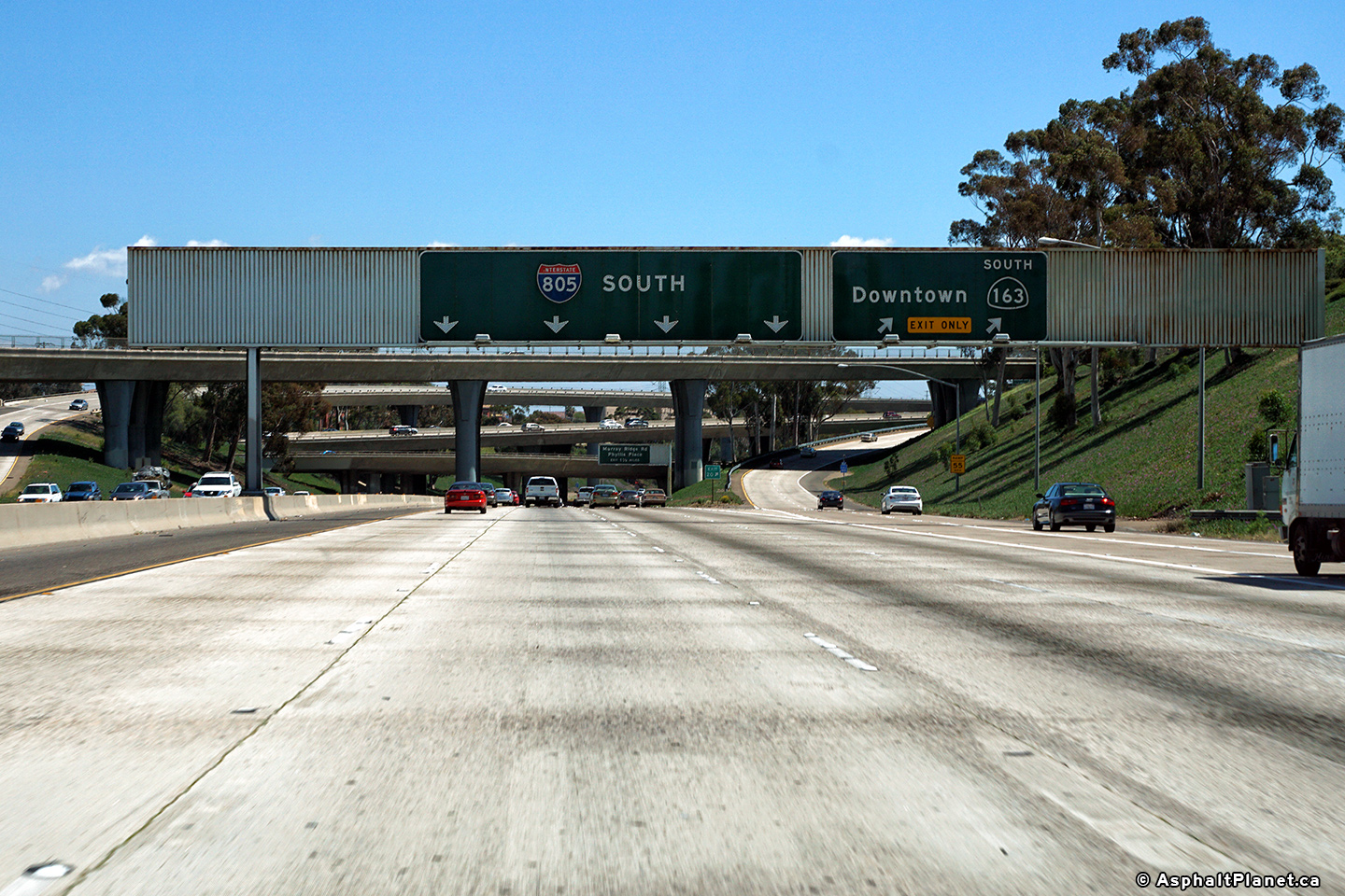
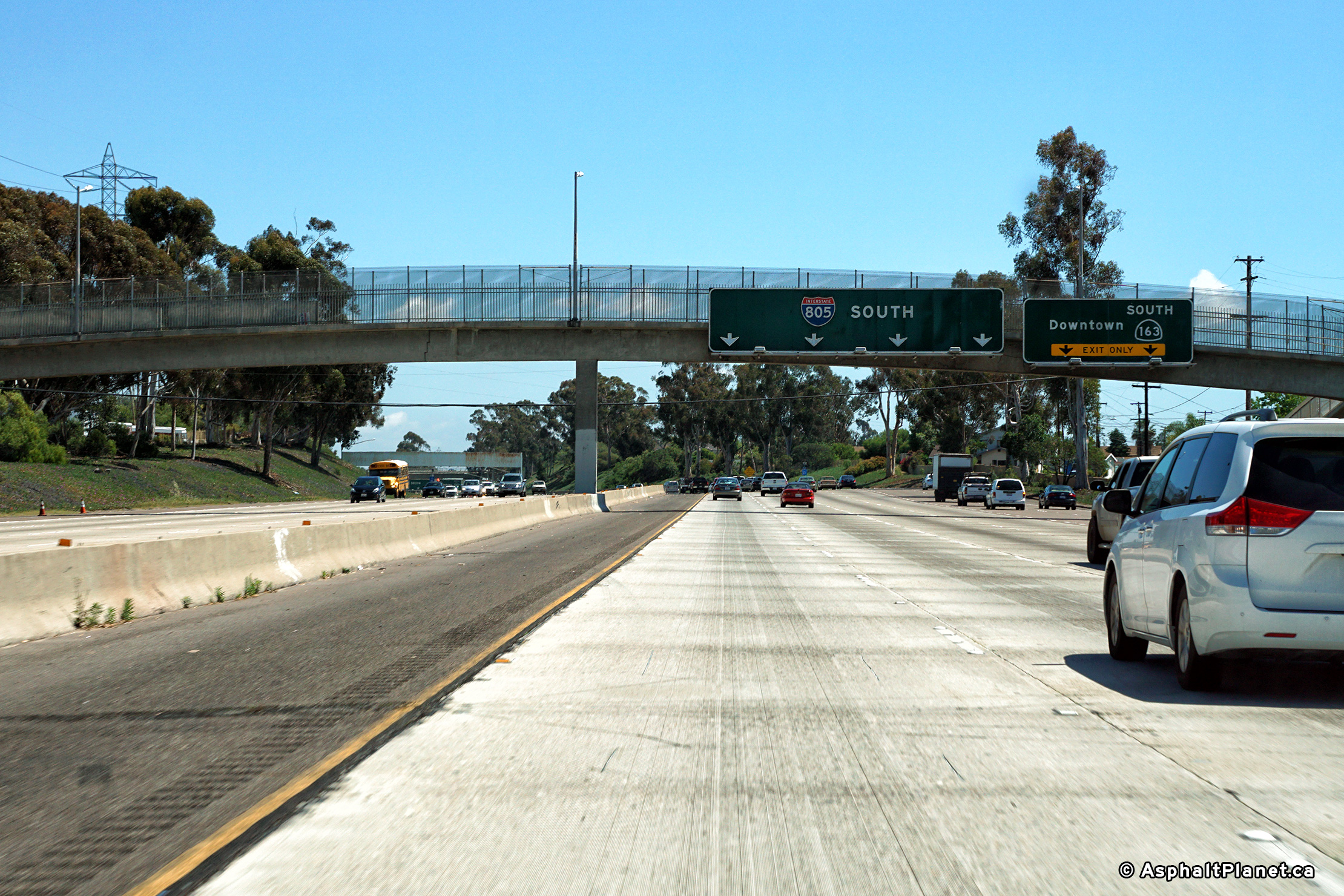
San Diego County |
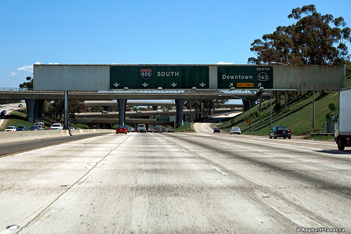
Signage for the northbound off-ramp to SR-163. Because I-805 and SR-163 travel in the same direction there are no ramps between I-805 and SR-163 South. |
 |
||
|
Date: 4/16/2017 |
High-res: (1440x960) (2400x1600) | |||
| SR-163 leads northerly from I-5 in Downtown San Diego to Interstate 15. Click here for SR-163 Images. | ||||
|
San Diego County |
An advanced sign for the Murray Ridge Road interchange has been placed just beneath the SR-163 flyovers. |
 |
||
|
Date: 30/30/2013 |
High-res: (1440x960) (2400x1600) | |||
|
San Diego County |
Southbound signage at the off-ramp to SR-163 South. SR-163 is the former alignment of US-395 |
 |
||
|
Date: 30/30/2013 |
High-res: (1440x960) (2400x1600) | |||
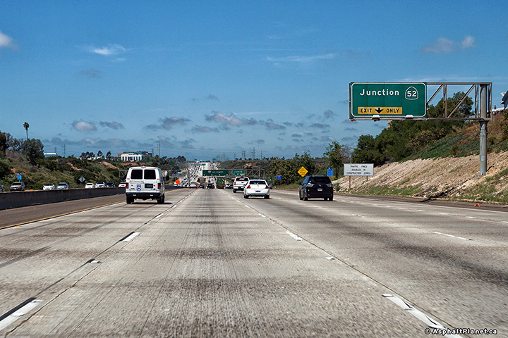
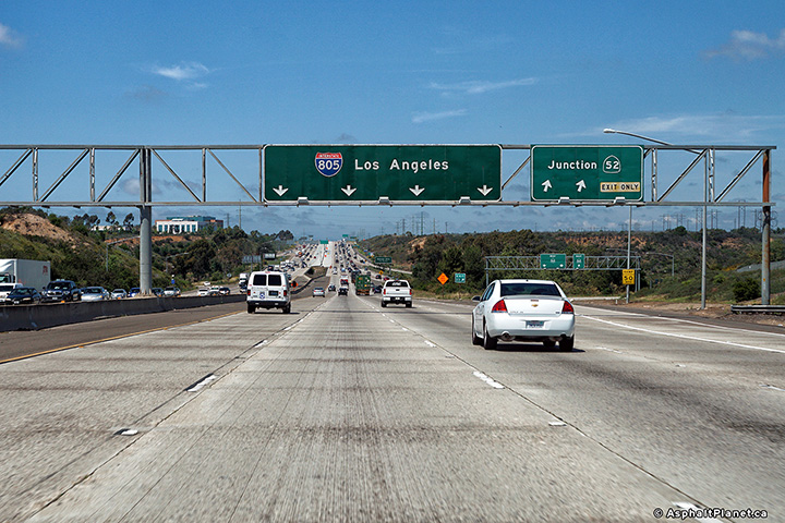
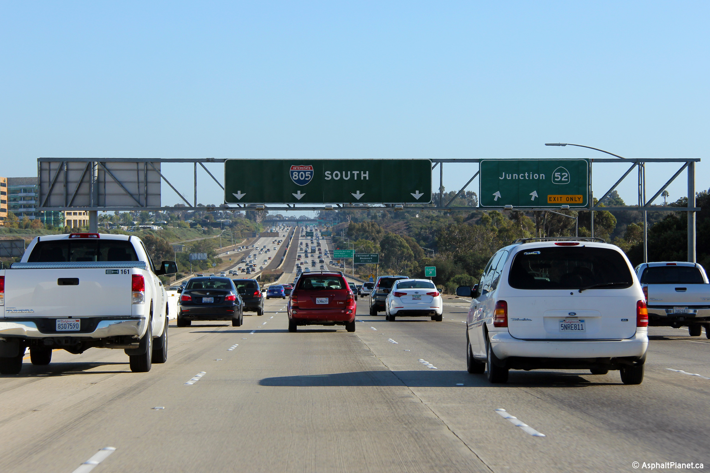
|
San Diego County |
Overhead signage at the southbound off-ramp to Highway 52. As with the I-8 interchange, I-805 is the highest level of the four level Highway 52 Interchange. |
 |
||
|
Date: 30/30/2013 |
High-res: (1440x960) (2400x1600) | |||
|
San Diego County |
Interchange sequence signage facing northbound motorists north of the SR-163 interchange. |
 |
||
|
Date: 4/16/2017 |
High-res: (1440x960) (2400x1600) | |||
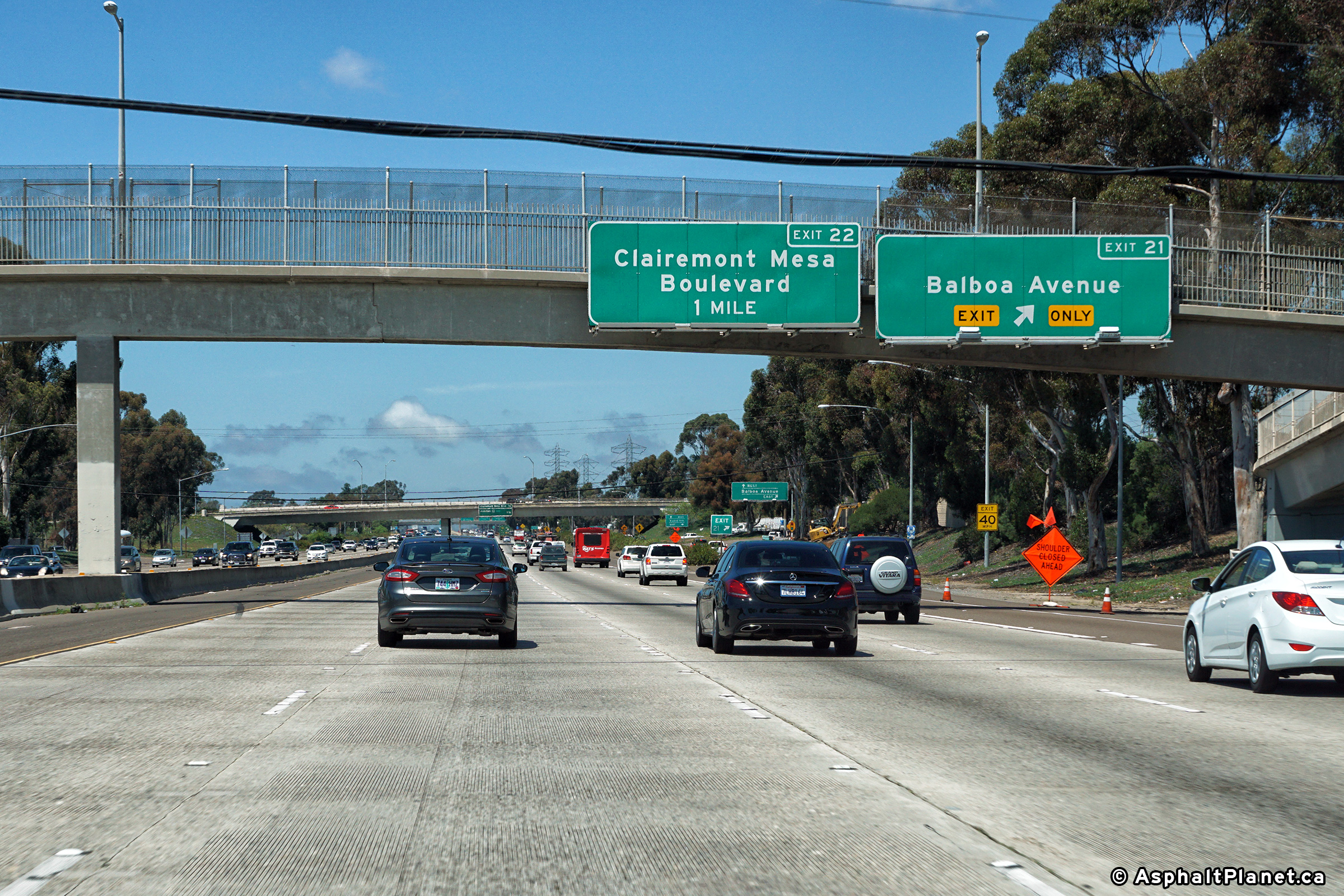
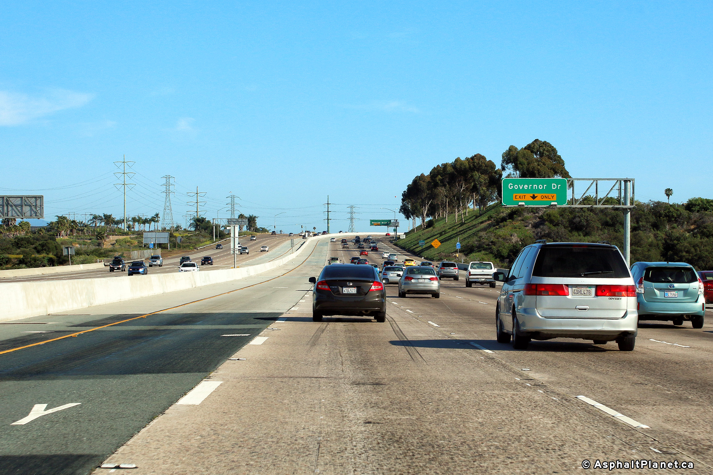
|
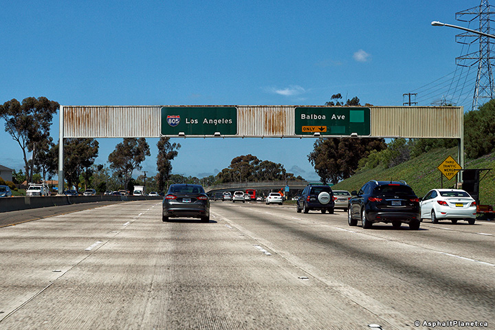
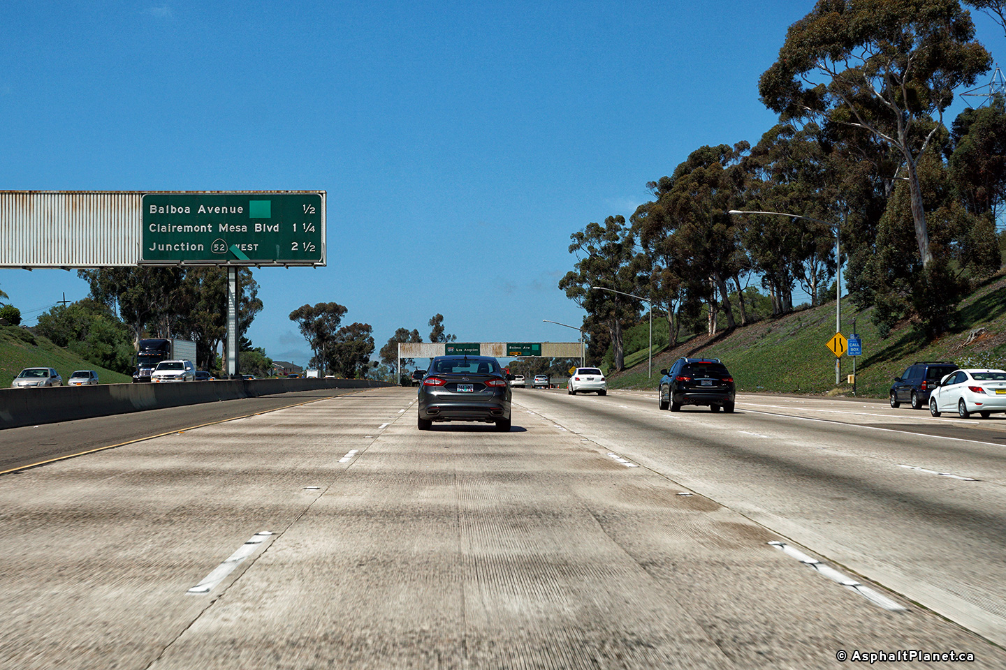
San Diego County |
Southbound advanced signage for the off-ramp to Balboa Avenue interchange. |
 |
||
|
Date: 4/16/2017 |
High-res: (1440x960) (2400x1600) | |||
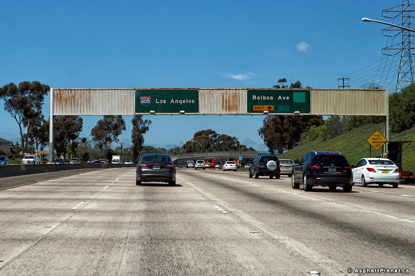
|
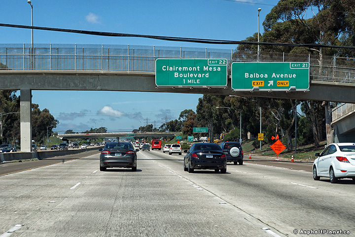
San Diego County |
Northbound signage at the off-ramp to Balboa Avenue. |
 |
||
|
Date: 4/16/2017 |
High-res: (1440x960) (2400x1600) | |||
|
San Diego County |
Median mounted advanced signage for the Interstate 5 interchange. |
|||
|
Date: 4/16/2017 |
High-res: (1440x960) (2400x1600) | |||
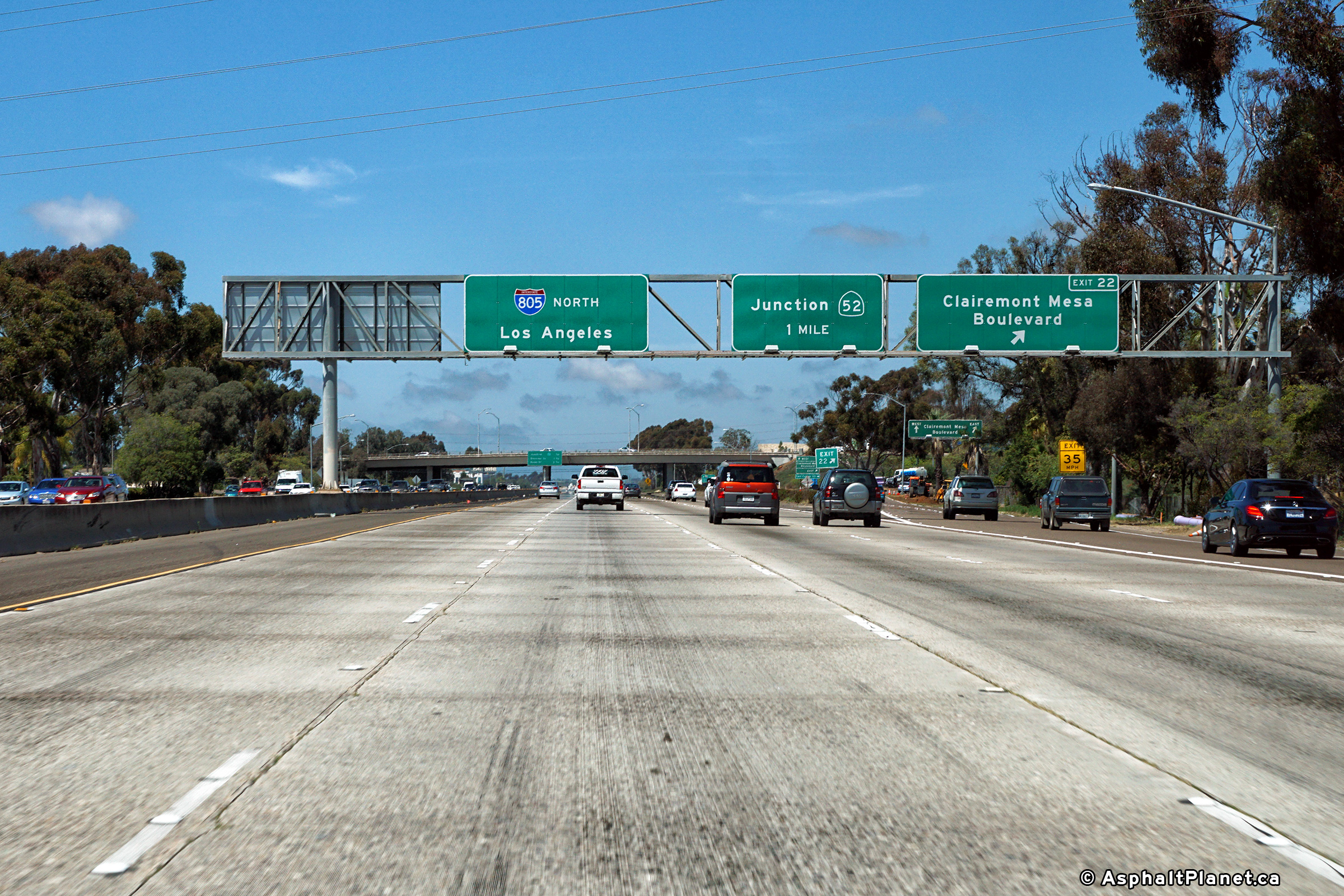
|
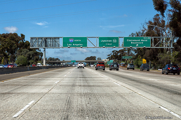
San Diego County |
Northbound signage at the off-ramp to Clairemont Mesa Road. SR-52 is the next downstream interchange. |
 |
||
|
Date: 4/16/2017 |
High-res: (1440x960) (2400x1600) | |||
|
San Diego County |
Median mounted advanced signage for the Interstate 5 interchange. |
|||
|
Date: 4/16/2017 |
High-res: (1440x960) (2400x1600) | |||
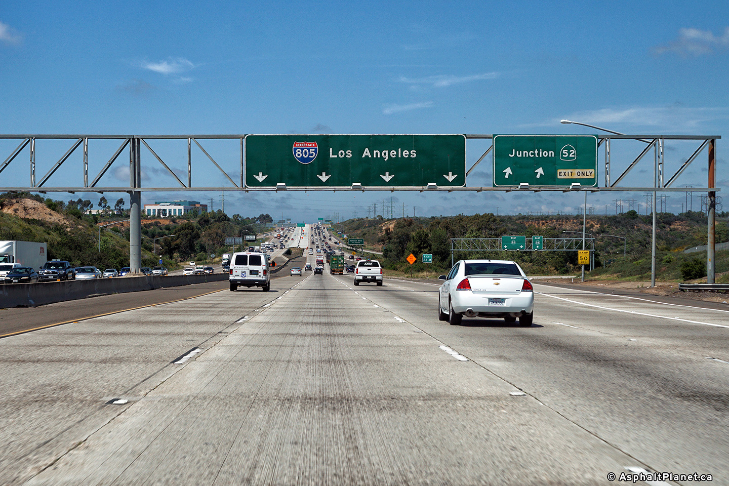
|
San Diego County |
Southbound advanced signage approaching the SR-52 interchange. |
 |
||
|
Date: 4/16/2017 |
High-res: (1440x960) (2400x1600) | |||
|
San Diego County |
Northbound signage at the off-ramp to SR-52. |
 |
||
|
Date: 4/16/2017 |
High-res: (1440x960) (2400x1600) | |||
| SR-52 is a short connector highway that leads easterly from I-5 to SR-67 along the northern edge of the San Diego's urban area. Click here for SR-52 Images. | ||||
|
San Diego County |
Overhead signage at the southbound off-ramp to Highway 52. As with the I-8 interchange, I-805 is the highest level of the four level Highway 52 Interchange. |
 |
||
|
Date: 30/30/2013 |
High-res: (1440x960) (2400x1600) | |||
|
San Diego County |
Overhead signage at the southbound off-ramp to Highway 52. As with the I-8 interchange, I-805 is the highest level of the four level Highway 52 Interchange. |
|||
|
Date: 30/30/2013 |
High-res: (1440x960) (2400x1600) | |||
|
San Diego County |
Overhead signage at the southbound off-ramp to Highway 52. As with the I-8 interchange, I-805 is the highest level of the four level Highway 52 Interchange. |
 |
||
|
Date: 30/30/2013 |
High-res: (1440x960) (2400x1600) | |||
|
San Diego County |
Overhead signage at the southbound off-ramp to Highway 52. As with the I-8 interchange, I-805 is the highest level of the four level Highway 52 Interchange. |
 |
||
|
Date: 30/30/2013 |
High-res: (1440x960) (2400x1600) | |||
|
San Diego County |
Median mounted advanced signage for the Interstate 5 interchange. |
 |
||
|
Date: 4/16/2017 |
High-res: (1440x960) (2400x1600) | |||
|
San Diego County |
Median mounted advanced signage for the Interstate 5 interchange. |
 |
||
|
Date: 4/16/2017 |
High-res: (1440x960) (2400x1600) | |||
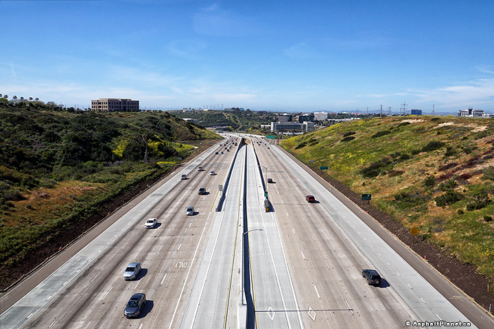
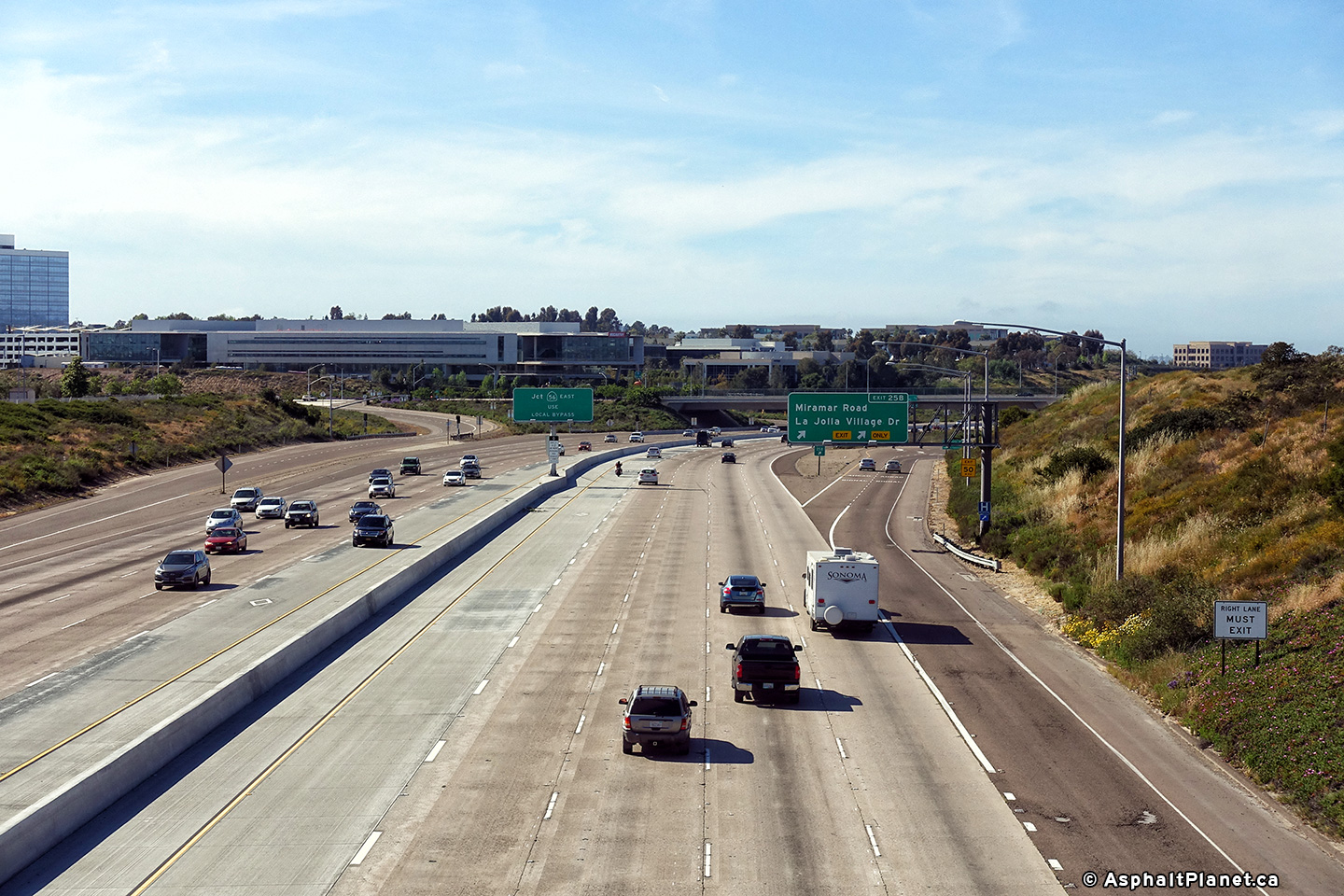
|
San Diego County |
View looking southerly from the Eastgate Mall overpass towards the Caroll Canyon median HOV lane interchange. |
 |
||
| High-res: (1440x960) (2400x1600) | ||||
 |
||||
|
Date: 4/16/2017 |
High-res: (1440x960) (2400x1600) | |||
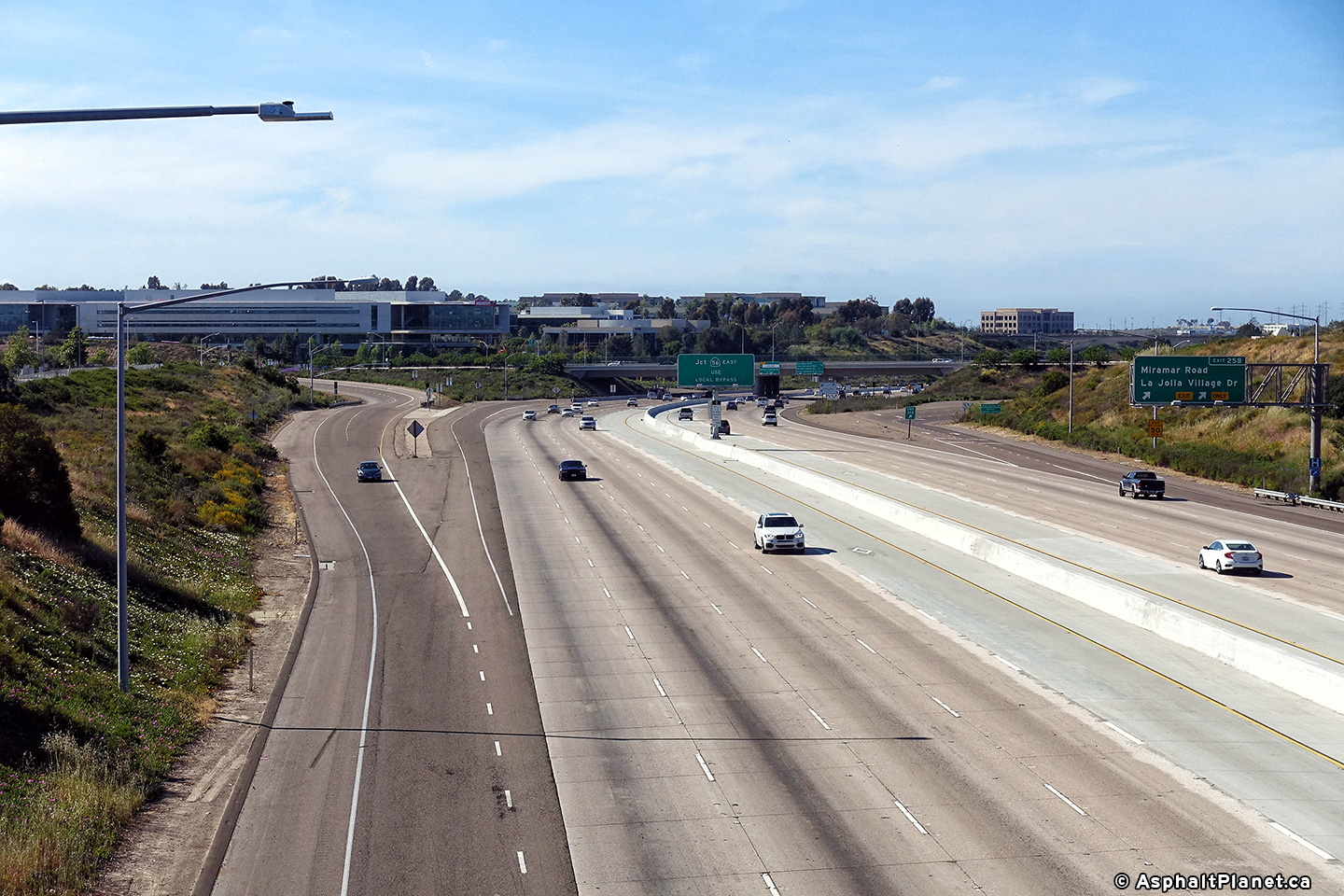
|
San Diego County |
View looking northerly from the Eastgate Mall overpass towards the Miramar Road interchange. |
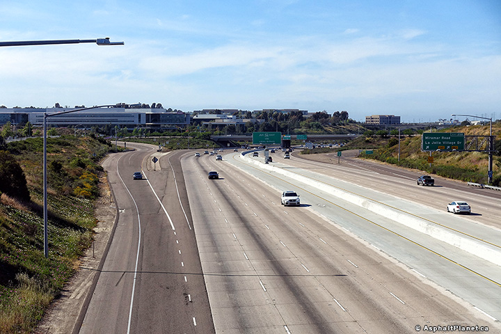 |
||
| High-res: (1440x960) (2400x1600) | ||||
 |
||||
|
Date: 4/16/2017 |
High-res: (1440x960) (2400x1600) | |||
|
San Diego County |
Overhead signage at the southbound off-ramp to Highway 52. As with the I-8 interchange, I-805 is the highest level of the four level Highway 52 Interchange. |
 |
||
|
Date: 30/30/2013 |
High-res: (1440x960) (2400x1600) | |||
|
San Diego County |
Median mounted advanced signage for the Interstate 5 interchange. |
 |
||
|
Date: 4/16/2017 |
High-res: (1440x960) (2400x1600) | |||
|
San Diego County |
Median mounted advanced signage for the Interstate 5 interchange. |
 |
||
|
Date: 4/16/2017 |
High-res: (1440x960) (2400x1600) | |||
|
San Diego County |
Northbound sigange for the HOV lane exit to Caroll Canyon Road. |
 |
||
|
Date: 4/16/2017 |
High-res: (1440x960) (2400x1600) | |||
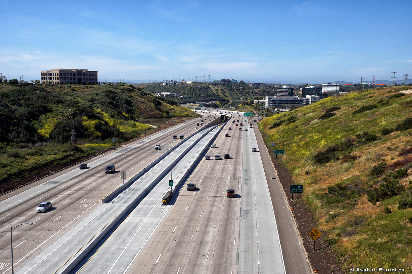
|
San Diego County |
View looking southerly from the Eastgate Mall overpass towards the Caroll Canyon median HOV lane interchange. |
 |
||
| High-res: (1440x960) (2400x1600) | ||||
 |
||||
|
Date: 4/16/2017 |
High-res: (1440x960) (2400x1600) | |||
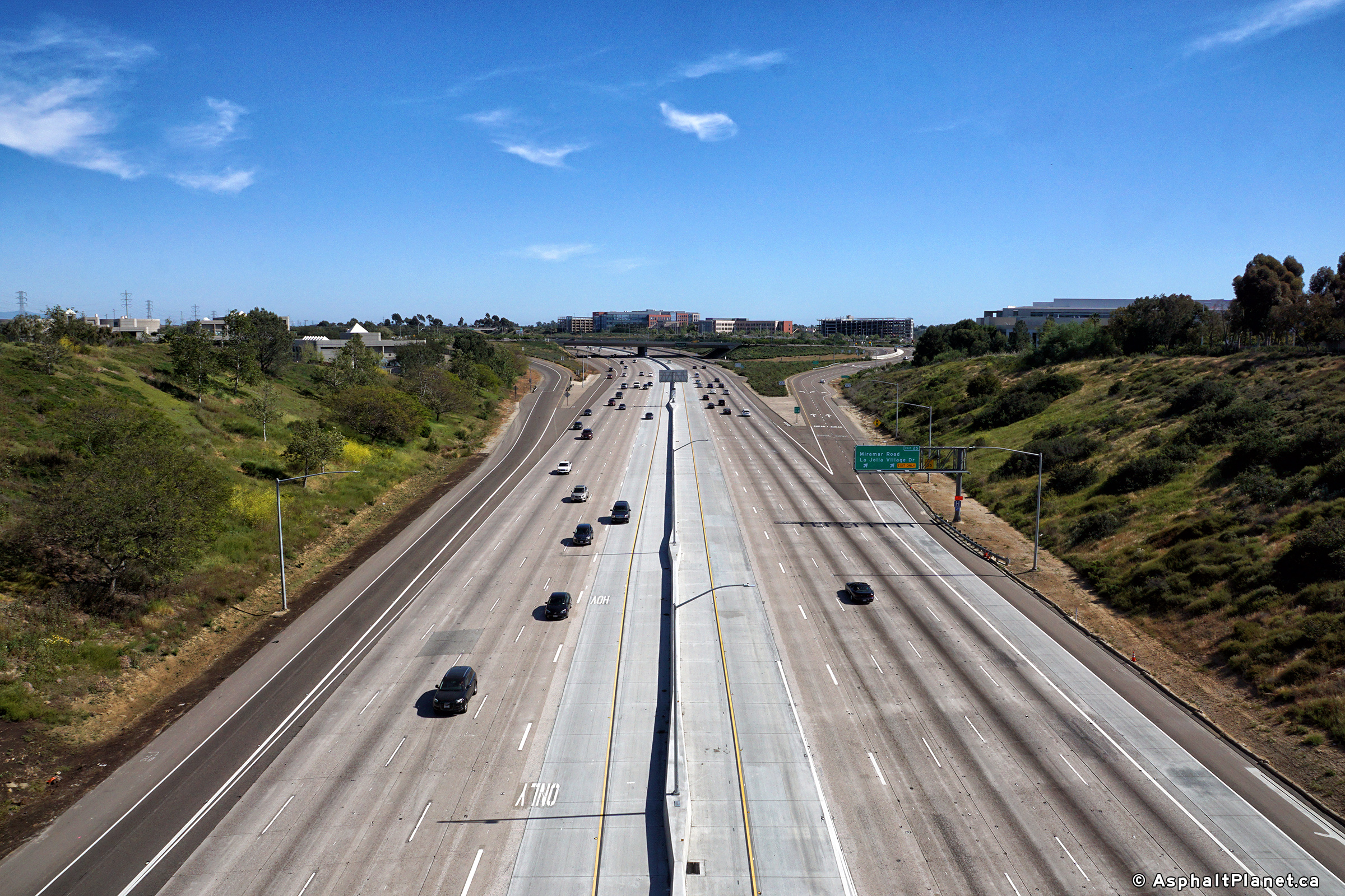
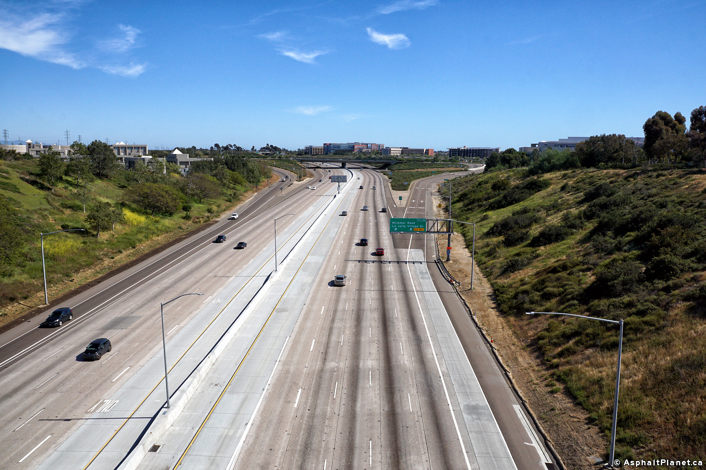
|
San Diego County |
View looking northerly from the Eastgate Mall overpass towards the Miramar Road interchange. |
 |
||
| High-res: (1440x960) (2400x1600) | ||||
 |
||||
|
Date: 4/16/2017 |
High-res: (1440x960) (2400x1600) | |||
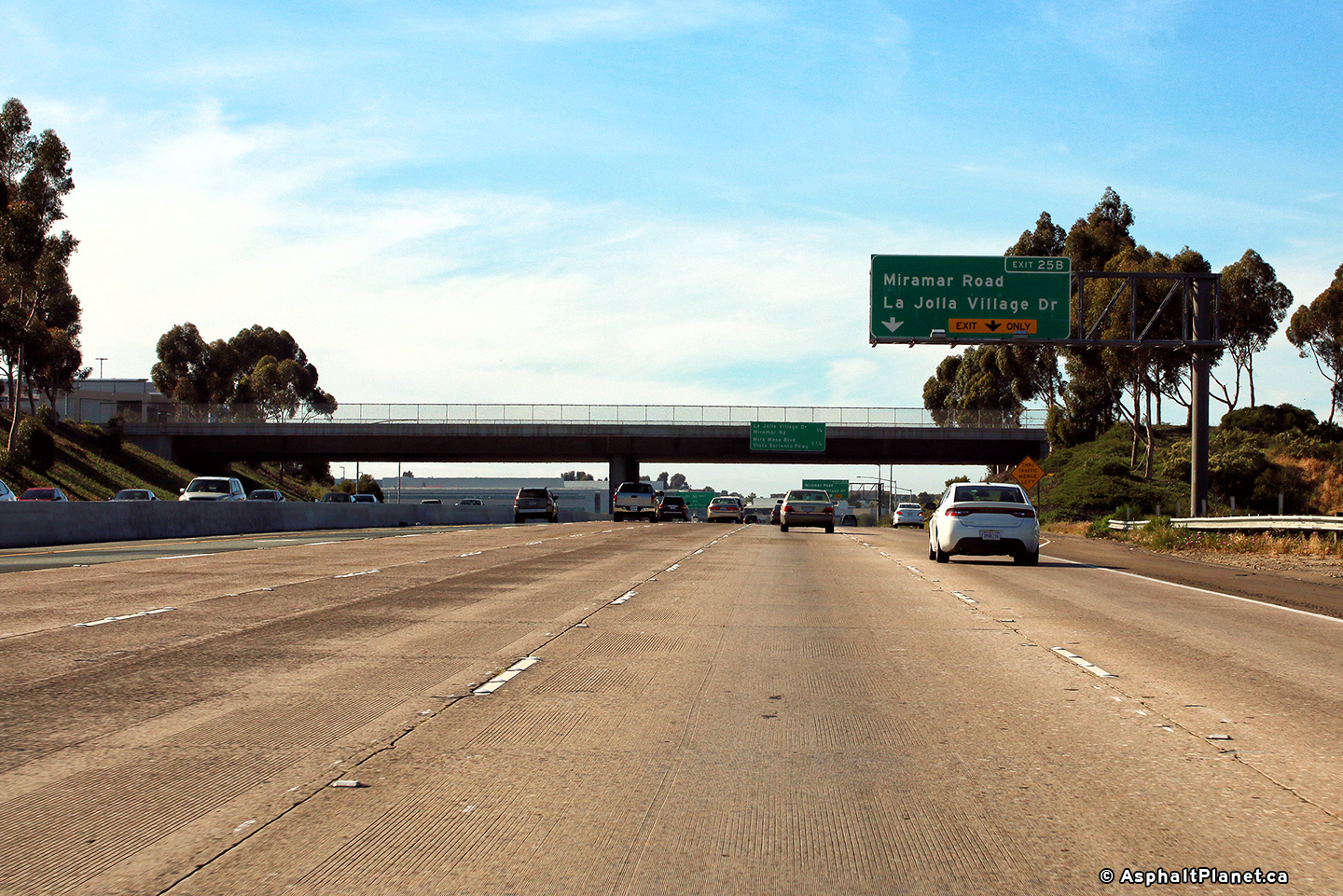
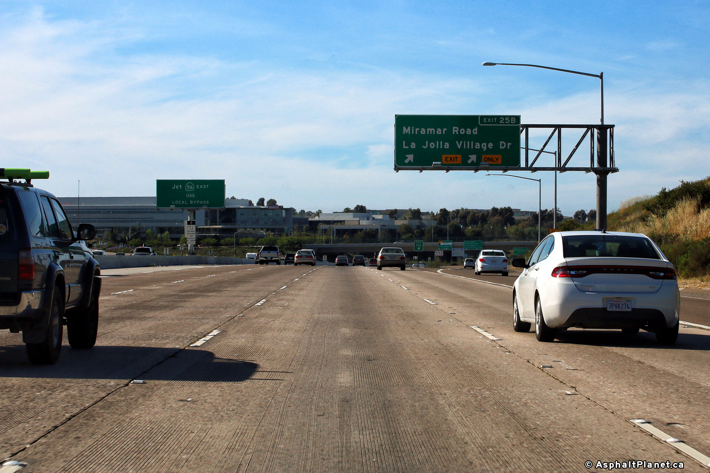
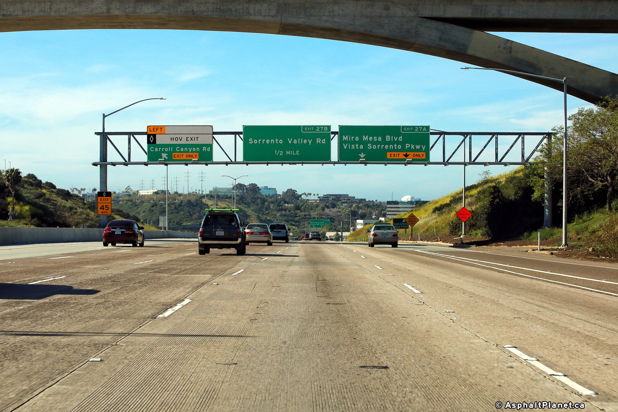
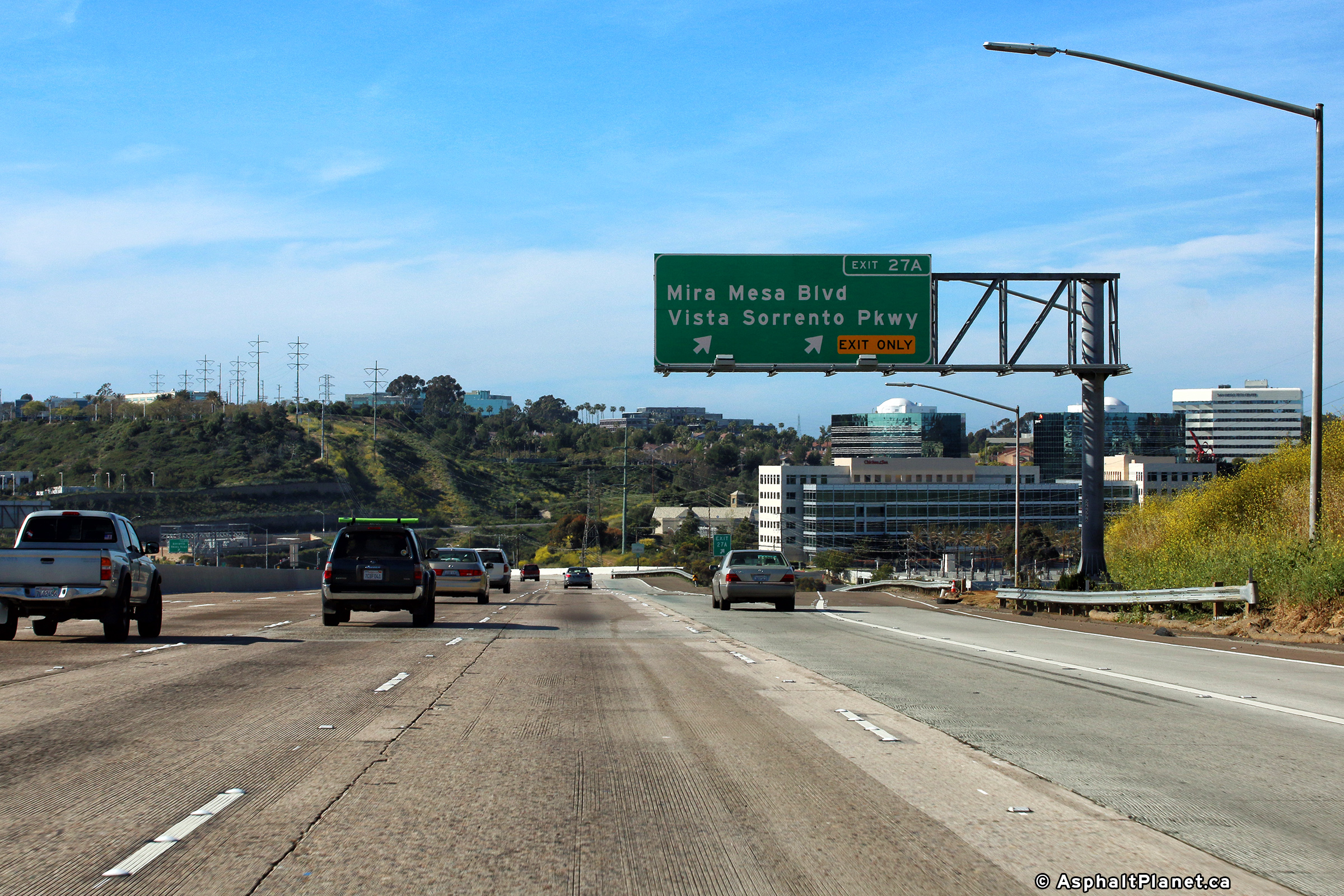
|
San Diego County |
Signage at the northbound off-ramp to Mira Mesa Road. |
 |
||
|
Date: 4/16/2017 |
High-res: (1440x960) (2400x1600) | |||
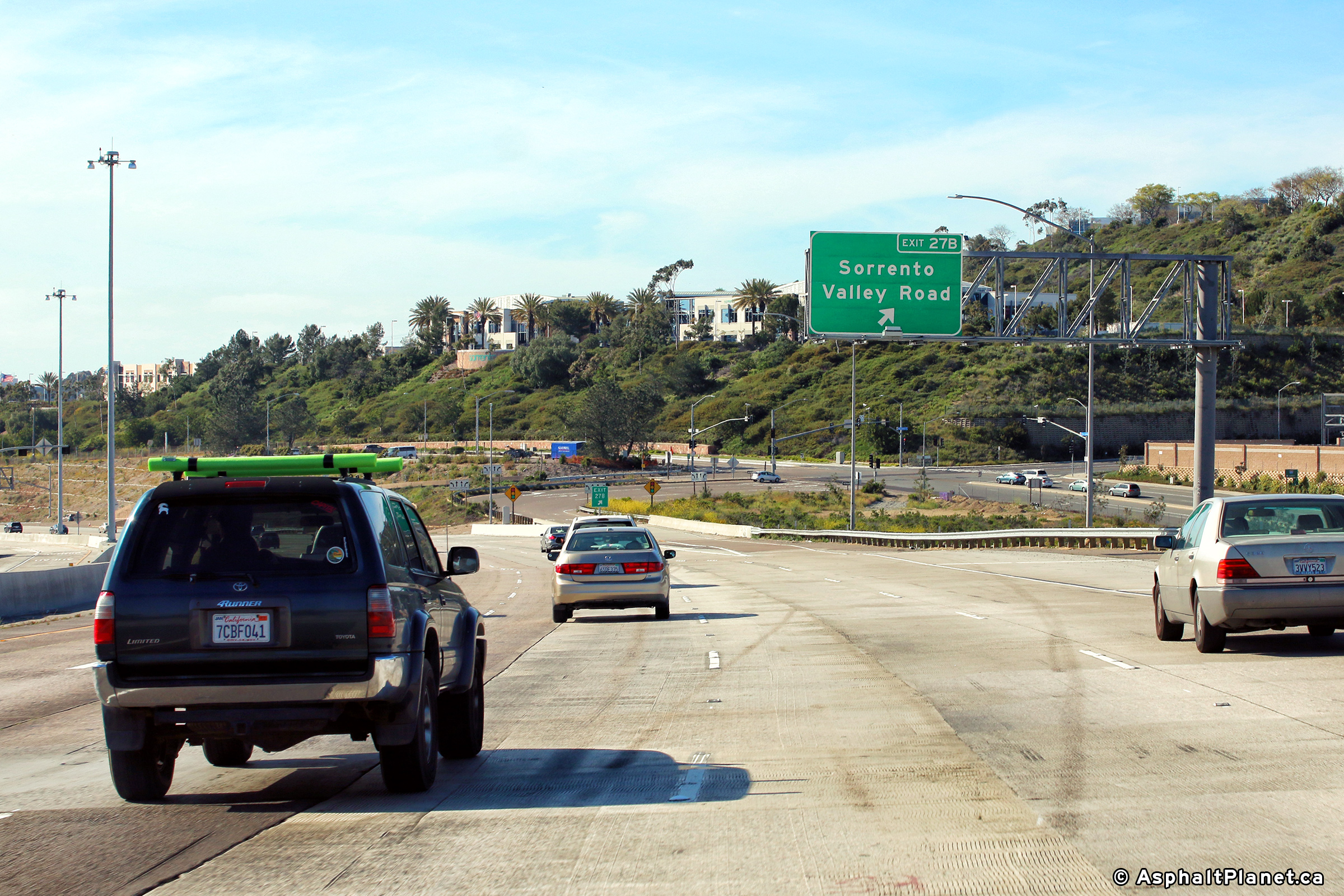
|
San Diego County |
View looking northerly at the off-ramp to Sorrento Valley Road. |
 |
||
|
Date: 4/16/2017 |
High-res: (1440x960) (2400x1600) | |||
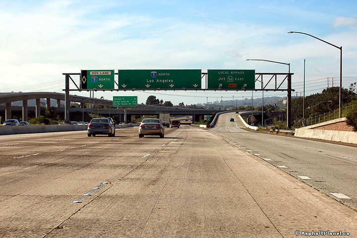
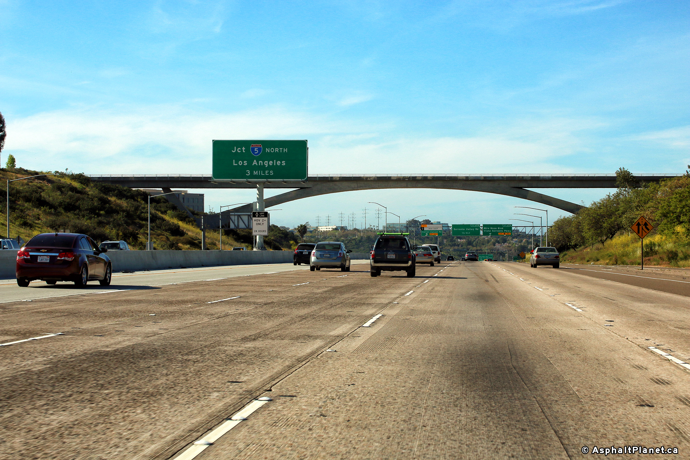
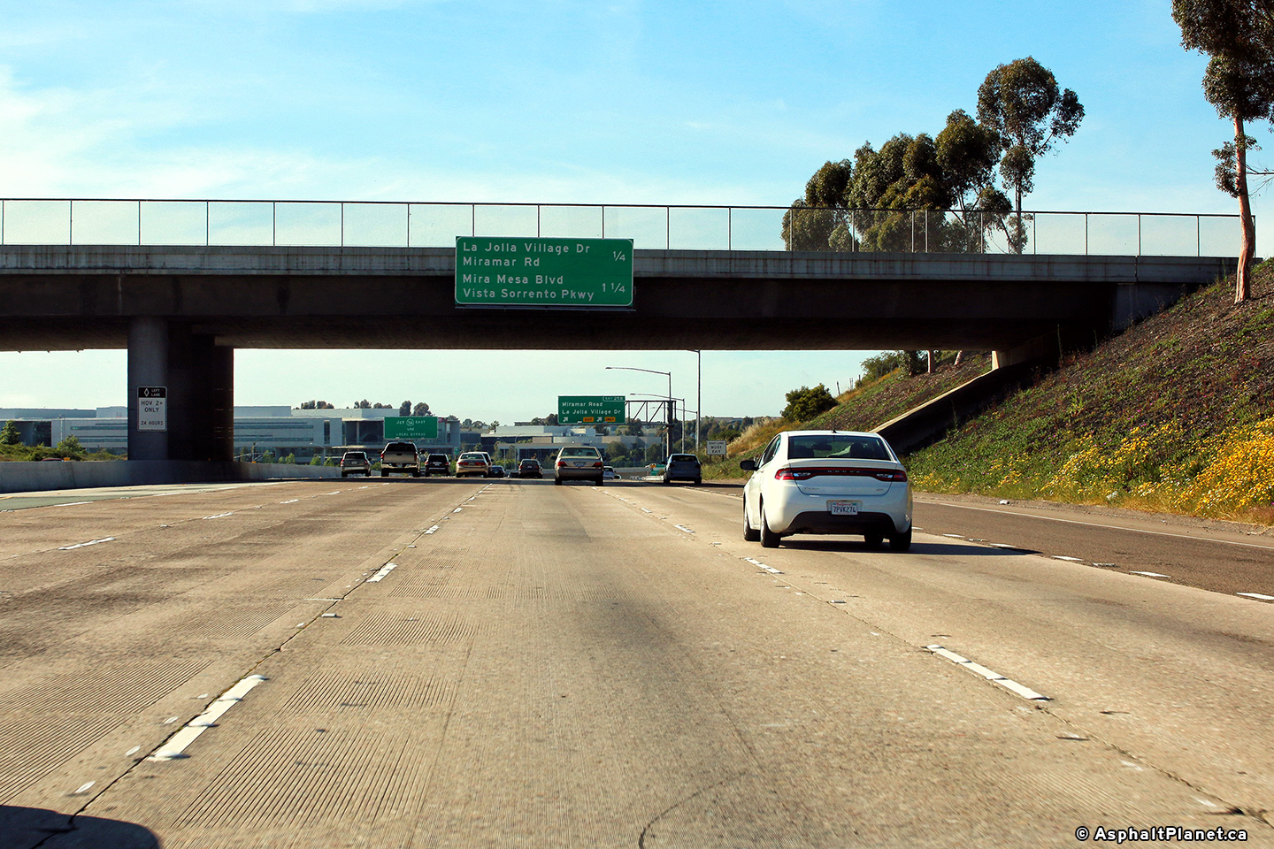
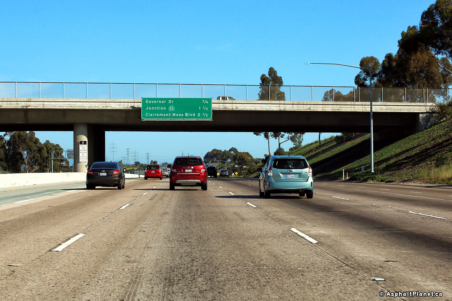
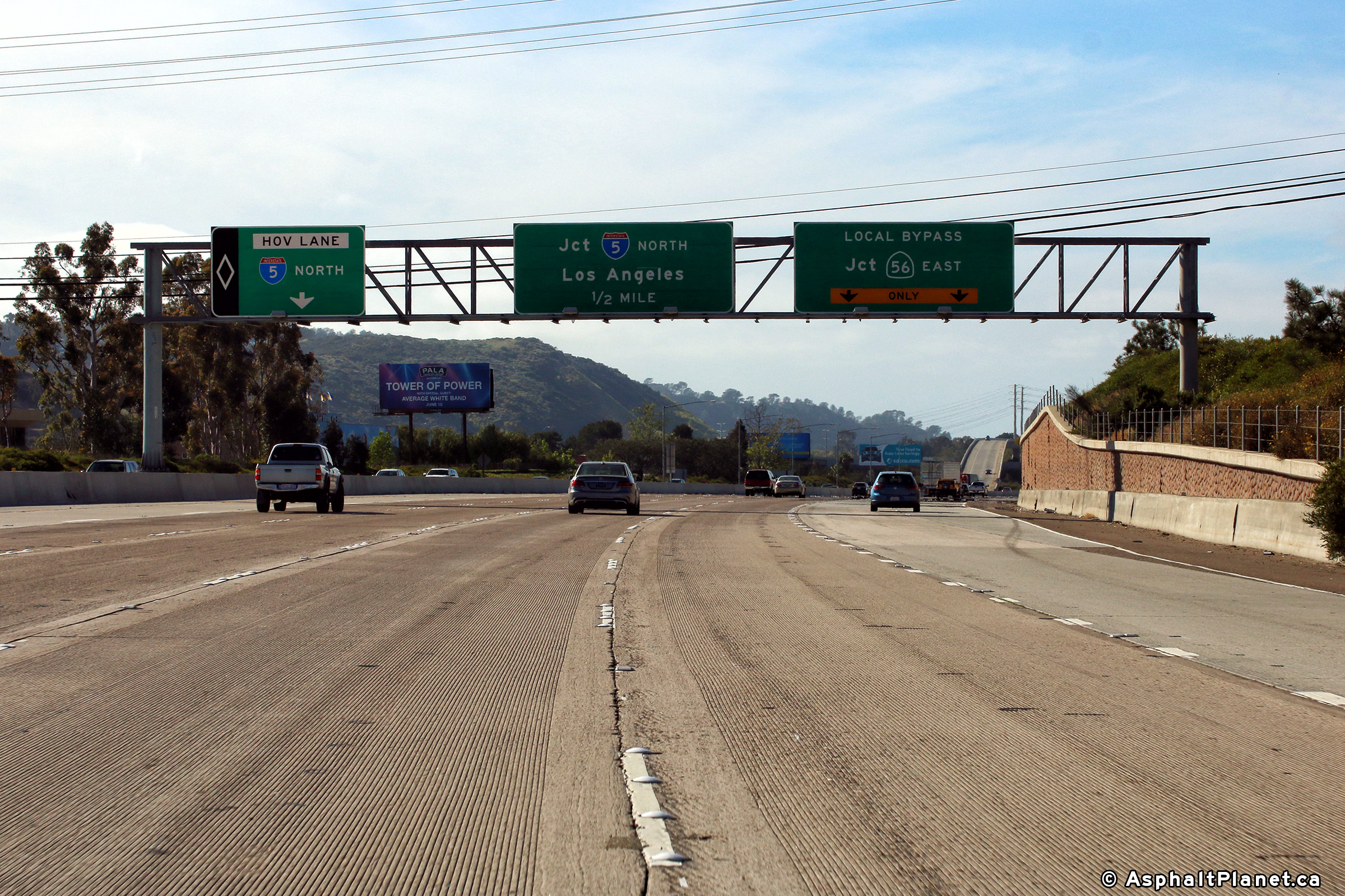
|
San Diego County |
Advanced signage for the upcoming I-5 interchange. Traffic bound for the SR-56 freeway must exit the freeway in advance of the I-5 interchange and follow the local by-pass. |
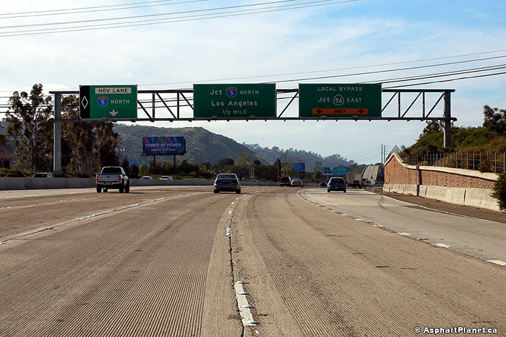 |
||
|
Date: 4/16/2017 |
High-res: (1440x960) (2400x1600) | |||
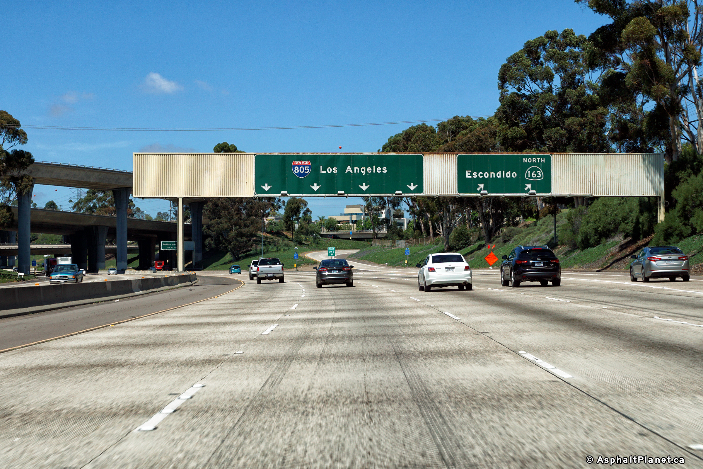
|
San Diego County |
Signage at the northern terminus of I-805 at the I-5 interchange. |
 |
||
|
Date: 4/16/2017 |
High-res: (1440x960) (2400x1600) | |||
<- I-780
CA Highways
I-880 ->
AsphaltPlanet.ca
© 2010-13 AsphaltPlanet.ca.
AsphaltPlanet@asphaltplanet.ca
Page Created: November 19, 2013.
Last Updated: November 19, 2013.