AsphaltPlanet.ca > Michigan > Interstate 94 > Page 6
|
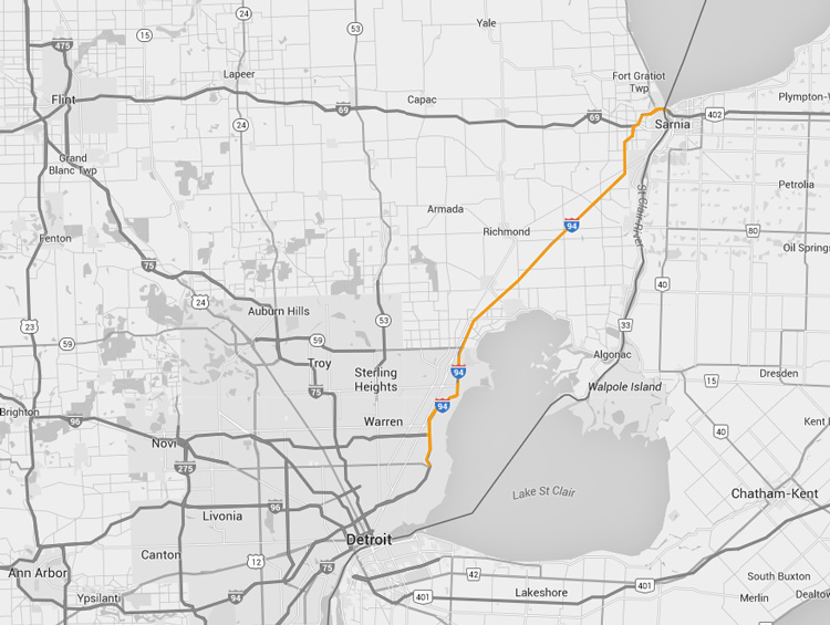
Interstate 94
(Michigan) |
| <- Page 5 |
|
ON-402 -> |
Pictures are arranged in order from
west to east.
I-94 East photos are
left-aligned in the last column, while I-94 West photos are right-aligned.
Center-line pictures are centered within the last column.
|
Location |
Description |
Photo |
||
|
East- |
West- Bound |
|||
|
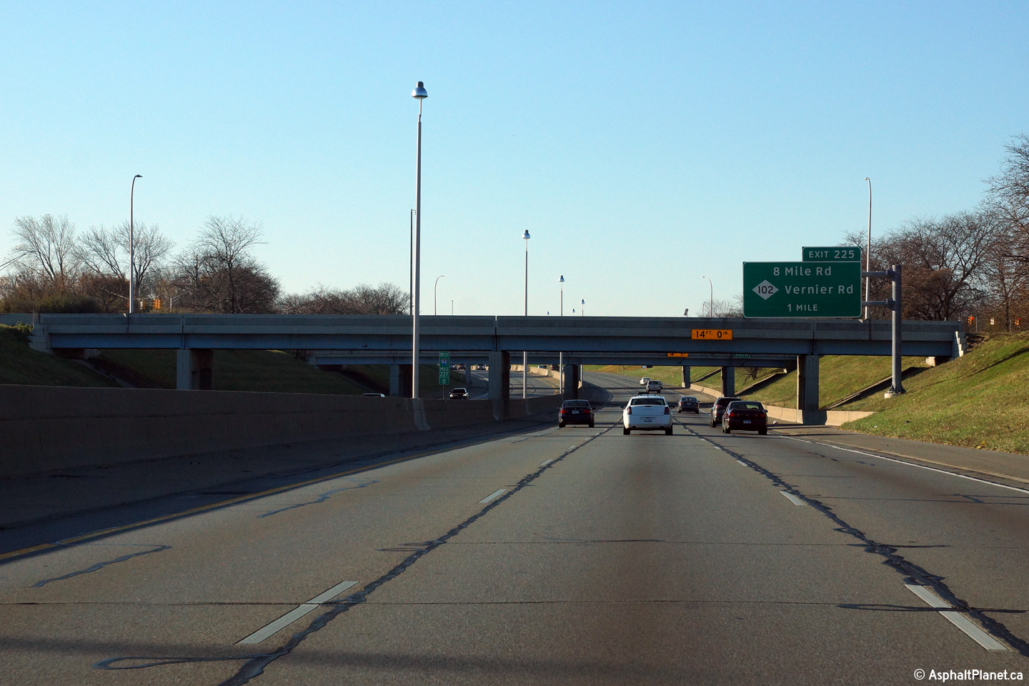
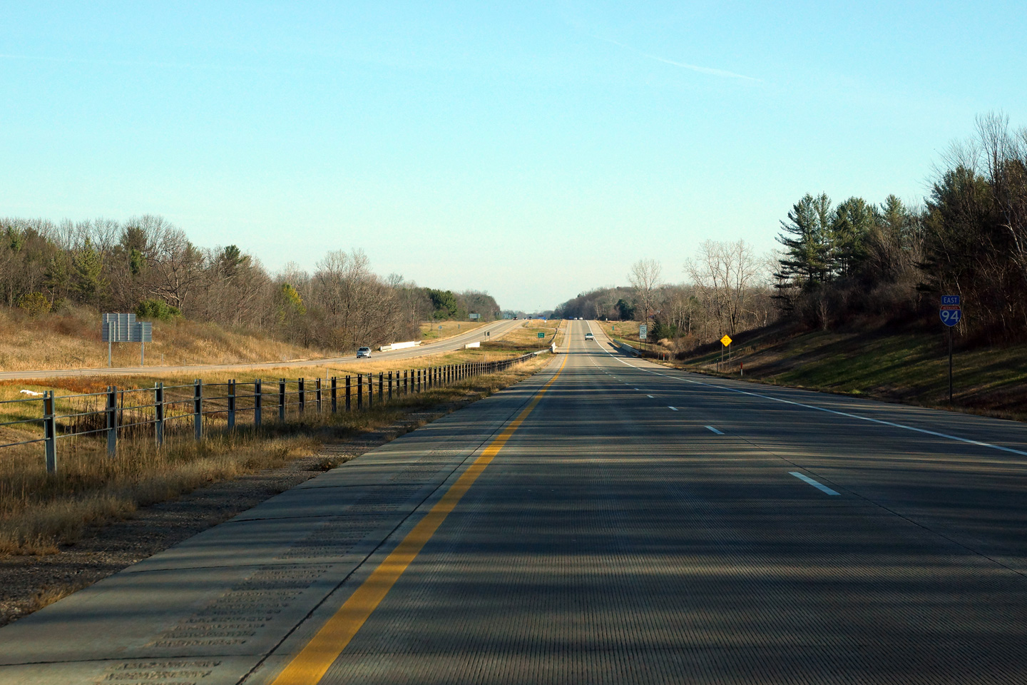
Macomb County City of St. Clair Shores |
Southbound advanced signage for the M-102 interchange. |
 |
||
|
Date: 11/15/2015 |
High-res: (1440x960) (2400x1600) | |||
|
I-696 leads travelers westerly from I-94 through the northern edge of the Detroit Metro to I-96 at Novi. Click here for I-696 images. |
||||
|
Macomb County City of St. Clair Shores |
View looking southerly from Martin Road overpass towards the I-696 interchange. During 2009, various (but extensive) construction projects were carried out along the length I-696, hence the construction signage along the ramps. |
|
||
|
Date: 4/20/2007 |
High-res: (1440x960) | |||
|
Macomb County City of St. Clair Shores |
View looking easterly from Martin Road towards the 12 Mile Rd. interchange. |
|
||
|
Date: 4/20/2007 |
High-res: (1440x960) | |||
|
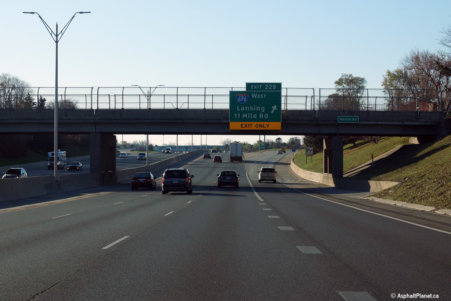
Macomb County City of St. Clair Shores |
The signage for the westbound off-ramp to the I-696 interchange is affixed to the Martin Road overpass. |
 |
||
|
Date: 11/15/2015 |
High-res: (1440x960) (2400x1600) | |||
|
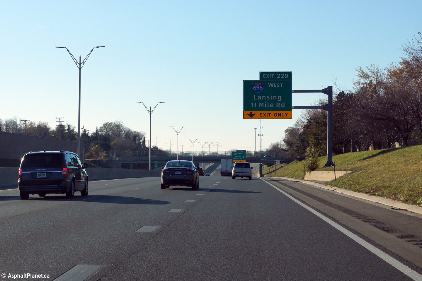
Macomb County City of St. Clair Shores |
Advanced signage for the off-ramp to I-696. A short auxiliary lane links the on-ramp from 12 Mile Road to the off-ramp to I-696. |
 |
||
|
Date: 11/15/2015 |
High-res: (1440x960) (2400x1600) | |||
|
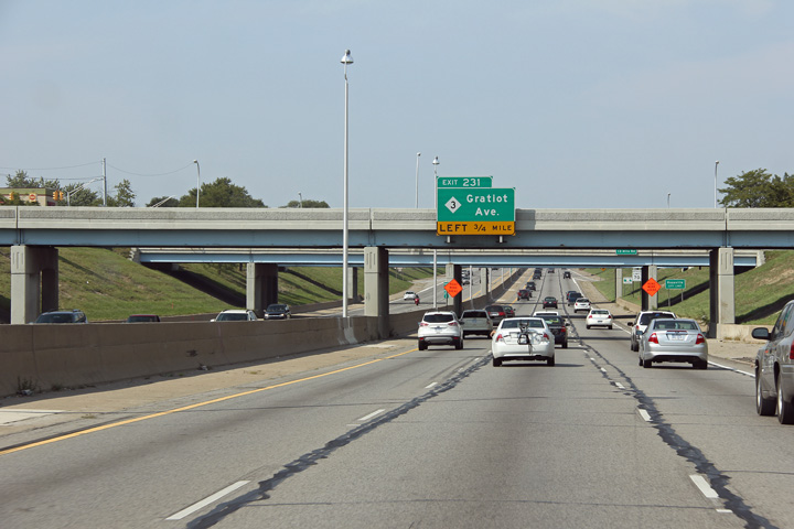
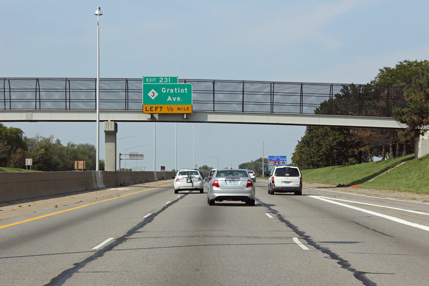
Macomb County City of St. Clair Shores |
Advanced signage for the left exit to M-3 just east of I-94. |
 |
||
|
Date: 08/26/2012 |
High-res: (1440x960) (2400x1600) | |||
|
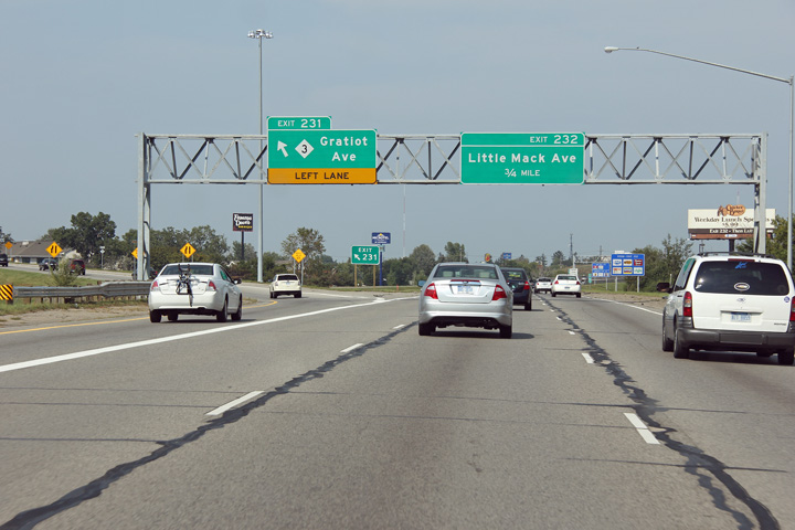
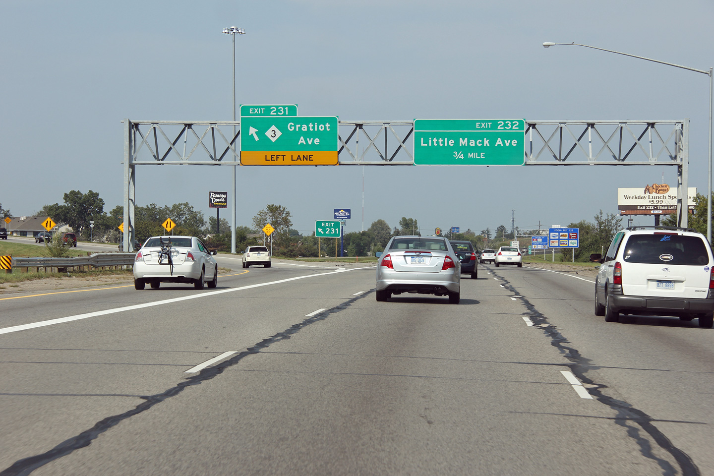
Macomb County City of St. Clair Shores |
A second eastbound advanced signage for the M-3 interchange. |
 |
||
|
Date: 08/26/2012 |
High-res: (1440x960) (2400x1600) | |||
|
Macomb County City of St. Clair Shores |
Signage for the left exit to M-3. |
 |
||
|
Date: 08/26/2012 |
High-res: (1440x960) (2400x1600) | |||
|
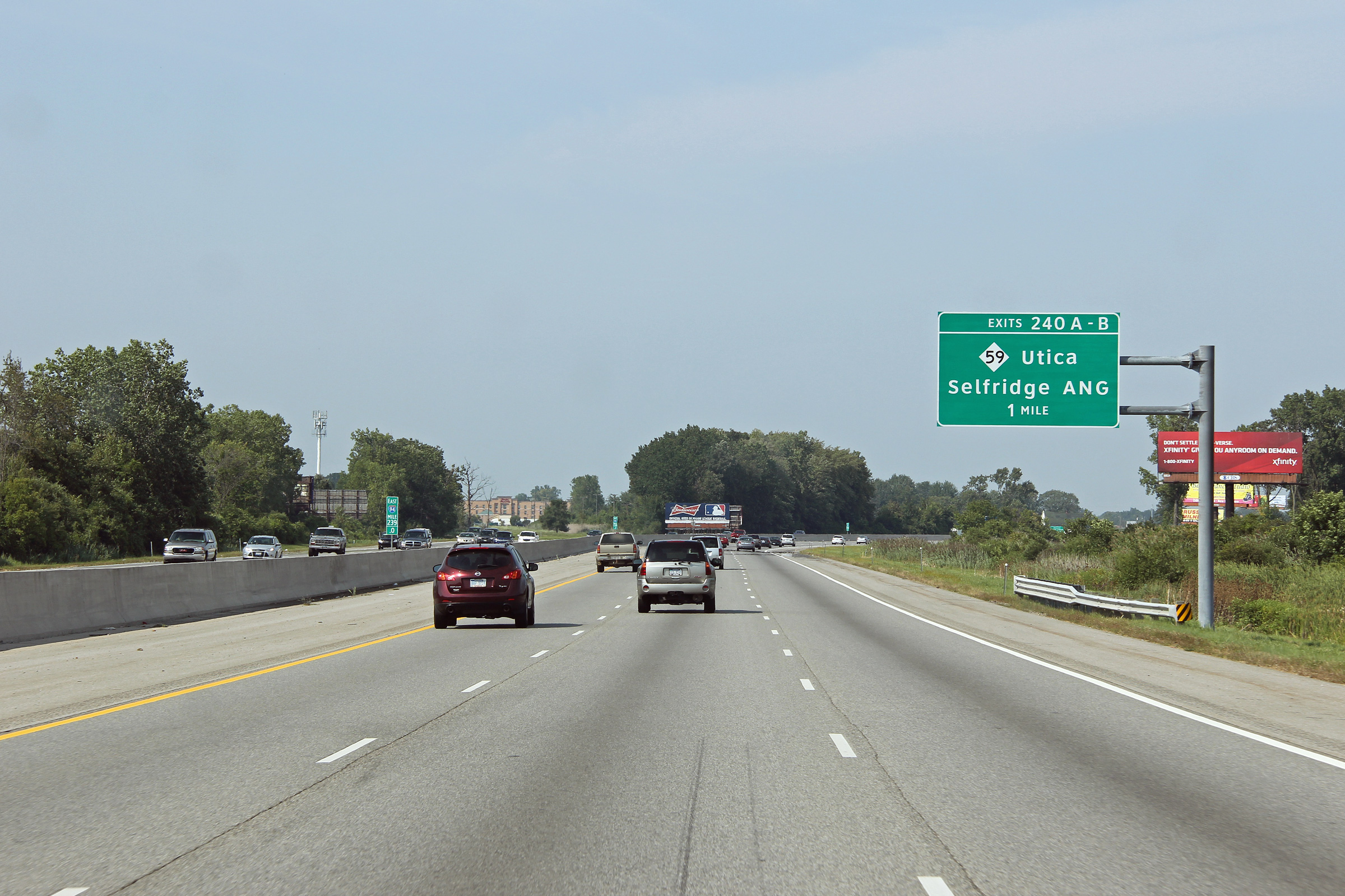
Macomb County |
Advanced signage for the M-59 interchange. |
 |
||
|
Date: 08/26/2012 |
High-res: (1440x960) (2400x1600) | |||
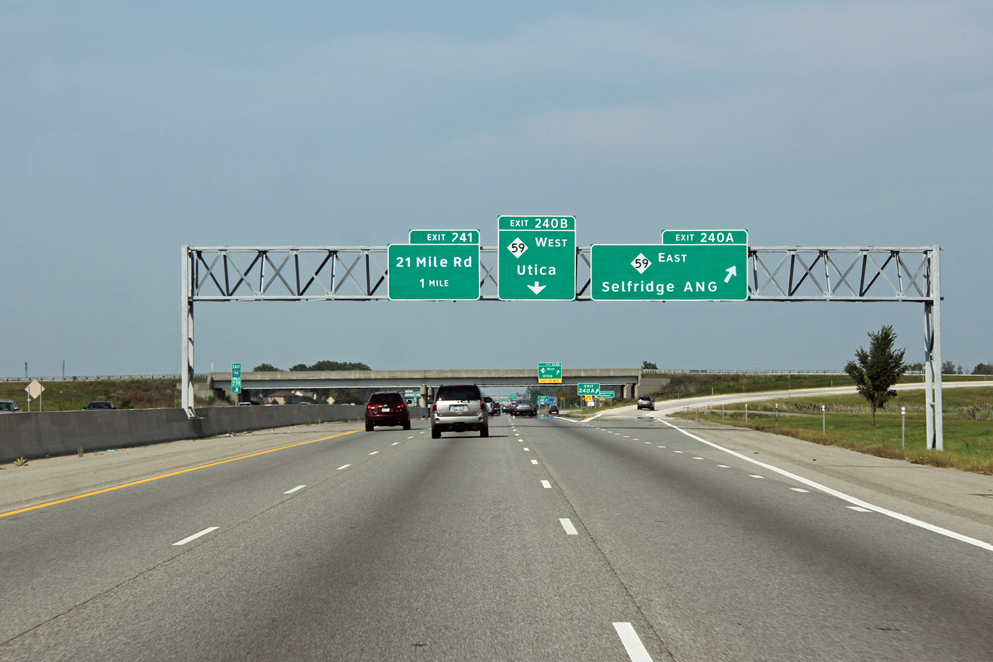
|
Macomb County |
Signage at the eastbound off-ramp to M-59 East. |
 |
||
|
Date: 08/26/2012 |
High-res: (1440x960) (2400x1600) | |||
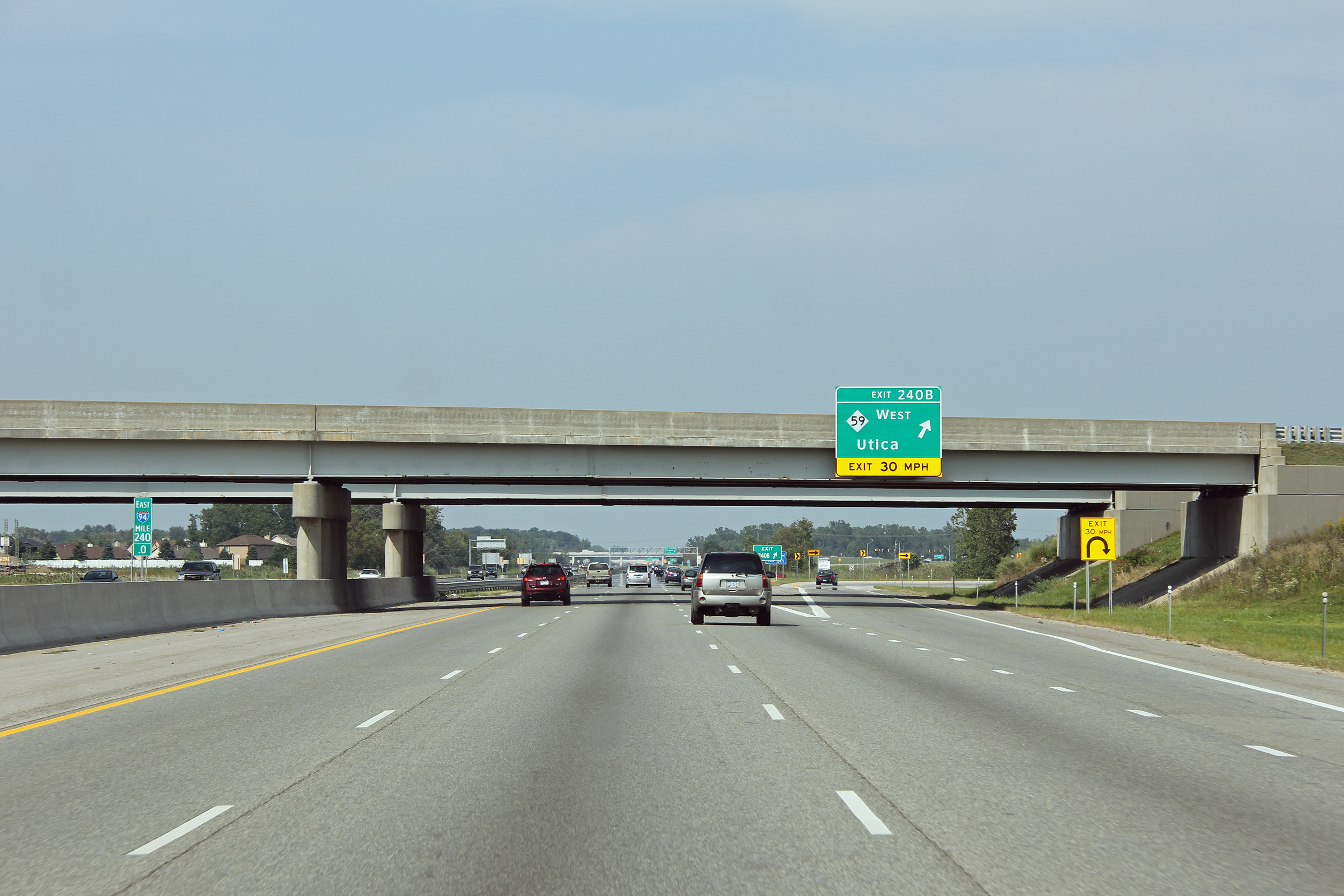
|
Macomb County |
Signage for the off-ramp to M-59 West. |
 |
||
|
Date: 11/15/2015 |
High-res: (1440x960) (2400x1600) | |||
|
M-59 leads westerly from I-94 through Utica, Pontiac and eventually leads to I-96 at Howell. Click here for M-59 images. |
||||
|
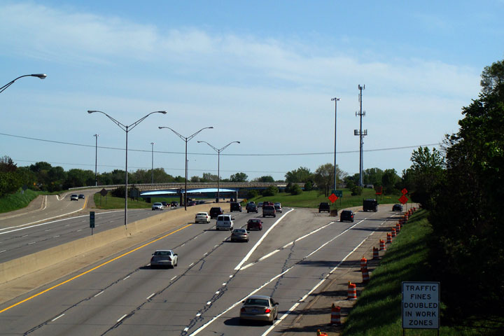
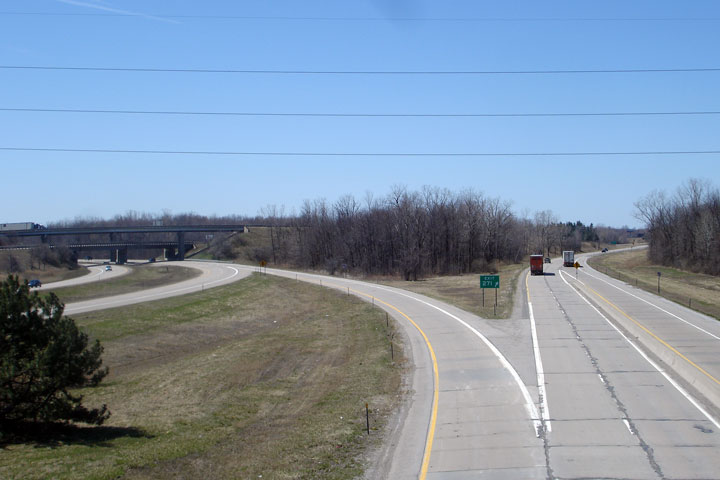
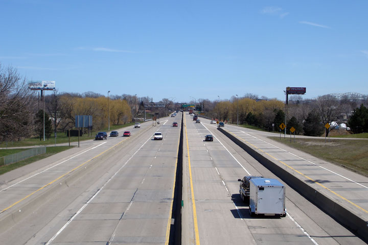
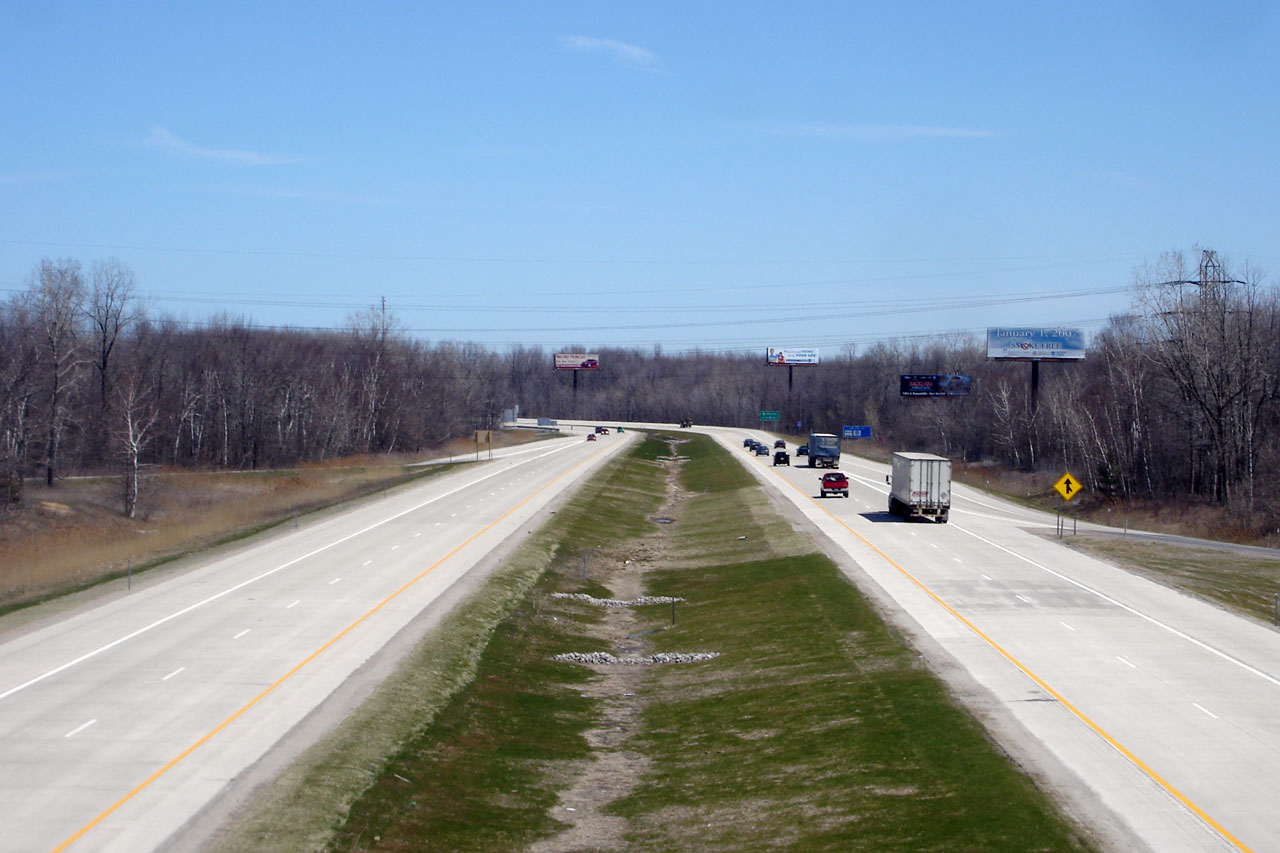
Macomb County |
View of I-94 looking west from the 23 Mile Rd. overpass. From this location westerly into Detroit, I-94 carries six lanes. The stretch of I-94 between here down to Little Mack Ave. was reconstructed during the 2007 construction season. |
|
||
|
Date: 4/20/2007 |
High-res: (1440x960) | |||
|
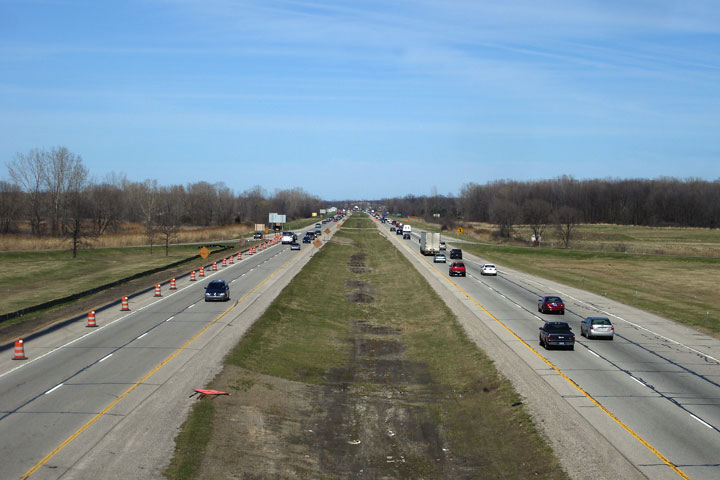
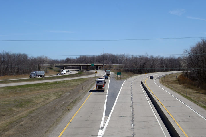
Macomb County |
View looking easterly from the 23 Mile Rd. overpass. East of this overpass, I-94 maintains a four-lane cross-section up to Port Huron. |
|
||
|
Date: 4/20/2007 |
High-res: (1440x960) | |||
|
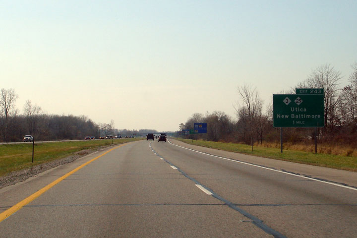
Macomb County |
1 mile advance exit sign for M-3 and M-29 (Exit 243) on I-94 West. This sign dates back to before 1998, as up until that time M-59 multiplexed with M-3 up to a common terminus at this location. In that year, M-59 was re-routed to a new Eastern Terminus at I-94's Exit 240, and M-3 carried on as a solo route to this upcoming interchange. |
 |
||
|
Date: 4/20/2007 |
||||
|
St. Clair County St. Clair Township |
View looking easterly along I-94 approaching the Pine River bridge, just southwest of Port Huron. |
 |
||
|
Date: 11/15/2015 |
High-res: (1440x960) (2400x1600) | |||
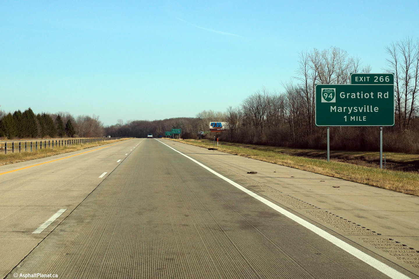
|
St. Clair County St. Clair Township |
Advanced signage for the off-ramp to BL-94. BL-94 follows Gratiot Avenue, which is the former historic alignment of US-25. |
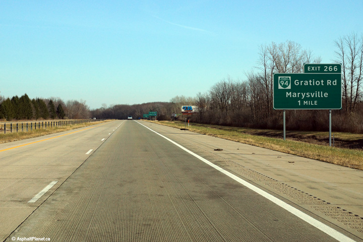 |
||
|
Date: 11/15/2015 |
High-res: (1440x960) (2400x1600) | |||
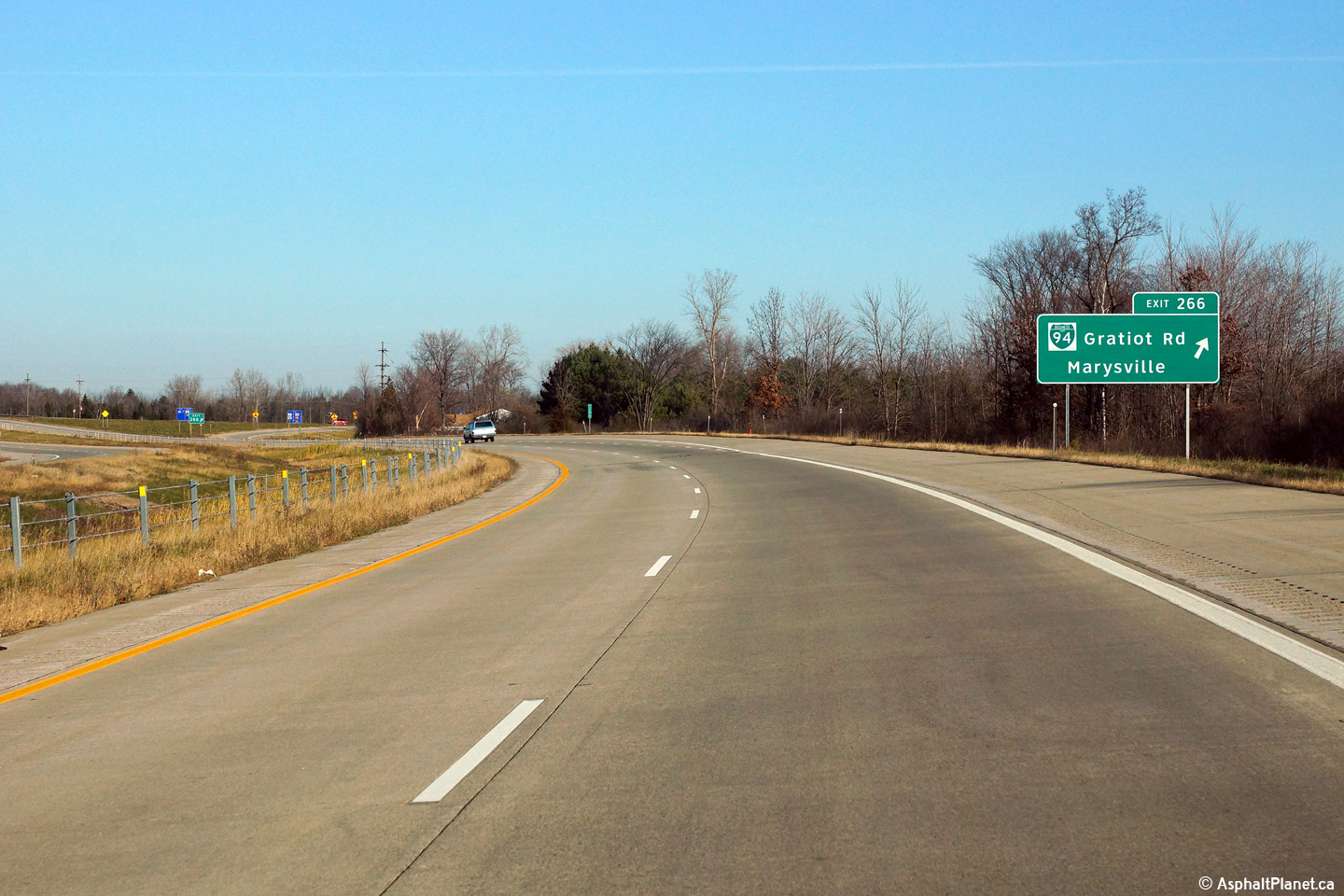
|
St. Clair County St. Clair Township |
Eastbound signage at the off-ramp to BL-94. |
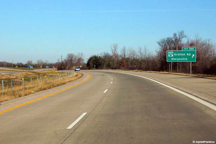 |
||
|
Date: 11/15/2015 |
High-res: (1440x960) (2400x1600) | |||
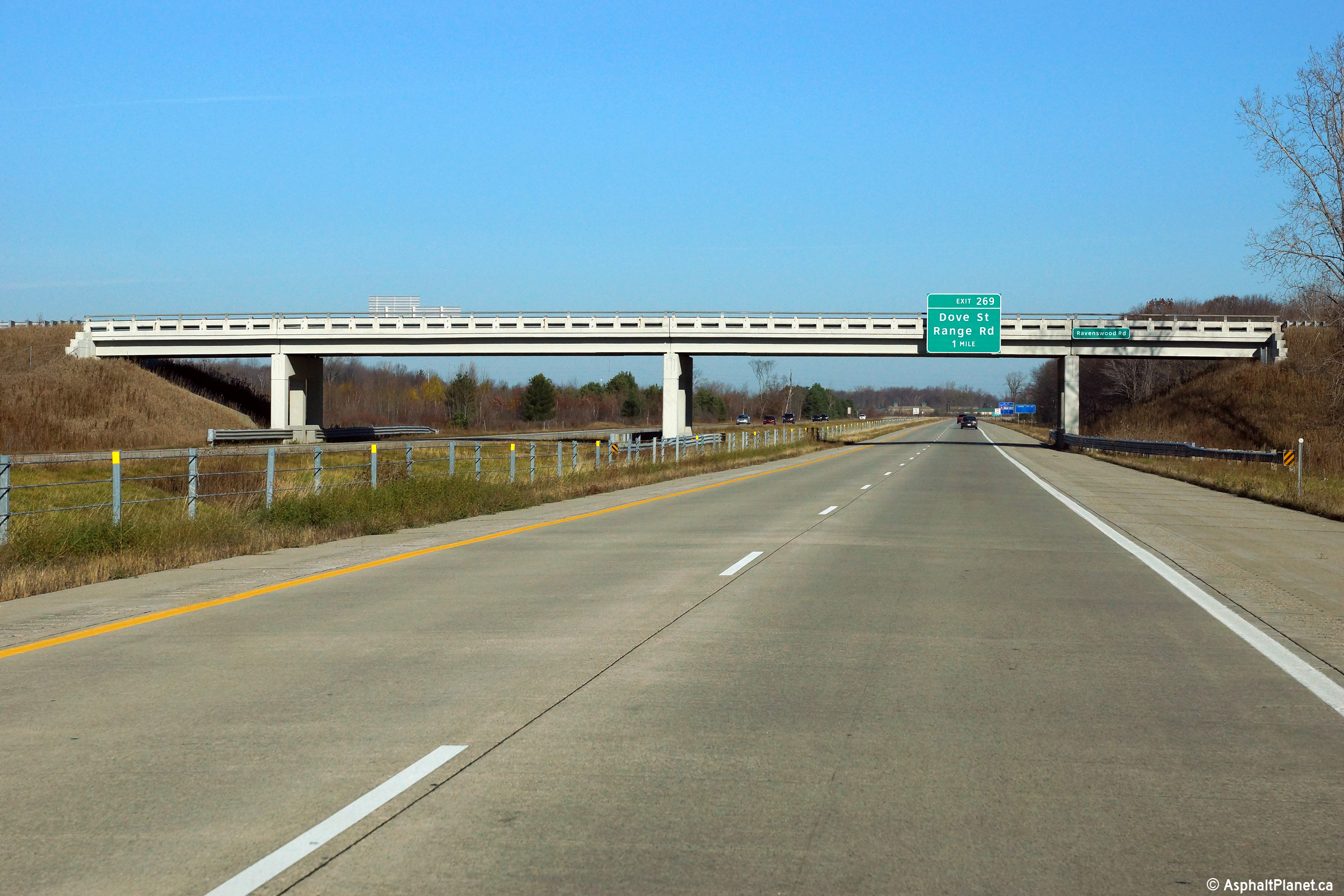
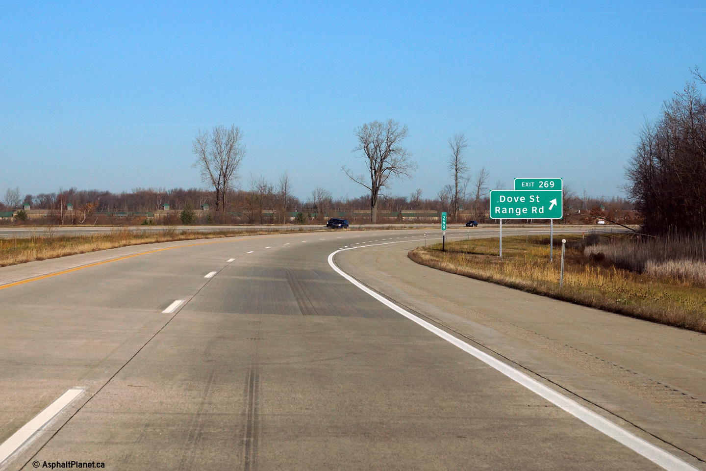
|
St. Clair County |
The eastbound advanced signage for the Range Road interchange has been affixed to the Ravenswood Road overpass. |
 |
||
|
Date: 11/15/2015 |
High-res: (1440x960) (2400x1600) | |||
|
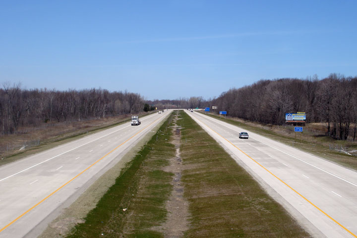
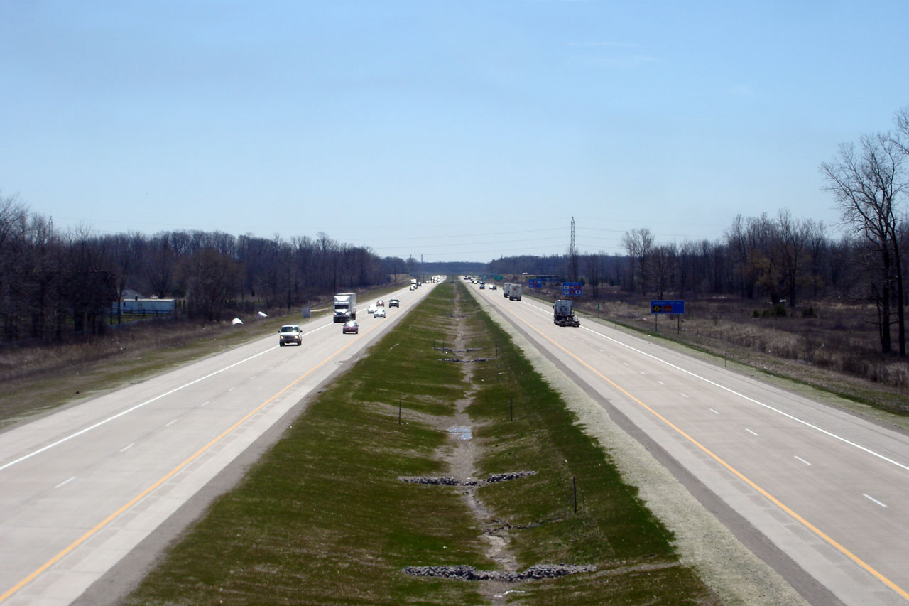
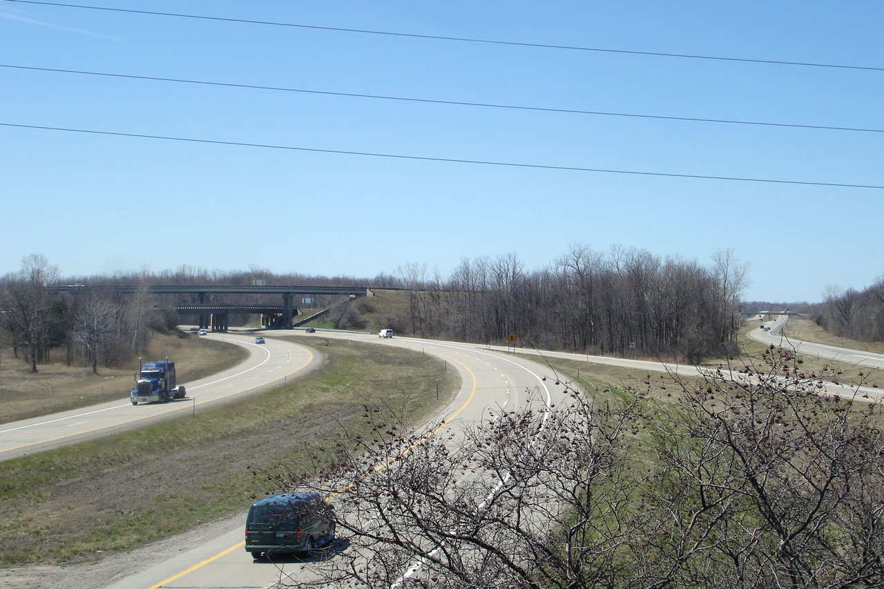
St. Clair County |
View west along I-94 from the Ravenswood Rd. overpass, which is located at approximately mile marker 268. |
|
||
|
Date: 4/20/2007 |
High-res: (1440x960) | |||
|
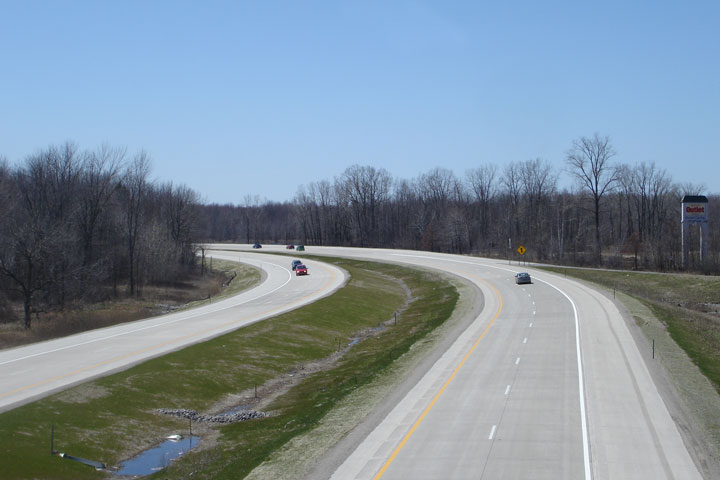
St. Clair County |
Opposing view from Ravenswood Rd. I-94 was extensively reconstructed through this area during the 2006 construction season. |
|
||
|
Date: 4/20/2007 |
High-res: (1440x960) | |||
|
St. Clair County |
Signage at the eastbound off-ramp to Range Road. |
 |
||
|
Date: 11/15/2015 |
High-res: (1440x960) (2400x1600) | |||
|
St. Clair County |
The first eastbound advanced signage for the I-69 and BL-69 interchange is affixed to the Range Road overpass. |
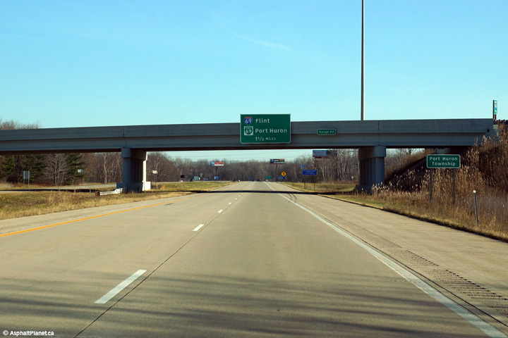 |
||
|
Date: 11/15/2015 |
High-res: (1440x960) (2400x1600) | |||
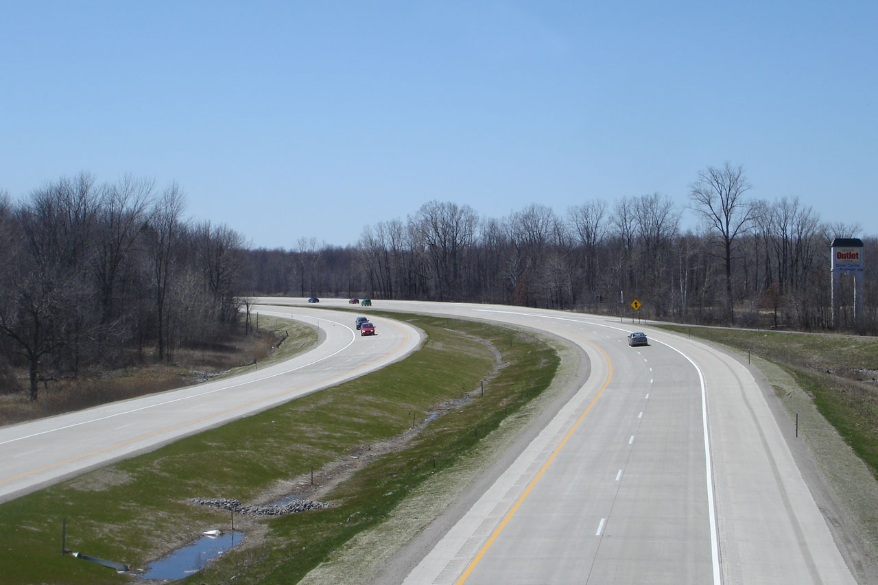
|
St. Clair County |
Westerly view from the Range Rd. overpass at Exit 269 between Marysville and Port Huron. |
|
||
|
Date: 4/20/2007 |
High-res: (1440x960) | |||
|
St. Clair County |
Looking east from the Range Rd. overpass. |
|
||
|
Date: 4/20/2007 |
High-res: (1440x960) | |||
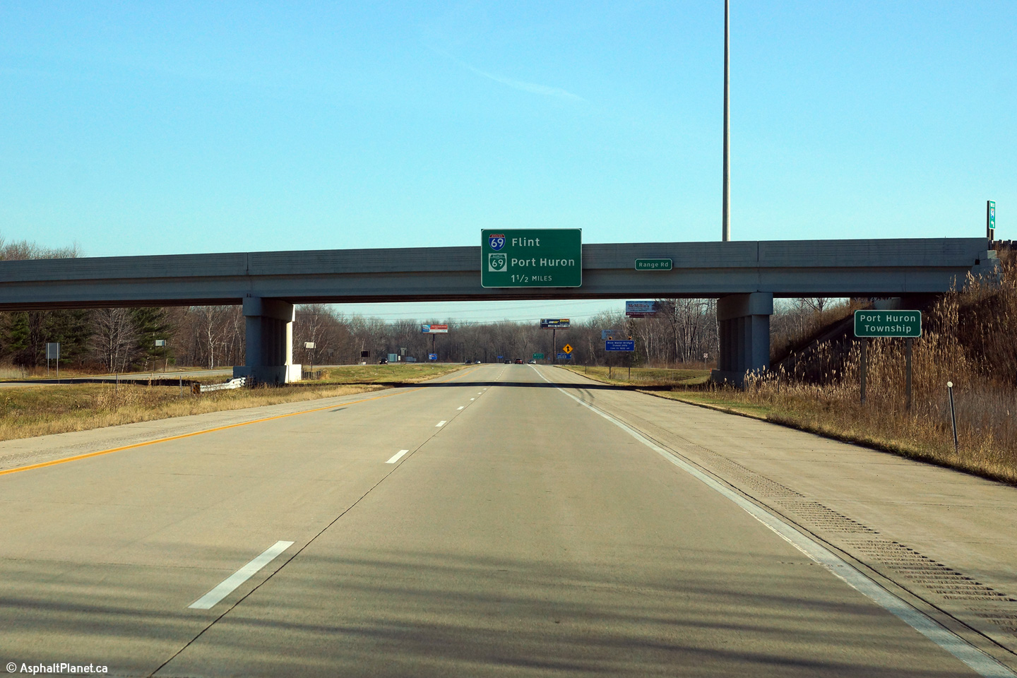
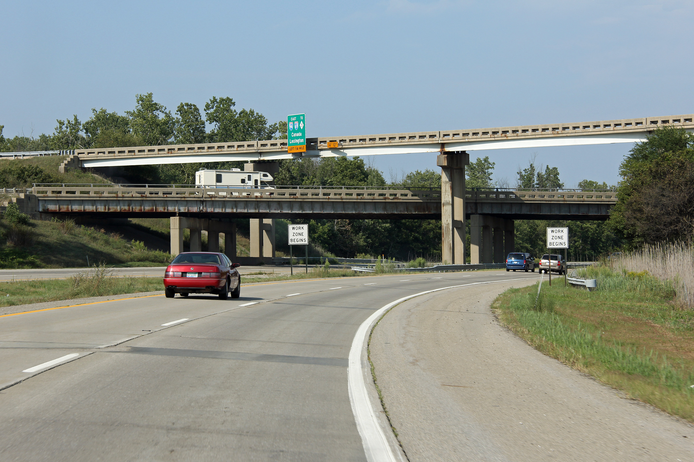
|
St. Clair County |
View looking easterly approaching the I-69 interchange. A major reconstruction project was completed in 2015 to reconstruct this interchange and replace a number of pre-existing structures. Click here for an older version of this signage, taken in August, 2012. |
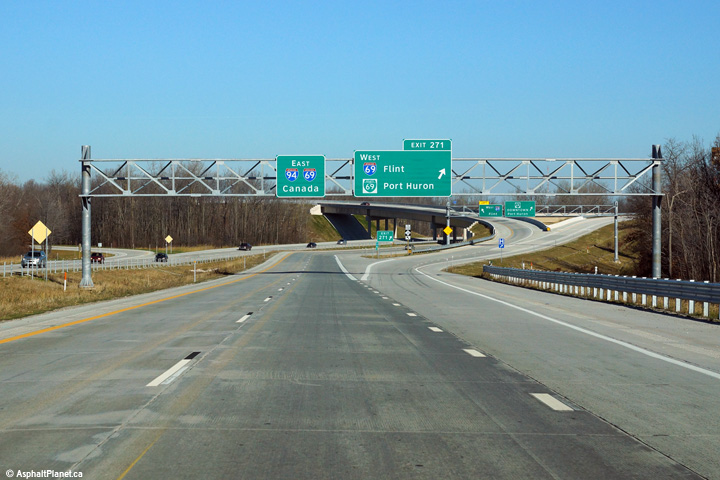 |
||
|
Date: 11/15/2015 |
High-res: (1440x960) (2400x1600) | |||
|
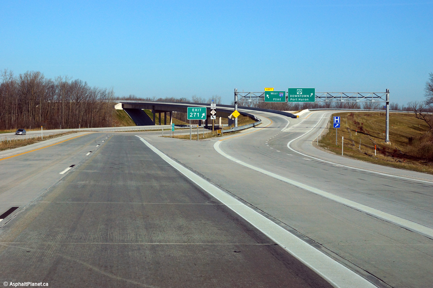
St. Clair County |
View looking easterly of the ramp to I-69 West as seen from the eastbound lanes of I-94. This ramp was realigned as part of the interchange replacement, it formerly had a much sharper trajectory. Click here for a view of this interchange before it was reconstructed, taken in August, 2012. |
 |
||
|
Date: 11/15/2015 |
High-res: (1440x960) (2400x1600) | |||
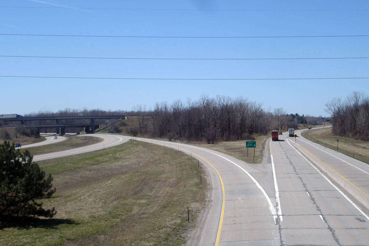
|
St. Clair County |
Two views of I-94 from the west side of the Michigan Rd. overpass. This overpass provides an excellent vantage point for the interchange between I-94 and I-69. |
|
||
| High-res: (1440x960) | ||||
|
|
||||
|
Date: 4/20/2007 |
High-res: (1440x960) | |||
|
St. Clair County |
Easterly view from Michigan Rd. BL I-69 can be seen departing the mainline freeway to the right heading toward Downtown Port Huron. This photo was taken before the I-69/94 interchange was reconstructed and reconfigured. |
|
||
|
Date: 4/20/2007 |
High-res: (1440x960) | |||
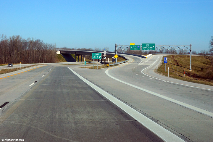
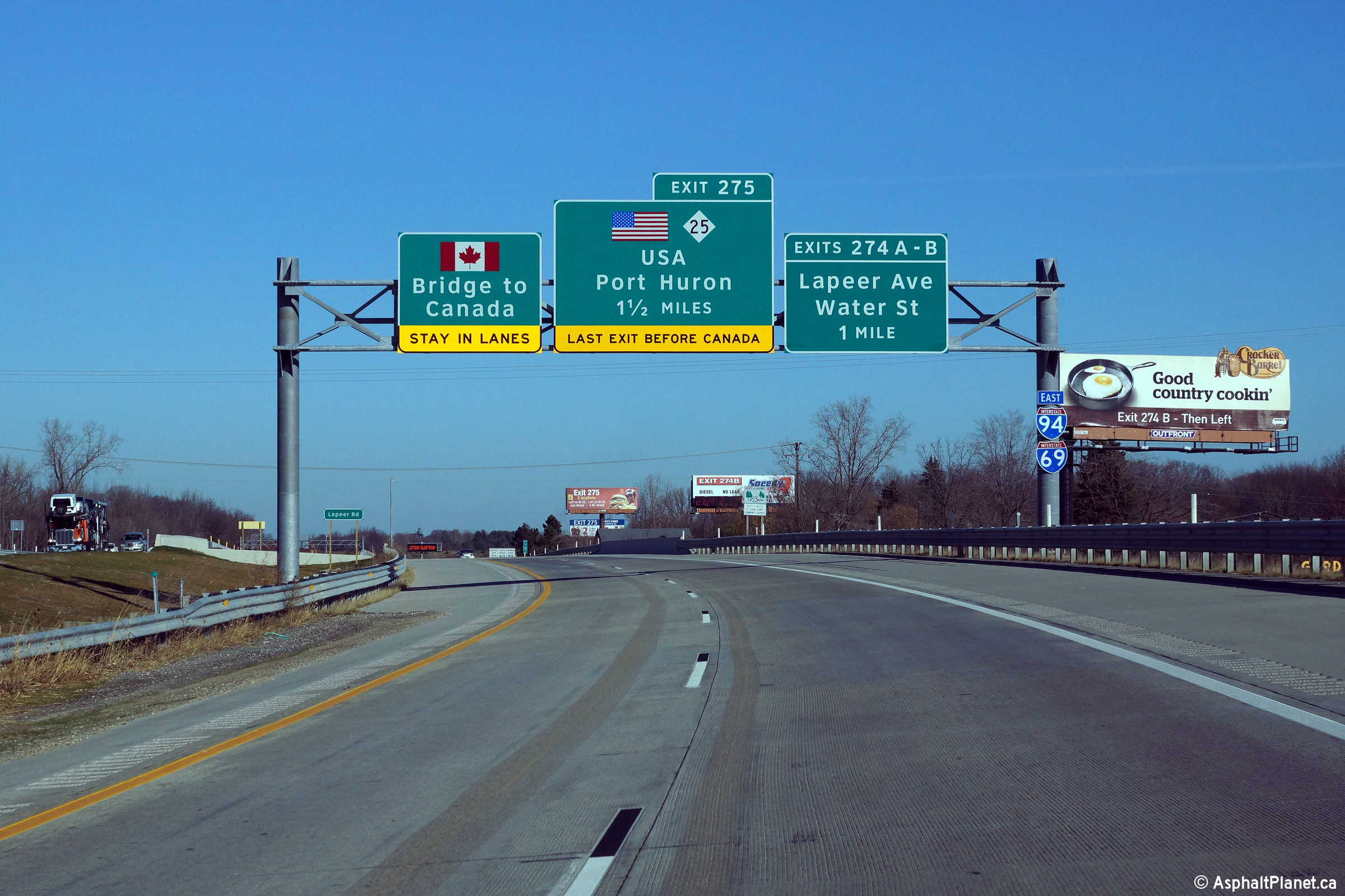
|
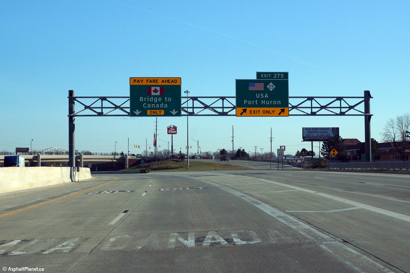
St. Clair County |
Advanced signage approaching the eastern terminus of I-94 and I-69. There are two exists remaining to destinations within Port Huron before traffic heads over the Blue Water Bridge into Sarnia, Ontario, Canada. |
 |
||
|
Date: 11/15/2015 |
High-res: (1440x960) (2400x1600) | |||
|
St. Clair County |
Eastbound off-ramp to both the Lapeer Avenue Connector and to Water Street in Port Huron. |
 |
||
|
Date: 11/15/2015 |
High-res: (1440x960) (2400x1600) | |||
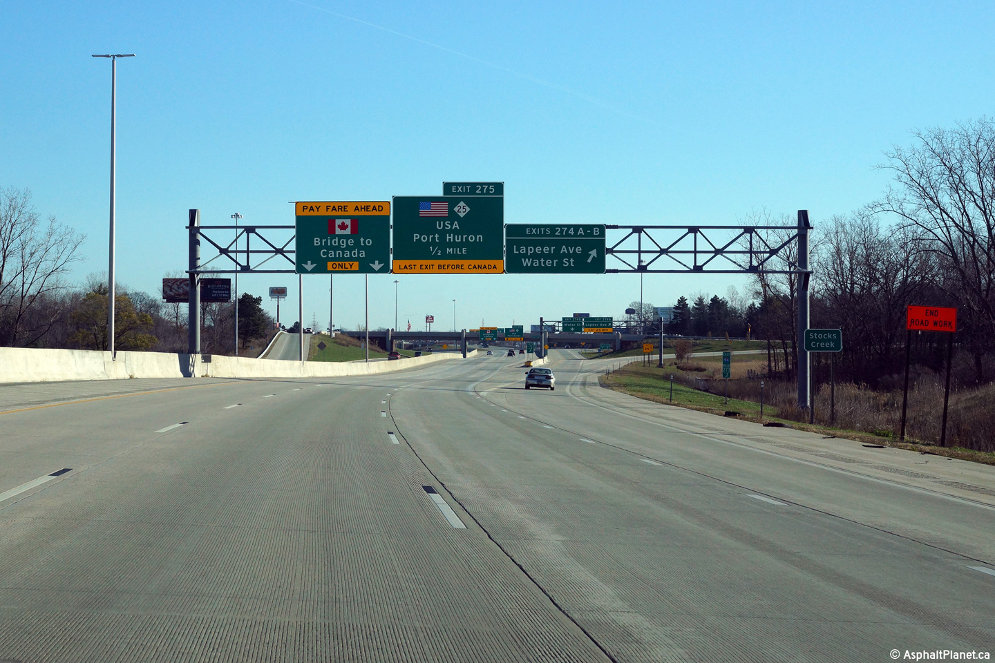
|
St. Clair County |
Advanced signage for the M-25 interchange affixed to the Lapeer Connector overpass. |
 |
||
|
Date: 11/15/2015 |
High-res: (1440x960) (2400x1600) | |||
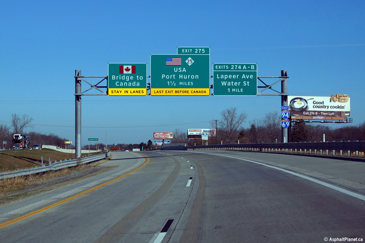
|
St. Clair County |
View at the eastbound off-ramp to M-25 in Port Huron. This is the final exit within the US along I-69/94. The M-25 interchange was relocated to this point in the early 2010s as part of a substantial reconstruction project through Port Huron. M-25 formerly exited from the left side of the interstate. |
 |
||
|
Date: 11/15/2015 |
High-res: (1440x960) (2400x1600) | |||
|
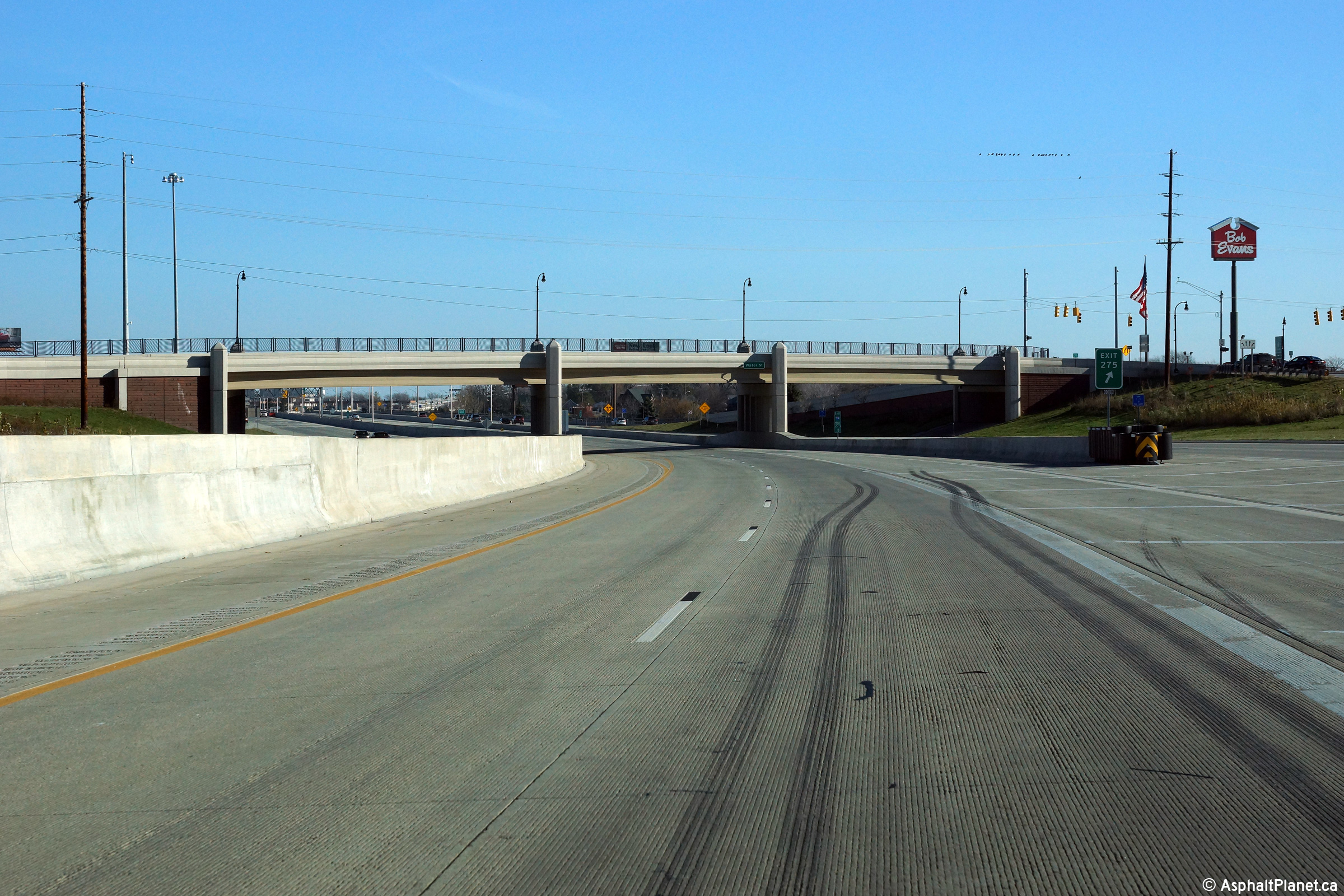
St. Clair County |
View looking easterly along I-69/94 as the interstate passes beneath the Water Street overpass. |
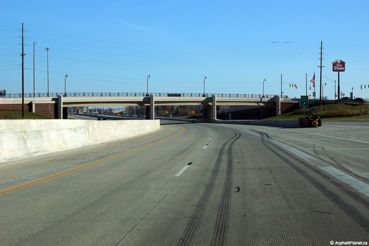 |
||
|
Date: 11/15/2015 |
High-res: (1440x960) (2400x1600) | |||
|
St. Clair County |
||||
|
View from the Western side of the Water St. overpass of I-94/I-69. There is a short C/D lane through this area, due to the close spacing of the Lapeer Rd. and Water St. exit and entrance ramps. Both Lapeer Rd. and Water St. are a part of I-94's Exit 274. |
|
|||
|
Date: 4/20/2007 |
High-res: (1440x960) | |||
|
St. Clair County |
Easterly view from the Water St. overpass toward the Black River bridge and the common Eastern Terminus of I-94 and I-69. The Blue Water Bridge can be seen on the right side of this photo. |
|
||
|
Date: 4/20/2007 |
High-res: (1440x960) | |||
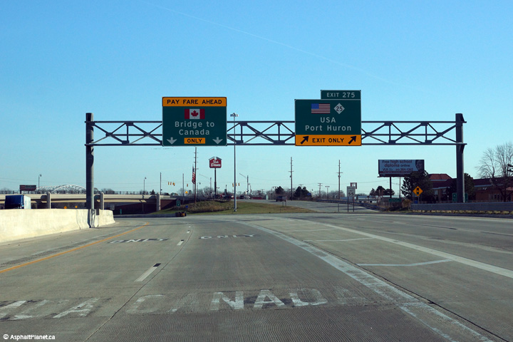
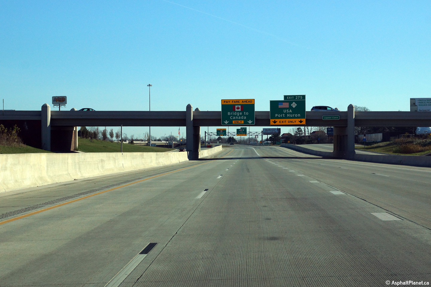
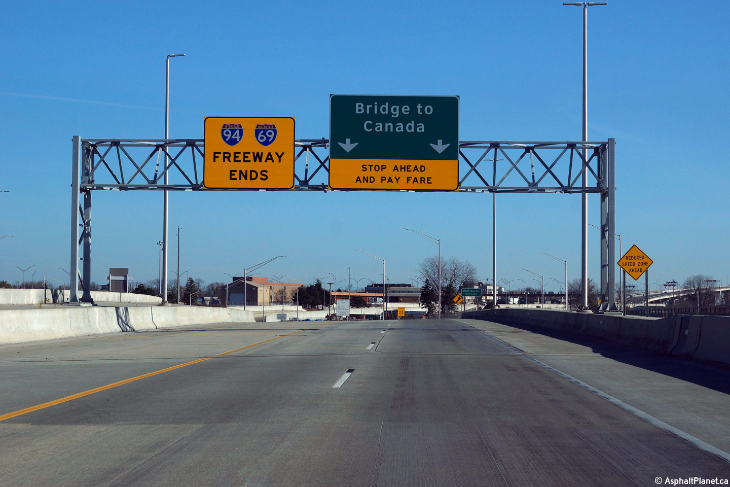
|
St. Clair County City of Port Huron |
Signage at the eastern terminus of both Interstate 94 and Interstate 69. Before the interstate was reconstructed through Port Huron, the exit to M-25 departed from the left side of the freeway at this location. |
 |
||
|
Date: 11/15/2015 |
High-res: (1440x960) (2400x1600) | |||
|
I-69 and I-94 dually end at the Bluewater Bridge, where the duplexed Interstates become Ontario's Highway 402. Click here for Highway 402 images. |
||||
<- Page 5 Back to I-94 Index ON 402 ->
Michigan Highways Index
AsphaltPlanet.ca - Home
© 2004-2016 Scott Steeves. AsphaltPlanet@asphaltplanet.ca
Page Created: June 7, 2007.
Last Updated: December 13, 2015.


