King's Highway 105 - www.OntHighways.com

Highway 105 is Ontario's northernmost King's Highway, stretching for nearly 200km north of the Trans-Canada Highway at Vermillion Bay into Red Lake.


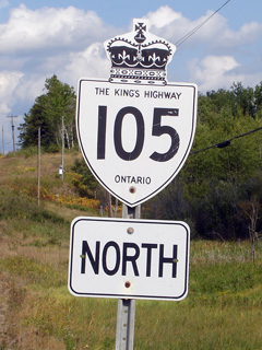
Old style Highway 105 shield

  Southern Terminus:  Junction Highway 17 at Vermillion Bay, between Kenora and Dryden

Northern Terminus:  Junction Secondary Highway 618 at Ontario's northernmost traffic signal in Downtown Red Lake

Length: 173.7 km.

Multiplexes:  None

Freeway:  None

AADT  (2010):  Highest: 4,300, from Highway 125 to Red Lake;

                              Lowest:  850 from Secondary Highway 609 to Onaway Lac Seul Road.

Road info:  Highway 105 is Ontario's northernmost King's Highway.  It is fairly well surfaced, and is lightly travelled.  As the highway runs through a remote area, services along Highway 105 are sparse, contained to Vermillion Bay, Ear Falls, as well as Red Lake.  Highway 105 has a posted speed limit of 80km/h.


Highway 105 information:


OntHighways.com  

Detailed Route information available below
Virtual Tour of Highway 105


TheKingsHighway.ca   History of Highway 105
Photographic History of Highway 105

Current Interchanges and RIRO's along Highway 115 from South to North:

Proper Municipality Name Community Name Distance Interchange or RIRO
District of Kenora --- 0 km / 173.7 km King's Highway 17 (Trans-Canada Highway)
District of Kenora --- 13.2 km / 160.5 km Secondary Highway 609
District of Kenora --- 37.0 km / 136.7 km Camp Robinson Road
District of Kenora --- 49.7 km / 124.0 km Cedar Point Road
District of Kenora --- 65.2 km / 108.5 km Rainbow Point Road
District of Kenora --- 77.6 km / 96.1 km Onaway Lac Suel Road
District of Kenora --- 99.3km / 74.4 km Tertiary Road 804
Ear Falls South Limits Ear Falls South Limits 100.3 km / 73.4km ---
Township of Ear Falls Ear Falls 103.1 km / 70.6 km Secondary Highway 547 / Gold Pines Road
Ear Falls North Limits Ear Falls North Limits 104.2 km / 69.5 km ---
District of Kenora --- 123.1 km / 50.6 km Silander's Camp Road
District of Kenora --- 138.0 km / 35.7 km (Chukuni River Bridge)
District of Kenora --- 157.4km / 16.3 km Bellocks Road
District of Kenora --- 170.8 km / 2.9 km King's Highway 125
Red Lake South Limits Red Lake South Limits 172.7 km / 1.0 km ---
Town of Red Lakes Red Lake 173.7 km / 0 km Secondary Highway 618

Highway 105 ENDS


<- Highway 102         www.OntHighways.com - Home         Highway 108 ->


Copyright (c) 2004-2014, AsphaltPlanet.ca  AsphaltPlanet@asphaltplanet.ca

Page last updated:  April 1, 2014

Page created:  April 1, 2014