King's Highway
112 - O N T H I G H W A Y S
King's Highway 112 is a fairly
short highway with an interesting history. The highway is in actuality an
original alignment of Highway 11. In the early 1940s, a new alignment west
of Round Lake (often called the Round Lake Diversion) was constructed and also
designated as part of Highway 11. This obviously proved to be a problem as area
motorists were faced with two parallel routes designated as Highway 11. Fortunately
in 1953, this now bypassed portion Highway 11 was re-designated as Highway 112.
Since then, Highway 112 has changed very little, and was not affected by
provincial downloading.
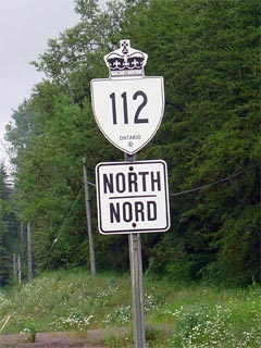
New Style King's
Highway 112 Shield
|
|
Southern Terminus: Junction Highway
11 at the southern start of the Round Lake Diversion.
Northern Terminus: Junction Highway
66 west of Kirkland Lake.
Length: 19.8 km
Multiplexes: None
Freeway: No
AADT (2002):
Highest: 2,000, from Highway 650 northerly to Highway 66;
Lowest: 1,600 from Highway 11 northerly to Highway 650.
Road Info: Coming Soon! |
Communities and Major Intersections along Highway 112 from South to North:
|
Proper Municipality Name |
Community Name |
Distance |
Intersecting Road |
| District of Timiskaming |
----- |
0 km / 19.8 km |
King's
Highway 11 |
| District of Timiskaming |
----- |
4.7 km / 15.1 km |
Secondary Highway 564 |
| District of Timiskaming |
Tarzwell |
--- |
----- |
| District of Timiskaming |
Dane |
12.4 km / 7.4 km |
Secondary Highway 650 |
| Town of Kirkland Lake |
----- |
19.8 km / 0 km |
King's Highway 66 |
|
Highway 112 ENDS |
Highway 112 - Images
O N T
H I G H W A Y S - Home
Copyright (c) 2004-2010, AsphaltPlanet.ca
AsphaltPlanet@asphaltplanet.ca
Page last updated: October 24th, 2005
Page created: October 24th, 2005