King's Highway 18 - www.OntHighways.com

Highway 18 is the lowest numbered Ontario highway outside of Ontario's original un-numbered highways (Highways 2-17 pre-dated the modern numbering system by several years).  This being said, In 1997, Highway 18 followed a different route then it did in the 1930s.  In the 1930s, Highway 18 was a by-pass of Highway 2, utilizing what is now known as Essex Road 42.  Since the 1930s, Highway 18 had instead run south from Windsor near to the Detroit River Shoreline.  South of Amhearsburg the highway abruptly turns easterly  where it follows the north side of Lake Erie, several kilometres inland until it met Highway 3 and 77 in Leamington.


Old Style Highway 18 Shield
Photo Courtesy: Averill Hecht

  Western Terminus:  Windsor - Different official sources cite different information for the western terminus of Highway 18, however it is clear that MTO maintenance of the route did not extend past Windsor's Southern City Limit.

Eastern Terminus:  At the former Highway 3/77 junction in Downtown Leamington.

Length:  80.2km

Multiplexes:  None

Freeway: No

AADT (1994):  Highest:  16,800, from La Salle to Windsor;

                             Lowest:  1,750, from Essex Road 9 to Essex Road 50.

Status:  Totally downloaded in 1998, now known as Oulette Avenue in Windsor, Essex Road 20 for the bulk of the highway, and as Erie Street in Leamington

Road Info: Highway 18 is a busy 4-lane highway on its trek south of Windsor to Amherstburg.  Between Amherstburg and Kingsville, traffic is light along Highway 18.  East of Kingsville, traffic volumes once again pick up as there is a substantial population in the Kingsville, Leamington area.


Highway 18 information:


OntHighways.com  

Detailed Route information available below
Virtual Tour of Highway 18


TheKingsHighway.ca   History of Highway 18
Photographic History of Highway 18

Communities and Major Intersections Located on Highway 18 from West to East:

Proper Municipality Name Community Name Distance Intersection Name

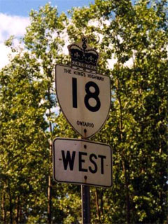
Within Windsor, Highway 18 is known as Ojibiwaw Parkway.

City of Windsor Windsor   E.C. Row Expressway (Formerly Highway 7087) & Ojibiway Parkway

At the Windsor-La Salle Boundary:  SB: Highway 18 is known as Essex Road 20.  NB: Highway 18 is known as Ojibiway Parkwa

Windsor - La Salle Boundary -----   -----
Town of La Salle La Salle   -----
La Salle - Amhearstburg Boundary River Canard   Malden Road (Essex Road 3)
Town of Amhearstburg Edgewater Beach   -----
Town of Amhearstburg -----   Essex Road 10
Town of Amhearstburg Amhearstburg   Alma Street (Essex Road 16)
Town of Amhearstburg Amhearstburg   Pike Road (Essex Road 18)
Town of Amhearstburg Malden Centre   Essex Road 50
Town of Amhearstburg -----   Howard Avenue (Essex Road 9)
Amhearstburg - Essex Boundary -----   Meadows Road (Essex Road 41)
Town of Essex Harrow   Erie Road (Essex Road 13)
Town of Essex Harrow   Queen Street (Essex Road 11)
Essex - Kingsville Boundary Arner   Arner Townline Road (Essex Road 23)
Town of Kingsville -----   Heritage Road (Essex Road 50)
Town of Kingsville Kingsville   Division Road (Essex Road 29)
Town of Kingsville Union   Union Avenue (Essex Road 45)
Kingsville - Leamington Boundary -----   Albuna Townline Road (Essex Road 31)
Municipality of Leamington Seacliffe   -----

At the Essex Road 20/Erie Street intersection:  EB:  Turn left onto Erie Street.  WB: Turn Right onto Essex Road 20

Municipality of Leamington Leamington   Seacliffe Drive (Essex Road 20-East)
Municipality of Leamington Leamington   Oak Street
Municipality of Leamington Leamington   Essex Road 34 (Formerly Highway 3) & Highway 77

Highway 18 ENDS


<- Highway 17B         www.OntHighways.com - Home         Highway 19 ->


Copyright (c) 2004-2007, Scott Steeves (Webmaster)  webmaster@onthighways.com

Page last updated:  July 25th, 2006

Page created:  July 25th, 2006