King's Highway 4 - www.OntHighways.com

Highway 4 serves as the major north-South corridor for the city of London.  Currently, Highway 4 runs from Highway 3 at Talbotville northerly to Highway 8 at Clinton.  Before downloading Highway 4 ran northerly from Port Stanly to Highway 9 north of Teeswater.  At Highway 9, Highway 4 turned east, (running concurrently with Highway 9 to Walkerton) eventually ending at Highway 24 near Collingwood.


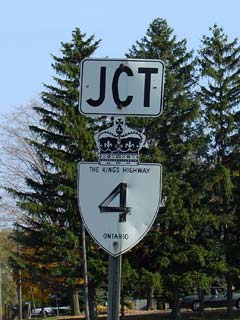
JCT King's Highway 4


Southern Terminus:  Pre-1998: Port Stanly Ontario

                                         Current: Junction King's Highway 3 in Talbotville (near St. Thomas)


Eastern / Northern Terminus:  Pre-1998: Junction King's Highway 24 just south of Singhampton

                                                            Current: Junction King's Highway 8 in Clinton

Length:  Pre-1998: 275.6 km.  Current: 100.8 km.

Multiplexes: Presently none. Before downloading there was an 8.4 km multiplex with Highway 2, and a 13.4 km multiplex with Highway 9.  (Both very historic multiplexes)

Freeway:  No

AADT (2002):  Highest: 14,700, from Southminster Bourne to Highway 401;

                             Lowest:  3,800, from Huron Road 12 to Clinton South Limits.

Road Info:  Highway 4 is in good shape for its entire current length (with the exception of the connecting link in London).  Between Clinton and Exeter Highway 4 is built to an older standard which I found made for an enjoyable trip.  Travelers should be wary of the communities of Exeter and London, these communities can be quite congested at peak traffic times.


Highway 4 information:


OntHighways.com  

Detailed Route information Coming Soon!
Virtual Tour of Highway 4


TheKingsHighway.ca   History of Highway 4
Photographic History of Highway 4


<- Highway 3B          www.OntHighways.com - Home          Highway 5 ->


Copyright (c) 2004-2010, AsphaltPlanet.ca  AsphaltPlanet@asphaltplanet.ca

Page last updated:  April 14th, 2005

Page created:  January 4th, 2004