King's Highway 404 - www.OntHighways.com

Highway 404 is effectively a northern extension of the Don Valley Parkway from Highway 401 northerly to Newmarket.  For many years, the northern terminus of Highway 404 was located at Davis Drive in Newmarket.  The MTO plans to extend Highway 404 northeasterly to Highway 12 just south of Beaverton in the future.  The first 2 km extension in this project opened in 2002, and extended the highway northerly from Davis Drive to Green Lane.  Construction began in 2007 with advanced structure work to extend the highway from Green Lane northerly to Ravenshoe Road.  The MTO was hoping to have the highway completed to Ravenshoe Road late in 2012, however difficult soil conditions and utility relocations delayed the opening until September 17, 2014.  No construction commitments have been made to extend the highway beyond Ravenshoe Road towards Highway 12.


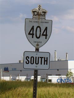
Old Style King's Highway 404 Shield

  Southern Terminus:  Junction King's Highway 401 and continuing to downtown Toronto as the Don Valley Parkway

Northern Terminus:  Highway 404 ends at the Northeast side of Newmarket at the Green Lane interchange

Length:  (approx) 48 km. 

Multiplexes:  None

Freeway: Entire Length (17 Interchanges)

Control cities:

Northbound:  Newmarket (Exits 22 - 45).  In the city of Toronto no control city is used (other then at the 401).

Southbound:  Toronto (Exits 51 - 22)  No control city is used in the city of Toronto.  Newmarket (Exits 65-53)

AADT (2002):  Highest: 256,600 from Highway 401 to Sheppard Avenue;

                             Lowest:  32 800 from York Road 74 to Davis Drive (York Road 31).

Road Info:  Highway 404 is in good shape (good but not excellent) from top to bottom.  Highway 404 has eight mainline lanes, plus 2 (one each direction) HOV lanes from Highway 401 northerly to Highway 407; six lanes north of 407 to Aurora Road, and four from Aurora to its northern terminus in East Gwillimbury.


Highway 404 information:


OntHighways.com  

Detailed Route information available below
Virtual Tour of Highway 404
Traffic Volumes and Mileage Logs

HOV lane Info


TheKingsHighway.ca   History of Highway 404
Photographic History of Highway 404


Interchanges along Highway 404 from South to North:

Proper Municipality Name Exit Number Intersecting Roads North / West Control City South / East Control City
City of Toronto 17 King's Highway 401 & Don Valley Parkway

City of Toronto

Population: 2,462,000

Ontario's Capital

City of Toronto 18 Sheppard Avenue
City of Toronto 20 Finch Avenue
Toronto - Markham Boundary 22 Steeles Avenue
Town of Markham 25 Highway 407 ETR ----- -----
Markham - Richmond Hill Boundary 27 Highway 7 (York Road 7, Highway 7) Richmond Hill Markham
Markham - Richmond Hill Boundary 29 16th Avenue (York Road 73) Richmond Hill Markham
Markham - Richmond Hill Boundary 31 Major Mackenzie Road (York Road 25) Richmond Hill -----
Markham - Richmond Hill Boundary 33 Elgin Mills Road (York Road 49) ----- -----
Richmond Hill - Whitchurch Stouffville Boundary 37 Stouffville Road (York Road 14) Gormly Stouffville
Richmond Hill - Whitchurch Stouffville - Aurora Boundary 41 Bloomington Road (York Road 40) ----- -----
Whitchurch Stouffville - Aurora Boundary 45 Wellington Street / Aurora Road (York Road 15) Aurora Ballantrae
Whitchurch Stouffville - Newmarket Boundary 49 - South Partial Interchange Mulock Road / Vivian Road (York Road 74) ----- -----
Whitchurch Stouffville - Newmarket Boundary 51 Davis Drive (York Road 31) ----- -----
Whitchurch Stouffville - Newmarket Boundary 53 Green Lane (York Road 19) ----- -----
Town of East Gwillimbury 59 Queensville Sideroad (York Road 77) Queensville -----
Town of East Gwillimbury 65 Woodbine Avenue (York Road 8) ----- -----
Highway 404 ENDS

<- Highway 403         www.OntHighways.com - Home         Highway 405 ->


Copyright (c) 2004-2014, AsphaltPlanet.ca  AsphaltPlanet@asphaltplanet.ca

Page last updated:  September 17th, 2014.

Page created:  March 30th, 2004