King's Highway 7 - www.OntHighways.com

Highway 7 is a long highway that before downloading stretched from Highway 40 at Sarnia, easterly to Highway 417 near Ottawa.  Between 1997 and 1998, Highway 7 was carved into several pieces as various portions of the route were downloaded.  In Southwestern Ontario, Highway 7 was entirely decommissioned west of Highway 4 at Elginfield between 1997 and 98.  Near Toronto, all of Highway 7 was decommissioned between Highway 410 and the 404 in 1997, coincidentally just one day after Highway 407 opened just to the south of the existing Highway 7.  Still in the GTA, in 1998 Highway 7 was decommissioned east of Highway 404 to Highway 48; and in 2003, Highway 7 was downloaded from Norval (on the Peel-Halton Boundary) east to Highway 410.  A small portion of Highway 7 was also downloaded in eastern Ontario.  The portion of 7 between Highway 7A at Scott's Corners and The Parkway in Peterborough was downloaded leaving a small 5km gap in the route near Peterborough.  This gap was 'filled-in' in 2003 when Highway 7 assumed the short north-south portion of Highway 7A southerly from Scott's Corners to Highway 115, and was co-designated along Highway 115 to the eastern end of the Peterborough By-pass.  Highway 7 now runs from Highway 4 at Elginfield easterly to Norval, and then once again from Highway 48 in Markham, easterly to the Highway 417 interchange in Ottawa.


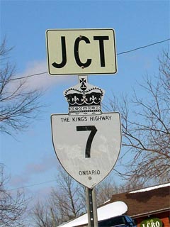
Old Style King's Highway 7 Shield


Western Terminus:  Pre-1997: Highway 40 interchange in Sarnia.

                                       Current: Junction Highway 4 in Elginfield

Eastern Terminus: Highway 417 interchange in Ottawa

Discontinuity:  Highway 7 was downloaded between Norval and the Markham By-pass in Markham between 1997 and 2006, leaving distinct western and eastern segments of the highway.

Length:  Pre-1997: 694.5 km.  Currently: 536.6 km.

Multiplexes:  Currently, Highway 7 is multiplexed with highway 6, 8, 12, 35, and 115.  Before downloading, with the exception of the co-designation with Highway 115 (which was created in 2003), Highway 7 was also cosigned with highway 15, 19, 21, 24, 25, 79, 81, and 410.

Freeway:  Highway 7 is a freeway in Kitchener where it is known as the Conestoga Expressway.  Highway 7 is also a freeway  where it runs concurrent with Highway 115 along the Peterborough Bypass.

AADT (2002):  Highest: 93,800, from Ottawa Street easterly to Highway 85 in Kitchener;

                             Lowest: 3,050, from Highway 62 easterly to St. Lawrence Street near Madoc.


Highway 7 information:


OntHighways.com  

Detailed Route information:

Page 1 (Sarnia to Guelph)
Page 2 (Stratford to Sunderland)

Page 3 (Sunderland to Ottawa)
 

Virtual Tour and other photos index


TheKingsHighway.ca   History of Highway 7
Photographic History of Highway 7


<- Highway 6         www.OntHighways.com - Home         Highway 7A ->


Copyright (c) 2004-2010, AsphaltPlanet.ca  AsphaltPlanet@asphaltplanet.ca

Page last updated:  October 26th, 2010

Page created:  February 14th, 2004