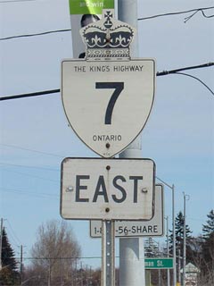
First Highway 7 shield EB in Markham
|
|
Highway 7 Information that
Pertains to the Guelph to Sunderland Section:
Discontinuity:
Highway 7 was downloaded between Norval and Highway 48 in Markham between 1997
and 2001, leaving distinct western and eastern segments of the highway.
Multiplexes: Currently, Highway 7 is
multiplexed with Highway's 6 and 12 in this section.
Freeway: None
AADT
(2002): Highest: 48,300, from Conestoga Drive to Highway 410 in
Brampton;
Lowest: 5,800, from Albert Street to Durham Road 10 in Sunderland.
Road Info: Highway 7 is in very
good shape for this entire section of Highway. Between Guelph and
Brampton, though in good condition, the highway has a somewhat redundant
routing. The route features a lot of long curves, turns, and passes through
several
small communities. In Peel and York Regions, the downloaded section of
Highway 7 can be very congested, particularly in western Brampton, and at
the 400, and 404 junctions. In York Region, Highway 7 is 6-lane at-grade
urban expressway from Dufferin Street easterly Bayview Avenue. From
Markham easterly, though still very busy, Highway 7 typically moves very
well, and has been recently rehabilitated almost entirely. |
|
Proper Municipality
Name |
Community
Name |
Distance* |
Major Intersection |
|
At Highway 6-North: EB:
Continue from Page 1. WB: Turn Left towards Kitchener at the end of
the Hanlon Parkway (Page 1) |
| City of Guelph |
Guelph |
105.8 km / 489.8 km |
King's Highway 6-North (Woodlawn Road) |
| City of Guelph |
Guelph |
--- |
Speedvale Road |
| City of Guelph |
Guelph |
--- |
Paisley Road |
|
At Highway 6-South: EB:
Exit the Hanlon Parkway at Wellington Street, and turn left at the ramp terminus. WB: Ramp
to the right on Highway 6/7 towards Mount Forest |
| City of Guelph |
Guelph |
109.5 km / 486.1 km |
King's Highway 6-South &
Highway 24-West
(Wellington Street) |
| City of Guelph |
Guelph |
--- |
Edinburgh Road |
| City of Guelph |
Guelph |
--- |
Gordon Street |
|
In Downtown Guelph: EB: To
stay on Highway 7 turn Right on Wyndham Street South. WB: Turn left
onto Wellington Street to head towards Kitchener. |
| City of Guelph |
Guelph |
111.9 km / 483.7 km |
Highway 24-East
(Wellington Road East) & Wyndham Street North |
| City of Guelph |
Guelph |
114.0 km / 481.6 km |
Victoria Road |
| City of Guelph |
York - Watson Industrial Park |
116.1 km / 479.5 km |
Watson Parkway |
| Township of Guelph-Eramosa |
----- |
119.9 km / 475.7 km |
Wellington Road 29 |
| Township of Guelph-Eramosa |
----- |
122.5 km / 473.1 km |
Wellington Road 44 |
|
In Rockwood at Main Street:
EB: Turn Right onto Main Street towards Acton. WB: Turn Left on Alma
Street towards Guelph. |
| Township of Guelph-Eramosa |
Rockwood |
124.0 km / 471.6 km |
Main Street (Wellington Road 27) |
| Township of Guelph-Eramosa |
Rockwood |
125.1 km / 470.5 km |
Harris Road (Wellington Road 50) |
| Guelph-Eramosa - Milton Boundary |
----- |
127.3 km / 468.3 km |
Halton Road 32 |
| Guelph-Eramosa - Milton Boundary |
Blue Springs |
--- |
----- |
| Guelph-Eramosa - Erin - Halton Hills Boundary |
Crewsons Corners |
131.2 km / 464.4 km |
----- |
| Town of Halton Hills |
Acton |
134.1 km / 461.5 km |
Highway 25-North (Halton Road 25, Main Street) |
|
At Highway 25 South: EB:
Turn Left into downtown via Mill Street. WB: Turn Right towards
Guelph north along Highway 25. |
| Town of Halton Hills |
Acton |
134.7 km / 460.9 km |
Highway 25-South (Halton Road 25, Main Street) |
| Town of Halton Hills |
----- |
142.0 km / 453.6 km |
Trafalgar Road North (Halton Road 3) |
| Town of Halton Hills |
Georgetown |
145.8 km / 449.8 km |
Trafalgar Road South (Halton Road 3) |
| Town of Halton Hills |
Georgetown |
148.0 km / 447.6 km |
Main Street |
| Town of Halton Hills |
Georgetown |
149.0 km / 448.6 km |
Maple Avenue (Halton Road 11) |
| Town of Halton Hills |
Georgetown |
150.1 km / 445.5 km |
Mountainview Road (Halton Road 13) |
| Town of Halton Hills |
Norval |
153.8 km / 441.8 km |
Adamson Street / Winston Churchill Boulevard (Halton Road 19) |
| Halton Hills - Brampton Boundary |
----- |
153.8 km / 441.8 km |
----- |
|
Discontinuity: 59.5 km of Highway 7 was
downloaded between Norval and Highway 48, see 1997 route info for more
information |
| Town of Markham |
Markham |
213.3 km / 382.3 km |
King's Highway 48 (Main Street) |
| Town of Markham |
Markham |
215.4 km / 380.2 km |
Ninth Line (York Road 69) |
| Town of Markham |
----- |
--- |
Markham Bypass-North |
| Town of Markham |
----- |
--- |
Markham Bypass-South |
| Town of Markham |
----- |
--- |
Reesor Road |
| Town of Markham |
Locust Hill |
--- |
----- |
| Markham - Pickering Boundary |
----- |
220.4 km / 375.2 km |
York-Durham Line (York Road 30) |
| City of Pickering |
Green River |
--- |
----- |
| City of Pickering |
Brougham |
227.5 km / 368.1 km |
Brock Road (Durham Road 1) |
|
At Highway 407: EB: Turn
left at the traffic lights towards Brooklin. WB: Ramp to the right
away from the 407 towards Brougham |
| City of Pickering |
----- |
--- |
Highway 407 ETR |
| City of Pickering |
Greenwood Bypass |
231.0 km / 346.4 km |
Westney Road (Durham Road 21) |
| City of Pickering |
Kinsale |
--- |
----- |
| Pickering - Whitby Boundary |
----- |
232.2 km / 360.4 km |
Lake Ridge Road (Durham Road 23) |
|
In Brooklin: EB: Turn Left
onto Highway 12, away from Durham Road 3. WB: Ramp to the right
towards Markham |
| Town of Whitby |
Brooklin |
240.0 km / 355.6 km |
King's Highway 12-South & Winchester Road
(Durham Road 3) |
| Town of Whitby |
----- |
244.2 km / 351.4 km |
Thickson Road (Durham Road 26) |
| Town of Whitby |
Myrtle |
246.4 km / 349.2 km |
Myrtle Road (Durham Road 5) |
| Town of Whitby |
Myrtle Station |
--- |
----- |
| Whitby - Scugog Boundary |
----- |
248.6 km / 347.0 km |
----- |
| Township of Scugog |
Manchester |
254.3 km / 341.3 km |
King's Highway 7A & Durham Road 21 |
| Township of Scugog |
----- |
258.0 km / 338.2 km |
Reach Street (Durham Road 8) |
| Township of Scugog |
----- |
216.6 km / 334.0 km |
Highway 47 (Durham Highway 47) |
| Township of Scugog |
Greenbank |
--- |
----- |
| Township of Scugog |
Saintfield |
267.5 km / 328.1 km |
Saintfield Road (Durham Road 6) |
| Township of Brock |
----- |
271.9 km / 323.7 km |
Durham Road 13 |
| Township of Brock |
Blackwater |
--- |
----- |
| Township of Brock |
Sunderland |
176.6 km / 319.0 km |
River Street (Durham Road 10) |
| Township of Brock |
----- |
279.5 km / 316.1 km |
King's Highway 12-North |
|
At Highway 12-North: EB: Take the ramp to the
right towards Lindsay. WB: Continued from
Page 3 |