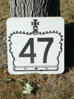
King's Highway 47 - www.OntHighways.com

Highway 47 was completely downloaded January 1, 1998.  While, Highway 47 was fairly impractical for through traffic, if did provide the necessary provincial connection to the fairly sizable Town of Uxbridge.  Since being downloaded, the region of Durham has established a truck by-pass around Uxbridge, diverting traffic along Regional Road's 21 and 23.  Highway 47 is currently known as York Road 40 and Durham Highway 47.


Highway 47 Crown

  Western Terminus:  Junction King's Highway 48 north of Stouffville.  Before the early 90's, Highway 47 was routed through downtown Stouffville via Tenth Line and Main Street and had its southern terminus a few kilometres south of its "current" one.

Eastern Terminus:  Junction King's Highway 7/12 just south of Greenbank

Length:  29.9 km

Multiplexes:  None

Freeway: No

AADT (1994):  Highest:  11,800 from Highway 48 easterly to Durham Road 21;

                             Lowest:  2,250, from Durham Road 23 easterly to Highway 7/12.

Status:  Totally downloaded in 1998.  Now known as York Road 40 (Bloomington Road), and Durham Highway 47

Road Info:  Highway 47 is in respectable condition for its entire length.  (The highlight would be from the east end of Uxbridge to Highway 7/12).  Traffic volumes are heavy from Uxbridge, westerly, and very light east of the community.  The rural speed limit on Highway 47 is 80km/h.


Highway 47 information:


OntHighways.com  

Detailed Route information available below
Virtual Tour of Highway 47


TheKingsHighway.ca   History of Highway 47
Photographic History of Highway 47

Communities and Major Intersections Located on Highway 47 from West to East:

Proper Municipality Name Community Name Distance Intersection Name

York Region has renamed Highway 47 to York Road 40 (Bloomington Road), as it was before Highway 47's routing was changed in the early 90's.

Township of Whitchurch Stouffville ----- --- (0km) / --- (29.9km) King's Highway 48
Township of Whitchurch Stouffville Bloomington --- (2.1km) / --- (27.9km) Ninth Line (York Road 69)

Durham has renamed Highway 47 to Durham Highway 47; a very noble solution to accepting downloaded highways

Whitchurch Stouffville - Uxbridge Boundary ----- --- (4.4km) / --- (25.6km) York Durham Line (York/Durham Road 30)
Township of Uxbridge Goodwood --- (8.0km) / --- (21.9km) Durham Road 21 (Goodwood Road)
Township of Uxbridge ----- --- (12.5km) / --- (17.4km) Brock Road (Durham Road 1-South)
Township of Uxbridge Uxbridge South Limits --- (17.9km) / --- (12.0km) -----

EB:  Turn right at Brock Street (well signed) in downtown Uxbridge.  WB:  At the second light in Uxbridge turn left (Toronto Street)

Township of Uxbridge Uxbridge --- (20.2km) / --- (9.8km) Brock Street (Durham Road 8-West)
Township of Uxbridge Uxbridge --- (20.4km) / --- (9.6km) Main Street (Durham Road 1-North & Durham Road 8-East)
Township of Uxbridge Uxbridge East Limits --- (21.2km) / --- (8.7km) -----
Uxbridge - Scugog Boundary ----- --- (22.7km) / --- (7.2km) Lakeridge Road (Durham Road 23)
Township of Scugog ----- --- (29.9km) / --- (0km) King's Highway 7/12

Highway 47 ENDS


<- Highway 46         www.OntHighways.com - Home         Highway 48 ->


Copyright (c) 2004-2010, AsphaltPlanet.ca  AsphaltPlanet@asphaltplanet.ca

Page last updated:  August 21st, 2007

Page created:  January 11th, 2004