AsphaltPlanet.ca >
OntHighways > Highway 46 > Images
< Hwy 45
Hwy 47 >
King's
Highway 46 - www.OntHighways.com
Highway 46 was transferred to local
municipalities in 1997. This was a very logical transfer, as Highway 46
served a very local purpose. At the height of the highway's historic
length, Highway 46 was far more important than it was in 1997. Prior to
the mid 1960's when Highway 48 was extended northeasterly from Highway 12
through Bolsover, Highway 46 carried traffic northerly from
Highway 7 near Oakwood to Highway 35 at Coboconk along the current routing of
what is now Kawartha Lakes Road 46, and Kawartha Lakes Road 48. In the mid-1960s when
Highway 48 was extended northeast of Highway 12 through Bolsover the east-west
leg of Highway 46 was designated as Highway 48. From the 1960s until its
decommissioning in 1997, Highway 46 extended from Highway
7 near Oakwood to Highway 48 just east of Bolsover.
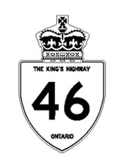
CGI
of Highway 46 Shield
Courtesy Jamie Malecki
|
|
Southern Terminus: Junction Highway 7
between Oakwood and Manilla
Northern Terminus:
Junction Highway 48 near Bolsover
Length: 26.0 km
Multiplexes: None
Freeway: No
AADT (1994):
Highest: 2,100, from Woodville northerly to Victoria (Kawartha Lakes) Road
8;
Lowest: 1,100, from Highway 7 northerly to Woodville.
Status: Totally downloaded in 1997.
Now known as Kawartha Lakes Road 46
Road Info: Highway 46 is in
pretty good shape for a county road, but I would consider it substandard for a
King's Highway. |
Communities and Major Intersections located along Highway 46 from South to
North:
|
Proper Municipality Name |
Community Name |
Distance |
Intersecting Road |
|
Highway 46 is now known as Kawartha Lakes Road 46
for its entire length |
| City of Kawartha Lakes |
----- |
0 km / 26.0 km |
King's Highway 7
(TCH - Central Ontario Route) |
|
At Kawartha Lakes Road 9-East: NB Turn Left
at the stop sign. SB: Turn Right towards Highway 7. |
| City of Kawartha Lakes |
Woodville |
9.5 km / 16.5 km |
Woodville Road-East (Kawartha Lakes Road 9) |
|
At Kawartha Lakes Road 9-West: NB: Turn Right
towards Argyle. SB: Turn Left at the stop sign. |
| City of Kawartha Lakes |
Woodville |
--- |
Woodville Road-West (Kawartha Lakes Road 9) |
| City of Kawartha Lakes |
Lorneville |
--- |
----- |
| City of Kawartha Lakes |
Argyle |
16.0 km / 10.0 km |
Glenarm Road (Kawartha Lakes Road 8) |
| City of Kawartha Lakes |
----- |
26.0 km / 0 km |
Highway 48
(Kawartha Lakes Road 48) |
|
Highway 46 ENDS |
<- Highway
45 www.OntHighways.com - Home
Highway 47 ->
Copyright (c) 2004-2010, AsphaltPlanet.ca
AsphaltPlanet@asphaltplanet.ca
Page last updated: June 11th, 2005
Page created: April 21st, 2004