|
Proper Municipality
Name |
Community
Name |
Distance |
Major Intersection |
|
At Highway 12-North: EB:
Continued from Page 2. WB: Turn left towards Whitby, and continue
westerly via Page 2 |
|
Trans-Canada Highway Traffic:
EB: Head east on Highway 7 from Highway 12. WB: Take the ramp to the
right onto Highway 12 North. |
| Township of Brock |
----- |
279.5 km (381.4km) / 316.1 km
(313.2km) |
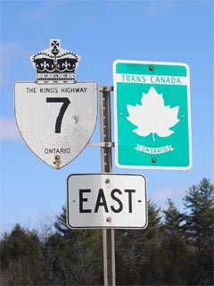
King's Highway 12-North |
| Brock - Kawartha Lakes Boundary |
Manilla |
286.6 km / 309.0 km |
Simcoe Street (Durham/Kawartha Lakes Road 2) |
| City of Kawartha Lakes |
----- |
289.7 km / 305.9 km |
Highway 46 (Kawartha Lakes Road 46) |
| City of Kawartha Lakes |
Oakwood |
295.7 km / 299.9 km |
Eldon Street (Kawartha Lakes Road 6) |
| City of Kawartha Lakes |
----- |
302.0 km / 293.6 km |
Elm Tree Road (Kawartha Lakes Road 18) |
| City of Kawartha Lakes |
Lindsay Bypass |
304.4 km / 291.2 km |
King's Highway 7B/35-North (Kent Street) |
| City of Kawartha Lakes |
Lindsay Bypass |
308.4 km / 287.2 km |
Kawartha Lakes Road 4 (Angeline Street / Little
Brittain Road) |
| City of Kawartha Lakes |
Lindsay Bypass |
309.8 km / 285.8 km |
King's Highway 35-South &
Highway 7B/35B (Kawartha
Lakes Road 15) |
| City of Kawartha Lakes |
----- |
311.2 km / 284.4 km |
Highway 36 (Kawartha Lakes Road 36) |
| City of Kawartha Lakes |
----- |
323.6 km / 272.0 km |
Mount Horeb Road (Kawartha Lakes Road 31) |
| City of Kawartha Lakes |
Omemee West Limits |
324.3 km / 271.3 km |
----- |
| City of Kawartha Lakes |
Omemee |
324.9 km / 270.7 km |
Deane Street (Kawartha Lakes Road 38) |
| City of Kawartha Lakes |
Omemee |
325.7 km / 269.9 km |
Sturgeon Street (Kawartha Lakes Road 7) |
| City of Kawartha Lakes |
Omemee East Limits |
327.0 km / 268.6 km |
----- |
| City of Kawartha Lakes |
----- |
329.4 km / 266.2 km |
Emily Park Road (Kawartha Lakes Road 10) |
|
At Fowlers Corners: EB:
Ramp to the right towards Port Hope. WB: Turn left at traffic lights
towards Lindsay |
| Kawartha Lakes - Cavan- Millbrook- North
Managhan Boundary |
Fowlers Corners |
335.7 km / 259.9 km |
Highway 7B (Lindsay Road, Peterborough Road 1) &
Kawartha Lakes Road 26 |
| Kawartha Lakes - Cavan- Millbrook- North
Managhan Boundary |
----- |
339.8 km / 255.8 km |
Parkhill Road (Peterborough Road 3) |
| Township of Cavan- Millbrook- North Monaghan |
----- |
341.3 km / 254.3 km |
Peterborough Road 9 (Mount Pleasant Road &
Sherbrooke St) |
| Township of Cavan- Millbrook- North Monaghan |
----- |
342.9 km / 252.7 km |
Lansdowne Street (Peterborough Road 5) |
|
The 1997 Version of Highway 7 turned left at North
Monaghan Parkway (EB). Click here for 1997 route information |
| Township of Cavan- Millbrook- North Monaghan |
----- |
344.4 km / 251.2 km |
North Monaghan Parkway (Peterborough Road 15)
(Pre-1997: Highway 7-East) |
| Township of Cavan- Millbrook- North Monaghan |
Springville |
----- |
----- |
|
At Highway 115: EB: Turn
left after the bridges towards Peterborough and Ottawa. WB: Exit the
freeway, towards Fowlers Corners, turn right at the end of the ramp. |
| Township of Cavan- Millbrook- North Monaghan |
----- |
345.9 km / 249.7 km |
King's Highway 115-South &
Highway 28
(Peterborough Road 28) |
| Cavan- Millbrook- North Monaghan - Peterborough
Boundary |
----- |
349.9 km / 245.7 km |
Airport Road (Peterborough Road 11) |
|
Sir Sandford Fleming Drive is the
pre-1997 routing of Highway 7. Click here 1997 route information |
| City of Peterborough |
Peterborough
(By-Pass) |
352.3 km / 243.3 km |
The Parkway (Old Highway 28-North and
Old
Highway 115-North) & Sir Sandford Fleming Drive (Pre-1997: Highway
7-West) |
| City of Peterborough |
Peterborough
(By-Pass) |
355.6 km / 240.0 km |
Bensfort Drive |
| City of Peterborough |
Peterborough
(By-Pass) |
357.1 km / 238.5 km |
Ashburnham Drive |
|
At the northern end of Highway
115: EB: Take the ramp to the right towards Ottawa. WB: Turn
left on the freeway towards Lindsay and Toronto. |
| City of Peterborough |
Peterborough |
358.4 km / 236.8 km |
Highway 7B (Lansdown Street) & Television Road |
| Peterborough - Otonabee- South Monaghan Boundary |
----- |
359.1 km / 236.5 km |
Old Keene Road (Peterborough Road 35, formerly
30) |
| Township of Otonabee- South Monaghan |
Woodview |
--- |
----- |
| Township of Otonabee- South Monaghan |
----- |
366.0 km / 229.6 km |
King's Highway 28 (Former
Highway 134) & Heritage Road
(Peterborough County 34) |
| Township of Otonabee- South Monaghan |
Jermyn |
--- |
----- |
| Township of Asphodel- Norwood |
----- |
375.6 km / 220.0 km |
Peterborough Road 38 |
| Township of Asphodel- Norwood |
Norwood West Limits |
384.6 km (483.6km) /
211.0 km |
----- |
| Township of Asphodel- Norwood |
Norwood |
385.4 km (484.4km) /
210.2 km |
Highway 45 (Peterborough Road 45) & Peterborough
Road 40 |
| Township of Asphodel- Norwood |
Norwood East Limits |
386.7 km (485.7km) / 208.9 km |
----- |
| Township of Havelock- Belmont- Methuen |
Havelock West Limits |
394.4 km (493.3km) / 201.2 km |
----- |
| Township of Havelock- Belmont- Methuen |
Havelock |
394.7 km (493.7km) / 200.9 km |
Highway 30
(Peterborough Road 30) & Peterborough Road 46 |
| Township of Havelock- Belmont- Methuen |
Havelock East
Limits |
396.3 km (495.3km) / 199.3 km |
Peterborough Road 48 |
| Township of Havelock- Belmont- Methuen |
Preneveau |
400.9 km (499.9km) / 194.7 km |
Peterborough Road 50 |
| Municipality of Marmora and Lake |
Marmora West Limits |
411.3 km (510.8km) / 183.8 km |
----- |
| Municipality of Marmora and Lake |
Marmora |
412.6 km (511.6km) / 183.0 km |
Highway 14 (Stirling-Marmora Road 14) & Cordova
Road |
| Municipality of Marmora and Lake |
Marmora East
Limits |
413.7 km (512.7km) / 181.9 km |
----- |
| Municipality of Marmora and Lake |
----- |
417.2 km (516.2km) / 178.4 km |
Deloro Road (Hastings Road 11) |
| Township of Madoc |
----- |
427.9 km 526.9km) / 167.7 km |
St Lawrence Street (Hastings Road 23) |
| Municipality of Centre Hastings |
Madoc Bypass |
429.7 km (528.7km) / 166.0 km |
King's Highway 62
(Russell Street) |
| Township of Madoc |
----- |
430.6 km (529.6km) / 165.1 km |
Wellington Street & Cooper Road (Hastings
Road 12) |
| Township of Madoc |
----- |
432.4 km (531.4km) / 163.2 km |
St Lawrence Street (Hastings Road 23) |
| Municipality of Tweed |
----- |
440.2 km (539.2km) / 155.4 km |
Queensborough Road (Hastings Road 20) |
| Municipality of Tweed |
----- |
442.9 km (541.9km) / 152.7 km |
King's Highway 37 |
| Municipality of Tweed |
----- |
443.8 km (542.8km) / 151.8 km |
Flinton Road (Hastings Road 2) |
| Township of Addington Highlands |
Addington |
--- |
----- |
| Township of Addington Highlands |
Kaladar |
464.6 km (563.6km) / 131.0 km |
King's Highway 41 / Lennox & Addington
Road 41 |
| Township of Central Frontenac |
Ronaldson |
--- |
----- |
| Township of Central Frontenac |
----- |
475.6 km (574.6km) / 120.1 km |
Elm Tree Road / Henderson Road |
| Township of Central Frontenac |
----- |
489.8 km (588.8km) / 105.8 km |
Mountain Grove Road |
| Township of Central Frontenac |
----- |
504.3 km (603.3km) / 91.3 km |
Highway 509 (Frontenac Road 509) |
| Township of Central Frontenac |
----- |
505.6 km (604.6km) / 90.1 km |
Highway 38 (Frontenac Road 38) |
| Central Frontenac - Tay Valley Boundary |
----- |
513.3 km (612.2km) / 82.3 km |
----- |
| Township of Tay Valley |
----- |
518.2 km (617.2km) / 77.4 km |
Lanark Road 36 (Maberly Elphin Road &
Bollingbroke Road) |
| Township of Tay Valley |
Brooke |
--- |
----- |
| Township of Tay Valley |
Wemyss |
530.2 km (629.2km) / 65.3 km |
----- |
| Tay Valley - Perth Boundary |
Perth West Limits |
540.5 km (639.5km) / 55.1 km |
Highway 511 (Lanark Road 511, Lanark Road) |
| Town of Perth |
Perth |
541.1 km (640.1km) / 54.5 km |
Highway 43 (Wilson Street) |
| Perth - Drummond/North Elmsley Boundary |
Perth East Limits |
541.8 km (640.8km) / 53.9 km |
----- |
| Township of Drummond/ North Elmsley |
Wayside |
--- |
----- |
| Township of Drummond/ North Elmsley |
Innisville |
--- |
----- |
| Township of Lanark Highlands |
----- |
561.7 km (663.5km) / 34.0 km |
Ferguson Falls Road (Lanark Road 15) |
| Town of Mississippi Mills |
McCrearys |
566.0 km (665.0km) / 29.6 km |
Tatlock Road (Lanark Road 9) |
| Mississippi Mills - Beckwith Boundary |
Carleton Place
Bypass |
570.6 km (669.4km) / 25.1 km |
Highway 7B (Lanark Road 7B) |
| Town of Carleton Place |
Carleton Place |
574.3 km (673.3km) / 21.3 km |
King's Highway 15-South & Franktown Road |
| Town of Carleton Place |
Carleton Place |
575.0 km (674.0km) / 20.1 km |
Highway 15-North (McNeeley Avenue, To Lanark
Road 29 North) |
| Township of Beckwith |
----- |
577.0 km (677.0km) / 17.6 km |
Lanark Road 17 (Cemetery Sideroad & Mississippi
Wonderland Road) |
| Beckwith - Ottawa Boundary |
----- |
581.1 km (681.1km) / 13.7 km |
Ashton Station Road |
| City of Ottawa |
----- |
585.7 km (684.7km) / 9.9 km |
Dwyer Hill Road (Ottawa Road 3) |
| City of Ottawa |
----- |
593.1 km (692.1km) / 2.5 km |
Hazeldean Road (Ottawa Road 36) |
| City of Ottawa |
----- |
595.6 km (694.6km) / 0 km |
King's Highway 417 |
|
Highway 7 ENDS |