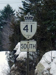
|
Proper Municipality Name |
Community Name |
Distance |
Intersecting Road |
|
Highway 41 was downloaded south
of Highway 7, it is now known as Lennox&Addington Road 41. |
| Town of Greater Napanee |
Napanee |
0 km / 206.0 km |
Highway 2 (Dundas
Street) |
| Town of Greater Napanee |
Napanee |
--- |
Bridge Street |
| Town of Greater Napanee |
Napanee |
--- |
Industrial Boulevard |
| Town of Greater Napanee |
Napanee North Limits |
1.9 km / 204.1 km |
----- |
| Town of Greater Napanee |
----- |
2.3 km / 203.7 km |
King's
Highway 401 (Autoroute Macdonald-Cartier Freeway) |
| Town of Greater Napanee |
(Selby Bypass) |
6.2 km / 199.8 km |
Lennox & Addington Road 11 |
| Town of Greater Napanee |
Sharps Corners |
10.5 km / 195.5 km |
Heming Lane (Lennox & Addington Road 12) |
| Town of Greater Napanee |
Grieves Corners |
12.7 km / 193.3 km |
----- |
| Town of Greater Napanee |
Roblindale Station |
--- |
----- |
| Town of Greater Napanee |
Roblin |
--- |
----- |
| Greater Napanee - Stone Mills Boundary |
----- |
17.4 km / 188.6 km |
Lennox & Addington Road 14 |
| Township of Stone Mills |
----- |
20.1 km / 185.9 km |
Lennox & Addington Road 3 |
| Township of Stone Mills |
Ingle |
--- |
----- |
| Township of Stone Mills |
----- |
27.7 km / 178.3 km |
Tamworth Road (Lennox &Addington Road 4) |
| Township of Stone Mills |
----- |
28.7 km / 177.3 km |
Lennox & Addington Road 13 |
| Township of Stone Mills |
Erinsville |
--- |
----- |
|
Current Southern Terminus of
Highway 41 is located at Highway 7 in Kaladar. |
| Township of Addington Highlands |
Kaladar |
50.9 km / 155.1 km |
King's Highway 7 |
| Township of Addington Highlands |
Flinton Corners |
--- |
Flinton Road |
| Township of Addington Highlands |
Northbrook |
--- |
----- |
| Township of Addington Highlands |
Bishop Corners |
--- |
----- |
| Addington Highlands - North Frontenac Boundary |
----- |
69.2 km / 136.8 km |
Highway 506 (North Frontenac Road 506) |
| Addington Highlands - North Frontenac Boundary |
Cloyne |
--- |
----- |
| Township of North Frontenac |
----- |
81.1 km / 124.9 km |
Bon Echo Provincial Park Access Road |
| Township of Addington Highlands |
Ferguson Corners |
104.1 km / 101.9 km |
----- |
| Township of Addington Highlands |
Vennachar Junction |
--- |
Buckshot Lake Road |
| Township of Addington Highlands |
----- |
114.0 km / 92.0 km |
King's Highway 28 |
| Addington Highlands - Greater Madawaska Boundary |
----- |
126.2 km / 79.8 km |
----- |
| Township of Greater Madawaska |
Griffith |
129.7 km / 76.3 km |
Matawatchan Road (Renfrew Road 71) |
| Township of Greater Madawaska |
Khartum |
--- |
----- |
| Municipality of Bonnechere Valley |
----- |
151.4 km / 54.6 km |
King's Highway 132 |
| Municipality of Bonnechere Valley |
----- |
--- |
Openogo Road (Renfrew Road 64) |
| Municipality of Bonnechere Valley |
Perrault |
161.1 km / 44.9 km |
----- |
| Municipality of Bonnechere Valley |
----- |
--- |
Grantan Road (Renfrew Road 22) |
| Municipality of Bonnechere Valley |
Eganville South Limits |
171.3 km / 34.7 km |
Highway 512 (Foymont Road, Renfrew Road 512) |
| Municipality of Bonnechere Valley |
Eganville |
172.4 km / 33.6 km |
King's Highway 60-East |
| Bonnechere Valley - North Algona Wilberforce
Boundary |
Eganville North Limits |
173.2 km / 32.8 km |
----- |
|
At Highway 60-West Junction:
NB: Turn Right towards Pembroke. SB: Turn Left towards Eganville and
Foymont. |
| Township of North Algona Wilberforce |
----- |
176.2 km / 29.8km |
King's Highway 60-West |
| Township of North Algona Wilberforce |
---- |
185.4 km / 20.6 km |
Lake Dore Road (Refrew Road 30) & Bulger Road
(Renfrew Road 9) |
| Township of North Algona Wilberforce |
--- |
186.2 km / 19.8 km |
Mountain Road (Renfrew Road 13) |
| Township of North Algona Wilberforce |
Allans Corners |
--- |
----- |
| Township of North Algona Wilberforce |
Rankin |
--- |
----- |
| North Algona Wilberforce - Laurential Valley
Boundary |
Huckabones Corners |
194.0 km / 12.0 km |
Micksburg Road (Formerly Renfrew Road 11) |
| North Algona Wilberforce - Laurential Valley
Boundary |
----- |
--- |
Woito Station Road (Renfrew Road 56) |
| Township of Laurentian Valley |
----- |
197.8 km / 8.2 km |
White Water Road (Renfrew Road 24) |
| Township of Laurentian Valley |
----- |
200.0 km / 6.0 km |
Witt Road (Formerly Renfrew Road 14) |
| Township of Laurentian Valley |
Shady Nook |
--- |
----- |
| Township of Laurentian Valley |
Fairview |
--- |
----- |
| Laurentian Valley - Pembroke Boundary |
Pembroke Bypass |
205.0 km / 1.0 km |
King's Highway 17 (Pembroke Bypass) |
| Laurentian Valley - Pembroke Boundary |
Pembroke |
206.0 km / 0 km |
Mud Lake Road (Renfrew Road 19) |
|
Highway 41 ENDS |
