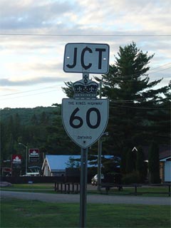
|
Proper Municipality Name |
Community Name |
Distance |
Intersecting Road |
| Town of Huntsville |
Huntsville Bypass |
0 km / 253.9 km |
King's
Highway 11 |
| Town of Huntsville |
Huntsville |
2.6 km / 251.3 km |
Muskoka Road 3 |
| Town of Huntsville |
----- |
6.8 km / 247.1 km |
Dearhurst Canal Road (Muskoka Road 24) |
| Township of Lake of Bays |
Grassmere |
--- |
----- |
| Township of Lake of Bays |
----- |
12.8 km / 241.1 km |
Limberlost Road (Muskoka Road 8) |
| Township of Lake of Bays |
Hillsdale |
--- |
----- |
| Township of Lake of Bays |
----- |
18.9 km / 235.0 km |
South Portage Road (Muskoka Road 9) |
| Township of Lake of Bays |
Dwight |
--- |
----- |
| Township of Lake of Bays |
----- |
23.7 km / 230.2 km |
King's Highway 35 |
| Township of Algonquin Highlands |
Oxtongue Lake |
--- |
----- |
| District of Nipissing (Algonquin Park) |
----- |
44.5 km / 209.4 km |
Algonquin Park West Gate (Access Road) |
| District of Nipissing (Algonquin Park) |
----- |
58.5 km / 195.4 km |
(Smoke Lake Road) |
| District of Nipissing (Algonquin Park) |
----- |
68.1 km / 185.8 km |
(Station Road) |
| District of Nipissing (Algonquin Park) |
----- |
76.5 km / 177.4 km |
(Two River Road) |
| District of Nipissing (Algonquin Park) |
----- |
91.8 km / 162.1 km |
(Opeongo Lake Road) |
| Township of South Algonquin |
Whitney |
--- |
----- |
| Township of South Algonquin |
----- |
109.8 km / 144.1 km |
King's Highway
127 |
| Township of South Algonquin |
L'Amable |
--- |
----- |
| Township of South Algonquin |
Murchison |
--- |
----- |
| Township of South Algonquin |
Madawaska |
128.8 km / 125.1 km |
Secondary Highway
523 |
| Township of Madawaska Valley |
Barry's Bay West Limits |
156.5 km / 97.4 km |
----- |
| Township of Madawaska Valley |
Barry's Bay |
157.0 km / 96.9 km |
Highway 62-South
(Bay Street, Renfrew Road 62) |
| Township of Madawaska Valley |
Barry's Bay East Limits |
157.8 km / 96.1 km |
----- |
| Madawaska Valley - Killaloe, Hagarty and
Richards Boundary |
Wilno |
166.8 km / 87.1 km |
Wilno South Road (Renfrew Road 66) |
| Township of Killaloe, Hagarty and Richards |
Shrine Hill Bypass |
--- |
----- |
| Township of Killaloe, Hagarty and Richards |
----- |
--- |
Simpson Pit Road (Renfrew Road 67) |
| Township of Killaloe, Hagarty and Richards |
Killaloe (Killaloe Station) |
179.8 km / 74.1 km |
Highway 62-North
(Renfrew Road 58) & Highway 512 (Renfrew Road 512) |
| Township of North Algona Wilberforce |
Deacon |
--- |
----- |
| Township of North Algona Wilberforce |
----- |
198.0 km / 55.9 km |
Lake Dore Road (Renfrew Road 30) |
| Township of North Algona Wilberforce |
Mud Lake |
--- |
|
| Township of North Algona Wilberforce |
----- |
208.0 km / 45.9 km |
King's Highway
41-North |
| North Algona Wilberforce - Bonnechere Valley
Boundary |
Eganville North Limits |
211.0 km / 42.9 km |
----- |
|
In Eganville. EB: Turn Left
towards Renfrew. WB: Turn Right towards Pembroke and Barry's Bay |
| Municipality of Bonnechere Valley |
Eganville |
211.8 km / 42.1 km |
King's Highway
41-South |
| Bonnechere Valley - North Algona Wilberforce
Boundary |
Eganville East Limits |
213.1 km / 40.8 km |
----- |
|
At Cobden and Bulger Roads:
EB: Ramp to the right away from Cobden. WB: Turn left towards
Eganville. |
| North Algona Wilberforce - Adamston Bromley
Boundary |
Kellys Corners |
220.5 km / 33.4 km |
Bulger Road (Renfrew Road 9) & Cobden Road
(Renfrew Road 8) |
|
In Douglas: EB: Turn Left
towards Renfrew. WB: Turn Right towards Eganville. |
| Township of Adamston Bromley |
Douglas |
227.9 km / 26.0 km |
Stone Road (Renfrew Road 5) |
| Township of Adamston Bromley |
Northcote |
--- |
----- |
| Township of Adamston Bromley |
Rosebank |
240.8 km / 13.1 km |
Haley Road (Renfrew Road 61) |
| Horton - Renfrew Boundary |
Renfrew West Limits |
248.1 km / 5.8 km |
----- |
| Town of Renfrew |
Renfrew |
--- |
Bruce Road (Renfrew Road 20) |
| Town of Renfrew |
Renfrew |
249.7 km / 4.2 km |
King's Highway 132 |
|
At Raglan Street South: EB:
Turn Left onto Coumbes Street, heading towards Highway 17 . EB: Turn
Right onto Raglan Street. |
| Town of Renfrew |
Renfrew |
--- |
Raglan Street South (Renfrew Road 52) |
| Town of Renfrew |
Renfrew |
--- |
Gillian Road (Renfrew Road 6) |
| Renfrew - Horton Boundary |
Renfrew East Limits |
253.6 km / 0.3 km |
----- |
| Township of Horton |
----- |
253.9 km / 0 km |
King's Highway 17 |
|
Highway 60 ENDS |
