|
Proper Municipality Name |
Photo Description |
Photo |
|
Pictures taken
from driver's perspective appear offset from centre-line pictures: |
East-
bound |
West-
bound |
|
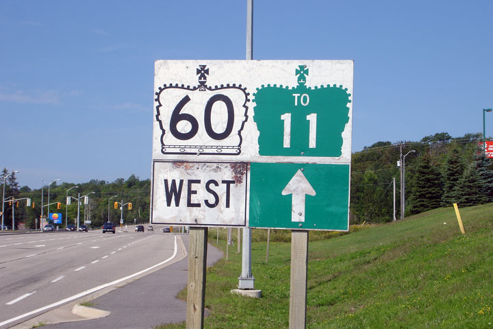
Highway 60's western terminus can
be found at Highway 11 in Huntsville.
Click here for Highway 11 images. |
| Town of Huntsville District
Municipality of Muskoka |
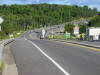
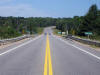
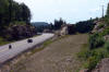
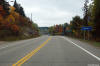
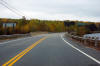
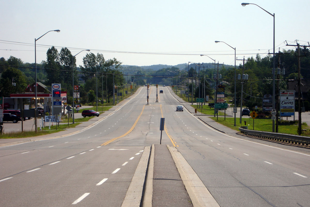
Highway 60 looking east from the Highway 11
overpass along the Huntsville Bypass. Highway 60 is a limited access
highway from Highway 11 at Huntsville
easterly to Muskoka Road 3. Picture taken: August 7th, 2004. Size: 75kb. |
 |
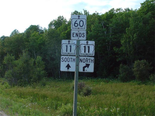
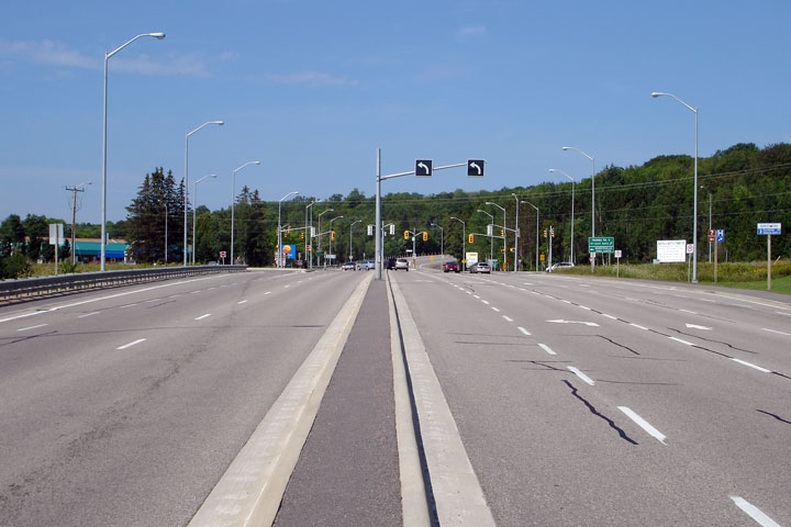
| Town of Huntsville District
Municipality of Muskoka |
This junction assembly denotes the western terminus of Highway 60 at the
Highway 11 interchange. Through
traffic on Highway 60 defaults to the southbound
Highway 11. Traffic wishing to continue northbound on
Highway 11 must take the directional ramp to
the right.
Picture size: 45kb. |
 |
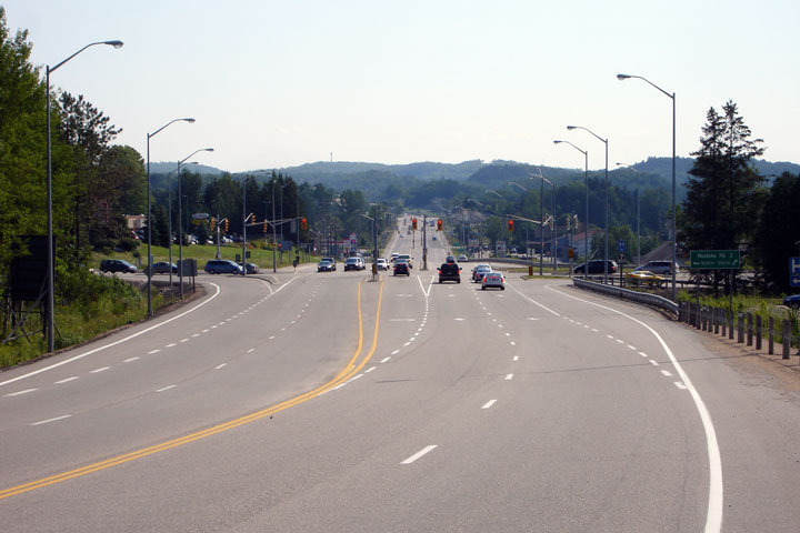
Town of Huntsville
District Municipality of Huntsville |
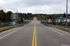
Easterly view along Highway 60 from just east of the Highway 11 interchange.
Photo taken: October 1st, 2014. |

(720x480)
(1440x960)
(2400x1600) |
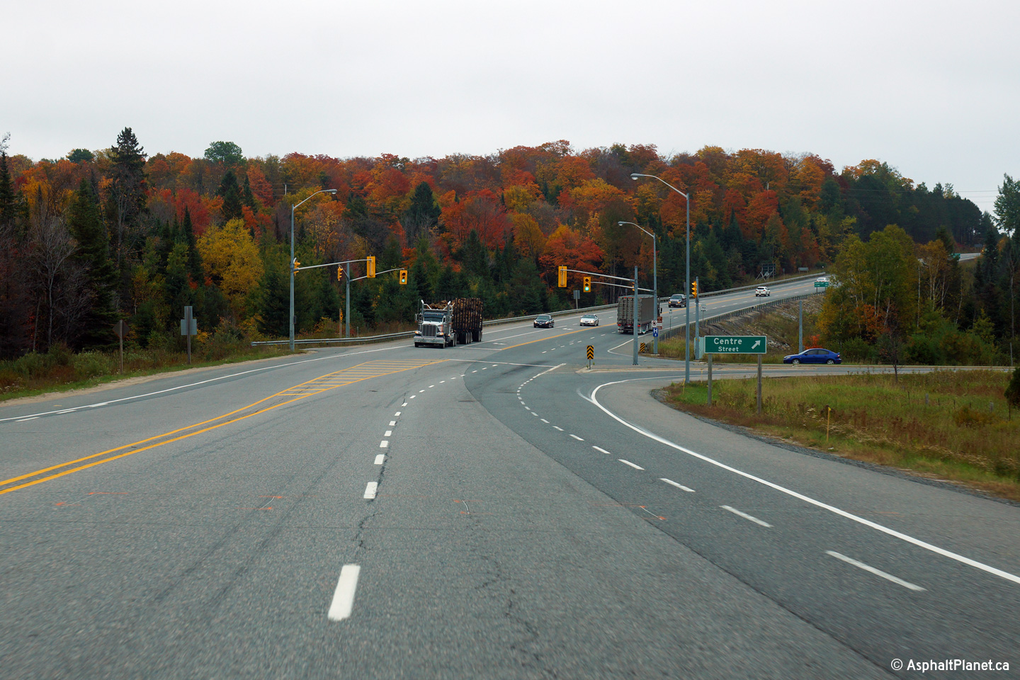
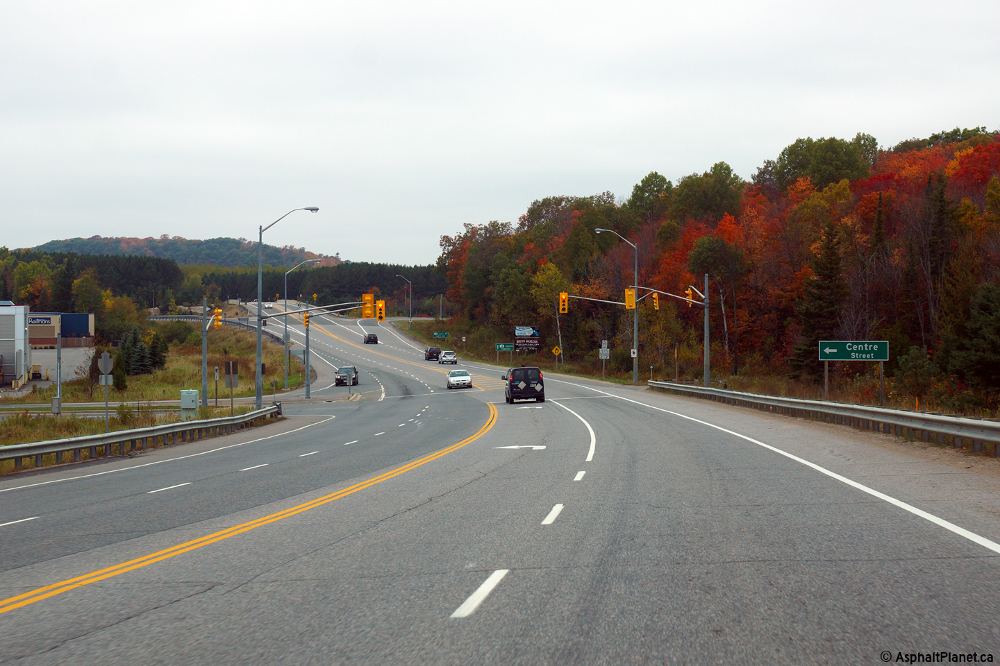
Town of Huntsville
District Municipality of Huntsville |
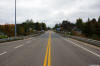
Westerly view towards both the Centre Street intersection as well as the
Highway 11 interchange.
Photo taken: October 1st, 2014. |
(720x480)
(1440x960)
(2400x1600) |
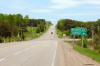
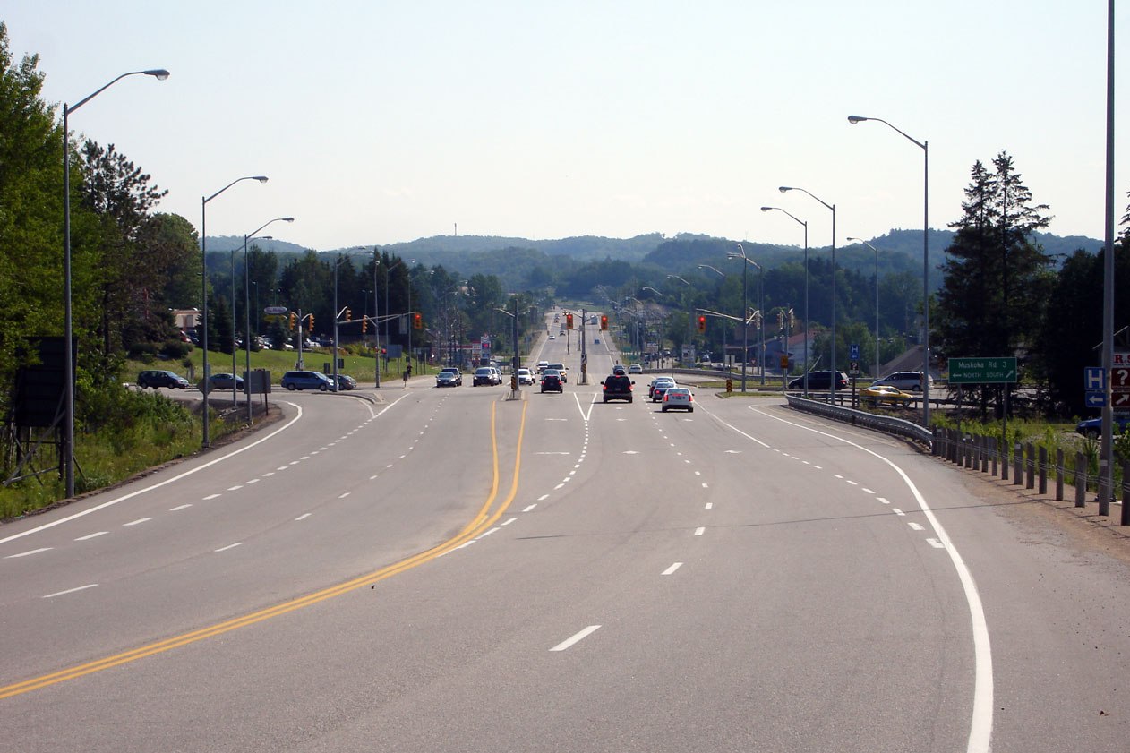
| Town of Huntsville District
Municipality of Muskoka |
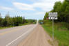
Easterly view towards the Muskoka Road 3 intersection. Photo taken: August
6th, 2006. |
(720x480)
(1440x960) |
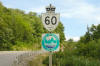
| Town of Huntsville District
Municipality of Muskoka |
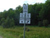
Green signage found along Muskoka Road 3 for Highway 60. Photo taken:
August 6th, 2006. |
 |
| Town of Huntsville District
Municipality of Muskoka |
Oversized reassurance marker and trailblazer in advance of the Muskoka Road
3 intersection. This sign is significant since Muskoka Road 3 was the
original alignment of Highway 11 through Huntsville. Photo taken: August
6th, 2006. |
 |
| Town of Huntsville District
Municipality of Muskoka |
The Muskoka Road 3 intersection is of impressive scale. Photo taken:
August 6th, 2006. |
(720x480)
(1440x960) |
| Town of Huntsville District
Municipality of Muskoka |
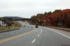
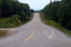
Highway 60 continues as a multilane highway for several kilometres east of
Huntsville. Photo taken: August 6th, 2006. |
(720x480)
(1440x960) |
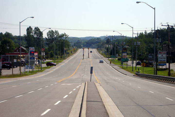
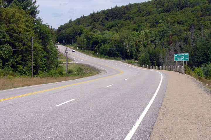
| Town of Huntsville District
Municipality of Muskoka |
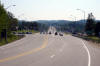
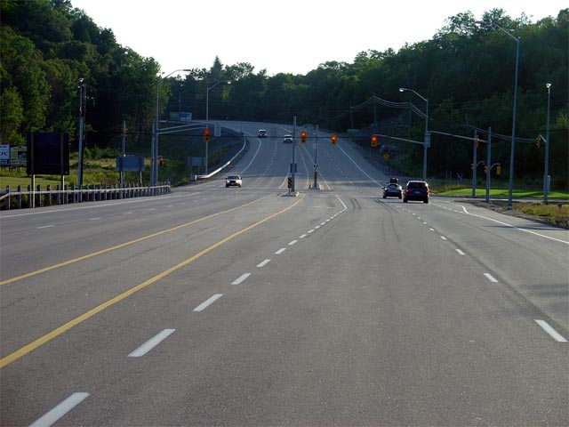
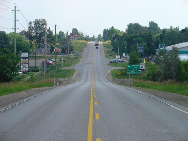
Highway 60 looking west towards the Muskoka Road 8 intersection. For
about 10km east of downtown Huntsville, Highway 60 is has a standard 4.5
lane cross section, with several signalized intersections, such as the one
shown in this photo.
Picture taken: August 7th, 2004. Size: 50kb. |
 |
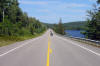
| Township of Lake of Bays
District Municipality of Muskoka |
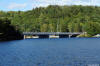
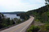
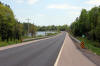
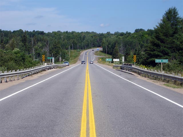
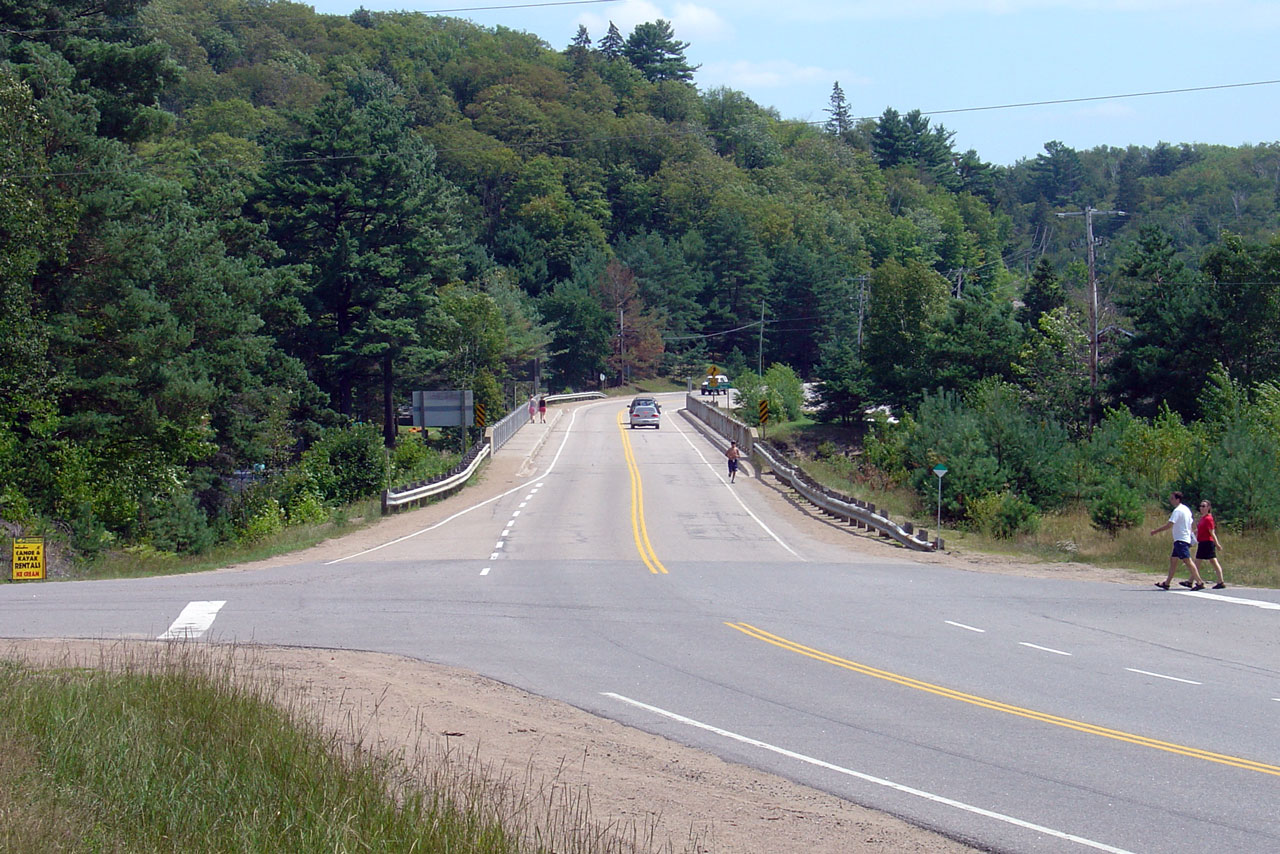
View looking westerly across the Boyne Creek Bridge towards the Muskoka Road
9 junction. Picture taken: August 6th, 2006. Size: 55kb. |
 |
| Township of Lake of Bays
District Municipality of Muskoka |
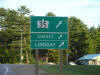
The eastbound Highway 35 MGS on Highway 60
just east of Dwight. Highway 35 leads
south from Dwight heading through Minden, Lindsay, to
Highway 401 at Newcastle.
Picture size: 45kb. |
 |
|
Highway 35 starts its trek
southern at Highway 60 just east of Dwight.
Click here for Highway 35 images. |
|
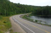
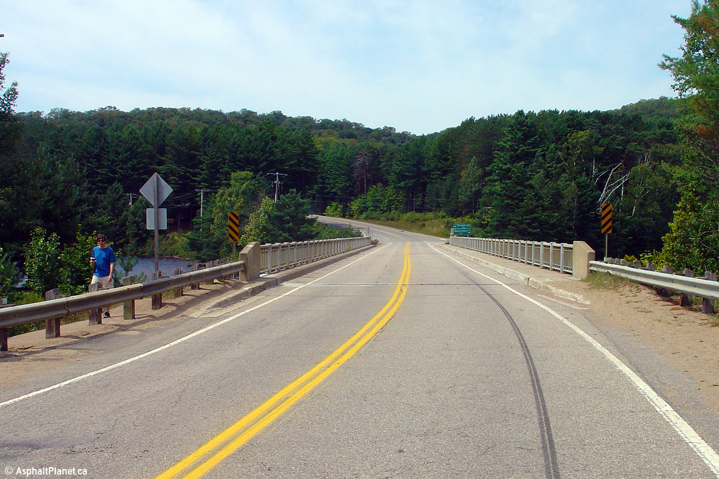
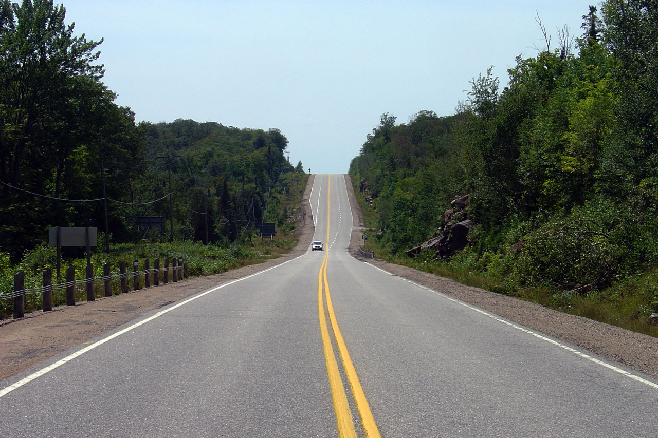
Township of Lake of Bays District Municipality of Muskoka |
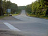
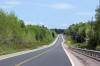
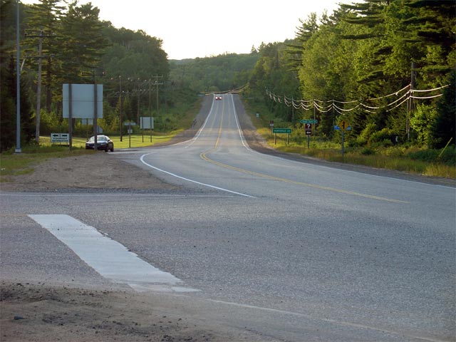
Highway 60 looking west from the Highway 35
intersection. This is a fairly typical looking section of Highway 60
from Western Algonquin Park to Huntsville. Picture taken: August 7th,
2004. Size: 60kb. |
 |
|
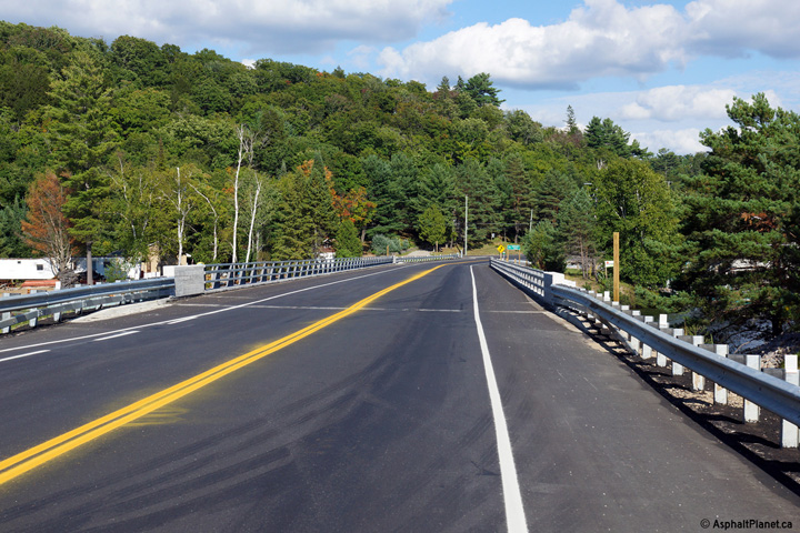
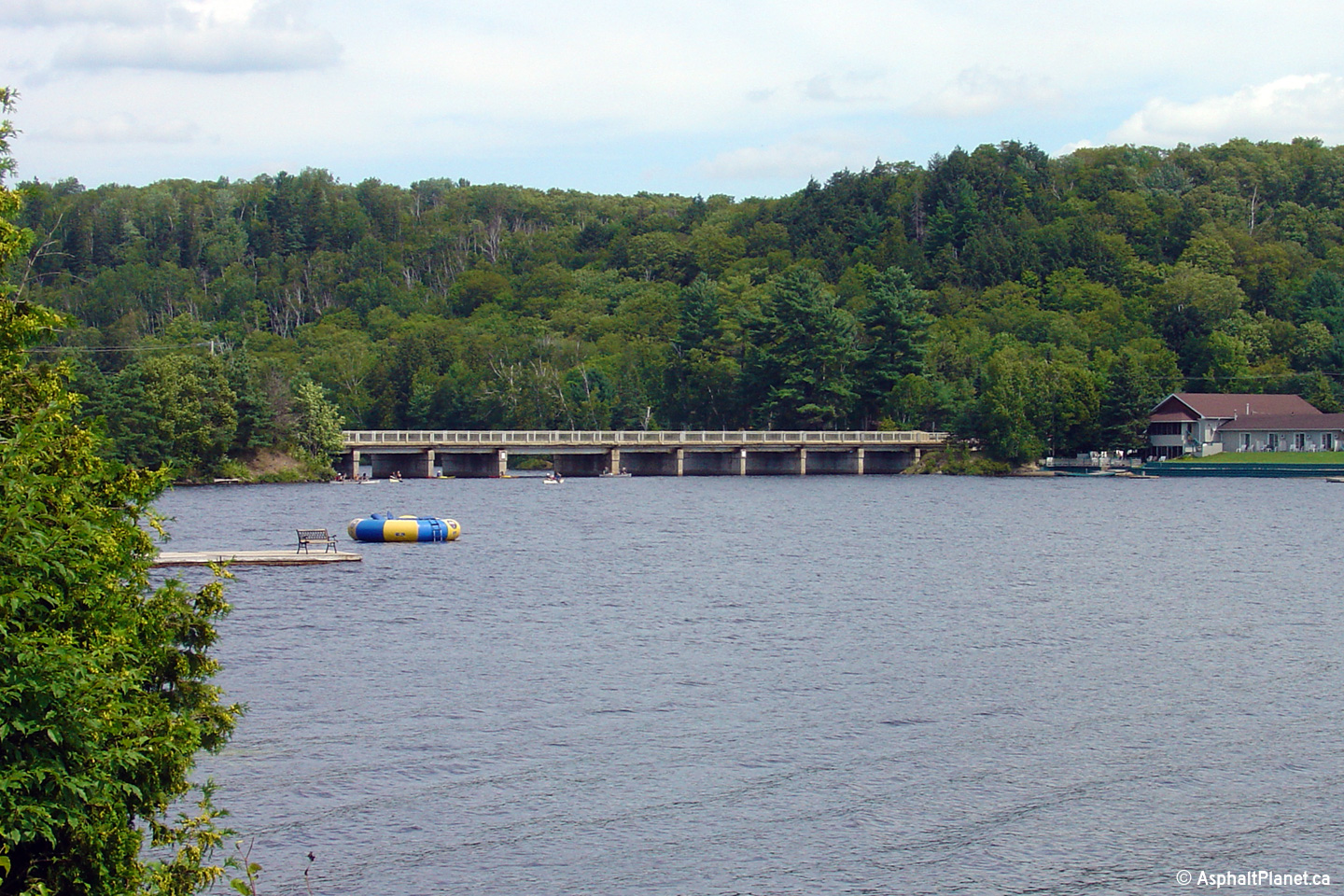
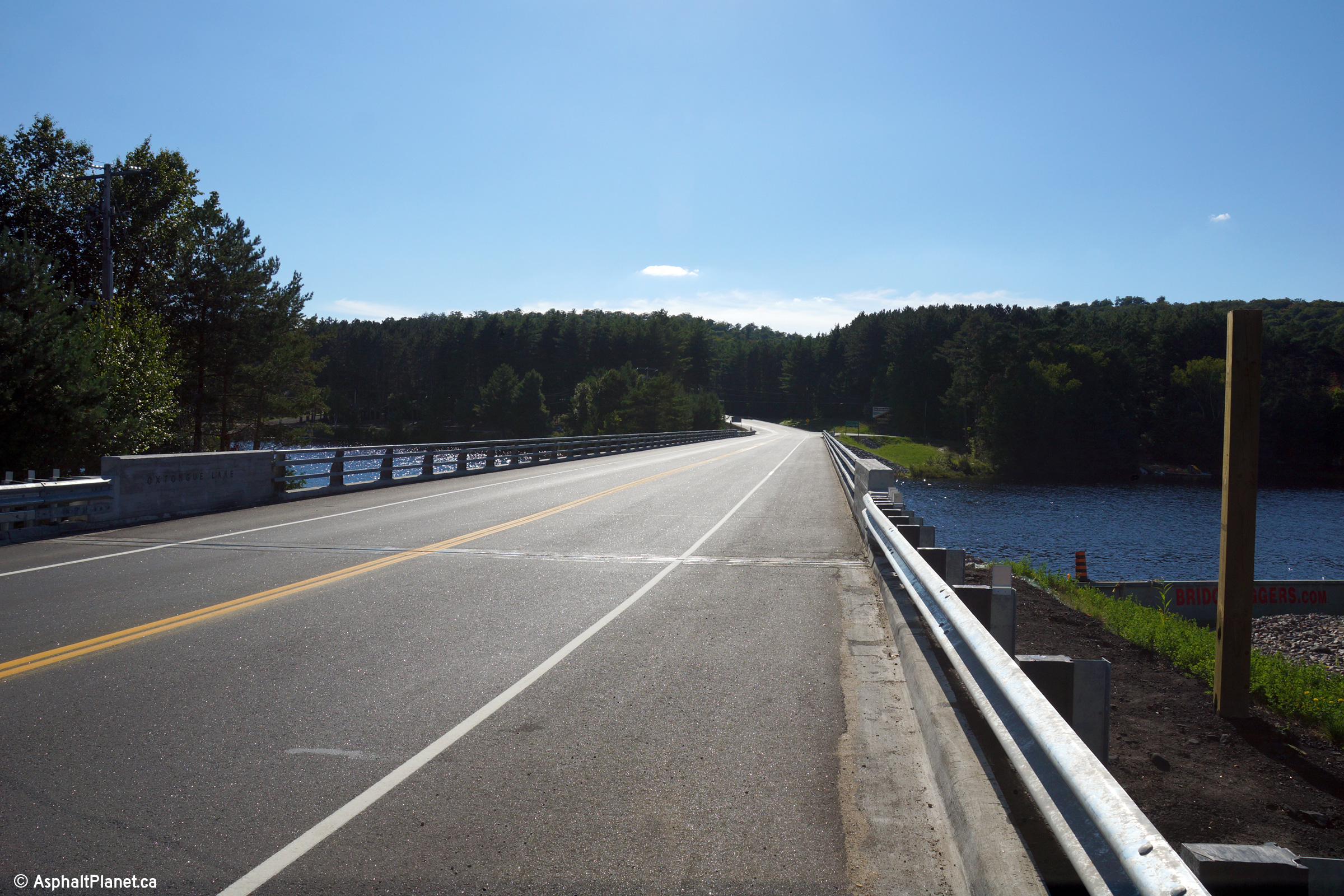
Township of Algonquin Highlands
County of Haliburton |
Two views looking east across the Oxtongue Lake Narrows Bridge. Upper photo taken:
August 6th, 2006. Lower photo taken: August 25th, 2014. |

(720x480)
(1440x960)
(2400x1600) |
|
Township of Algonquin Highlands
County of Haliburton |
View looking southeasterly towards the northern side of the Oxtongue Lake
Narrows Bridge along Highway 60.
Photo taken: August 25th, 2014. |

(720x480)
(1440x960)
(2400x1600) |
|
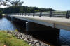
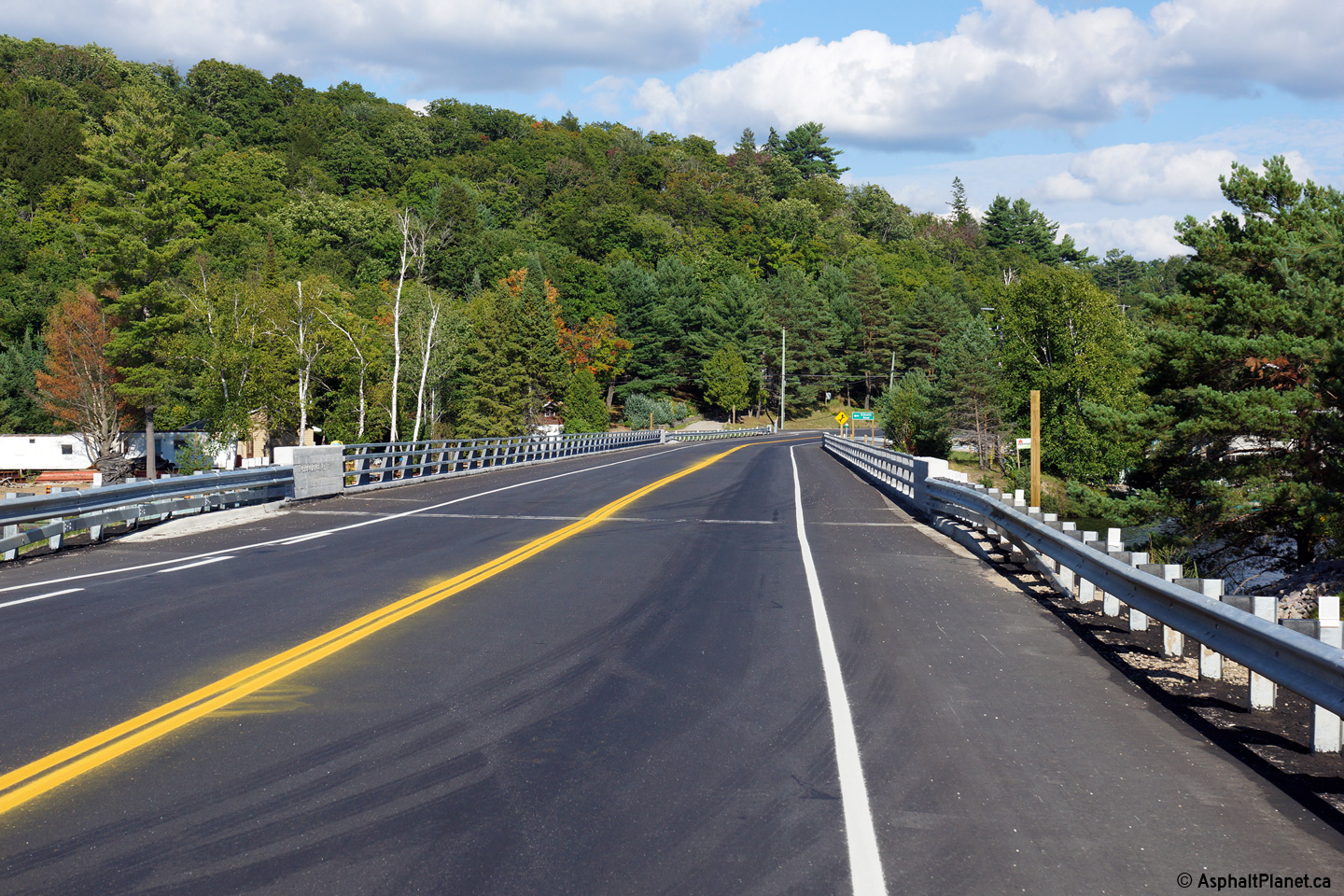
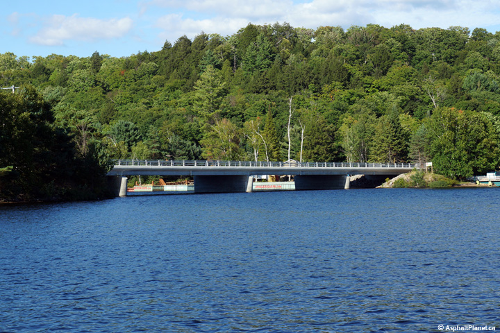
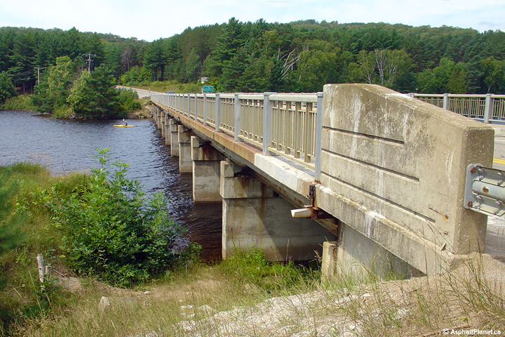
Township of Algonquin Highlands
County of Haliburton |
Tow views looking northeasterly towards the southern side of both the old
and new Oxtongue Lake Narrows Bridge. The old Oxtongue Lake Bridge was
completed in 1962, and was subsequently fully replaced with the current structure in 2011.
Upper photo taken: August 6th, 2006.
Lower photo taken: August 25th, 2014. |
(720x480)
(1440x960)
(2400x1600) |
|
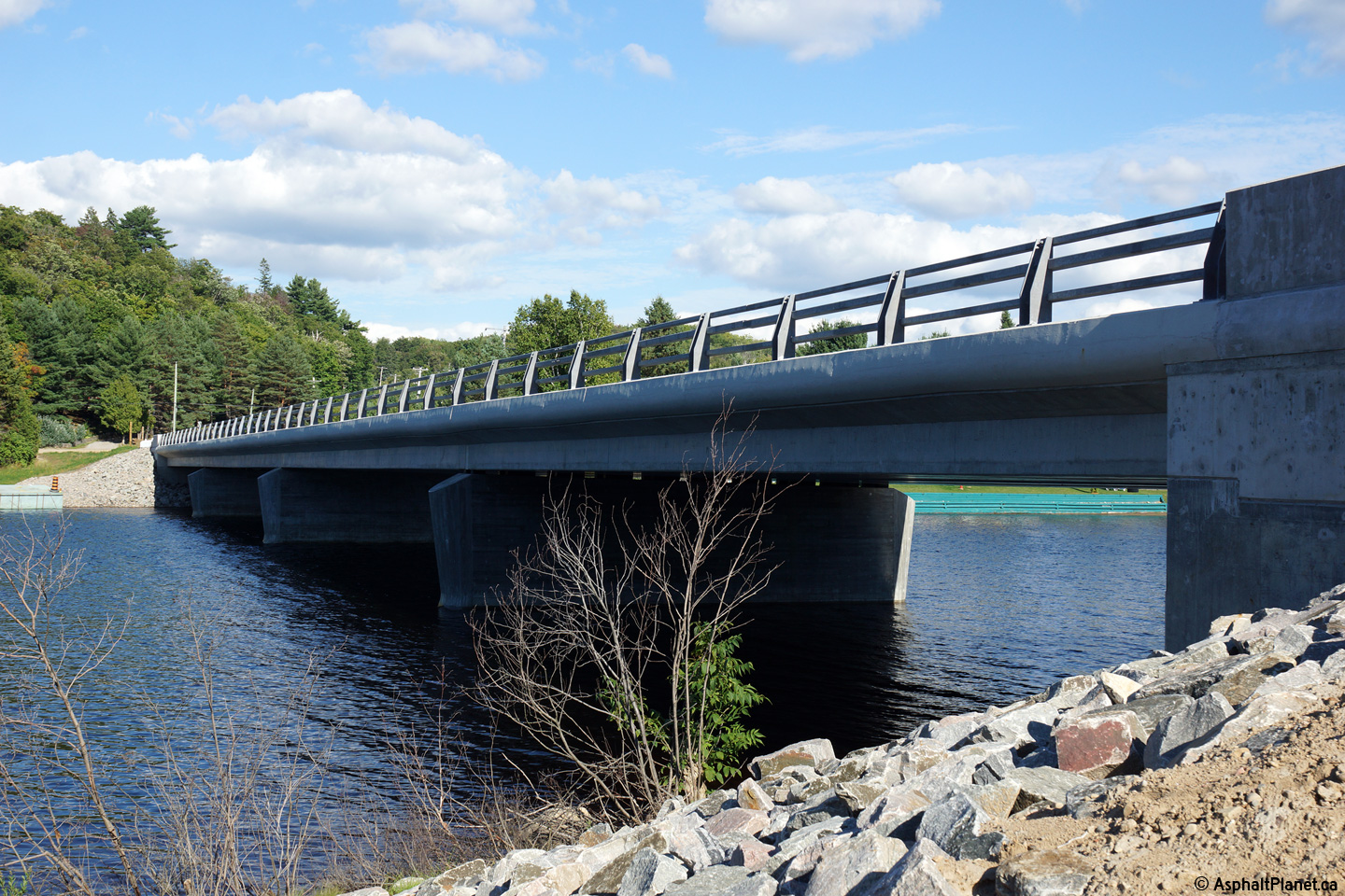
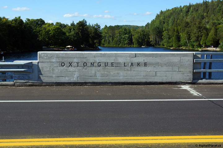
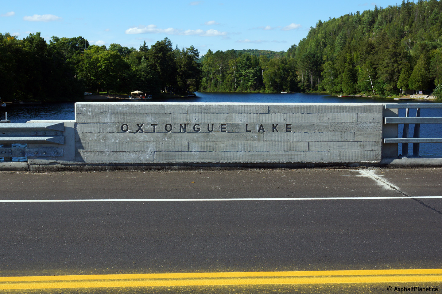
Township of Algonquin Highlands
County of Haliburton |
The 2011 Oxtongue Lake Structure has had the name of the lake as well as a
faux-wood pattern embossed into all four of the parapets of the structure.
This greatly enhances the aesthetics of this bridge. The faux-wood
pattern is also culturally significant as logging has long been a sign cant
part of the economy for this part of central Ontario, including Algonquin
Park.
Photo taken: August 25th, 2014. |
(720x480)
(1440x960) |
|
Township of Algonquin Highlands
County of Haliburton |
Two views looking northwesterly towards both the old and new Oxtongue Lake
Narrows Bridges.
Upper photo taken: August 6th, 2006.
Lower photo taken: August 25th, 2014. |
(720x480)
(1440x960)
(2400x1600) |
|
Township of Algonquin Highlands
County of Haliburton |
View looking south-westerly at the new Oxtongue Lake Narrows Bridge.
Photo taken: August 25th, 2014. |

(720x480)
(1440x960)
(2400x1600) |
|
Township of Algonquin Highlands
County of Haliburton |
Two views looking westerly across both the old and new Oxtongue Lake Narrows
Bridge decks. While the new bridge lacks a concrete sidewalk, the
shoulders are considerably wider than the old bridge, which allows for the
safe passage of cyclists in addition to pedestrians.
Upper photo taken: August 6th, 2006.
Lower photo taken: August 25th, 2014. |

(720x480)
(1440x960)
(2400x1600) |
|
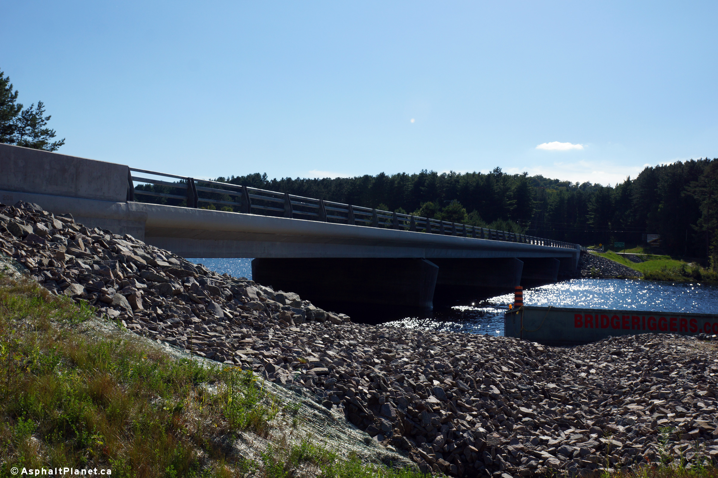
Township of Algonquin Highlands
County of Haliburton |
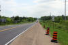
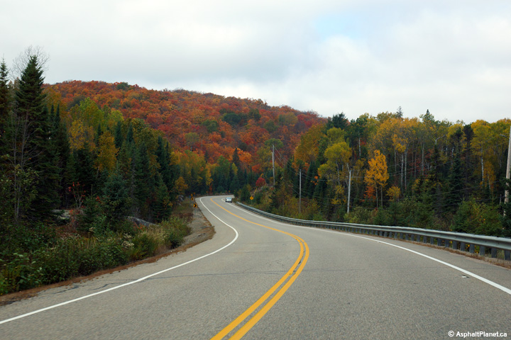
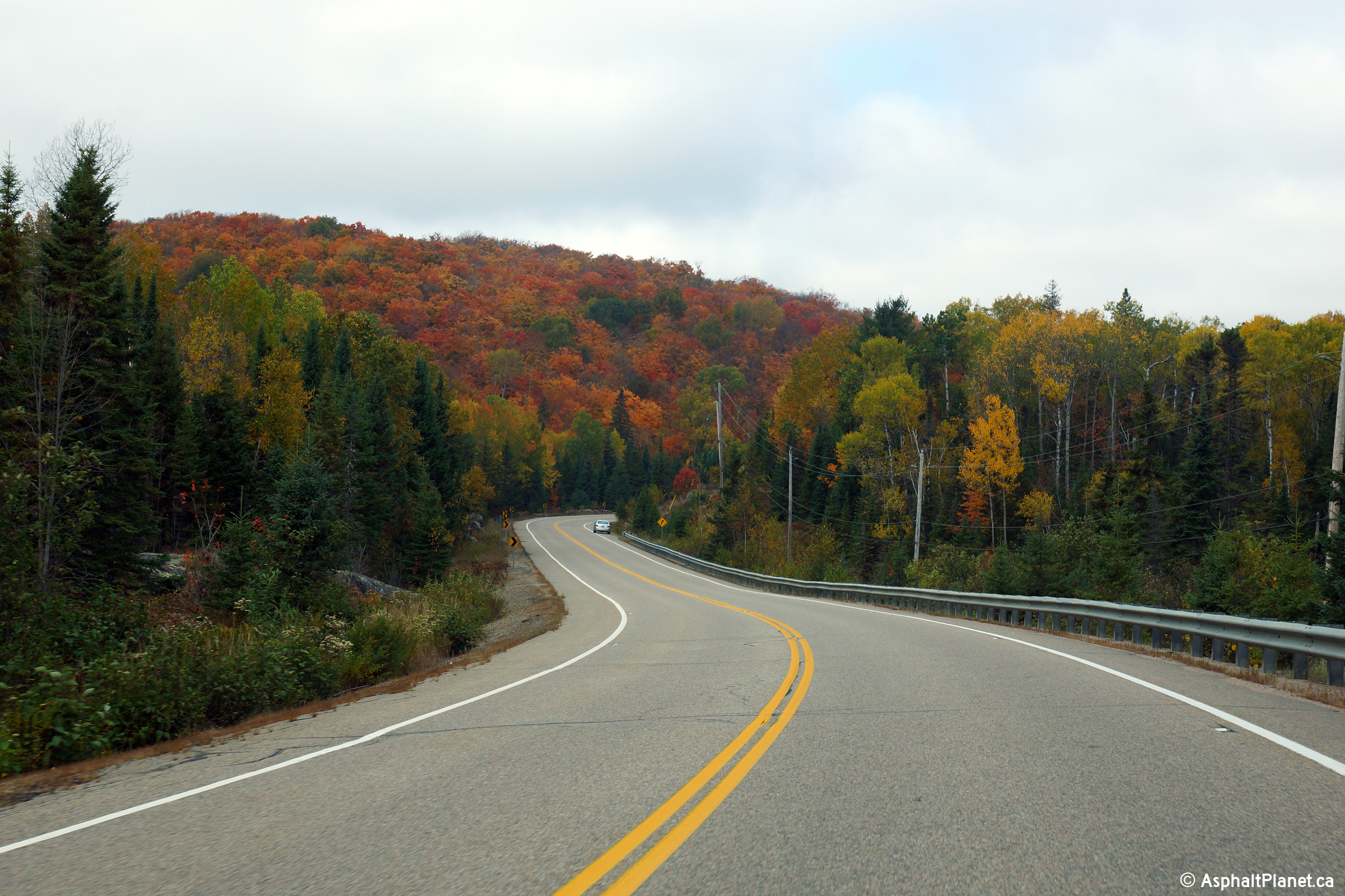
An eastbound passing lane is found just east of Oxtongue Lake along Highway
60. Photo taken: August 6th, 2006. |
(720x480)
(1440x960) |
|
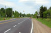
District of Nipissing |
There is a short 4-lane section at the top of the pictured hill as Highway
60 crosses into Algonquin Park from the west. Photo taken: August 6th,
2006. |
(720x480)
(1440x960) |
|
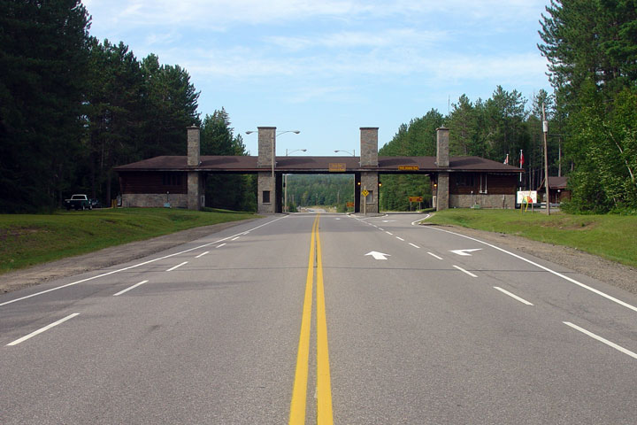
District of Nipissing |
The MTO has erected specific distance signage demarking the distance
easterly from Algonquin Park's west gate.
Photo taken: May 11th, 2011. |
 (720x480) (720x480)
(1440x960) |
|
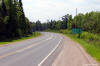
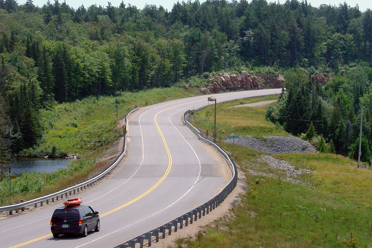
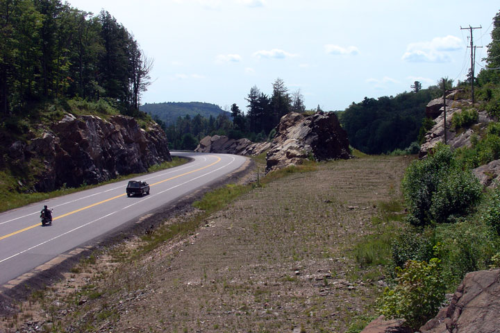
District of Nipissing |
Reversing curve at Smoke Creek. Note the grading to the right of the
current bridge. Ironically, considering the creek name, the original
Smoke Creek bridge burned several years ago. Photo taken: August 6th,
2006. |

(720x480)
(1440x960) |
|
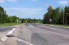
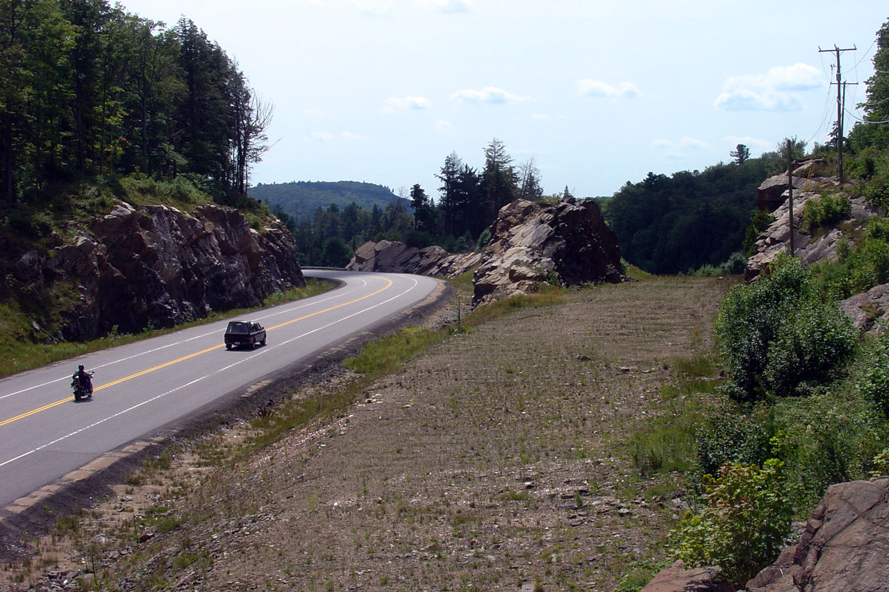
District of Nipissing |
Just west of Smoke Creek an interesting alignment comparison is found.
Photo taken: August 6th, 2006. |
(720x480)
(1440x960) |
|
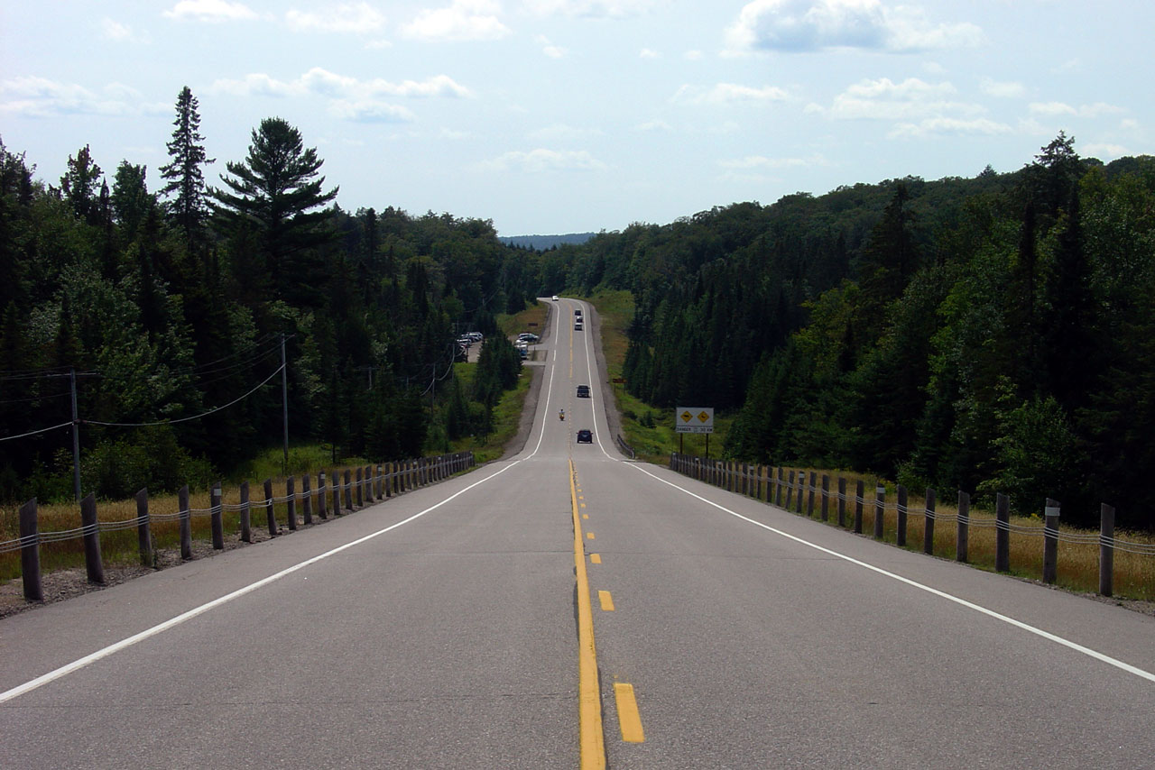
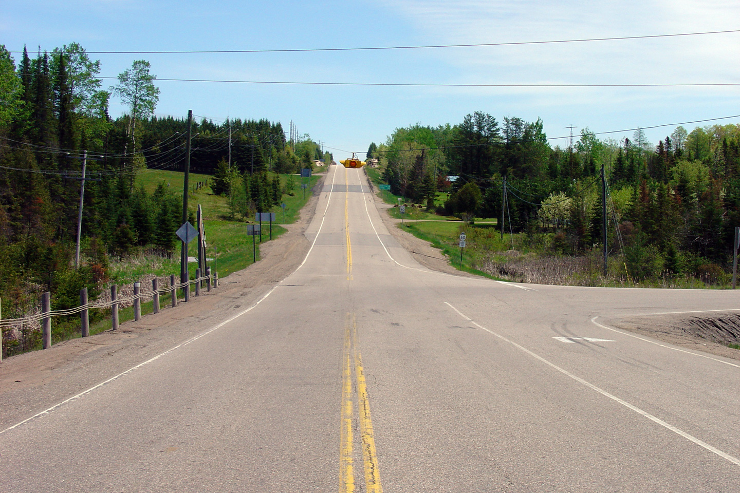
District of Nipissing |
Long sag curve in the west end of Algonquin Park. Photo taken: August 6th,
2006. |

(720x480)
(1440x960) |
|
District of Nipissing |
The entrance to the Algonquin Gallery. Note the pass-around lane that
seem to be found primarily on roads in Eastern Ontario. Photo taken:
August 6th, 2006. |
(720x480)
(1440x960) |
|
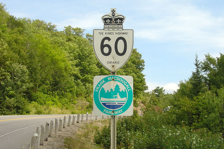
District of Nipissing |
Highway 60 is designated as the Frank MacDougall Parkway through Algonquin
Park. Photo taken: August 6th, 2006. |
 |
|
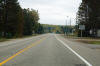
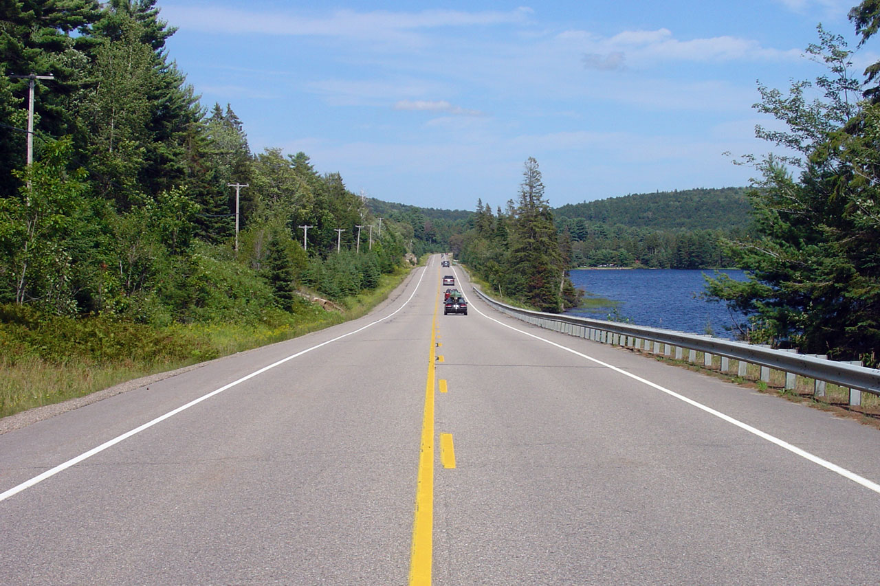
District of Nipissing |
Highway 60 alongside Lake of Two Rivers. Photo taken: August 6th, 2006. |
(720x480)
(1440x960) |
|
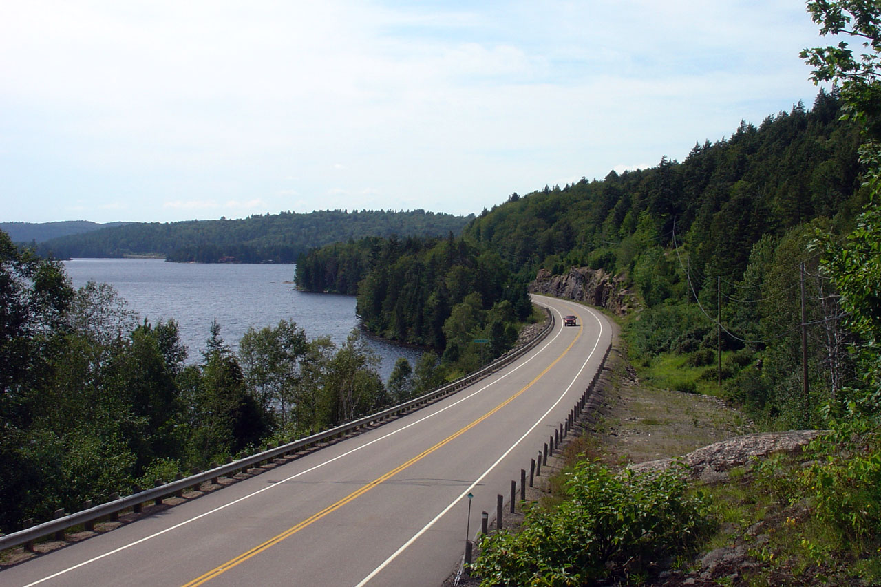
District of Nipissing |
A similar scene at Lake of Two Rivers adorned the 1992-93 Official Ontario
Road map. Photo taken: August 6th, 2006. |
(720x480)
(1440x960) |
|
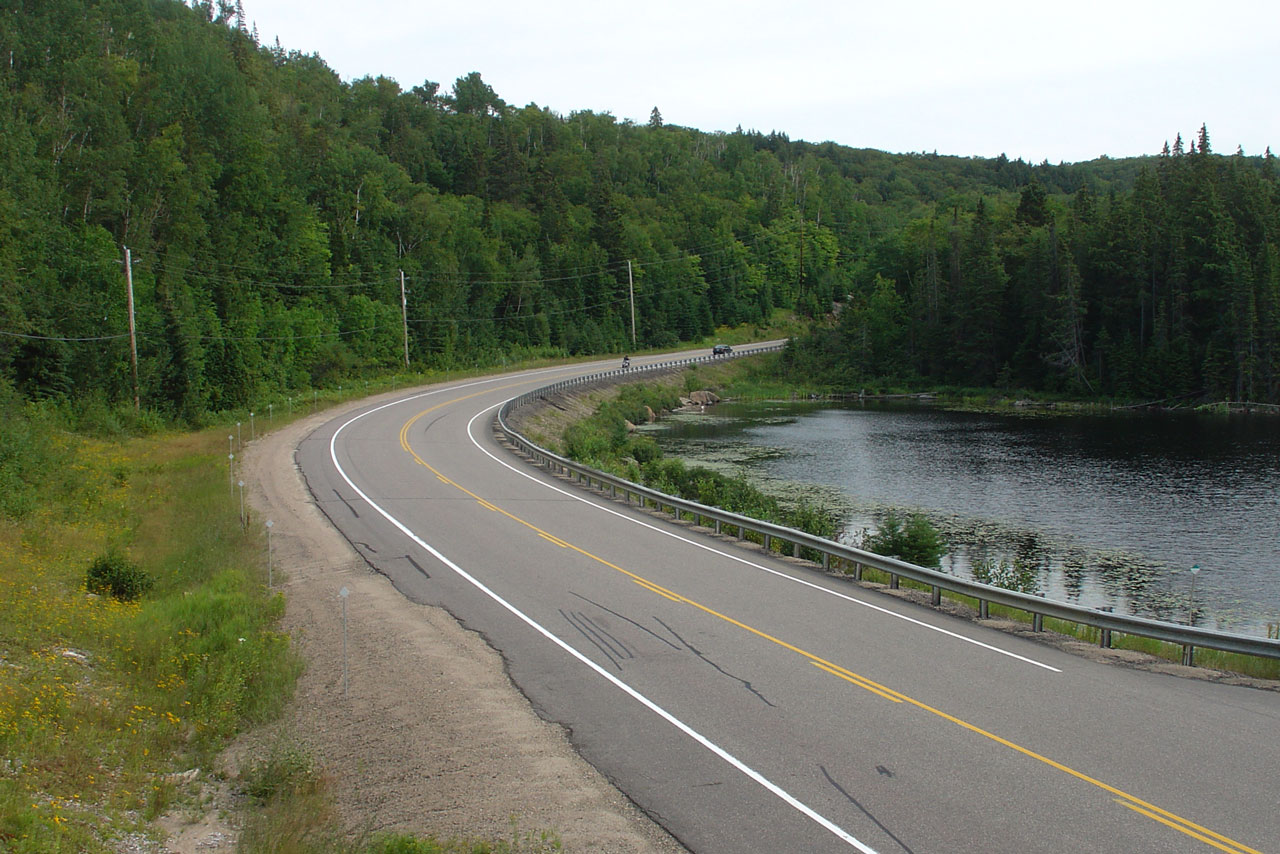
District of Nipissing |
This is the scene found at Brewer Lake in the east end of Algonquin
Provincial Park. Photo taken: August 6th, 2006. |
(720x480)
(1440x960) |
|
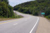
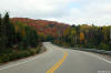
District of Nipissing |
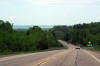
Westerly view along Highway 60 in the eastern portion of Algonquin Park.
Highway 60 traverses a series of high ridges through eastern Algonquin Park
immediately east of Brewer Lake.
Photo taken: October 1st, 2014. |
(720x480)
(1440x960)
(2400x1600) |
|
District of Nipissing |
Facing west towards Algonquin Provincial Park's east gate. Photo taken:
August 6th, 2006. |
(720x480)
(1440x960) |
|
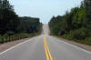
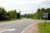
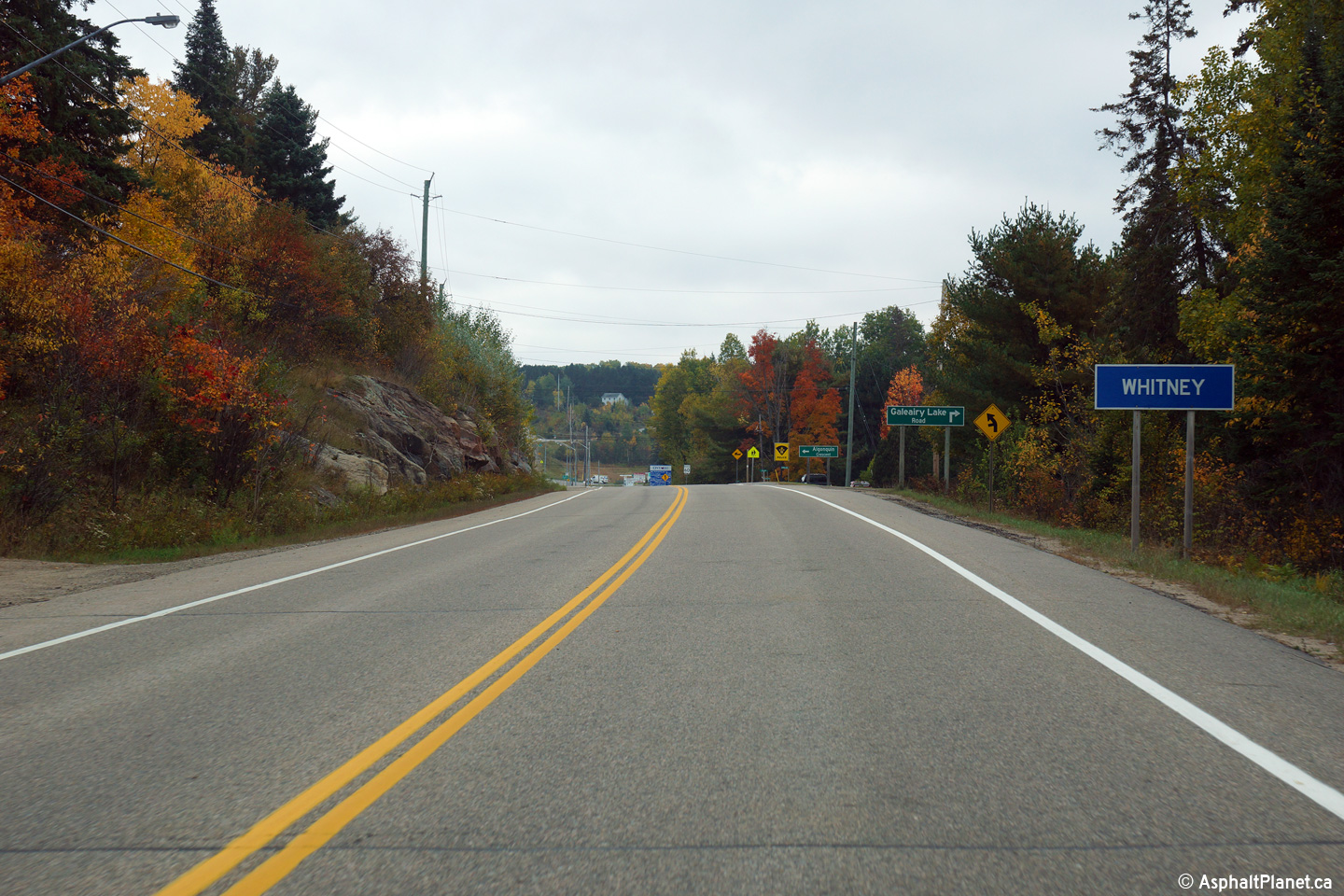
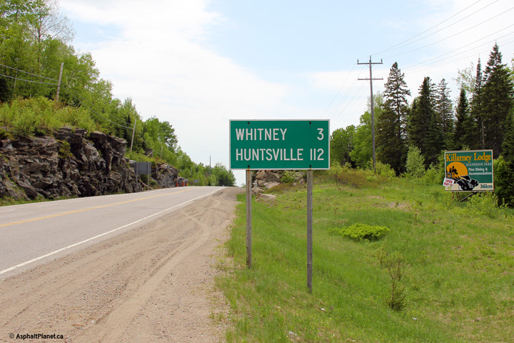
Township of South Algonquin District of Nipissing |
Easterly view as the highway approaches the small village of Whitney.
Photo taken: October 1st, 2014. |
(720x480)
(1440x960)
(2400x1600) |
|
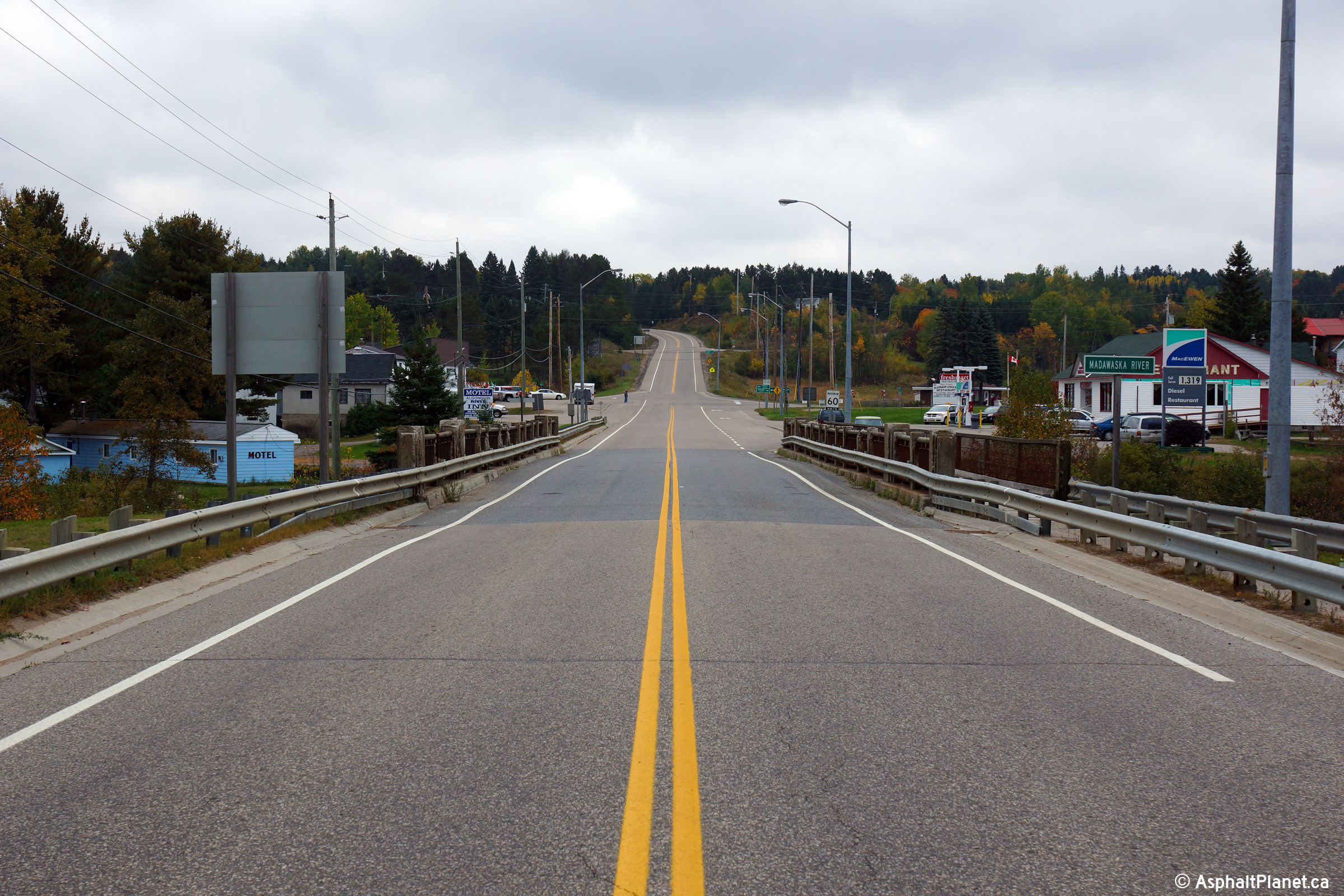
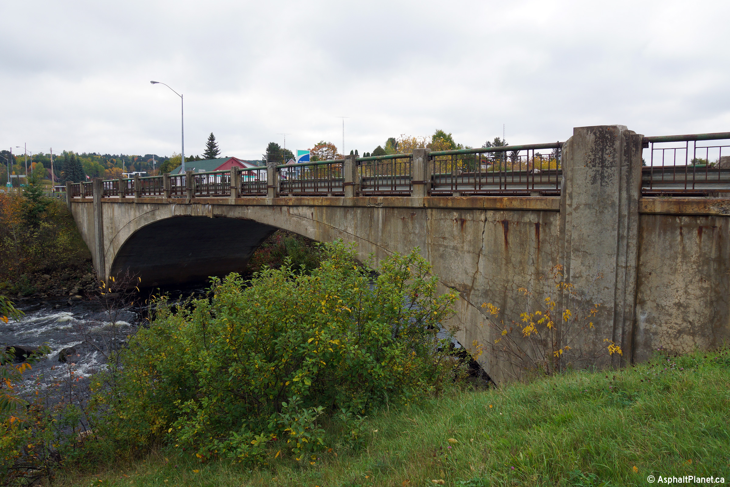
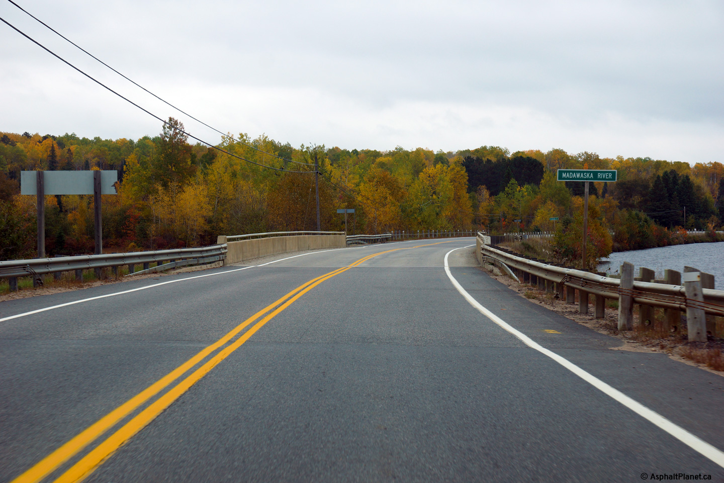
Township of South Algonquin District of Nipissing |
Easterly view along Highway 60 as the highway passes overtop the Madawaska
River bridge in Whitney. The Madawaska River Bridge in Whitney is one
of the oldest structures remaining on Highway 60.
Photo taken: October 1st, 2014. |
(720x480)
(1440x960)
(2400x1600) |
|
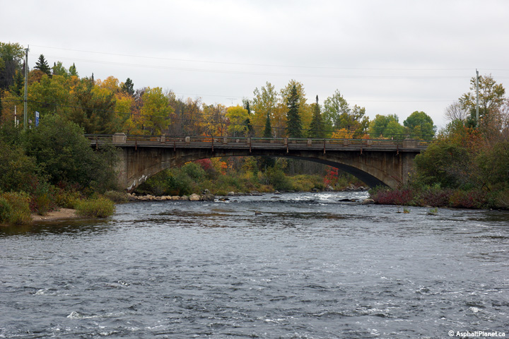
Township of South Algonquin District of Nipissing |
Northerly view towards the Madawaska River Bridge in Whitney. Few
closed spandrel arch bridges, such as this, were built by the Department of
Highways. This bridge retains its original steel railings.
Photo taken: October 1st, 2014. |

(720x480)
(1440x960)
(2400x1600) |
|
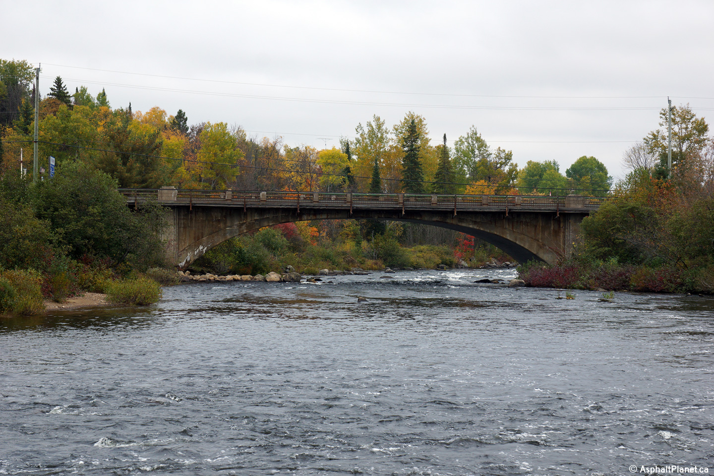
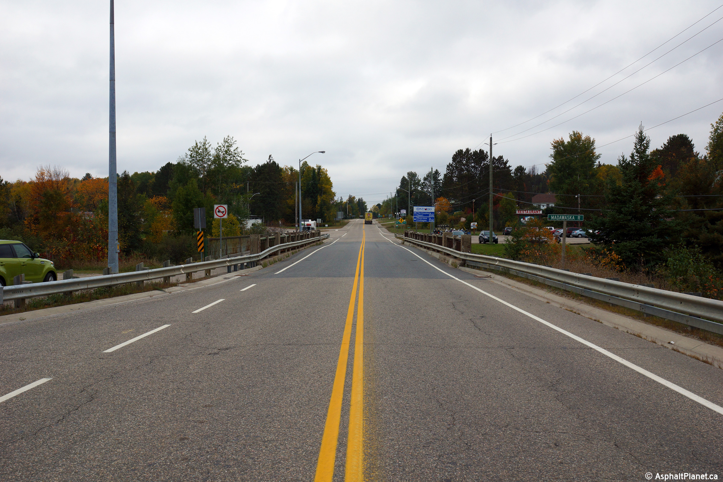
Township of South Algonquin District of Nipissing |
This view looks southeasterly towards the Madawaska River Bridge in Whitney.
Photo taken: October 1st, 2014. |

(720x480)
(1440x960)
(2400x1600) |
|
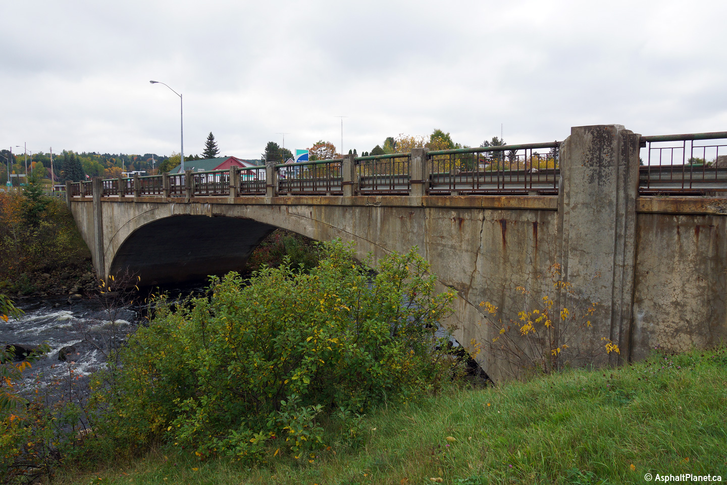
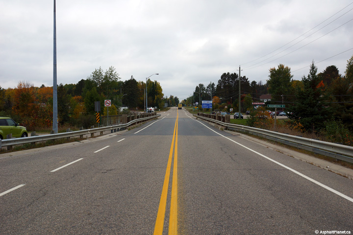
Township of South Algonquin District of Nipissing |
This view looks westerly across the Madawaska River Bridge in Whitney.
Photo taken: October 1st, 2014. |
(720x480)
(1440x960)
(2400x1600) |
|
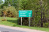
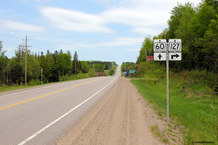
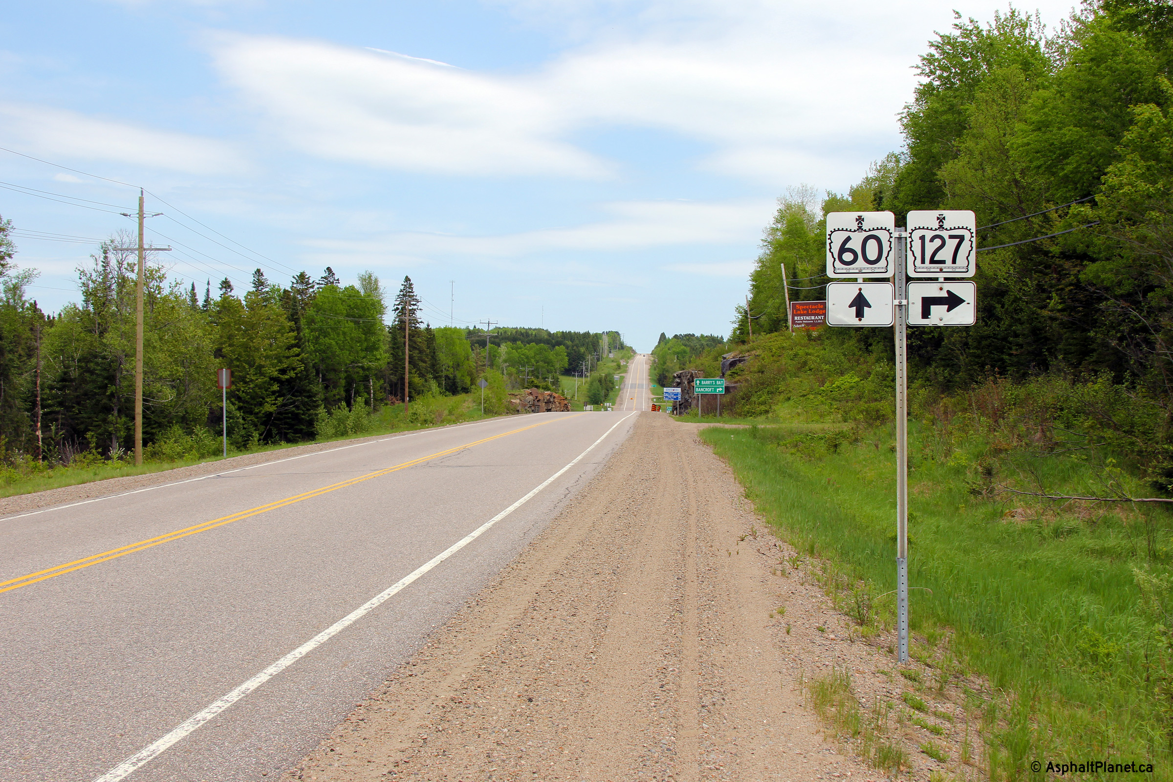
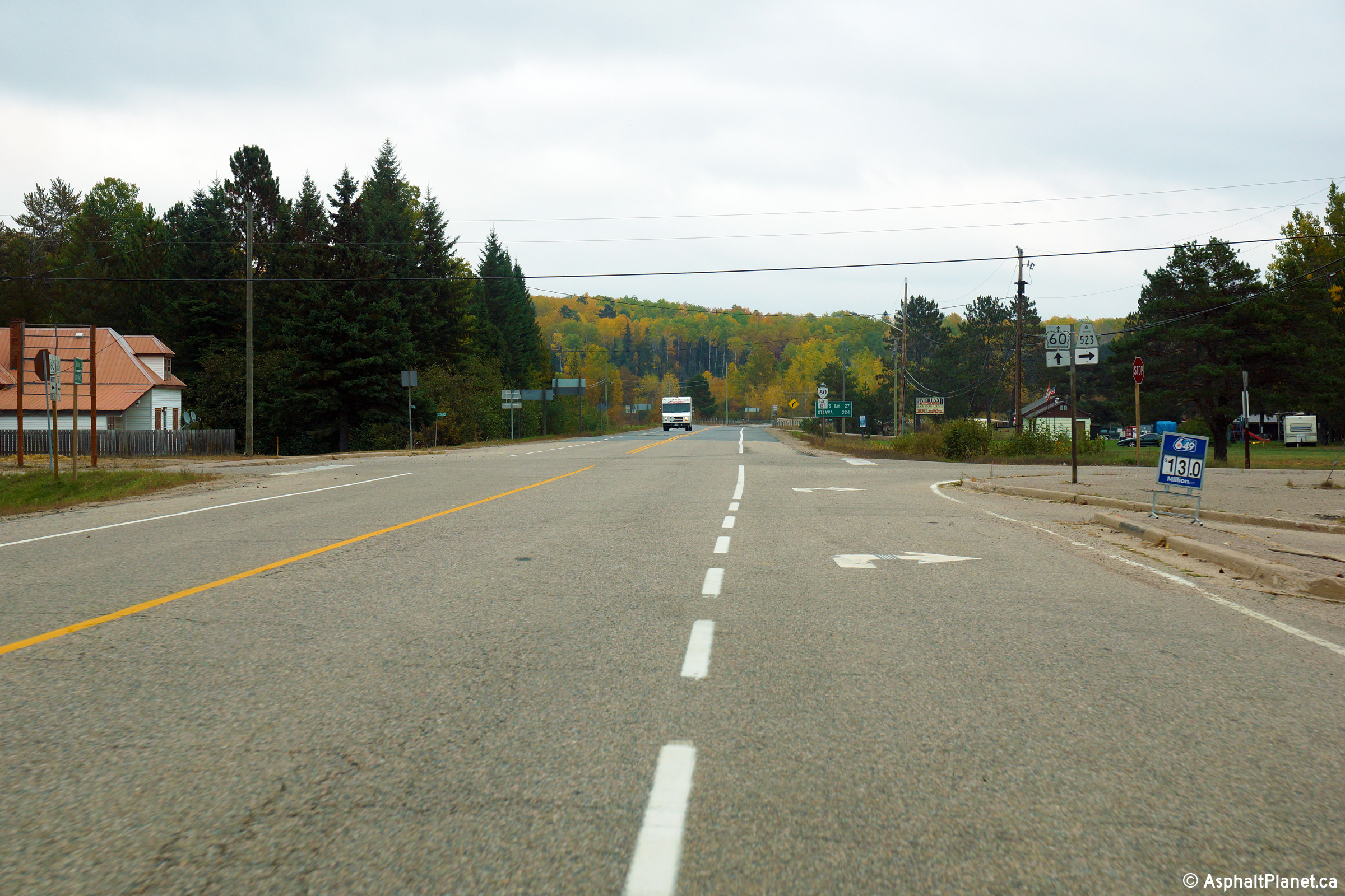
Township of South Algonquin District of Nipissing |
Distance signage located westerly from the Highway 127 intersection.
Note the older style font used on the distance sign.
Photo taken: May 30th, 2011. |
 (720x480) (720x480)
(1440x960) |
|
Township of South Algonquin District of Nipissing |
Highway 60 looking east at the Highway 127
intersection just east of Whitney.
Highway 127 leads traffic south to Highway
62 at Maynooth. Click here
for a similar view of this intersection taken in May, 2004.
Photos taken: May 30th, 2011. |
(720x480)
(1440x960)
(2400x1600)
(720x480)
(1440x960)
(2400x1600) |
|
Just east of Algonquin Park,
Highway 60 intersects the northern end of Highway 127.
Click here for Highway 127 images. |
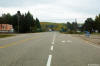
Township of South Algonquin
District of Nipissing |
View looking westerly into the short valley where Highway 60 intersects
Highway 127.
Photo taken: May 30th, 2011. |

(720x480)
(1440x960)
(2400x1600) |
|
Township of South Algonquin District of Nipissing |
Eastbound views at both eastbound junction assemblies approaching the
Highway 523 junctions in Madawaska. Highway 523 runs southerly
terminating at the Hastings / Nipissing Boundary.
Photos taken: October 1st, 2014. |
(720x480)
(1440x960)
(2400x1600)
(720x480)
(1440x960)
(2400x1600)
|
|
Township of South Algonquin District of Nipissing |
Distance signage facing eastbound motorists east of the Highway 523 junction
at Madawaska.
Photo taken: October 1st, 2014. |
(720x480)
(1440x960)
(2400x1600) |
|
Township of South Algonquin District of Nipissing |
Easterly view at the eastern Madawaska River bridge crossing east of the
Highway 523 junction in Madawaska.
Photo taken: October 1st, 2014. |
(720x480)
(1440x960)
(2400x1600) |
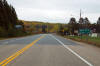
Township of Madawaska Valley
County of Renfrew |
Easterly view along Highway 60 as it passes a
small pond about halfway between Madawaska and Barry's Bay.
Photo taken: May 30th, 2011. |
(720x480)
(1440x960)
(2400x1600) |
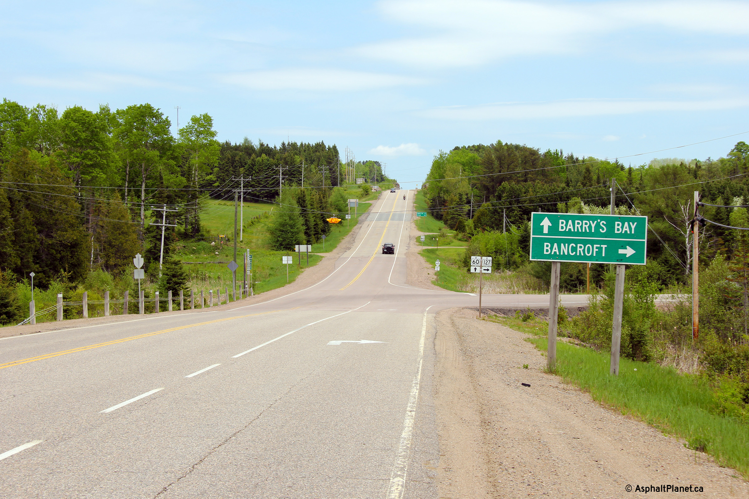
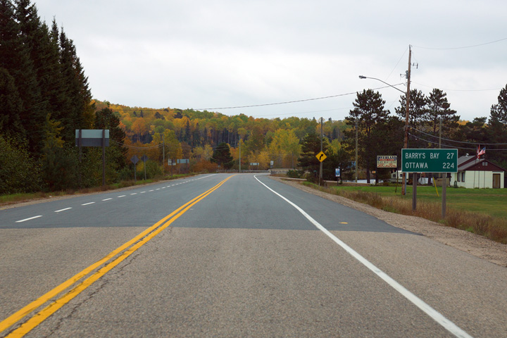
Township of Madawaska Valley
County of Renfrew |
Another easterly view, this time at the
commencement of an eastbound passing lane, still about halfway between
Madawaska and Barry's Bay.
Photo taken: May 30th, 2011. |
(720x480)
(1440x960)
(2400x1600) |
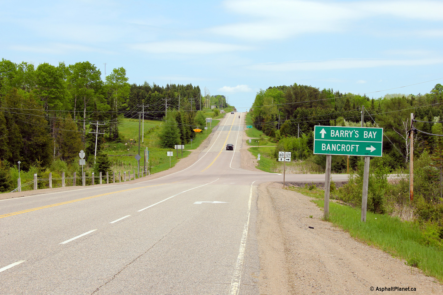
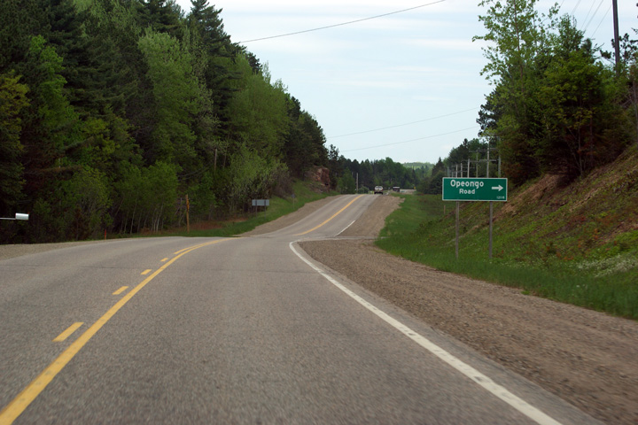
Township of Killaloe, Hagarty and
Richards
County of Renfrew |
View looking easterly along Highway 60
approaching the Opeongo Road intersection east of Barry's Bay. The
Opeongo Road is a
historic colonization road that was build between 1854 and 1867 in order
to attract settlers to today's Renfrew County.
Photo taken: May 30th, 2011. |

(720x480)
(1440x960)
(2400x1600) |
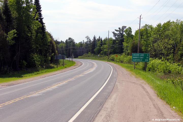
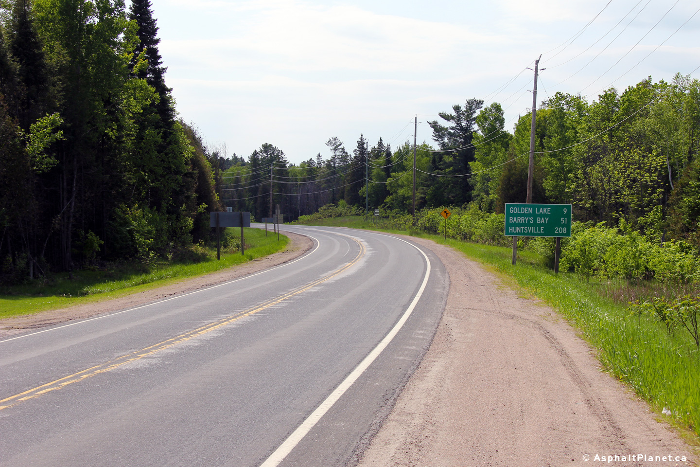
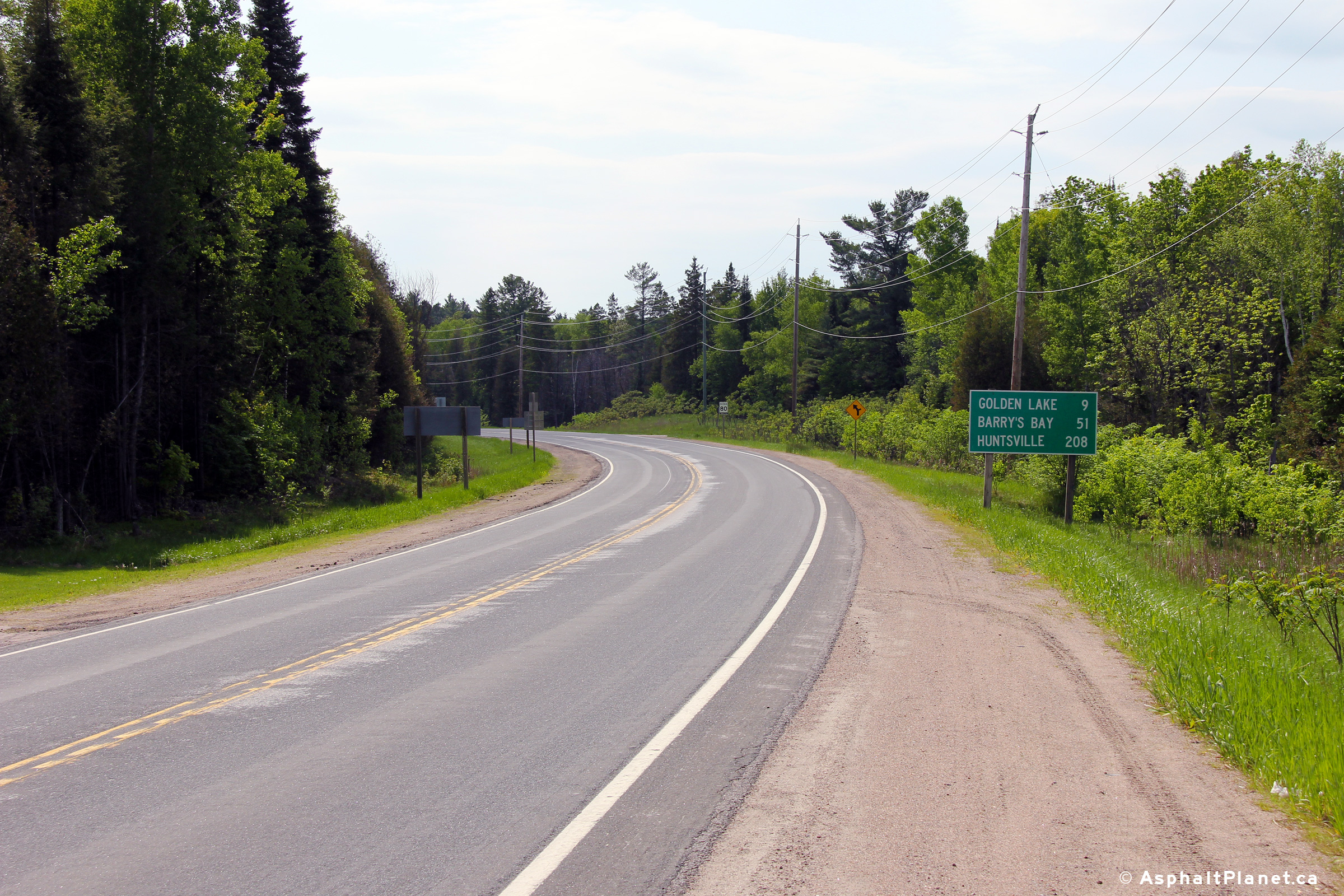
Township of Killaloe, Hagarty and
Richards
County of Renfrew |
View looking easterly from the Shrine Hill
intersection east of Wilno. Golden Lake is visible in the distance.
Photo taken: May 30th, 2011. |
(720x480)
(1440x960)
(2400x1600) |
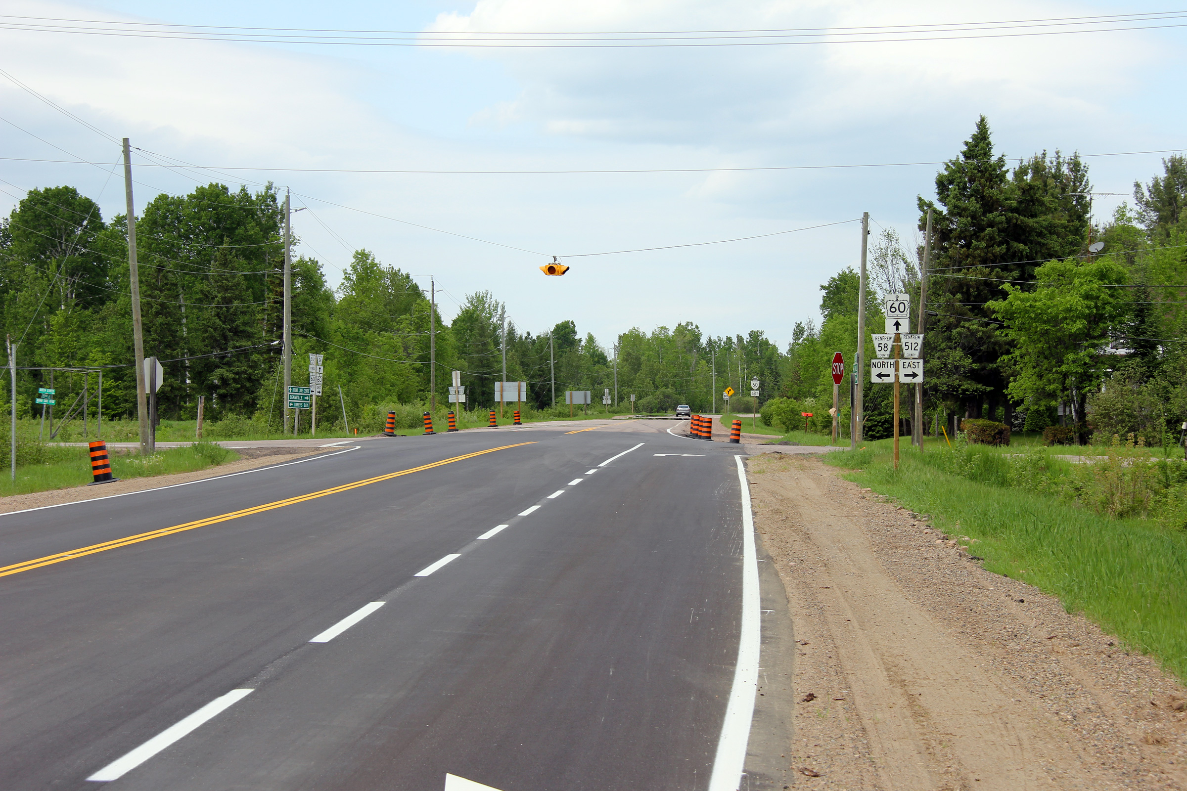
Township of Killaloe, Hagarty and
Richards
County of Renfrew |
View looking westerly along Highway 60/62 from the eastern Highway 60
junction at Highway 512. Before Highway 62 was transferred to local
municipalities north of Maynooth, the pictured reassurance marker indicating the
road solely as Highway 60 would have included a Highway 62 marker as well.
Photo taken: May 30th, 2011. |
(720x480)
(1440x960)
(2400x1600) |
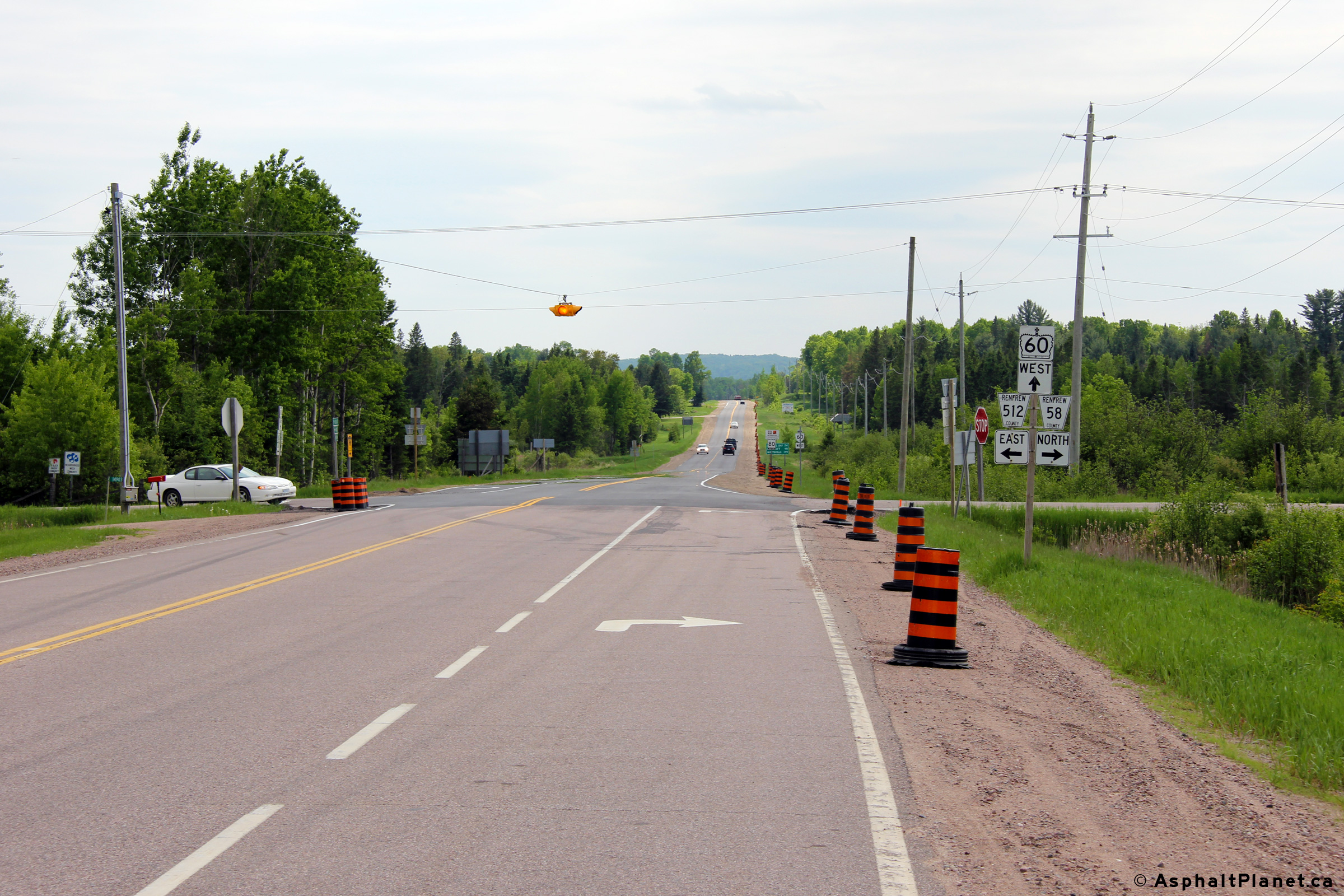
Township of Killaloe, Hagarty and
Richards
County of Renfrew |
View looking westerly towards the eastern Highway 60/62 junction.
Northbound Highway 62 traffic must turn to the left at this intersection,
while traffic continuing easterly follows the through road.
Photo taken: May 30th, 2011. |
(720x480)
(1440x960)
(2400x1600) |
|
At Killaloe, Highway 62 splits from Highway
40 heading for Round Lake and eventually Pembroke.
Click here for Highway 62-East images. |
Township of Killaloe, Hagarty and
Richards
County of Renfrew |
View looking westerly towards the eastern
Highway 60/62 junction. The eastern leg of Highway 62 was
re-designated as Renfrew Road 58 when it was transferred to the county in
1998.
Photo taken: May 30th, 2011. |

(720x480)
(1440x960)
(2400x1600) |
| Township of North Algona
Wilberforce County of Renfrew |
Westerly view along Highway 60 from just west of
the northern Highway 41 junction.
Photo taken: May 30th, 2011. |
(720x480)
(1440x960)
(2400x1600) |
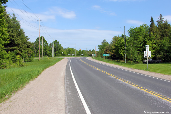
| Township of North Algona
Wilberforce County of Renfrew |
Easterly view along Highway 60 approaching the
northern Highway 41 junction. East from this junction, Highway 41 runs
concurrent with Highway 60 into Downtown Eganville.
Photo taken: May 30th, 2011. |

(720x480)
(1440x960)
(2400x1600) |
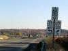
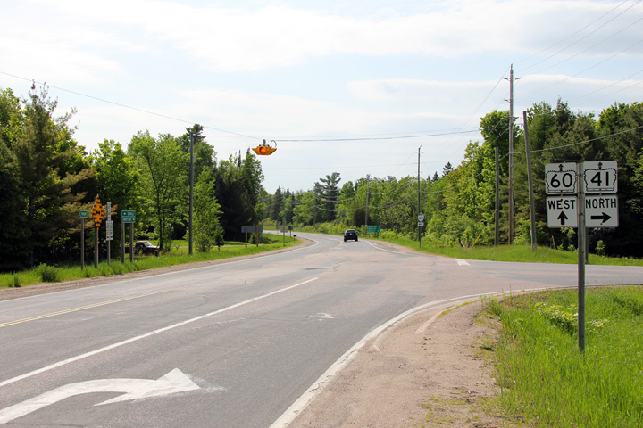
| Township of North Algona
Wilberforce County of Renfrew |
Easterly view at the northern Highway 41 and 60
junction. This intersection is stop controlled with a flashing beacon
overhead.
Photo taken: May 30th, 2011. |
(720x480)
(1440x960)
(2400x1600) |
|
Highway 41 continues northerly
beyond Highway 60 continuing around Lake Doré, bound for Pembroke.
Click here for Highway 41-North images. |
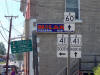
| Township of North Algona
Wilberforce County of Renfrew |
This view looks westerly towards the northern
Highway 41 and 60 junction. Highway 60 traffic continues straight through
the intersection, while traffic bound towards Pembroke on Highway 41 must
turn right.
Photo taken: May 30th, 2011. |
(720x480)
(1440x960)
(2400x1600) |
| Township of North Algona
Wilberforce County of Renfrew |
Eastbound distance signage along Highway 41/60
just east of the northern Highway 41 and 60 junction.
Photo taken: May 30th, 2011. |
 (720x480) (720x480)
(1440x960) |
| Township of North Algona
Wilberforce County of Renfrew |
Westbound signage along Highway 41/60 north of
Eganville.
Photo taken: May 30th, 2011. |
 (720x480) (720x480)
(1440x960) |
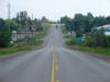
| Township of North Algona
Wilberforce County of Renfrew |
Looking southerly on Highway
41/60
from just north of the Crooked Rapids Road junction. This intersection
is located roughly 2km north of Downtown Eganville. Picture taken: July
4th, 2005. |
 |
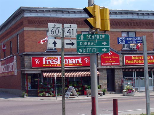
| Municipality of Bonnechere Valley
County or Renfrew |
Southbound junction assembly in Downtown Eganville for the eastern split of
Highway's 41 and 60.
. Picture size: 50kb. |
 |
|
Highway 60 splits from Highway
41-South in Eganville.
Click here for Highway 41-South images. |
|
Municipality of Bonnechere Valley
County or Renfrew |
Signage looking westbound along Highway 60 in Downtown Eganville.
Highway 41 follows Highway 60 for a short
distance north of Eganville before departing northerly towards Pembroke.
Notice, to the left of the junction assembly, the old style directional
signage. Signs like this were at one time extremely common.
Picture size: 75kb. |
 |
|
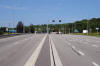
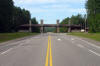
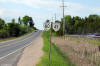
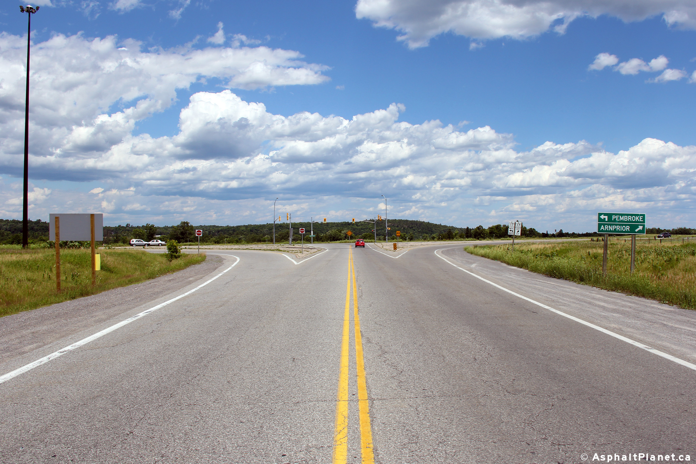
Township of Horton County of Renfrew |
Distance sign located immediately west of the Highway 17 intersection.
Photo taken: June 30th, 2012. |
 (720x480) (720x480)
(1440x960) |
|
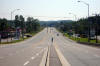
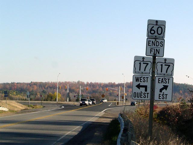
Township of Horton County of Renfrew |
Highway 60 ends junction Highway 17.
This picture shows the junction assembly denoting the eastern terminus of
Highway 60. In the background is the junction with
Highway 17. A more detailed picture of
this junction is shown below.
Photo taken: October 23rd, 2004. |
 |
|
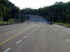
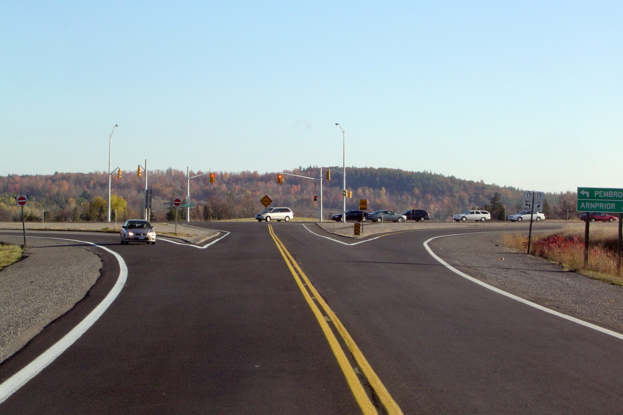
Township of Horton County of Renfrew |
This picture showcases the eastern terminus of Highway 60 at the
Highway 17 junction. Until recently,
this was an un-signalized intersection. Traffic signals were installed
during the fall of 2004. Click
here for an earlier version of this photo, taken October, 2004 Picture
taken: June 30th, 2012. |
(720x480)
(1440x960)
(2400x1600) |
|
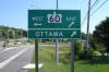
Highway 17 is the Ottawa Valley
Route of the Trans-Canada Highway. Click
here for Highway 17-West images and
here for Highway 17-East images. |


 (720x480)
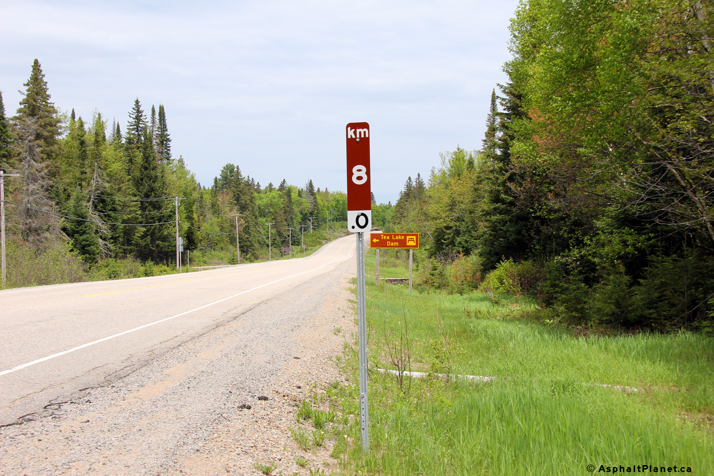


 (720x480)
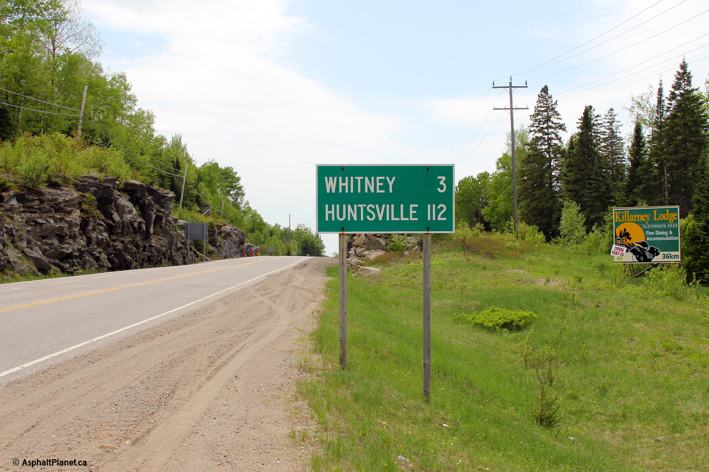


 (720x480)
 (720x480)

 (720x480)
