|
Proper Municipality Name |
Photo Description |
Photo |
|
Pictures taken
from driver's perspective appear offset from centre-line pictures: |
North-
Bound |
South-
Bound |
|
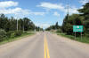
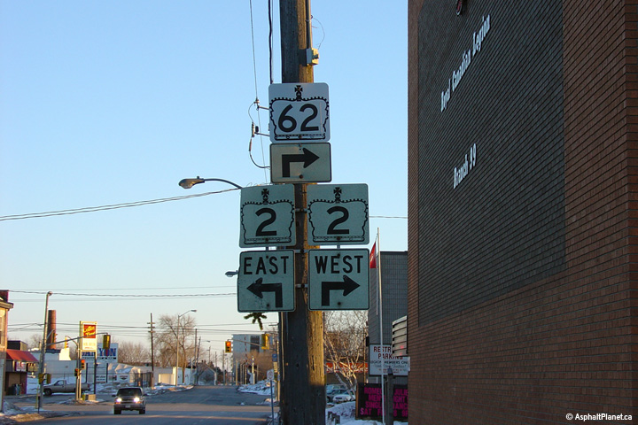
Highway 33 continues easterly from Highway 62 bound for
Picton, Bath and eventually Kingston.
Click here for Highway 33 images. |
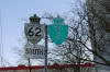
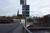
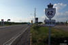
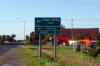
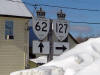
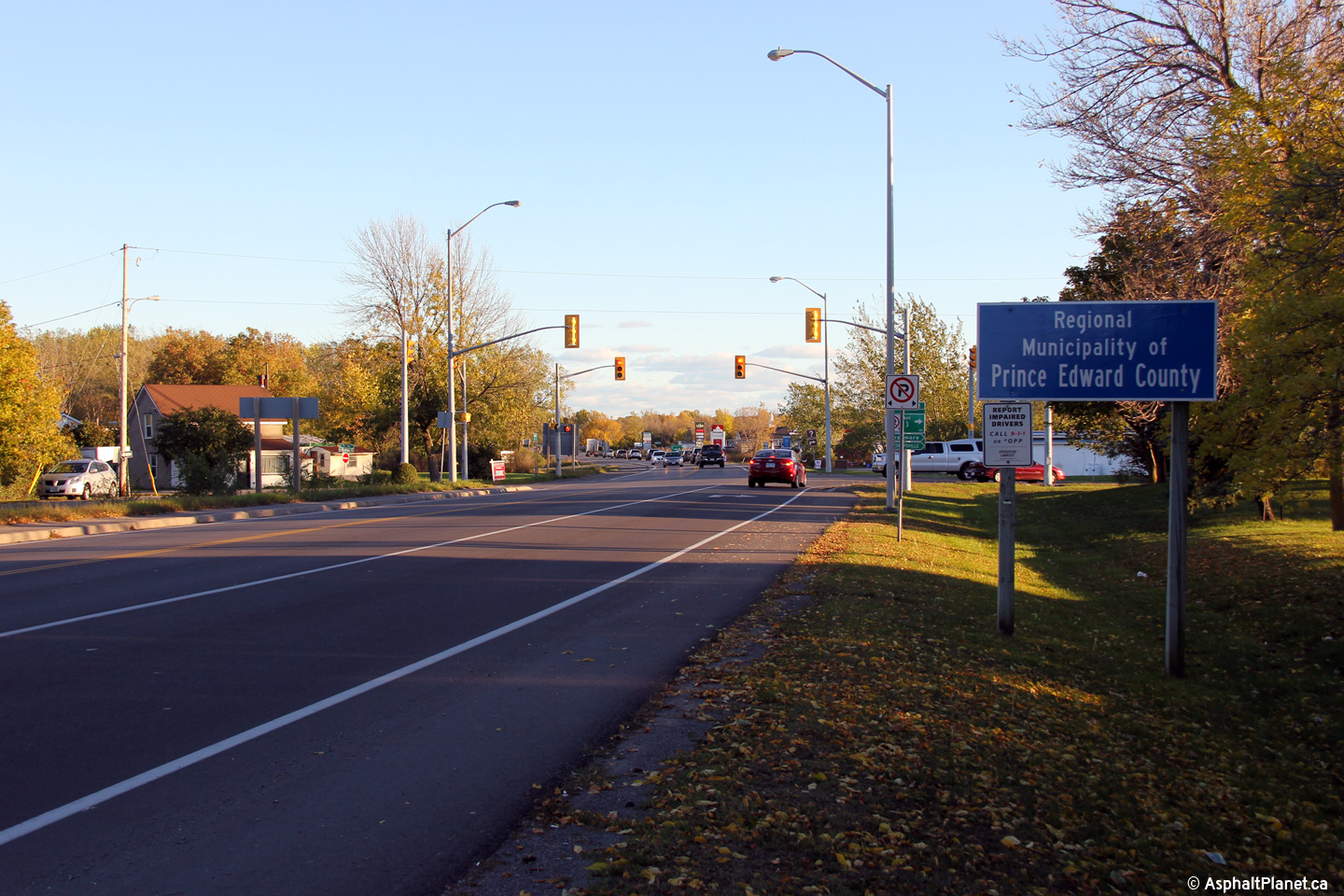
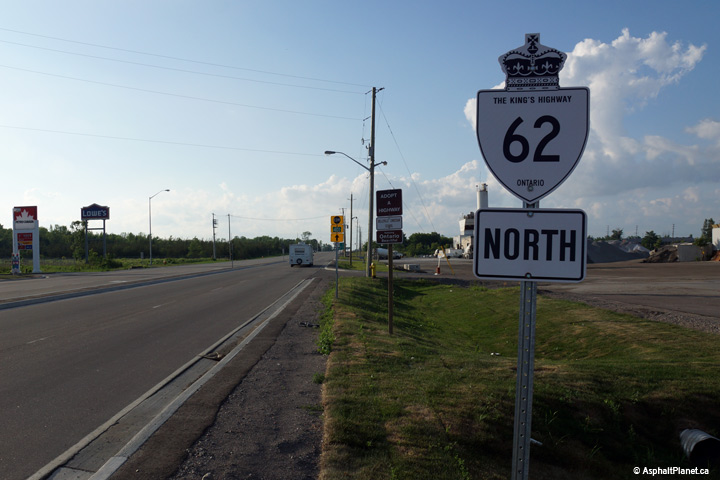
| Municipality of Prince Edward
County |
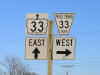
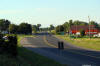
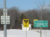
Signage located at the southern
end of Highway 62 denoting Highway 33.
This signage correctly indicates Highway 33
continuing straight ahead.
Picture size: 45kb. |
 |
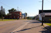
| Municipality of Prince Edward
County |
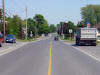
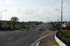
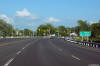
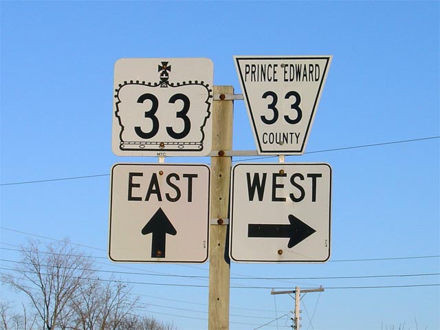
Looking southeasterly at the southern terminus of Highway 62 at the
Highway 33 junction. As evident in the
photo, the Highway 33/62 junction favours
continuous movement between Belleville and Picton.
Picture taken: June 2nd, 2005. Size: 55kb. |
 |
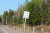
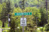
| Municipality of Prince Edward
County |
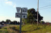
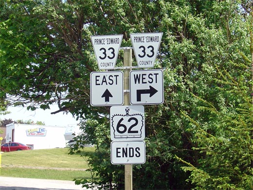
Ends assembly for Highway 62 in Bloomfield. This signage was erected
sometime in 2004, to (obviously) delineate the southern
terminus of Highway 62. Notice however, that this signage erroneously
shows Prince Edward Road 33 continuing east of Highway 62 instead of
indicating the through road as
Highway 33.
Picture size: 80kb. |
 |
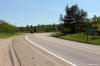
| Municipality of Prince Edward
County |
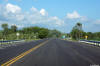
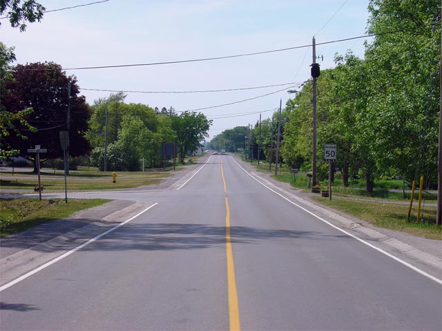
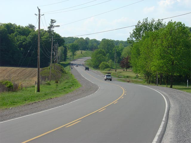
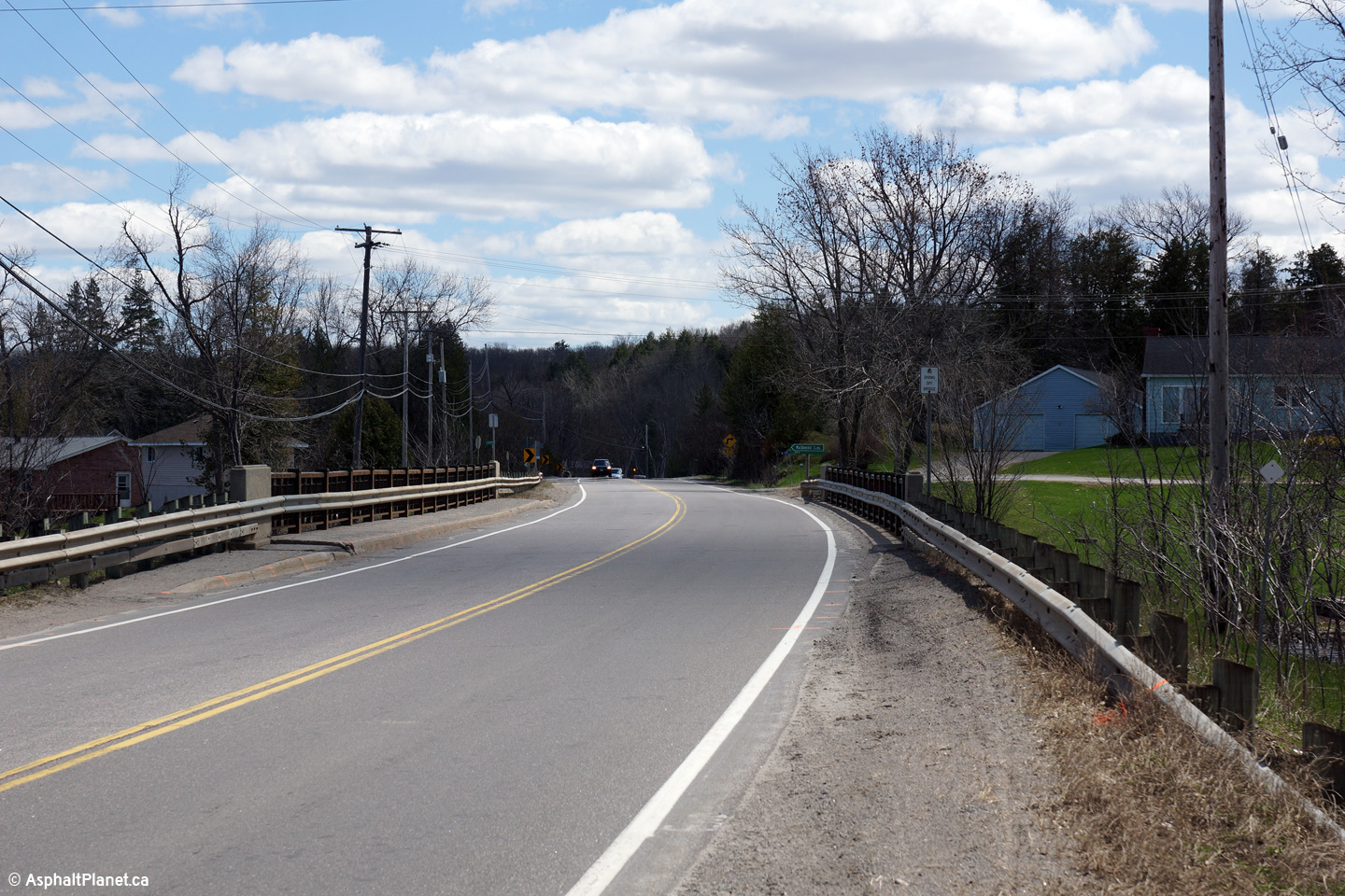
Looking north from Bloomfield (roughly 300m north of the
Highway 33 junction) along Highway 62.
The southern 600m of Highway 62 is maintained by the
Municipality of Prince Edward County as part of a connecting link agreement.
Picture taken: June 2nd, 2005. Size: 60kb. |
 |
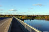
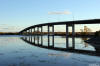
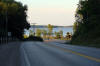
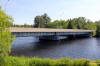
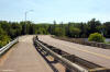
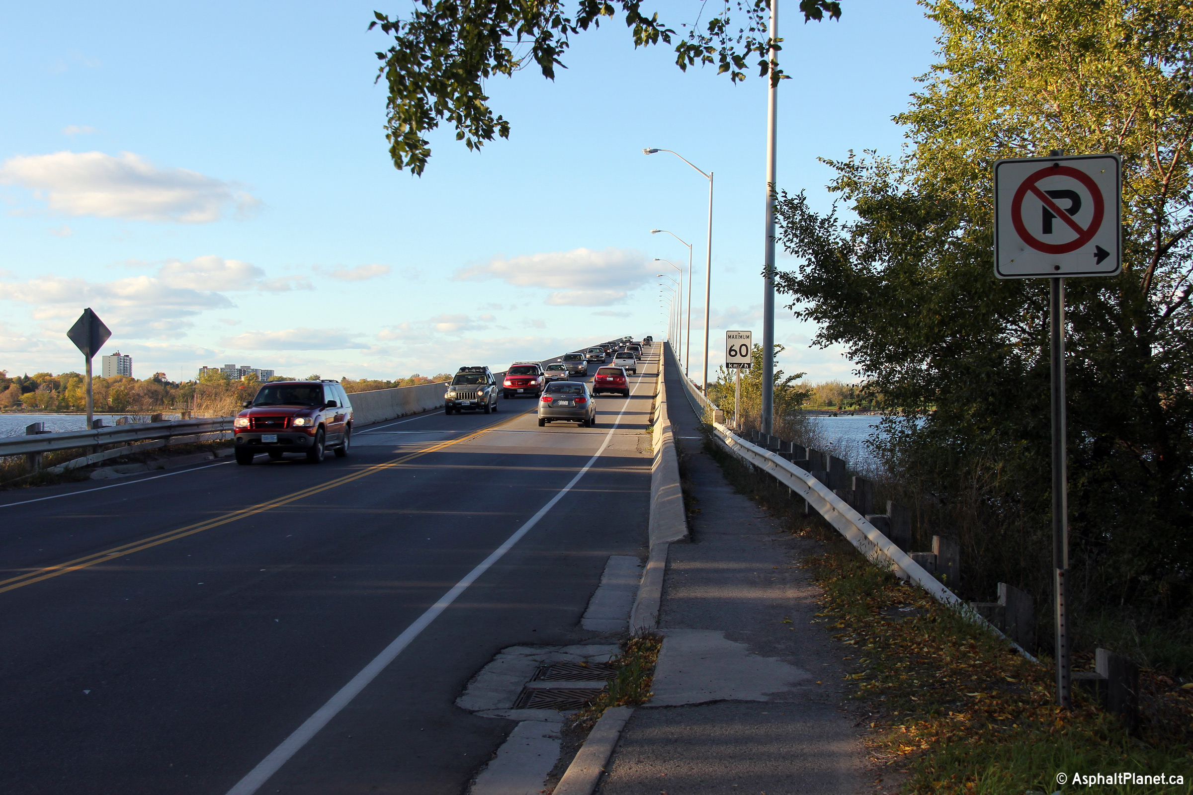
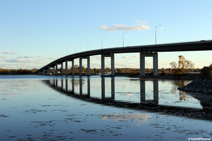
| Municipality of Prince Edward
County |
View looking southerly from the southern touchdown of the Belleville Bay
Bridge.
Photo taken: October 12th, 2012. |
(720x480)
(1440x960)
(2400x1600) |
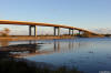
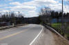
| Municipality of Prince Edward
County |
View looking northerly as Highway 62 begins its ascent up the Bay Bridge
into Belleville.
Photo taken: October 12th, 2012. |
(720x480)
(1440x960)
(2400x1600) |
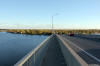
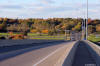
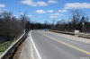
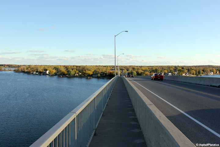
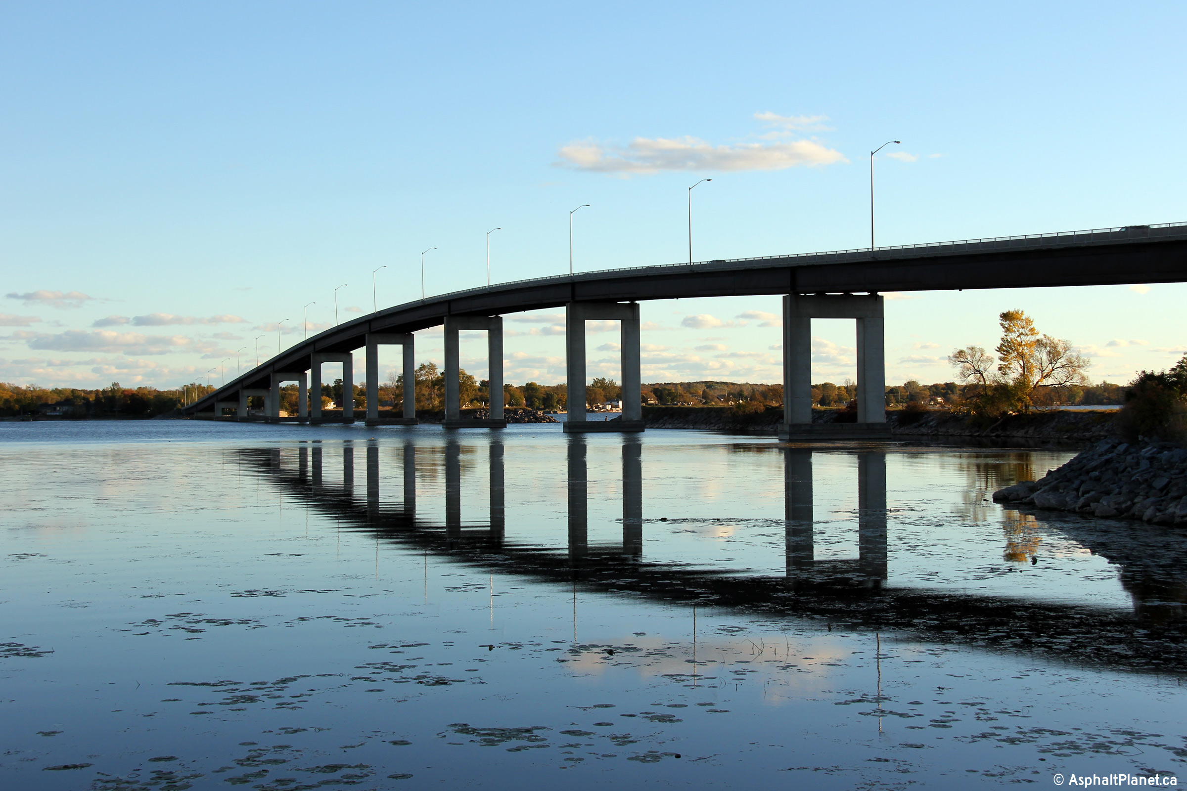
| Municipality of Prince Edward
County |
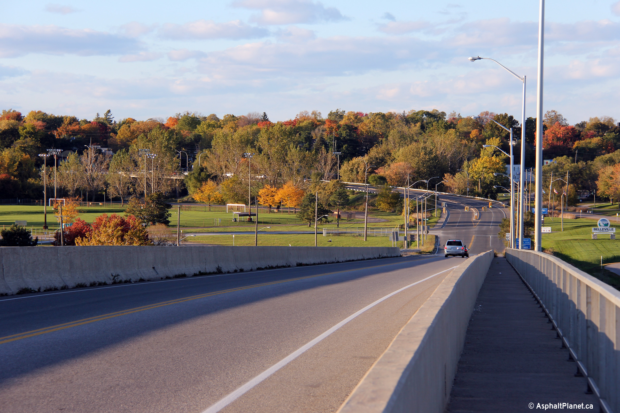
View looking northerly towards the Bay Bridge from the Prince Edward County
approach.
Photo taken: October 12th, 2012. |
(720x480)
(1440x960)
(2400x1600) |
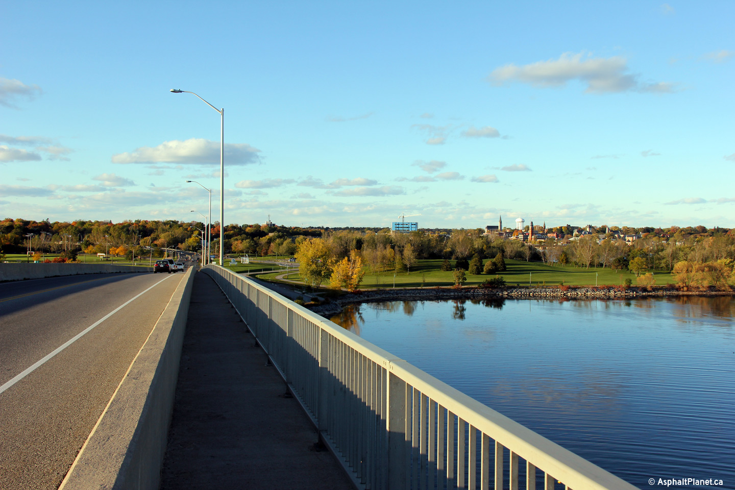
| Municipality of Prince Edward
County |
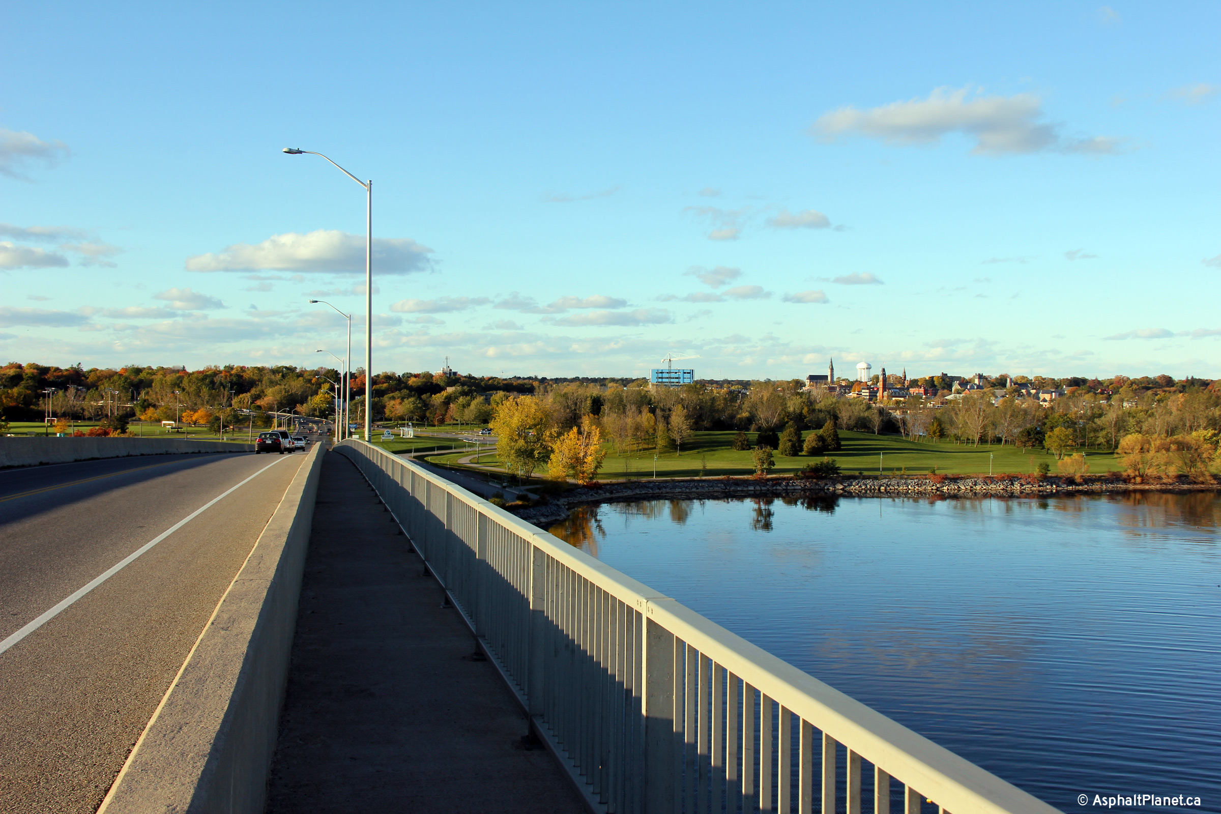
View looking southerly into Prince Edward County from mid-span of the
Belleville Bay Bridge.
Photo taken: October 12th, 2012. |
(720x480)
(1440x960)
(2400x1600) |
| City of Belleville. |
Two views looking northerly into Belleville from mid-span of the Bay Bridge.
Photos taken: October 12th, 2012. |
(720x480)
(1440x960)
(2400x1600)
(720x480)
(1440x960)
(2400x1600) |
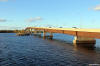
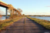
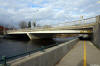
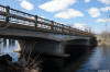
| City of Belleville |
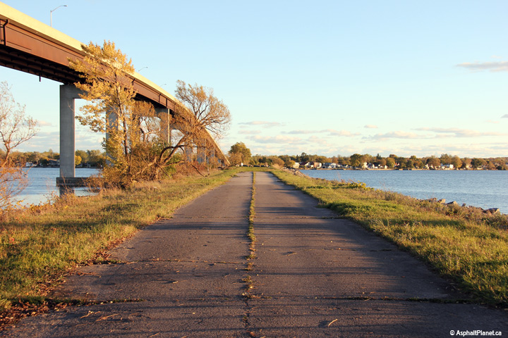
Before the high-level bridge was constructed in 1982, the highway crossed
the bay via a low level causeway with a swing bridge. This view looks
southerly from the Belleville shore.
Photo taken: October 12th, 2012. |
(720x480)
(1440x960)
(2400x1600) |
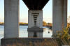
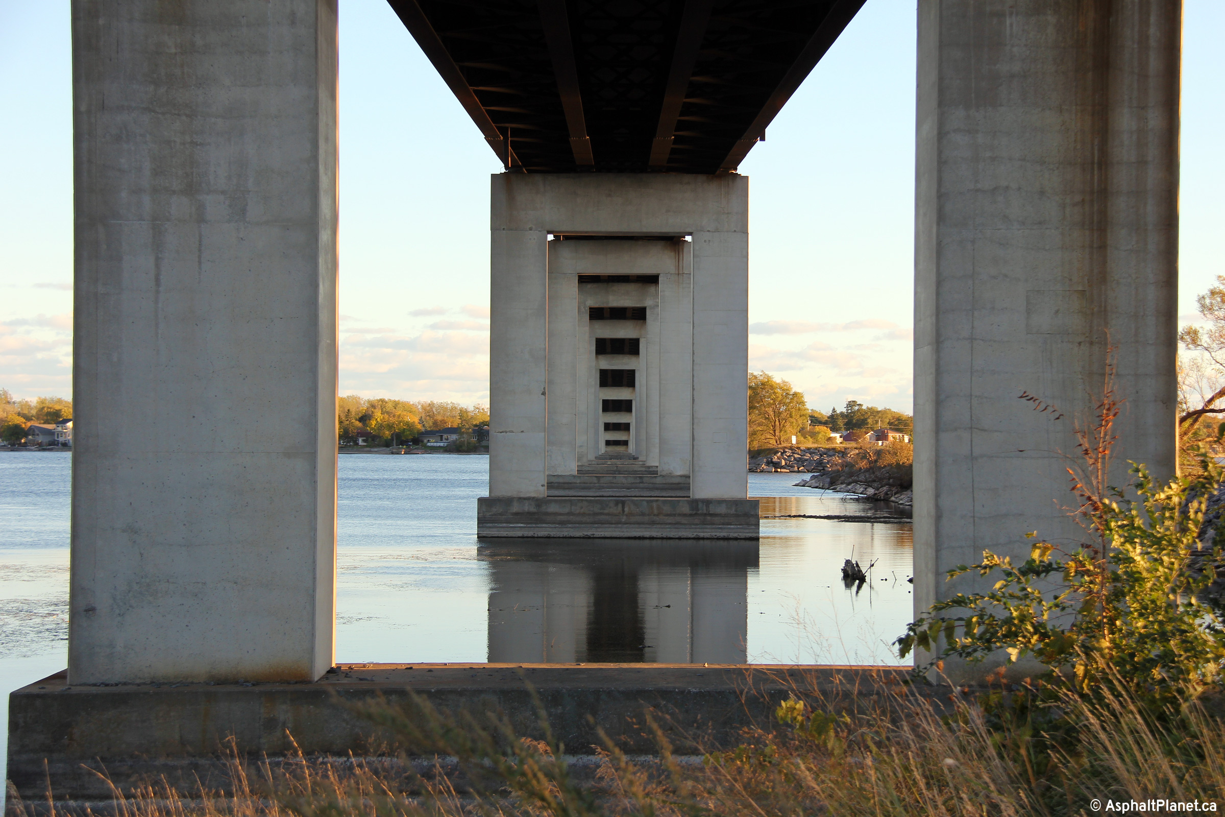
| City of Belleville |
View looking beneath the Bay Bridge from the Belleville side of the bridge.
Photo taken: October 12th, 2012. |
(720x480)
(1440x960)
(2400x1600) |
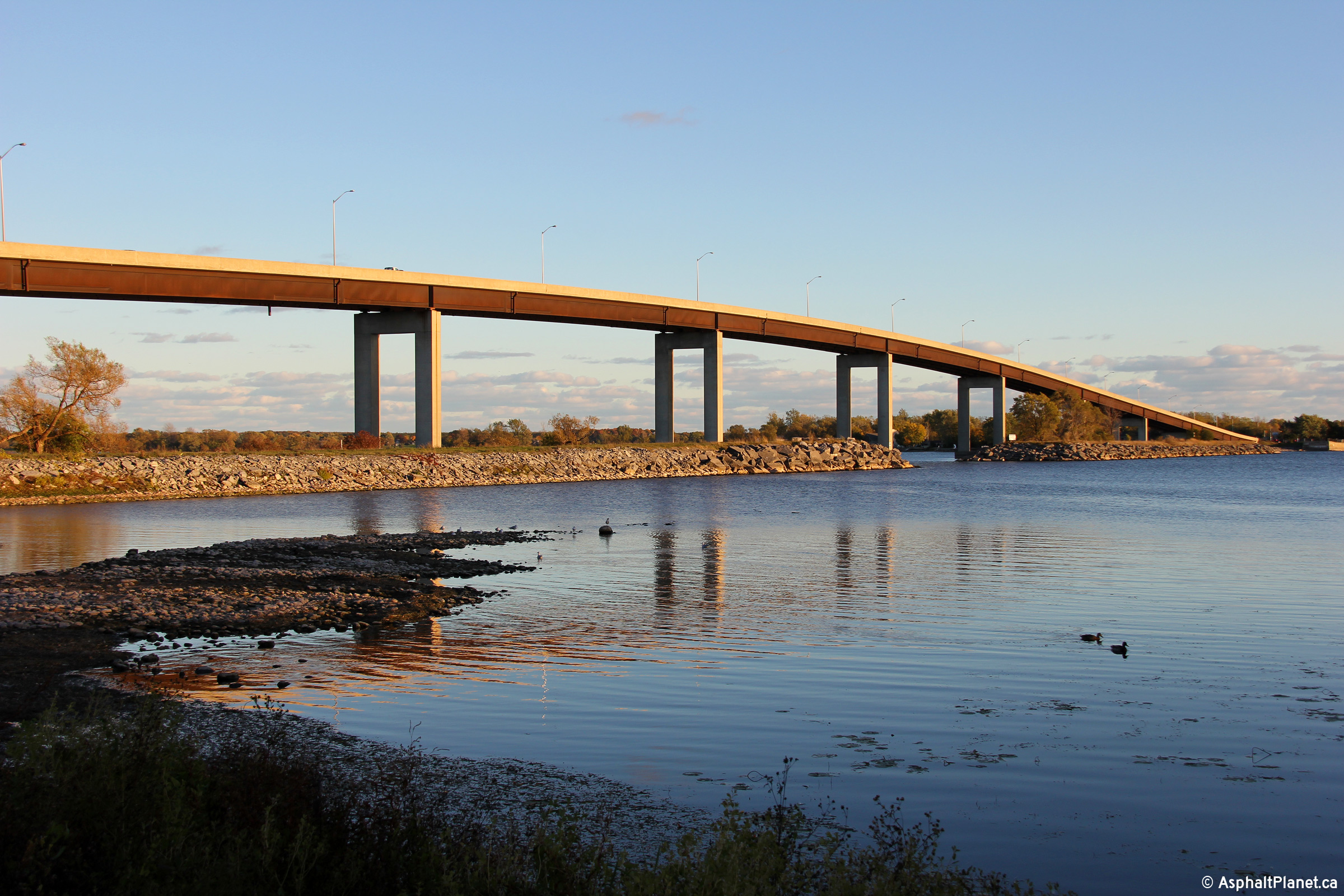
| City of Belleville |
Early spring view of the eastern facade of Belleville's Bay Bridge.
The Bay Bridge carries Highway 62 from Belleville south to Prince Edward
County.
Photos taken: October 12th, 2012. |
(720x480)
(1440x960)
(2400x1600)
(720x480)
(1440x960)
(2400x1600) |
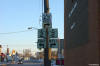
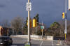
| City of Belleville |
Junction assembly for Highway 62
heading SB approaching Highway 2. Traffic wishing to continue SB on
Highway 62 must turn right on Dundas Street (Highway 2), then turn left a
few blocks later to cross the Bay Bridge into Prince Edward County.
Photo taken: February 22nd, 2004. |
 (720x480) (720x480)
(1440x960) |
| City of Belleville |
Southbound signage for Highway 62 south of the Highway 37 junction.
Photo taken: February 22nd, 2004. |
 (720x480) (720x480)
(1440x960) |
| City of Belleville |
Signage for the Highway 37 junction northbound along Highway 62 in
Belleville.
Photo taken: November 15th, 2014. |
 (720x480) (720x480)
(1440x960) |
|
Highway 37 continues northeasterly from Highway 62 in
Belleville, bound for Tweed and Highway 7 at Actinolite.
Click here for Highway 37 images. |
| City of Belleville |
This photo shows the junction
assembly for the Highway 62/37 intersection.
This picture is taken looking southbound.
Photo taken: November 15th,
2014. |
 (720x480) (720x480)
(1440x960) |
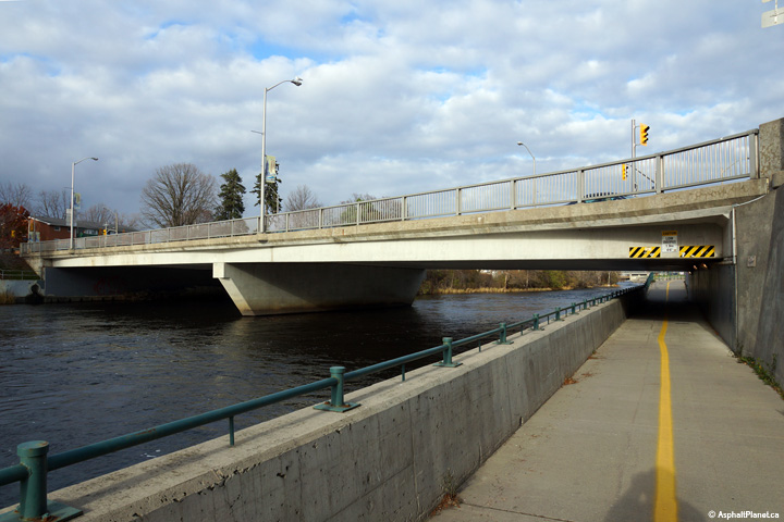
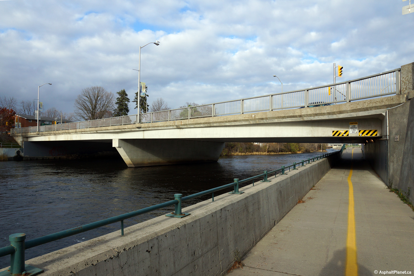
| City of Belleville |
View looking easterly at the structure that carries Highway 62 over the
Moira River.
Photo taken: November 15th, 2014. |
(720x480)
(1440x960)
(2400x1600) |
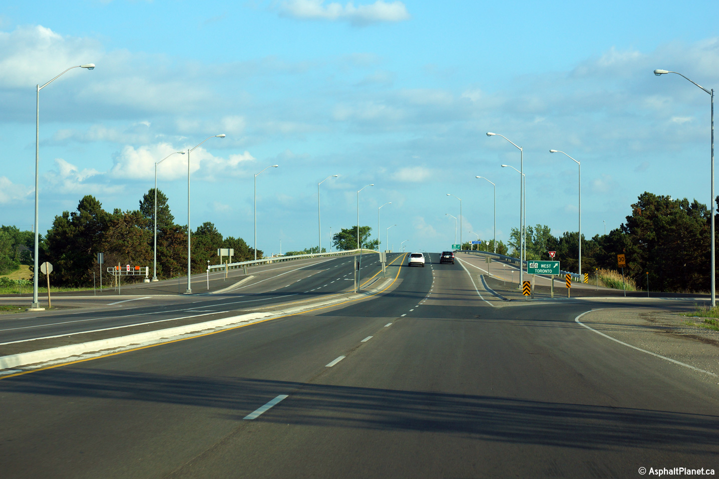
|
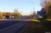
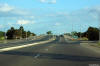
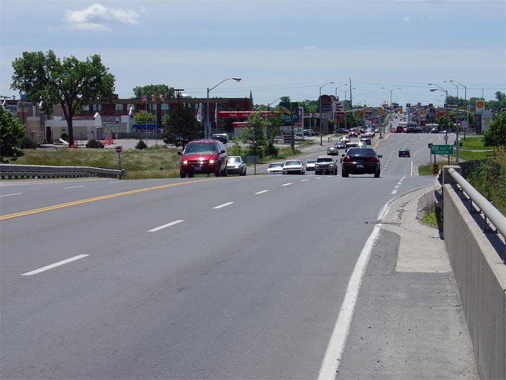
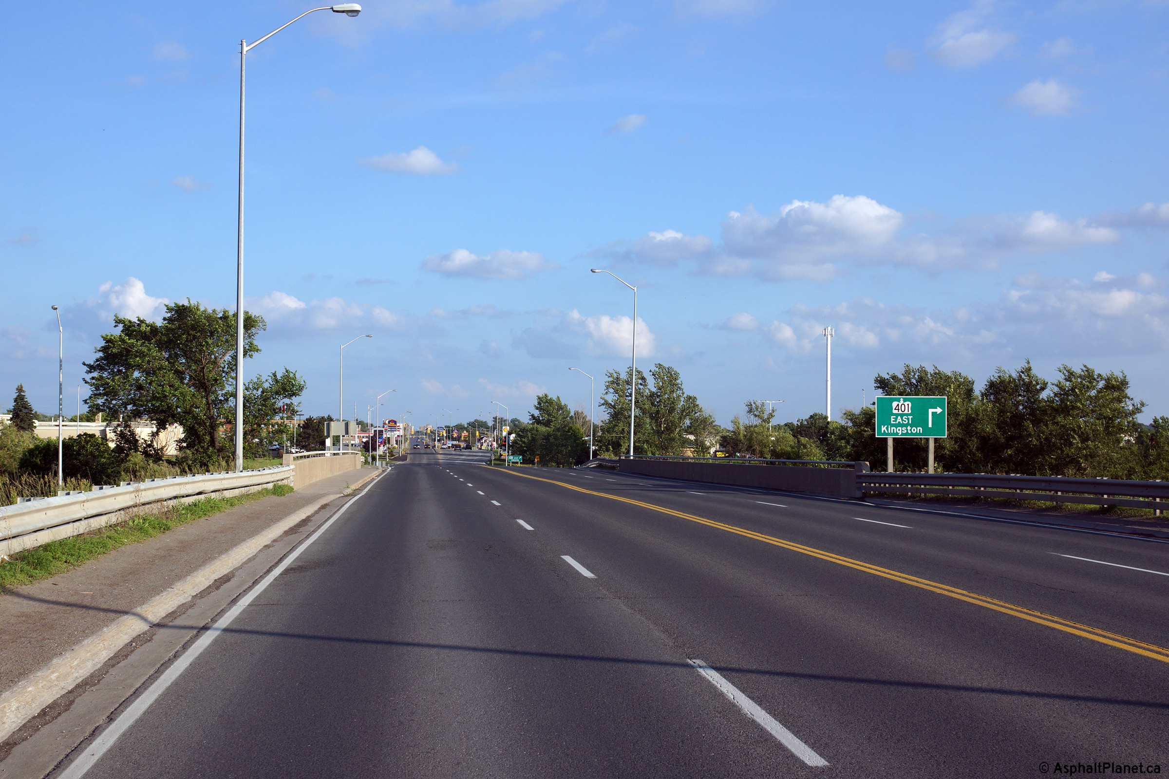
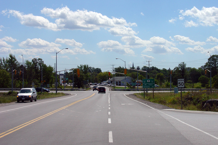
City of Belleville |
Looking south along Highway 62 from the Highway 401 overpass in Belleville.
As evident in the photo, Highway 62 is quite congested in the vicinity of
Highway 401. South of
Highway 401 through Belleville, Highway 62 is
maintained by the City of Belleville as part of a connecting link agreement.
Click here for an older photo from this
vantage point, taken June, 2004.
Photo taken: June 21st, 2015. |

(720x480)
(1440x960)
(2400x1600) |
|
Highway 401 is Ontario's Trans-Provincial East West
Freeway.
Click
here for Highway 401 images. |
|
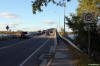
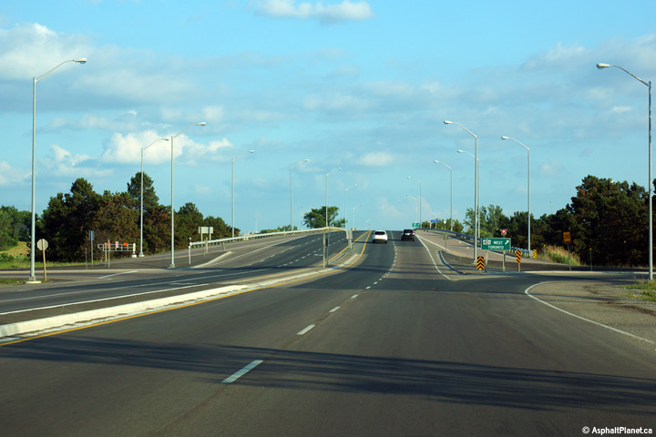
City of Belleville |
Southerly view as Highway 62 passes overtop of Highway 401 in Belleville.
Photo taken: June 21st, 2015. |
(720x480)
(1440x960)
(2400x1600) |
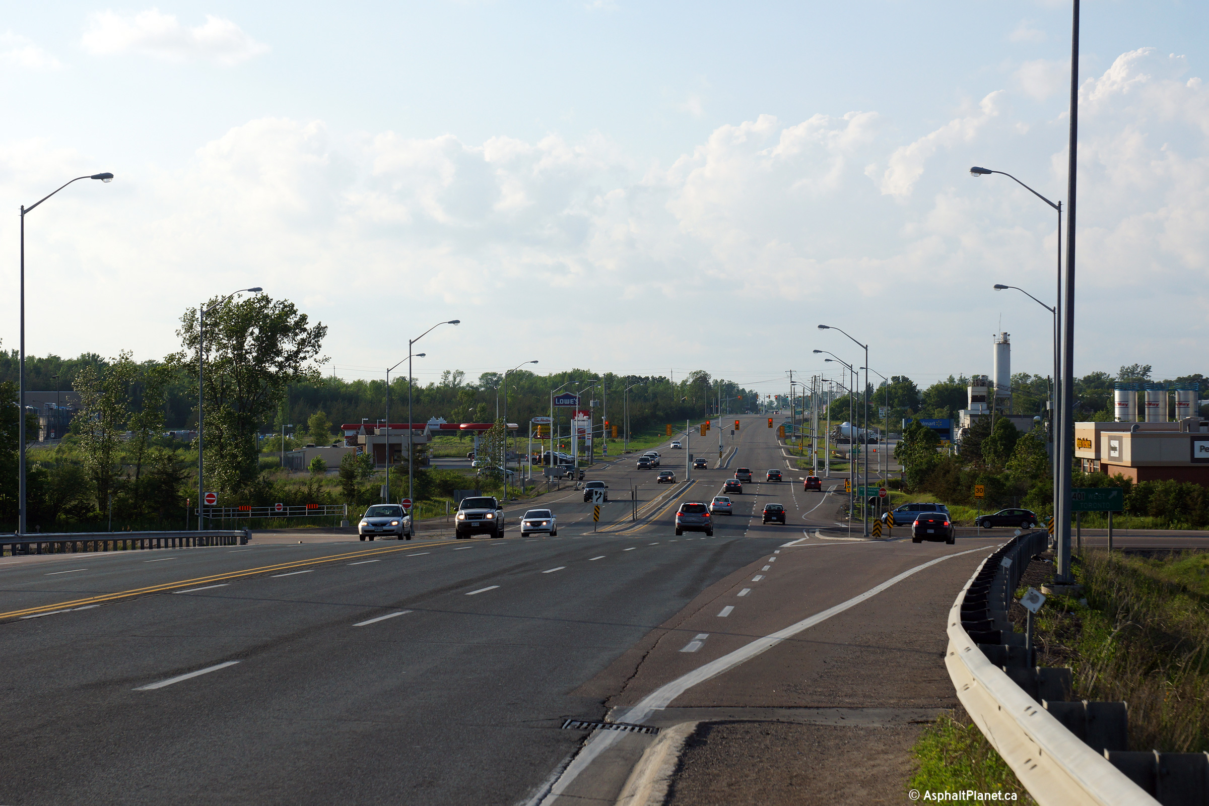
|
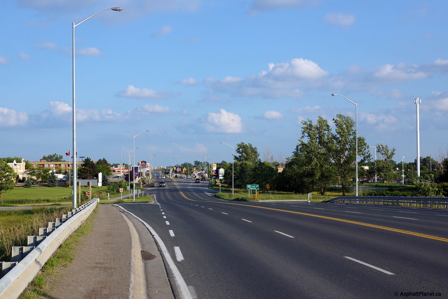
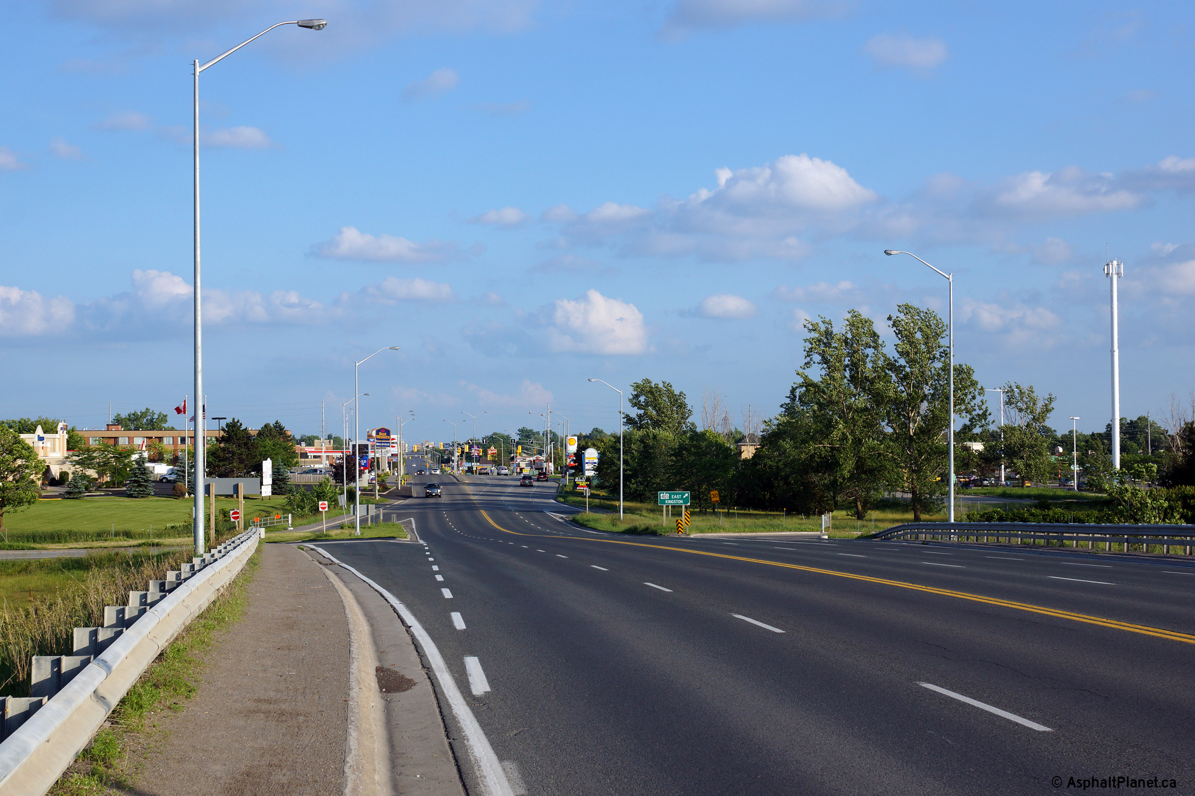
City of Belleville |
Highway 62 looking north from the
Highway 401 overpass. The 62/401
interchange is one of the few remaining cloverleaf interchanges left on
Ontario's highways. Click here for an
older version of this photo from this vantage point, taken in June, 2004.
Photo taken: June 21st, 2015. |
(720x480)
(1440x960)
(2400x1600)
|
|
City of Belleville |
This view looks southerly along
Highway 62 approaching the Highway 401 interchange.
Photo taken: June 21st, 2015. |
(720x480)
(1440x960)
(2400x1600) |
|
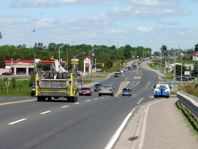
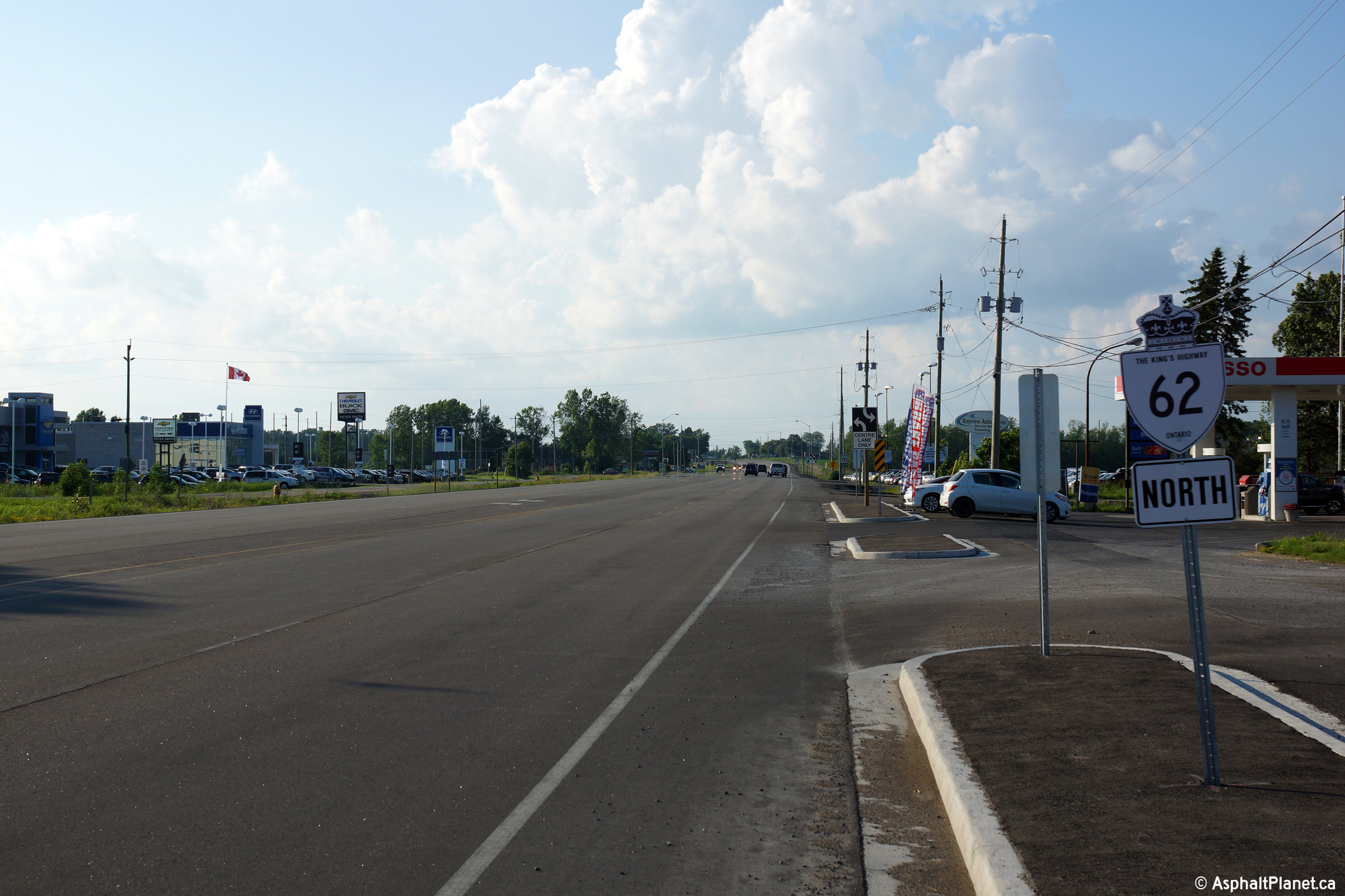
City of Belleville |
Two views looking southerly approaching the
signalized intersection with Cloverleaf Drive. At the end of 2014, a
multi-year widening project was completed that saw Highway 62 widened
northerly from Cloverleaf Drive through to just north of Ashley Street in
Foxboro. Both the pre-widening and post widening cross-section is
pictured.
Upper photo taken: August 16th, 2008.
Lower photo taken: June 21st, 2015. |

(720x480)
(1440x960)
(2400x1600) |
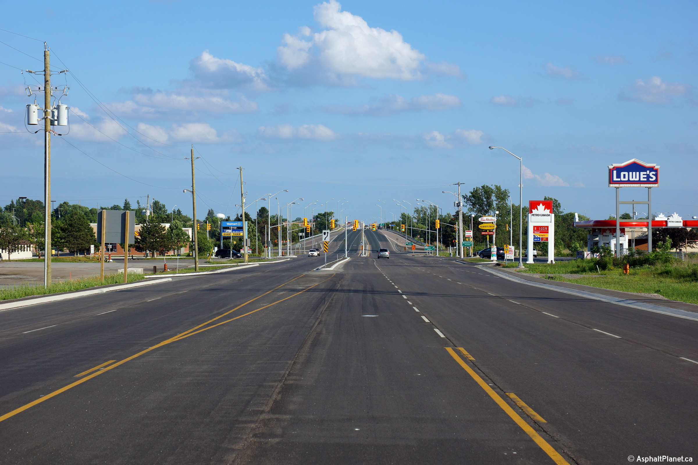
|
City of Belleville |
Old style Highway 62 shield just
north of the Millennium Parkway intersection.
Photo taken: June 21st, 2015. |
 (720x480) (720x480)
(1440x960) |
|
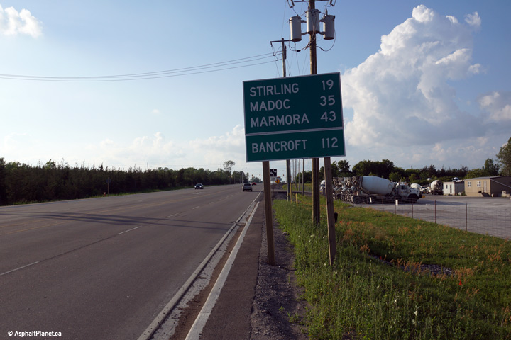
City of Belleville |
This distance signage along Highway
62 is located just north of the Millennium Parkway intersection. Both
Stirling and Marmora are located along the former routing of Highway 14 and
are not directly accessible from Highway 62.
Photo taken: June 21st, 2015. |
 (720x480) (720x480)
(1440x960) |
|
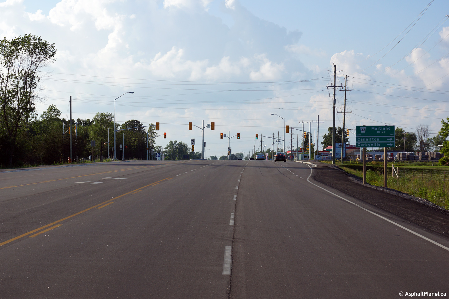
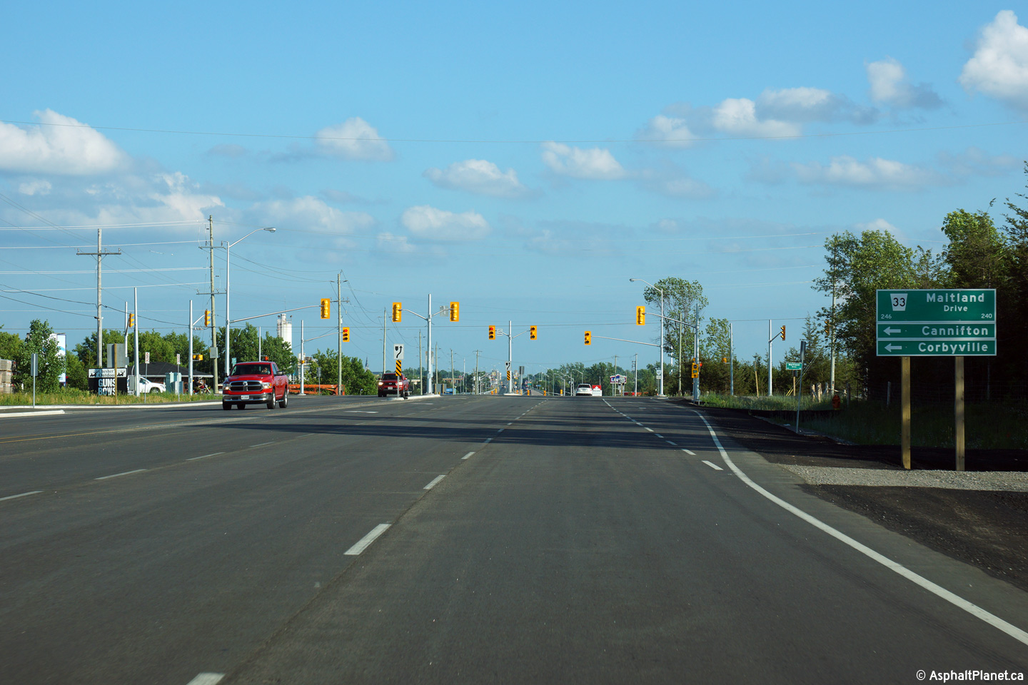
City of Belleville |
View looking northerly approaching
the Maitland Road intersection.
Photo taken: June 21st, 2015. |
(720x480)
(1440x960)
(2400x1600) |
|
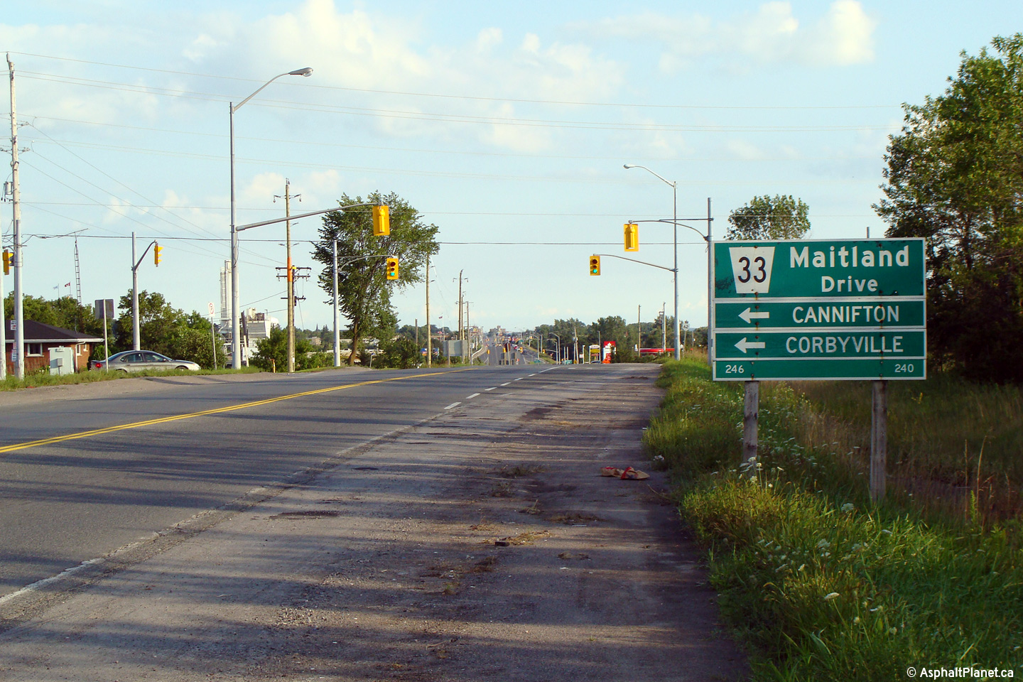
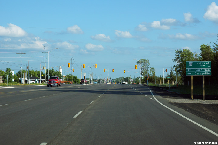
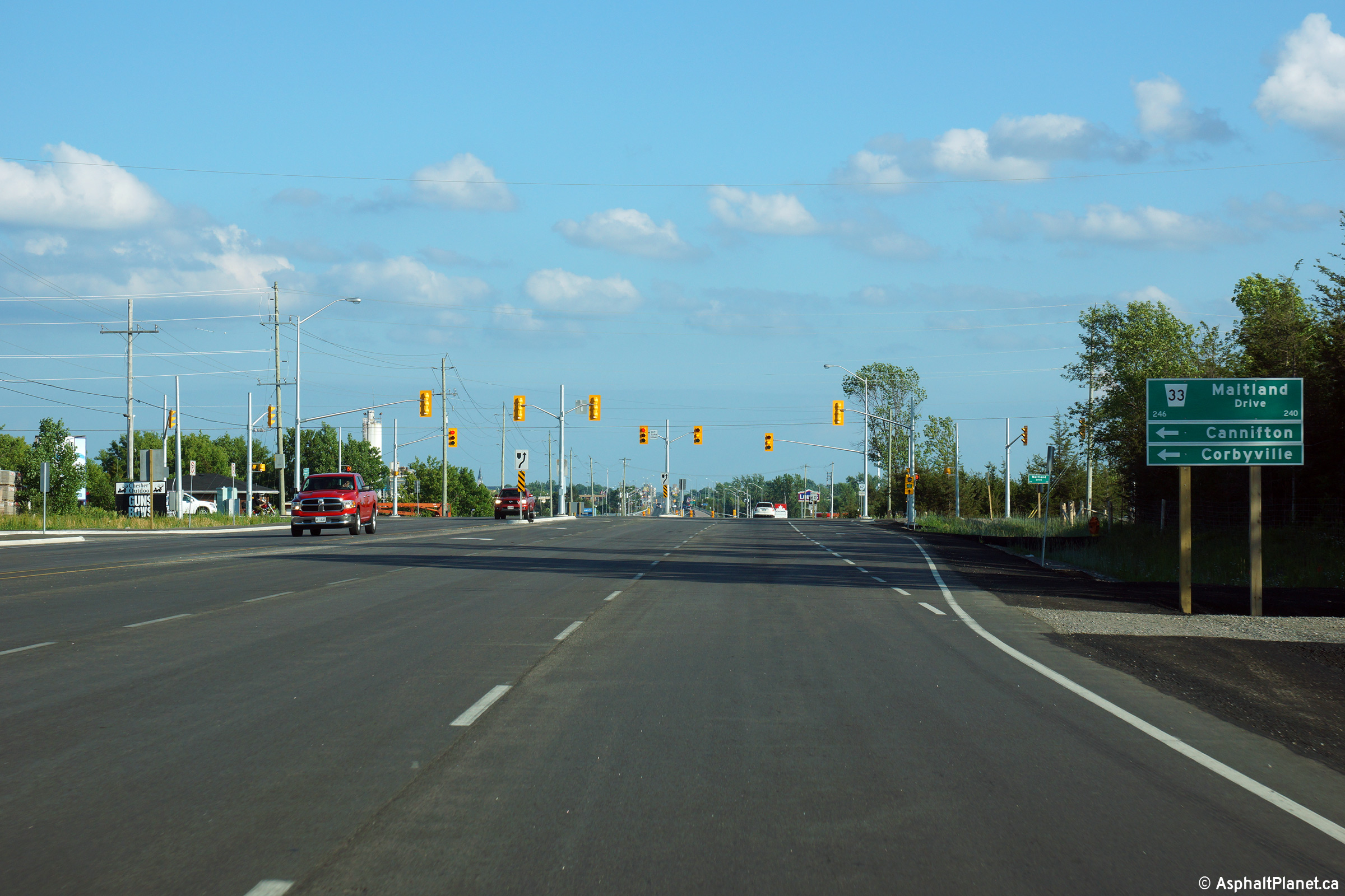
City of Belleville |
Two views looking southerly
approaching the Maitland Road intersection. The Maitland Road
intersection was considerably widened during the recent construction
project.
Upper photo taken: August 16th, 2008.
Lower photo taken: June 21st, 2015.
|
(720x480)
(1440x960)
(2400x1600) |
|
City of Belleville |
Two views looking northerly along
Highway 62 from just north of the Maitland Road intersection.
Upper photo taken: August 16th, 2008.
Lower photo taken: June 21st, 2015. |

(720x480)
(1440x960)
(2400x1600) |
|
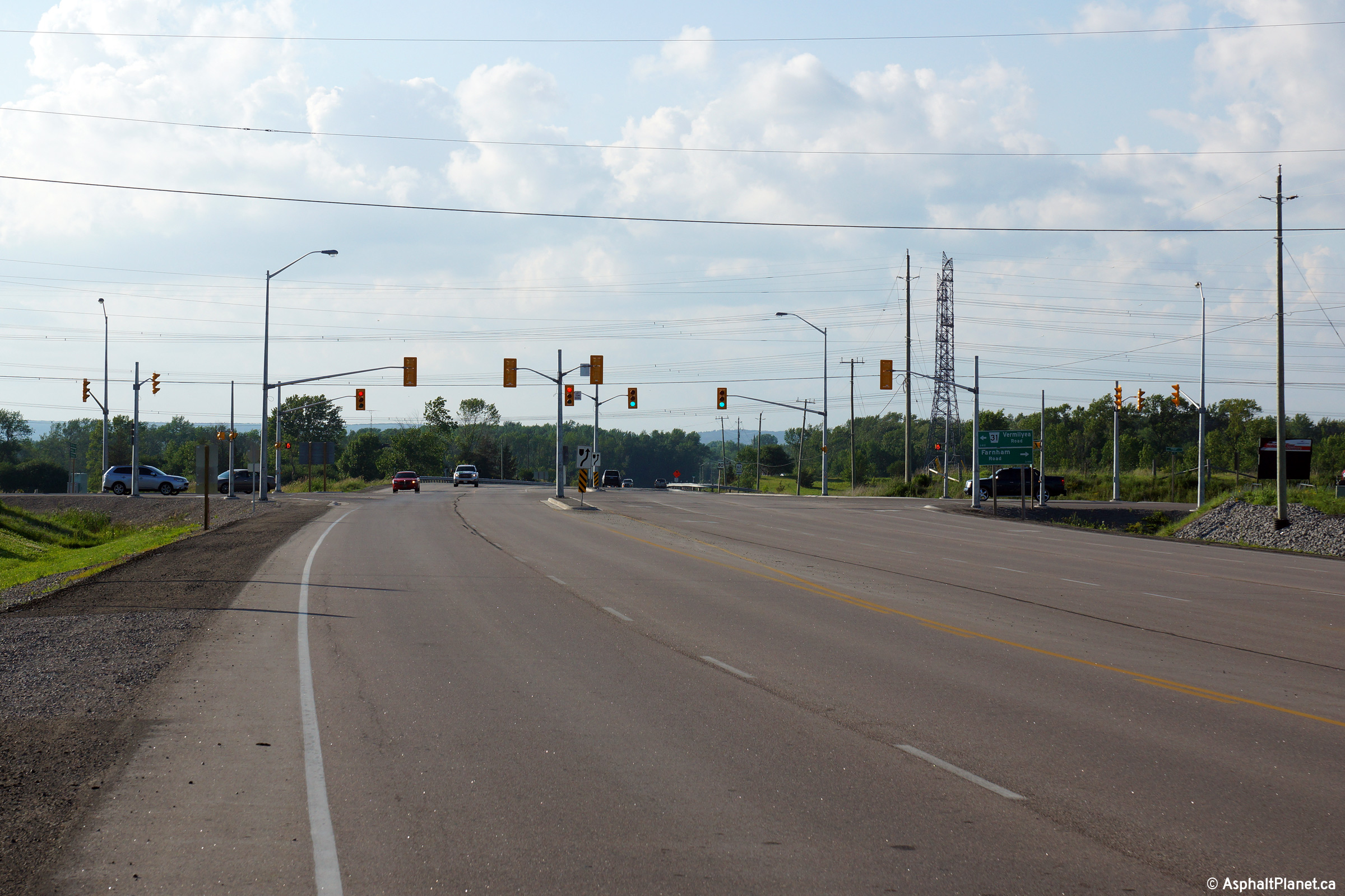
City of Belleville |
View looking southerly from just
south of the Vermilyeah Road intersection.
Photo taken: June 21st, 2015. |
(720x480)
(1440x960)
(2400x1600) |
|
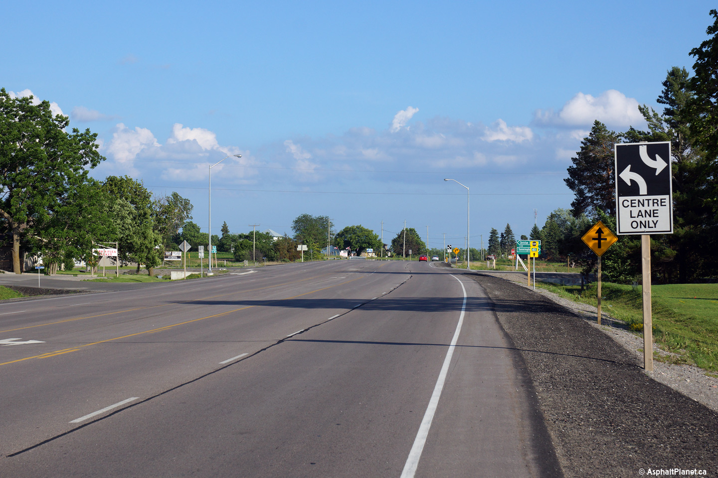
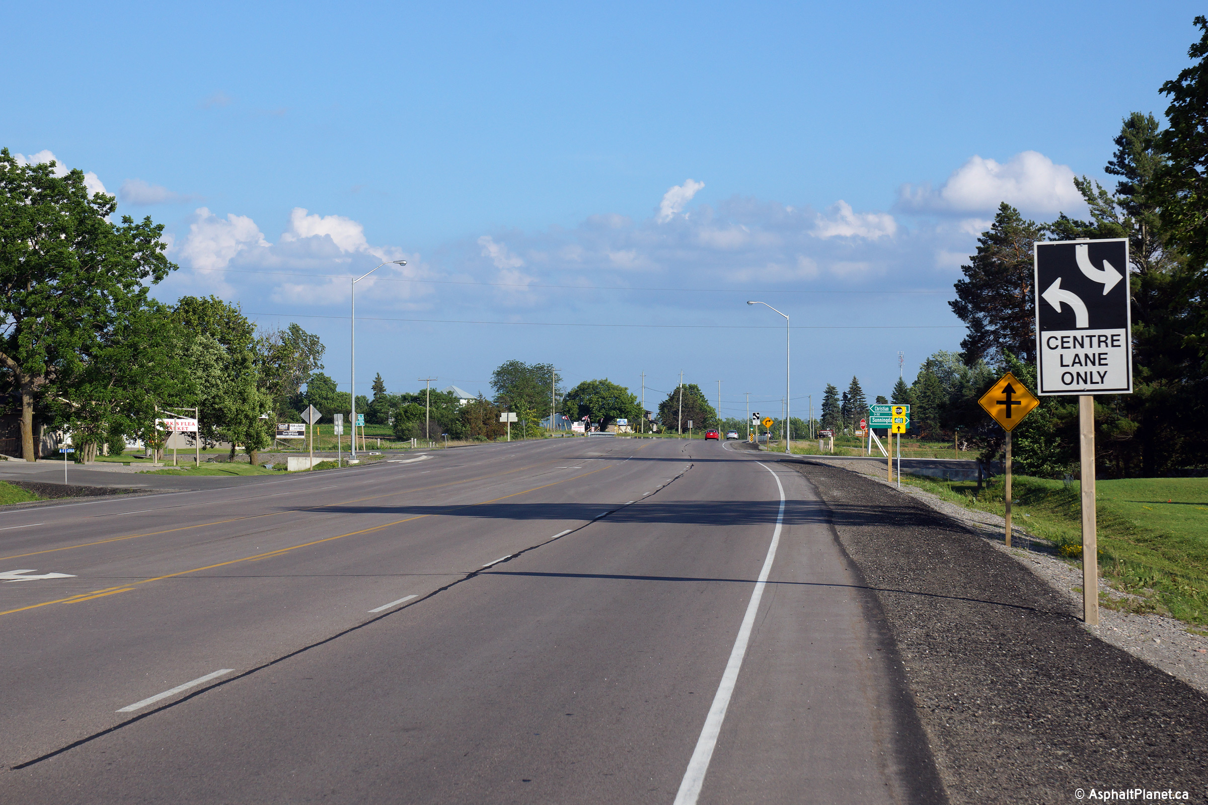
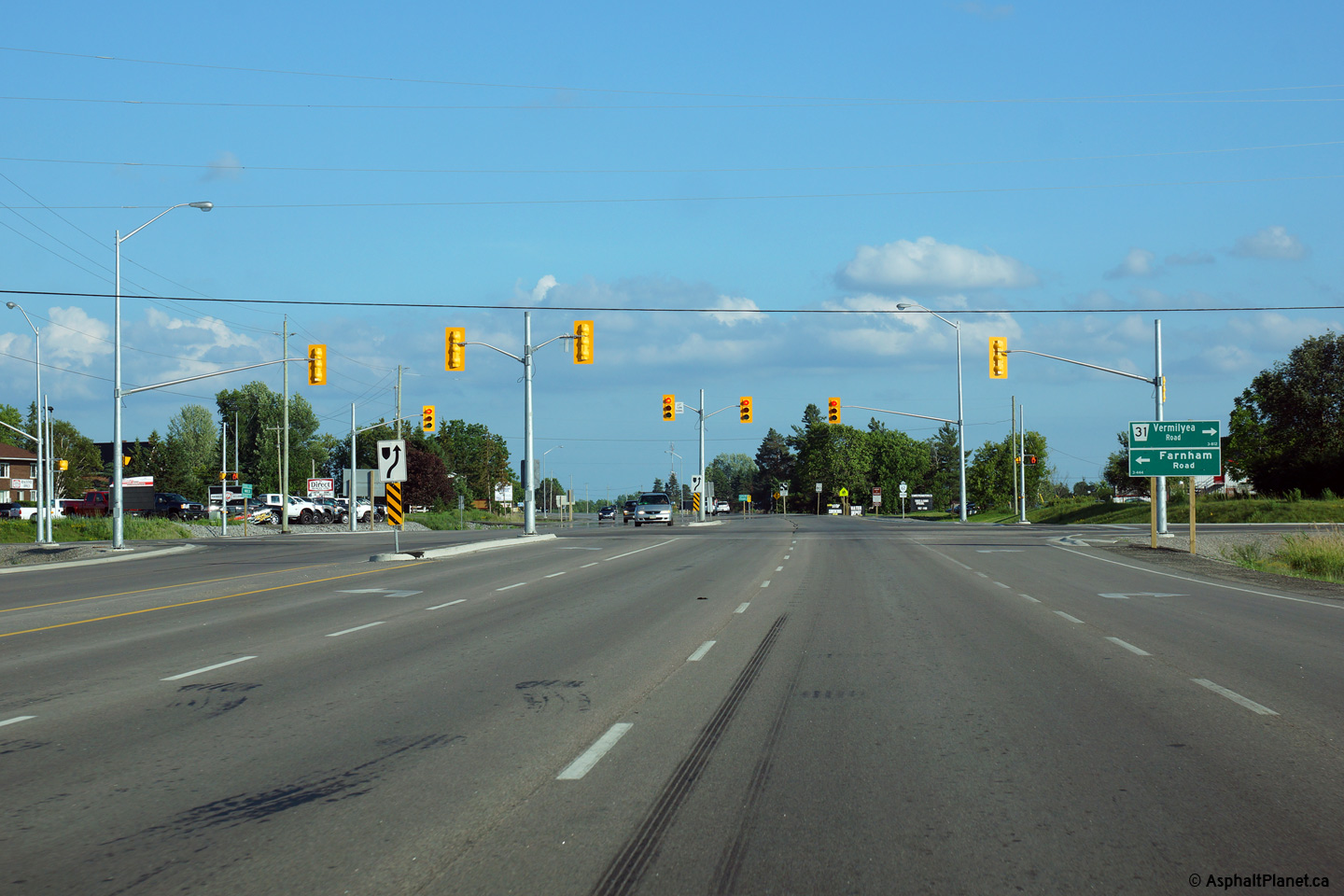
City of Belleville |
Two views looking northerly
approaching the Vermilyea Road intersection along Highway 62.
Upper photo taken: August 16th, 2008.
Lower photo taken: June 21st, 2015. |
(720x480)
(1440x960)
(2400x1600) |
|
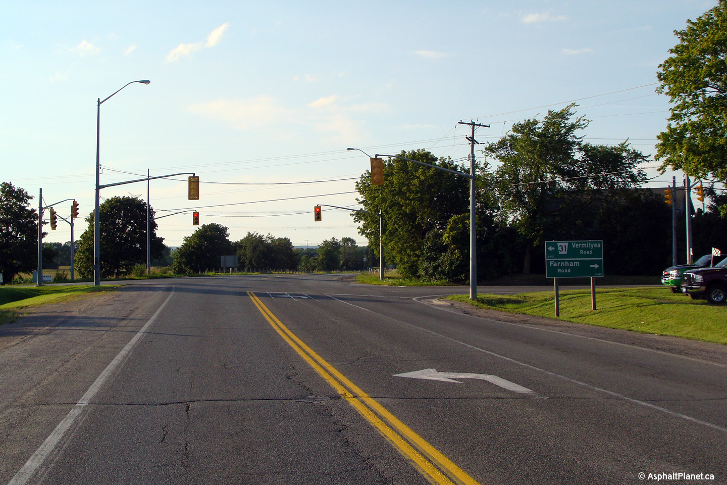
City of Belleville |
This view looks southerly at the
Vermilyea Road intersection.
Photo taken: June 21st, 2015. |
(720x480)
(1440x960)
(2400x1600) |
|
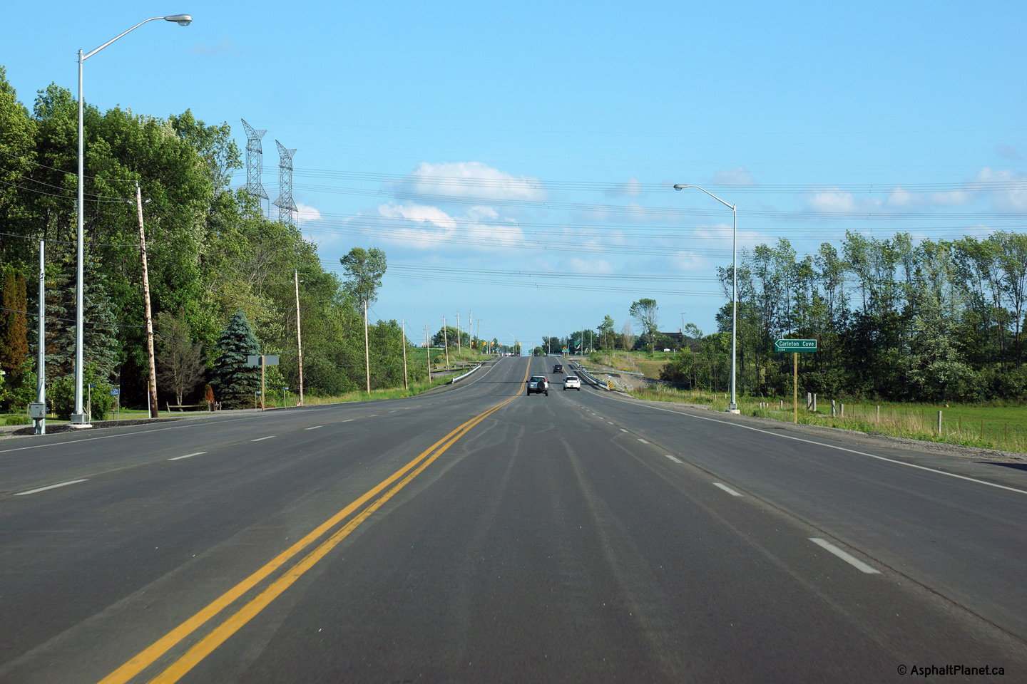
City of Belleville |
Southerly view along Highway 62
from just south of Ashley Street in Foxboro. Between Vermilyea Road
and Ashley Street, Highway 62 lacks a flush median.
Photo taken: June 21st, 2015. |

(720x480)
(1440x960)
(2400x1600) |
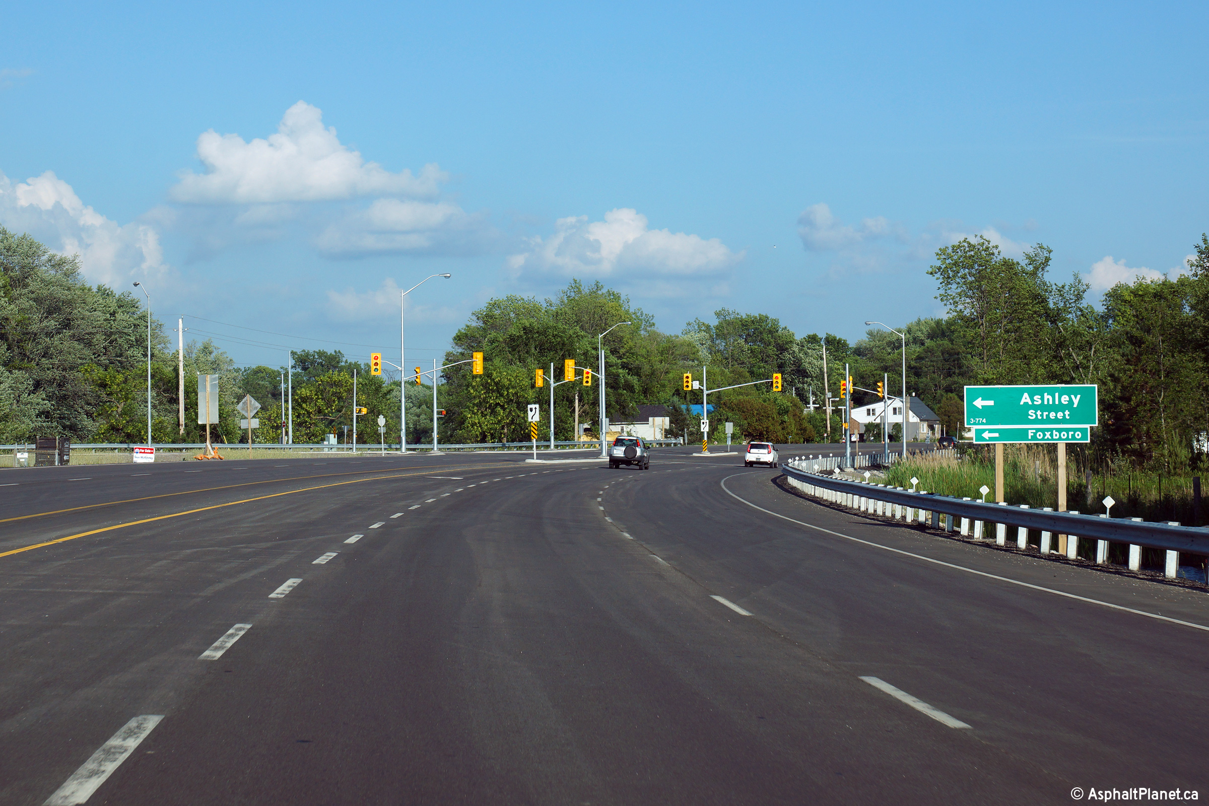
|
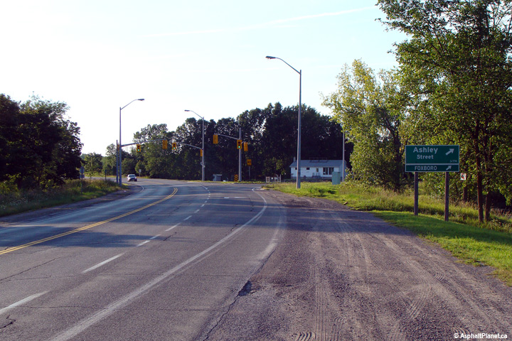
City of Belleville |
Two views looking northerly towards
the Ashley Street intersection at the southern end of the Foxboro By-pass.
Upper photo taken: August 16th, 2008.
Lower photo taken: June 21st, 2015. |

(720x480)
(1440x960)
(2400x1600) |
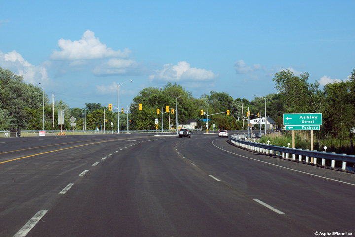
|
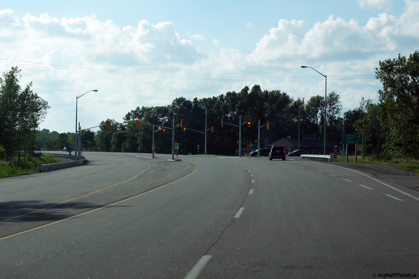
City of Belleville |
Southerly view approaching the
Ashley Street intersection.
Photo taken: June 21st, 2015. |
(720x480)
(1440x960)
(2400x1600) |
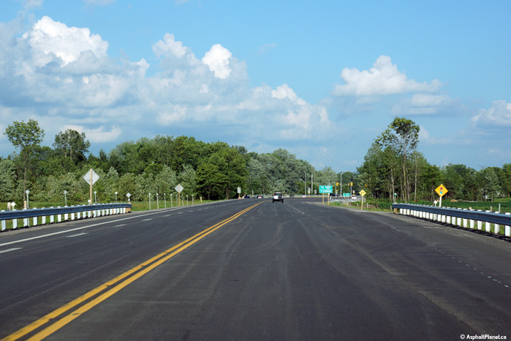
|
City of Belleville |
View looking southerly as Highway
62 widens to four lanes just north of the Ashley Street intersection.
Photo taken: June 21st, 2015. |
(720x480)
(1440x960)
(2400x1600) |
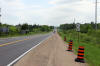
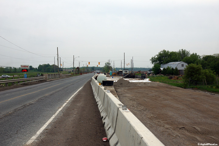
|
City of Belleville |
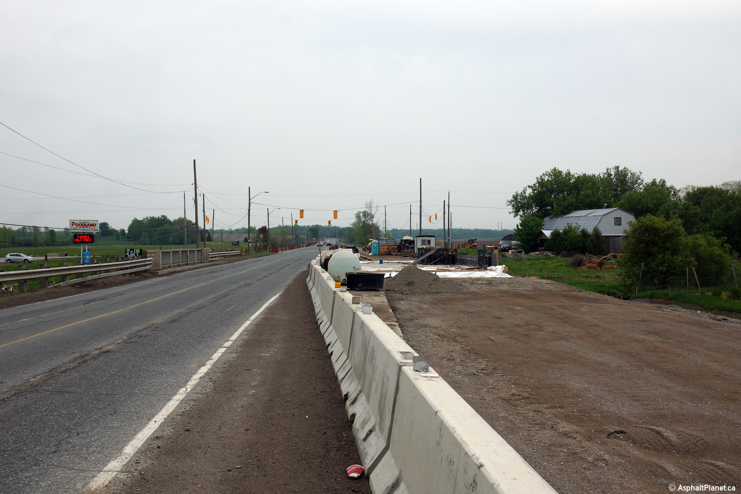
This view looks southerly approaching the Frankford Road intersection.
Construction was ongoing to widen the Palliser Creek Bridge to facilitate
intersection improvements at the Frankford Road intersection.
Photo taken: May 16th, 2015.
|

(720x480)
(1440x960)
(2400x1600) |
|
City of Belleville |
Southerly view along Highway 62
from just south of the Highway 14 junction.
Photo taken: August 16th, 2008. |

(720x480)
(1440x960)
(2400x1600) |
|
City of Belleville |
Junction assembly along Highway 62
in advance of the former Highway 14 junction. In the late 1990s, the
County of Hastings divested itself of all of its county roads, transferring
responsibilities to the local municipalities. Because of this, today,
it is actually quite rare to see a Hastings County route marker.
Photo taken: August 16th, 2008. |
 (720x480) (720x480)
(1440x960) |
|
City of Belleville |
This view looks northerly
approaching the former Highway 14 junction, and is taken from a large
embankment along the west side of the highway. Though a bit difficult
to discern from the photo, since the highway needs to be re-striped, this
intersection is an old MTO offset intersection, where opposing left turning
traffic does not directly face each other.
Photo taken: August 16th, 2008. |
(720x480)
(1440x960)
(2400x1600) |
|
City of Belleville |
Green sign for the Foxboro-Stirling
Road. The Foxboro-Stirling Road is the former Highway 14.
Because Hastings County has no official county road network any longer
(though county route shields do still persist across the county), the
Foxboro-Stirling Road is not signed as Hastings Road 14.
Photo taken: August 16th, 2008. |
 (720x480) (720x480)
(1440x960) |
|
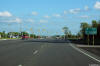
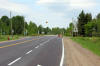
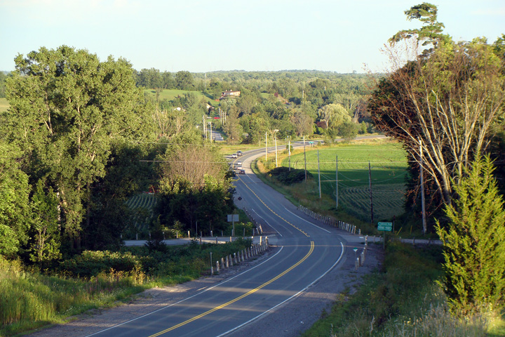
City of Belleville |
Looking north along Highway 62 from
the north end of the Foxboro Bypass. From Foxboro northerly towards
West Huntington Highway 62 passes through the eastern end of the Oak Ridges
Moraine. Picture taken: June 2nd, 2005. Size: 50kb. |
 |
|
City of Belleville. |
This view looks south
towards Belleville from the large hill at Halloway Road. As Highway 62
arcs to the right in this photo, notice the through road that continues
ahead on a straight alignment from Highway 62. This road is the old
Madoc Road, and was the county road that predated Highway 62 through Central
Hastings County.
Photo taken: August 16th, 2008. |

Low-res
High-res |
|
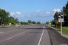
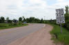
City of Belleville |
Looking south towards Belleville
from the Dutch Lane intersection north of Foxboro. Highway 62 is not
particularly well built from Foxboro northerly to Madoc. The highway
features narrow lanes and shoulders, and has a few relatively sharp curves.
Picture taken: June 2nd, 2005. Size: 60kb. |
 |
|
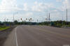
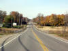
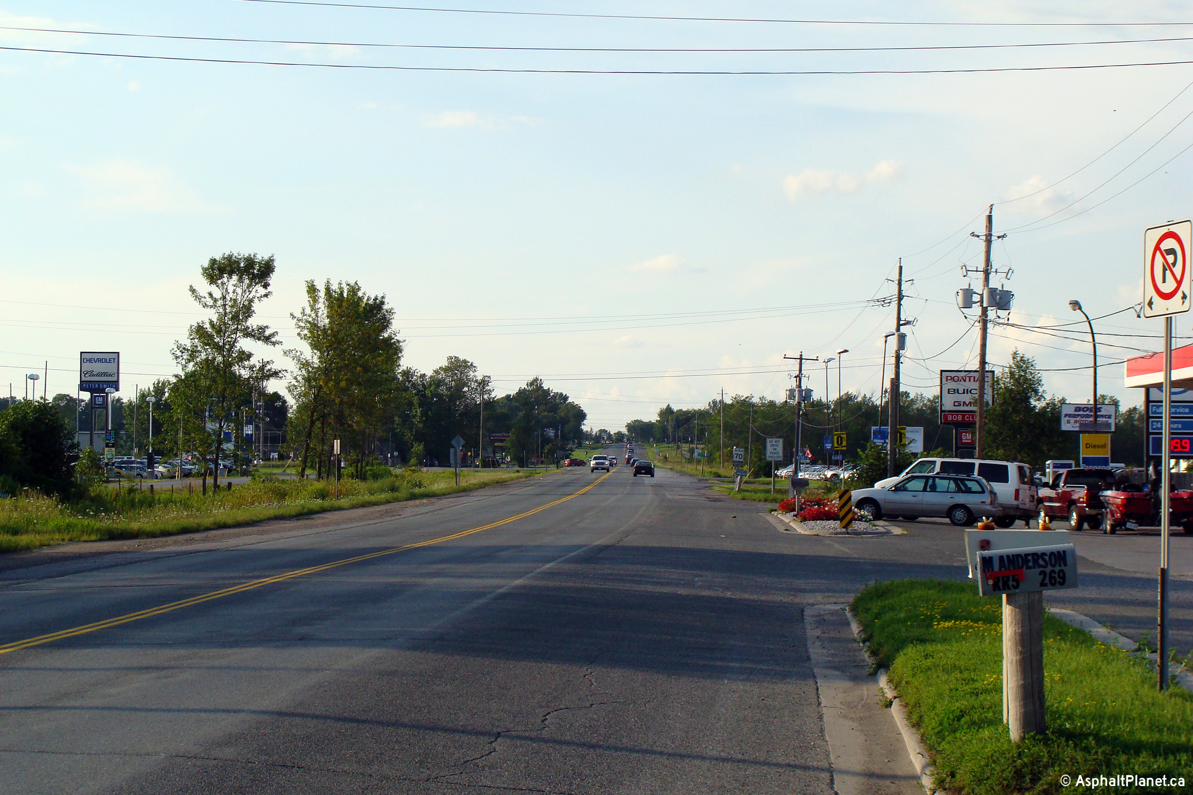
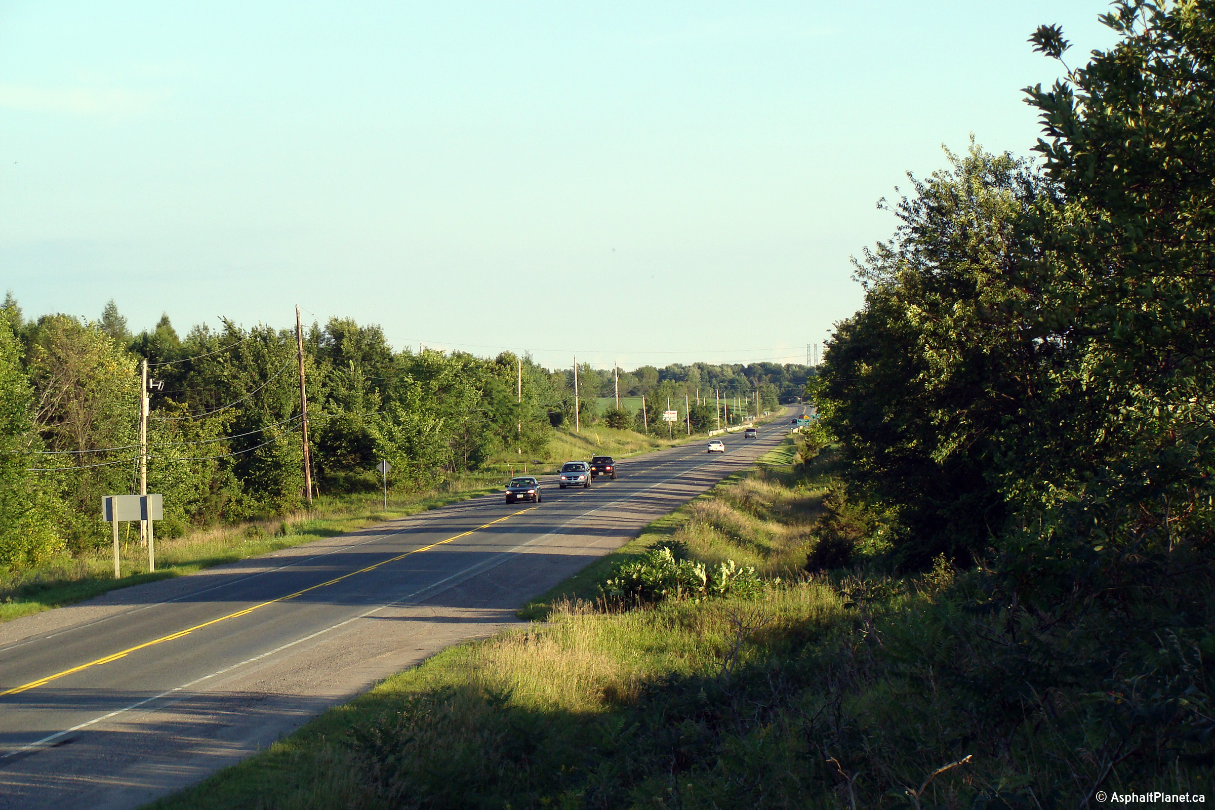
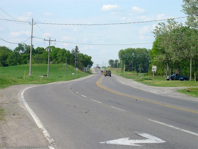
Municipality of Centre Hastings County of Hastings |
Looking south towards Belleville
from the Moira Road junction. Moira Road is part of County Road 8, and
stretches easterly through the south-central part of Hastings County.
Picture taken: June 2nd, 2005. Size: 60kb. |
 |
|
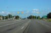
Municipality of Centre Hastings County of Hastings |
Looking north towards Madoc from
the junction of Moira Road. Picture taken: June 2nd, 2005. Size:
55kb. |
 |
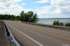
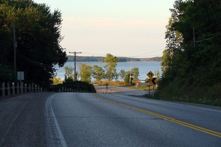
Municipality of Centre Hastings
County of Hastings |
Picturesque view of Moira Lake as
Highway 62 rounds the curves at Moira Lane. This view looks
northerly. Generally, the road between Belleville and Bancroft is not
overly scenic, however this is a noteworthy exception.
Photo taken: August 16th, 2008. |
Low-res
High-res |
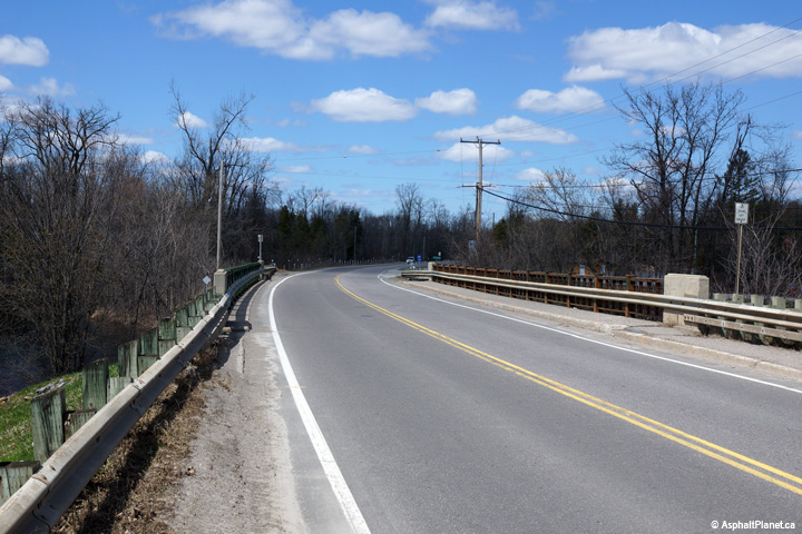
Municipality of Centre Hastings
County of Hastings |
View looking northerly as Highway
62 crosses overtop the structure that carries the highway overtop of the
Moira Lake Narrows.
Photo taken: May 6th, 2014. |
(720x480)
(1440x960)
(2400x1600) |
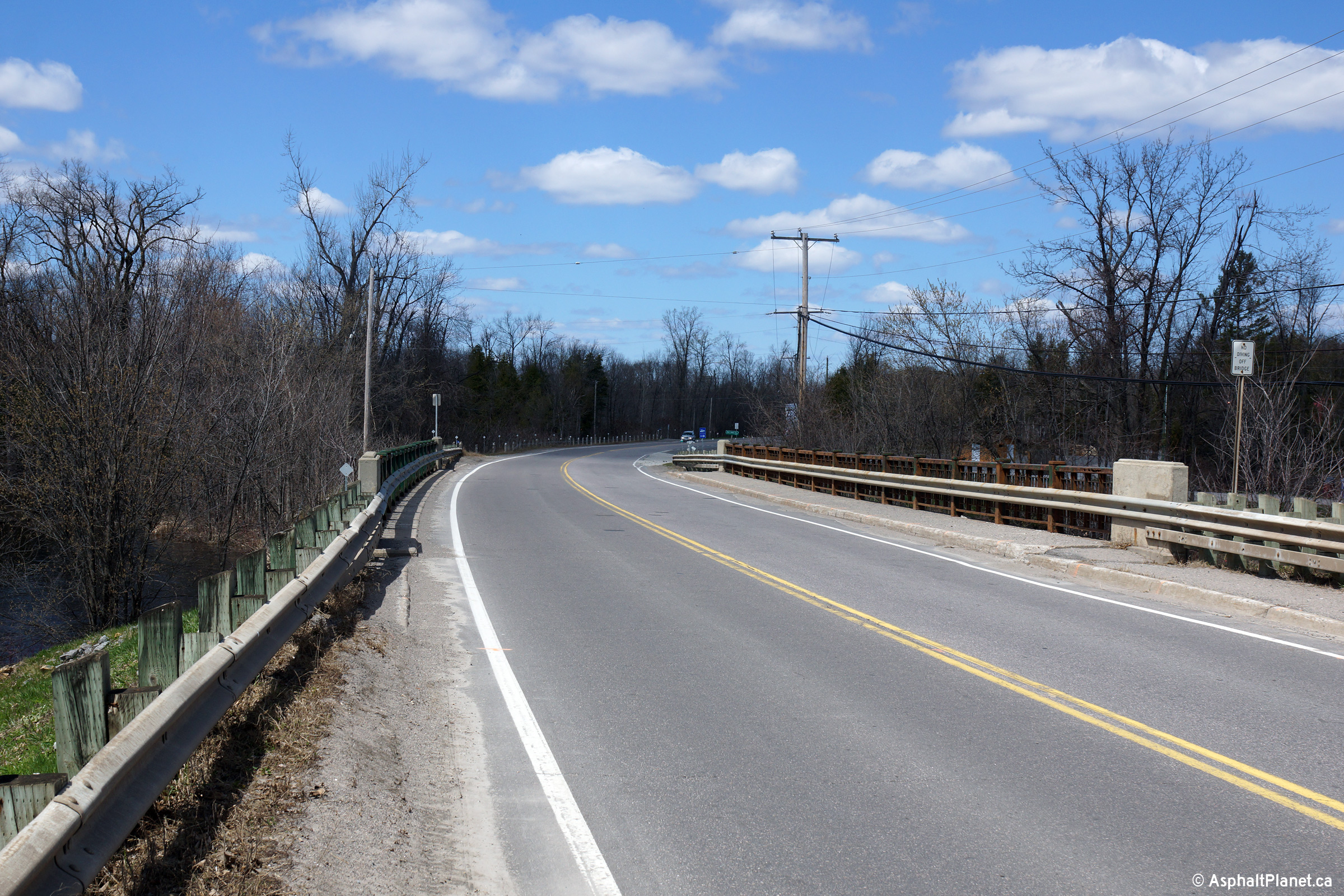
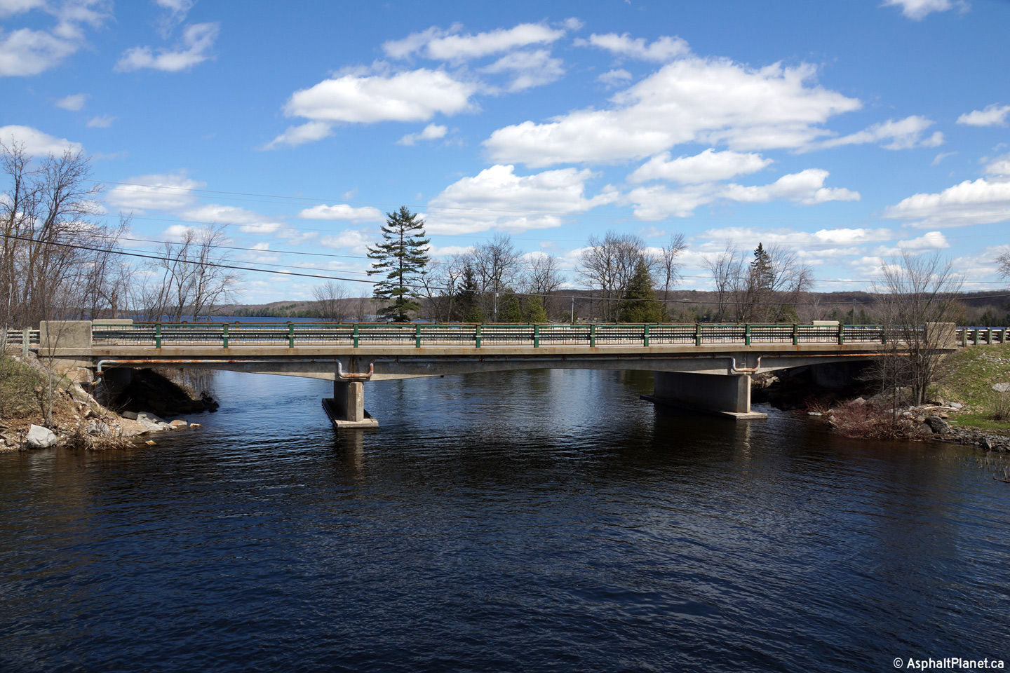
Municipality of Centre Hastings
County of Hastings |
A series of two views of the Moira
Lake Narrows structure. During the Summer of 2015, this structure was
extensively rehabilitated.
Photos taken: May 6th, 2014. |
(720x480)
(1440x960)
(2400x1600)

(720x480)
(1440x960)
(2400x1600) |
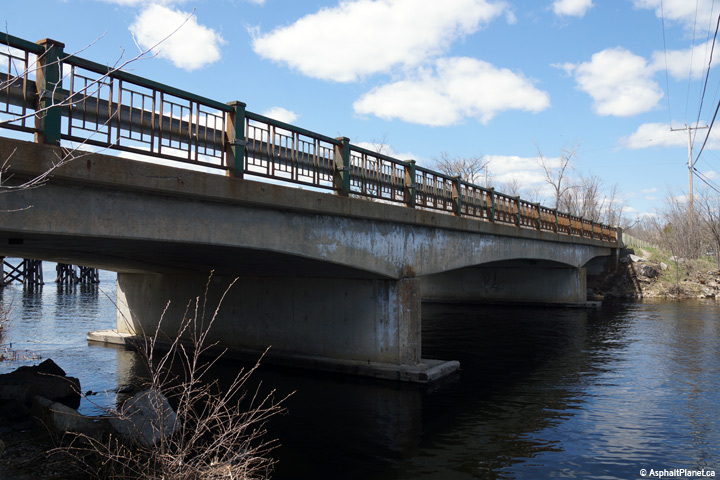
Municipality of Centre Hastings
County of Hastings |
View looking southerly overtop of
the Moira Lake Narrows Structure.
Photo taken: May 6th, 2014. |
(720x480)
(1440x960)
(2400x1600) |
|
Highway 7 forms the Central Ontario Route of the
Trans-Canada Highway between Ottawa and Sunderland. Click
here for Highway 7-East
images, and here for
Highway 7-West images. |
|
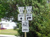
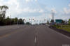
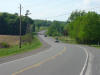
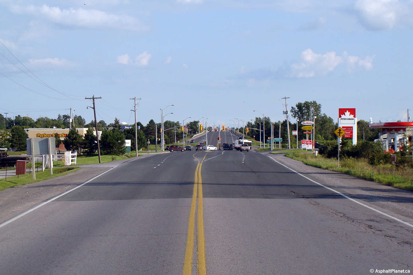
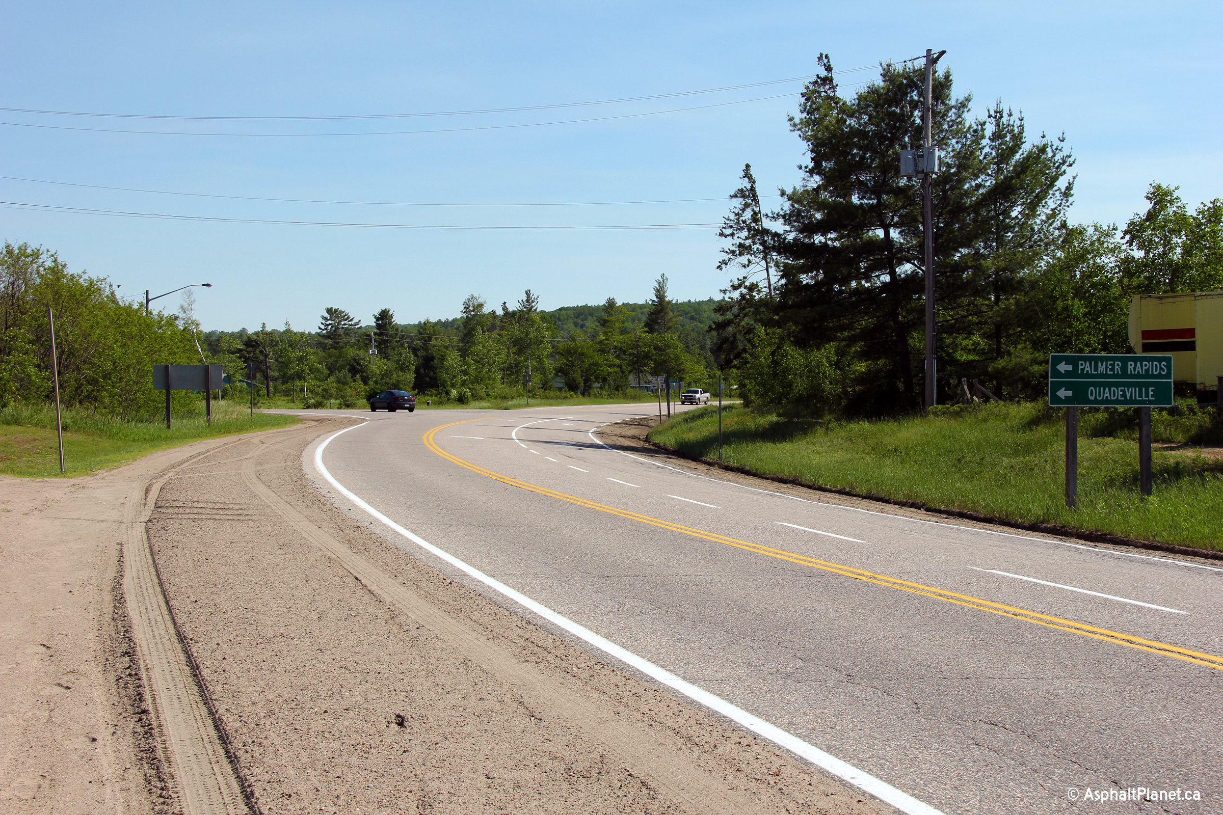
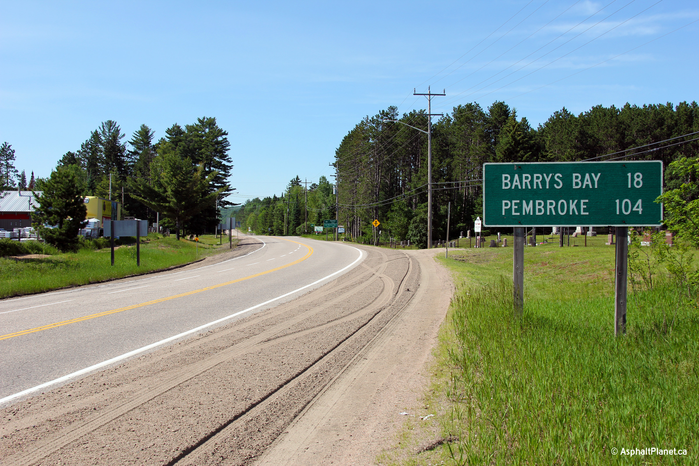
Township of Madoc County of Hastings |
Highway
7/62 junction assembly,
taken looking northbound along Highway 62 at the traffic lights. Madoc
was the southern terminus of Highway 62 for many years. It wasn't
until 1966 that the MTO assumed local roads leading from Madoc to Foxboro.
Picture size: 60kb |
 |
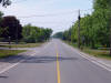
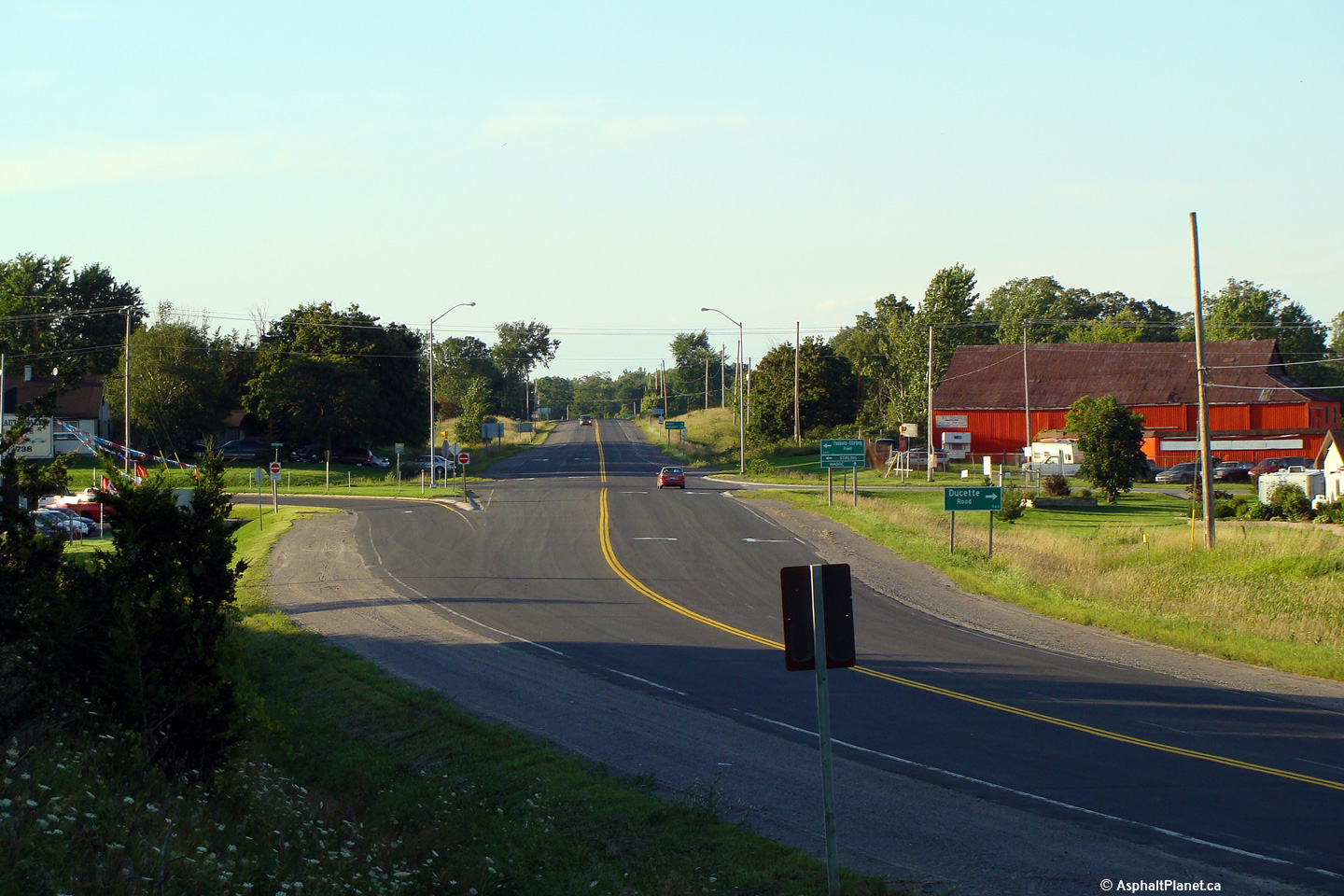
| Township of Madoc County of
Hastings |
Looking south towards Madoc and the Highway 7 junction.
Highway 62 meets Highway 7 at a signalized
intersection just to the north of Madoc. The Highway 7 traffic signal is the only signal
along Highway 62 from suburban Belleville northerly to Bancroft.
Photo taken: September 2nd, 2005. |
(720x480)
(1440x960) |
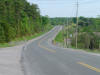
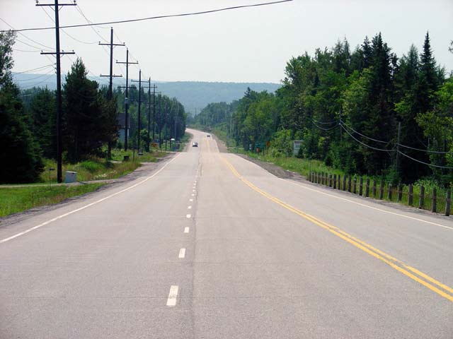
| Township of Madoc County of
Hastings |
Highway 62 looking north from
just north of Highway 7 at Madoc. This is a fairly typical looking
section of Highway 62 between Madoc and Bancroft. This stretch of
Highway 62 makes for one of Ontario's more boring drives. Terrain is
fairly flat and scenery is pretty mundane.
Photo taken: October 23rd, 2004. |
 |
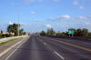
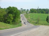
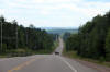
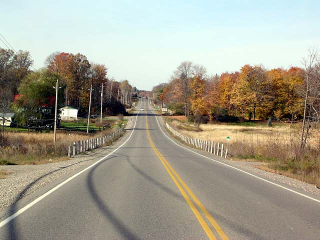
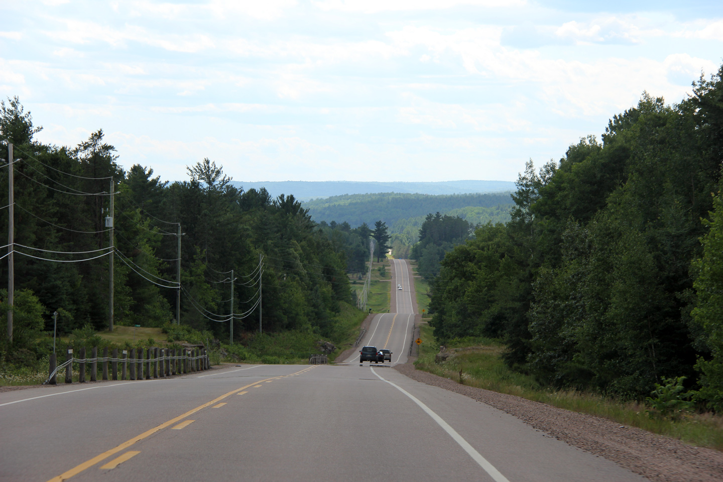
| Municipality of Hastings
Highlands County of Hastings |
Highway 62 looking south from Graphite Road (which is a few kilometres south
of Maynooth). Northbound Highway 62 travelers encounter a long hill
climb en route from Bancroft to Maynooth. This hill is known locally
as 'Selby Hill'. Due to this long grade, Highway 62 has a roughly 3
kilometre long northbound truck climbing lane.
Photo taken: July 17th, 2004. |
 |
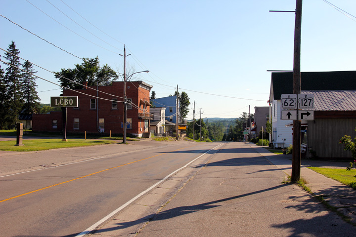
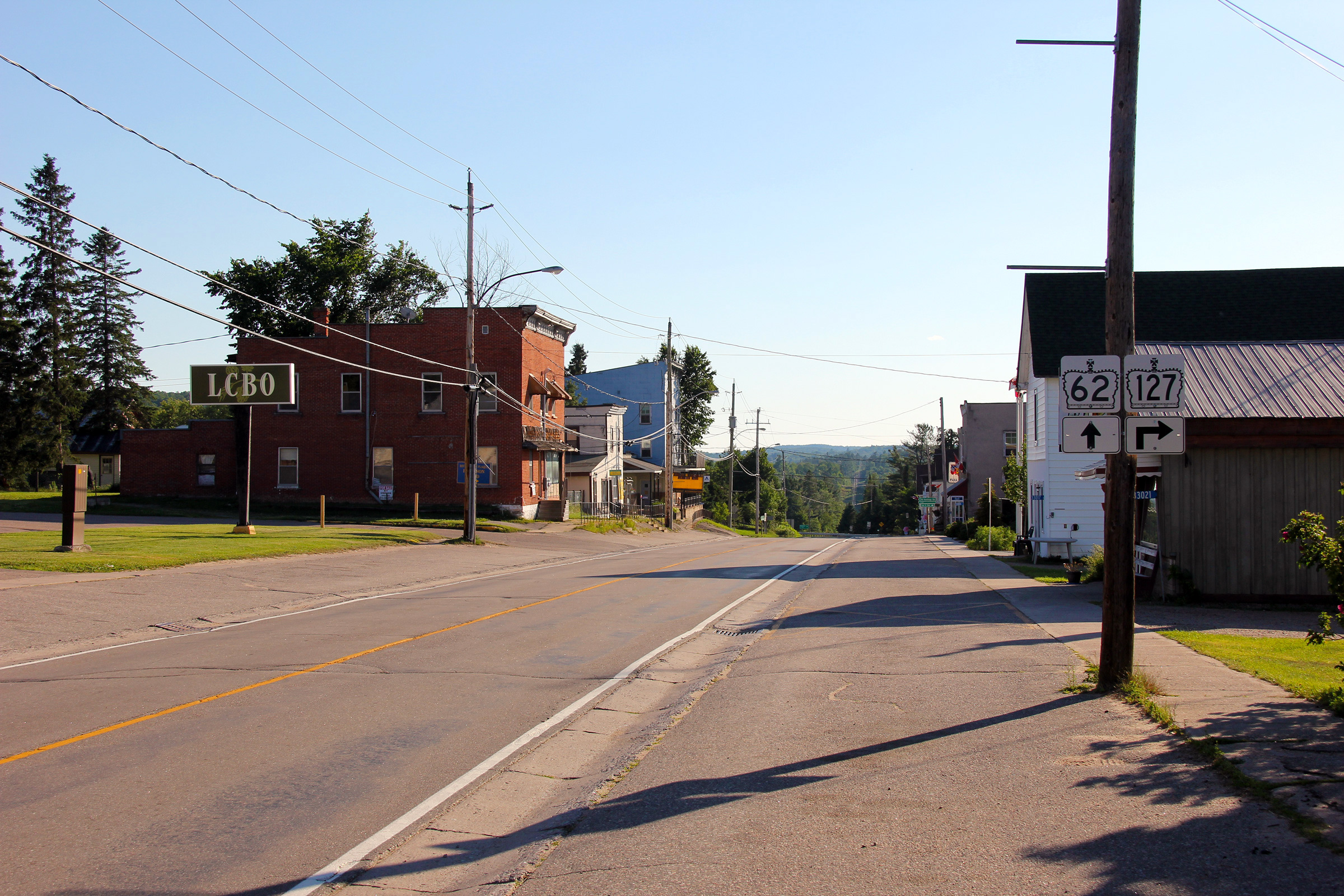
| Municipality of Hastings
Highlands County of Hastings |
Maynooth marks the current (1998)
northern terminus of Highway 62. (The Highway 62 junction in Maynooth
also notably the southern terminus of Highway 127). Picture taken: 50kb |
 |
|
Highway 127 continues northerly from Maynooth through Lake
St. Peter to Highway 60.
Click
here for Highway 127 images. |
| Municipality of Hastings
Highlands County of Hastings |
View looking southerly through Maynooth approaching the Highway 127
junction.
Photo taken: June 30th, 2012. |
(720x480)
(1440x960)
(2400x1600) |
| Municipality of Hastings
Highlands County of Hastings |
Eastbound sign leaving Maynooth advising travelers of the change from
provincial jurisdiction to municipal.
Photo taken: May 7th, 2013. |
 (720x480) (720x480)
(1440x960) |
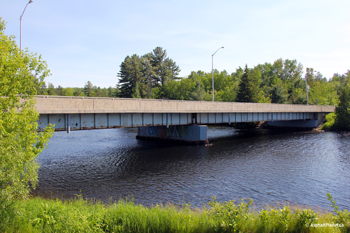
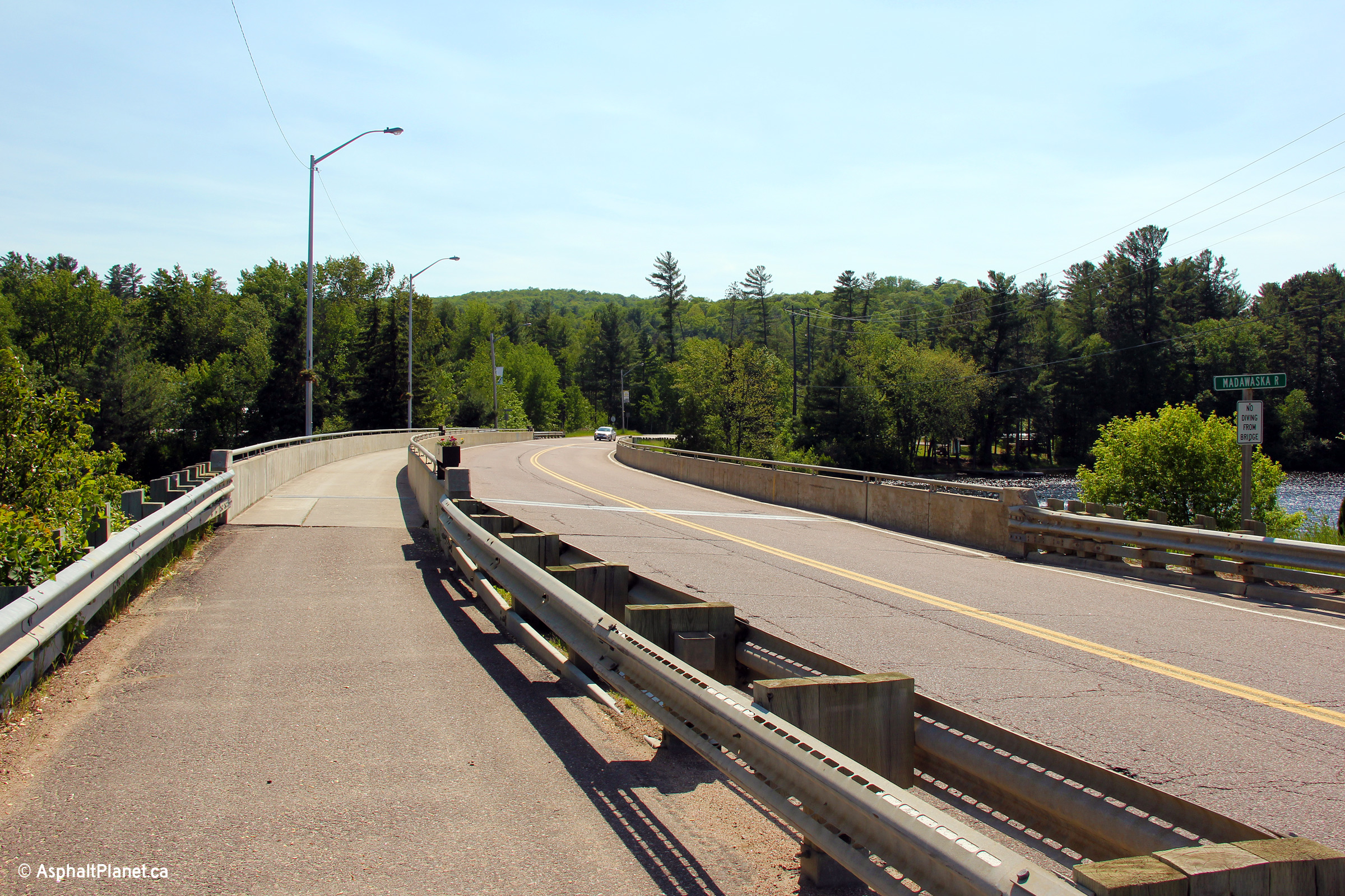
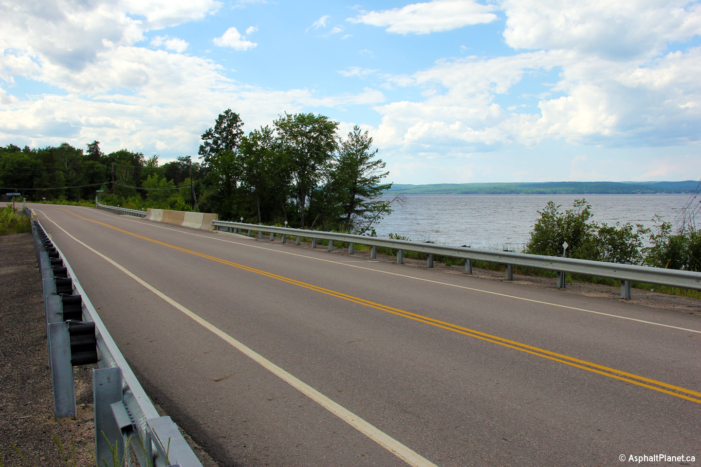
Township of Madawaska Highlands
County of Renfrew |
View looking southeasterly towards the Madawaska River Bridge. The
Madawaska River is one of eastern Ontario's principle drainage conduits.
Photo taken: June 14th, 2013. |
(720x480)
(1440x960)
(2400x1600) |
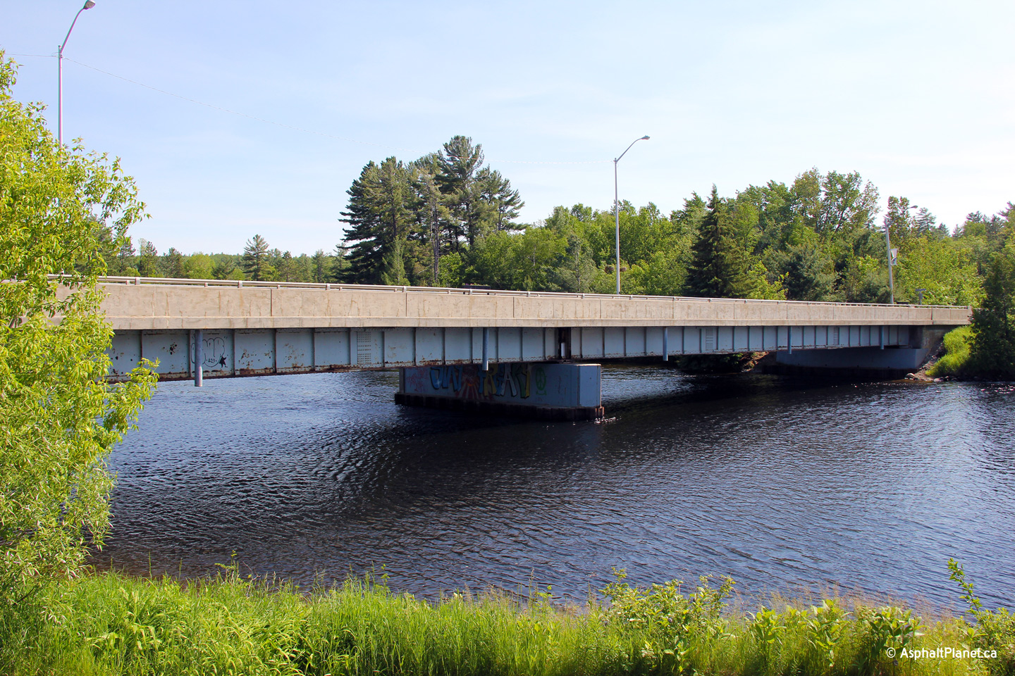
Township of Madawaska Highlands
County of Renfrew |
Deck view of the Madawaska River bridge along Highway 62 facing southerly.
It is uncommon in Ontario for the sidewalk to be partitioned from the
driving surface by a concrete parapet as it has been on this structure.
Photo taken: June 14th, 2013. |
(720x480)
(1440x960)
(2400x1600) |
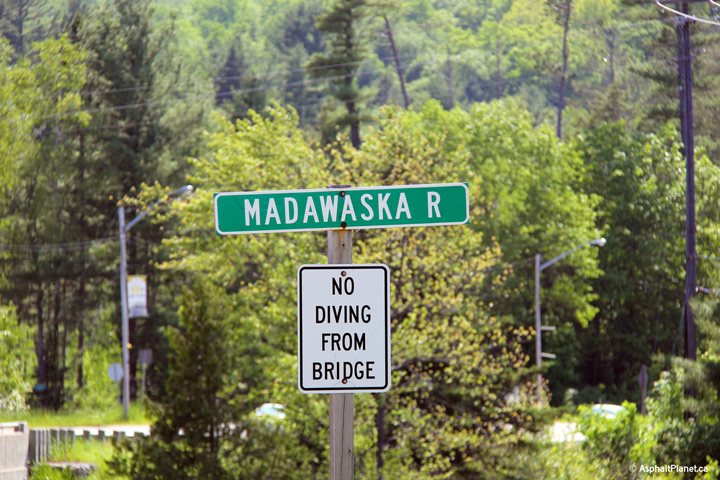
Township of Madawaska Highlands
County of Renfrew |
Close-up view of the southbound sign for the Madawaska River bridge
crossing.
Photo taken: June 14th, 2013. |
 (720x480) (720x480)
(1440x960) |
Township of Madawaska Highlands
County of Renfrew |
Southerly view approaching the Highway 515 junction.
Photo taken: June 14th, 2013. |
(720x480)
(1440x960)
(2400x1600) |
Township of Madawaska Highlands
County of Renfrew |
Distance sign located just north of the Highway 515 junction along Highway
62.
Photo taken: June 14th, 2013. |

(720x480)
(1440x960)
(2400x1600) |
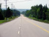
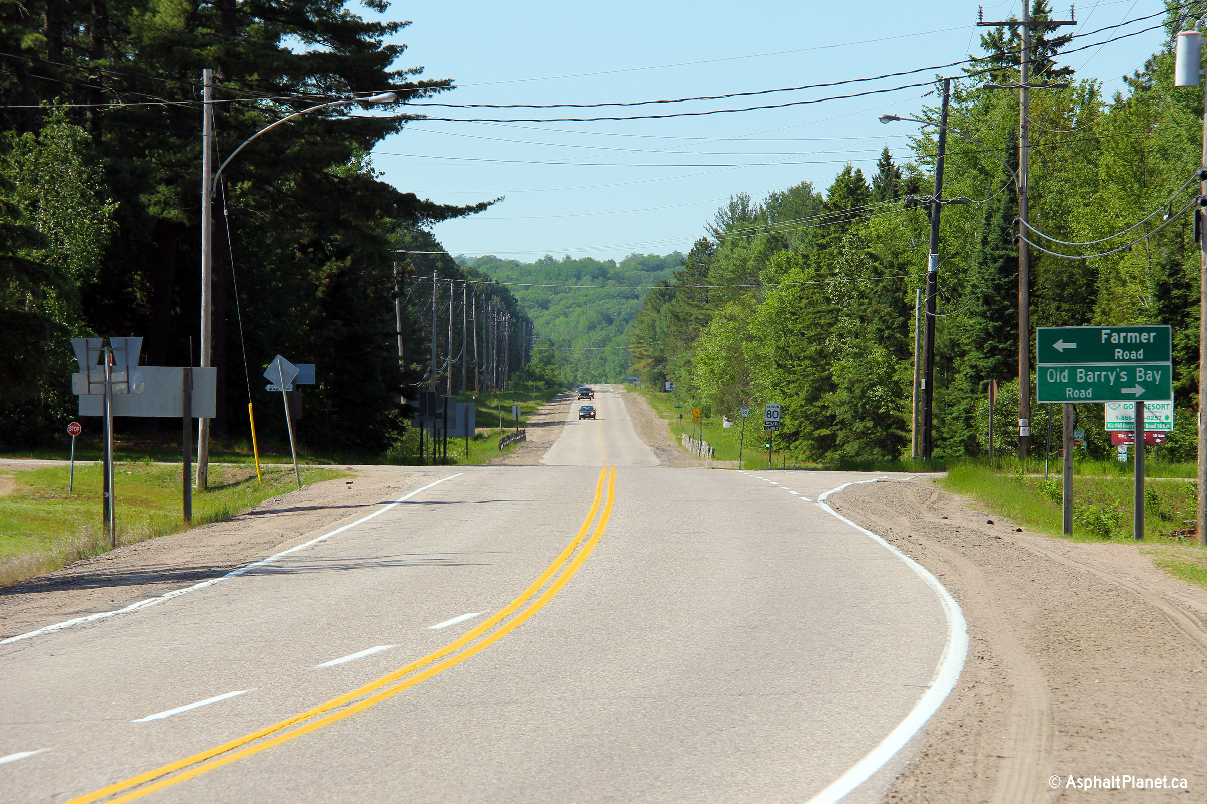
Township of Madawaska Highlands
County of Renfrew |
View looking northerly from Combermere towards one of the few straight
portions of Highway 62 between Bancroft and Barry's Bay.
Photo taken: June 14th, 2013. |

(720x480)
(1440x960)
(2400x1600) |
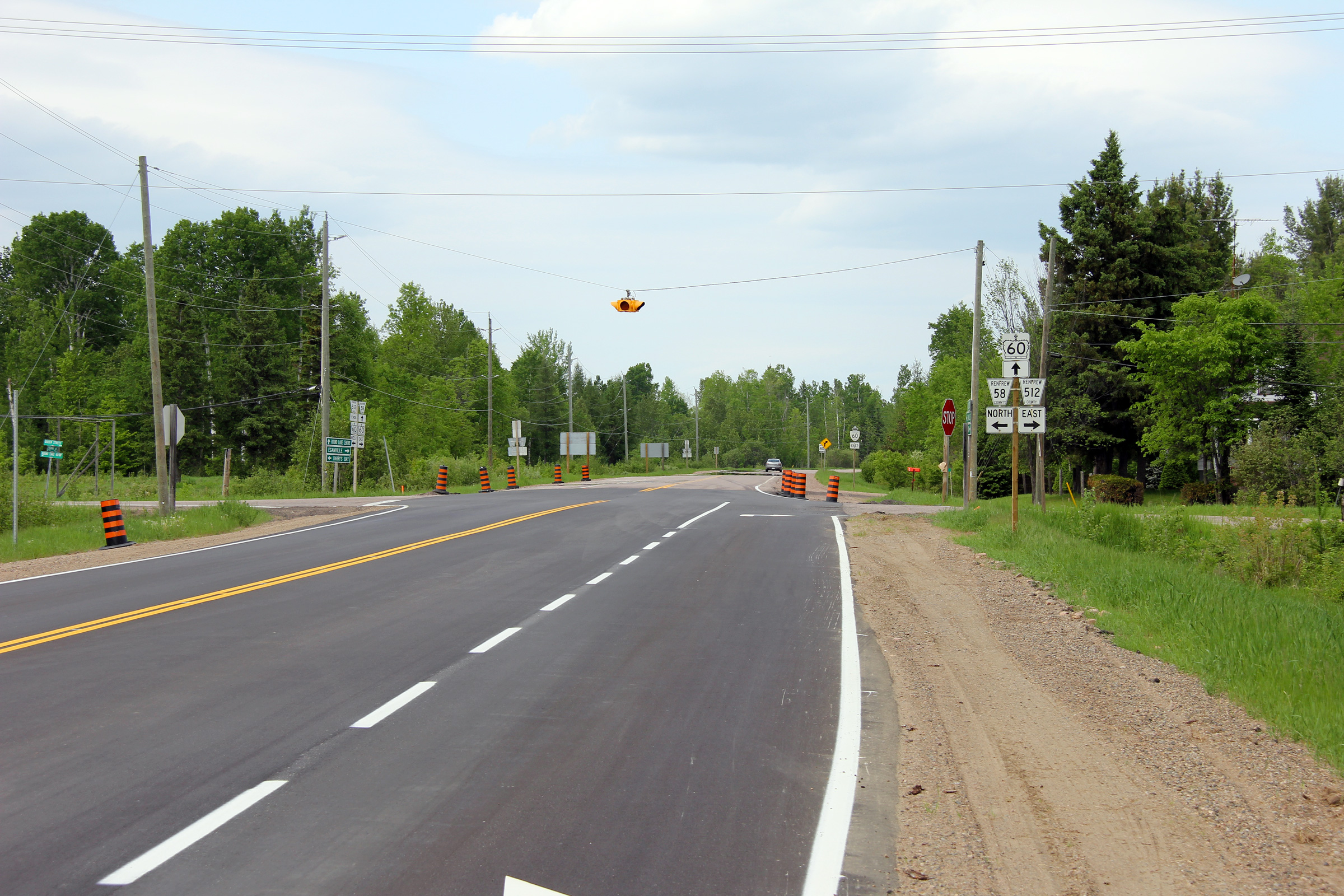
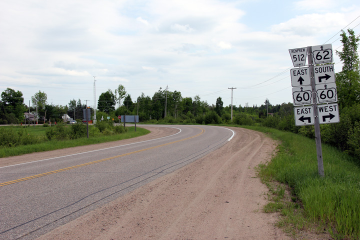
Township of Killaloe, Hagarty and
Richards
County of Renfrew |
View looking westerly along Highway 60/62 from the eastern Highway 60
junction at Highway 512. Before Highway 62 was transferred to local
municipalities north of Maynooth, the pictured reassurance marker indicating the
road solely as Highway 60 would have included a Highway 62 marker as well.
Photo taken: May 30th, 2011. |
(720x480)
(1440x960)
(2400x1600) |
Township of Killaloe, Hagarty and
Richards
County of Renfrew |
View looking westerly towards the eastern Highway 60/62 junction.
Northbound Highway 62 traffic must turn to the left at this intersection,
while traffic continuing easterly follows the through road.
Photo taken: May 30th, 2011. |
(720x480)
(1440x960)
(2400x1600) |
|
Highway 60 continues easterly from Killaloe bound for
Eganville and finally Highway 17 at Renfrew.
Click
here for Highway 60-East images. |
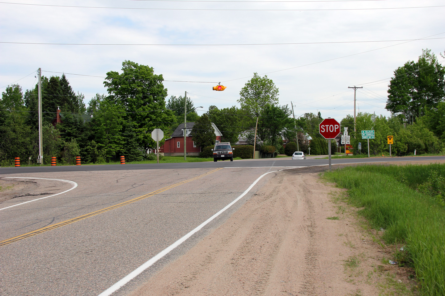
Township of Killaloe, Hagarty and
Richards
County of Renfrew |
Southerly view at Highway 60. This junction is very unassuming for the
intersection of two King's Highways. The simplicity of this junction probably speaks to Highway
62's relative unimportance through Renfrew County. Highway 62 has an
indirect alignment around Round Lake.
Photo taken: May 30th, 2011. |

(720x480)
(1440x960)
(2400x1600) |
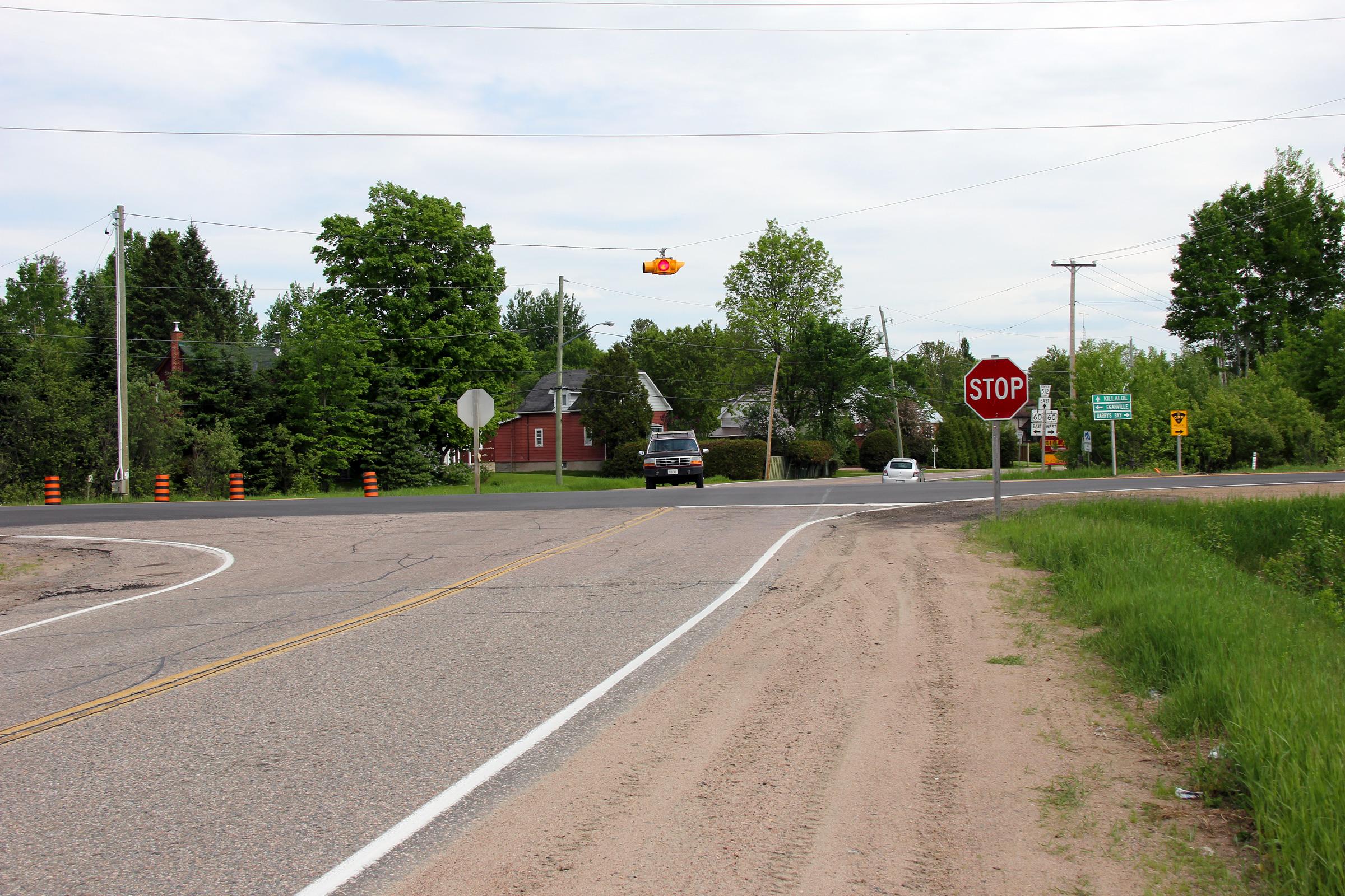
Township of Killaloe, Hagarty and
Richards
County of Renfrew |
Southbound junction assembly approaching the Highway 60 junction. This
is the only signage evidence that remains of the former Highway 60/62
multiplex between Barry's Bay and Killaloe.
Photo taken: May 30th, 2011. |
(720x480)
(1440x960)
(2400x1600) |
Township of Killaloe, Hagarty and
Richards
County of Renfrew |
Northerly view along Highway 62 as it runs along the southern portion of
Round Lake, immediately east of the community of Round Lake.
Photo taken: June 30th, 2012. |
(720x480)
(1440x960)
(2400x1600) |
Township of Laurentian Valley
County of Renfrew |
Southerly view along Highway 62 from about 3km south of the Pembroke
By-pass. The high hills of the Bonnechere River highlands dominate the
horizon line.
Photo taken: June 30th, 2012. |
(720x480)
(1440x960)
(2400x1600) |
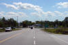
Township of Laurentian Valley
County of Renfrew |
Northerly view along Highway 62 approaching the Highway 17 junction at the
Pembroke By-pass.
Photo taken: June 30th, 2012. |
(720x480)
(1440x960)
(2400x1600) |
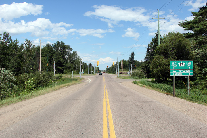
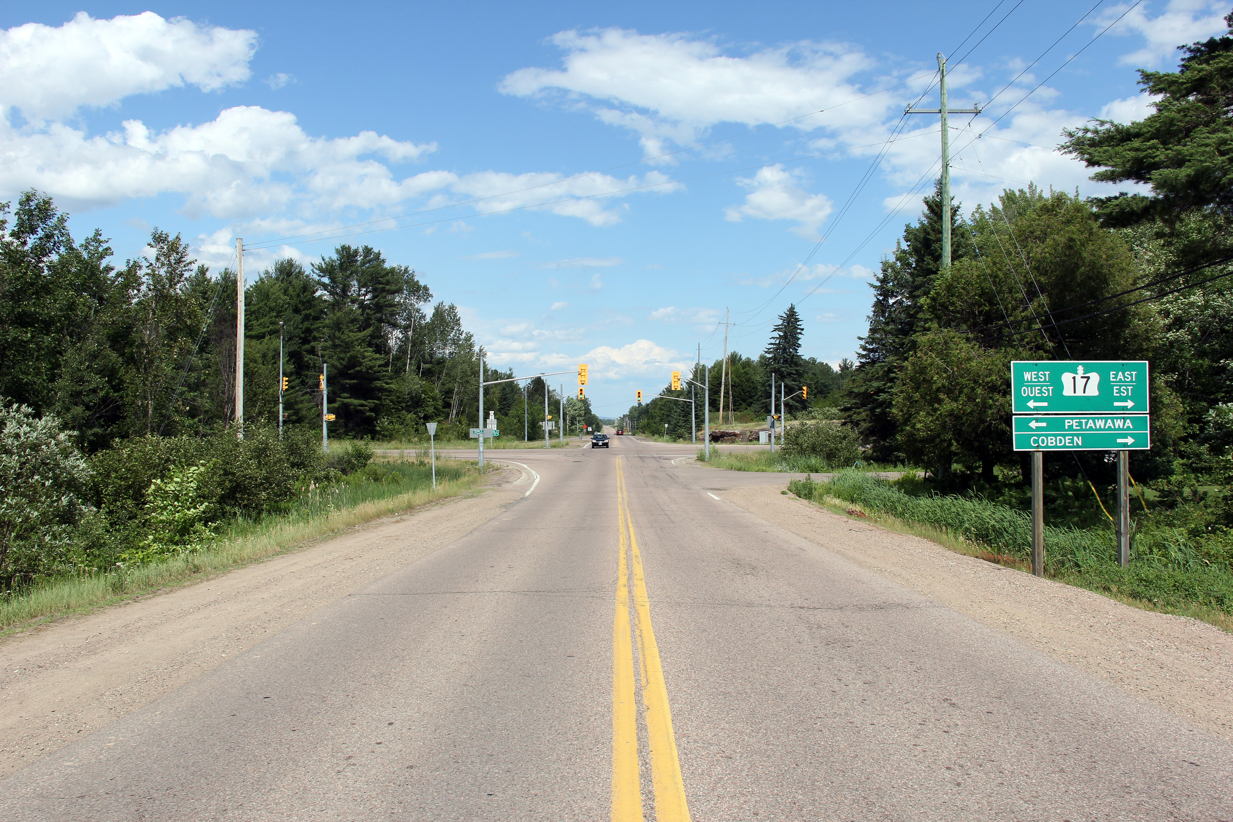
|
Highway 62 ends at the Highway 17 and Highway 148
junction just west of Pembroke. Click
here
for Highway 17 images and here for Highway
148 images. |


 (720x480)
 (720x480)
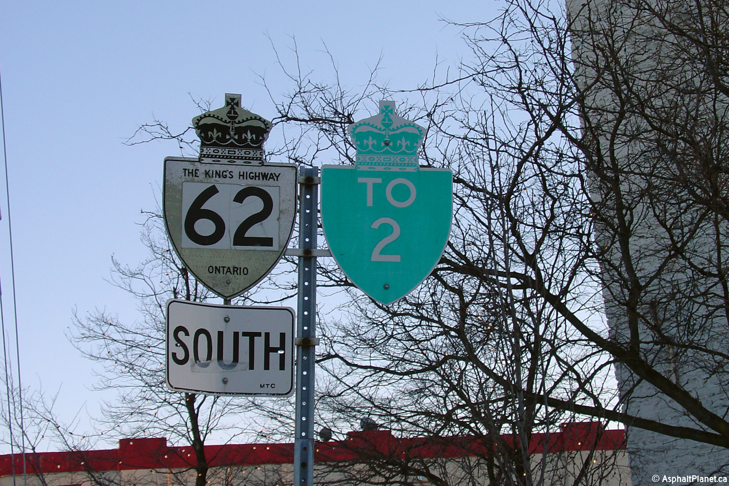
 (720x480)
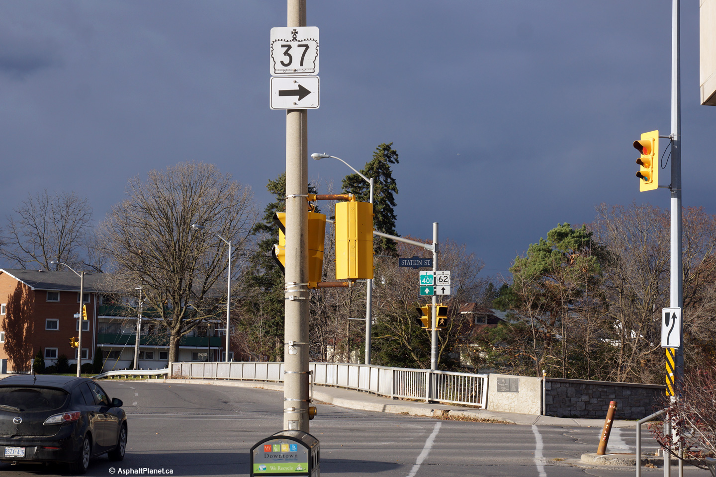
 (720x480)
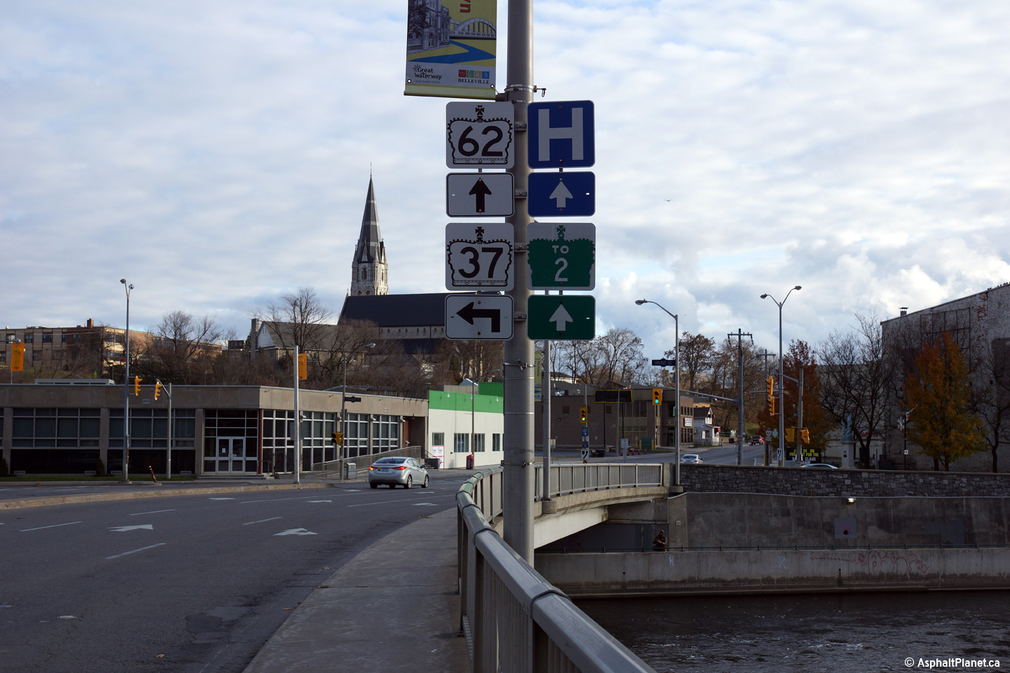


 (720x480)
 (720x480)


 (720x480)
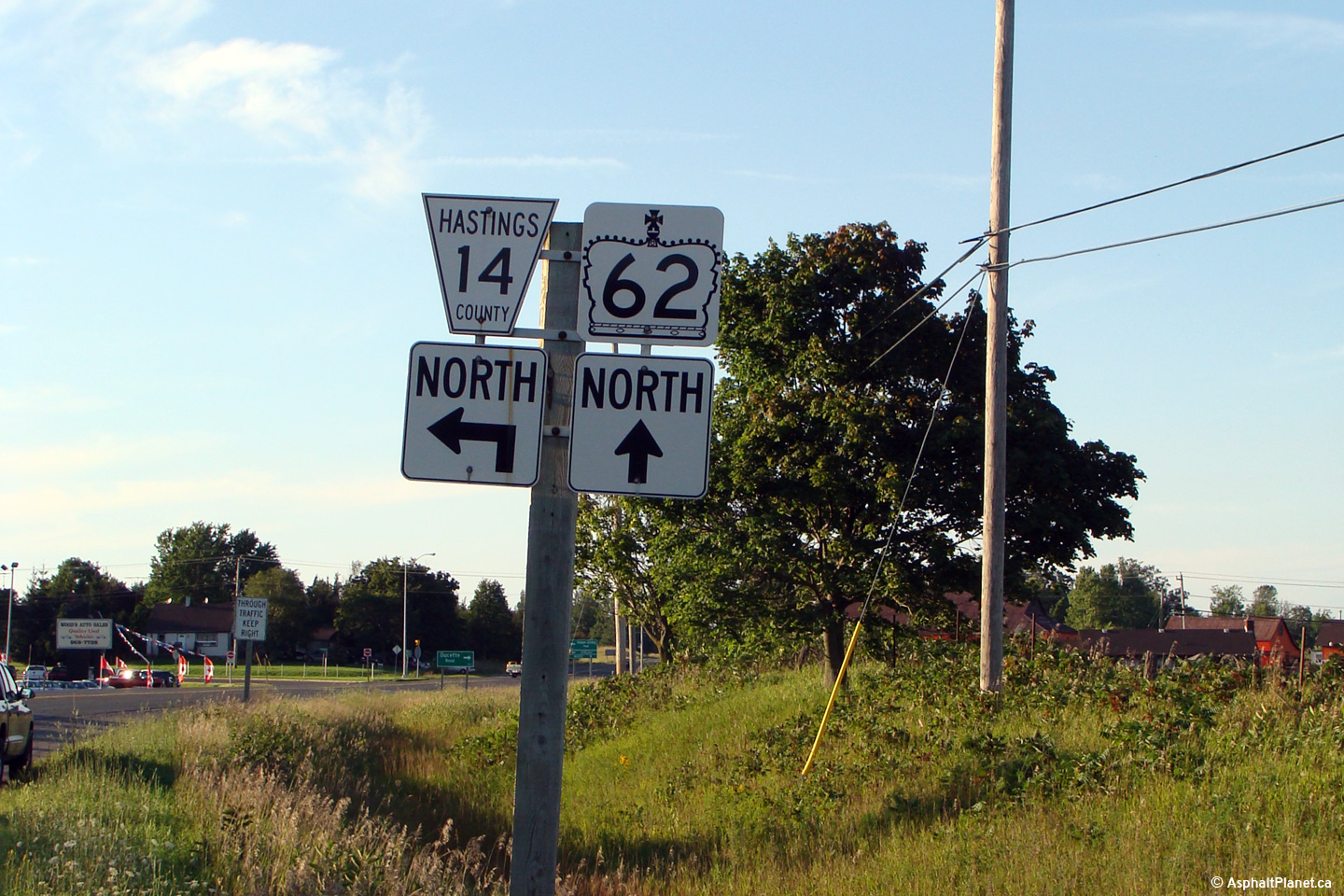

 (720x480)


 (720x480)

 (720x480)


