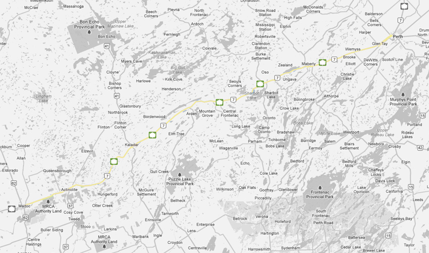
AsphaltPlanet.ca > OntHighways > Highway 7 > Images > Page 3C
King's Highway 7 - Images
<- Page 3B Page 3C - Madoc to Perth Page 3D->
Photos shown in this table are arranged from West to East:
| Proper Municipality Name | Photo Description | Photo | |
|
Photos taken from driver's perspective appear offset from centre-line Photos: |
East- Bound |
West- Bound |
|
| Peterborough to Madoc Images available here | |||
| Highway 62 is one of Eastern Ontario's longest and most notable highways -- stretching from Bloomfield northeasterly to Pembroke. Click here for Highway 62 images. | |||
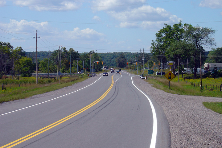
| Township of Madoc County of Hastings |
Looking west along Highway 7 towards the signalized intersection with
Highway 62. Traffic signals were added
at this intersection in the summer of 2003, as part of a larger project that
saw Highway 7 entirely reconstructed from west of Madoc to just east of
Highway 37. Photo taken: September 2nd, 2005. |
 |
|
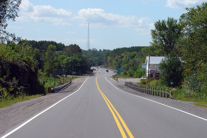
| Township of Madoc County of Hastings |
Looking east along Highway 7 towards the eastern junction of St. Lawrence
Street. Notice the offset left turn lanes at the St. Lawrence Street
intersection. This type of intersection design was quite common in the
past, but has generally been phased out in recent reconstructions. Photo taken: September 2nd, 2005. |
 |
|
| Township of Madoc County of Hastings |
Looking west towards the eastern junction of St. Lawrence Street.
Before September 1967 Highway 7 would have curved to the left following St.
Lawrence Street in Downtown Madoc. The Madoc by-pass was constructed
as part of a larger series of contracts which saw the Trans-Canada Highway
upgraded throughout Central Ontario. Photo taken: September 2nd, 2005. |
||
| Township of Madoc County of Hastings |
Looking east from the Harts Road intersection. Harts Road is located
about 1km east of the St. Lawrence Street intersection in Madoc. Photo taken: September 2nd, 2005. |
 |
|
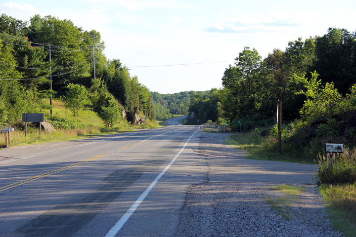
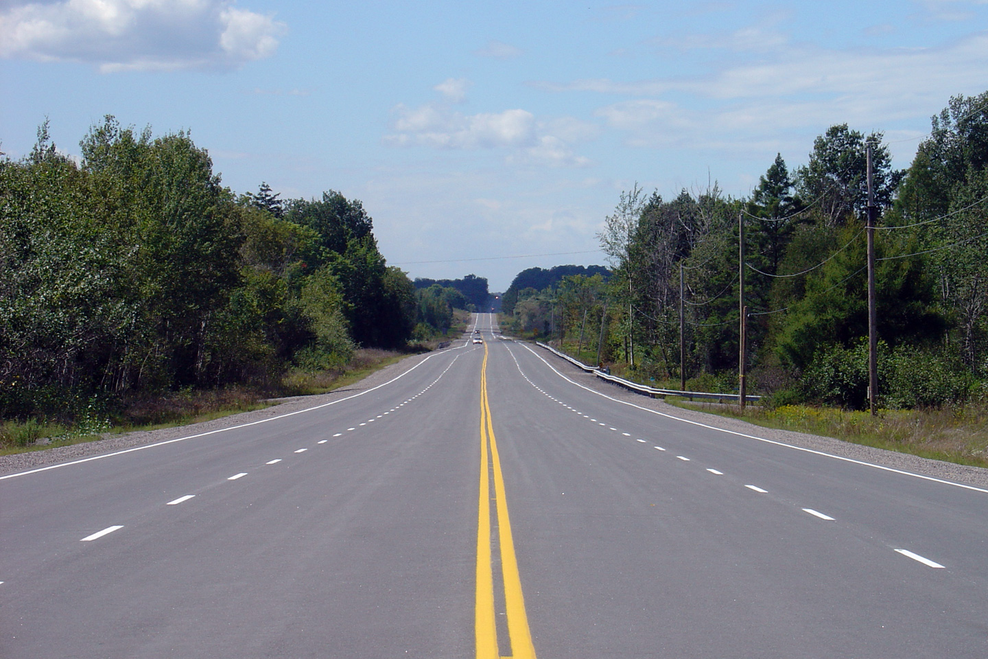
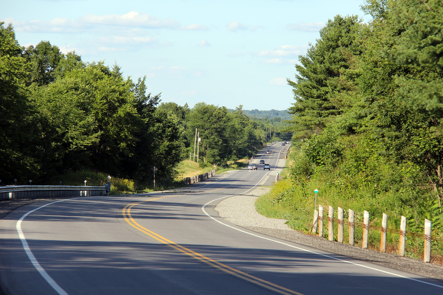
| Township of Madoc County of Hastings |
There is a brief four lane segment along Highway 7 east of Madoc where two
opposing passing lanes run concurrent with one another. Photo taken: September 2nd, 2005. |
 |
|
| Highway 62 is one of Eastern Ontario's longest and most notable highways -- stretching from Bloomfield northeasterly to Pembroke. Click here for Highway 37 images. | |||
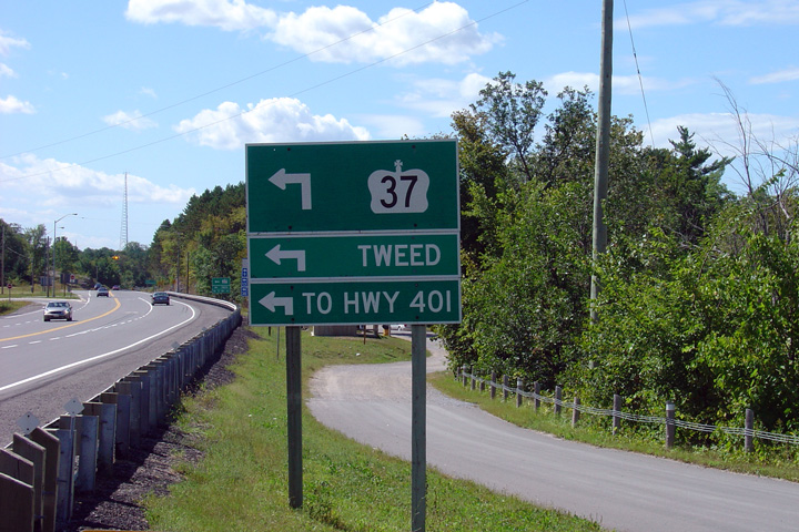
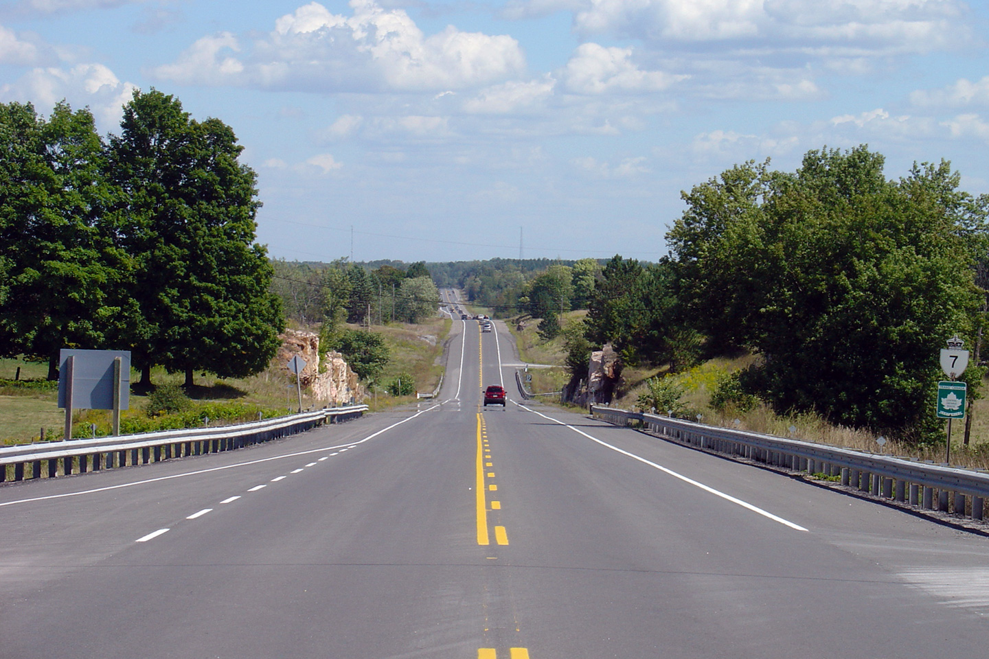
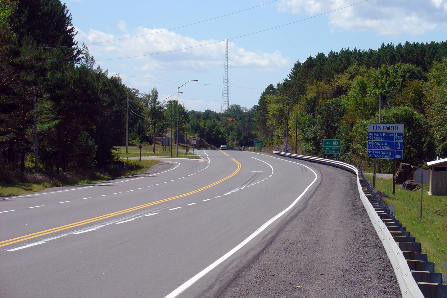
| Municipality of Tweed County of Hastings |
Looking east along Highway 7 towards the junction with
Highway 37 at Actinolite. The
Highway 37 junction is located roughly
84.5km east of Highway 115 in Peterborough,
and roughly 152.7km west of the highway's eastern terminus in Ottawa Photo taken: September 2nd, 2005. |
 |
|
| Municipality of Tweed County of Hastings |
Westbound advanced signage for the Highway 37 intersection. Highway 37
heads southeast from Highway 7 towards Tweed and Belleville. As well as
serving the area residents, Highway 37 is a useful short-cut
route between Ottawa and Toronto. Photo taken: September 2nd, 2005. |
 (720x480) (720x480)(1440x960) |
|
| Municipality of Tweed County of Hastings |
This photo provides a broader view of the
Highway 37 intersection, again looking west.
This photo is taken from the Flinton Road intersection. There is a
small picnic area immediately to the north of Highway 7 at the Highway 37
junction. Photo taken: September 2nd, 2005. |
 |
|
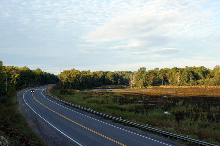
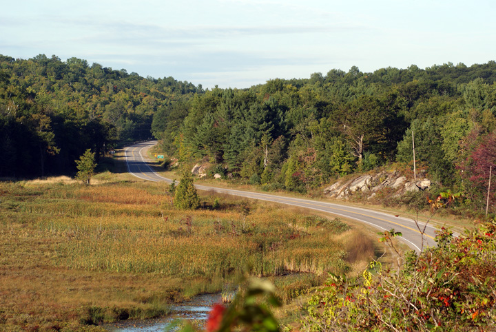
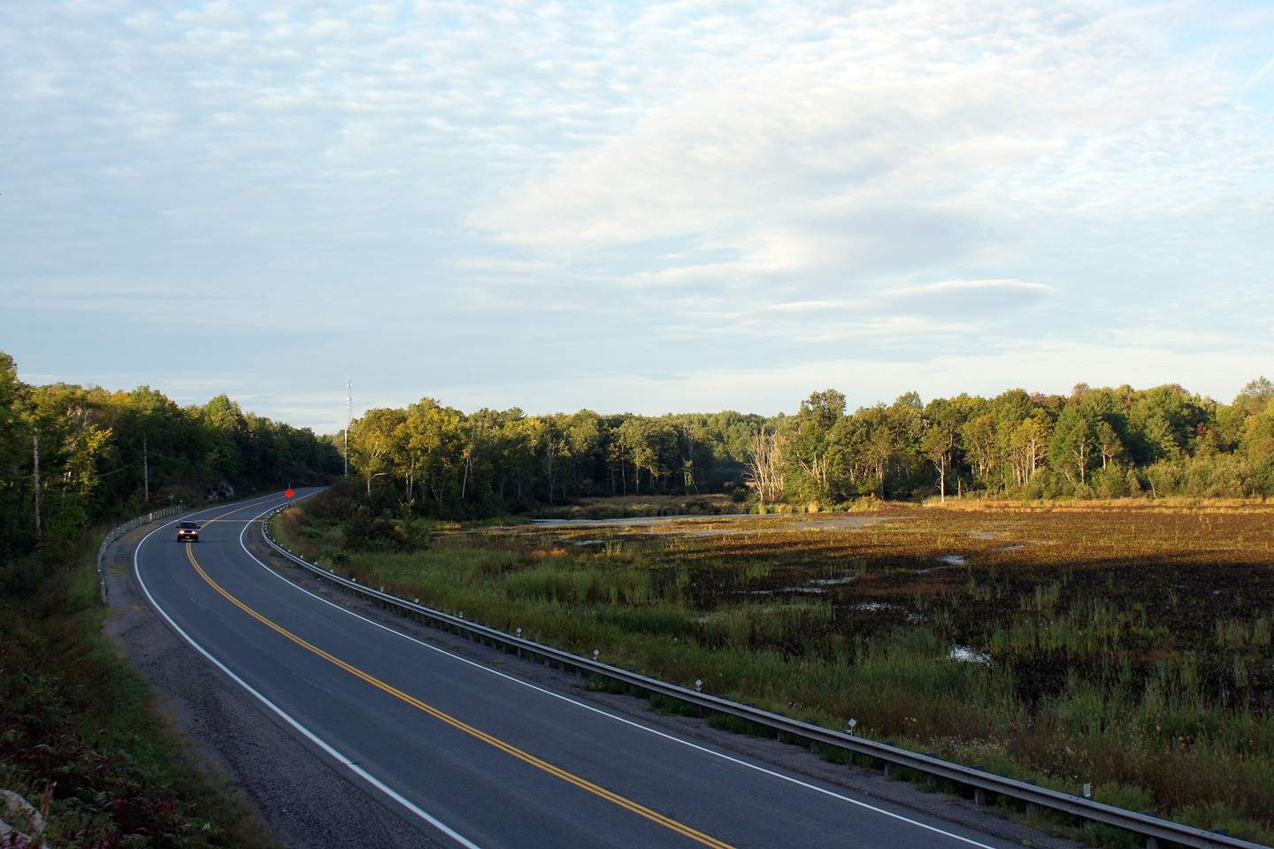
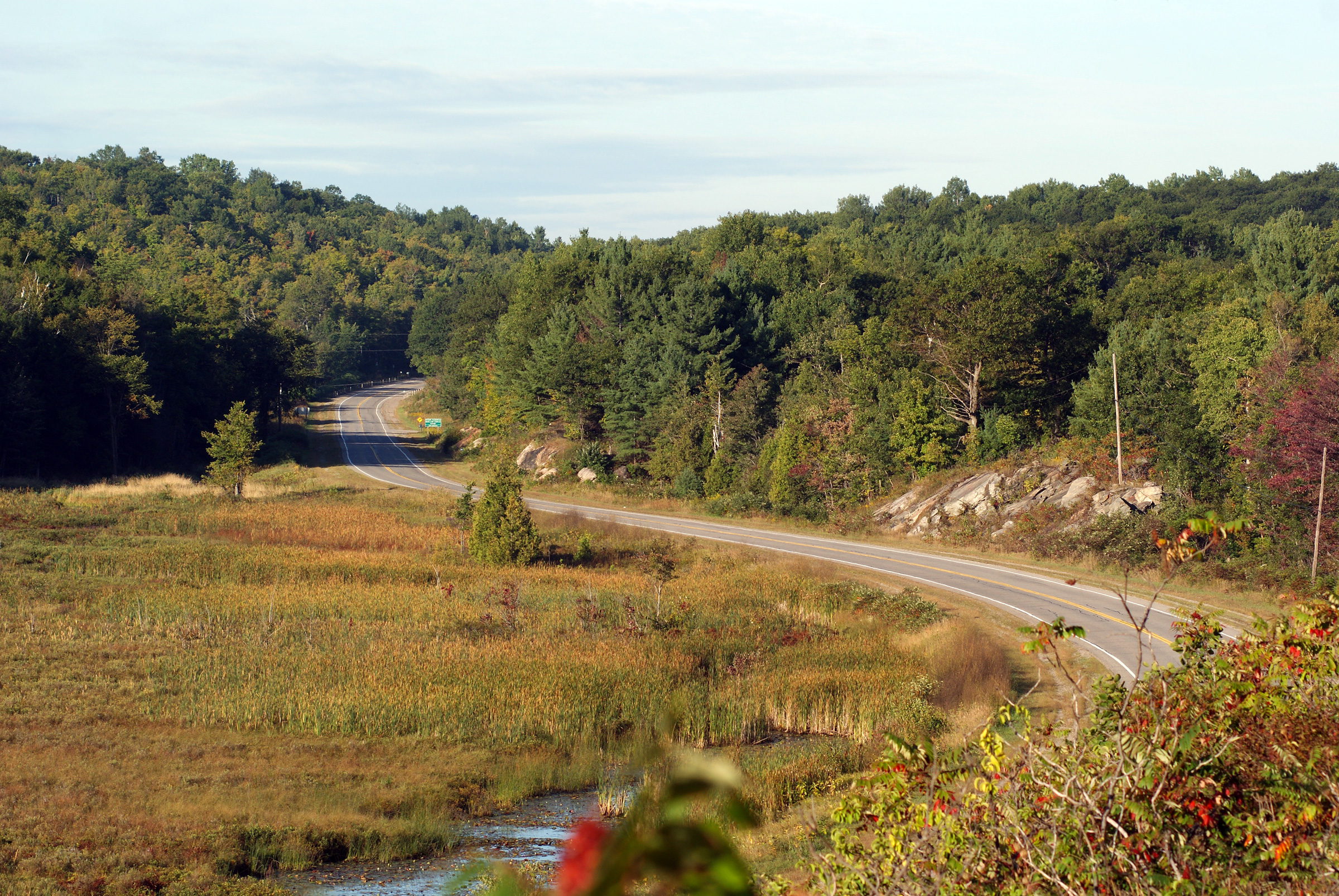
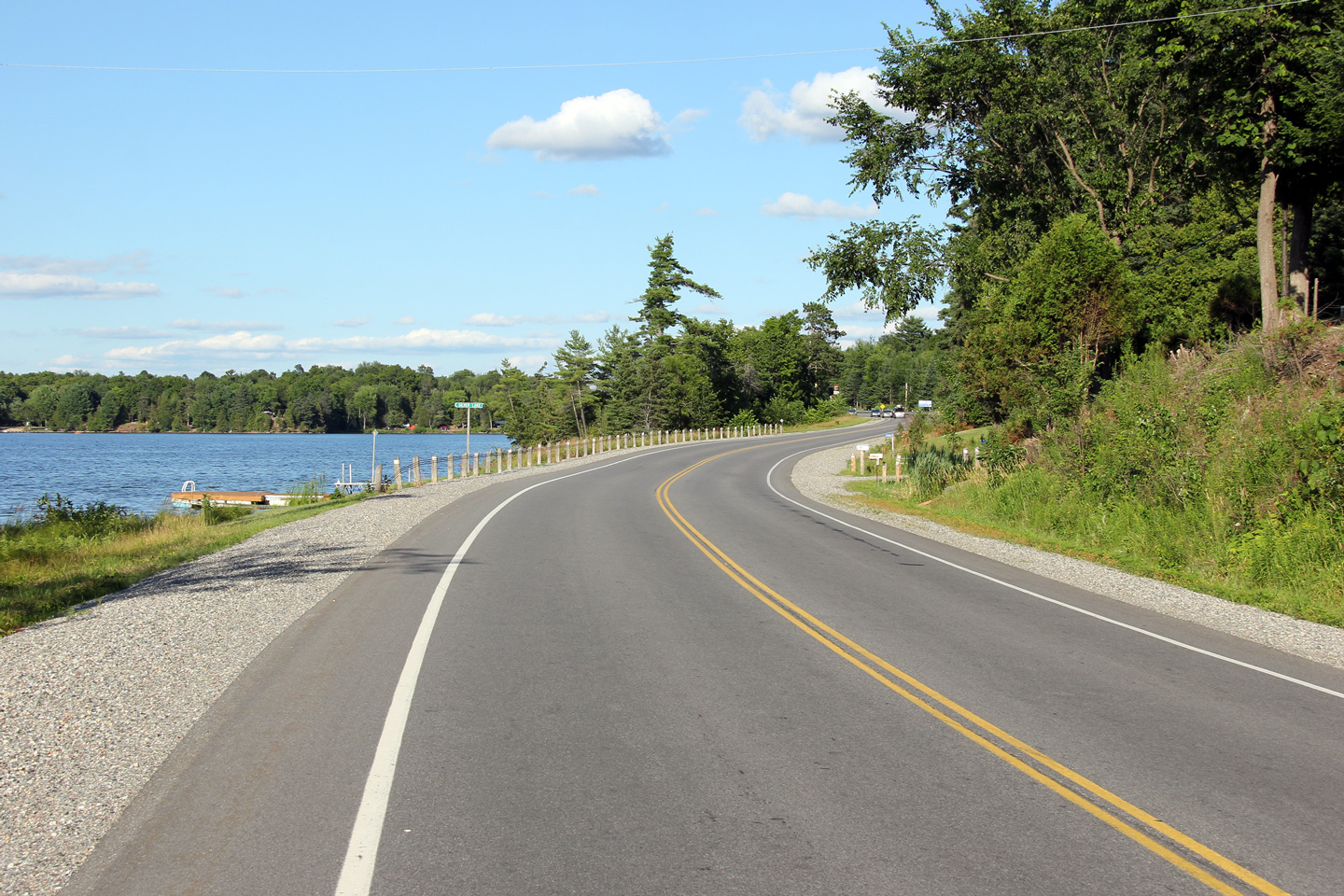
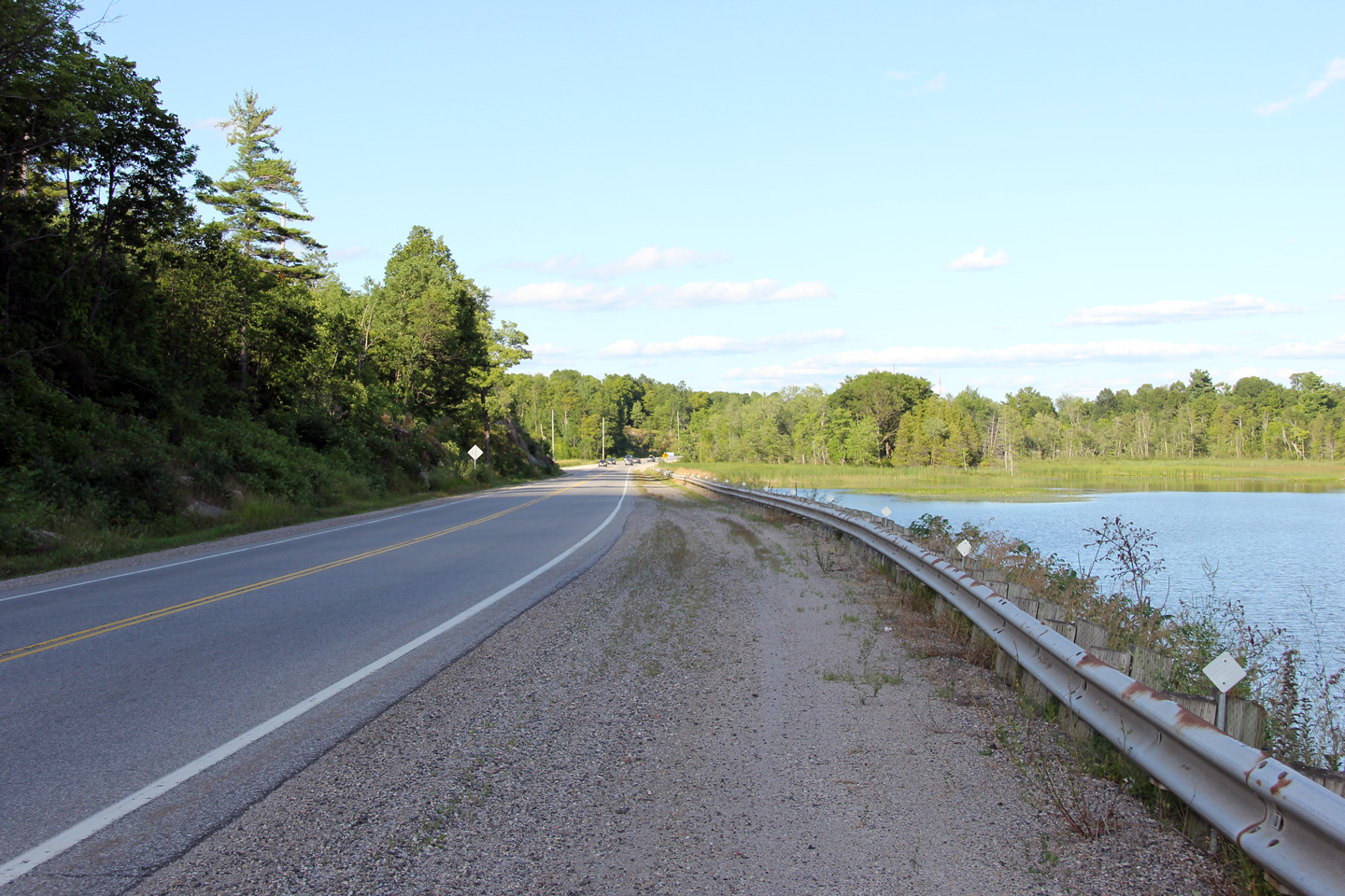
| Township of Addington Highlands County of Lennox & Addington |
Westerly view as Highway 7 runs along the southern side of a small marsh
about halfway between Actinolite and Kaladar. Highway 7 passes
adjacent to several small marshes where it runs through Addington County. Photo taken: September 12th, 2009. |
 |
|
| Township of Addington Highlands County of Lennox & Addington |
Opposing view (looking easterly) from the same vantage point as the previous
photo. Photo taken: September 12th, 2009. |
 |
|
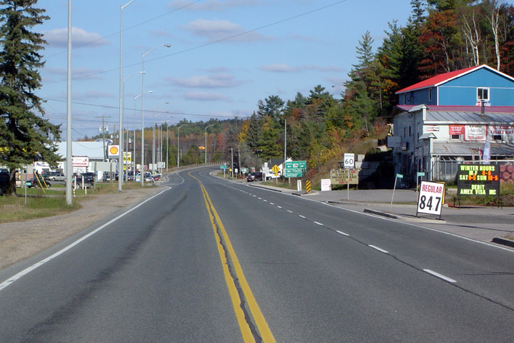
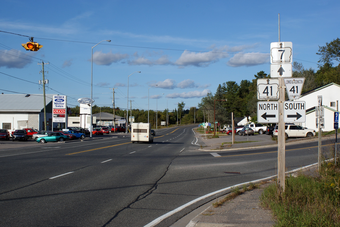
| Township of Addington Highlands County of Lennox & Addington |
Highway 7 looking east through Kaladar. Kaladar is small community
located at the junction of Highway 7 and 41, which is about 131km west
of Highway 417 in Ottawa. Photo taken: October 23rd, 2004. |
 |
|
| Township of Addington Highlands County of Lennox & Addington |
A close up on the Highway 41 medium green sign that is located heading
eastbound in Kaladar. Even though Highway 41 was decommissioned south
of Kaladar to Napanee, both directions are still indicated on all green
signs located along Highway 7. Photo taken: September 13th, 2009. |
 (720x480) (720x480)(1440x960) |
|
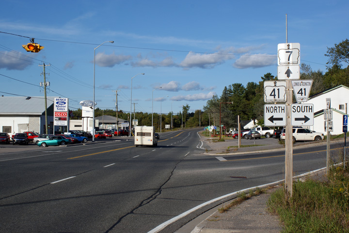
| Township of Addington Highlands County of Lennox & Addington |
Easterly view at the Highway 41 junction along Highway 7. Unlike the
previous green sign for Highway 41, the junction assembly reflects the
actual designation of Highway 41 south of Highway 7. Photo taken: September 13th, 2009. |
 |
|
| Highway 41 is a long highway that stretched from Napanee to Pembroke. In 1998, sections between Napanee and Kaladar were transferred to local control. Click here for Highway 41 images. | |||
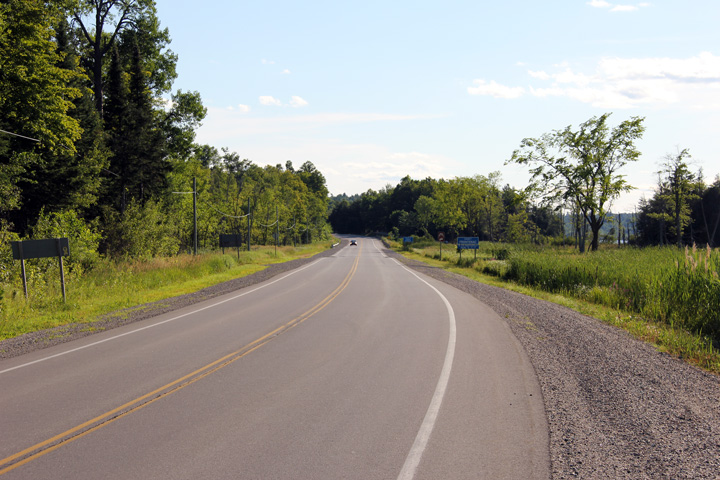
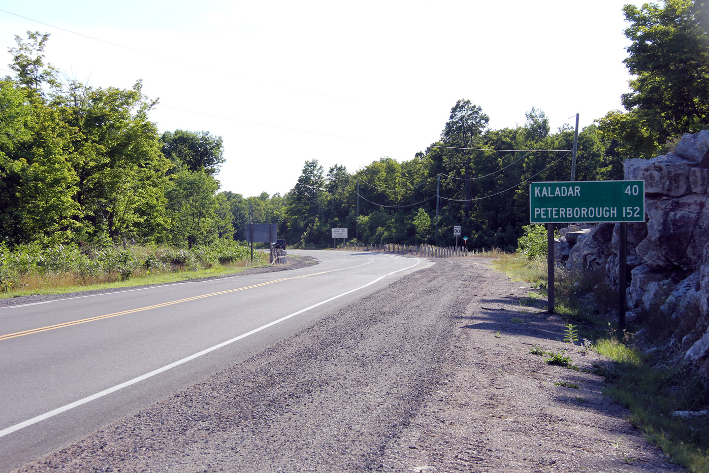
| Township of Central Frontenac County of Frontenac |
This view looks westerly from the Arden Road intersection along Highway 7
between Kaladar and Sharbot Lake. Photo taken: July 24th, 2011. |
 |
|
| Township of Central Frontenac County of Frontenac |
View looking westerly along Highway 7 where it passes south of White Lake.
The Ministry of Natural Resources has a fish hatchery at White Lake. Photo taken: September 12th, 2009. |
 |
|
| Township of Central
Frontenac County of Frontenac |
Westerly view, primarily of the distance sign along Highway 7, from the
Highway 509 junction. Photo taken: July 24th, 2011. |
 |
|
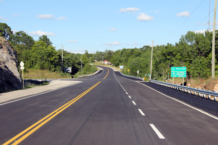
| Township of Central Frontenac County of Frontenac |
This view looks easterly along Highway 7 at the Highway 509 junction.
Highway 509 was a predominantly local secondary highway serving the
Land'O'Lakes region of Ontario. Since being transferred from
provincial jurisdiction to local, what was Highway 509 is now a series of
township roads. Photo taken: July 24th, 2011. |
 |
|
| Highway 38 carries traffic southerly from Highway 7 through Sharbot Lake to Highway 401 and Kingston. Click here for Highway 38 images. | |||
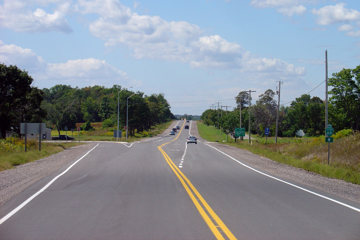
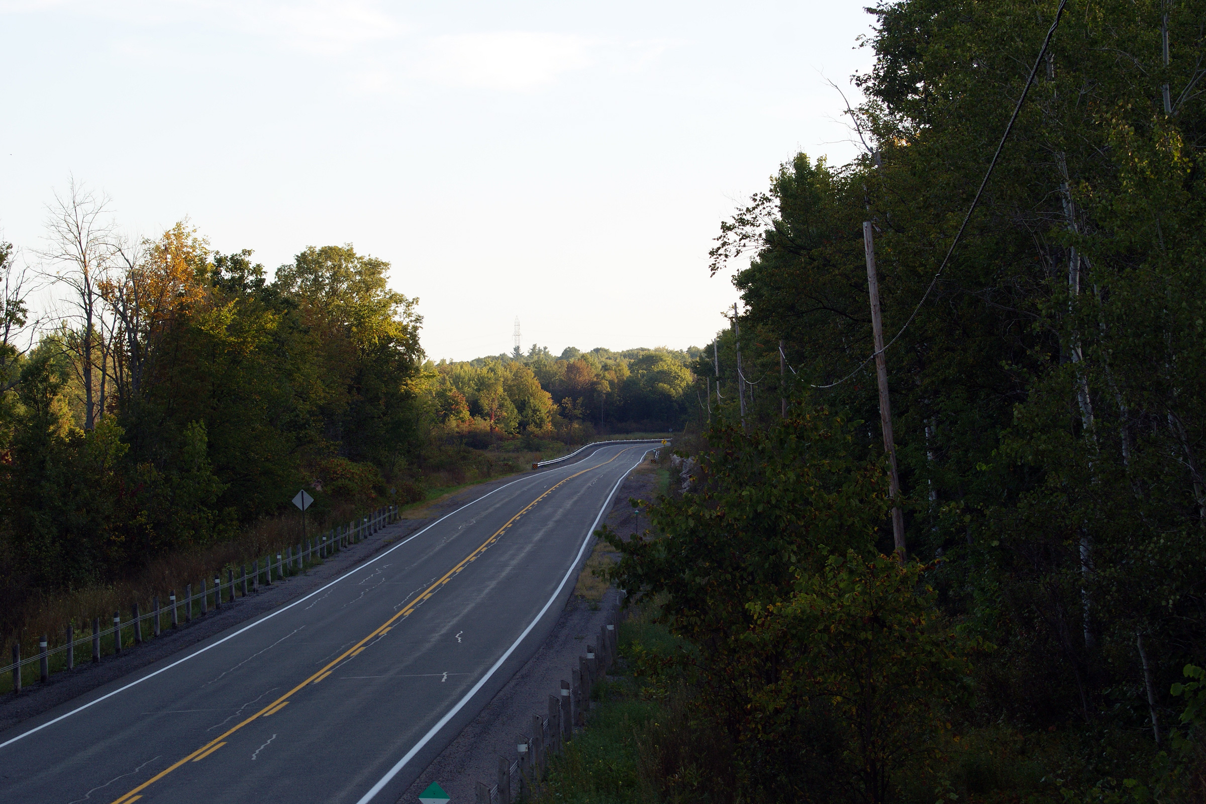
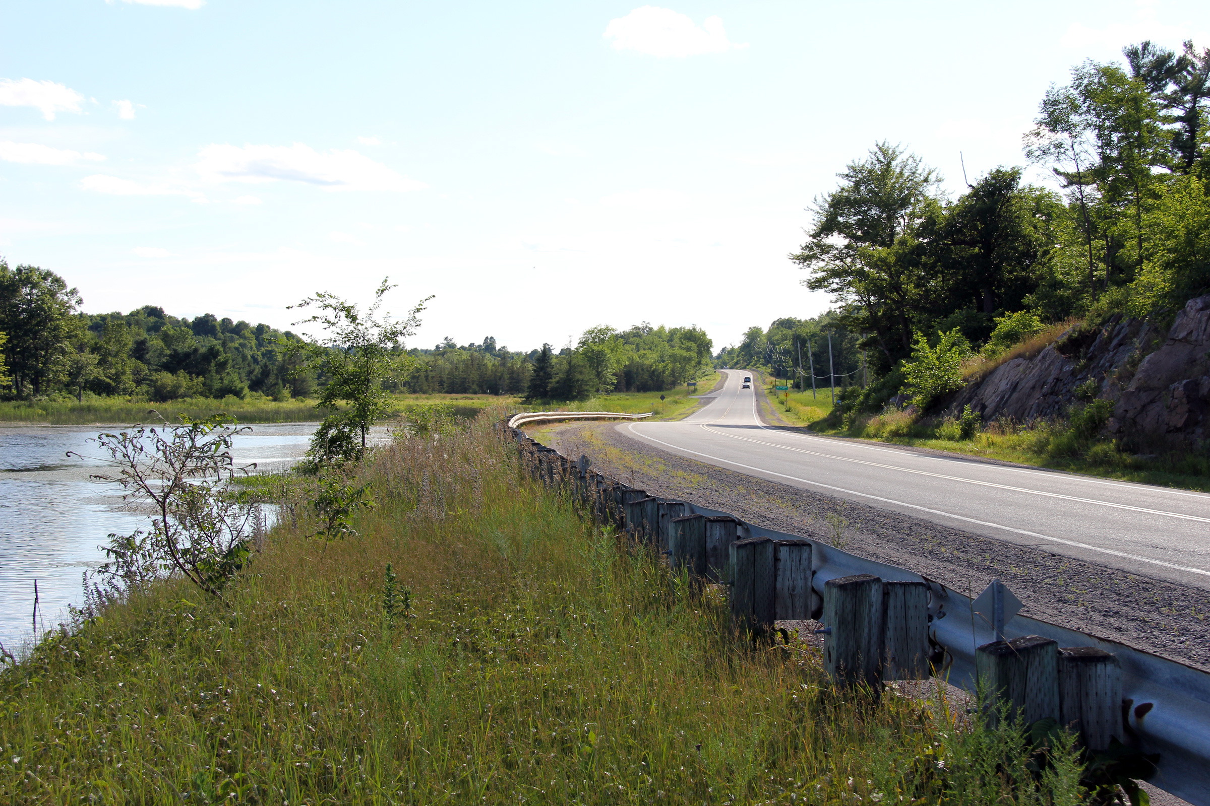
| Township of Central Frontenac County of Frontenac |
Easterly view on a newly reconstructed section of Highway 7 nearing both
Silver Lake and the Frontenac / Lanark County Line. This newly
reconstructed section of highway features a new style of durable lane
markings which have a three dimensional
texture to increase the reflectivity of the lane marking. Photo taken: July 24th, 2011 |
 |
|
| Township of Tay Valley County of Lanark |
This view looks westerly towards the Frontenac / Lanark County Line. Photo taken: July 24th, 2011. |
 |
|
| Township of Tay Valley County of Lanark |
Easterly view as Highway 7 runs along the southern shore of Silver Lake.
Highway 7 parallels the southern shore of Silver Lake for several
kilometres. Photo taken: July 24th, 2011. |
 |
|
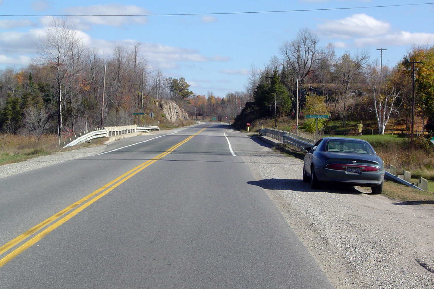
| Township of Tay Valley County of Lanark |
Highway 7 looking east over the Fall River bridge near Maberly. The Fall
River bridge at Maberly is one of the few bridges on a provincial highway in
Ontario to still retain this barrier design. Also featured in this
photo is my first car, a 1995 Buick Riviera. Photo taken: October 23rd, 2004. |
 |
|
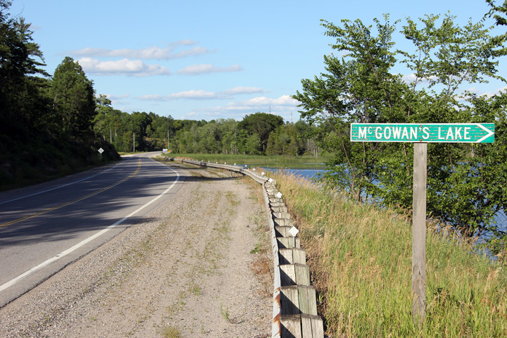
| Township of Tay Valley County of Lanark |
Westerly view along Highway 7 from McGowan's Lake east of Maberly. Photo taken: July 24th, 2011. |
 |
|
| Township of Tay Valley County of Lanark |
Two views looking easterly as Highway 7 skirts along the northern shore of
McGowan's Lake. Photos taken: July 24th, 2011. |
 |
|
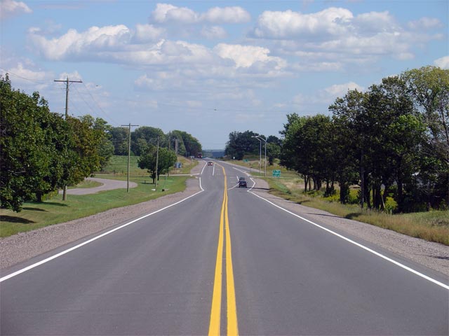
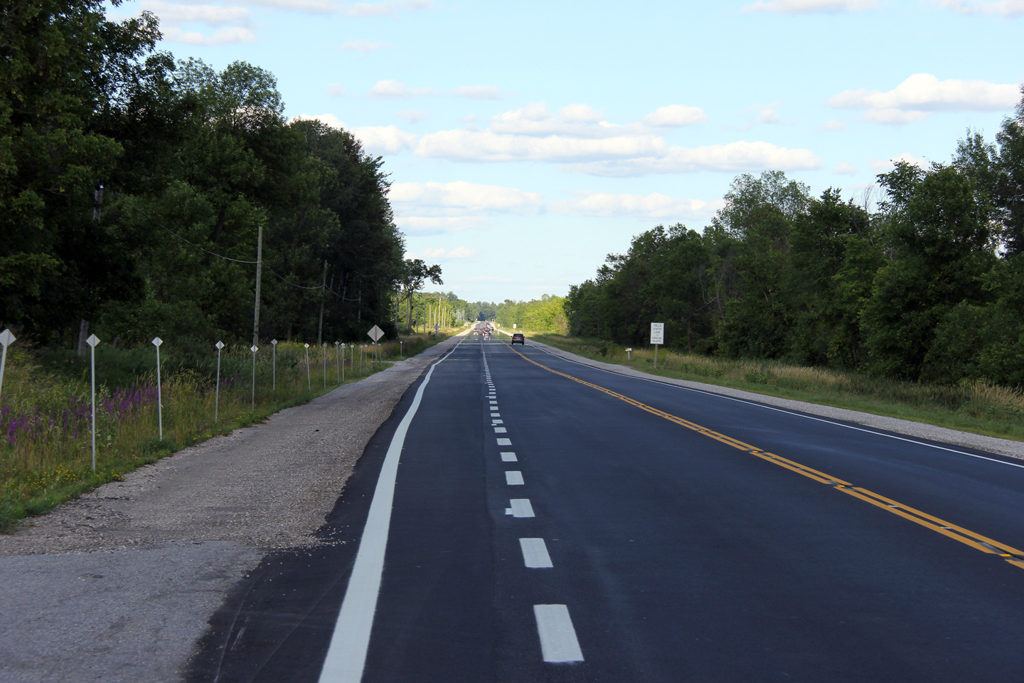
| Township of Tay Valley County of Lanark |
Easterly view at the end of the westbound passing lane that can be found
about 10 minutes west of Perth. Photo taken: July 24th, 2011. |
 |
|
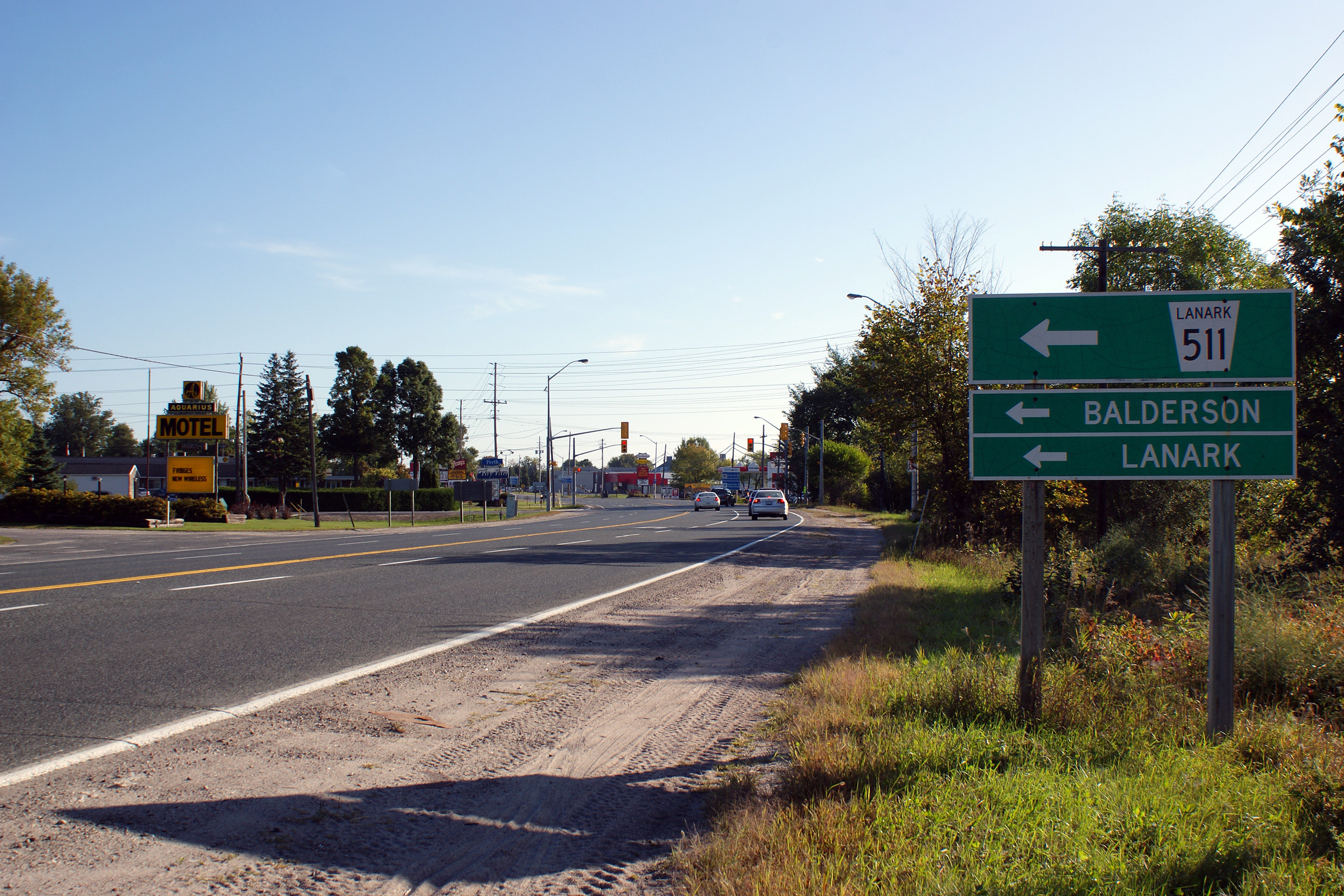
| Township of Tay Valley County of Lanark |
Easterly view approaching the Highway 511 intersection at the western end of
Perth. Photo taken: September 12th, 2009. |
 |
|
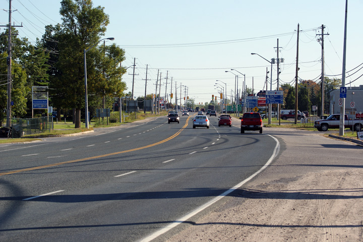
| Town of Perth County of Lanark |
This Photo looks easterly through Perth along Highway 7, taken
approximately 100m east of the Highway 511 intersection. At the time that
this photo was taken, Highway 7 still had a four-lane urban cross-section
through Perth. A simple four lane cross-section is seldom used for modern
urban cross-sections. As of 2011, the MTO is planning to widen Highway 7
through Perth to include a two-way-centre-turn-lane. Photo taken: September 12th, 2009. |
 |
|
| Highway 43 carries traffic easterly south of the Capital Region bound for Smith's Falls, Kemptville and Alexandria. Click here for Highway 43 images. | |||
| Perth to Ottawa Images available here |
<- Page 3B Images Highway 7 Images Index Page 3D Images ->
<- Highway 6 Images Back to Highway 7 - Page 3 Highway 7A Images ->
Copyright (c) 2004-2011, Scott Steeves (Webmaster) AsphaltPlanet@asphaltplanet.ca
