AsphaltPlanet.ca > OntHighways > Highway 61 > Images
< Hwy 60    Hwy 62 >

King's Highway 61 - www.OntHighways.com

Highway 61 is a very important route in the Thunder Bay region.  It extends southerly from Thunder Bay to the Canada-USA Border at Pigeon River.  Motorists can continue southerly into the Minnesota by crossing the Pigeon River International Bridge and following State Route 61.  In the vicinity of Thunder Bay (from Chippewa Road northerly) Highway 61 is part of the Thunder Bay Expressway, which is an at-grade cross-town expressway that bypasses the urban portion of Thunder Bay.  Highway 61 was extended by about 3km in 2007 when Highway 11/17 was rerouted from Arthur Street onto the newly completed Shabaqua Highway.


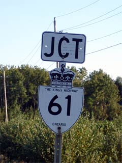
Old Style King's Highway 61 Shield

  Southern Terminus:  Highway 61 ends at the Pigeon River International Bridge.  South of the bridge, traffic can continue to Duluth, MN via Minnesota Highway 61.

Northern Terminus:  At the Highway 11/17 junction at Habour Expressway in Thunder Bay

Length:  60.1 km

Multiplexes:  None

Freeway:  No.  From Chippewa Avenue northerly Highway 61 is a limited access at-grade urban expressway.

AADT (2002):  Highest: 16,200, from Neebing Avenue northerly to Highway 11/17;

                             Lowest: 1,300, from the Pigeon River International Bridge northerly to Highway 593.

Road Info:  Highway 61 is a very well maintained route in Northwestern Ontario.  It has a 90km/h posted speed limit for its entire length.  Pavement conditions are very good along Highway 61, and the road features full-width paved shoulders.  Within the City of Thunder Bay, Highway 61 is part of the Thunder Bay Expressway, which is an at-grade urban expressway.


Highway 61 information:


OntHighways.com  

Detailed Route information available below
Virtual Tour of Highway 61
Historic AADT values


TheKingsHighway.ca   History of Highway 61
Photographic History of Highway 61

Communities and Major Intersections located Along Highway 61 from South to North:

Proper Municipality Name Community Name Distance Intersection Name

Highway 61 continues southerly into Minnesota via State Route 61.

USA - Canada Boundary ----- 0 km / 58.1 km Minnesota Highway 61 via Pigeon River International Bridge
Township of Neebing ----- 3.1 km / 55.0 km Secondary Highway 593
Township of Neebing ----- 12.1 km / 46.0 km Larsen Road
Township of Neebing ----- 26.2 km / 31.9 km Cloud Lake Road
Township of Neebing ----- 35.3 km / 22.8 km Secondary Highway 608
Municipality of Oliver & Paipoogne ----- 39.9 km / 18.2 km King's Highway 130
Oliver & Paipoonge - Thunder Bay Boundary ----- 46.5 km / 11.6 km Little Norway Road
City of Thunder Bay Thunder Bay By-pass 52.8 km / 5.3 km Highway 61B (Chippewa Road)
City of Thunder Bay Thunder Bay By-pass --- Broadway Avenue
City of Thunder Bay Thunder Bay By-pass --- Neebing Avenue
City of Thunder Bay Thunder Bay By-pass 58.1 km / 0 km King's Highway 11/17 & Highway 11B/17B (Arthur Street)

Highway 61 ENDS


<- Highway 60         www.OntHighways.com - Home         Highway 62 ->


Copyright (c) 2004-2010, AsphaltPlanet.ca  AsphaltPlanet@asphaltplanet.ca

Page last updated:  October 13th, 2006

Page created:  April 3rd, 2005