|
Proper Municipality Name |
Community Name |
Distance |
Intersecting Road |
|
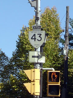
Lanark County has numbered
downloaded Highway 43 as: Lanark Road 43 |
| Town of Perth |
Perth |
0km / 153.8km |
King's Highway 7 (Dufferin Street) |
| Perth / Drummond/North Elmsley Boundary |
Perth East Limits |
3.2km / 150.6km |
----- |
| Township of Drummond/North Elmsley |
Port Elmsley |
12.7km / 141.1km |
Port Elmsley Road (Lanark Road 18) |
| Drummond/North Elmsley / Smiths Falls Boundary |
Smiths Falls West Limits |
20.8km / 133.0km |
----- |
| Town of Smiths Falls |
Smiths Falls |
21.4km / 132.4km |
King's Highway 15-North |
| Town of Smiths Falls |
Smiths Falls |
21.8km / 132.0km |
King's Highway 15-South |
| Smiths Falls / Montague Boundary |
Smiths Falls East Limits |
24.7km / 129.1km |
----- |
| Township of Montague |
----- |
30.2km / 123.6km |
Rosedale Road (Lanark Road 23) |
| Township of Montague |
Kilmarnock |
--- |
----- |
| Montague / Merrickville-Wolford Boundary |
Merrickville West Limits |
39.1km / 114.7km |
----- |
| Village of Merrickville-Wolford |
Merrickville |
40.3km / 113.5km |
Leeds & Grenville Road 15 |
| Village of Merrickville-Wolford |
(Former) Merrickville East Limits |
41.7km / 112.1km |
----- |
| Village of Merrickville-Wolford |
----- |
42.2km / 111.6km |
Leeds & Grenville Road 23-West Jct |
| Village of Merrickville-Wolford |
----- |
48.0km / 105.8km |
Leeds & Grenville Road 23-East Jct |
| Township of North Grenville |
Actons Corners |
53.4km / 100.4km |
Leeds & Grenville Road 25 |
| Township of North Grenville |
(Former) Kemptville West Limits |
59.3km / 94.5km |
----- |
| Township of North Grenville |
Kemptville |
59.5km / 94.3km |
Leeds & Grenville Road 44 |
| Township of North Grenville |
(Former) Kemptville East Limits |
60.5km / 93.3km |
----- |
| Township of North Grenville |
----- |
61.2km / 92.6km |
Rideau River Road (Leeds & Grenville Road 19) |
| Township of North Grenville |
----- |
62.1km / 91.7km |
King's Highway 416 (Formerly Highway 16) |
| Township of North Grenville |
----- |
62.7km / 91.1km |
Leeds & Grenville Road 24 |
| Township of North Grenville |
----- |
65.1km / 88.7km |
South Gower Road (Leeds & Grenville Road 22) |
| North Grenville / North Dundas Boundary |
----- |
67.7km / 86.1km |
Boundary Road |
| Township of North Dundas |
----- |
71.8km / 82.0km |
Rieds Mills Road (S D & G Road 1-North) |
| Township of North Dundas |
----- |
74.1km / 79.7km |
Mountain Road (S D & G Road 1-South) |
| Township of North Dundas |
----- |
81.4km / 72.4km |
Inkerman Road (S D& G Road 3) |
| Township of North Dundas |
Mulloys |
--- |
----- |
| Township of North Dundas |
----- |
85.2km / 68.8km |
Highway 31-North (S D & G Road 31-North) |
| Township of North Dundas |
----- |
88.8km / 65.0km |
St. Lawrence Street (S D & G Road 38-North) |
| Township of North Dundas |
----- |
89.3km / 64.5km |
Highway 31-South (S D & G Road 31-South) &
Holmes Road (S D & G Road 38-West) |
| Township of North Dundas |
----- |
96.4km / 57.4km |
Smith Road (S D & G Road 9) |
| Township of North Dundas |
Chesterville West Limits |
97.5km / 56.3km |
----- |
| Township of North Dundas |
Chesterville |
98.2km / 55.6km |
Queen Street (S D & G Road 37) |
| Township of North Dundas |
Chesterville |
100.2km / 53.6km |
Dunbar Road (S D & G Road 7) |
| Township of North Dundas |
Chesterville East Limits |
100.4km / 53.4km |
----- |
| North Dundas / North Stormont Boundary |
----- |
104.2km / 49.6km |
S D & G Road 11 |
| Township of North Stormont |
(Former) Finch West Limits |
111.4km / 42.4km |
----- |
| Township of North Stormont |
Finch |
112.1km / 41.7km |
Chrysler Road (S D & G Road 12-North) |
| Township of North Stormont |
Finch |
112.2km / 41.6km |
Victoria Street (S D & G Road 12-South) |
| Township of North Stormont |
(Former)
Finch East Limits |
113.1km / 40.7km |
----- |
| Township of North Stormont |
----- |
119.5km / 34.3km |
Newington Road (S D & G Road 14) |
| Township of North Stormont |
(Former) Avonmore West Limits |
121.4 km . 32.4km |
----- |
| Township of North Stormont |
Avonmore |
122.5km / 31.3km |
Main Street (S D & G Road 15) |
| Township of North Stormont |
(Former) Avonmore East Limits |
123.5km / 30.3km |
----- |
| Township of North Stormont |
----- |
129.8km / 24.0km |
King's Highway 138 (St. Andrews Street) |
| Township of North Stormont |
(Former)
Monkland West Limits |
129.9km / 23.9km |
----- |
| Township of North Stormont |
(Former)
Monkland East Limits |
130.9km / 22.9km |
----- |
| Township of North Glengarry |
----- |
137.2km / 16.6km |
Highlands Road (S D & G Road 20-North) |
| Township of North Glengarry |
----- |
139.0 km / 14.8km |
Apple Gill Road (S D & G Road 20-South) |
| Township of North Glengarry |
----- |
143.8kn / 10.0km |
Greenfield Road (S D & G Road 30) |
| Township of North Glengarry |
----- |
151.3km / 2.5km |
Kenyon Dam Road (S D & G Road 45) |
| Township of North Glengarry |
(Former) Alexandria West Limits |
152.8km / 1.0km |
----- |
| Township of North Glengarry |
Alexandria |
153.8km / 0km |
Highway 34 (S D & G Road 34, Main Street) |
|
Highway 43 ENDS |