|
Proper Municipality Name |
Community Name |
Distance |
Intersecting Road |
|
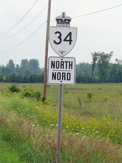
The downloaded portions of
Highway 34 are now known as Stormont, Dundas & Glengarry Road 34 |
| Township of South Glengarry |
----- |
0 km / 61.4 km |
King's
Highway 401 & Highway 2
(SD&G Road 2-West) |
| Township of South Glengarry |
----- |
0.2 km / 61.2 km |
SD&G Road 2-East (Formerly Highway 2) |
| Township of South Glengarry |
(Former)
Lancaster South Limits |
0.3 km / 61.1 km |
----- |
| Township of South Glengarry |
Lancaster |
1.0 km / 60.4 km |
Pine Street (SD&G Road 17) |
| Township of South Glengarry |
(Former) Lancaster North
Limits |
1.3 km / 60.1 km |
----- |
| Township of South Glengarry |
Brown House Corner |
11.3 km / 50.1 km |
King's Road (SD&G Road 18) |
| Township of South Glengarry |
----- |
15.2 km / 46.2 km |
The Nith Road-West (SD&G Road 25-West) |
| Township of South Glengarry |
Green Valley |
--- |
----- |
| South Glengarry - North Glengarry Boundary |
----- |
17.4 km / 44.0 km |
The Nith Road-East (SD&G Road 25-East) |
| Township of North Glengarry |
----- |
20.5 km / 40.9 km |
SD&G Road 45 |
| Township of North Glengarry |
(Former) Alexandria South
Limits |
20.6 km / 40.8 km |
----- |
| Township of North Glengarry |
Alexandria |
22.0 km / 39.4 km |
Glen Robertson Road (SD&G Road 10) |
| Township of North Glengarry |
Alexandria |
22.8 km / 38.6 km |
Highway 43 (SD&G Road 43, Kenyon Street) |
| Township of North Glengarry |
Alexandria |
--- |
McDougald Street (SD&G Road 46) |
| Township of North Glengarry |
(Former) Alexandria North
Kimits |
24.3 km / 37.1 km |
----- |
| Township of North Glengarry |
Guaytown |
--- |
----- |
| Township of North Glengarry |
Fassifern |
28.8 km / 32.6 km |
Lochiel Street (SD&G Road 21) |
| Township of North Glengarry |
Laggan |
33.1 km / 28.3 km |
Laggan Road (SD&G Road 24-East) |
| Township of North Glengarry |
----- |
35.3 km / 26.1 km |
Dunvegan Road (SD&G Road 24-West) |
| Township of North Glengarry |
----- |
37.4 km / 24.0 km |
McCrimmon Road (SD&G Road 23A) |
|
Current Southern Terminus of
Highway 34 is located at Highway 417. |
| North Glengarry - Champlain Boundary |
----- |
44.4 km / 17.0 km |
King's Highway 417 |
| Township of Champlain |
Aberdeen |
47.9 km / 13.5 km |
----- |
| Township of Champlain |
Vankleek Hill South Limits |
49.7 km / 11.7 km |
----- |
| Township of Champlain |
Vankleek Hill |
50.6 km / 10.8km |
Main Street (Prescott & Russell Road 10) |
| Township of Champlain |
Vankllek Hill North Limits |
51.1 km / 10.3 km |
----- |
| Township of Champlain |
Vankleek Hill Station |
--- |
----- |
| Township of Champlain |
Pleasant Corners |
--- |
----- |
| Township of Champlain |
Green Lane |
--- |
----- |
| Township of Champlain |
----- |
59.9 km / 1.5 km |
Highway 17 (Prescott & Russell Road 17) |
| Champlain - Hawkesbury Boundary |
Hawkesbury South Limits |
60.1 km / 1.3 km |
----- |
| Town of Hawkesbury |
Hawkesbury |
61.4 km / 0 km |
Main Street |
|
Highway 34 ENDS |