AsphaltPlanet.ca > OntHighways > Highway 138 > Images
< Hwy 137    Hwy 140 >

King's Highway 138 - www.OntHighways.com

Since the bulk of Highway 34's mileage was decommissioned in 1998, Highway 138 is now Ontario's eastern-most highway to link Highway 401 to 417.  Highway 138 is the major north-south highway to lead from Cornwall.  It's southern terminus is at Vincent Massey Drive, just north of the Seaway International Bridge which links Massena, New York to Cornwall, Ontario.  Highway 138 is a fairly new highway, being commissioned during the years leading up to Highway 417's construction in the early 1970s.  Because Highway 417 jogs so far to the south at Cassleman, Highway 138 is the preferred north-south road into both Ottawa, and Hawkesbury from the Highway 401 corridor in Eastern Ontario.  Highway 138's mileage was not altered during the downloading spree's of 1997/98.


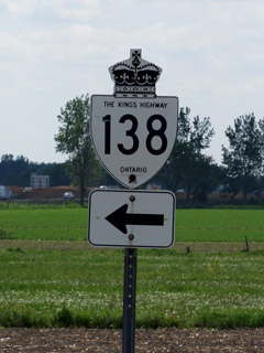
King's Highway 138 Shield


Southern Terminus:  Highway 2 (Vincent Massey Drive) in Cornwall.

Northern Terminus:  At the Highway 417 interchange just east of Casselman.

Length:  38.6km

Multiplexes:  None

Freeway: No

AADT (2006):  Highest: 10,300, from Cornwall northerly to County Road 18;

                             Lowest: 4,750, from Highway 43 northerly to County Road 22.

Road Info:  I have never driven Highway 138, so I cannot provide first hand experience.  From what I have seen of it in photos, and on Google Street view, Highway 138 appears to be in good to fair condition for its entire length.  It's not an overly busy highway, and it traverses the subdued terrain of Eastern Ontario.  It has a posted speed limit of 80km/h in rural areas..


Highway 138 information:


OntHighways.com  

Detailed Route information available below
Virtual Tour of Highway 138


TheKingsHighway.ca   History of Highway 138
Photographic History of Highway 138

Communities and Major Intersections located along Highway 138 from South to North:

Proper Municipality Name Community Name Distance Intersecting Road
City of Cornwall Cornwall 0km / 38.6km Highway 2 (Vincent Massey Drive)
City of Cornwall Cornwall 2.9km / 35.7km King's Highway 401 (Autoroute Macdonald-Cartier Freeway)
Highway 138 jogs to the right and then again to the left in both directions at Cornwall Centre Road / South Branch Road.
Cornwall - South Stormont Boundary Cornwall North Limits (Eamers Corners) 4.3km / 34.3km Cornwall Centre Road
Township of South Stormont Churchill Heights --- -----
Township of South Stormont ----- 6.3km / 32.3km Headline Road (S D & G Road 44)
Township of South Stormont St. Andrews 8.8km / 29.8km King's Road (S D & G Road 18)
Township of South Stormont Bonville --- -----
South Stormont - North Stormont Boundary McMillans Corners --- -----
Township of North Stormont Monkland 21.7km / 16.9km Highway 43 (S D & G Road 43)
Township of North Stormont Gravel Hill --- -----
Township of North Stormont Warina --- -----
Township of North Stormont ----- 30.6km / 8.0km Dyer Road (S D & G Road 22)
Township of North Stormont Valley Corniers 32.0km / 6.6km McLean Road (S D & G Road 15)
Township of North Stormont Tayside --- -----
Township of North Stormont ----- 38.6km / 0km King's Highway 417 & Prescott & Russell Road 8

Highway 138 ENDS


<- Highway 137         www.OntHighways.com - Home         Highway 140 ->


Copyright (c) 2004-2010, AsphaltPlanet.ca  AsphaltPlanet@asphaltplanet.ca

Page last updated:  June 7th, 2010

Page created:  June 7th, 2010