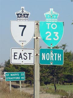
King's Highway 7 shield cosigned with a Highway 23 trailblazer
|
|
Highway 7 Information that
Pertains to the Elginfield to Guelph Section:
Discontinuity:
Though not shown in the detailed route information, legally Highway 7 is
discontinuous through Kitchener. The connecting link agreement between the City
of Kitchener and the MTO for Victoria Street was repealed as part of provincial
downloading in the late 1990s. Fortunately however, Highway 7 is still
consistently signed and indicated on maps along Victoria Street, and the average
driver would have no idea that there is actually a gap in Kitchener.
Multiplexes: At present, the only
co-designation between Elginfield and Guelph is a 45.1km multiplex with
Highway 8.
Freeway: Highway 7 is a freeway
through the City of Kitchener, where it follows the Conestoga Parkway.
AADT (2002):
Highest: 93,800, between the Ottawa Street interchange and Highway 85 in
Kitchener;
Lowest:
5,000, between Middlesex Road 50 and Perth Road 123.
Road Info: Through this section,
Highway 7 is well built for its entire distance. Certain areas of this
route are quite congested, however. The portion of Highway 7 between
Kitchener and Guelph, is very likely the most congested 2-lane highway in
the province. A freeway by-passing this busy route is currently being
considered by the MTO (though likely still a ways from being constructed).
Until recently, parts of Highway 7's routing along the Conestoga Parkway
were also very congested, however, recent upgrades and widenings have
alleviated much of this congested. Rural speed limits along Highway 7
are posted at 80km/h, with the exception of where Highway 7 is a freeway,
where the speed limit is 90km/h. |
|
Proper Municipality
Name |
Community
Name |
Distance |
Major Intersection |
|
Highway 7 was downloaded west of
Highway 4 between 1997 and 1998. Pre-1997 route information for
Highway 7 is available here (Coming Soon!) |
| Middlesex Centre - Lucan-Biddulph Boundary |
Elginfield |
0 km / 595.6 km |
King's Highway 4 |
| Middlesex Centre - Lucan-Biddulph Boundary |
----- |
1.2 km / 594.4 km |
King's Highway 23 |
| Middlesex Centre - Lucan-Biddulph Boundary |
----- |
5.1 km / 590.5 km |
Highbury Avenue (Middlesex Road 23) |
| Middlesex Centre - Lucan-Biddulph Boundary |
----- |
5.5 km / 590.1 km |
Middlesex Road 59 |
| Middlesex Centre - Lucan-Biddulph Boundary |
----- |
10.0 km / 585.6 km |
Middlesex Road 50 |
| Thames Centre - Perth South Boundary |
----- |
16.8 km / 578.8 km |
Middlesex Road 27 |
| Thames Centre - Perth South Boundary |
----- |
17.5 km / 578.1 km |
Perth Road 123 |
| Thames Centre - Perth South Boundary |
----- |
--- |
Perth Road 120A |
| Perth South - Zorra Boundary |
----- |
23.9 km / 571.7 km |
Highway 19-South (Perth Road 119) & Perth Road
118 |
| Township of Perth South |
----- |
26.9 km / 568.7 km |
Perth Road 9 (Perth South Line 9) |
| Township of Perth South |
Conroy |
--- |
----- |
| Township of Perth South |
----- |
31.7 km / 563.9 km |
Perth Road 20 (Perth South Line 20) |
| Township of Perth South |
----- |
33.8 km / 561.8 km |
Perth Road 25 (Perth South Line 25) |
| Perth South - Stratford Boundary |
Stratford South Limits |
35.9 km / 559.7 km |
----- |
| City of Stratford |
Stratford |
37.0 km / 558.6 km |
Embro Road (To Perth Road 113) |
| City of Stratford |
Stratford |
--- |
Lorne Avenue |
|
At Highway 8 in Stratford:
EB: Turn Right towards Kitchener. WB: Turn Left towards London |
| City of Stratford |
Stratford |
39.9 km / 555.7 km |
King's Highway 8-West |
| City of Stratford |
Stratford |
40.2 km / 555.4 km |
Highway 19-North (Waterloo Street) |
| Stratford - Perth East Boundary |
Stratford East Limits |
43.2 km / 552.4 km |
----- |
| Township of Perth East |
Shakespeare |
51.9 km / 543.7 km |
Highway 59 (Perth Road 107) |
| Perth East - Wilmot Boundary |
----- |
60.1 km / 535.5 km |
Waterloo Road 1 & Perth Road 101 |
| Township of Wilmot |
New Hamburg By-pass |
62.3 km / 533.3 km |
Walker Road (Waterloo Road 3) |
| Township of Wilmot |
New Hamburg By-pass |
63.4 km / 532.2 km |
Peel Street (Waterloo Road 4-West) |
| Township of Wilmot |
New Hamburg By-pass |
64.3 km / 531.3 km |
Bleams Road (Waterloo Road 4-East) |
| Township of Wilmot |
New Hamburg By-pass |
65.7 km / 529.9 km |
Nafziger Road (Waterloo Road 5) |
| Township of Wilmot |
----- |
67.9 km / 527.7 km |
Waterloo Road 51 |
| Township of Wilmot |
----- |
73.0 km / 522.6 km |
Waterloo Road 12 |
| Wilmot - Kitchener Boundary |
Kitchener West Limits |
76.8 km / 518.8 km |
Trussler Road (Waterloo Road 70) |
| City of Kitchener |
Kitchener |
79.9 km / 515.7 km |
Fischer-Hallman Road (Waterloo Road 58) |
| City of Kitchener |
Kitchener |
82.3 km / 513.3 km |
Homer Watson Boulevard (Waterloo Road 28) |
| City of Kitchener |
Kitchener |
83.6 km / 512.0 km |
Courtland Avenue |
| City of Kitchener |
Kitchener |
85.0 km / 510.6 km |
King's
Highway 8-East |
| City of Kitchener |
Kitchener |
86.3 km / 509.3 km |
Ottawa Street (Waterloo Road 4) |
| City of Kitchener |
Kitchener |
88.2 km / 507.4 km |
King's Highway 85 (Formerly Highway 86) &
Victoria Street |
|
At Highway 85 (Formerly Highway
86): EB: Exit the Freeway at Victoria Street, at the end of the ramp
turn left onto Bruce Street, then right onto Victoria Street. WB:
After the freeway overpass, turn left at Edna Street, followed by another
quick left turn towards Highway 8 and Highway 401. |
| City of Kitchener |
Kitchener |
--- |
Frederick Street (Waterloo Road 6) |
| City of Kitchener |
Kitchener |
--- |
Lackner Road (Waterloo Road 54) |
| Township of Woolwich |
Breslau |
93.2 km / 502.4 km |
Waterloo Road 17 (Ebycrest Road & Woolwich
Street) |
| Township of Woolwich |
----- |
97.1 km / 498.5 km |
Shantz Station Road (Waterloo Road 30) |
| Township of Guelph-Eramosa |
----- |
101.8 km / 493.8 km |
Wellington Road 32 |
| Guelph-Eramosa (twp) - Guelph (city) Boundary |
Guelph West Limits |
102.9 km / 492.7 km |
----- |
| City of Guelph |
Guelph |
103.9 km / 491.0 km |
Elmira Road (To Wellington Road 86) |
| City of Guelph |
Guelph |
105.8 km / 489.8 km |
King's Highway 6-North (Woodlawn Road) |
|
At Highway 6-North: EB:
Ramp to the Right towards Highway 401, and continue on
Page 2
WB: Continued From Page
2 |