King's Highway
95 - www.OntHighways.com
Highway 95 is a short highway that
exists entirely on Wolfe Island. Both Highway 95 and its cousin Highway 96
were downloaded in there entirety on January 1st, 1998. Historically, Both
Highways 95 and 96 were the only two King's Highways that were never physically
connected to the mainland via a fixed link. Because of this, traffic
volumes on both Highway 95 and 96 are very light. Both Highways 95 and 96
have changed very little from there inception into the highway network in the
mid-1930s, and as such, both offer an excellent look back through time at what
earlier King's Highways looked like. For anyone in the Kingston area,
Wolfe Island is certainly worth the short ferry ride. The ferry (schedule available
here
from the MTO site) runs throughout the day at half an hour intervals, departing
from Downtown Kingston.
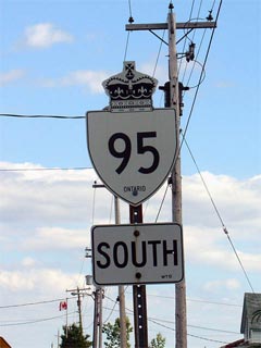
New Style
King's Highway 95 Shield
|
|
Southern Terminus: Highway 95 ends at
Port Alexandria on Wolfe Island. During the summer months there is a
private ferry that runs from Port Alexandria to Cape Vincent in New York State.
Northern Terminus: Wolfe Island Ferry
dock in Marysville.
Length: 11.4km
Multiplexes: Short co-designation with
Highway 96 in Marysville.
Freeway: No
AADT (1994): 650 for the entire
length of Highway 95 Status:
Totally downloaded in 1998, however still fully signed as Highway 95.
Road Info:
Highway 95 is a very interesting road for its entire length on Wolfe Island.
Highway 95 has changed very little since it was originally constructed in the
1930s. Pavement widths are narrow, and the road is paved with a coarser
type of pavement that wouldn't usually be found on King's Highways.
Traffic volumes are very light on Highway 95, and it has a rural posted
speed limit of 80km/h. Watch for reversing corner near Port Alexandria
with advisory speed of 30km/h |
Communities and Major Intersections along Highway 95 from South to North:
|
Proper Municipality Name |
Community Name |
Distance |
Intersection Road |
|
Township of Frontenac Islands |
Port Alexandria |
0 km / 11.4 km |
(Port Alexandria Ferry dock) |
|
Township of Frontenac Islands |
Marysville |
--- |
Highway 96-West |
|
At Highway 96-West: NB:
Turn right at Highway 96 (past the Highway 95 ends sign). SB: From
Highway 96 turn left onto Highway 95. |
|
Township of Frontenac Islands |
Marysville |
--- |
Highway 96-East |
|
At Highway 96-East: NB:
Turn left for the Wolfe Island (Summer) Ferry dock SB: From the Summer
Ferry dock, turn right on Highway 96. |
|
Township of Frontenac Islands |
Marysville |
11.4 km / 0 km |
(Wolfe Island Ferry Dock) |
|
Highway 95 ENDS |
Highway 95 - Images
www.OntHighways.com - Home
Copyright (c) 2004 - 2005, AsphaltPlanet.ca
webmaster@onthighways.com
Page last updated: July 25, 2006
Page created: June 2nd, 2005