King's Highway 96 - www.OntHighways.com

Highway 96 is a short highway that exists entirely on Wolfe Island.  Both Highway 96 and its cousin Highway 95 were downloaded in there entirety on January 1st, 1998.  Historically, Both Highways 95 and 96 were the only two King's Highways that were never physically connected to the mainland via a fixed link.  Because of this, traffic volumes on both Highway 95 and 96 are very light.  Both Highways 95 and 96 have changed very little from there inception into the highway network in the mid-1930s, and as such, both offer an excellent look back through time at what earlier King's Highways looked like.  For anyone in the Kingston area, Wolfe Island is certainly worth the short ferry ride.  The ferry (schedule available here from the MTO site) runs throughout the day at half an hour intervals, departing from Downtown Kingston.


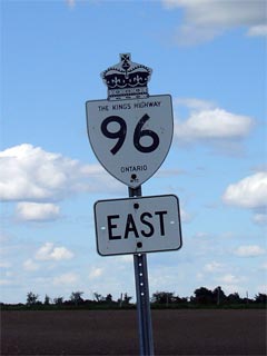
Old Style Highway 96 Shield

  Western Terminus:  At Sand Bay Road at the western edge of Wolfe Island.

Eastern Terminus:  At Port Metcalfe on the eastern edge of Wolfe Island

Length:  32.8km

Multiplexes:  Highway 96 was co-designated with Highway 95 for a short distance in Marysville

Freeway: No

AADT (1994):  Highest:  1,300, from Highway 95 to Dawson Point Road;

                             Lowest:  300, from Dawson Point Road to Port Metcalfe

Status:  Totally downloaded in 1998, however is still fully signed as a highway.

Road Info: Highway 96 is a very interesting road for its entire length on Wolfe Island.  Highway 96 has changed very little since it was originally constructed in the 1930s.  Pavement widths are narrow, and the road is paved with a coarser type of pavement that wouldn't usually be found on King's Highways.  Traffic volumes are very light on the route, and it has a rural posted speed limit of 80km/h.  Despite the 80km/h speed limit, be weary of sharp corners along the route that are not always posted with advisory speeds.


Highway 96 information:


OntHighways.com  

Detailed Route information available below
Virtual Tour of Highway 96


TheKingsHighway.ca   History of Highway 96
Photographic History of Highway 96

Communities and Major Intersections Located on Highway 96 from West to East:

Proper Municipality Name Community Name Distance Intersection Name

Despite being downloaded, Highway 96 is still fully signed as such.

Township of Frontenac Islands -----   Western End of Highway 96 (Sand Bay Road)
Township of Frontenac Islands Marysville   Highway 95-South
Township of Frontenac Islands Marysville   Wolfe Island Ferry Dock-North
Township of Frontenac Islands -----   Highway 7051 (Dawson Point Road)
Township of Frontenac Islands Scotch Settlment --- -----
Township of Frontenac Islands Port Metcalfe   -----

Highway 96 ENDS

<- Highway 95         www.OntHighways.com - Home         Highway 99 ->


Copyright (c) 2004-2010, AsphaltPlanet.ca  AsphaltPlanet@asphaltplanet.ca

Page last updated:  July 25th, 2006

Page created:  July 25th, 2006